 English
 Spanish
 French
 Chinese
 Russian
 Portuguese
 最新宪章启动
Charter activations
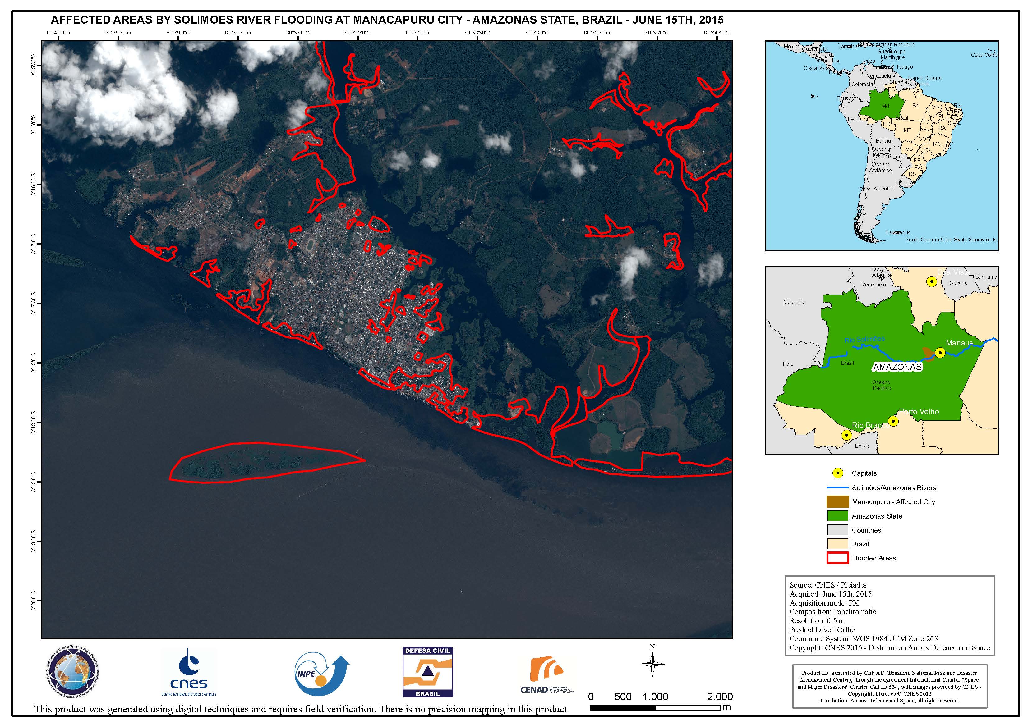
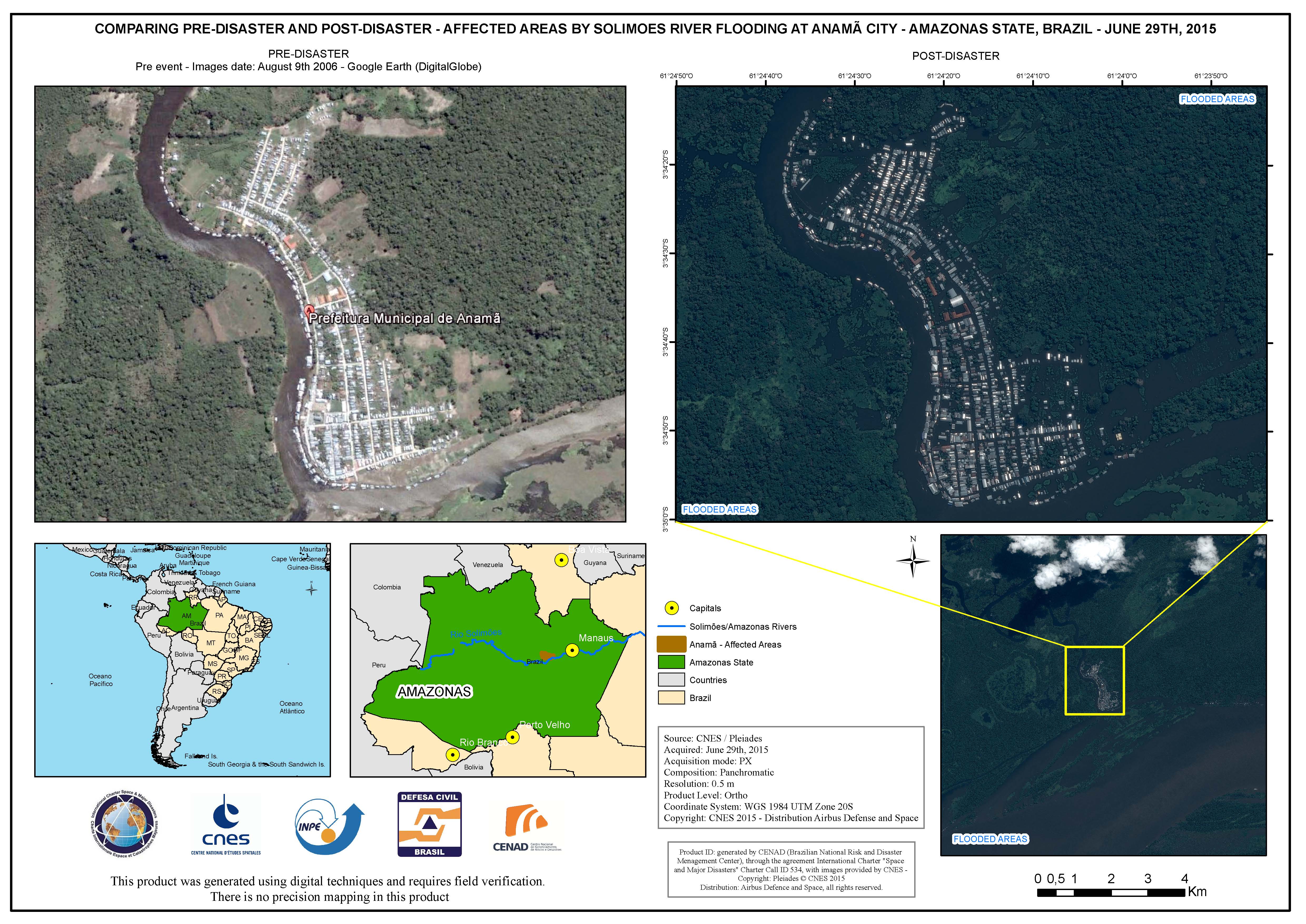
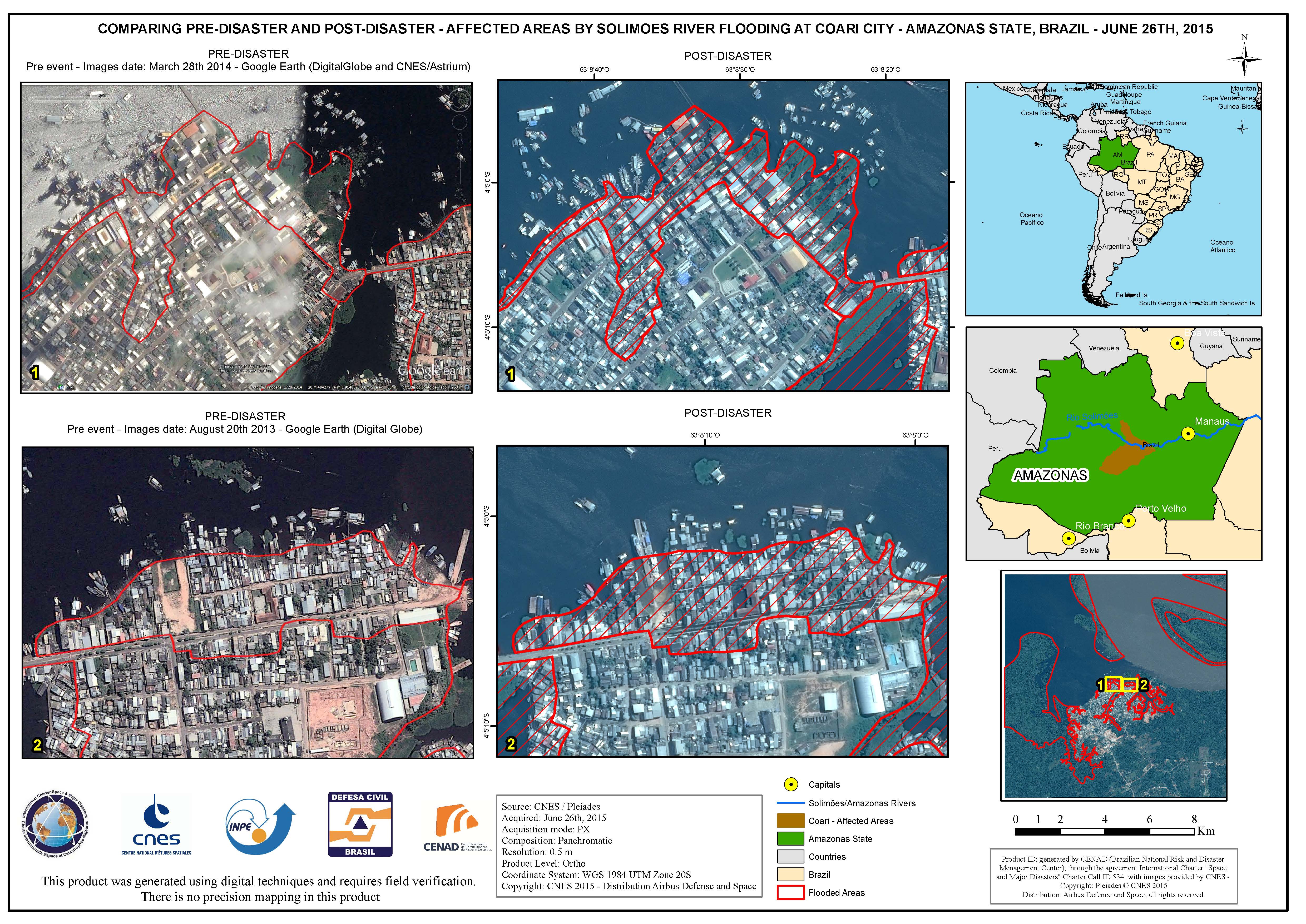
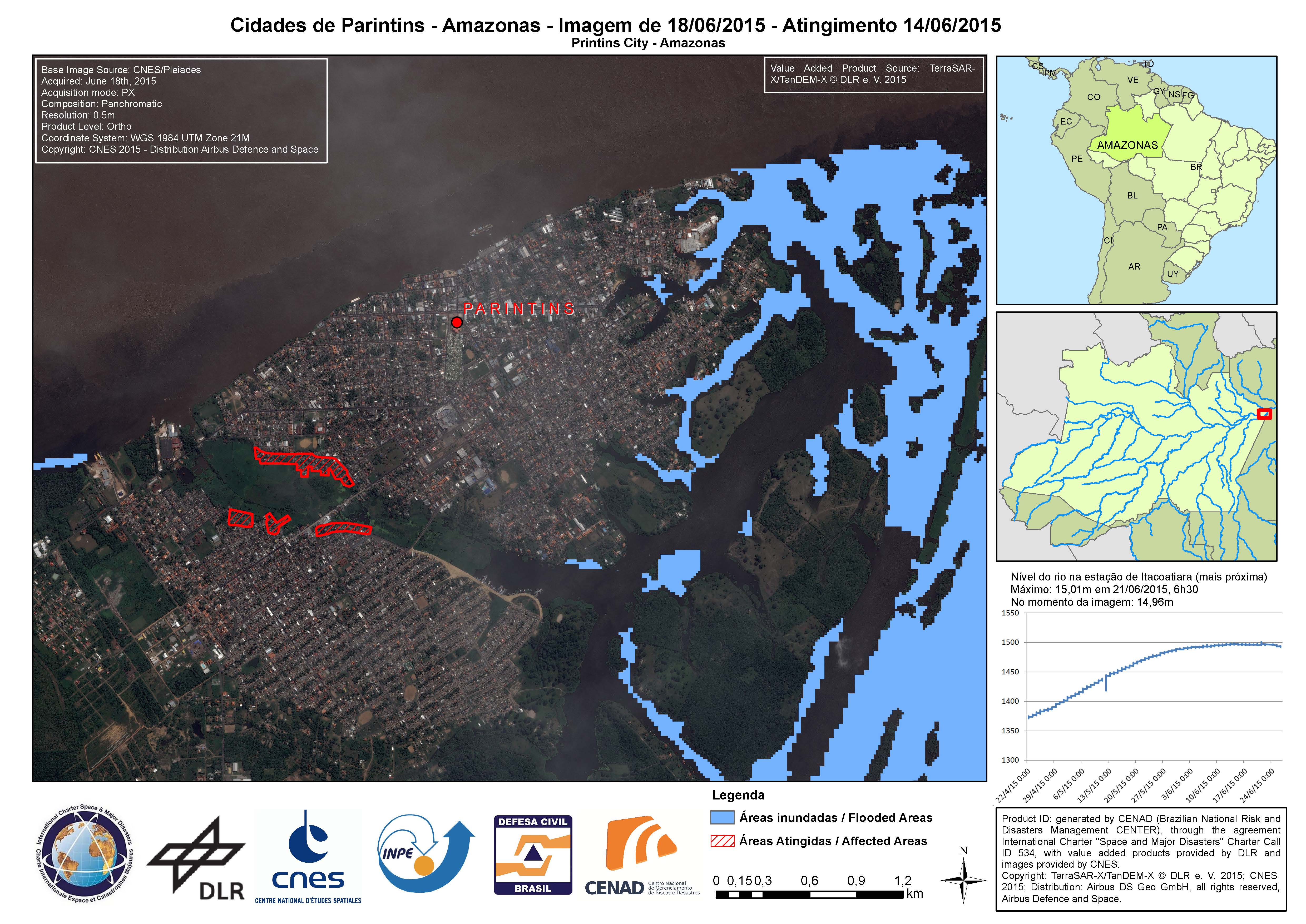
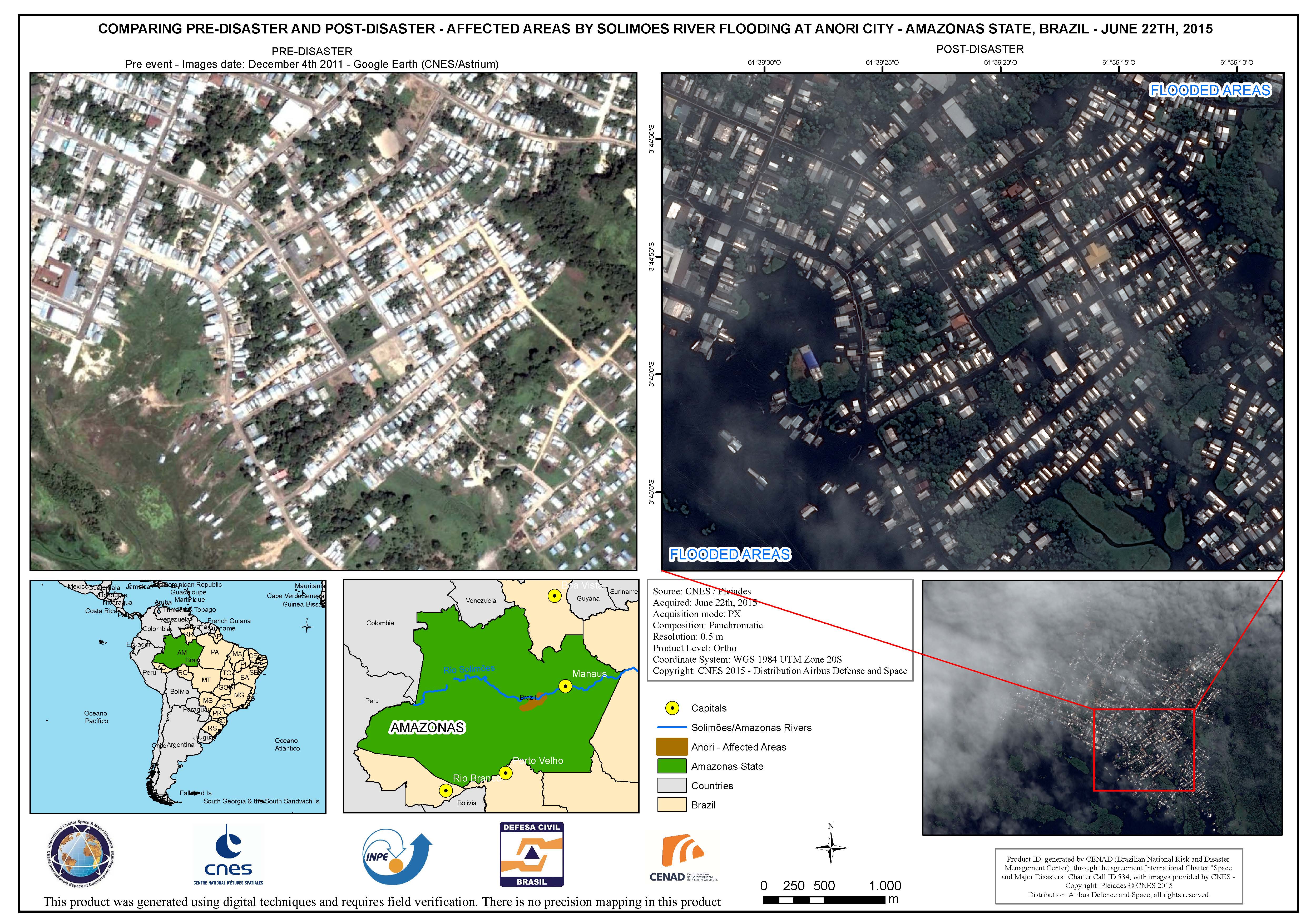
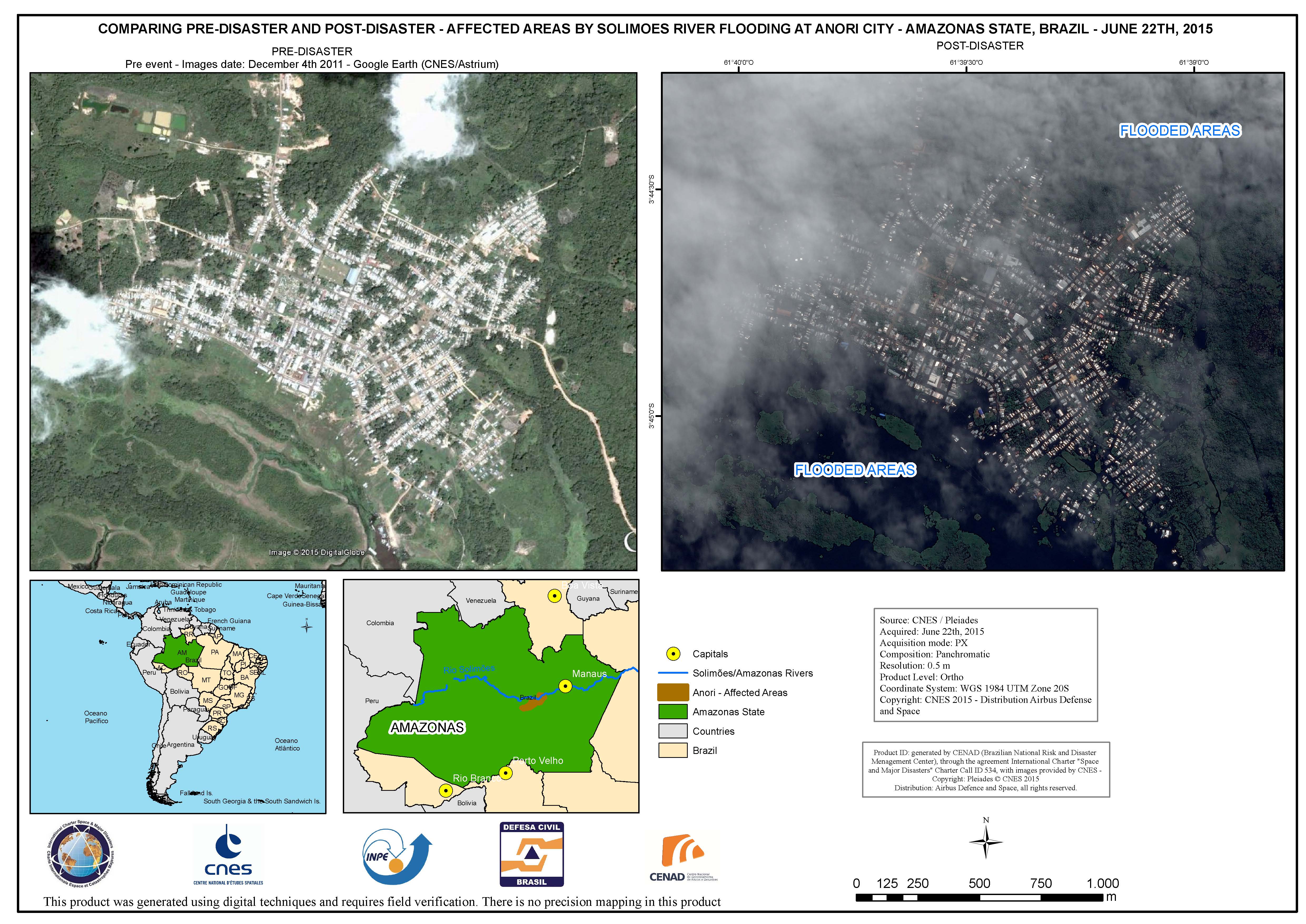
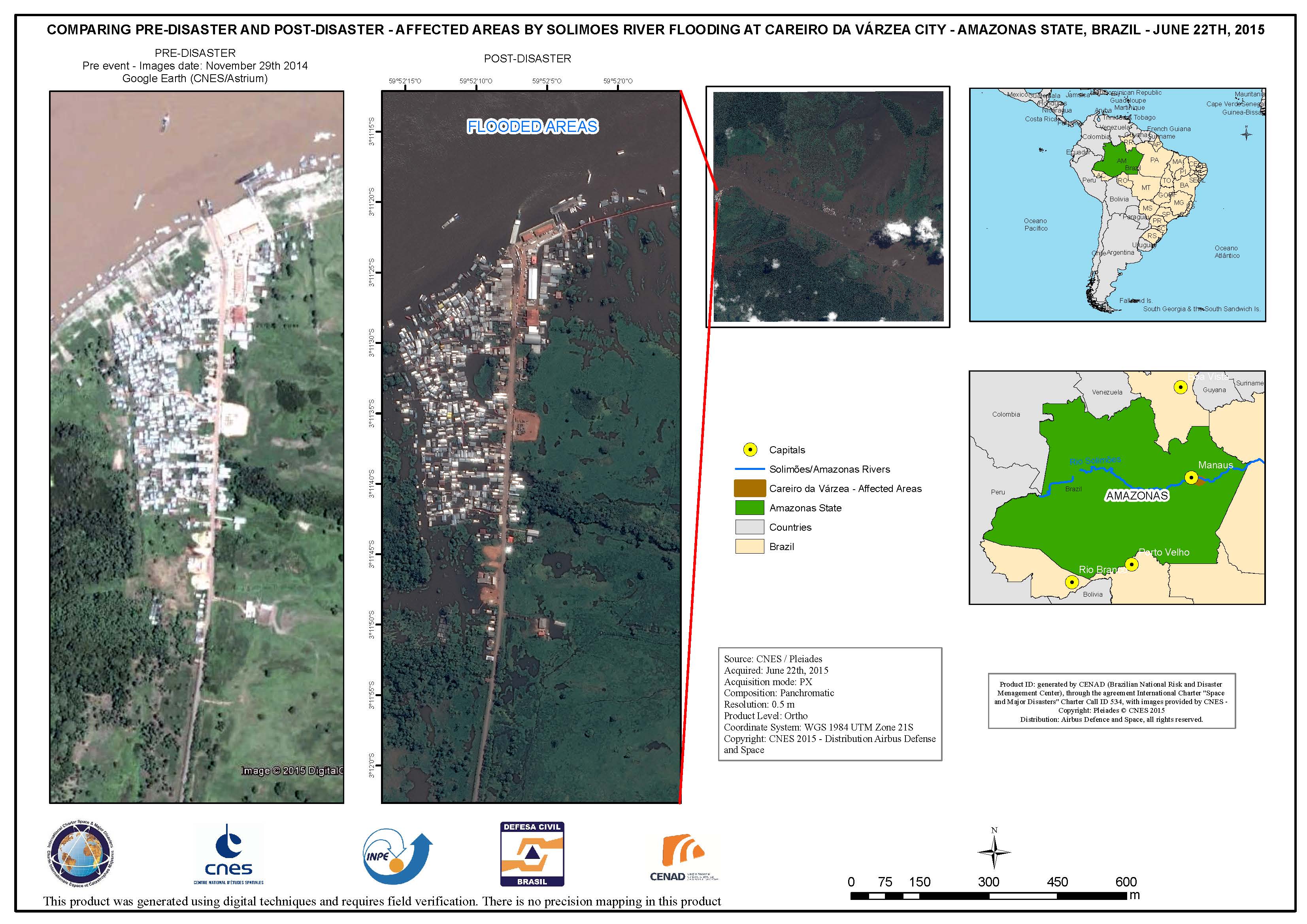
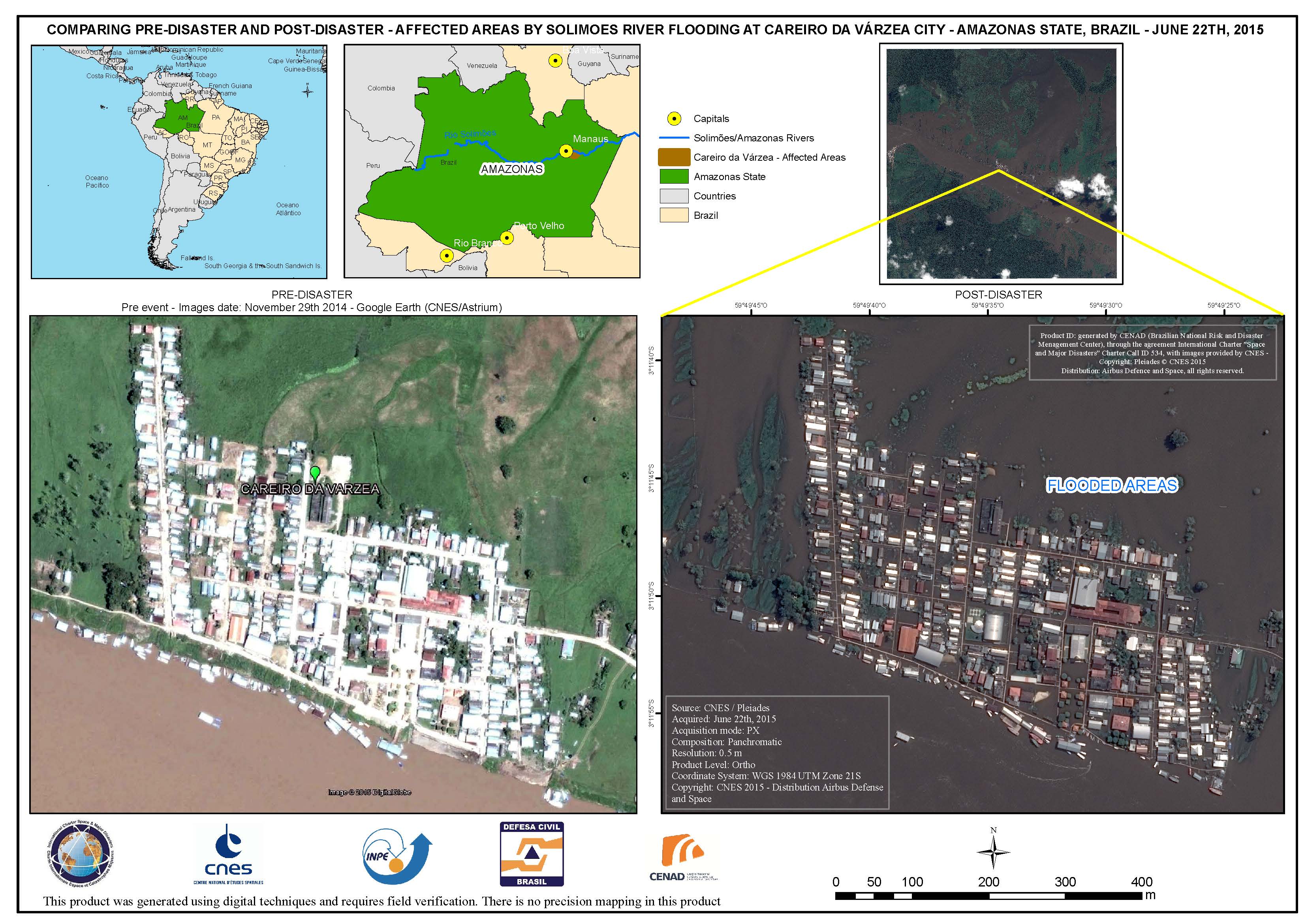
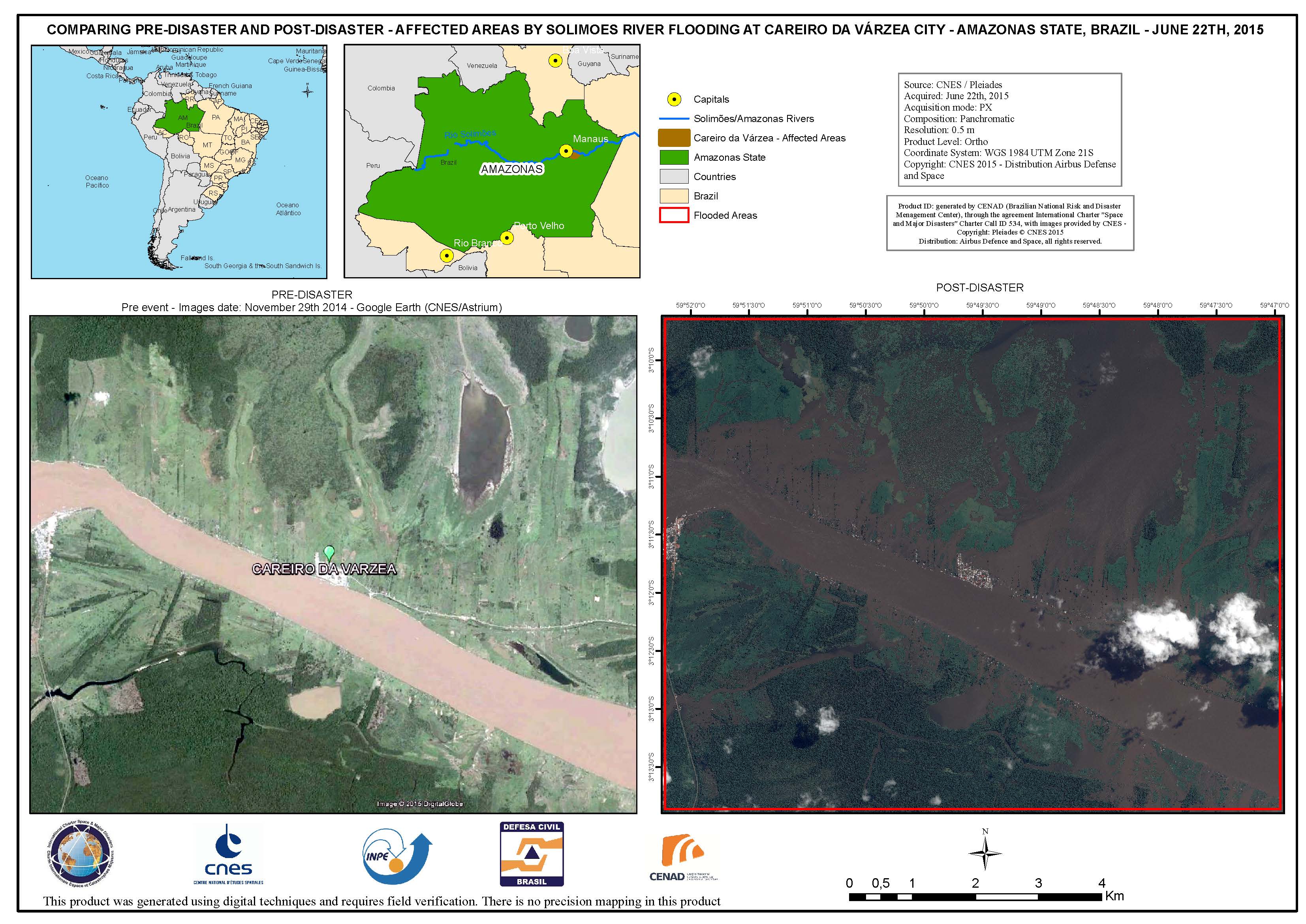
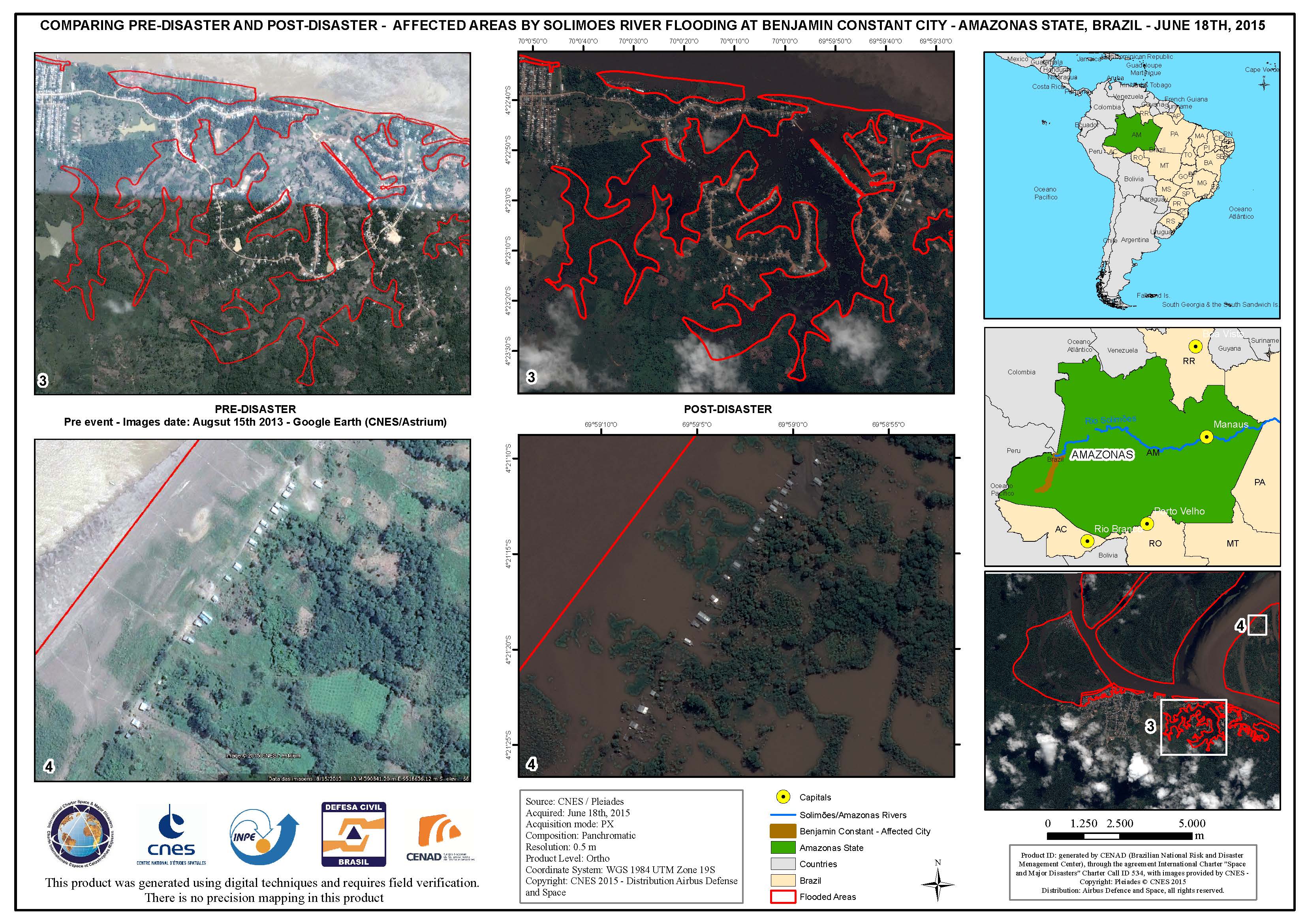
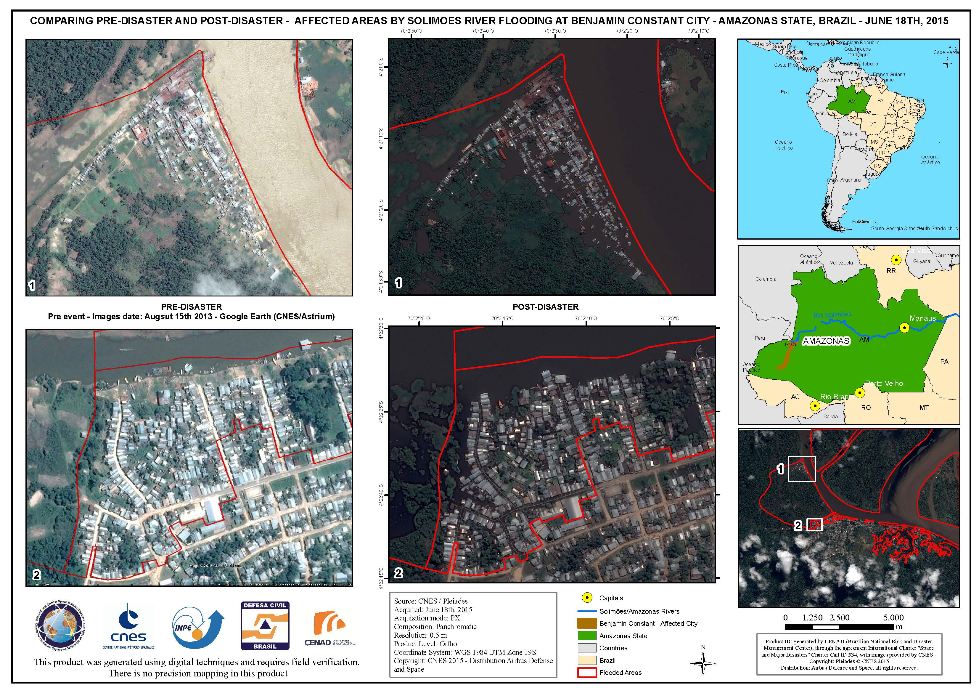
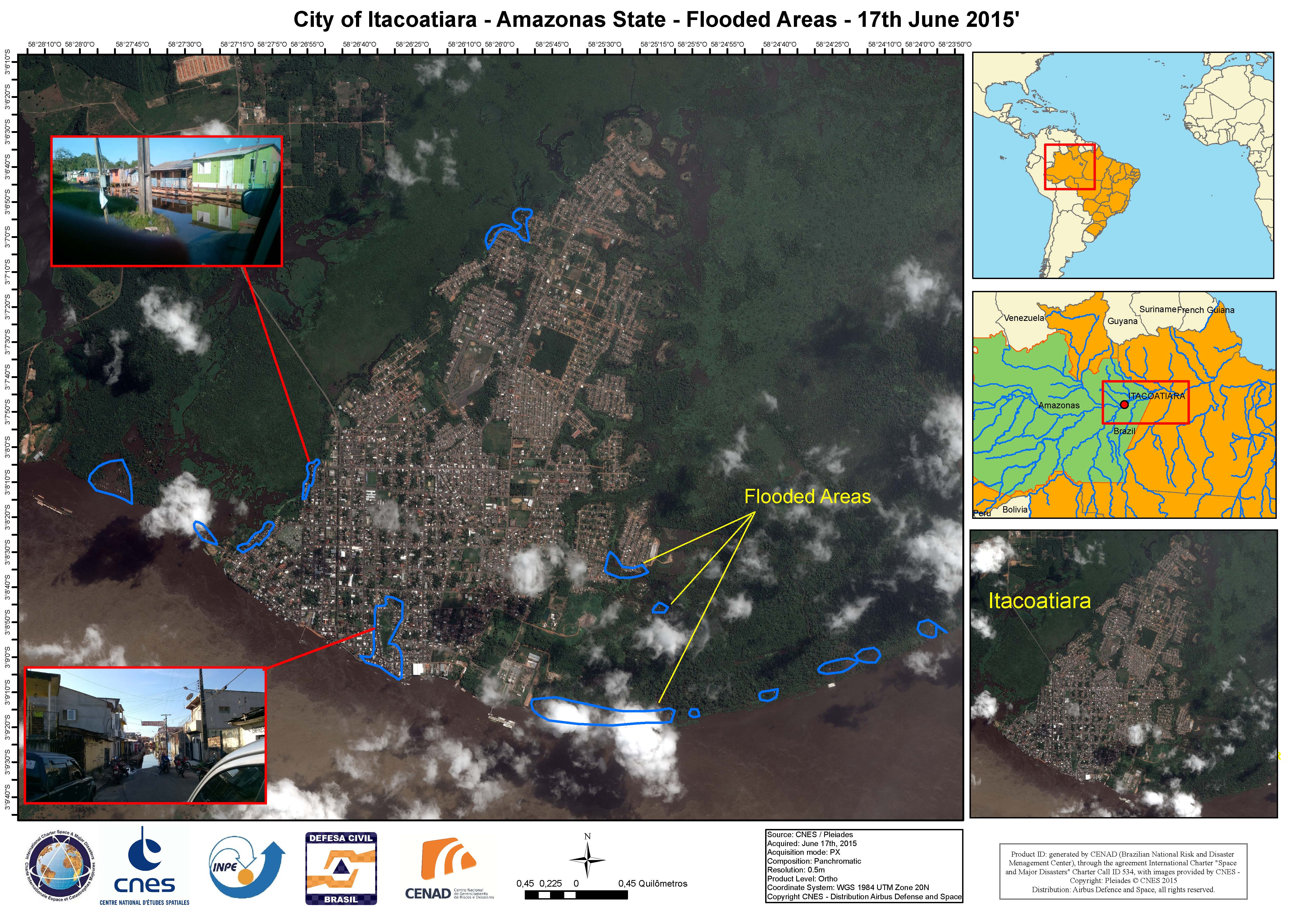
巴西洪水
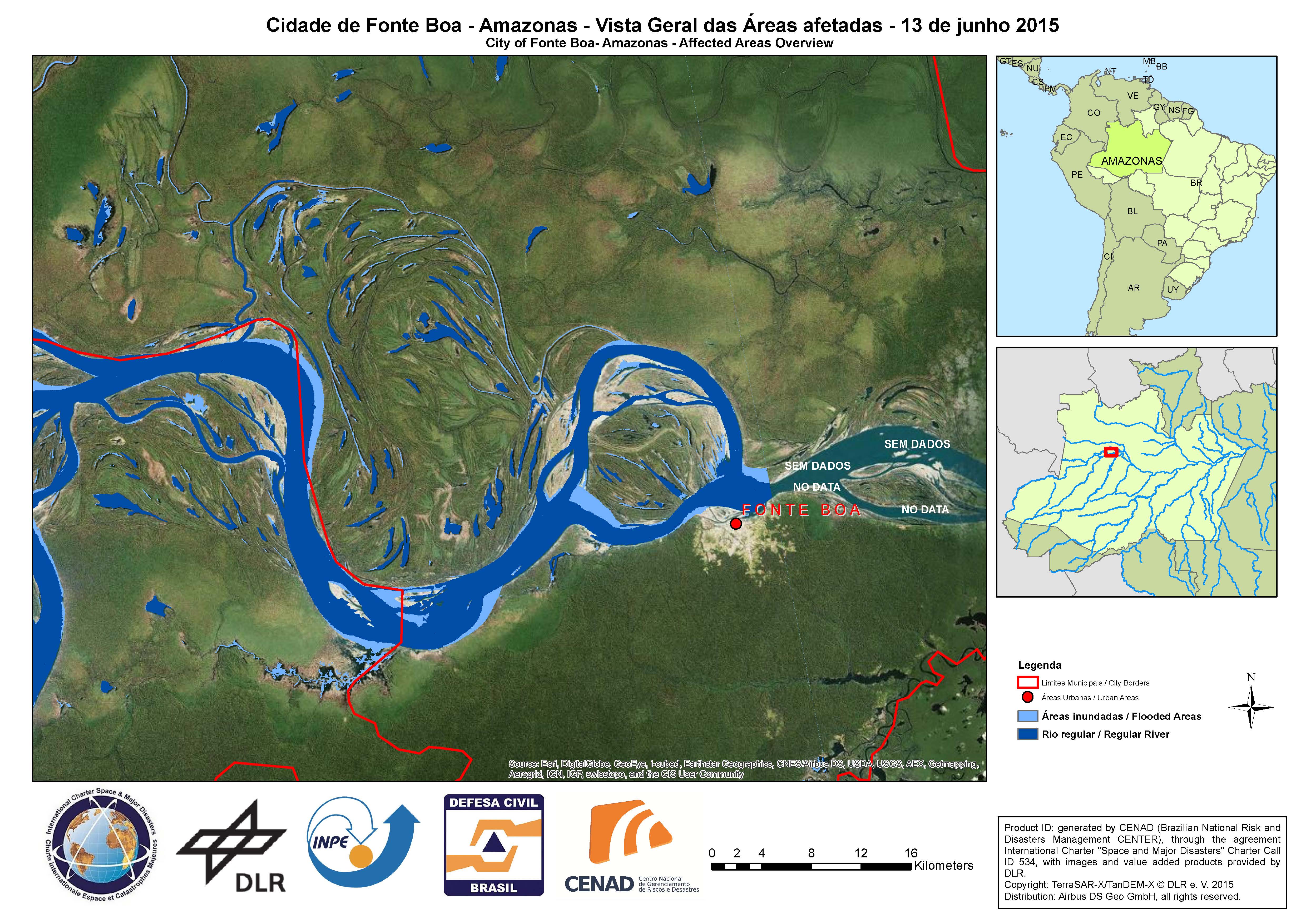
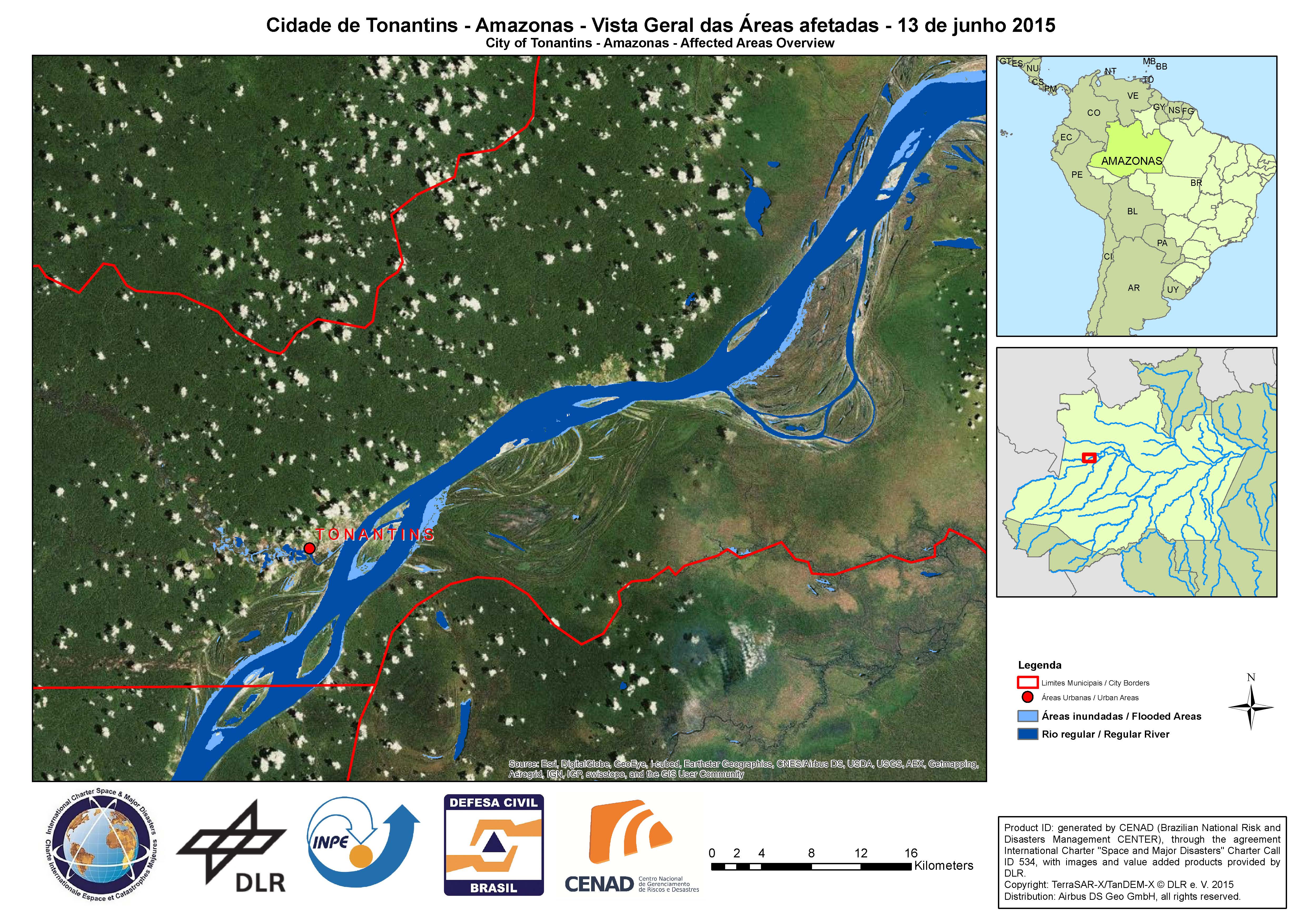
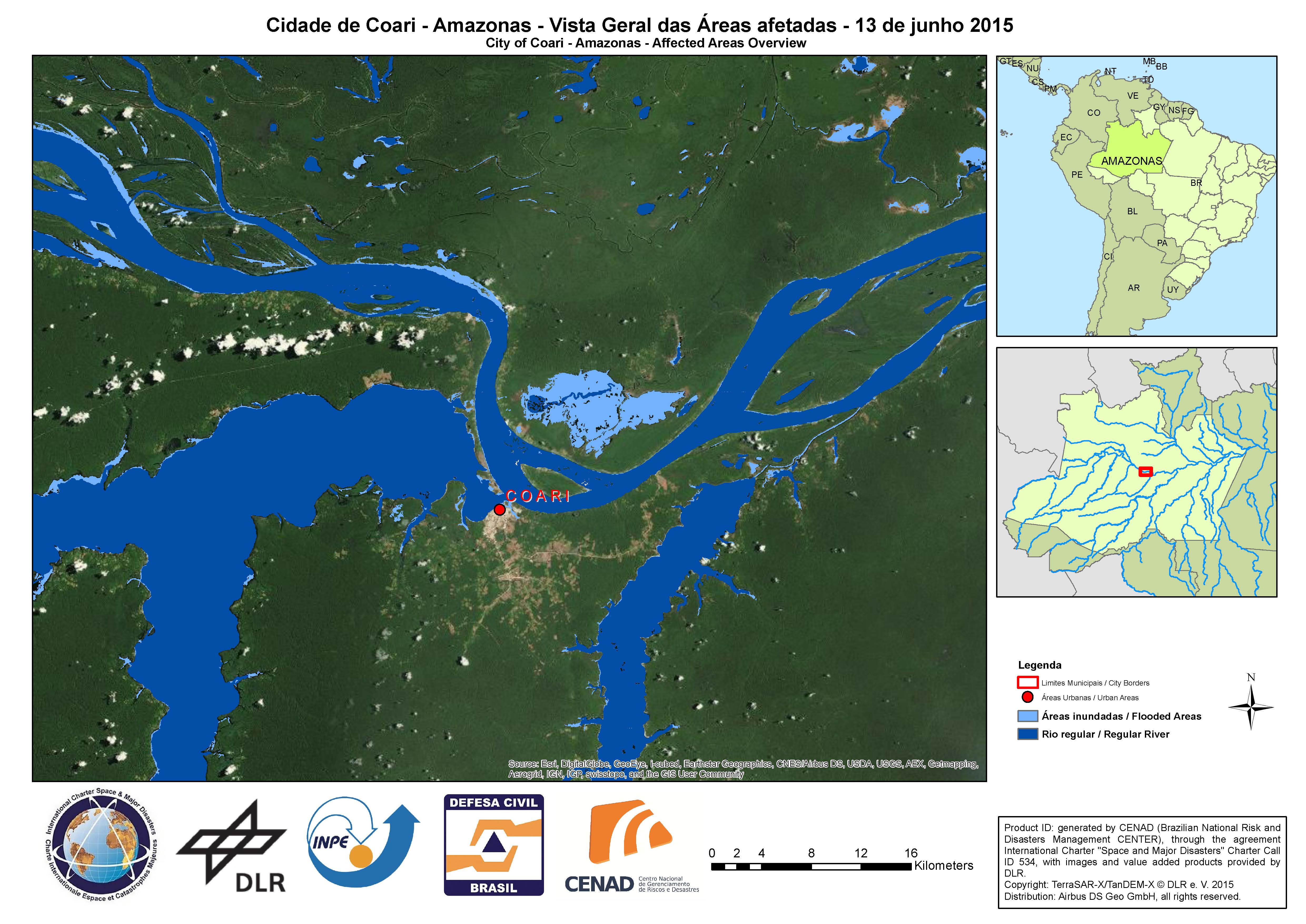
目前已有250000多人受巴西特大洪水影响,39座城市被淹。
此次洪水被认为是近年来巴西所经历的范围最广的洪水之一。
持续的洪灾开始于2015年4月,长期的大雨导致亚马逊河河水溢出,影响着沿河流域的城市。索利蒙伊斯河是位于巴西北部,亚马逊河上游的一条支流,在6月早期河水泛滥,淹没了附近的亚巴孙州的多个城市街道。由于洪水导致的高水位,一些居民只能借助独木舟,在洪水泛滥的街道航行。
每年这个时间,巴西经常会出现洪灾,持续的高水位造成了农业灾难,而且目前对该地区的破坏还在继续。
| 事件类型: | 洪水 |
| 事件地点: | 巴西 |
| 启动宪章的日期: | 2015年6月11日 |
| 宪章启动时间: | 21:37:56 |
| 宪章启动时区: | UTC+02:00 |
| 宪章要求者: | 巴西国家灾害管理中心 |
| 项目经理: | 巴西国家灾害管理中心 |
Products


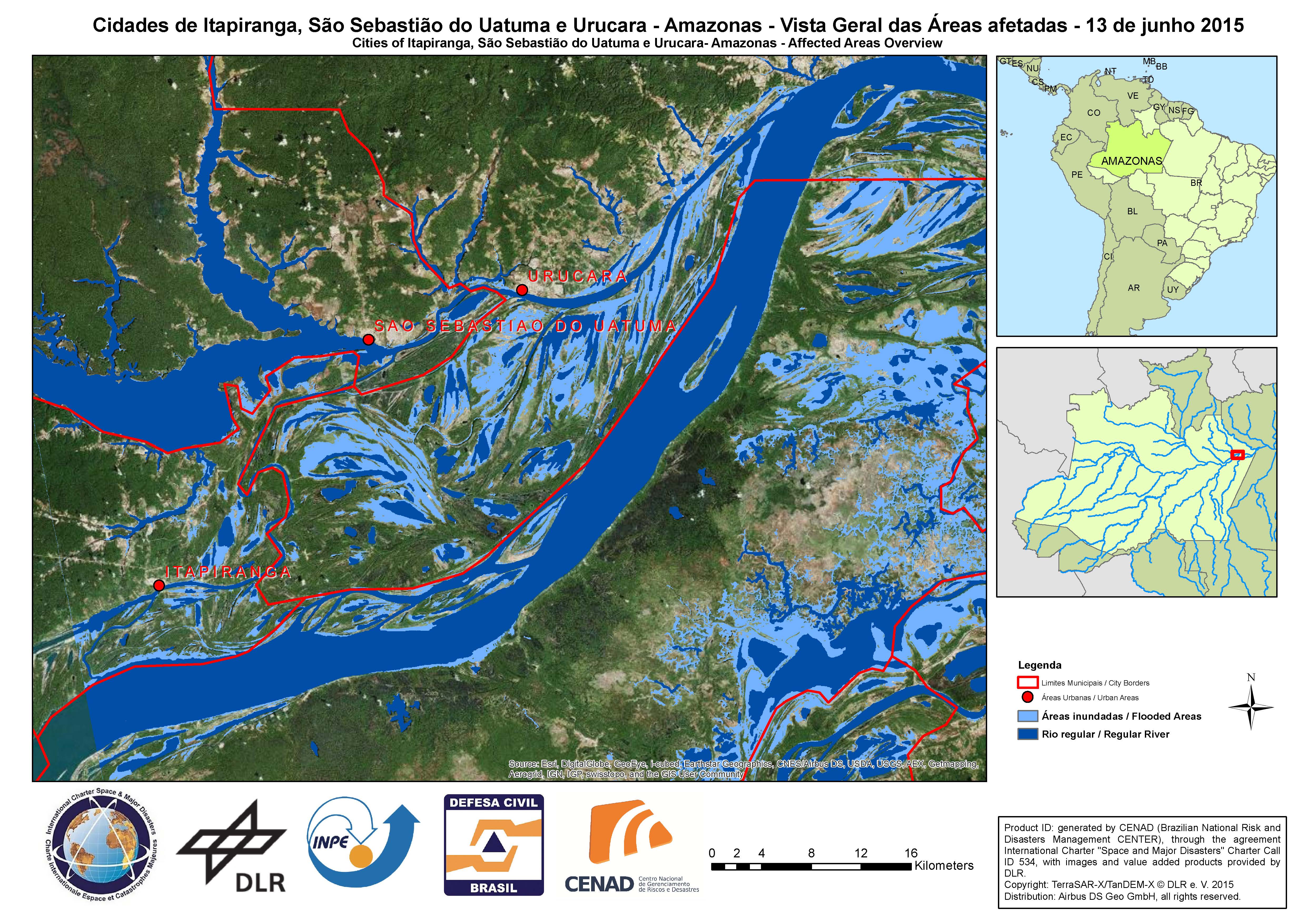
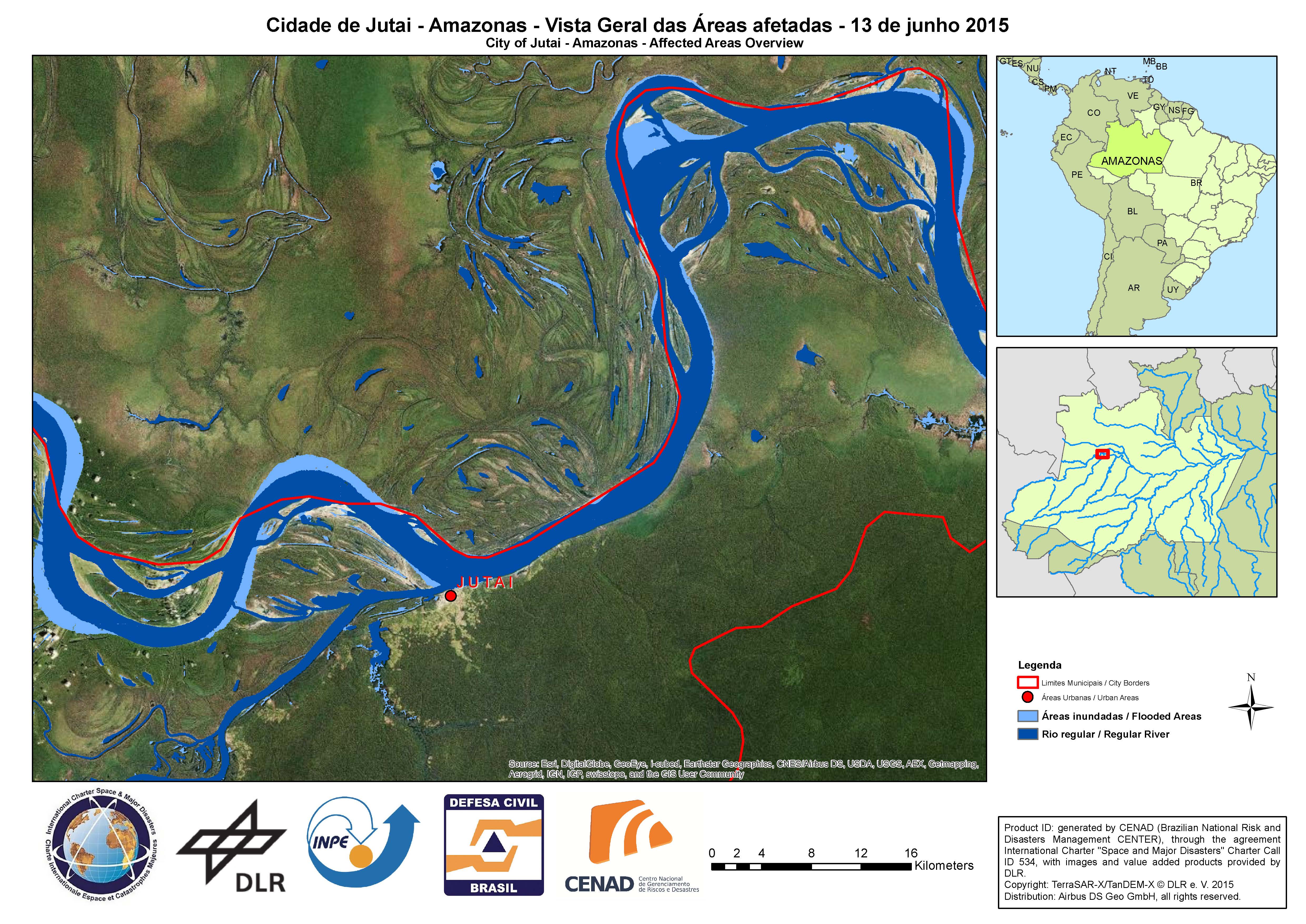
Affected areas overview - Cities of Itapiranga, Sao Sebastiao do Uatuma e Urucara, in Amazonas State
版权: German Aerospace Center (DLR), 2015 Airbus Defence and Space / Infoterra GmbH
Map produced by CENAD (Brazilian National Risk and Disaster Management Center)
Information about the Product
已获得: 13/06/2015
源: TerraSAR-X / TanDEM-X
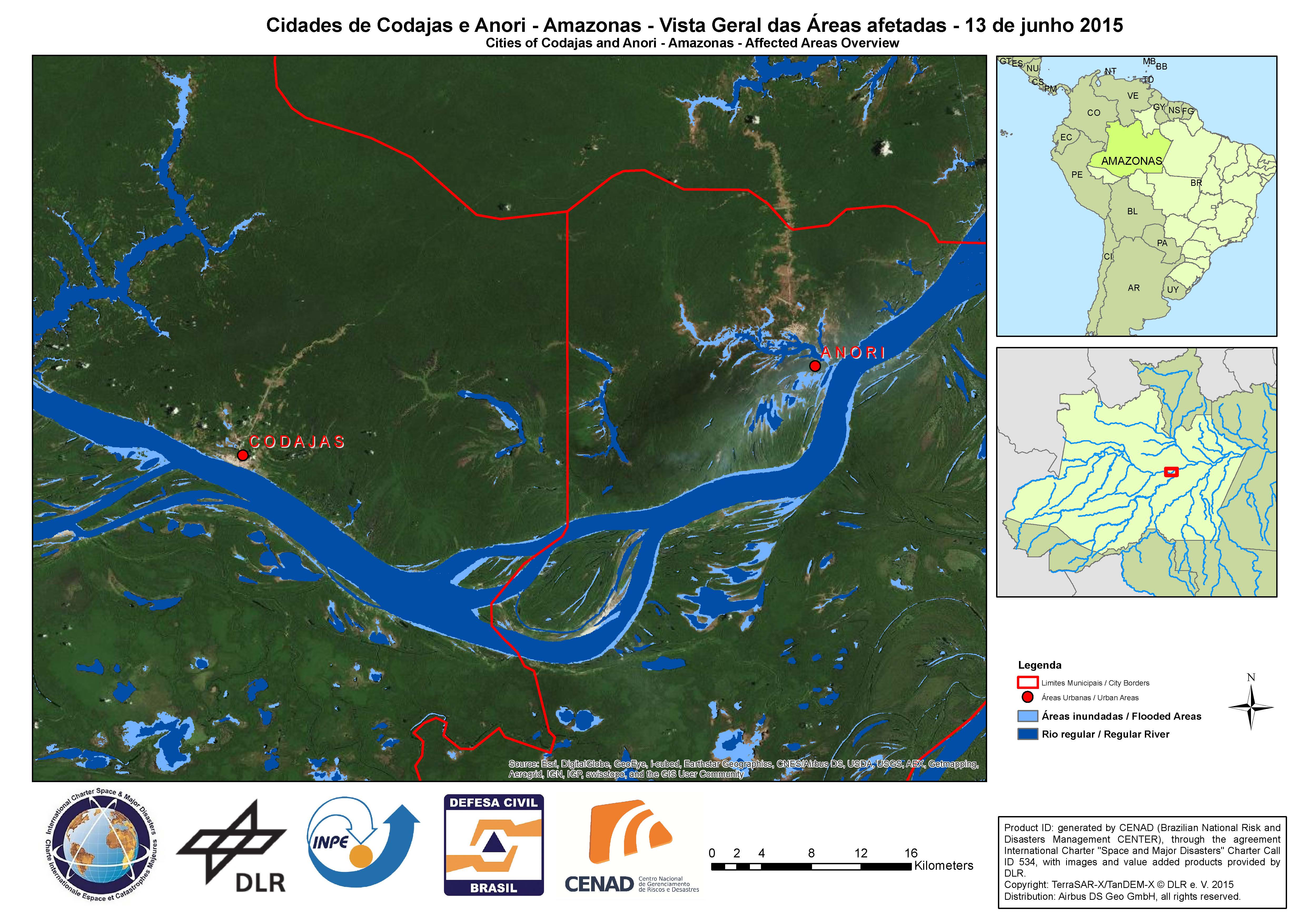
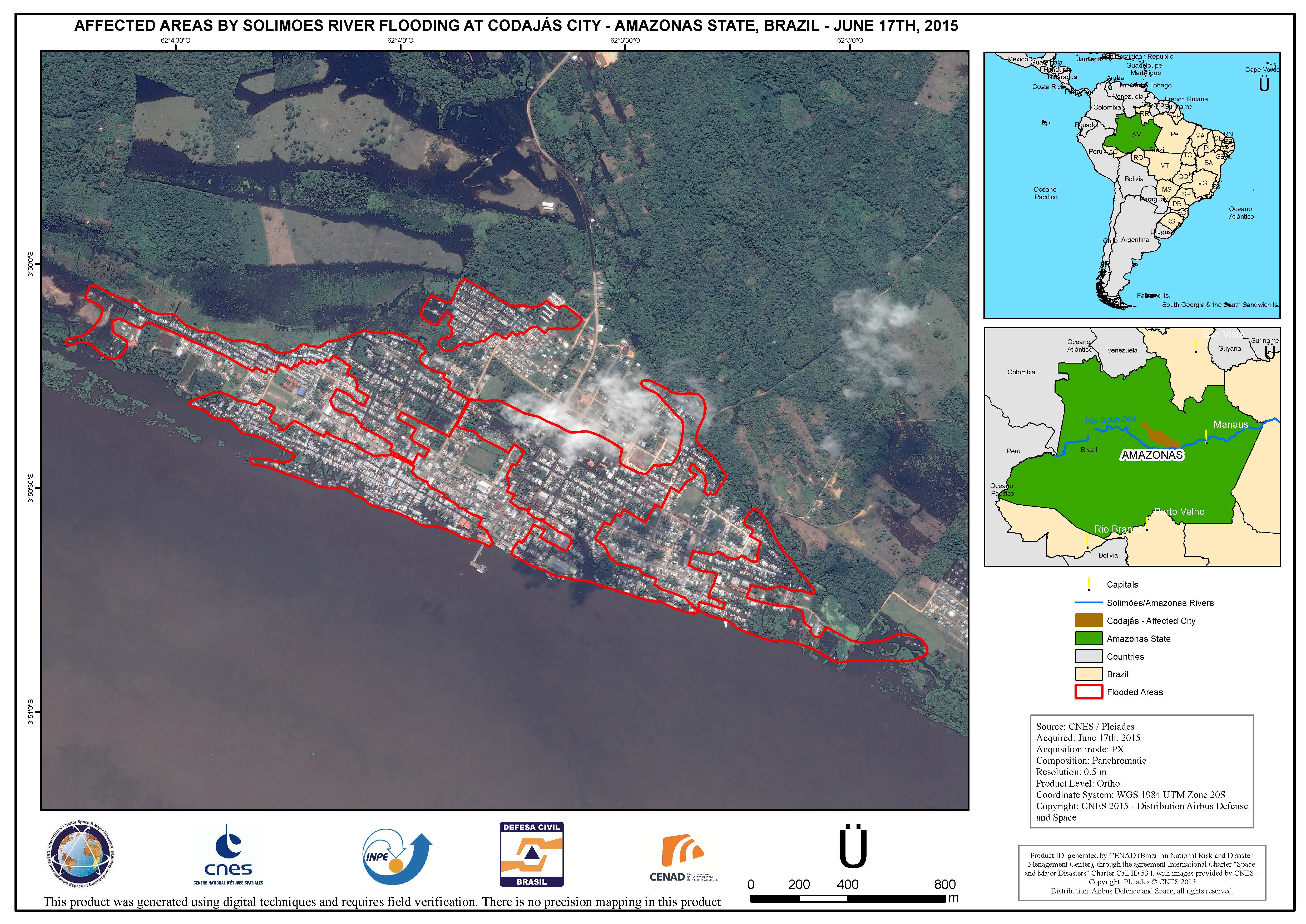
Affected areas overview - Cities of Codajas and Anori, in Amazonas State
版权: German Aerospace Center (DLR), 2015 Airbus Defence and Space / Infoterra GmbH
Map produced by CENAD (Brazilian National Risk and Disaster Management Center)
Information about the Product
已获得: 13/06/2015
源: TerraSAR-X / TanDEM-X
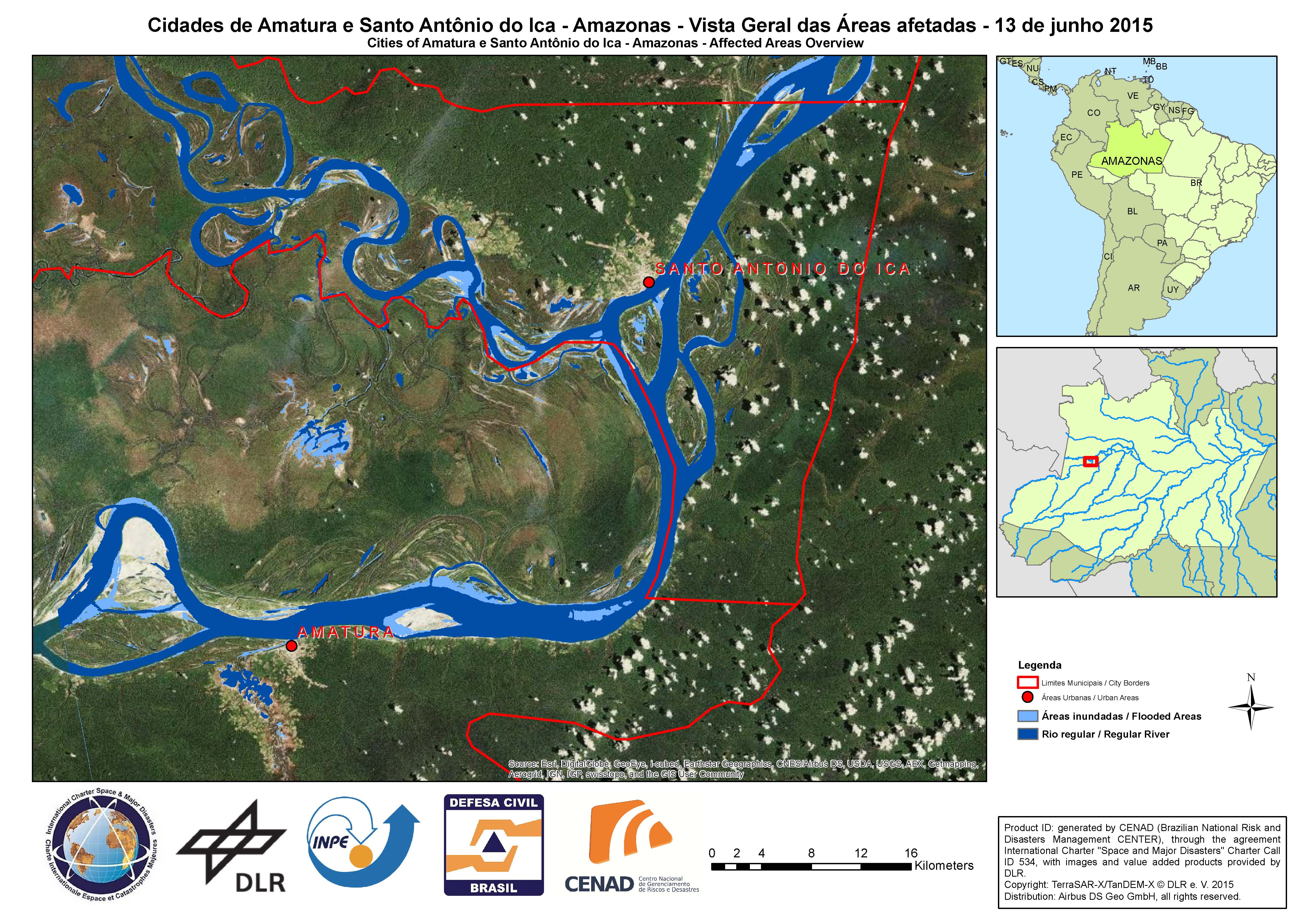
Affected areas overview - Cities of Amatura and Santo Antonio do Ica in Amazonas State
版权: German Aerospace Center (DLR), 2015 Airbus Defence and Space / Infoterra GmbH
Map produced by CENAD (Brazilian National Risk and Disaster Management Center)
Information about the Product
已获得: 13/06/2015
源: TerraSAR-X / TanDEM-X
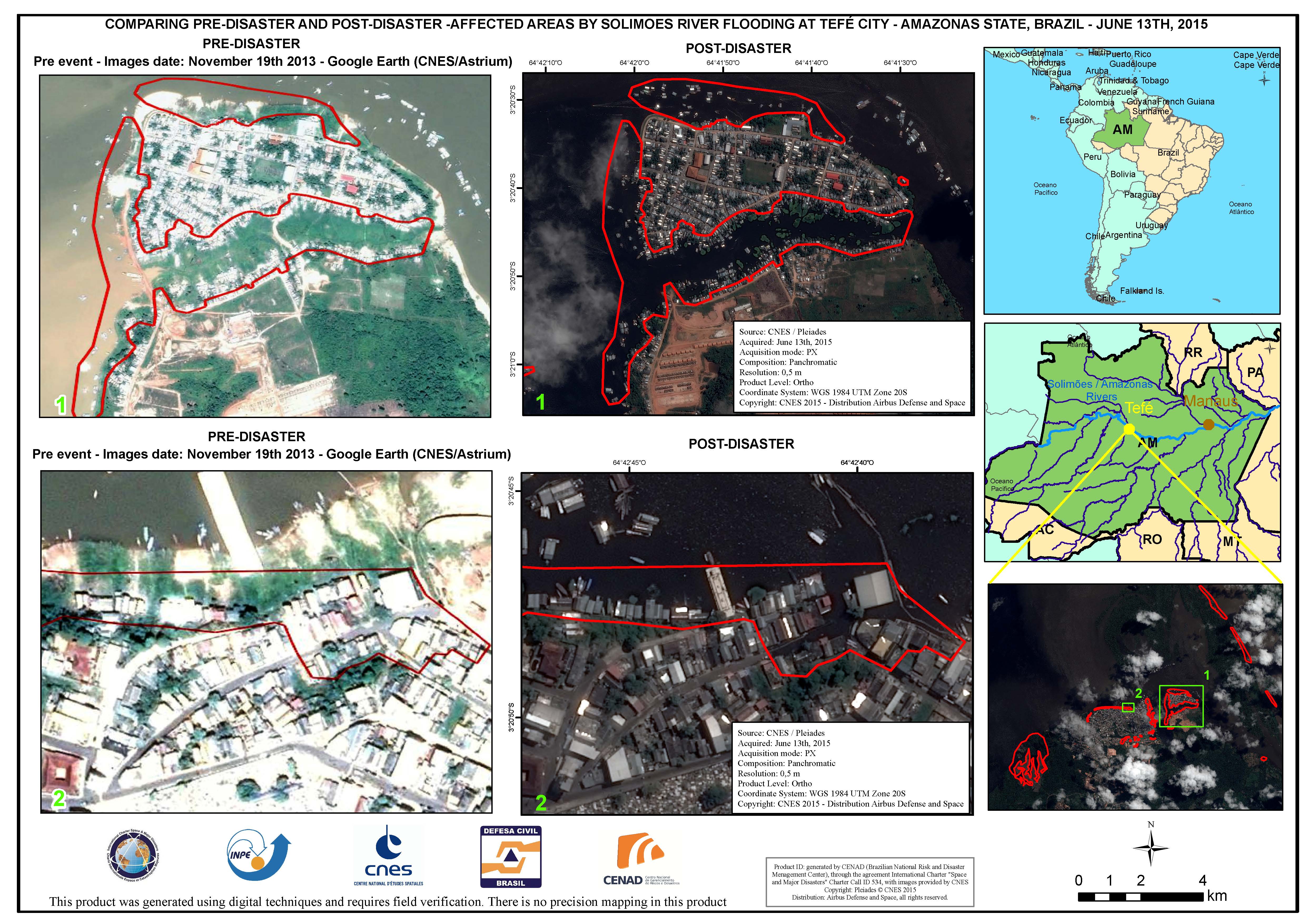
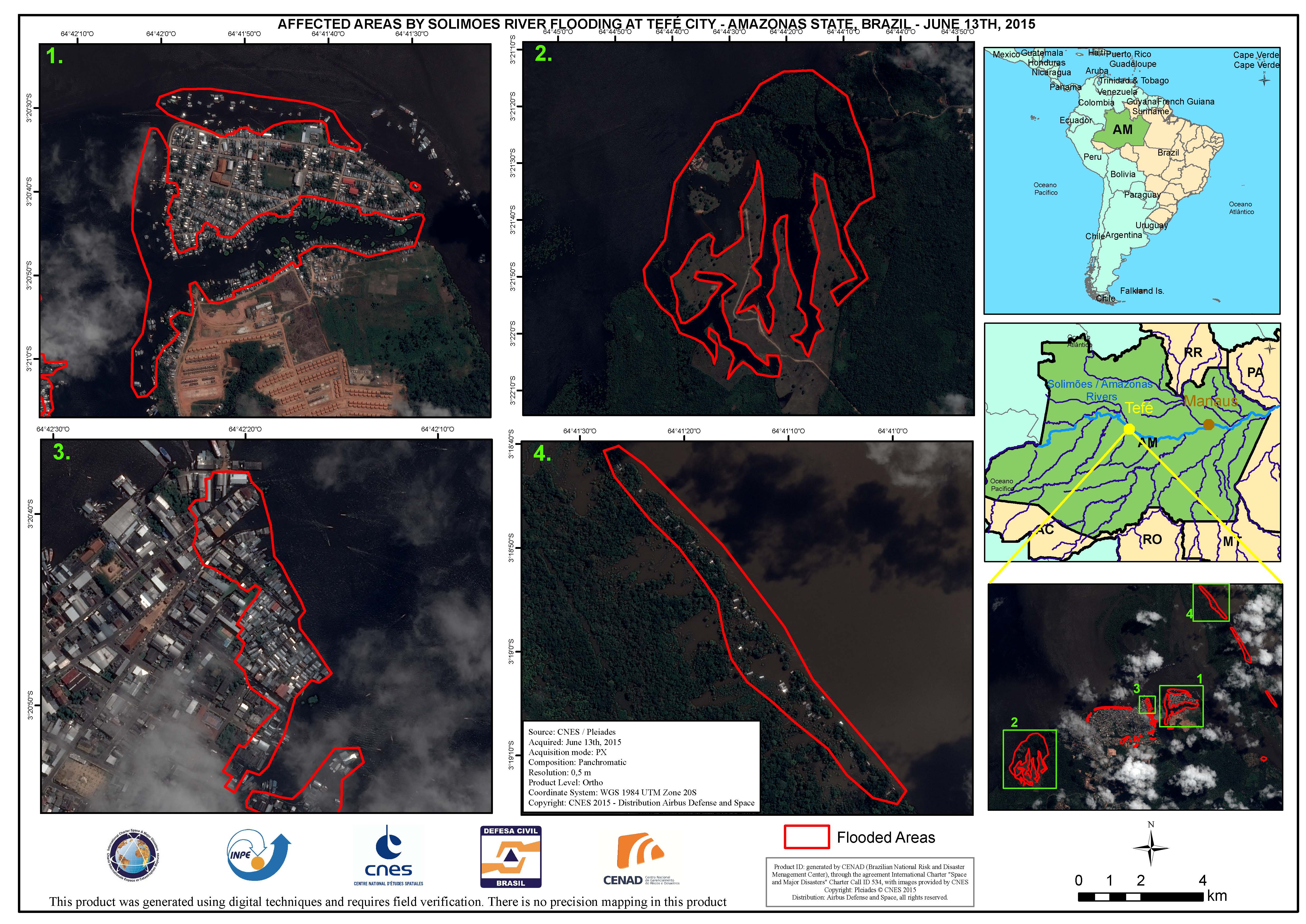
Comparison of areas affected by Solimoes River flooding at Tefe City, in Amazonas State, Brazil
版权: CNES 2015 - Distribution: Airbus Defence and Space, all rights reserved
Map produced by CENAD (Brazilian National Risk and Disaster Management Center)
Information about the Product
已获得: Pre-disaster: 19/11/2013
Post-disaster: 13/06/2015
源: Pleiades
 返回完整的响应档案

