 English
 Spanish
 French
 Chinese
 Russian
 Portuguese
 Последняя Активация
Charter activations
Flood in Myanmar
Torrential monsoon rains have flooded large areas of Myanmar, leaving at least 69 people dead and affecting the homes of more than 250,000 people, across 12 of Myanmar's 14 states. Many areas are cut off with flooding, high waters and landslides.
Residents of Myanmar's delta region expect flood water levels to increase as water continues to flow from the north of the country. Rivers in the Ayeyarwady delta region were 0.6 to 1 metre higher than safe levels, with water levels expected to rise a further 15cm in coming days.
The delta regions affected are a major rice producing area and local reports have estimated that 1 million acres of farmland, mostly rice paddies, are flooded and more than 65,000 acres have been destroyed, raising concerns over the countries food security.
The government of Myanmar has declared four areas; Chin, Magway, Sagaing and Rakhine as disaster zones, and called for international aid to assist in relief efforts.
| Тип события: | Flood |
| Место события: | Myanmar |
| Date of Charter Activation: | 5 August 2015 |
| Время активации Хартии: | 17:00:00 |
| TЧасовой пояс в районе активации Хартии: | UTC+02:00 |
| Запрос на активацию поступил от: | UNITAR/UNOSAT on behalf of UNDP Myanmar |
| Менеждер проекта от: | UNITAR/UNOSAT |
Products
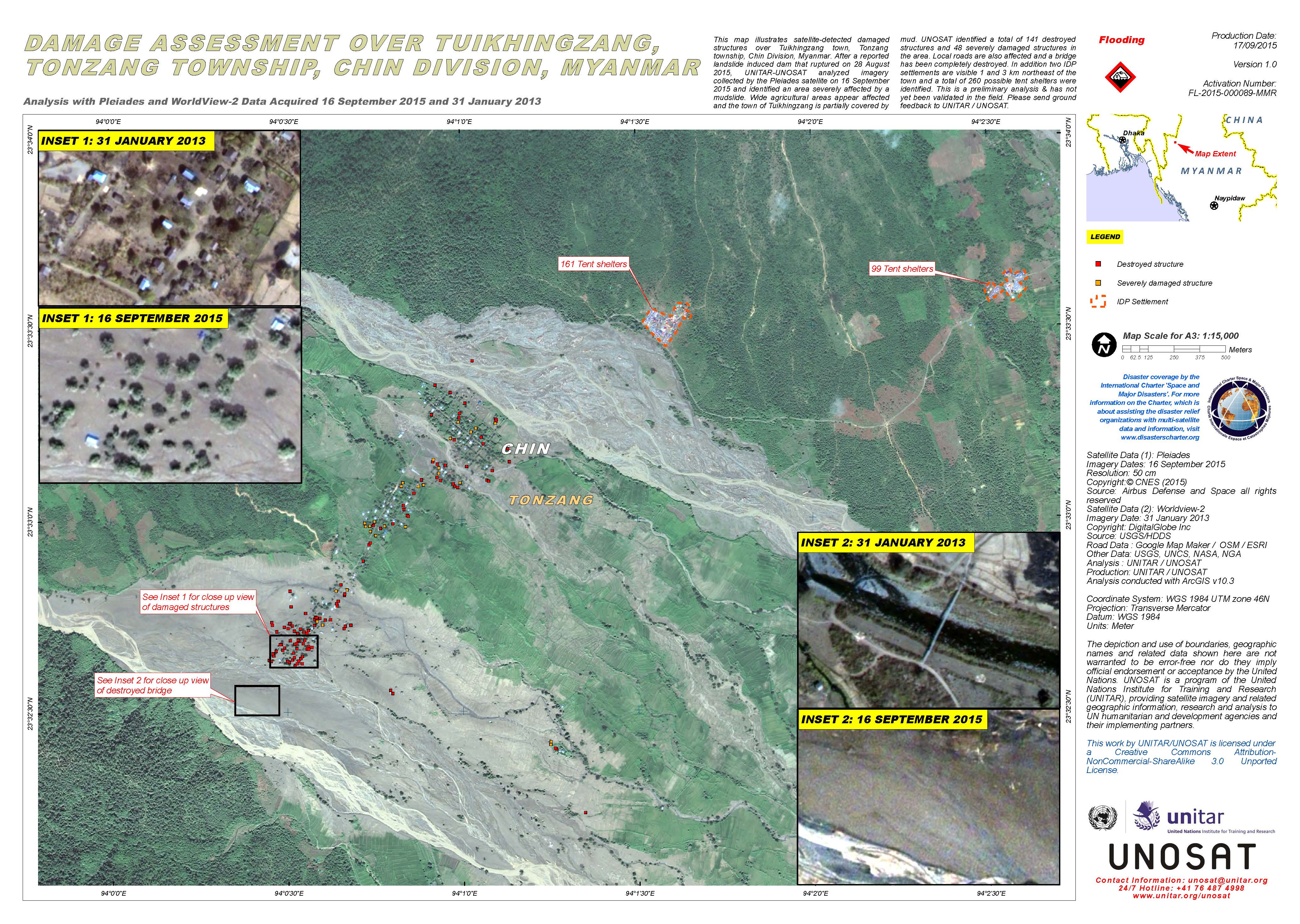
Damage assessment over Tuikhingzang and Tonzang township, Chin Division, Myanmar
Авторские права: Pleiades © CNES 2015 - Distribution: Airbus Defence and Space, all rights reserved
WorldView-2 © DigitalGlobe Inc.
Map produced by UNITAR/UNOSAT
Information about the Product
Получено: Pleiades: 16/09/2015
WorldView-2: 31/01/2013
Источник: Pleiades / WorldView-2
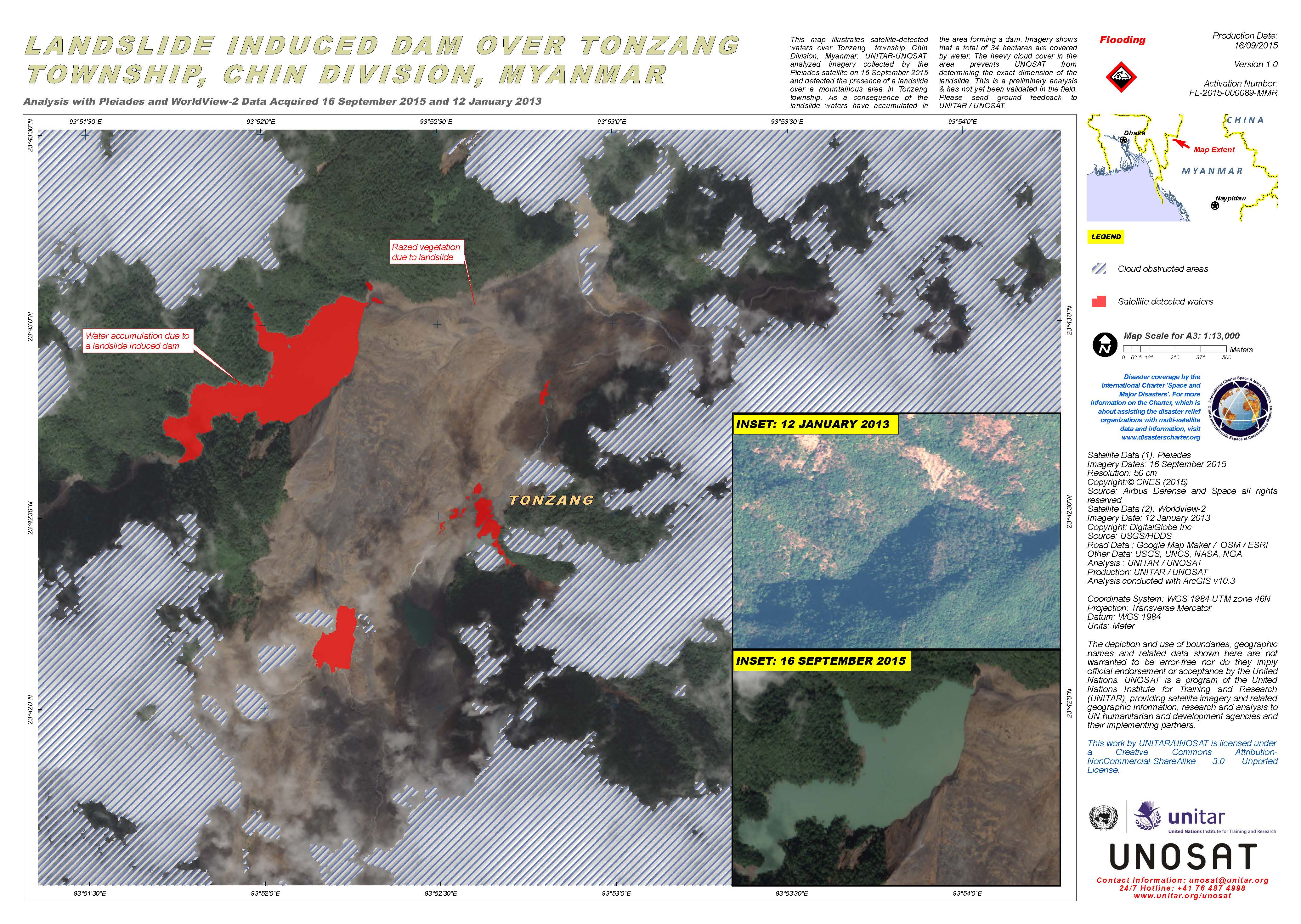
Landslide induced dam over Tonzang township, Chin Division, Myanmar
Авторские права: Pleiades © CNES 2015 - Distribution: Airbus Defence and Space, all rights reserved
WorldView-2 © DigitalGlobe Inc.
Map produced by UNITAR/UNOSAT
Information about the Product
Получено: Pleiades: 16/09/2015
WorldView-2: 12/01/2013
Источник: Pleiades / WorldView-2
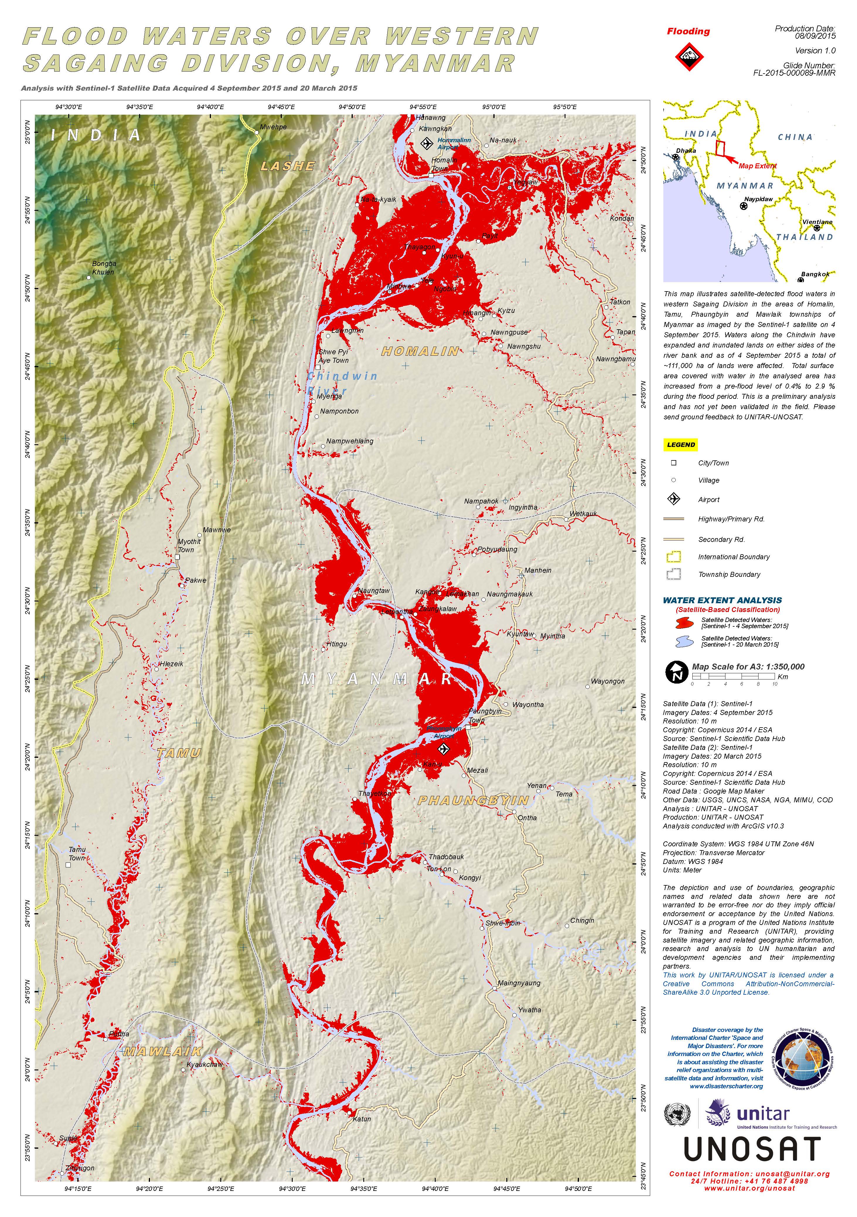
Flood waters over western Sagaing Division, Myanmar
Авторские права: Copernicus Sentinel data 2015 / ESA
Map produced by UNITAR/UNOSAT
Information about the Product
Получено: Pre-disaster: 20/03/2015
Post-disaster: 04/09/2015
Источник: Sentinel-1
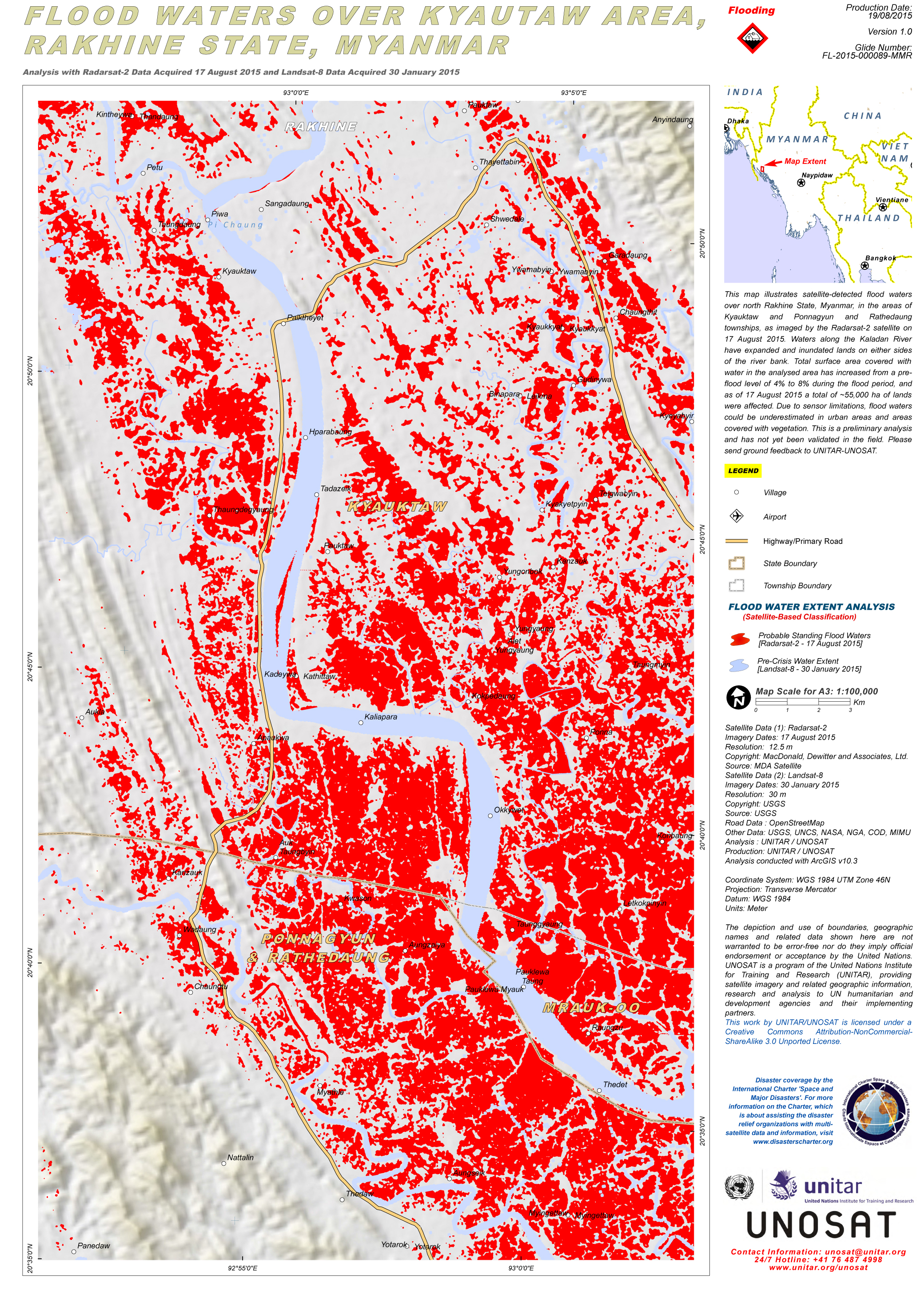
Flood waters over Kyautaw area, Rakhine State, Myanmar
Авторские права: RADARSAT-2 Data and Products © MacDonald, Dettwiler and Associates Ltd. (2015) - All Rights Reserved. RADARSAT is an official trademark of the Canadian Space Agency.
Landsat 8 data and products © USGS (2015) - All rights reserved
Map produced by UNITAR/UNOSAT
Information about the Product
Получено: RADARSAT-2: 17/08/2015
Landsat 8: 30/01/2015
Источник: RADARSAT-2 / Landsat 8
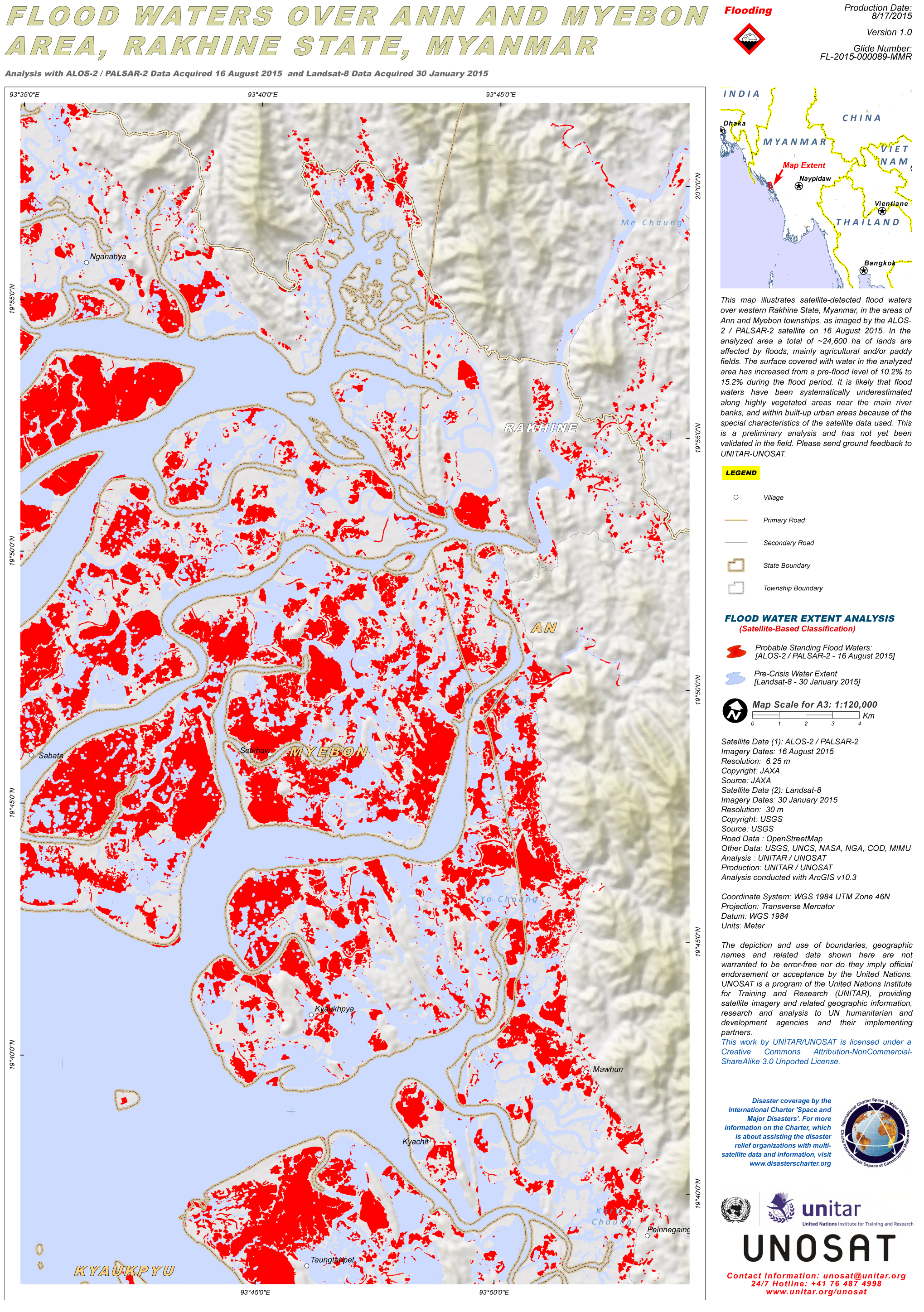
Flood waters over Ann and Myebon area, Rakhine State, Myanmar
Авторские права: ALOS-2 © JAXA 2015
Landsat 8 data and products © USGS (2015) - All rights reserved
Map produced by UNITAR/UNOSAT
Information about the Product
Получено: ALOS-2 / PALSAR-2: 16/08/2015
Landsat 8: 30/01/2015
Источник: ALOS-2 / PALSAR-2 / Landsat 8
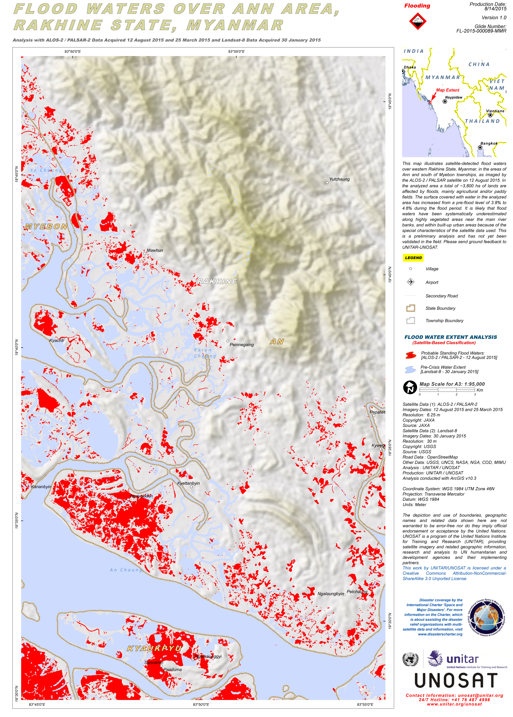
Flood waters over Ann Area, Rakhine State, Myanmar
Авторские права: ALOS-2 © JAXA 2015
Landsat 8 data and products © USGS (2015) - All rights reserved
Map produced by UNITAR/UNOSAT
Information about the Product
Получено: ALOS-2 / PALSAR-2: 25/03/2015 & 12/08/2015
Landsat 8: 30/01/2015
Источник: ALOS-2 / PALSAR-2 / Landsat-8
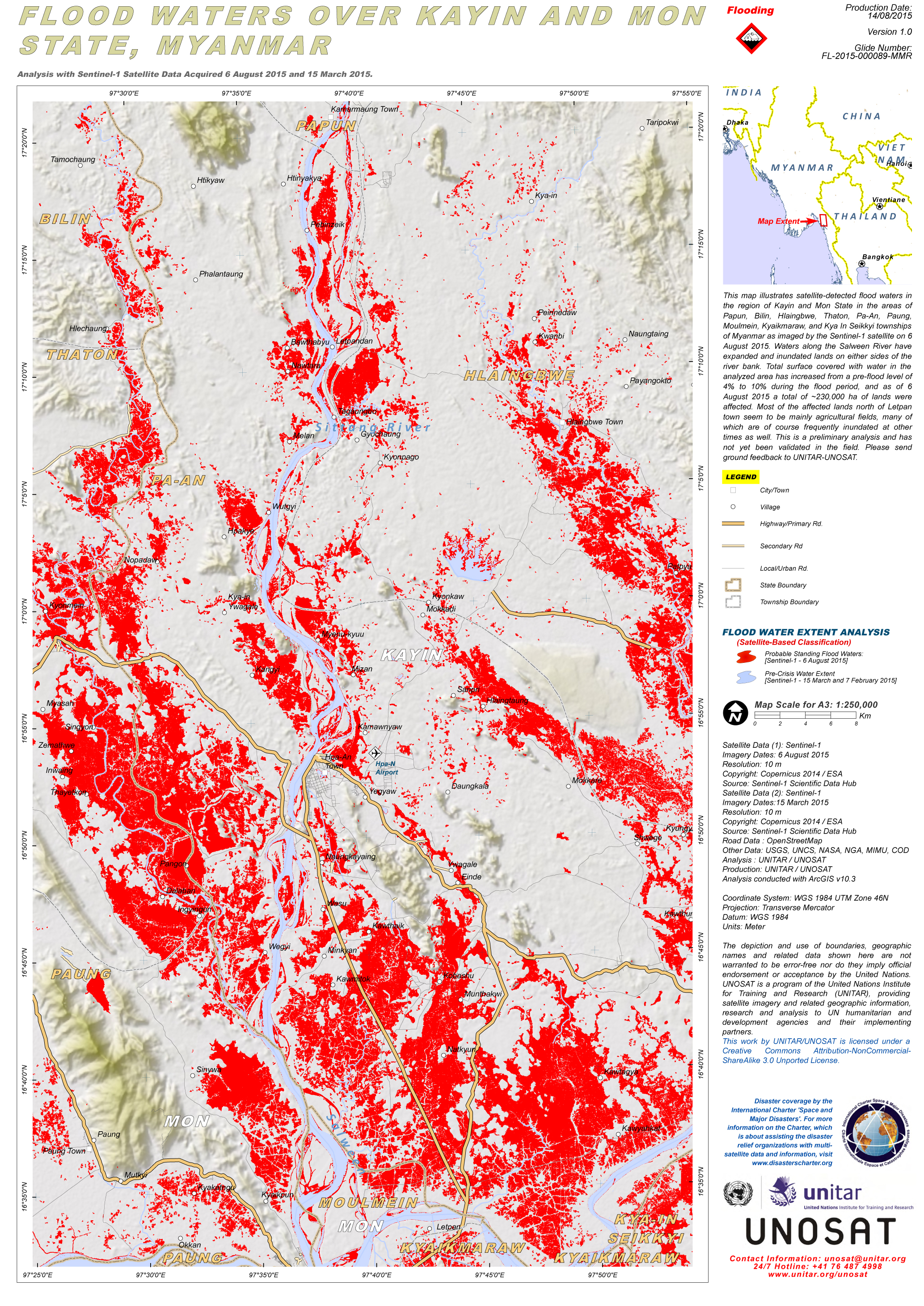
Flood waters over Kayin and Mon State, Myanmar
Авторские права: Copernicus Sentinel data 2015 / ESA
Map produced by UNITAR/UNOSAT
Information about the Product
Получено: Pre-disaster: 15/03/2015
Post-disaster: 06/08/2015
Источник: Sentinel-1
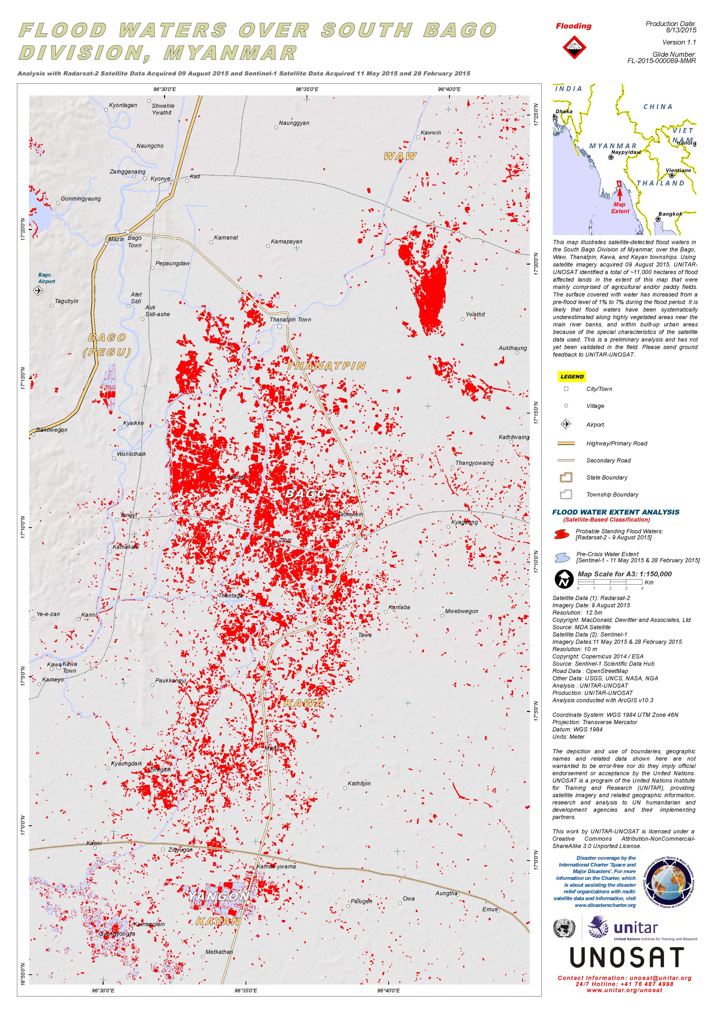
Flood waters over South Bago Division, Myanmar
Авторские права: RADARSAT-2 Data and Products © MacDonald, Dettwiler and Associates Ltd. (2015) - All Rights Reserved. RADARSAT is an official trademark of the Canadian Space Agency.
Sentinel-1A © Copernicus Sentinel data 2015 / ESA
Map produced by UNITAR/UNOSAT
Information about the Product
Получено: RADARSAT-2: 09/08/2015
Sentinel-1: 11/05/2015 and 28/02/2015
Источник: RADARSAT-2 / Sentinel-1
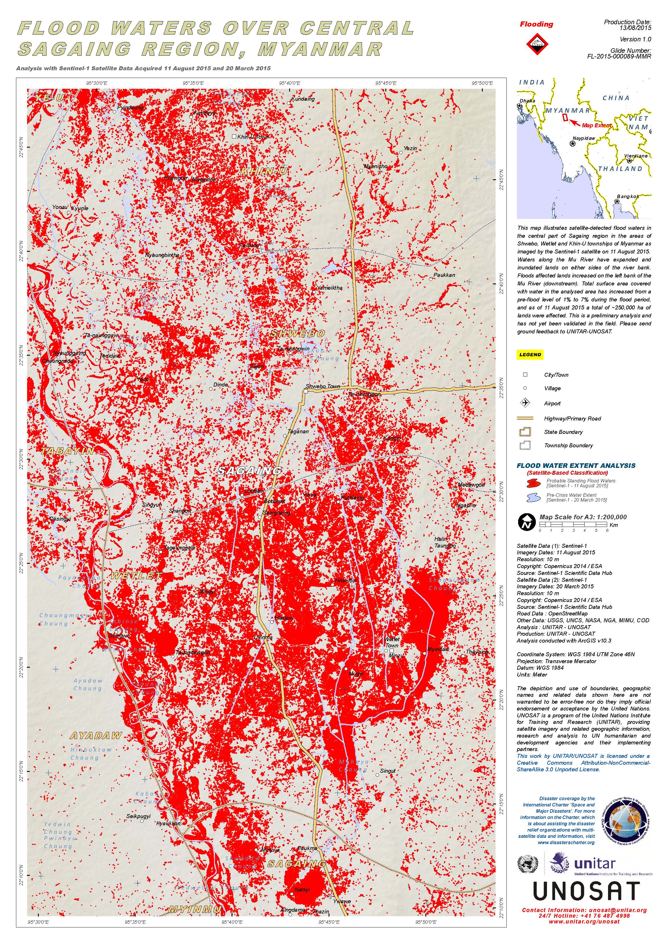
Flood waters over central Sagaing Region, Myanmar
Авторские права: Copernicus Sentinel data 2015 / ESA
Map produced by UNITAR/UNOSAT
Information about the Product
Получено: Pre-disaster: 20/03/2015
Post-disaster: 11/08/2015
Источник: Sentinel-1
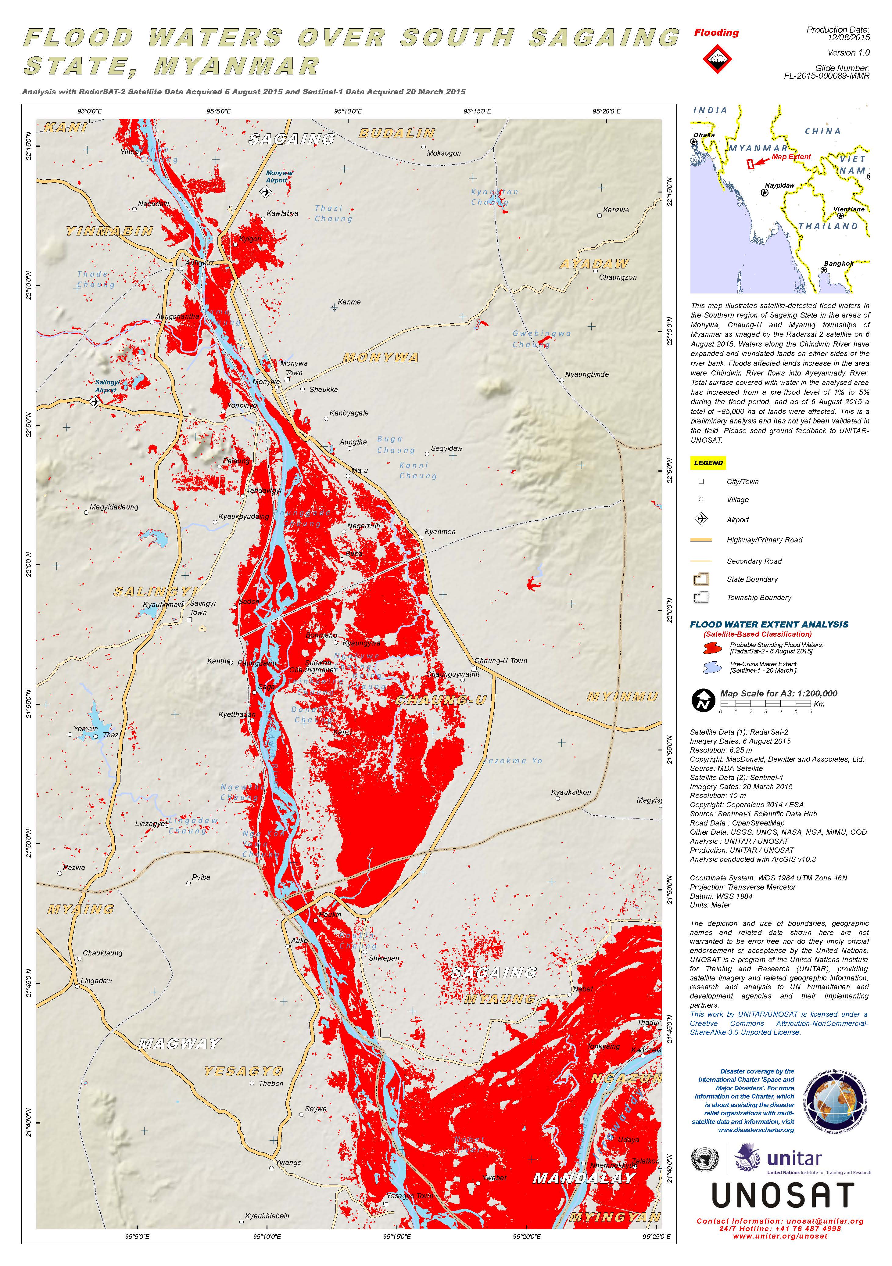
Flood waters over south Sagaing State, Myanmar
Авторские права: RADARSAT-2 Data and Products © MacDonald, Dettwiler and Associates Ltd. (2015) - All Rights Reserved. RADARSAT is an official trademark of the Canadian Space Agency.
Sentinel-1A © Copernicus Sentinel data 2015 / ESA
Map produced by UNITAR/UNOSAT
Information about the Product
Получено: RADARSAT-2: 06/08/2015
Sentinel-1: 20/03/2015
Источник: RADARSAT-2 / Sentinel-1
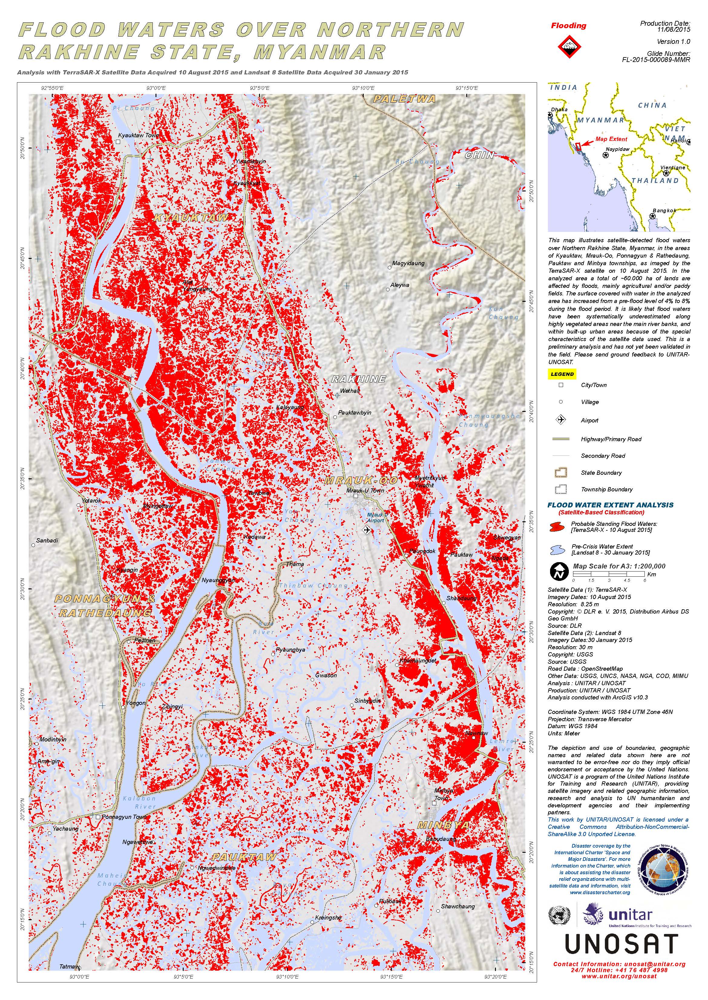
Flood waters over Northern Rakhine State, Myanmar
Авторские права: TerraSAR-X © DLR e. V. 2015, Distribution Airbus DS Geo GmbH
Landsat 8 data and products © USGS (2015) - All rights reserved
Map produced by UNITAR/UNOSAT
Information about the Product
Получено: TerraSAR-X: 10/08/2015
Landsat 8: 30/01/2015
Источник: TerraSAR-X / Landsat 8
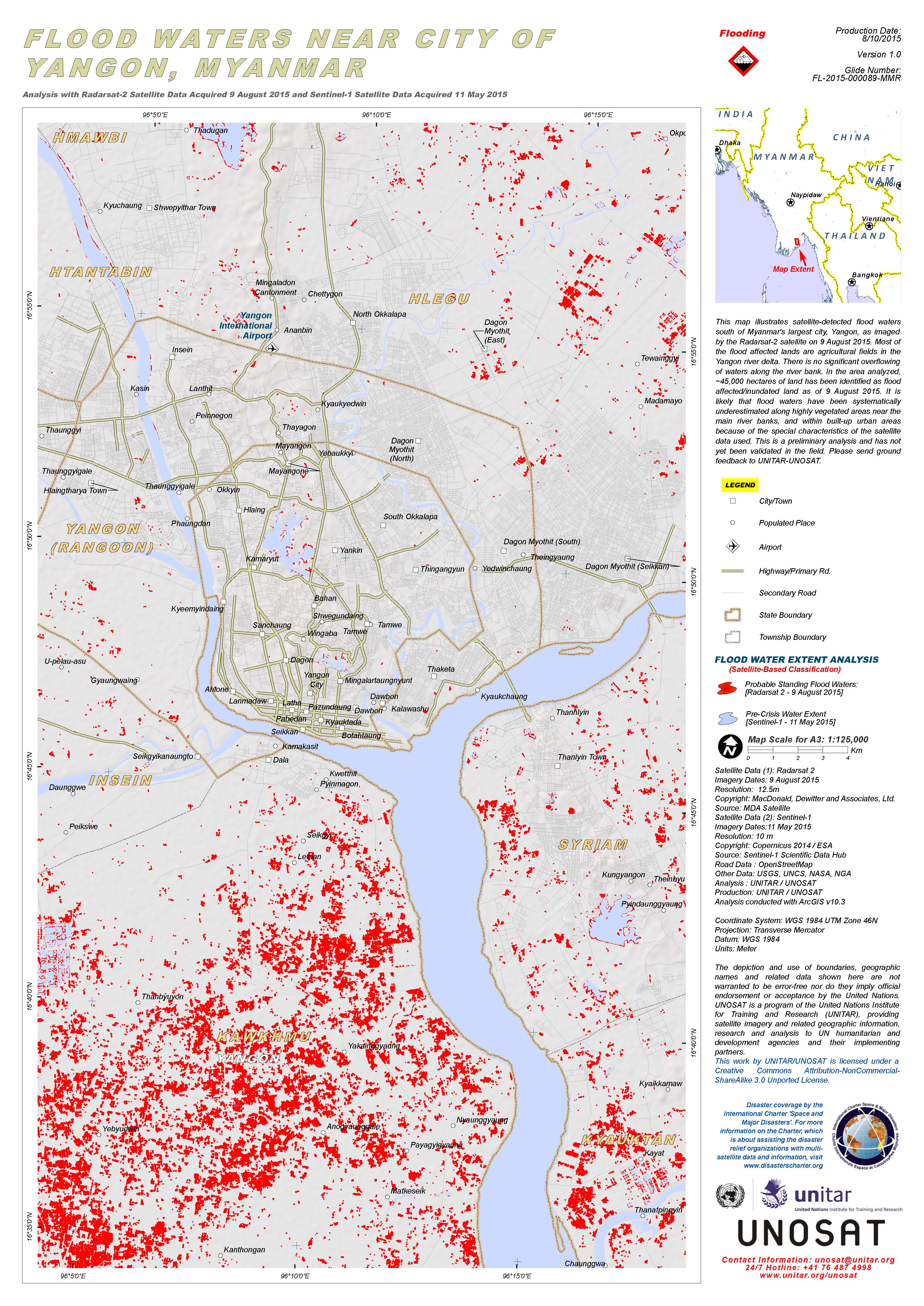
Flood waters near the city of Yangon, Myanmar
Авторские права: RADARSAT-2 Data and Products © MacDonald, Dettwiler and Associates Ltd. (2015) - All Rights Reserved. RADARSAT is an official trademark of the Canadian Space Agency.
Sentinel-1 © Copernicus Sentinel data 2015 / ESA
Map produced by UNITAR/UNOSAT
Information about the Product
Получено: RADARSAT-2: 09/08/2015
Sentinel-1: 11/05/2015
Источник: RADARSAT-2 / Sentinel-1
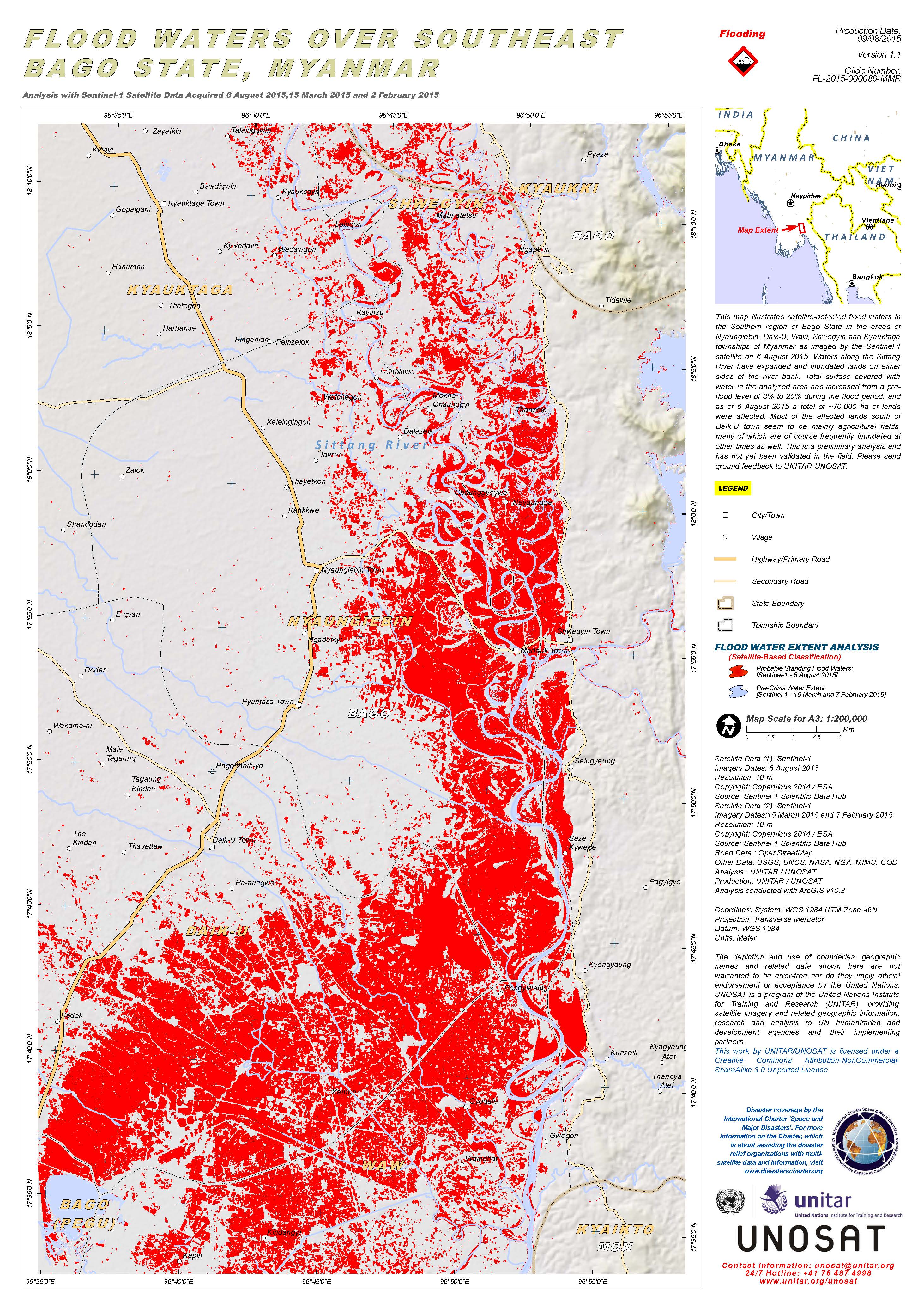
Flood waters over southeast Bago State, Myanmar
Авторские права: Copernicus Sentinel data 2015 / ESA
Map produced by UNITAR/UNOSAT
Information about the Product
Получено: Pre-disaster: 07/02/2015 and 15/03/2015
Post-disaster: 06/08/2015
Источник: Sentinel-1
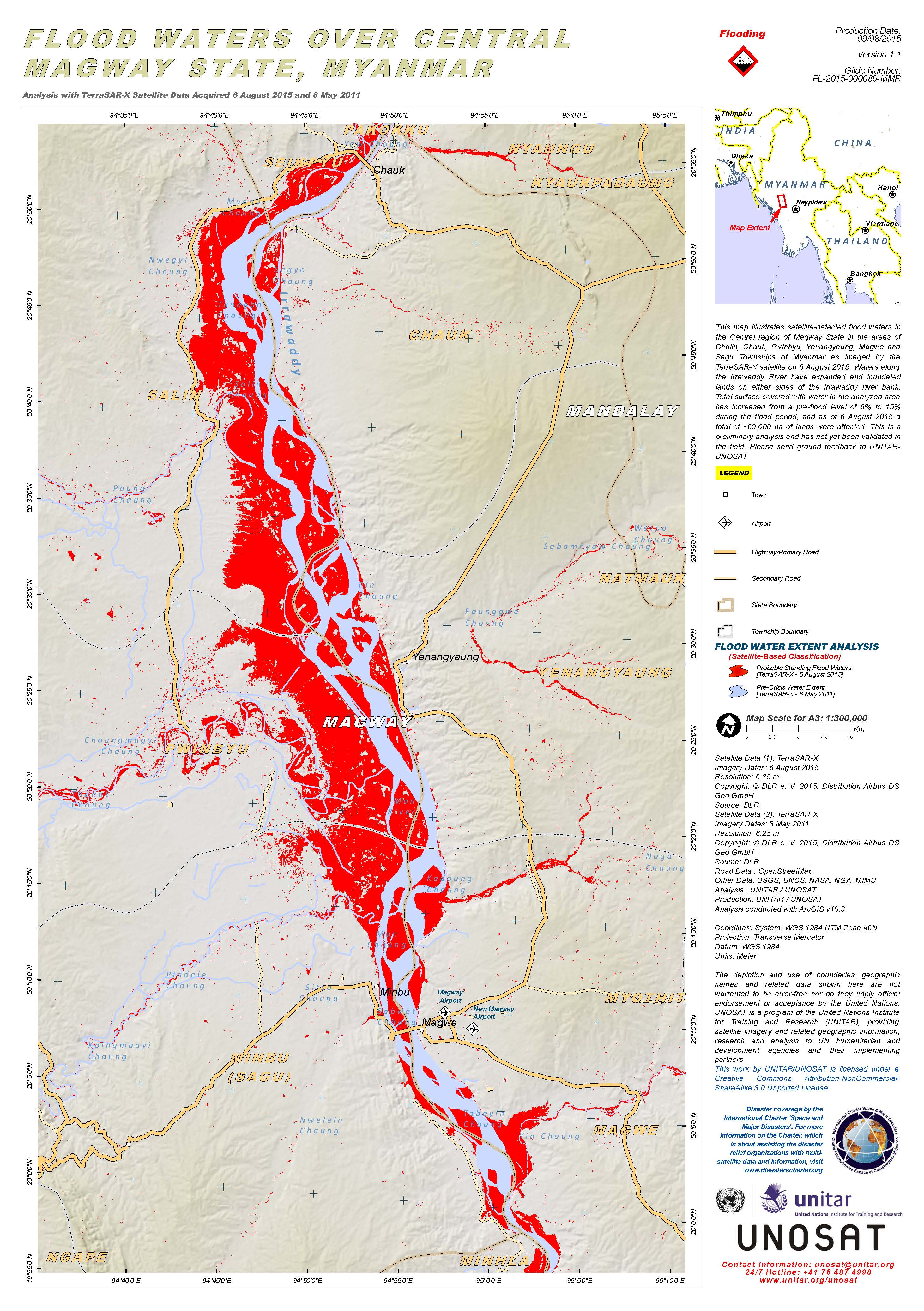
Flood waters over Central Magway State, Myanmar
Авторские права: DLR e. V. 2015, Distribution Airbus DS Geo GmbH
Map produced by UNITAR/UNOSAT
Information about the Product
Получено: Pre-disaster: 08/05/2011
Post-disaster: 06/08/2015
Источник: TerraSAR-X
 Вернуться к полному архиву активаций

