 English
 Spanish
 French
 Chinese
 Russian
 Portuguese
 Latest Activation
Charter activations
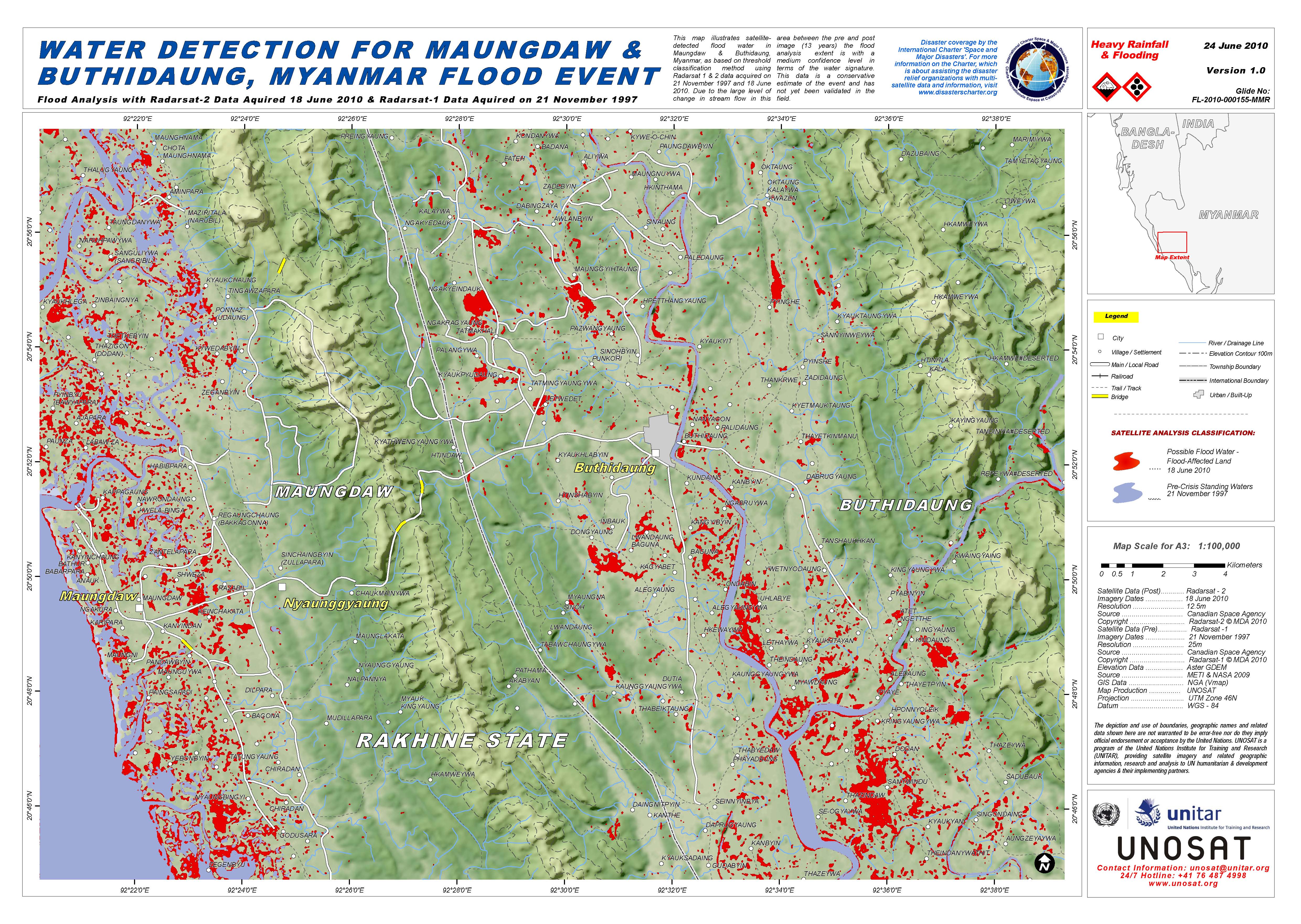
Floods in Myanmar
Tropical Cyclone Giri strengthened into a category 4 storm over the Northeast Indian Ocean as it approaches the west coast of Myanmar. Landfall of Giri on the coast of Myanmar is forecasted to happen, at or near Ramree Island.
The site of likely landfall lies between Chittagong, Bangladesh and the Myanmar capital, Yangon (or Rangoon).
As per field information major impact on local population is expected.
| Type of Event: | Flood, Cyclone |
| Location of Event: | Myanmar |
| Date of Charter Activation: | 22/10/2010 |
| Charter Requestor: | UNOOSA on behalf of WFP |
| Project Management: | ESA |
Products


 Back to the full activation archive

