 English
 Spanish
 French
 Chinese
 Russian
 Portuguese
 最新のチャータ発動
Charter activations
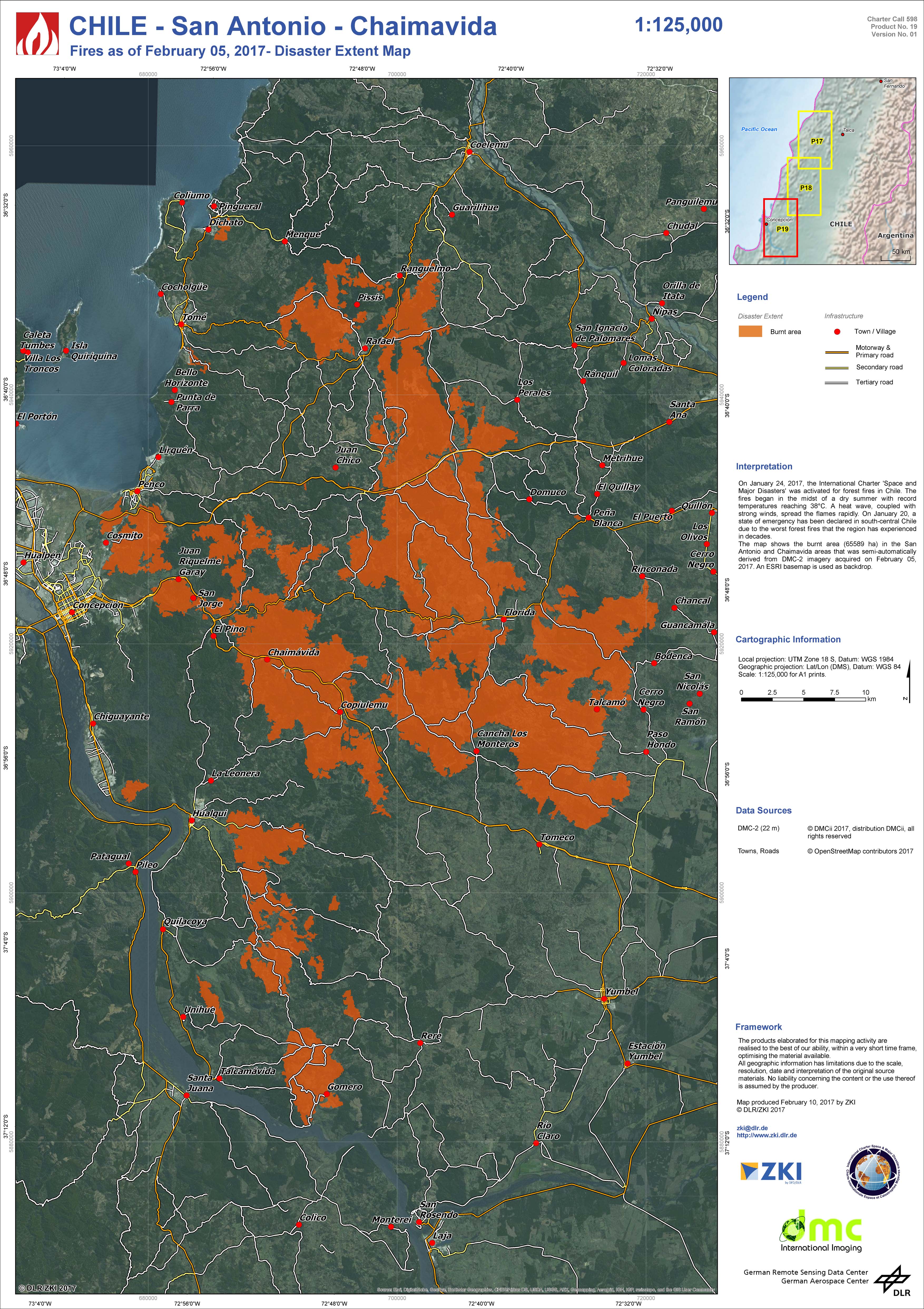
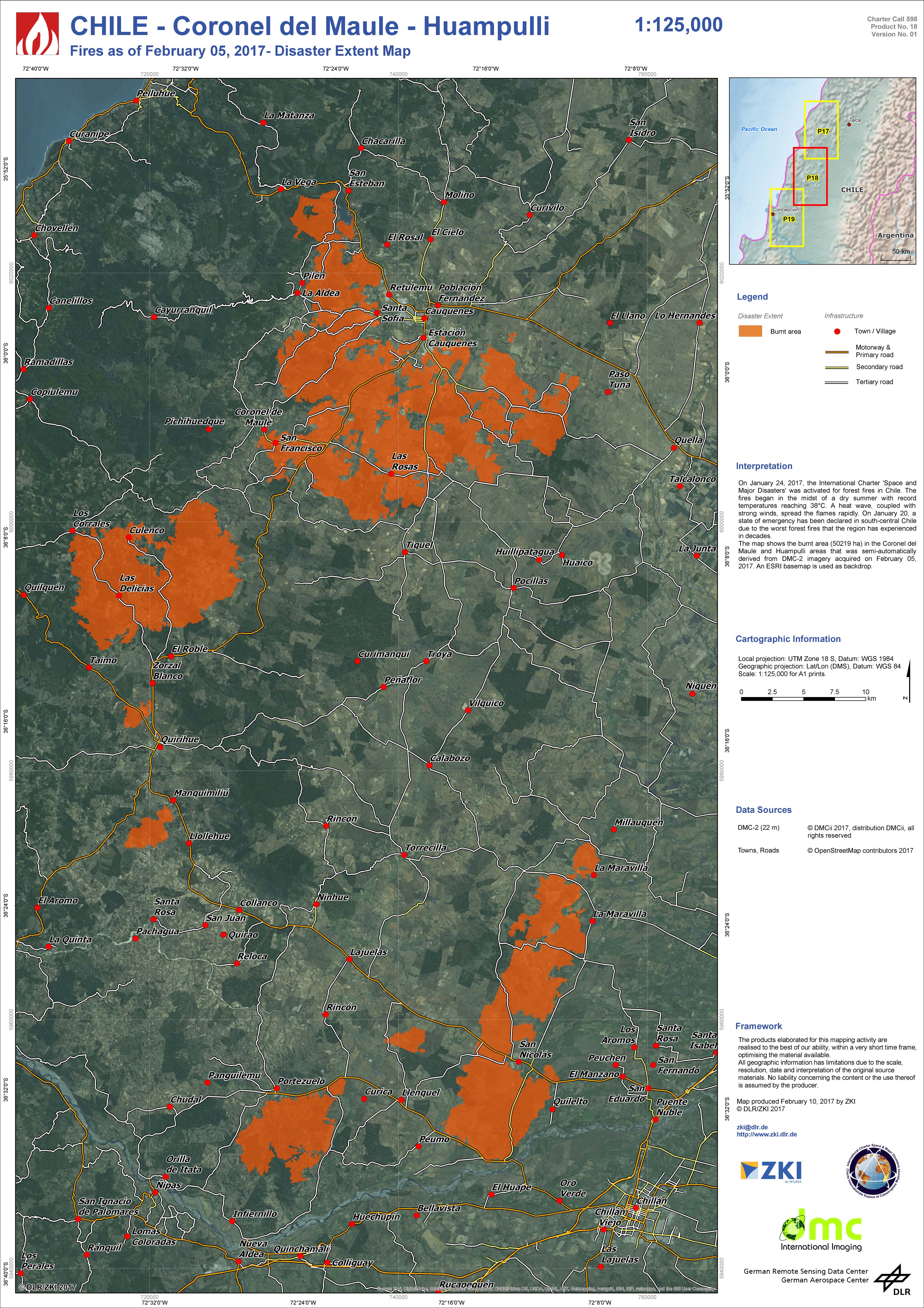
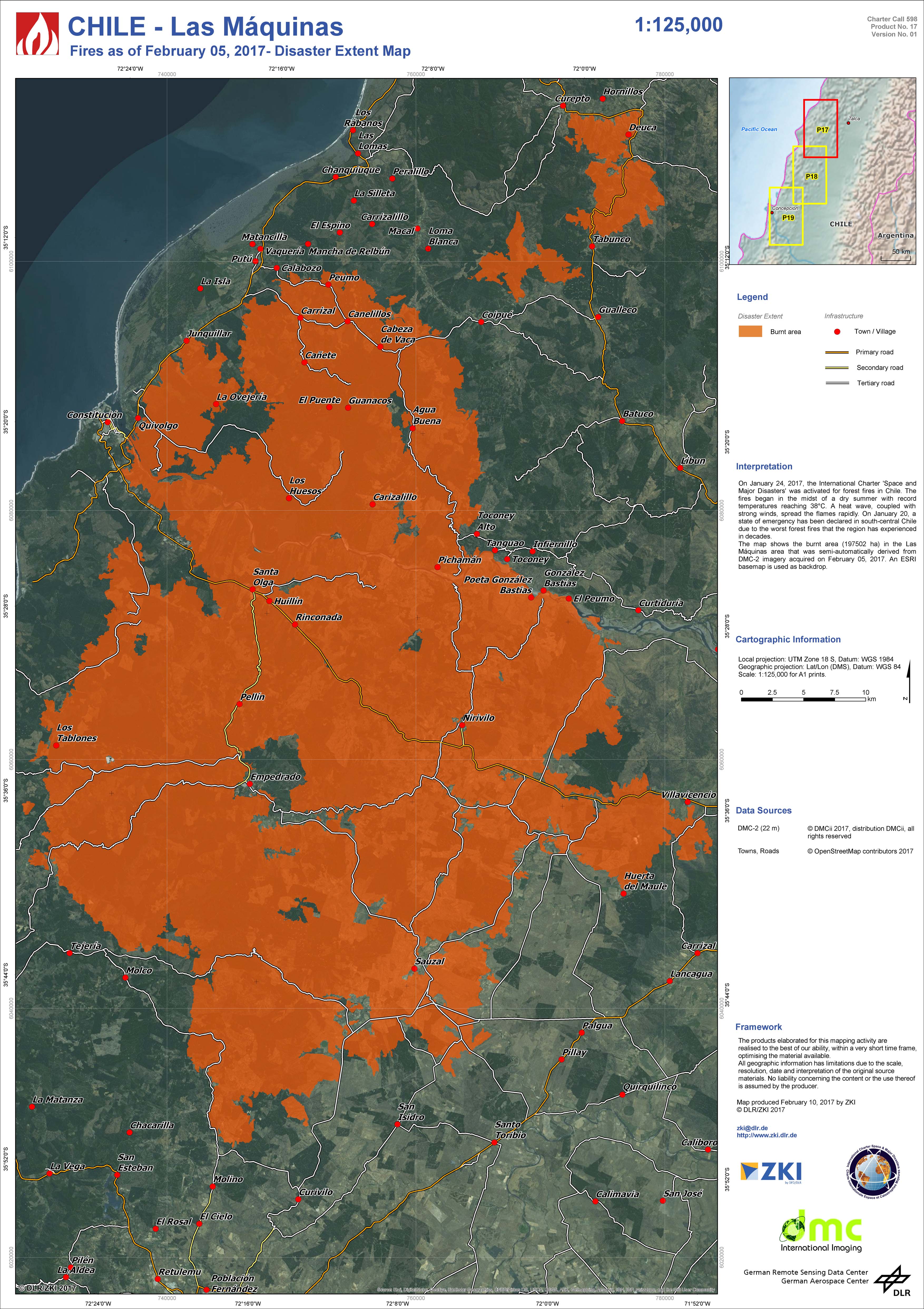
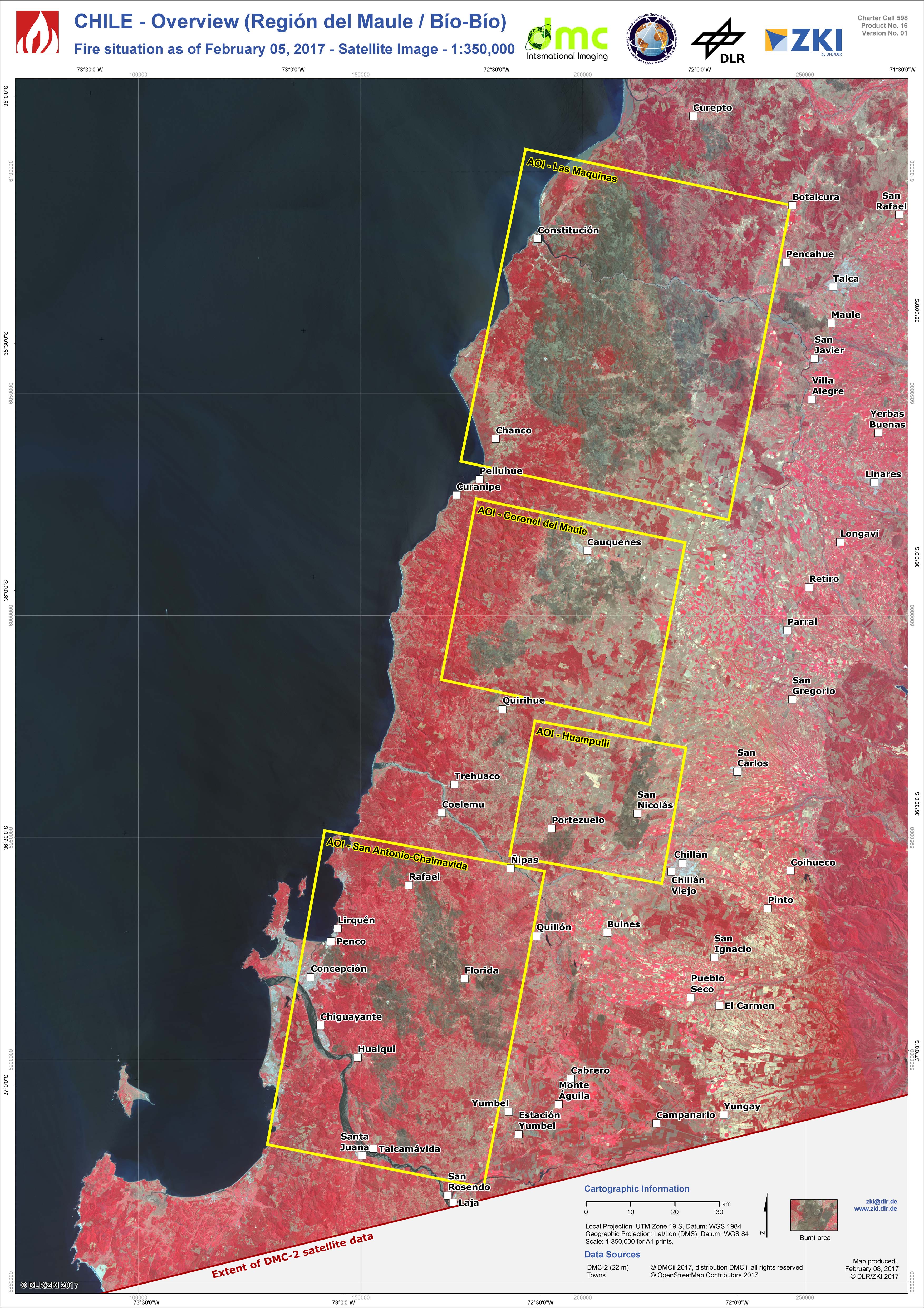
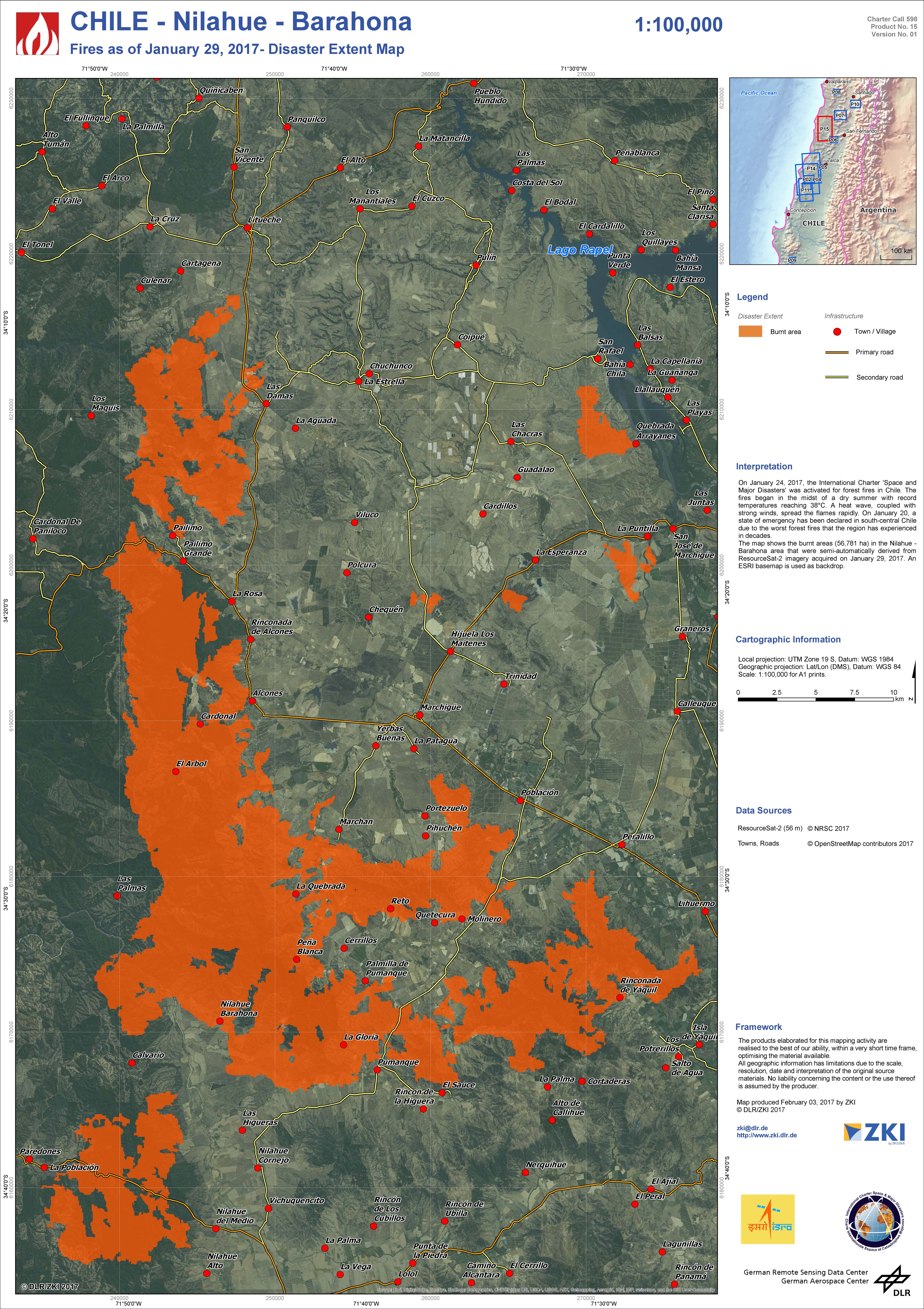
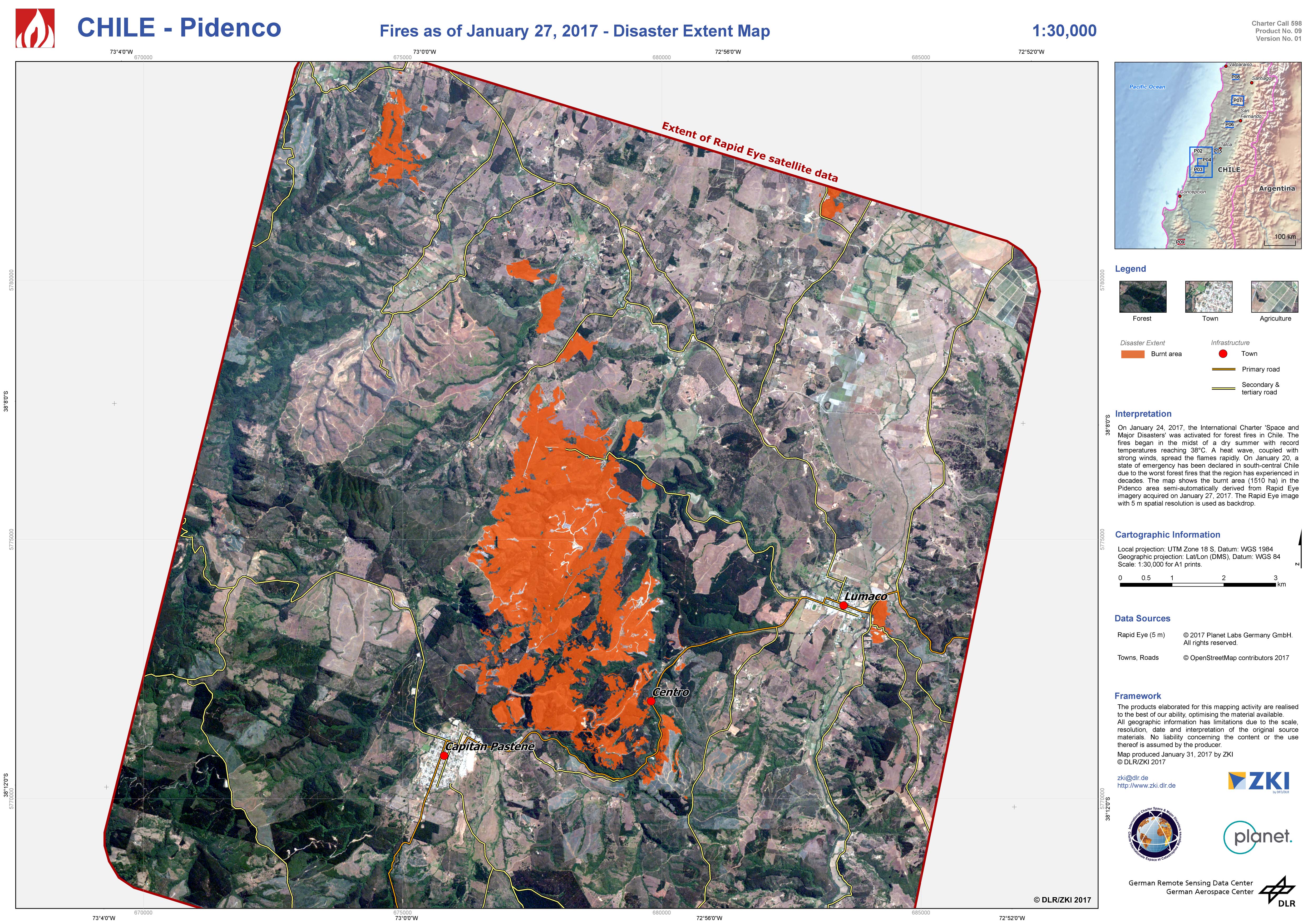
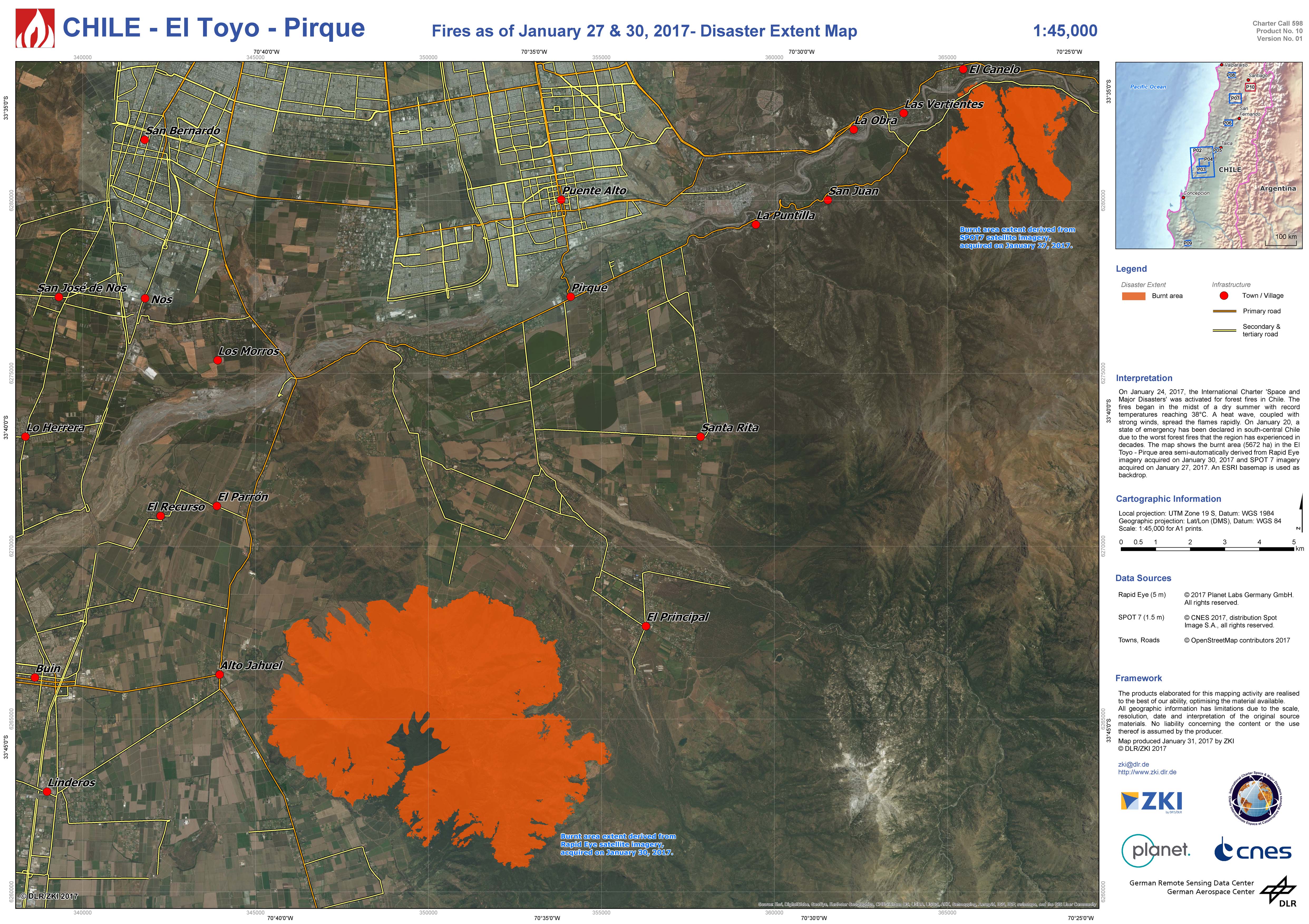
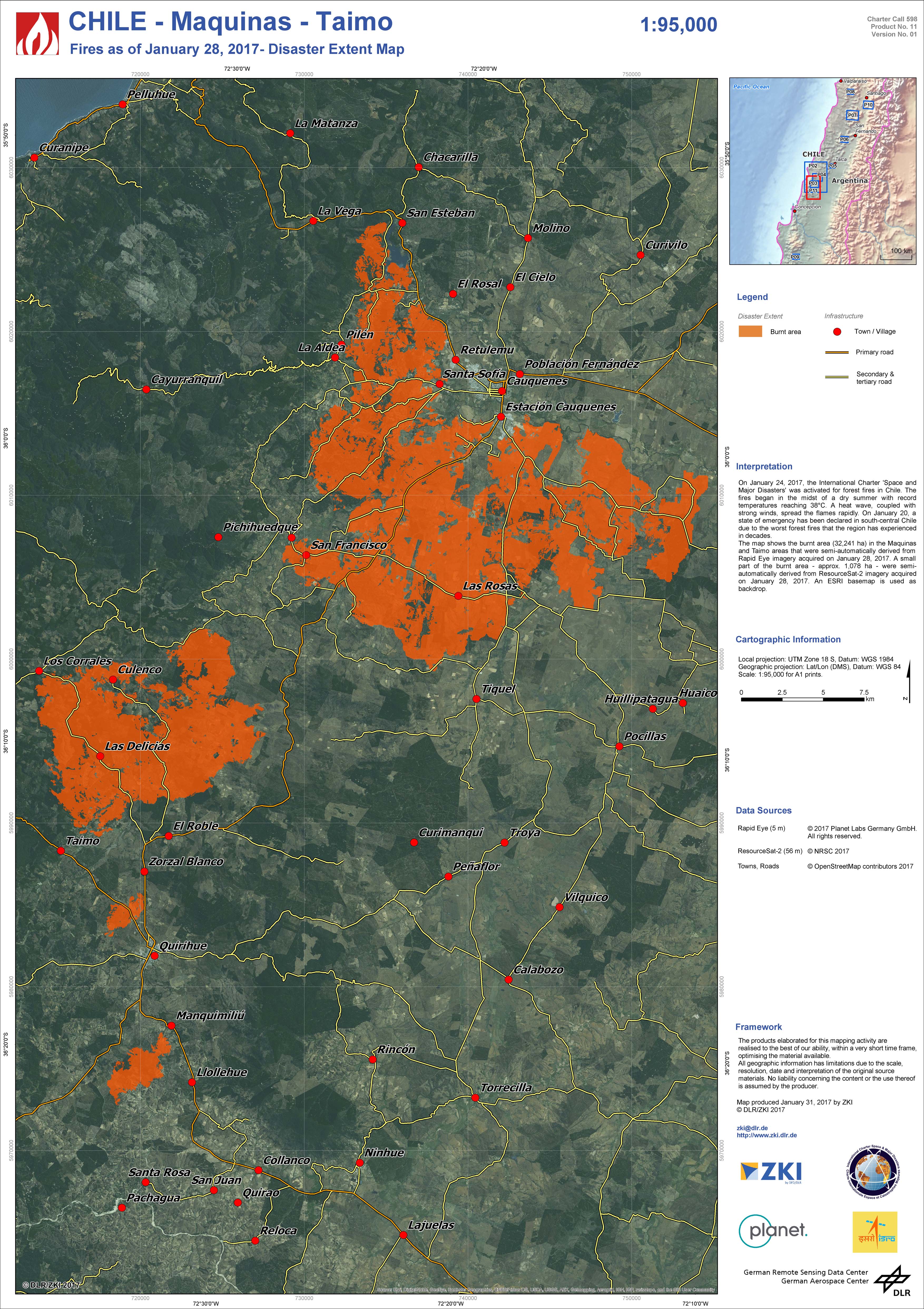
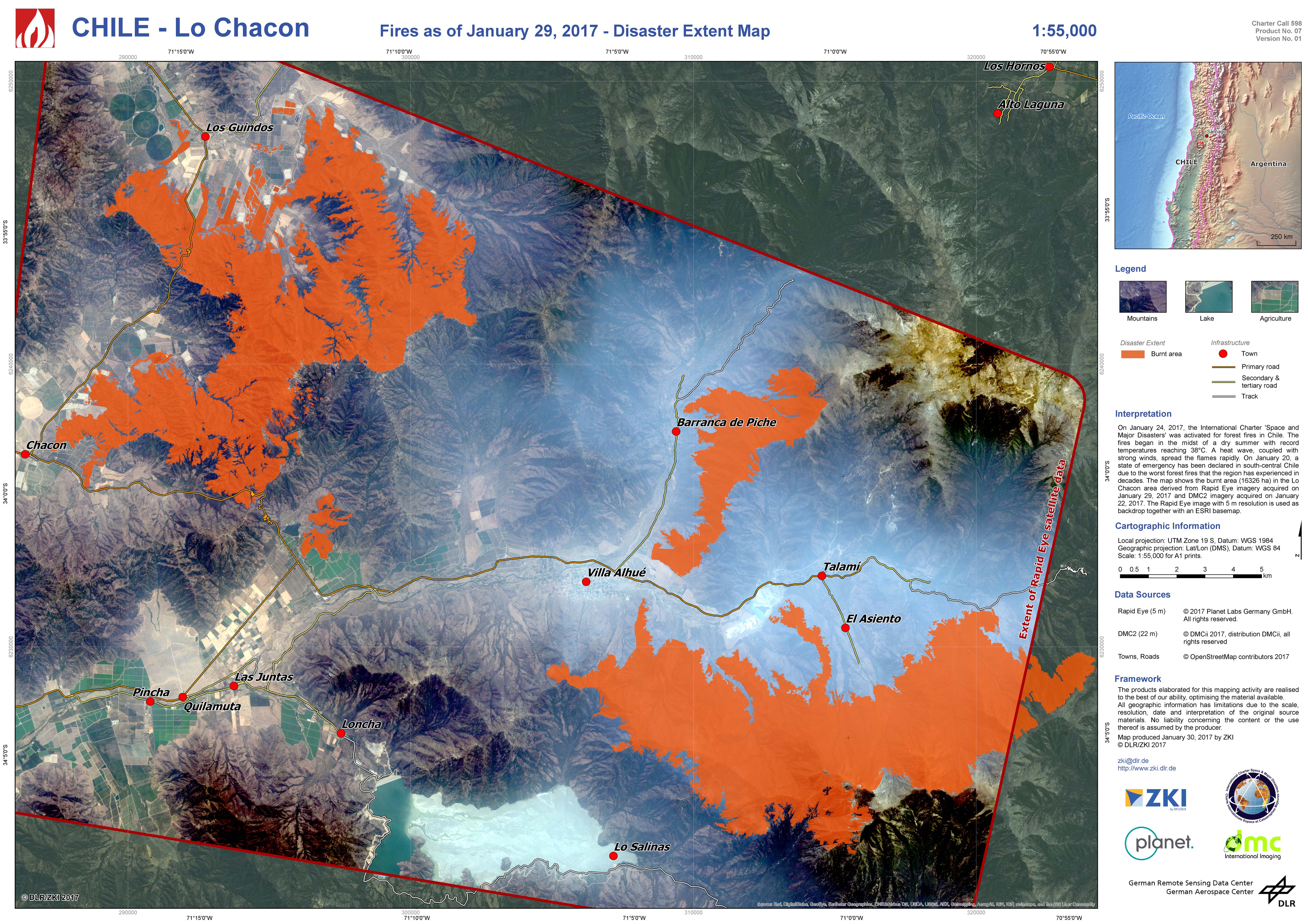
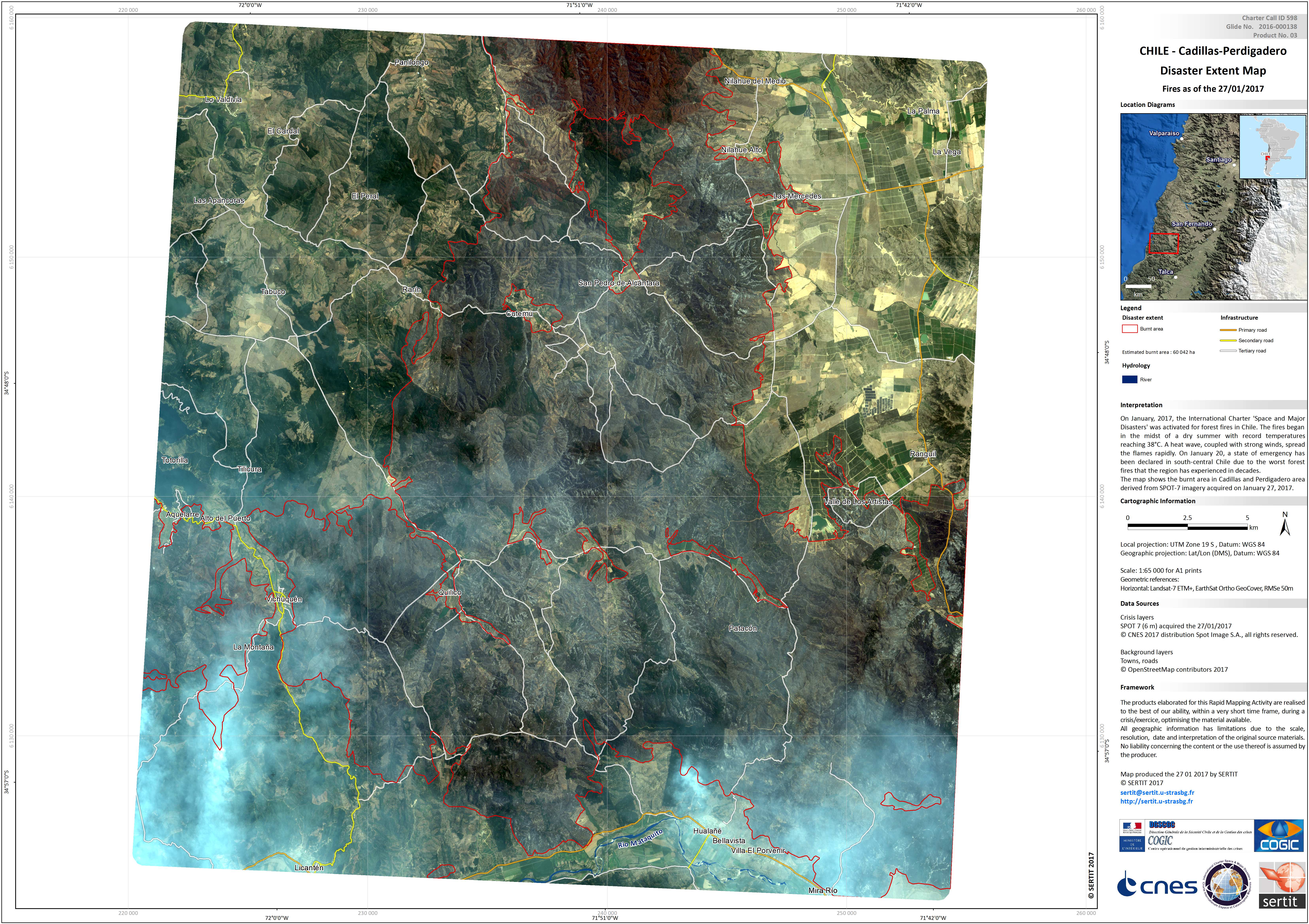
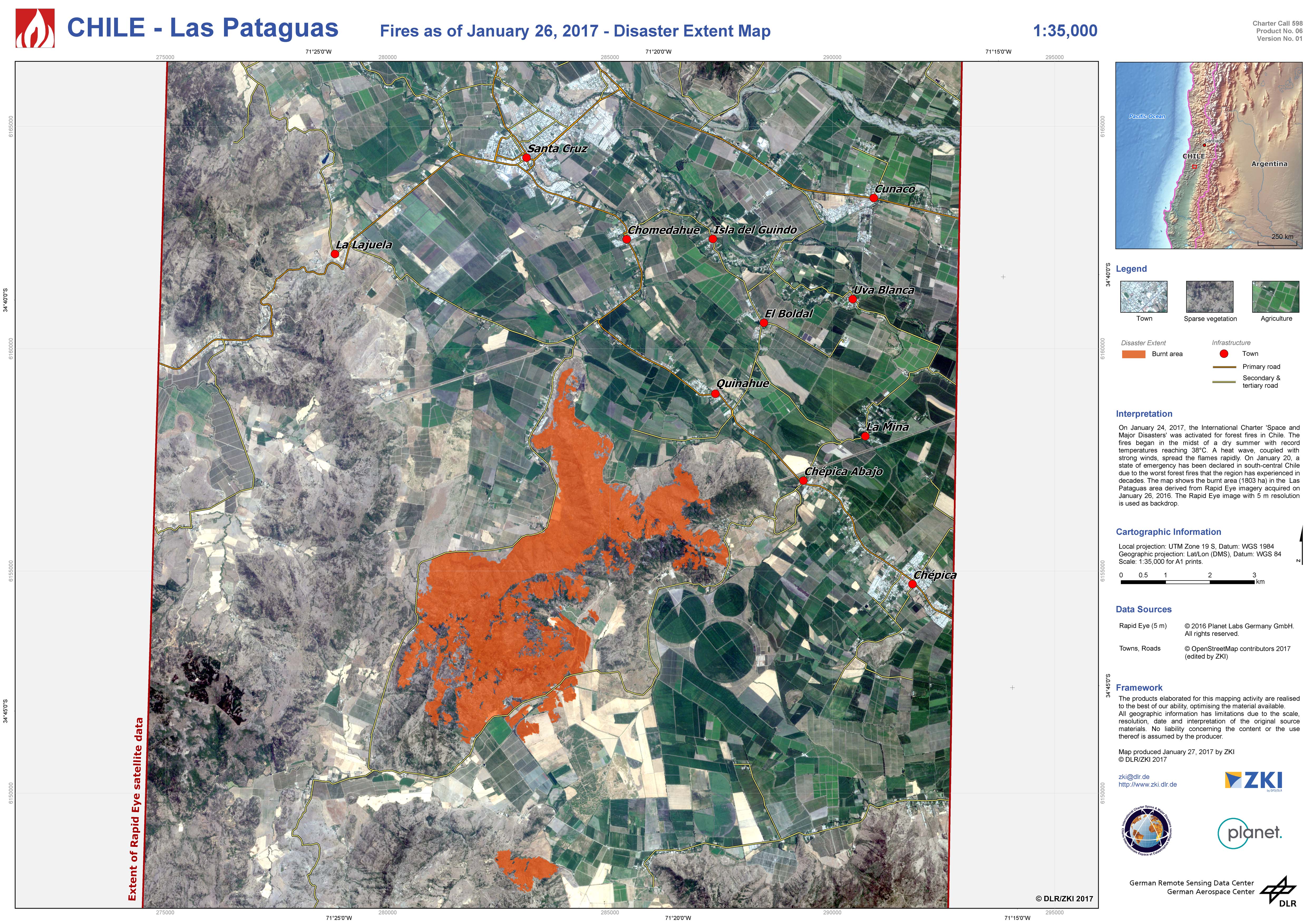
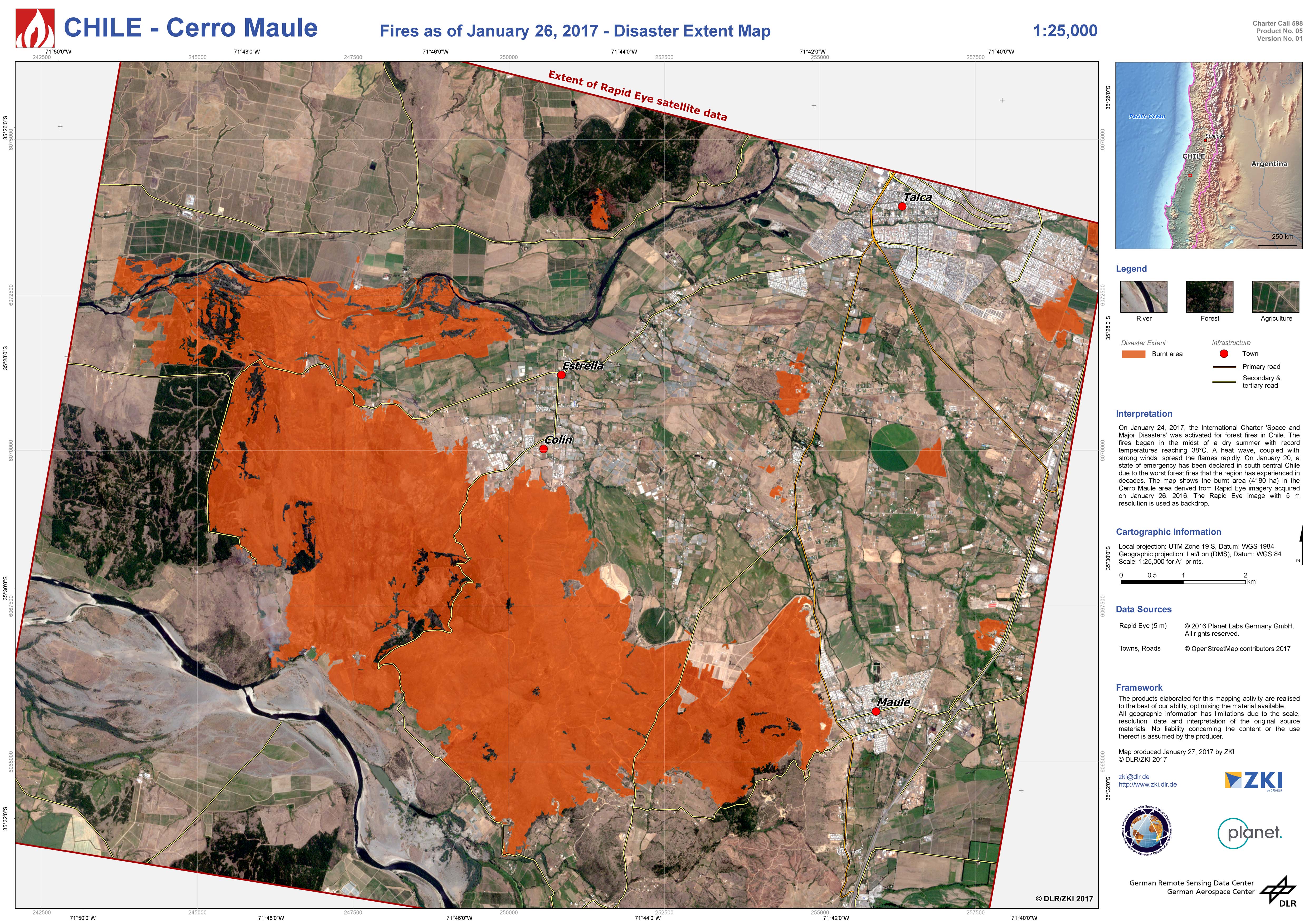
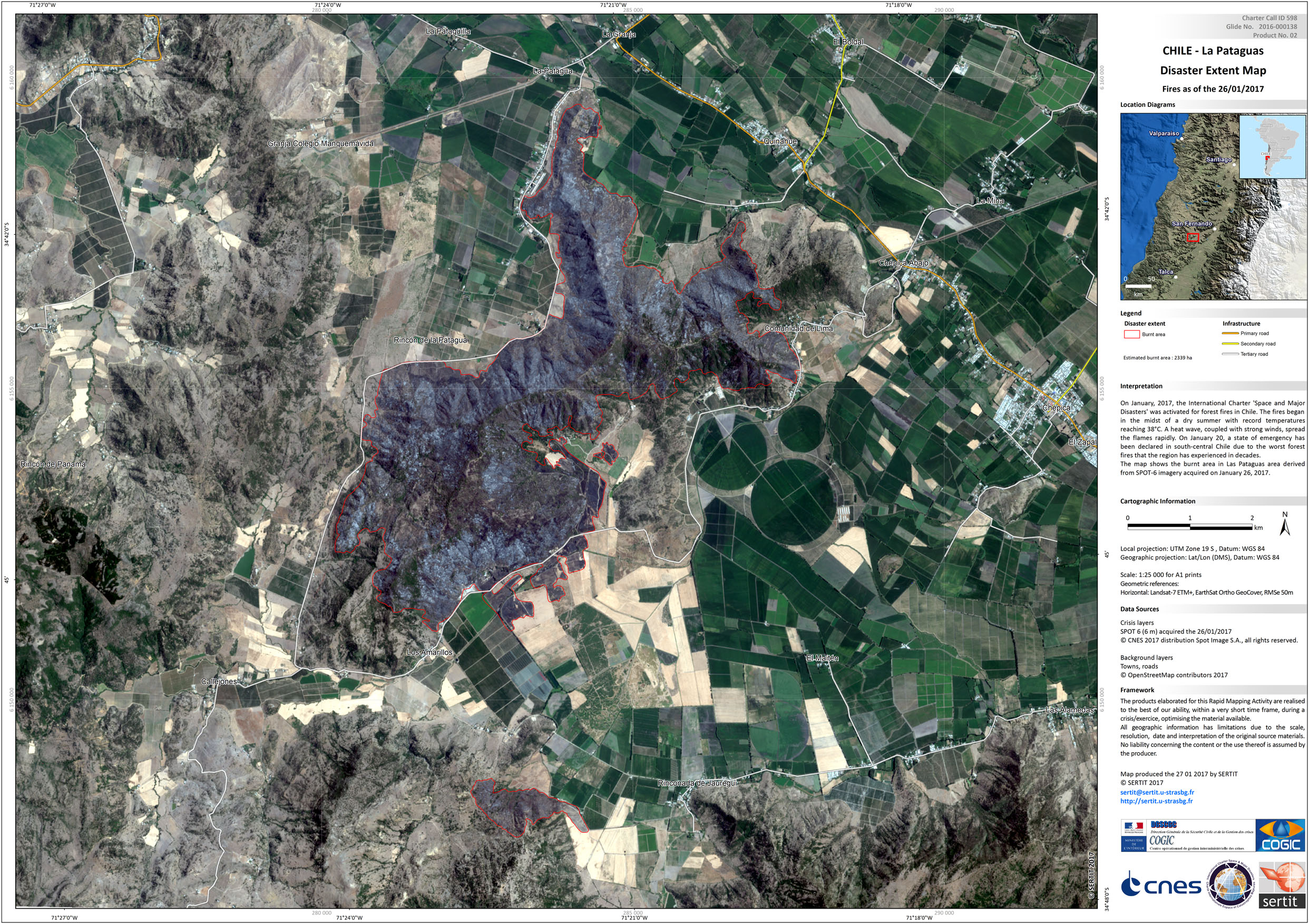
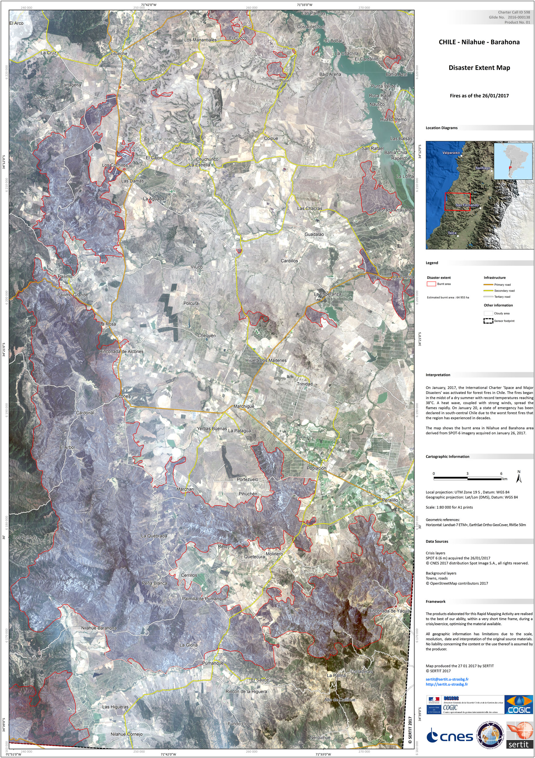
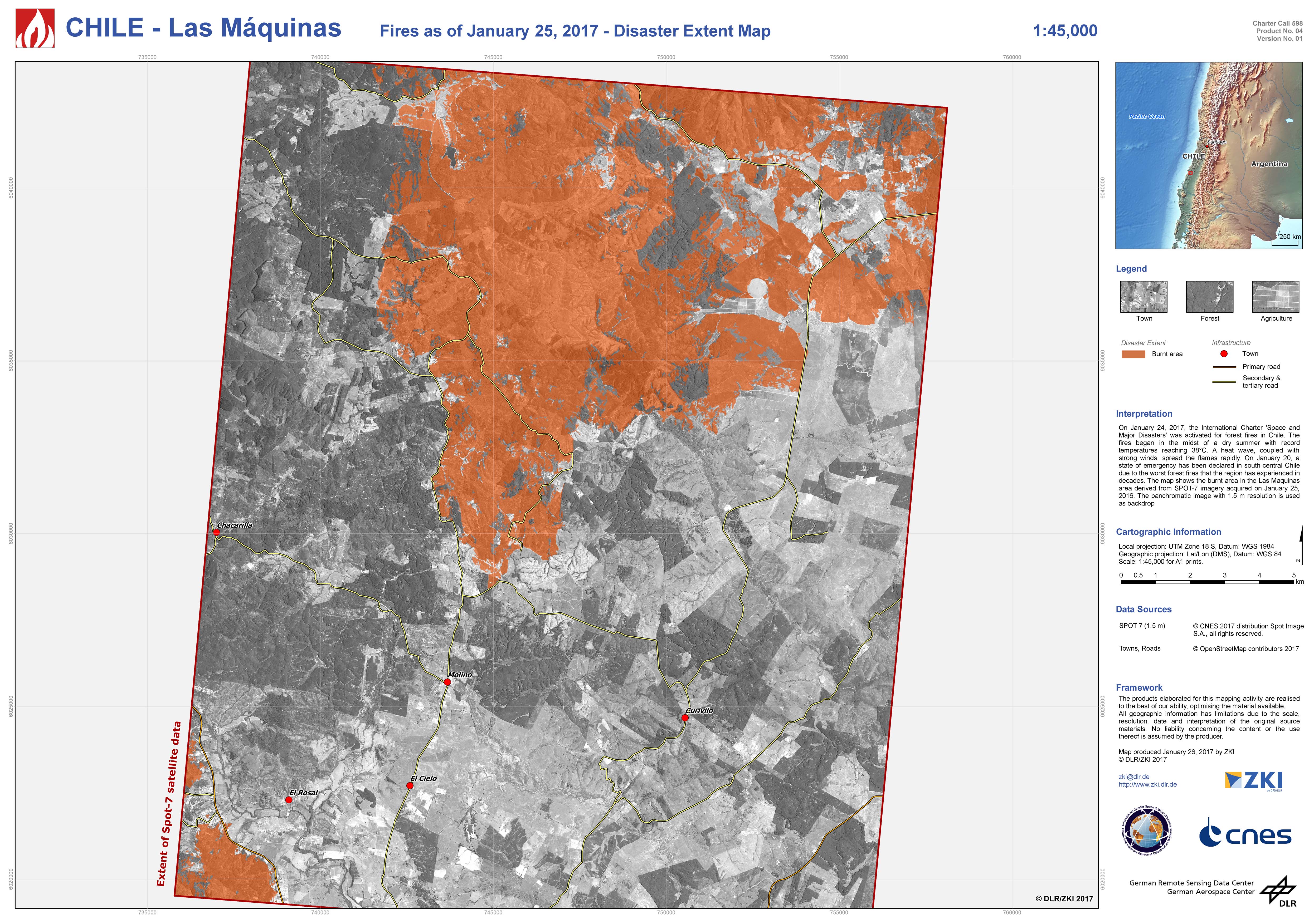
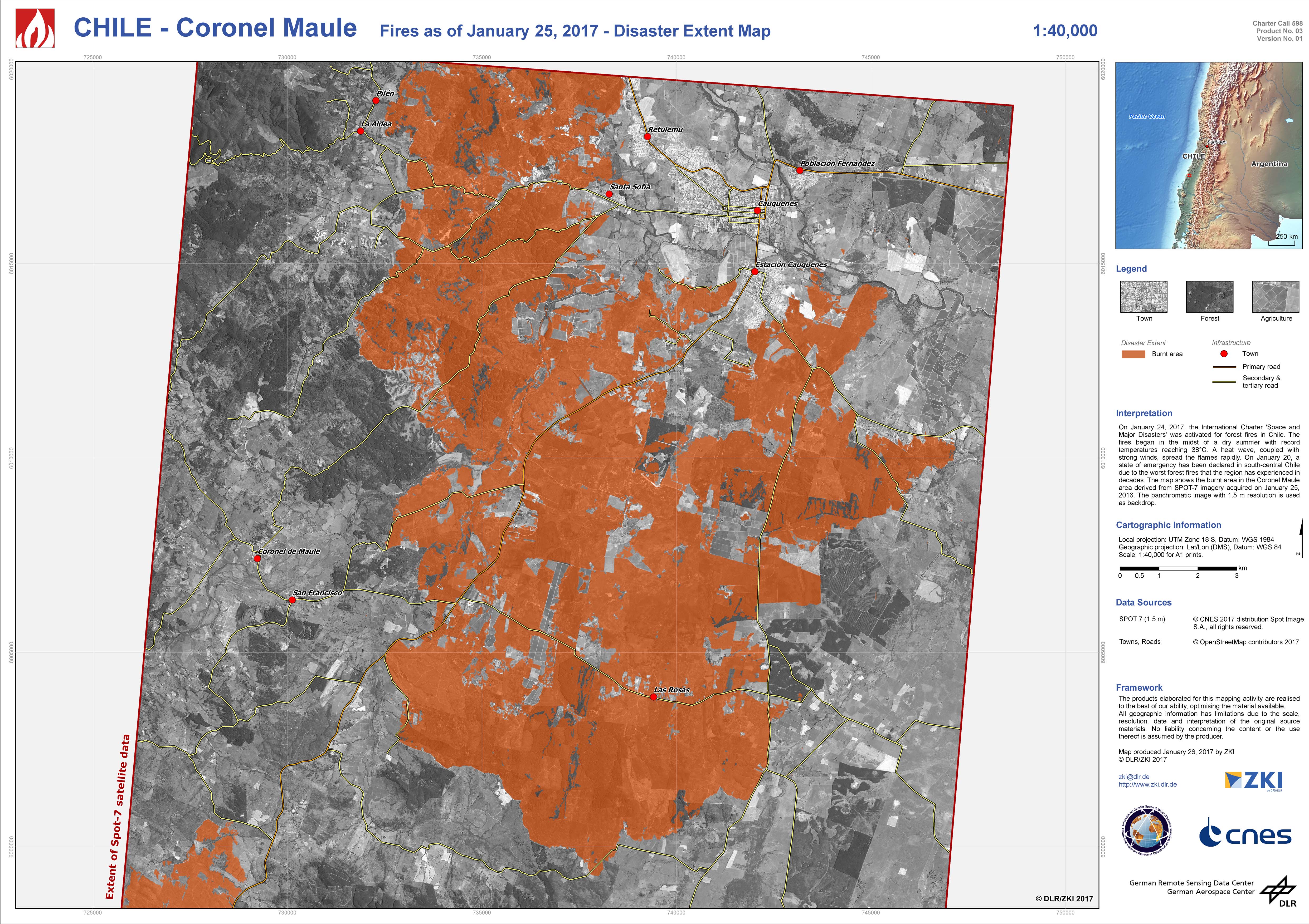
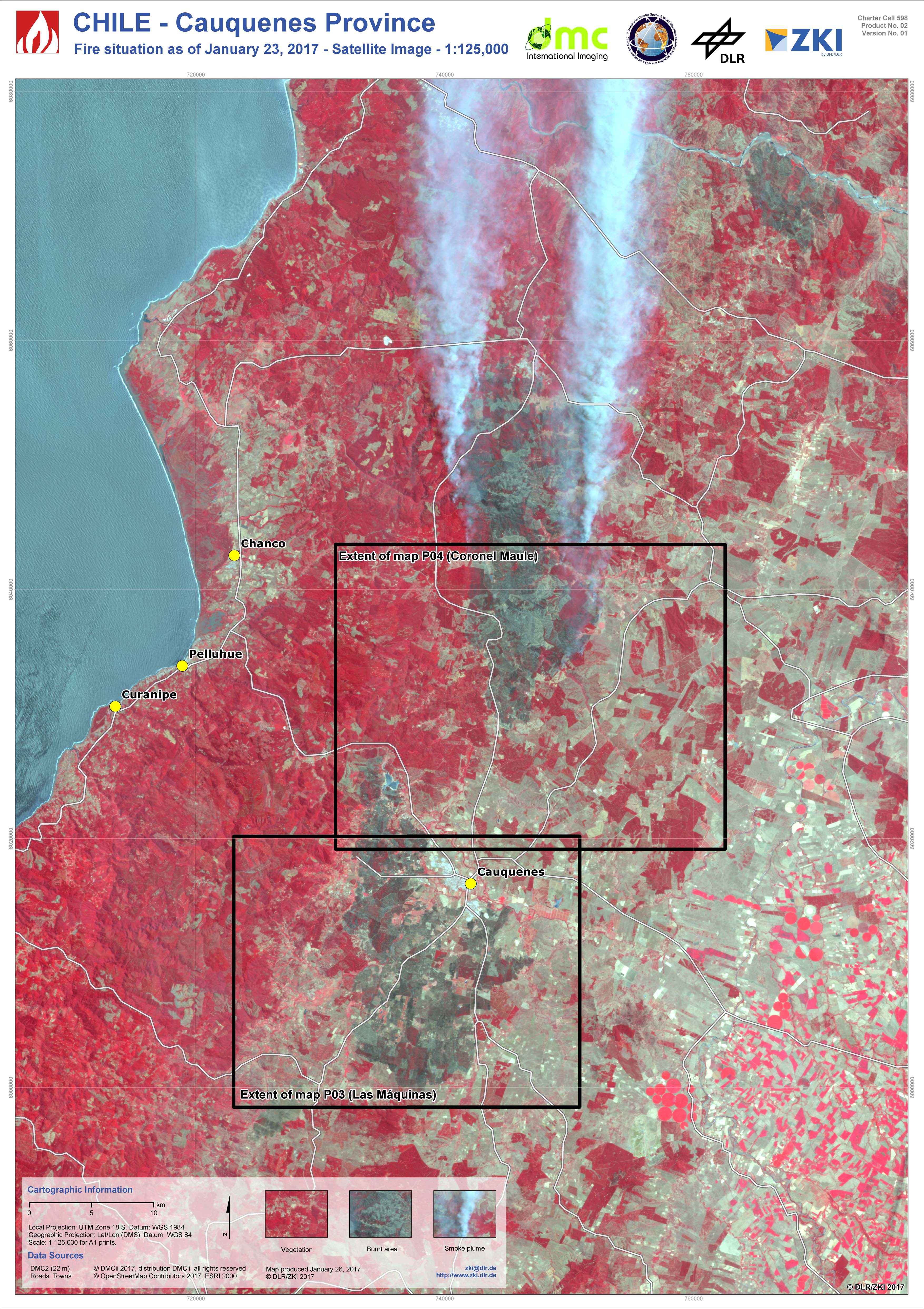
チリの火災
数十年間の中で最悪の森林火災により、チリの南中央域において非常事態が宣言された。
38℃という記録的な気温と夏の乾燥の最中、火災は一週間前に発生した。ONEMI(チリ国家緊急対策室)は、32の火災により、オイギンス州、マウレ州、ビオビオ州からチリの首都サンティアゴの南方に渡り被災したと報告した。
消火活動の中3名の消防隊が死亡、78の家屋が焼失、そして数百人が避難した。
約4,000人(消防隊、軍隊、救急隊員とボランティアを含む)が消火活動に従事し、いくつかの火災は鎮火したが、29の火災が今もなお消火活動下にあり、チリ政府は大規模火災の対処に国際支援を要請した。
火災は100,000ヘクタール以上の森林を焼失したと推定されている。
| Type of Event: | 森林火災 |
| Location of Event: | チリ |
| Date of Charter Activation: | 2017年1月24日 |
| Time of Charter Activation: | 08:51:00 |
| Time zone of Charter Activation: | UTC-03:00 |
| Charter Requestor: | Oficina Nacional de Emergencia del Ministerio del Interior y Seguridad Pública (ONEMI) |
| Project Management: | DLR |
Products
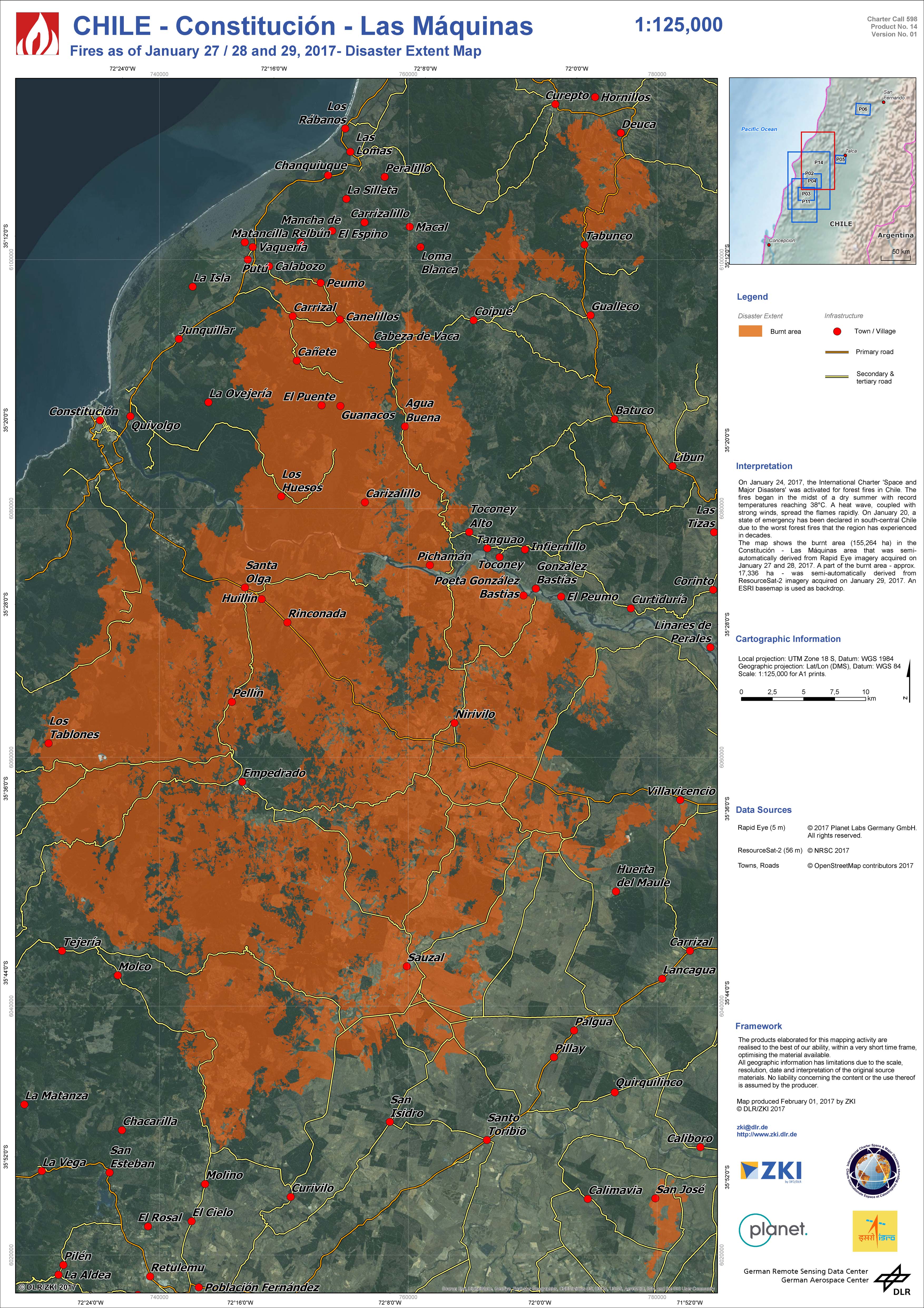
Disaster extent map of Constitución and Las Máquinas
Copyright: RapidEye © Planet (2017) - All rights reserved
ResourceSat-2 data and products © ISRO (2017) - All rights reserved
Map produced by DLR/ZKI
Information about the Product
Acquired: RapidEye: 27/01/2017 and 28/01/2017
ResourceSat-2: 29/01/2017
Source: RapidEye / ResourceSat-2
 Back to the full activation archive

