 English
 Spanish
 French
 Chinese
 Russian
 Portuguese
 Последняя Активация
Charter activations
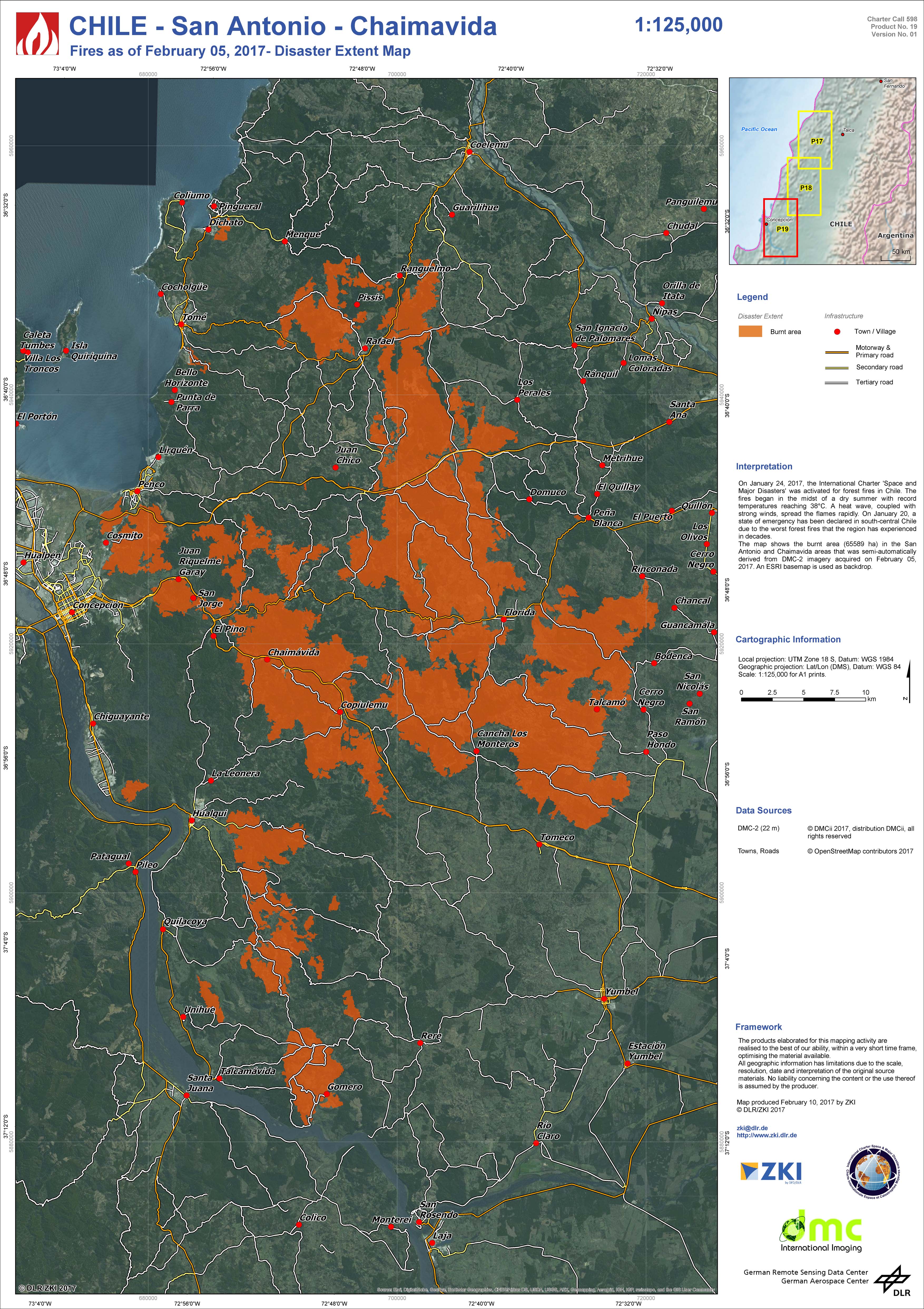
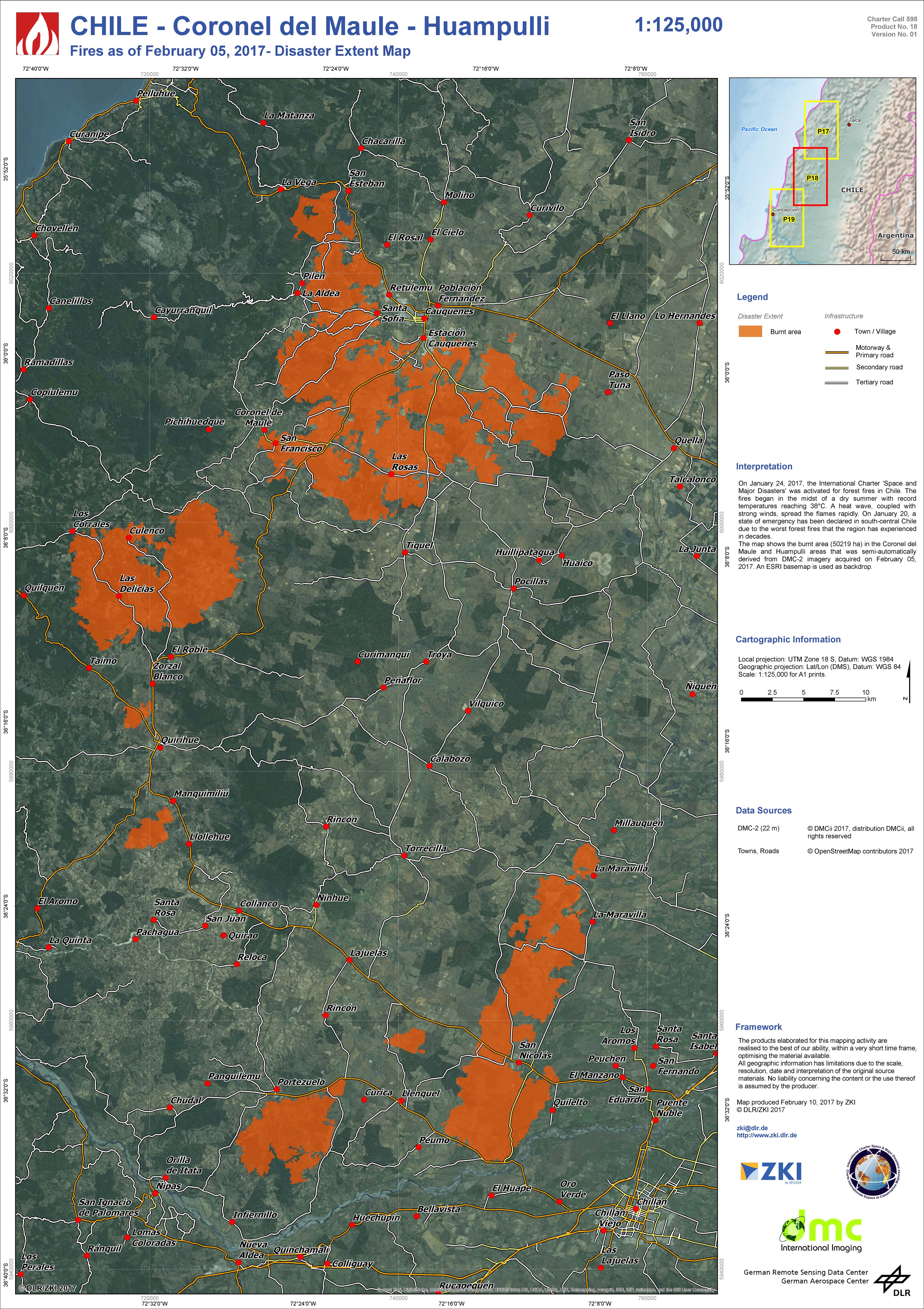
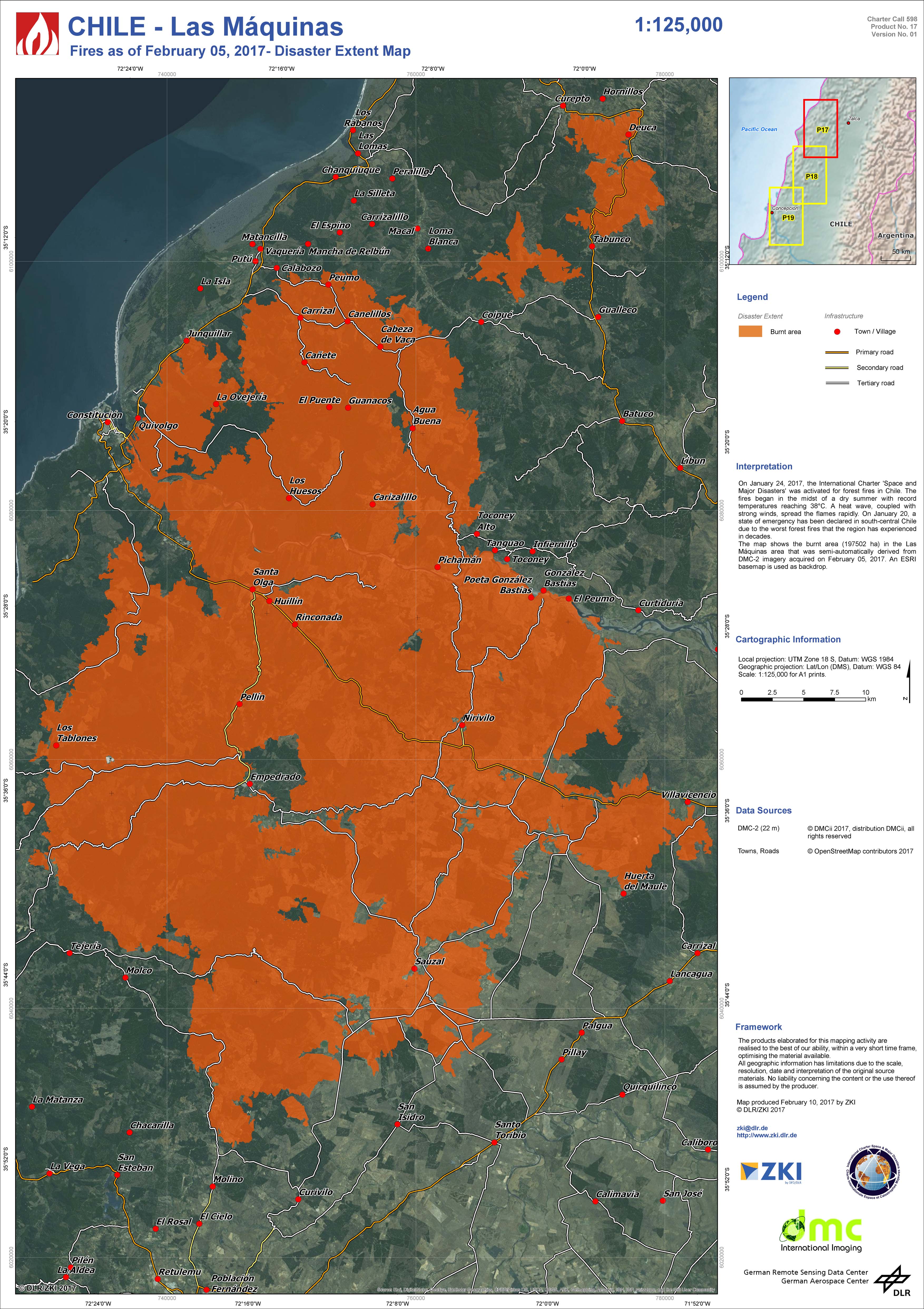
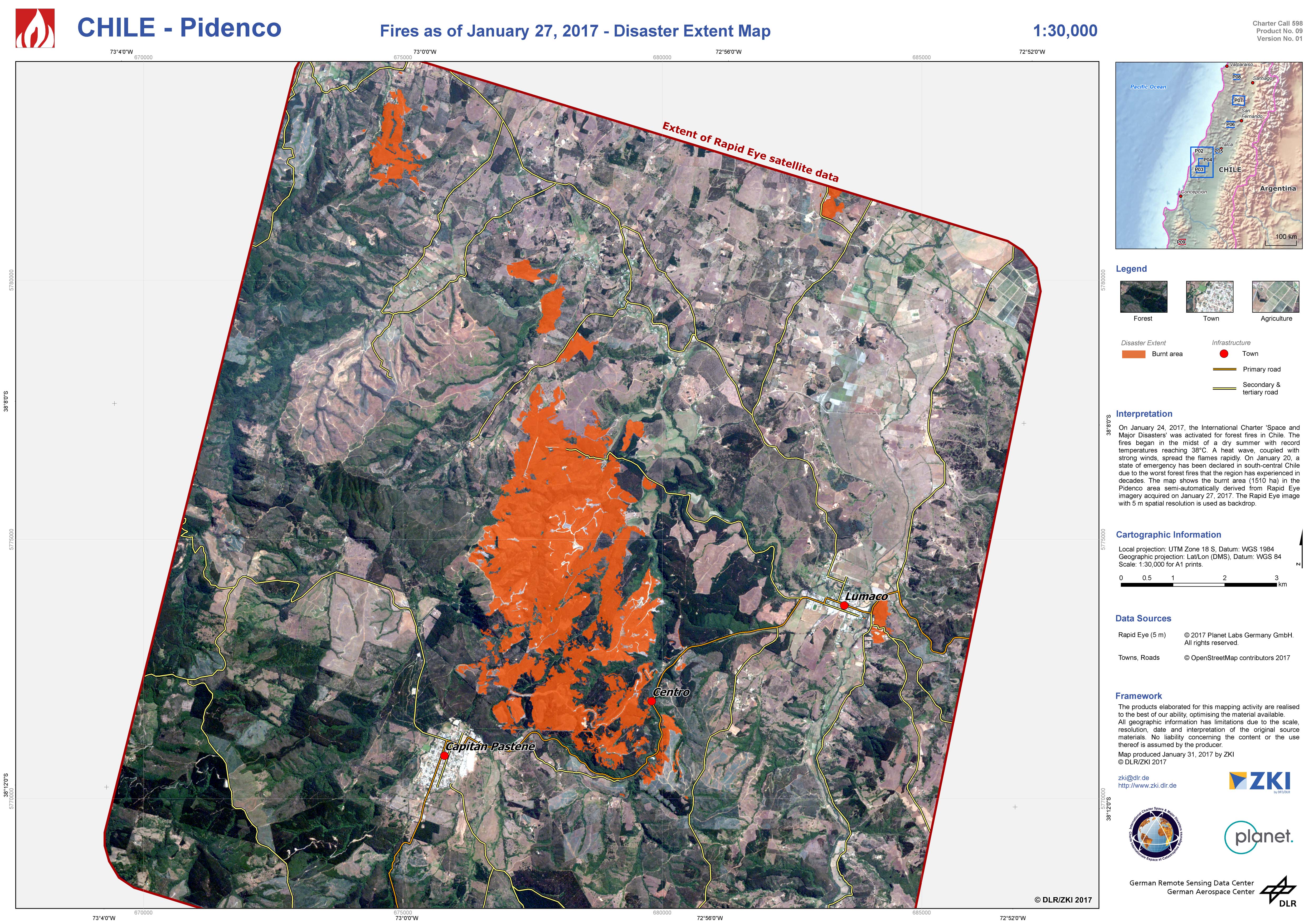
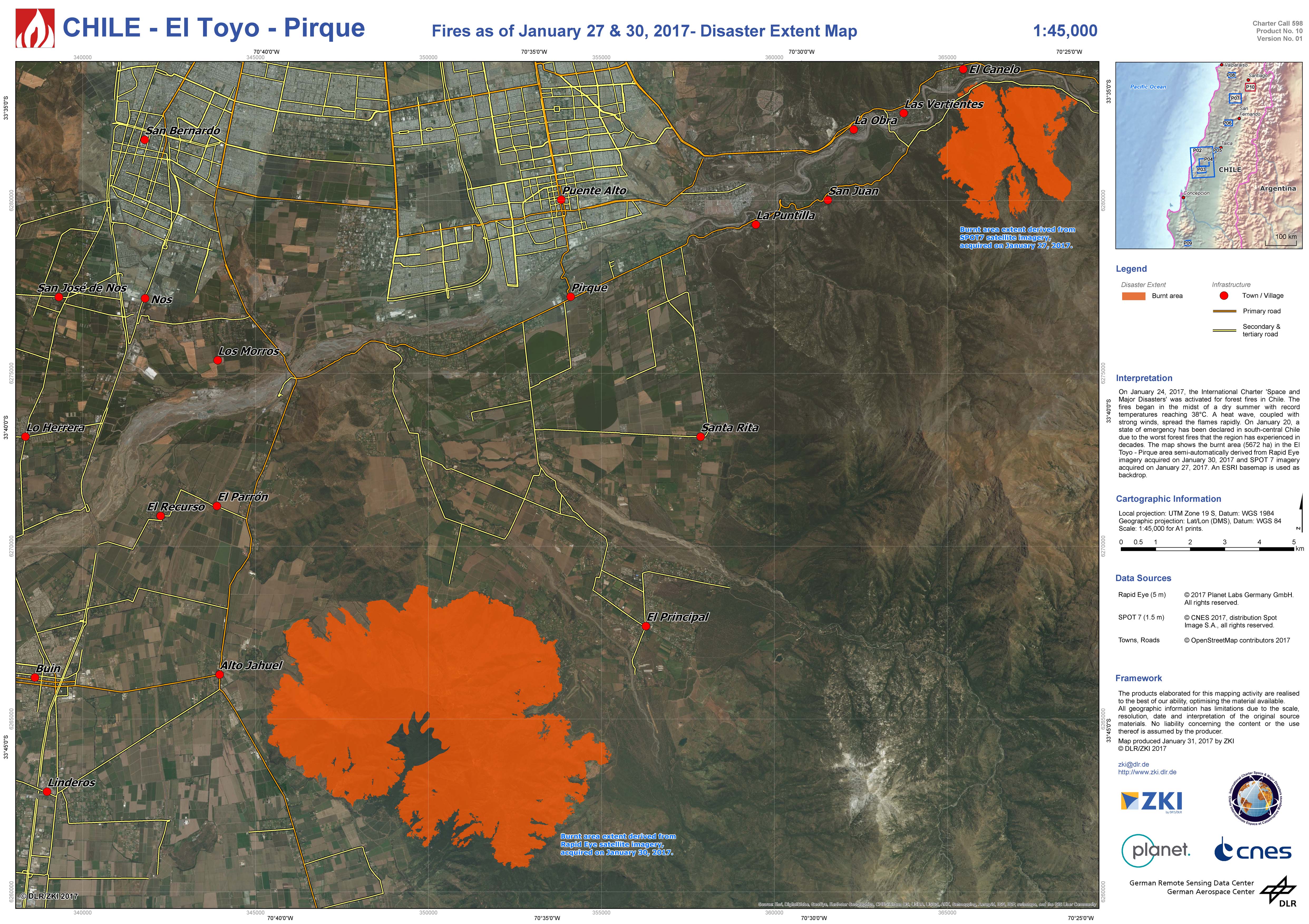
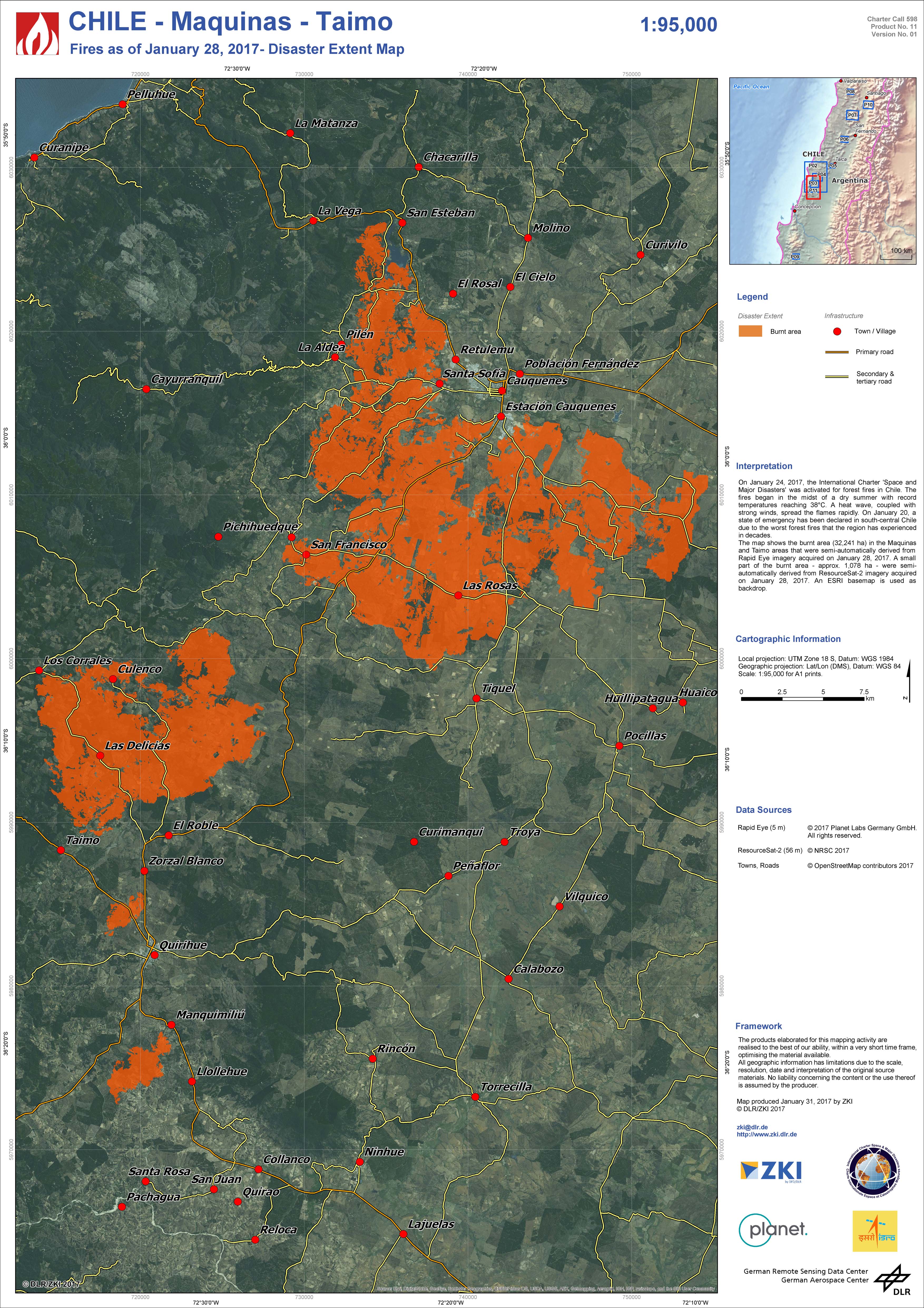
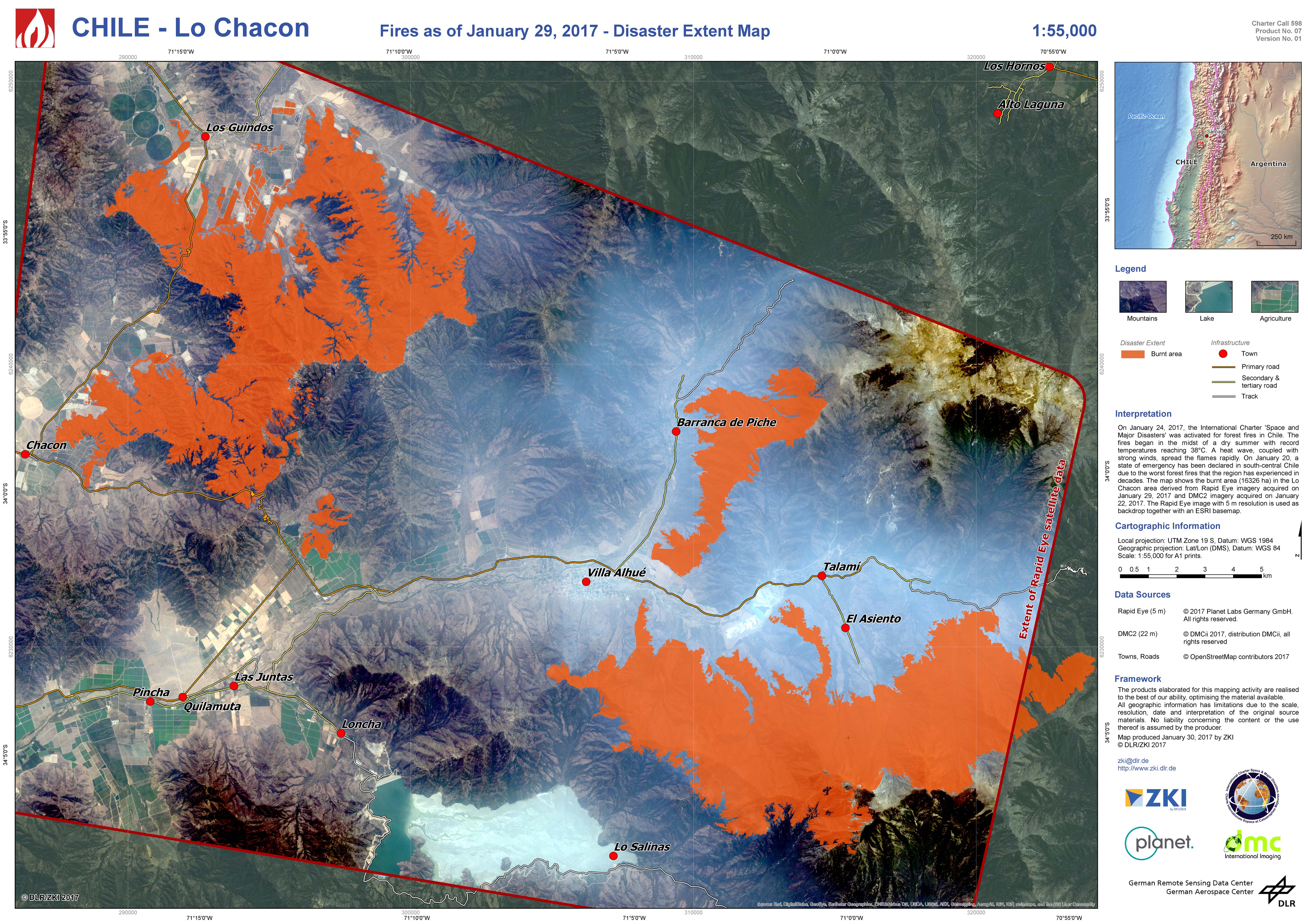
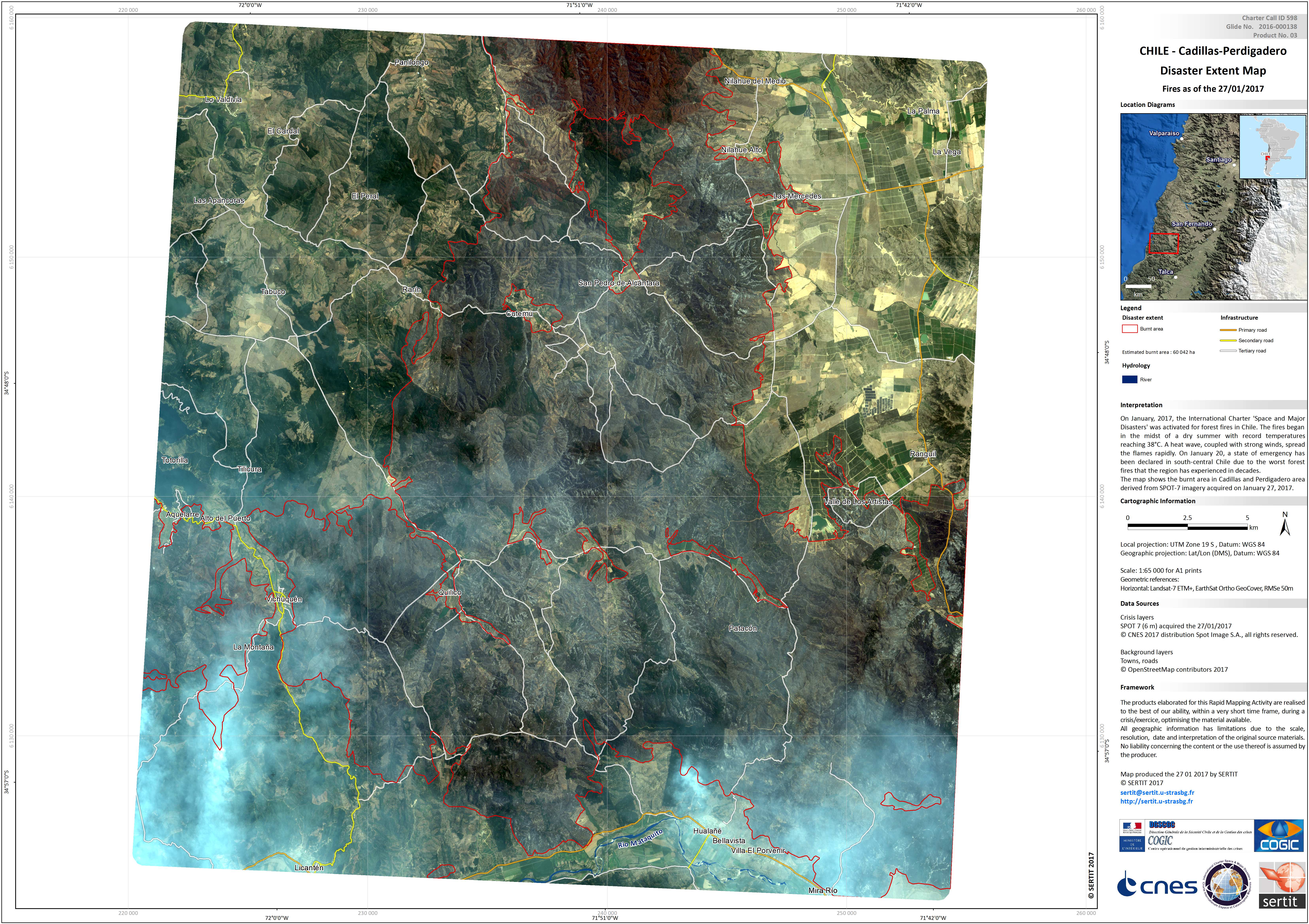
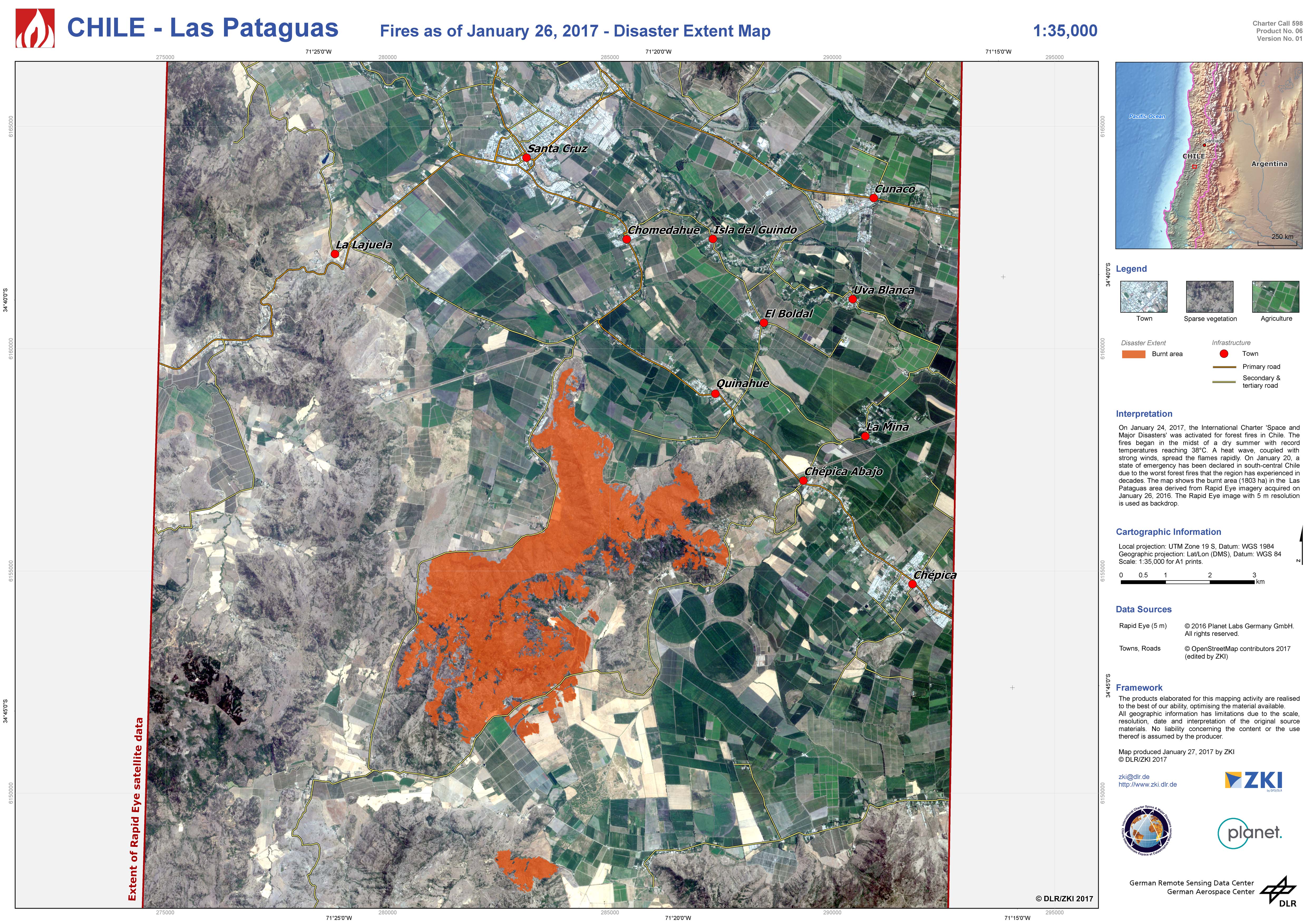
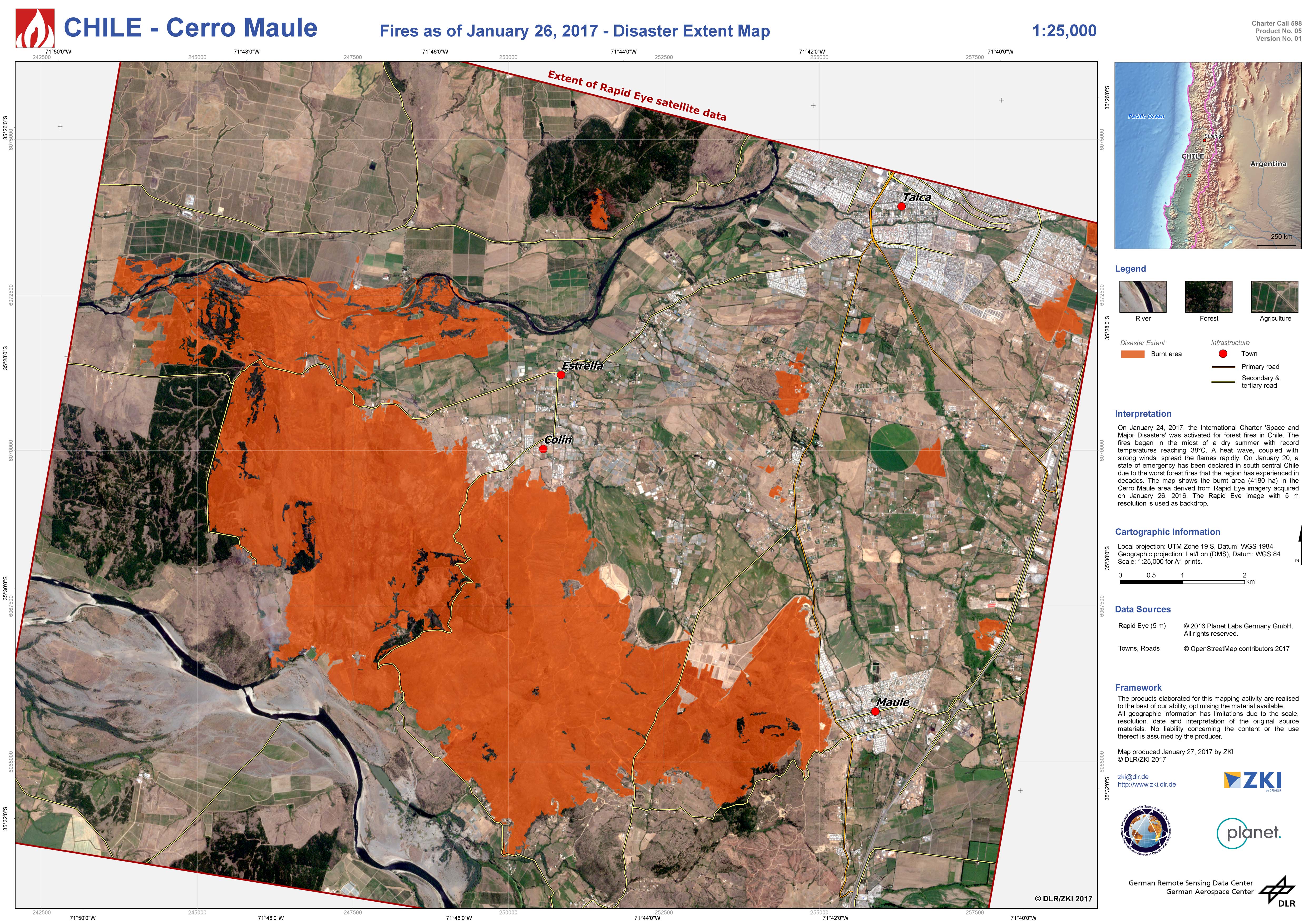
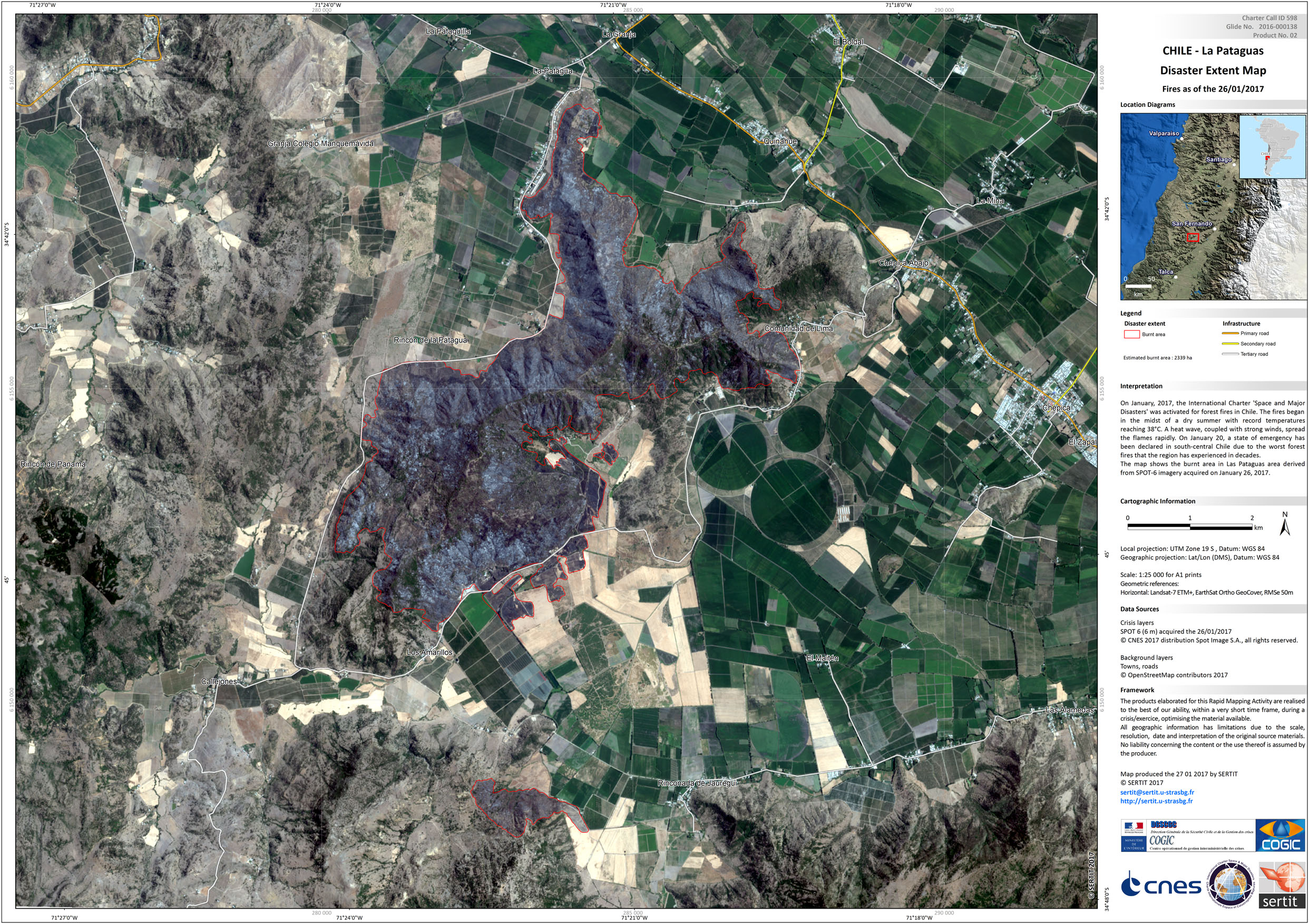
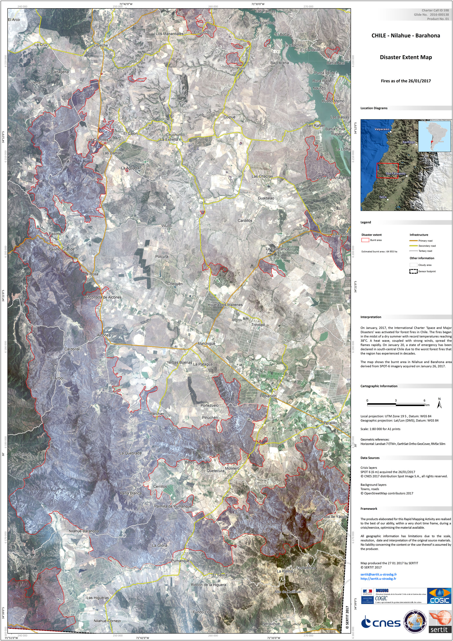
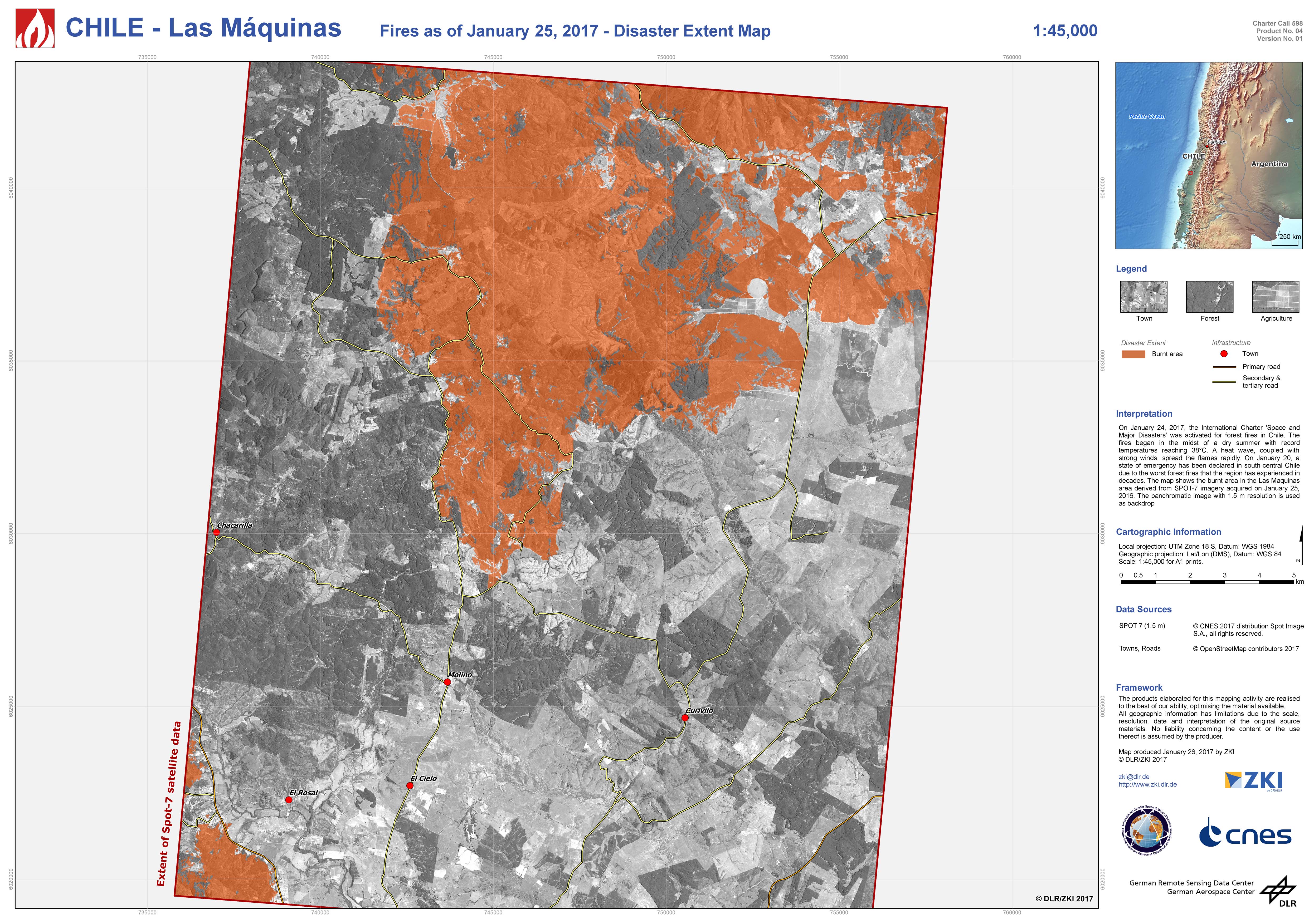
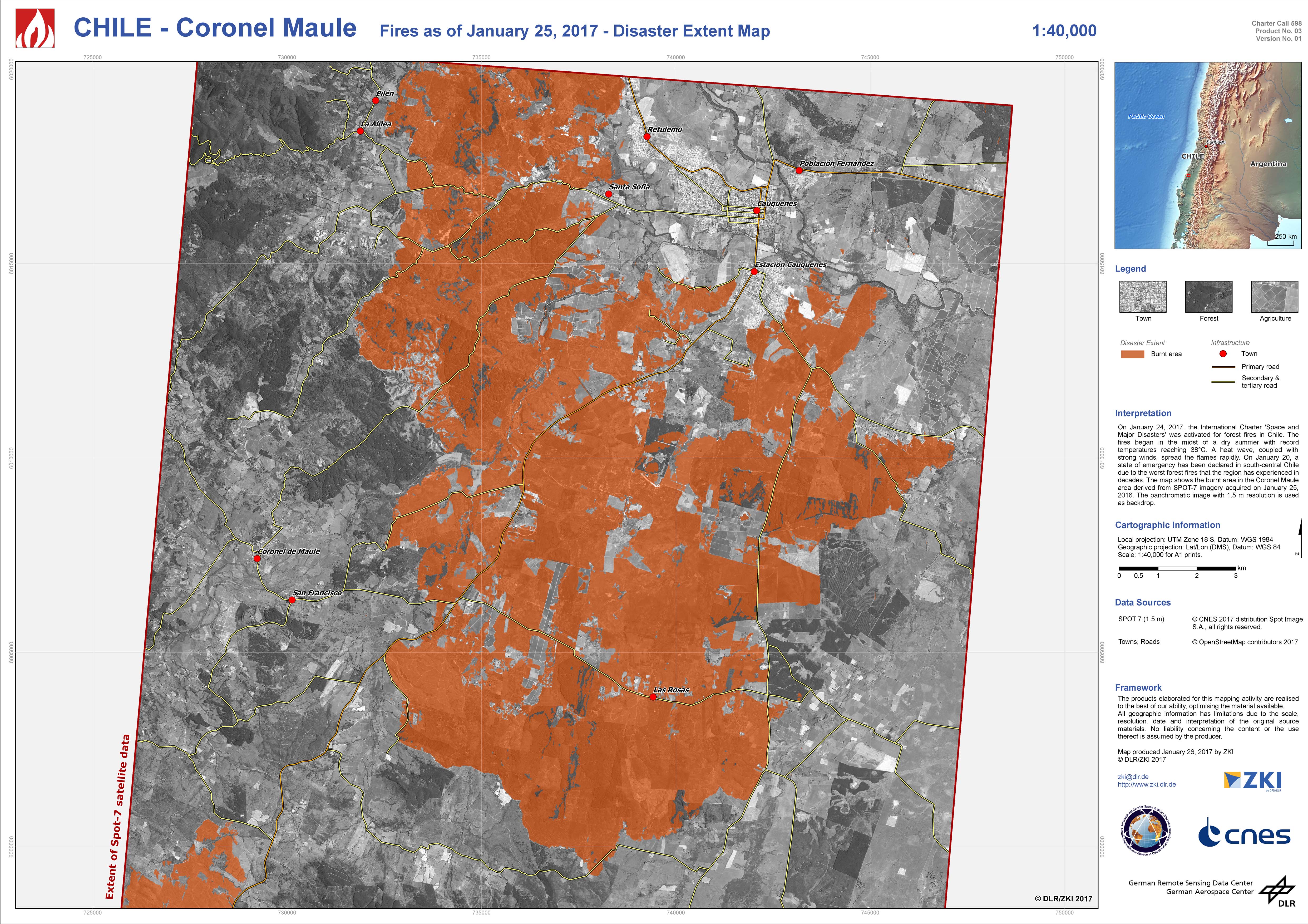
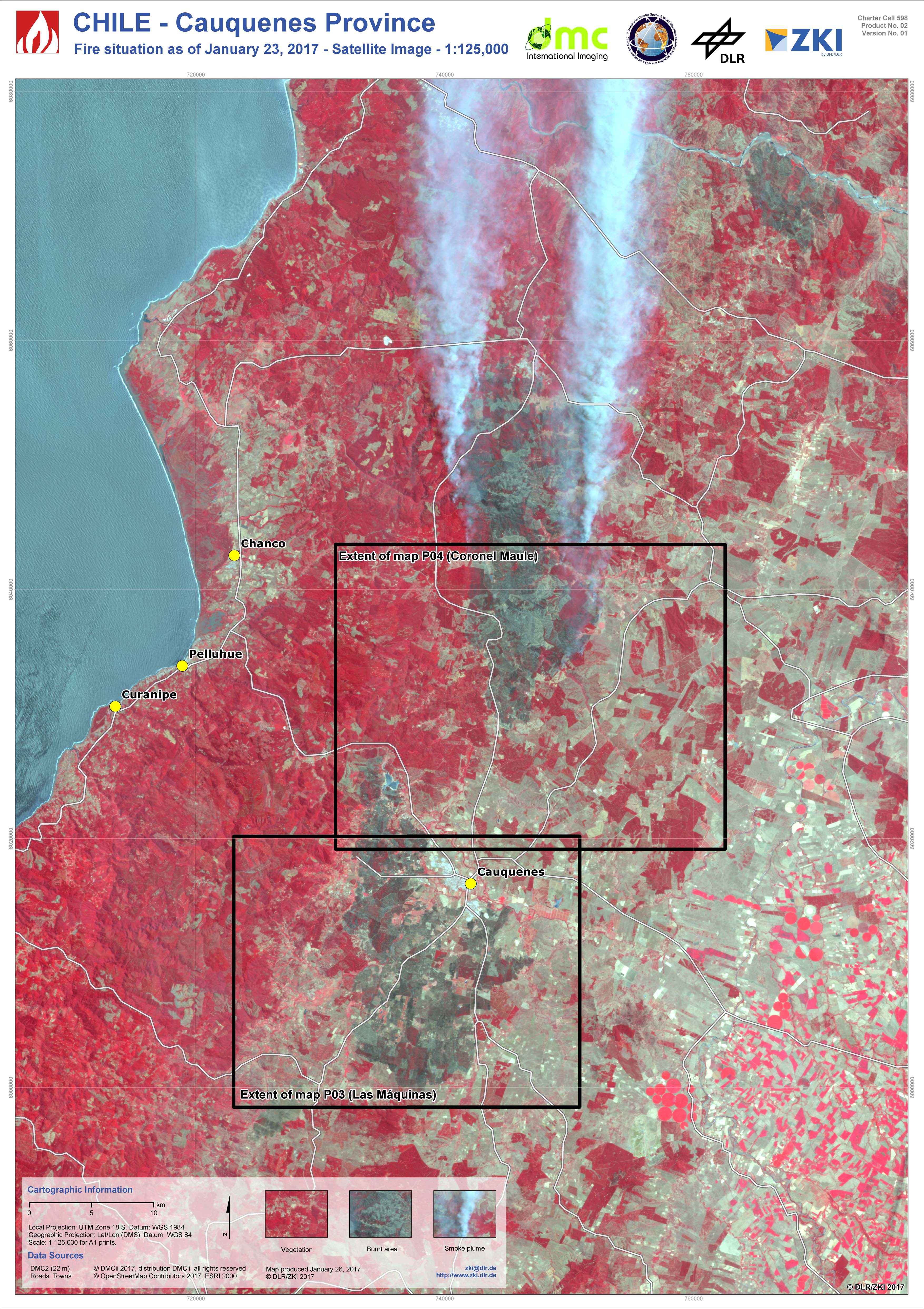
Fire in Chile
A state of emergency has been declared in south-central Chile due to the worst forest fires that the region has experienced in decades.
The fires began a week ago in the midst of a dry summer with record temperatures reaching 38°C. ONEMI - the Chilean National Office of Emergency of the Interior Ministry - reports 32 active fires, affecting the O'Higgins, Maule and Biobío regions to the south of Chile's capital, Santiago.
Three firefighters have died while combating the flames, 78 homes have been destroyed and hundreds of people have been evacuated.
Almost four thousand people (among them firefighters, soldiers, emergency personnel and volunteers) have been working to control the fires and while some have been extinguished and 29 are under control, the government has requested international aid to cope with the large scale of the fires.
It is estimated that the fires have destroyed more than 100,000 hectares of forest.
| Тип события: | Forest fire |
| Место события: | Chile |
| Date of Charter Activation: | 24 January 2017 |
| Время активации Хартии: | 08:51:00 |
| TЧасовой пояс в районе активации Хартии: | UTC-03:00 |
| Запрос на активацию поступил от: | Oficina Nacional de Emergencia del Ministerio del Interior y Seguridad Pública (ONEMI) |
| Менеждер проекта от: | DLR/ZKI |
Products
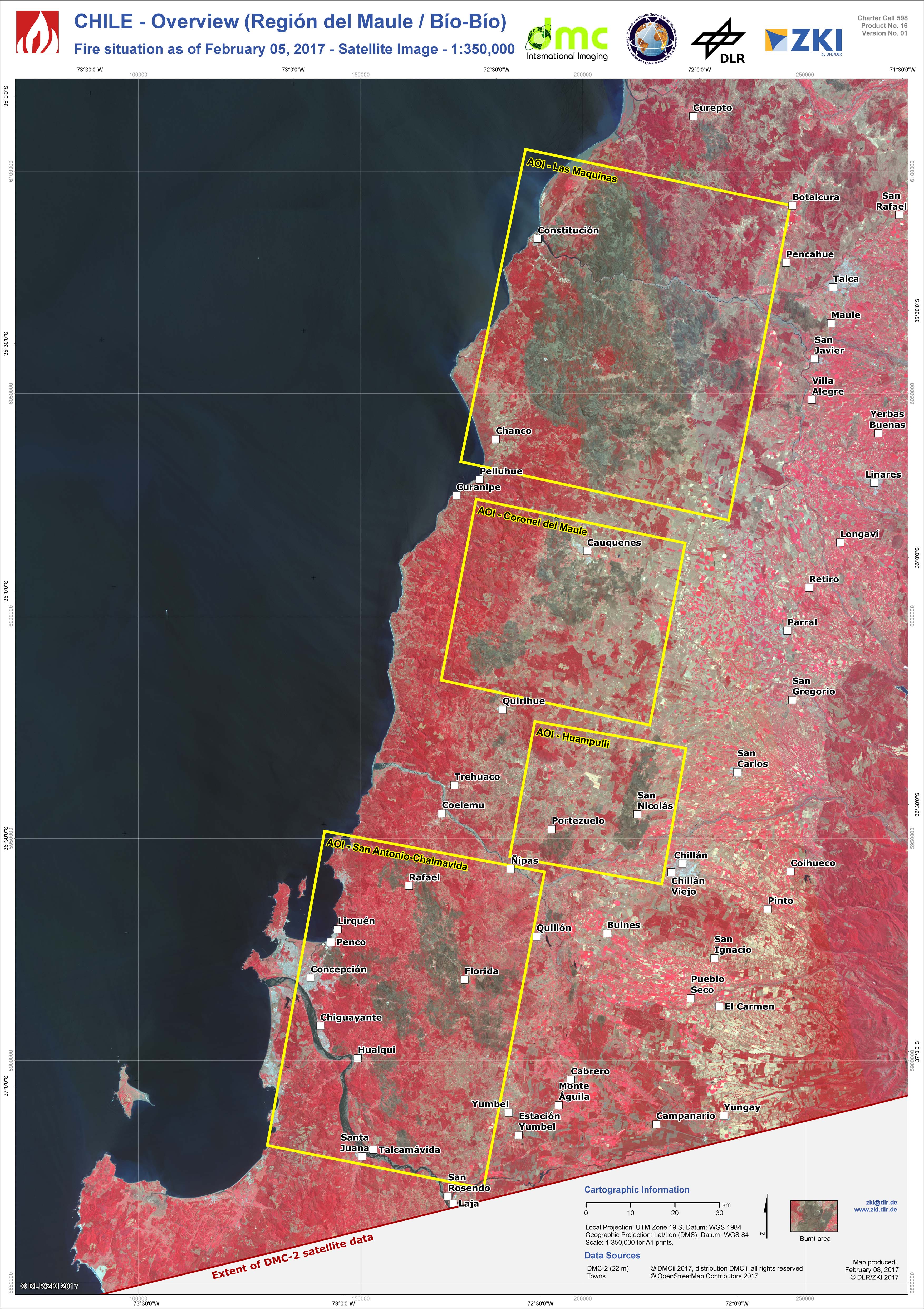
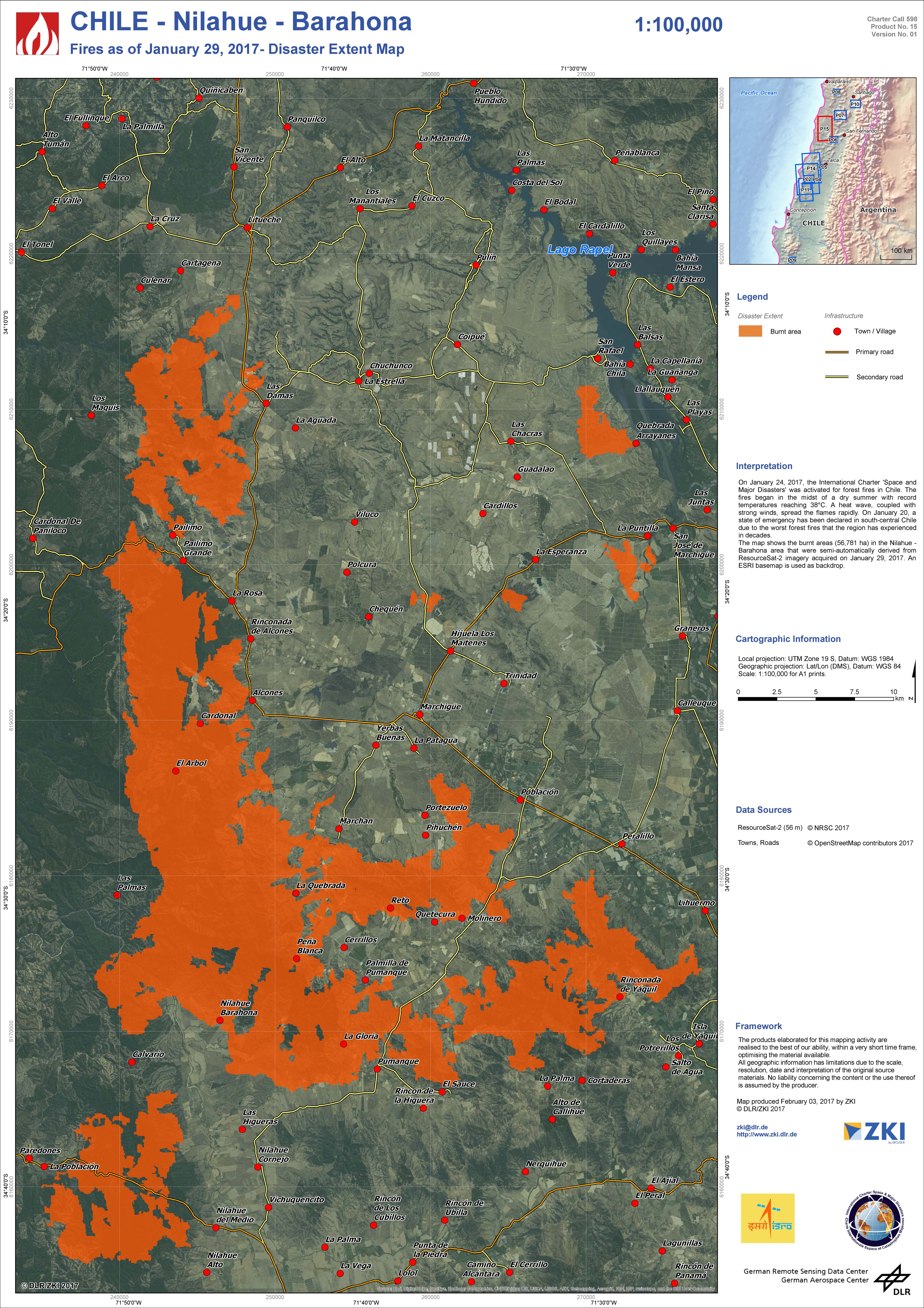
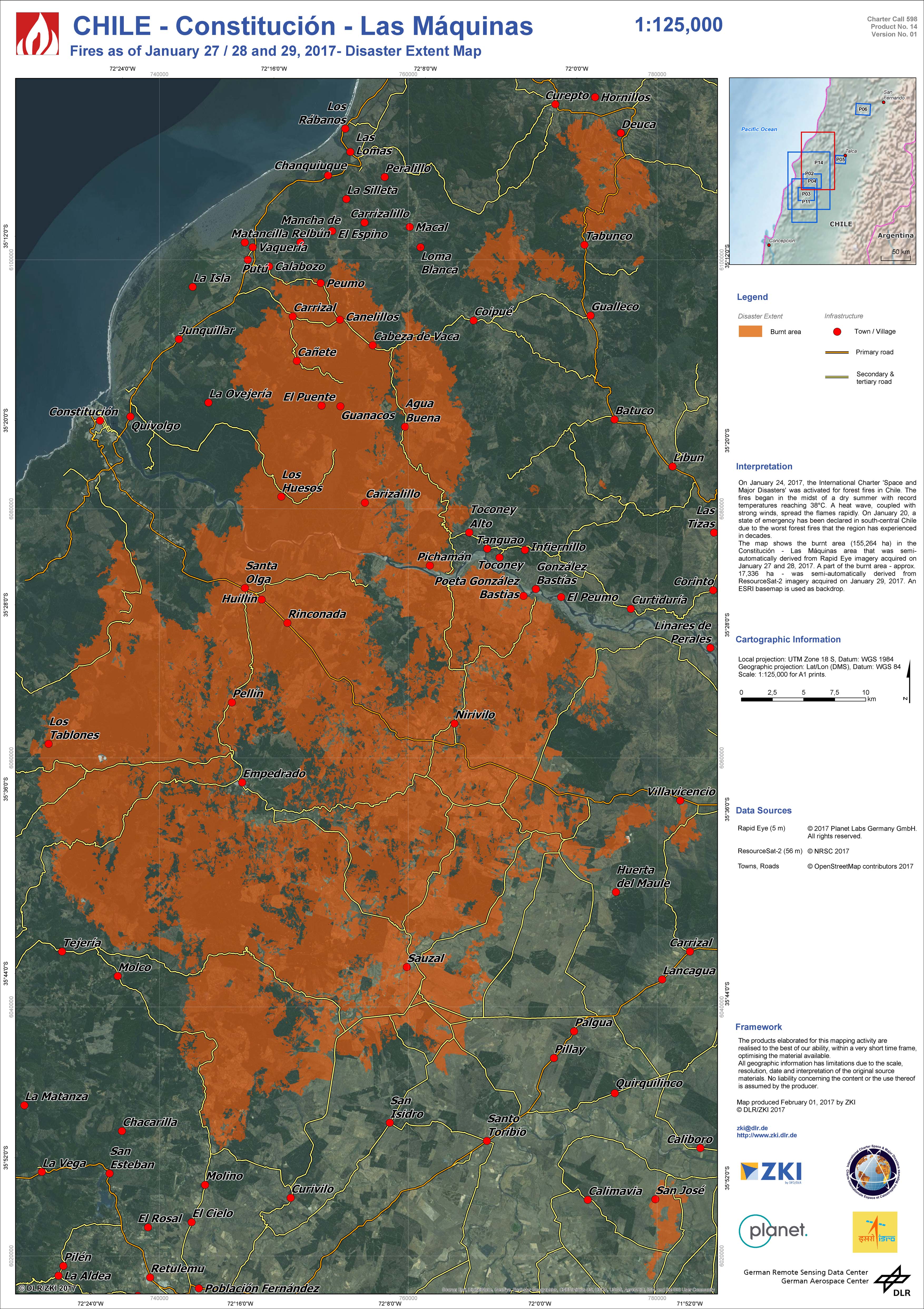
Disaster extent map of Constitución and Las Máquinas
Авторские права: RapidEye © Planet (2017) - All rights reserved
ResourceSat-2 data and products © ISRO (2017) - All rights reserved
Map produced by DLR/ZKI
Information about the Product
Получено: RapidEye: 27/01/2017 and 28/01/2017
ResourceSat-2: 29/01/2017
Источник: RapidEye / ResourceSat-2
 Вернуться к полному архиву активаций

