 English
 Spanish
 French
 Chinese
 Russian
 Portuguese
 最新宪章启动
Charter activations
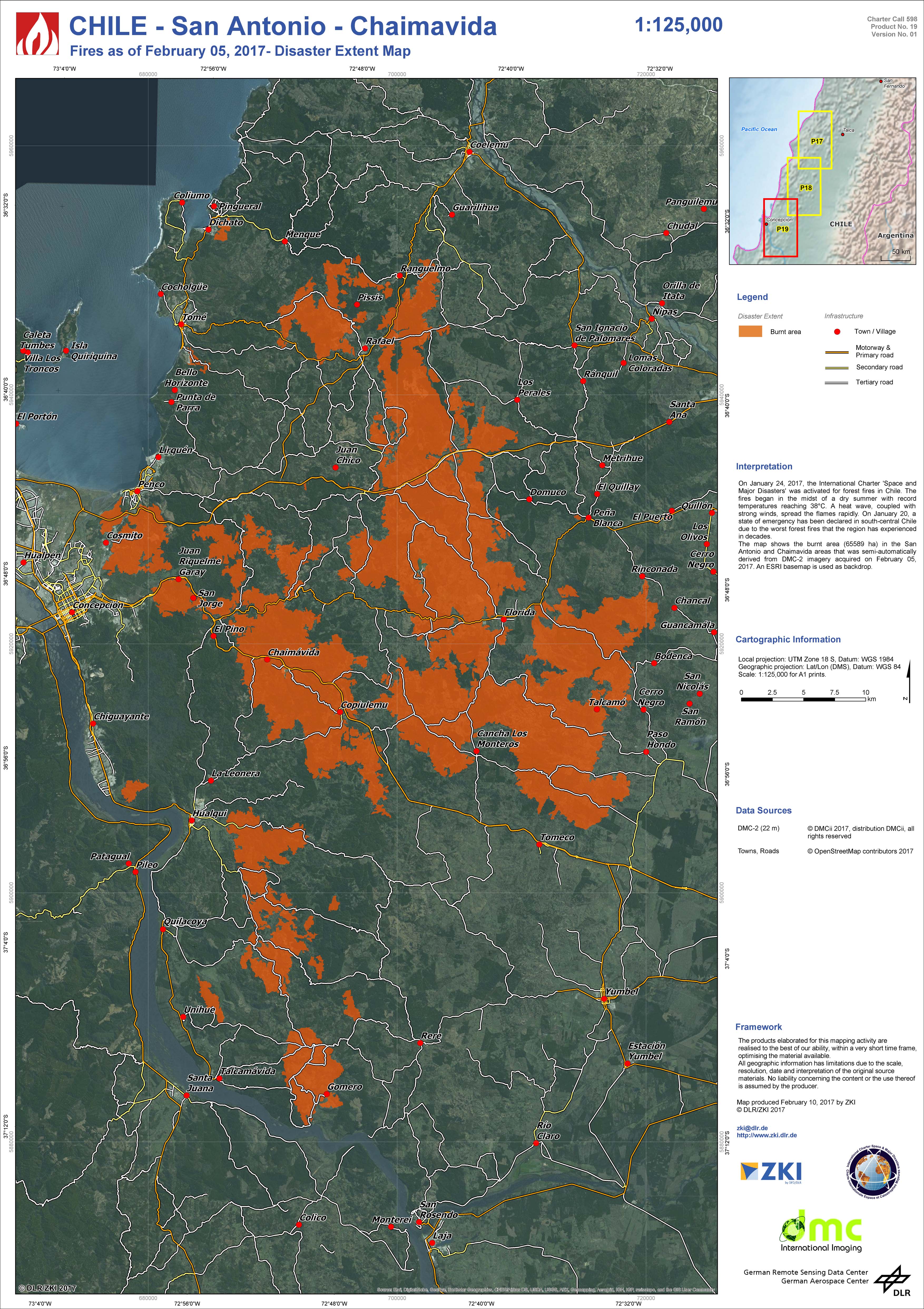
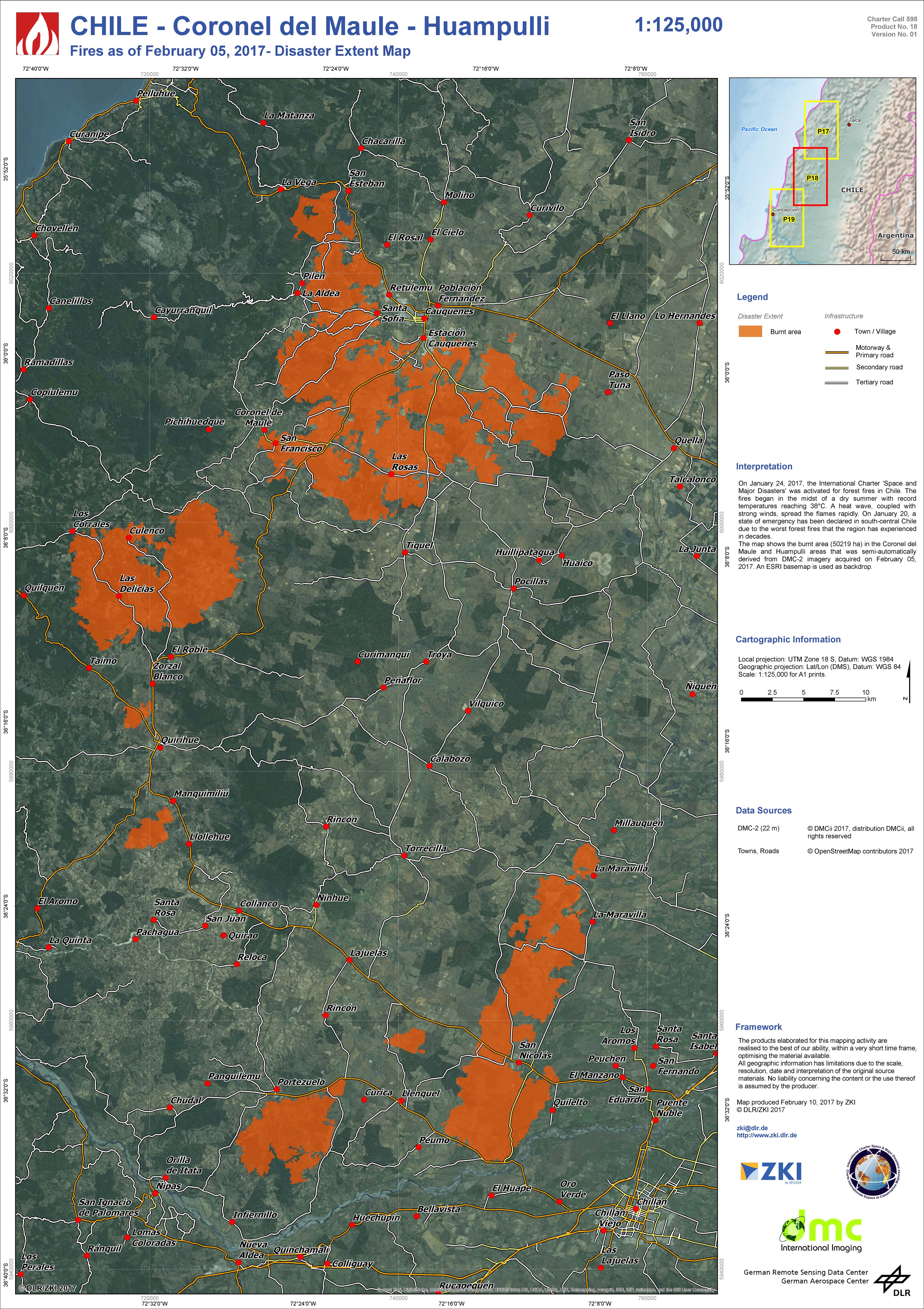
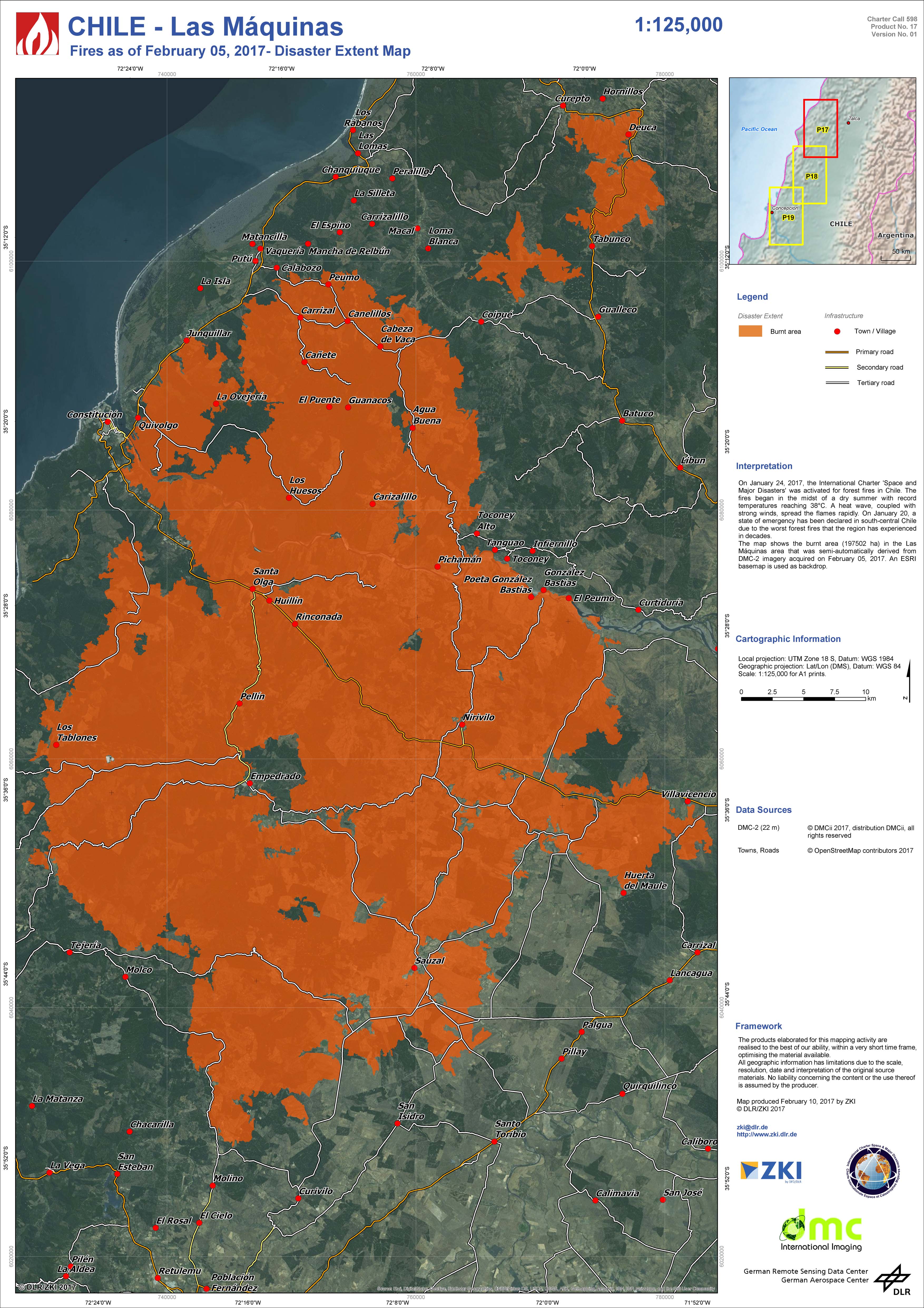
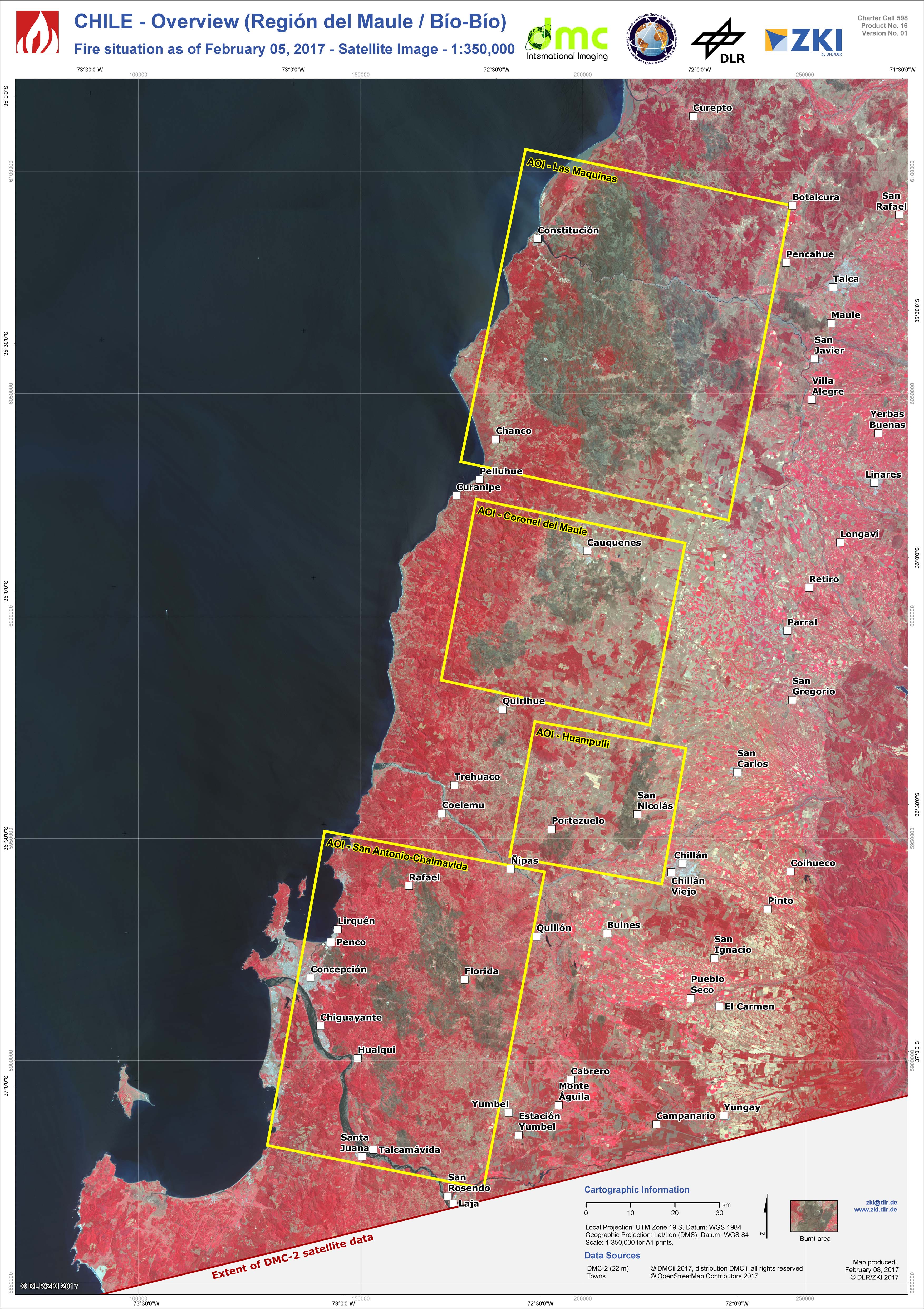
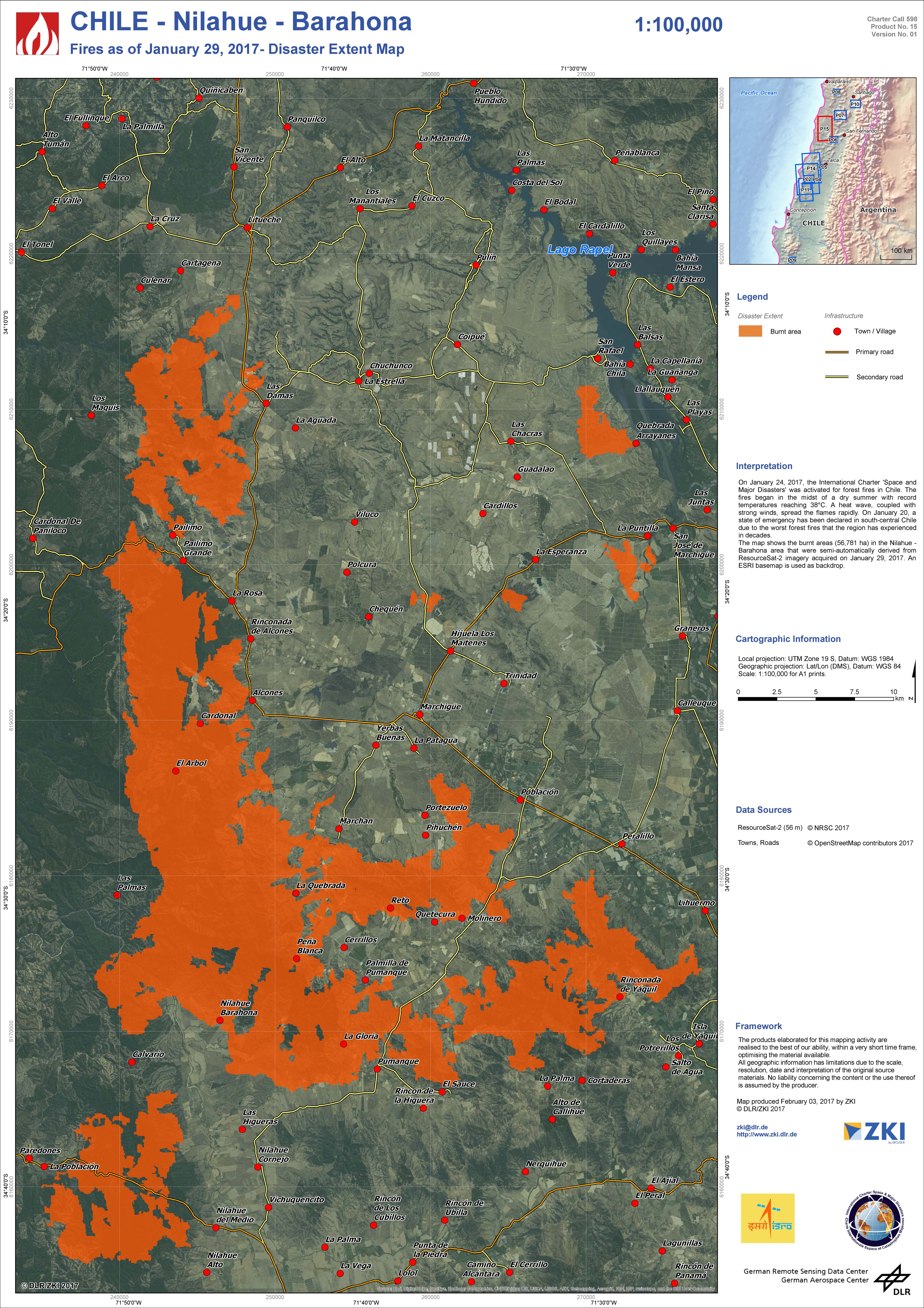
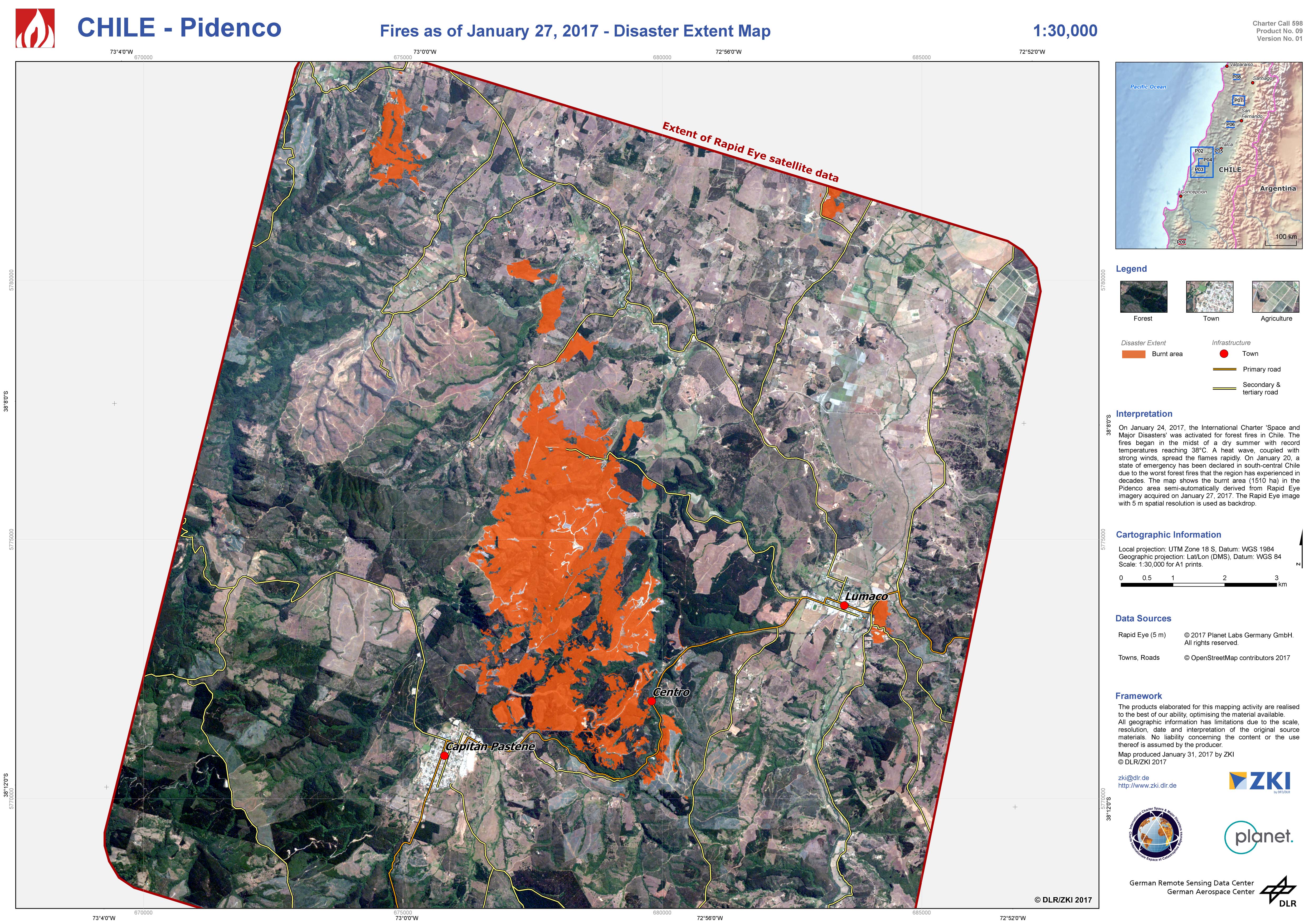
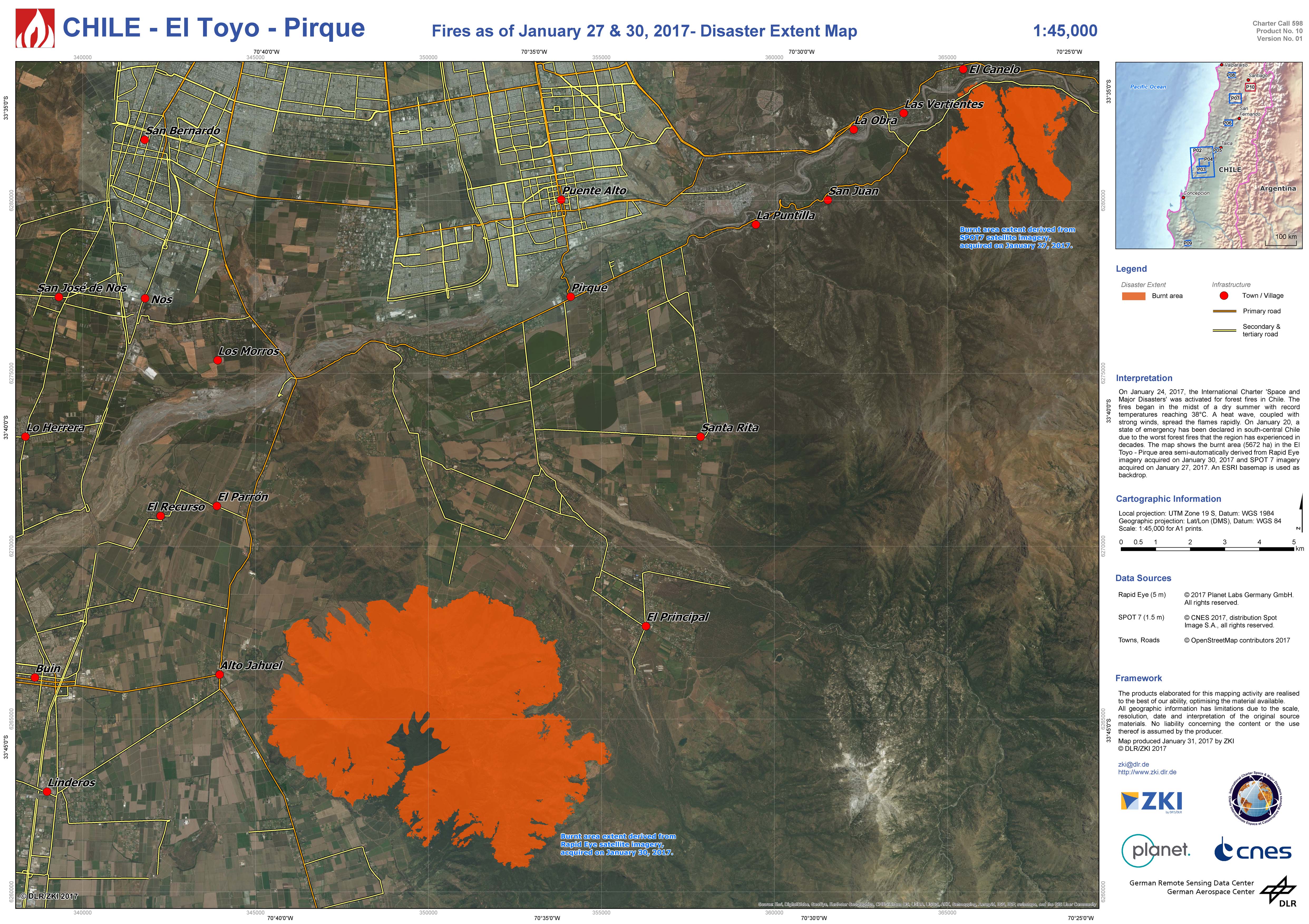
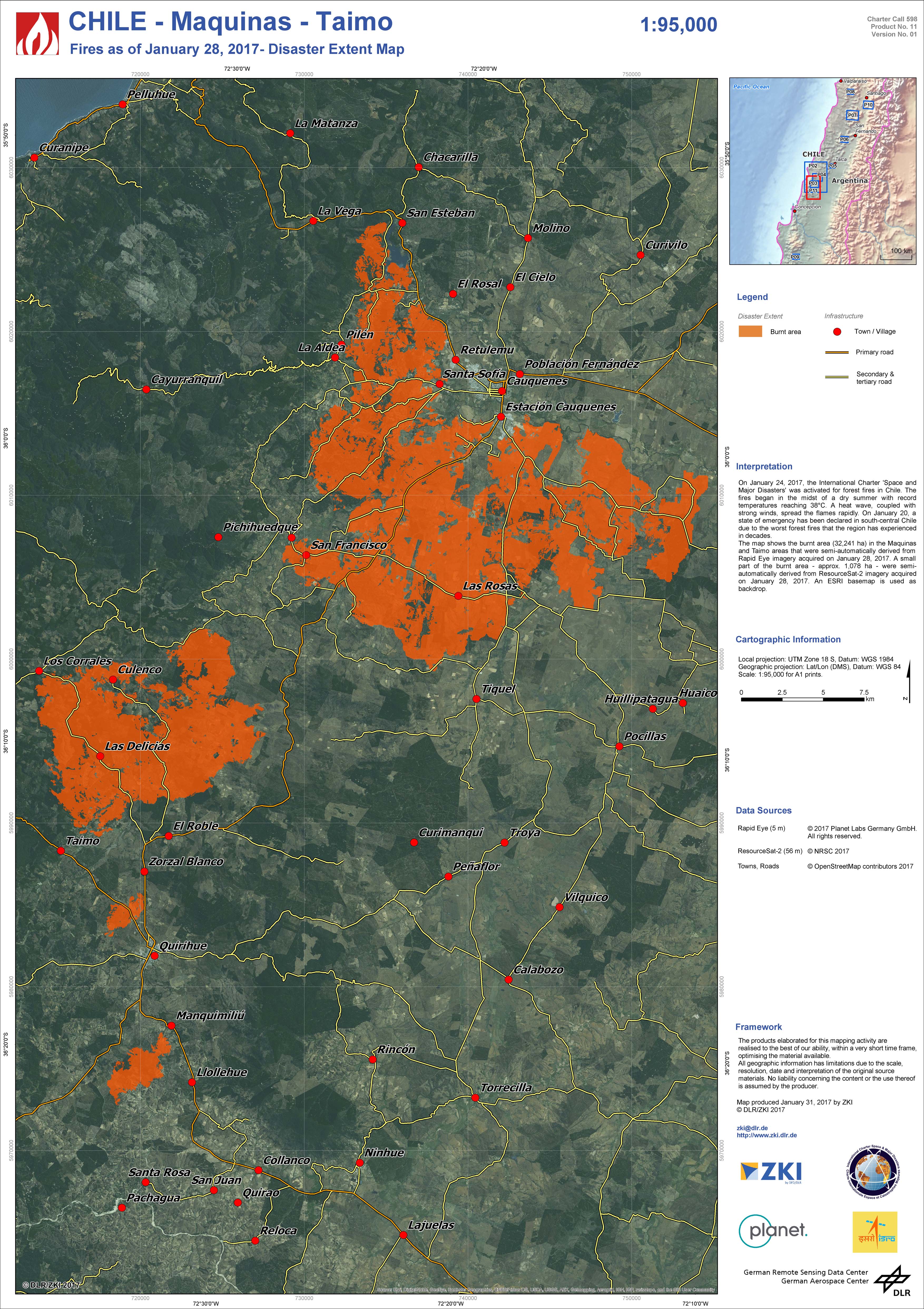
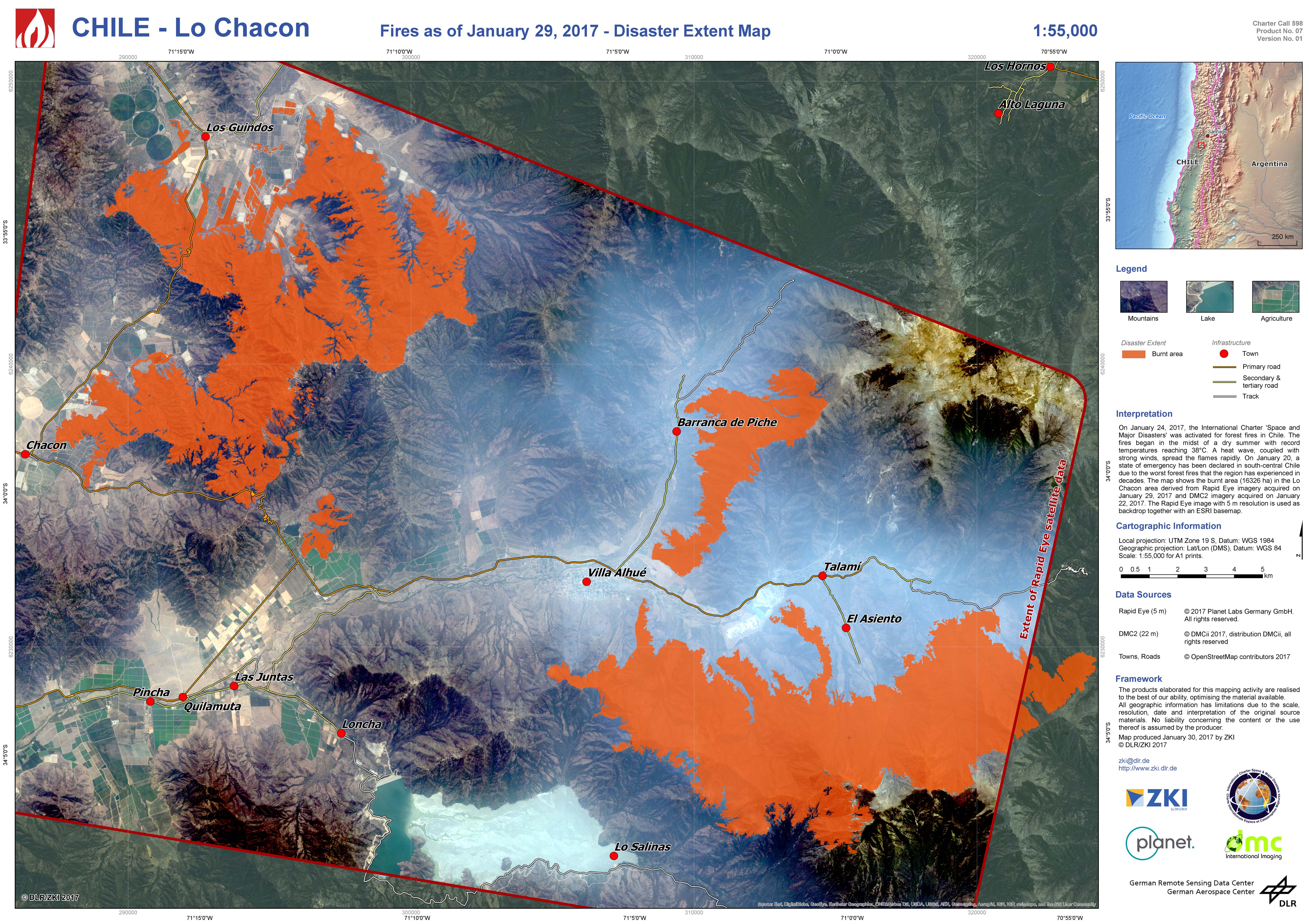
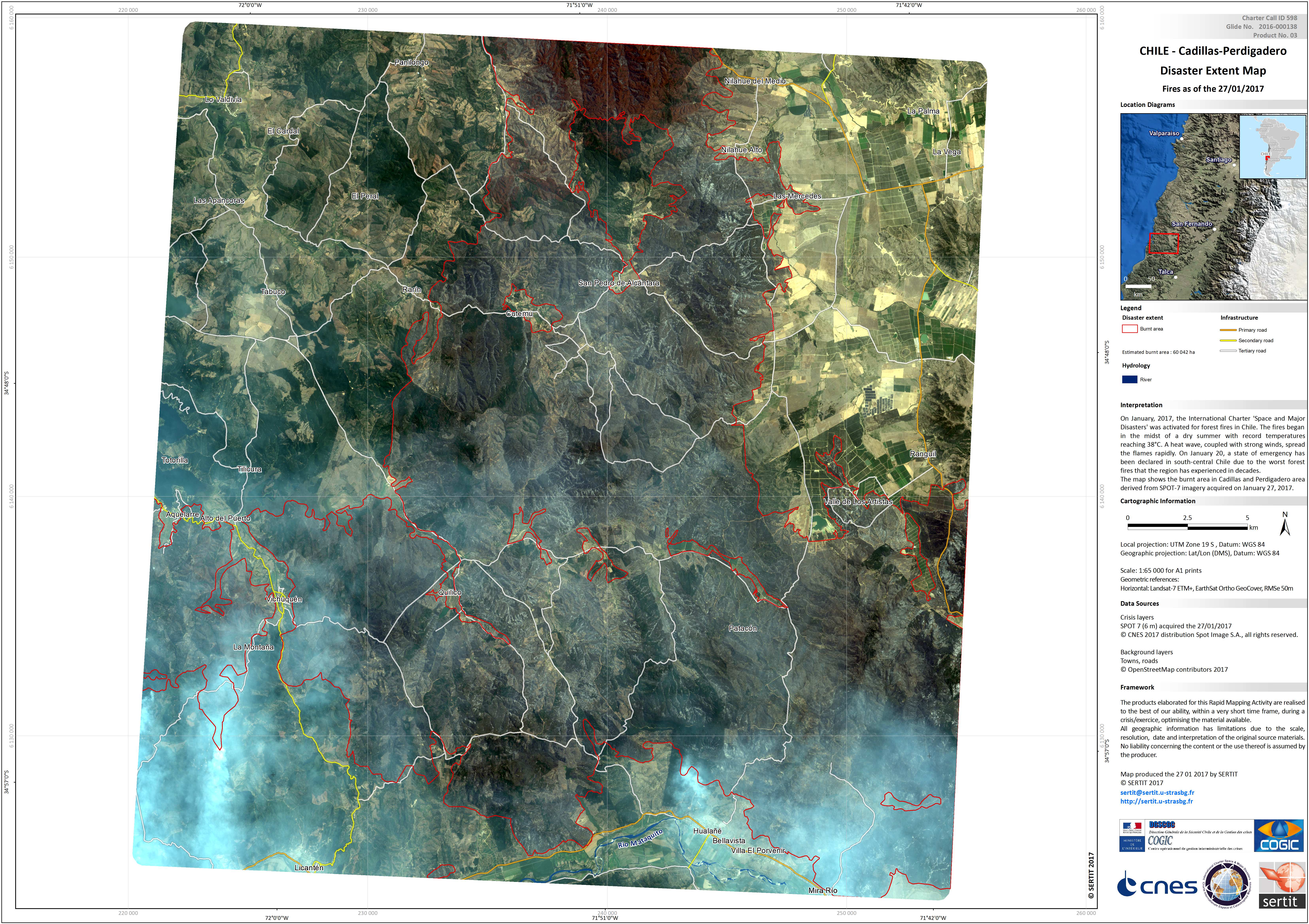
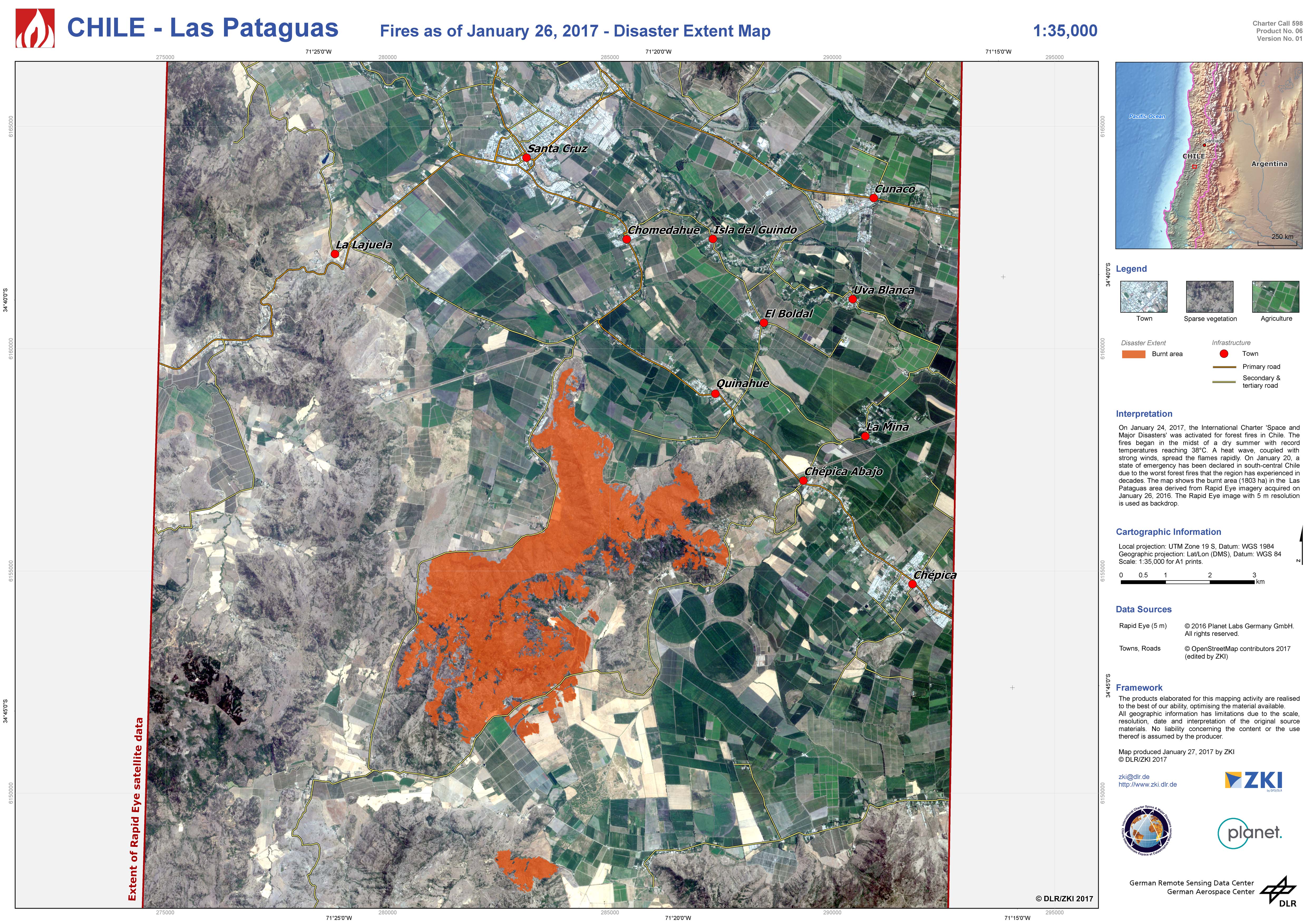
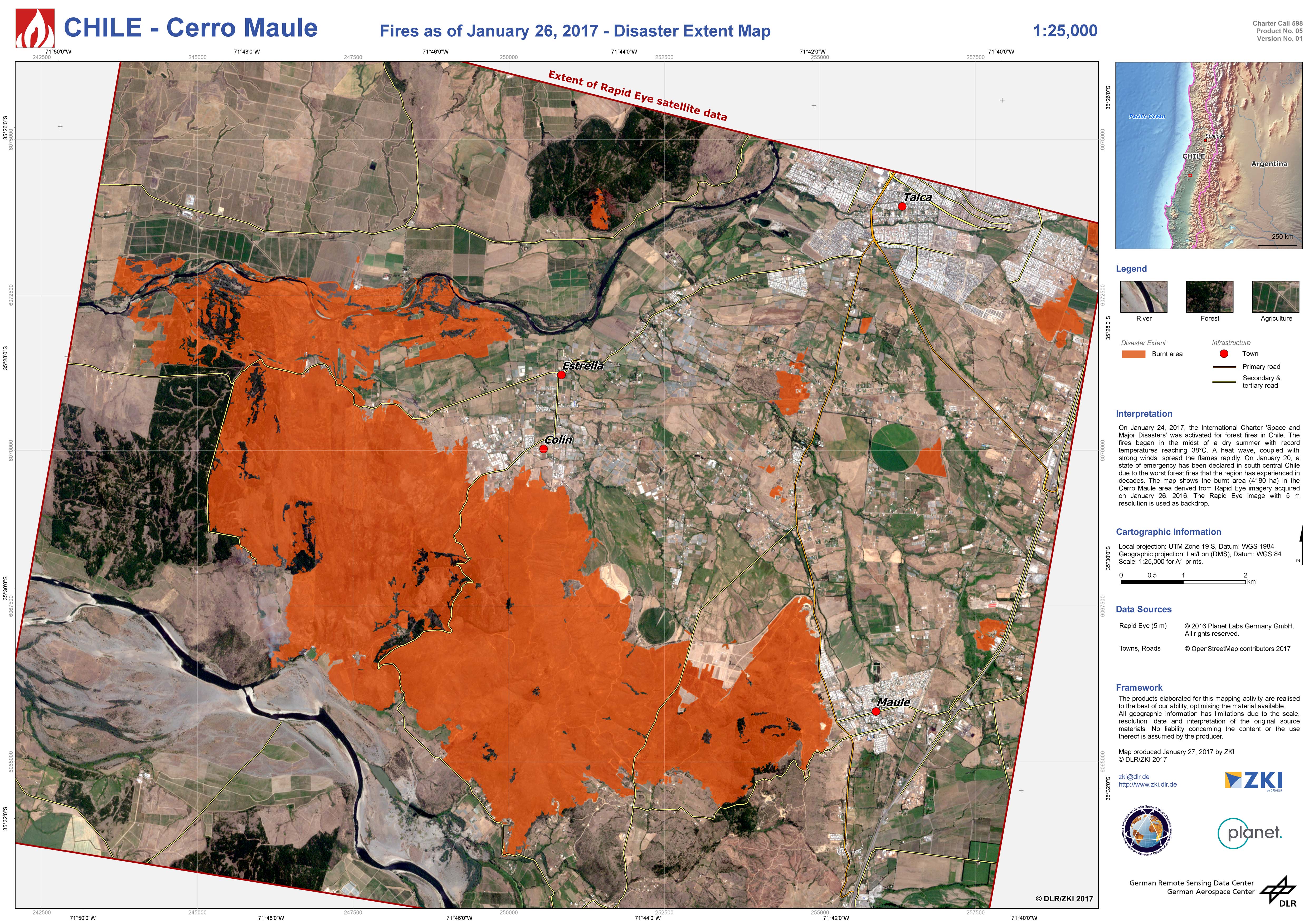
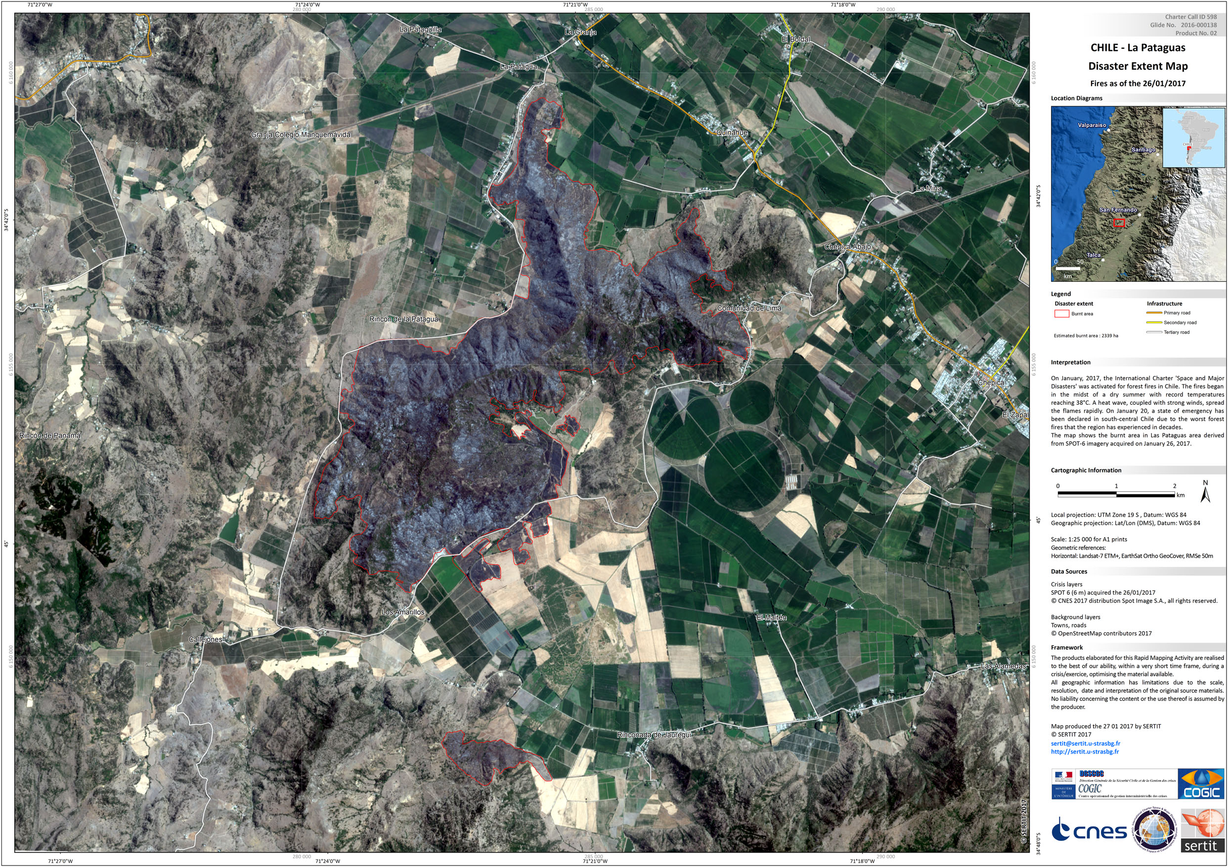
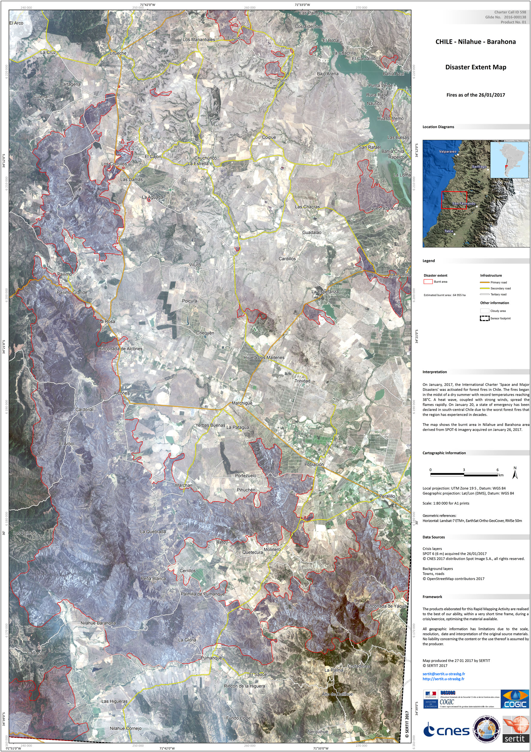
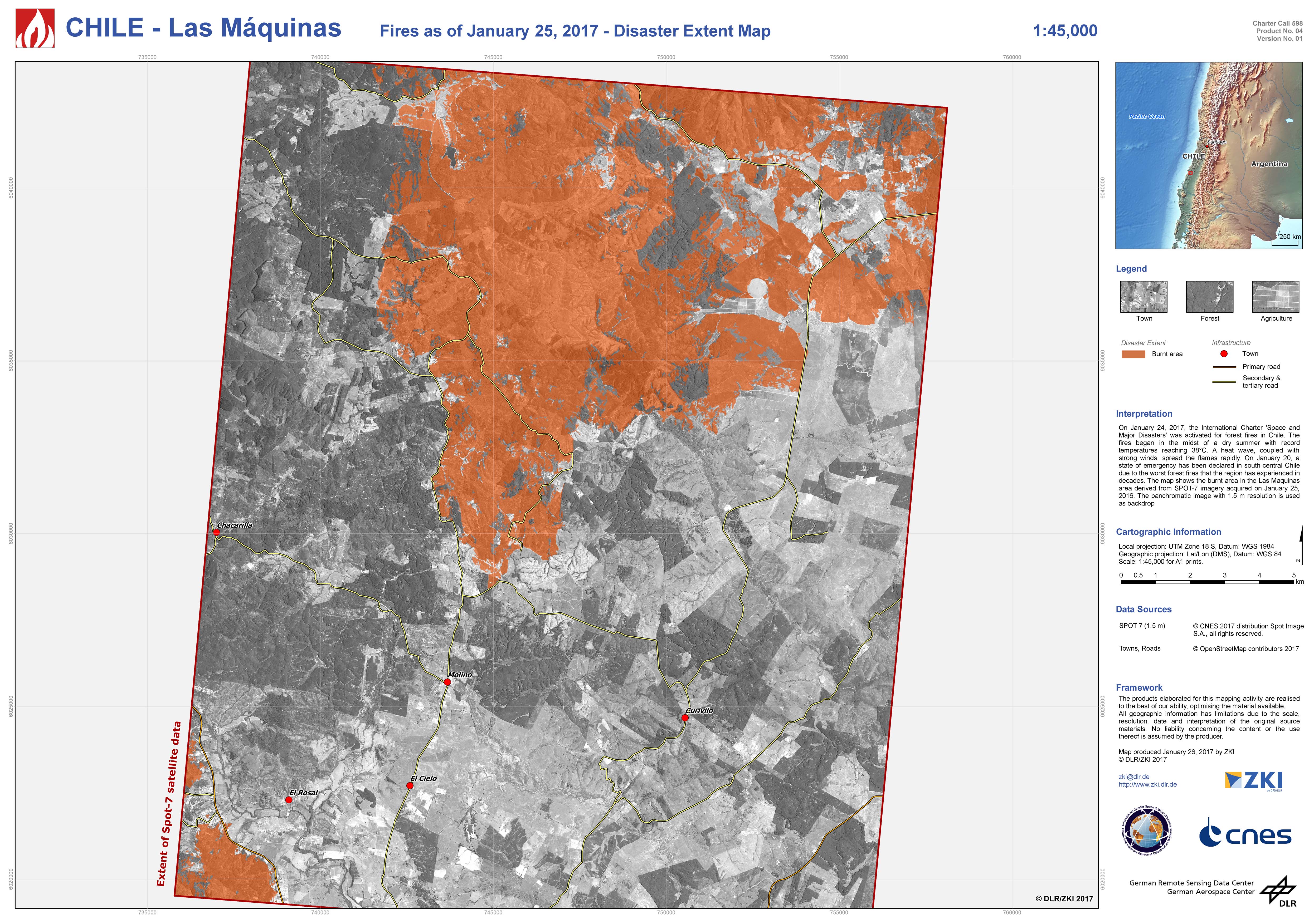
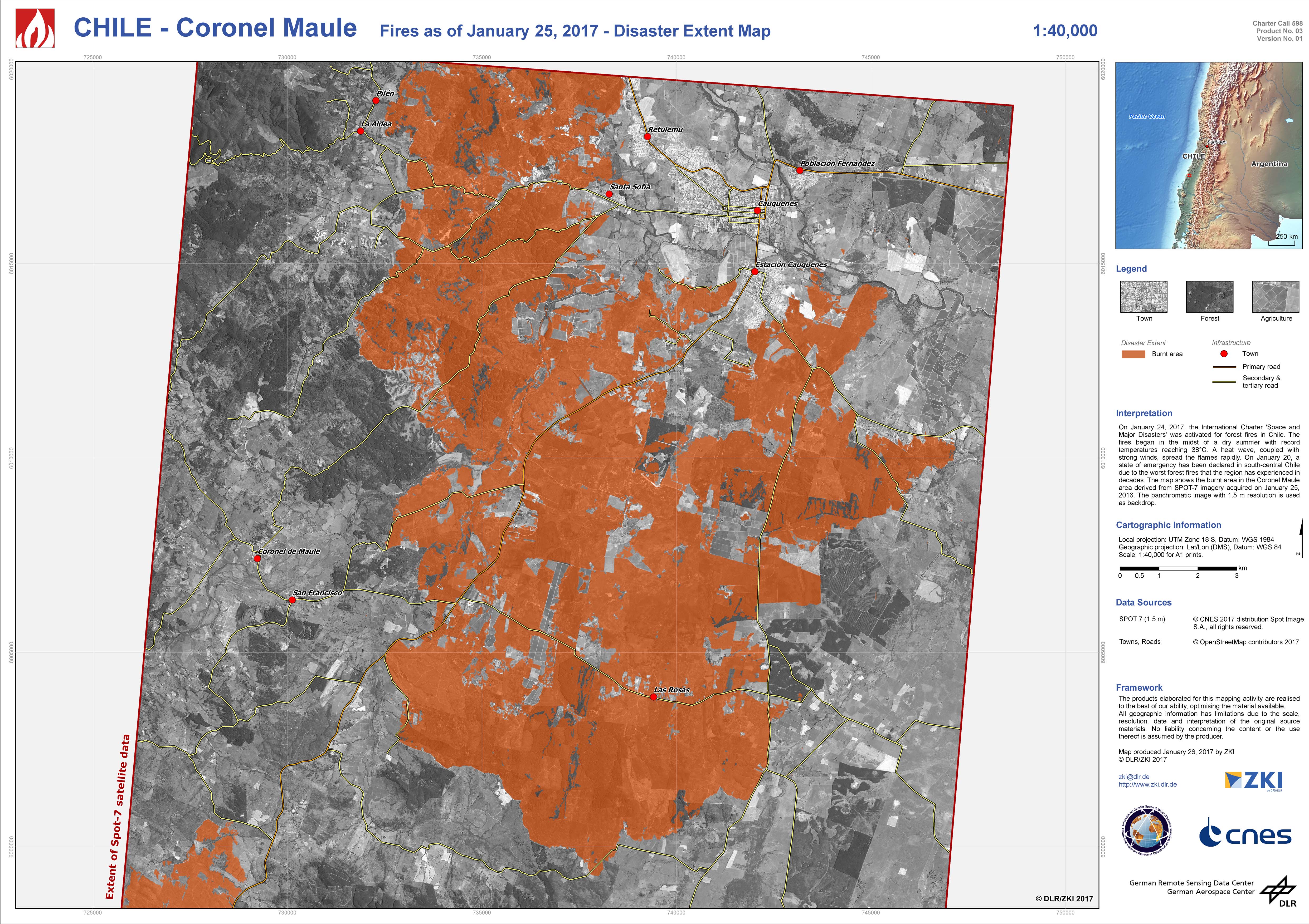
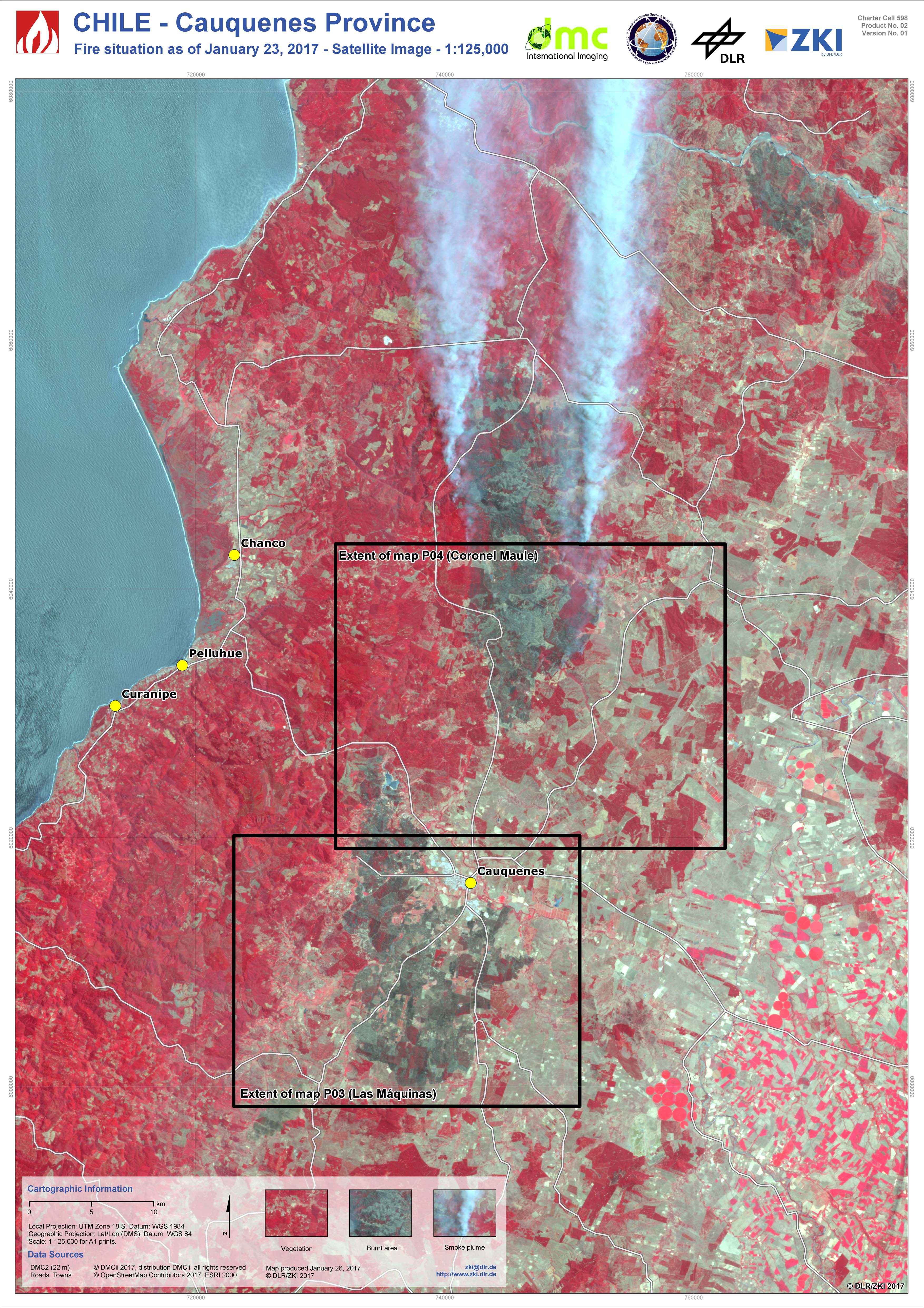
智利火灾
由于该地区遭受了几十年来最严重的森林大火,智利中南部已经宣布进入紧急状态。
大火发生干燥夏季的一个星期前,气温达到了38°C。 ONEMI - 内政部国家应急办公室 - 报道了32次仍在继续的火灾,对智利首都圣地亚哥南部的奥希金斯、莫尔和比奥比奥地区造成了影响。
三名消防员在扑灭大火时遇难,有78所房屋被毁,数百人被疏散。
近四千人(包括消防员、士兵、应急人员和志愿者)一直在努力控制火势,一些大火已被扑灭,29处得到控制。政府已经请求国际援助,应对大规模的火灾。
据估计,这场火灾已经烧毁了10万公顷以上的森林。
| 事件类型: | 森林大火 |
| 事件地点: | 智利 |
| 启动宪章的日期: | 2017年1月24日 |
| 宪章启动时间: | 08:51:00 |
| 宪章启动时区: | UTC-03:00 |
| 宪章要求者: | 内政部和公安部国家应急办公室 (ONEMI) |
| 项目经理: | DLR/ZKI |
Products
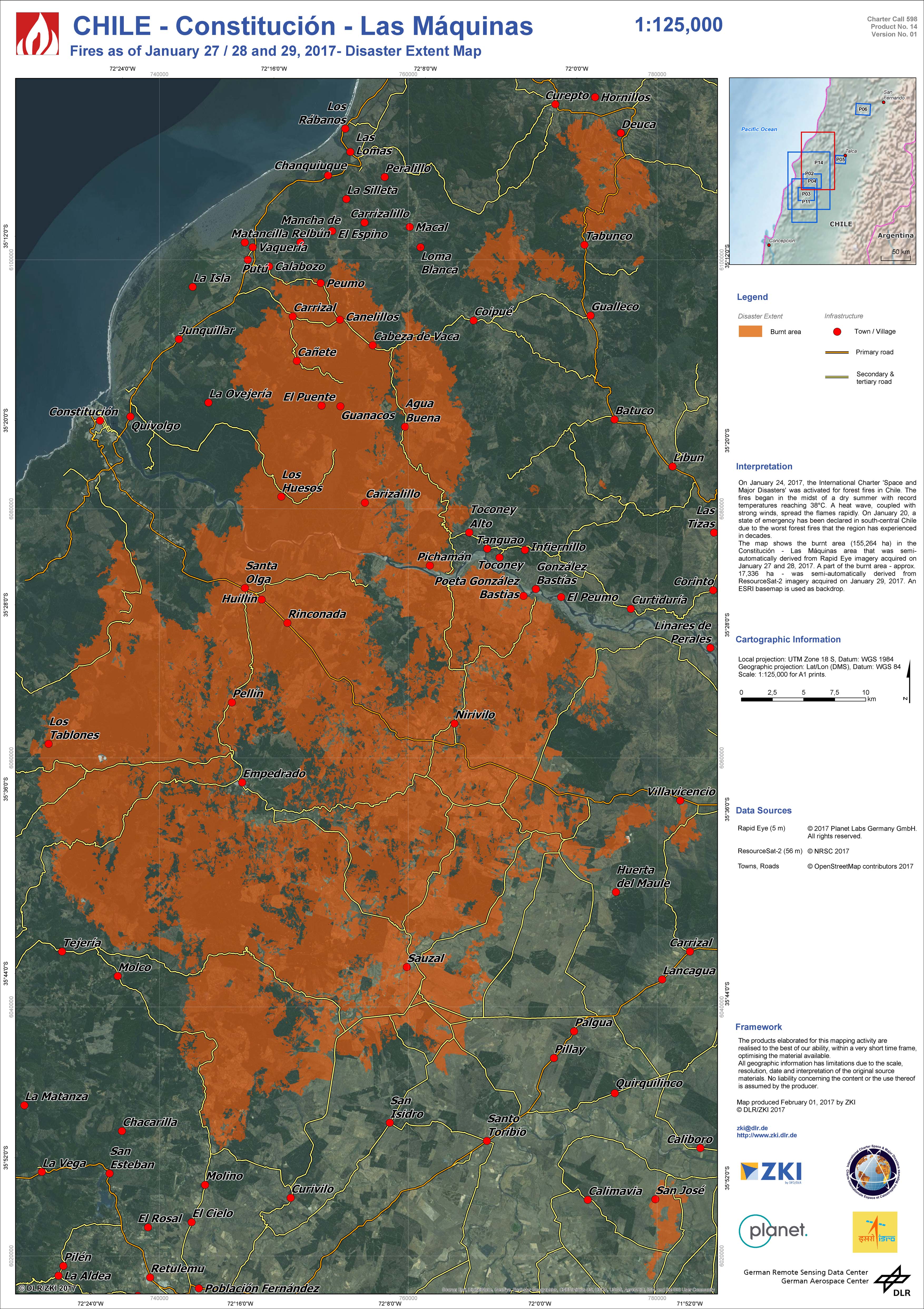
Disaster extent map of Constitución and Las Máquinas
版权: RapidEye © Planet (2017) - All rights reserved
ResourceSat-2 data and products © ISRO (2017) - All rights reserved
Map produced by DLR/ZKI
Information about the Product
已获得: RapidEye: 27/01/2017 and 28/01/2017
ResourceSat-2: 29/01/2017
源: RapidEye / ResourceSat-2
 返回完整的响应档案

