 English
 Spanish
 French
 Chinese
 Russian
 Portuguese
 最新宪章启动
Charter activations
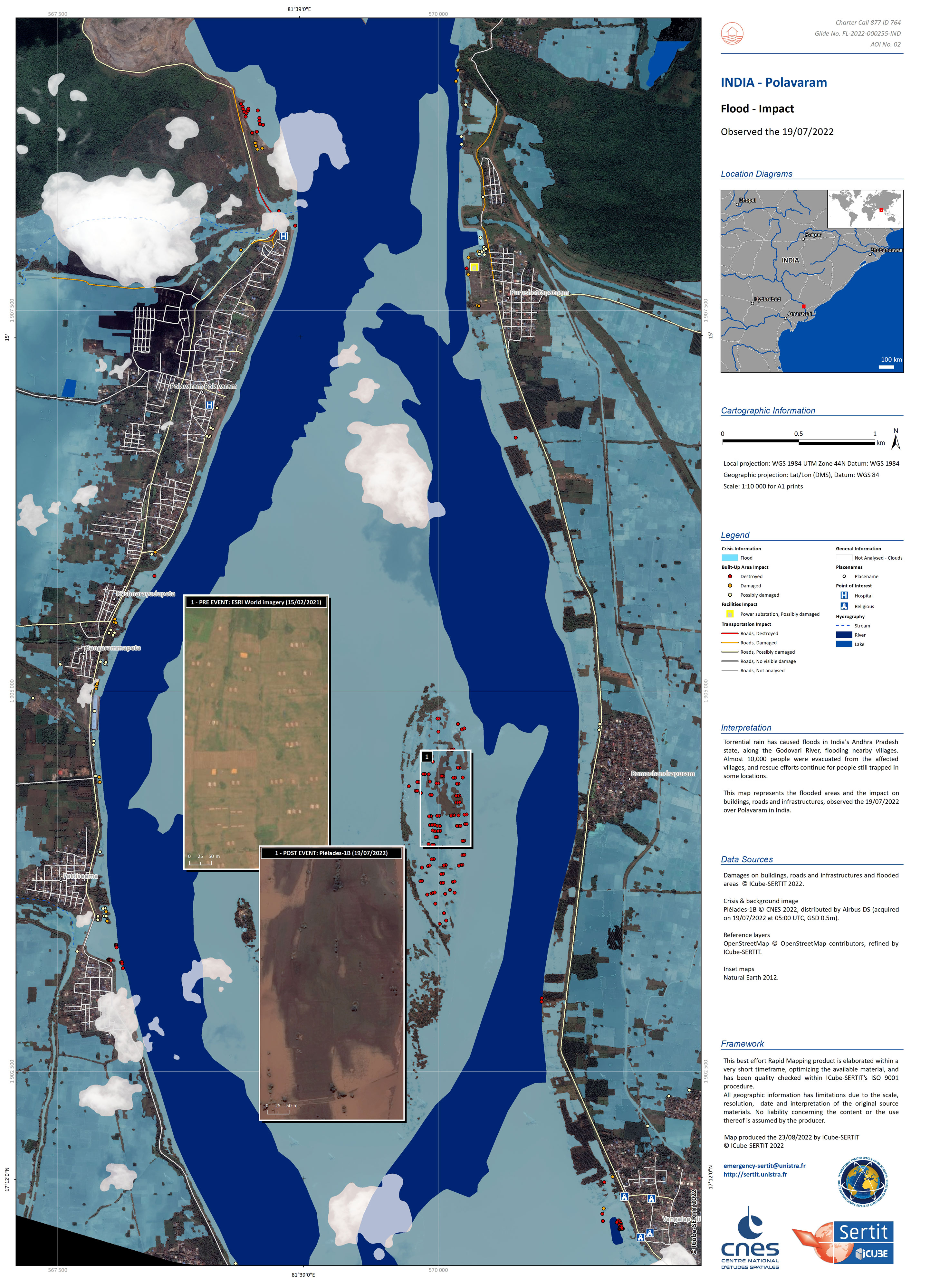
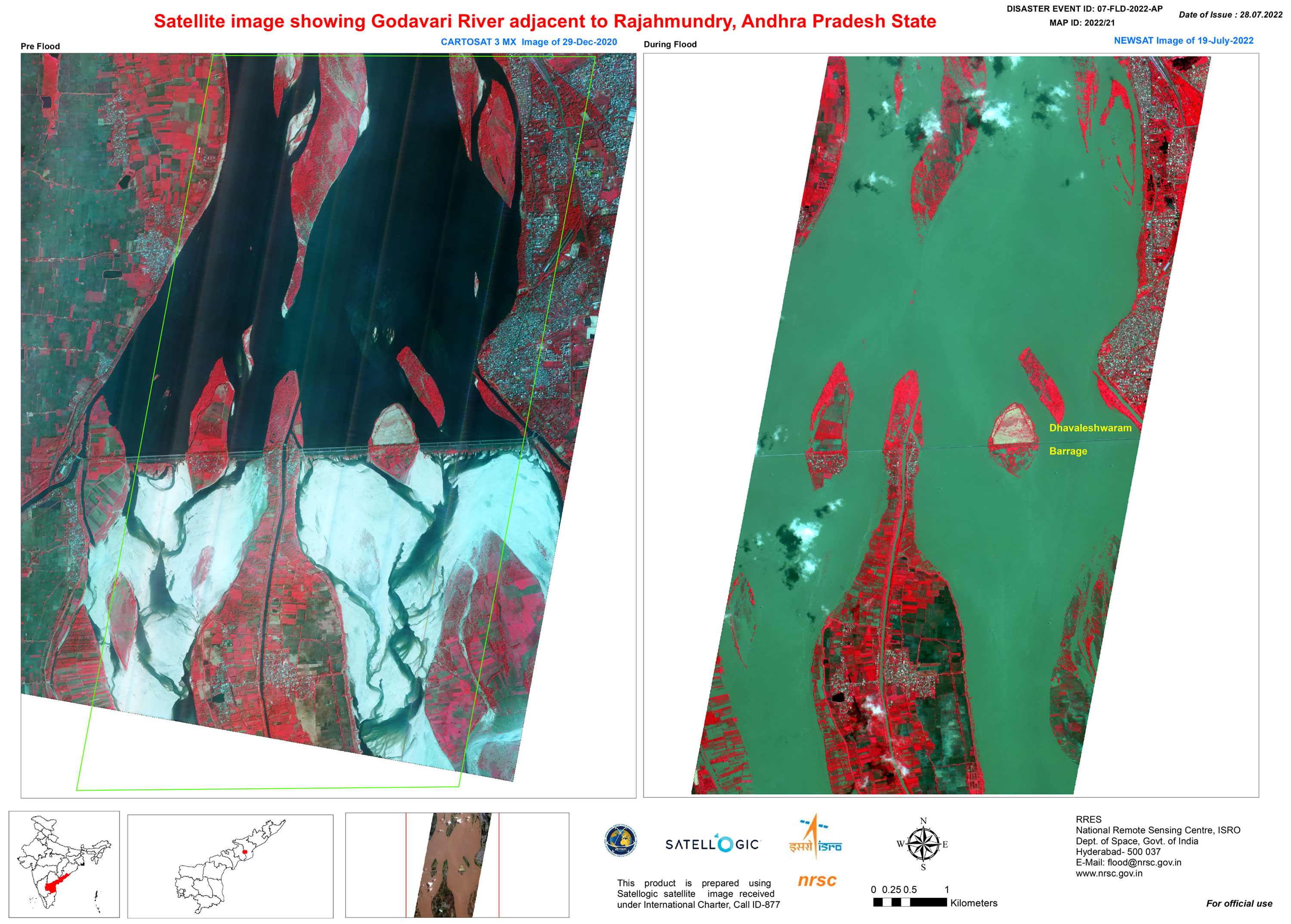
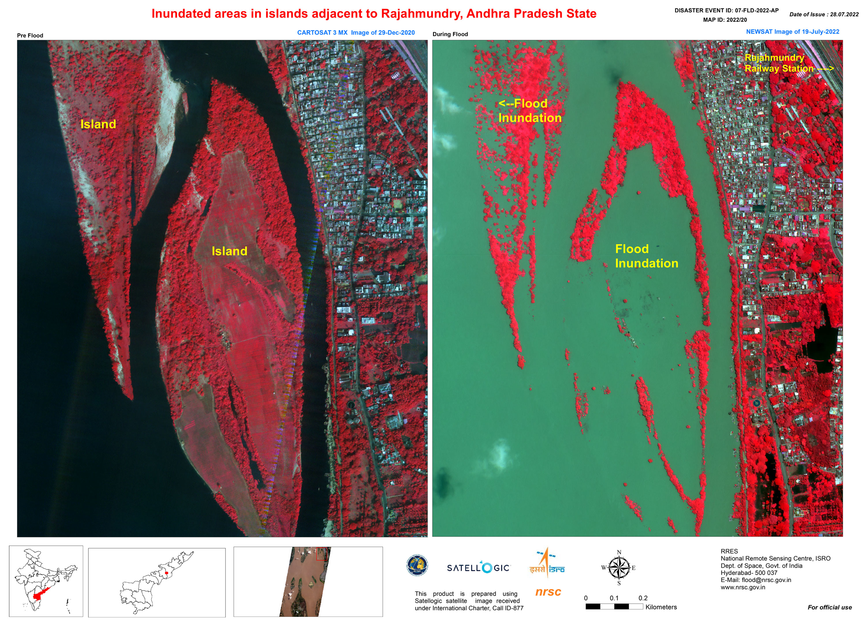
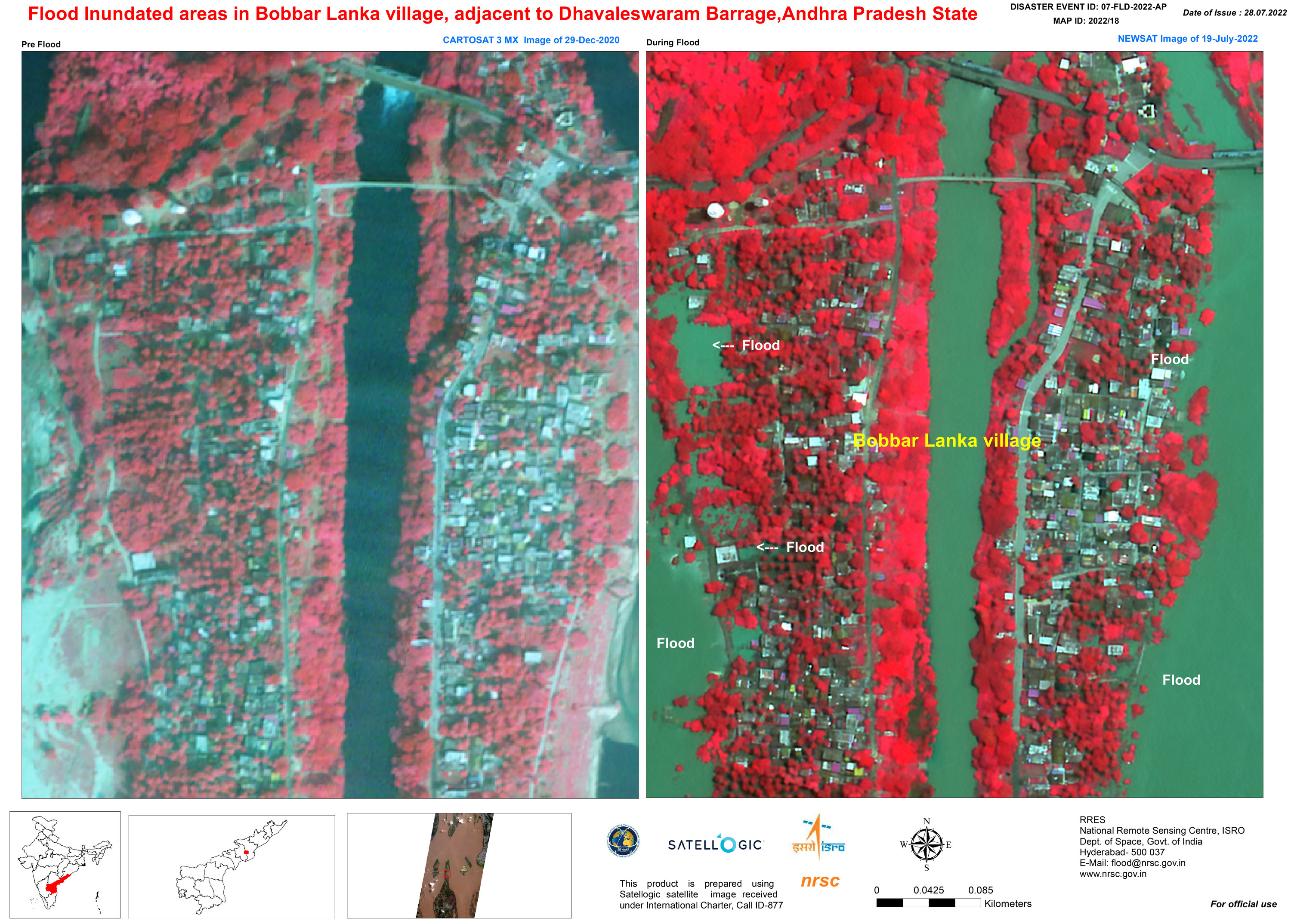
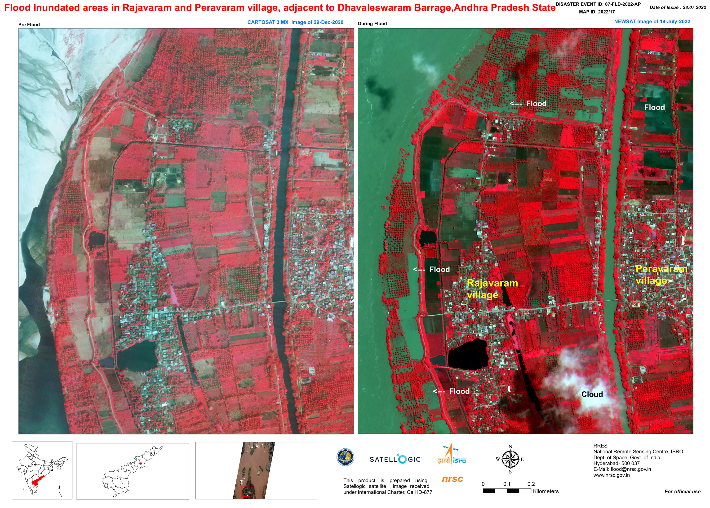
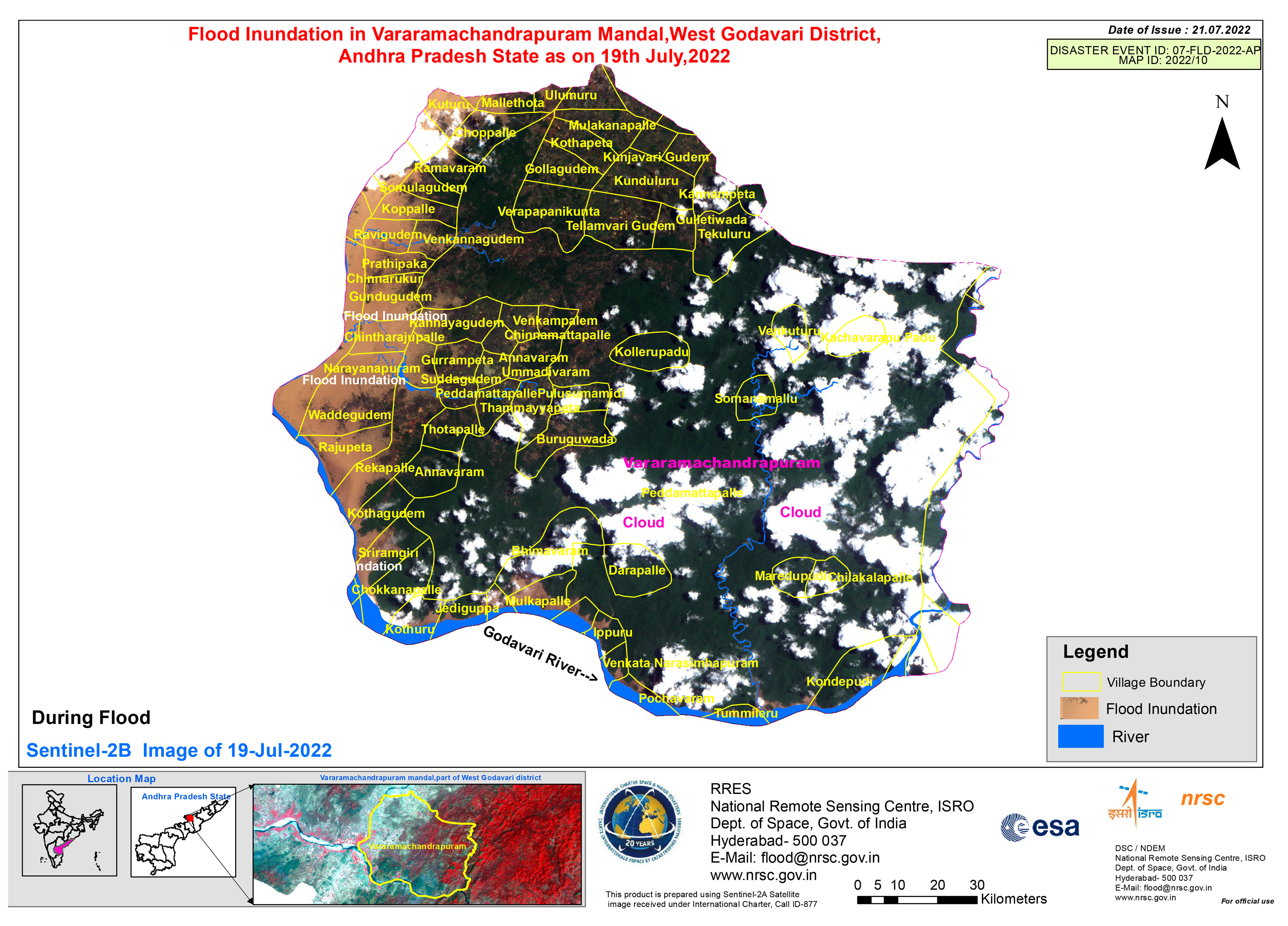
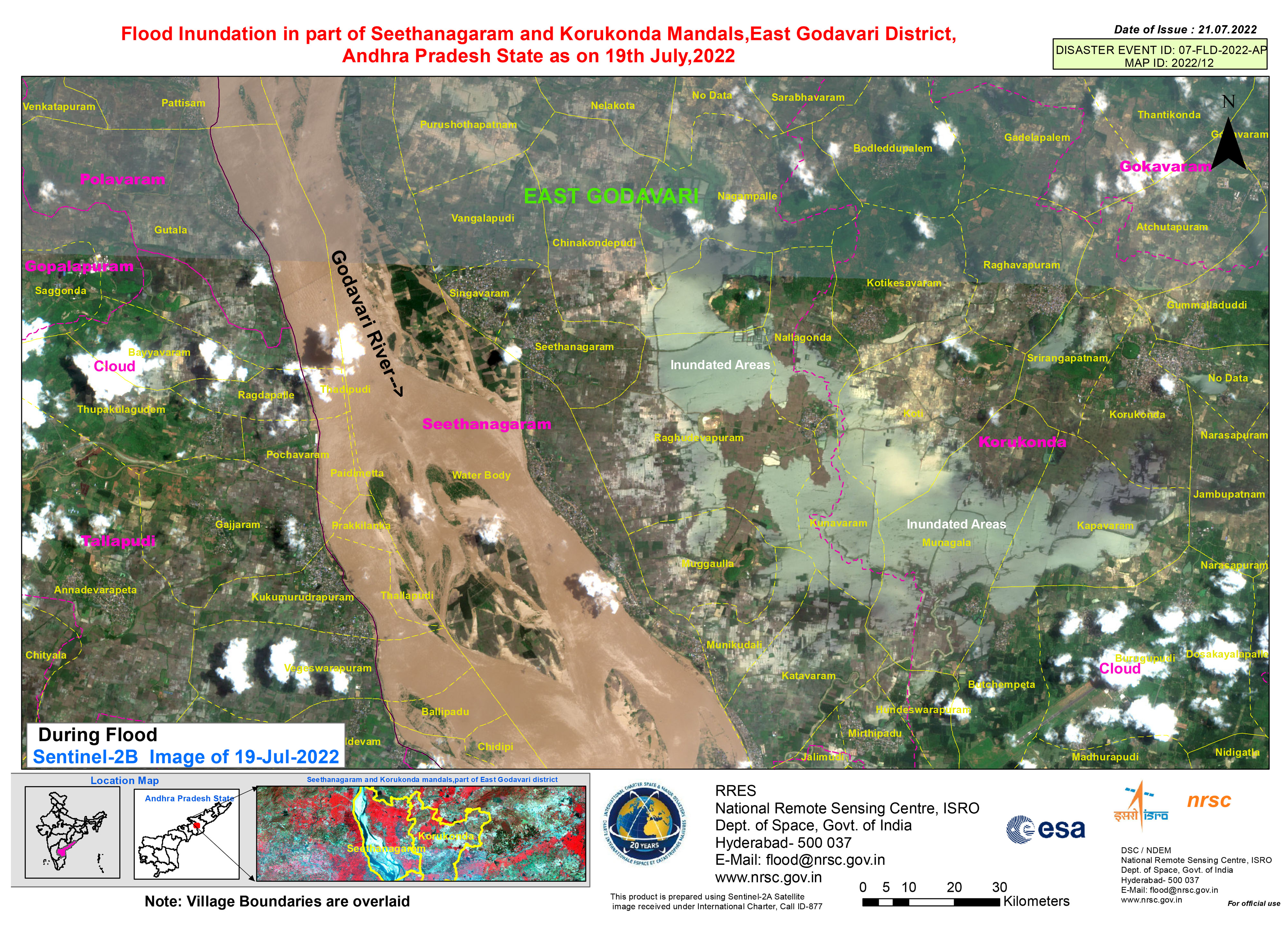
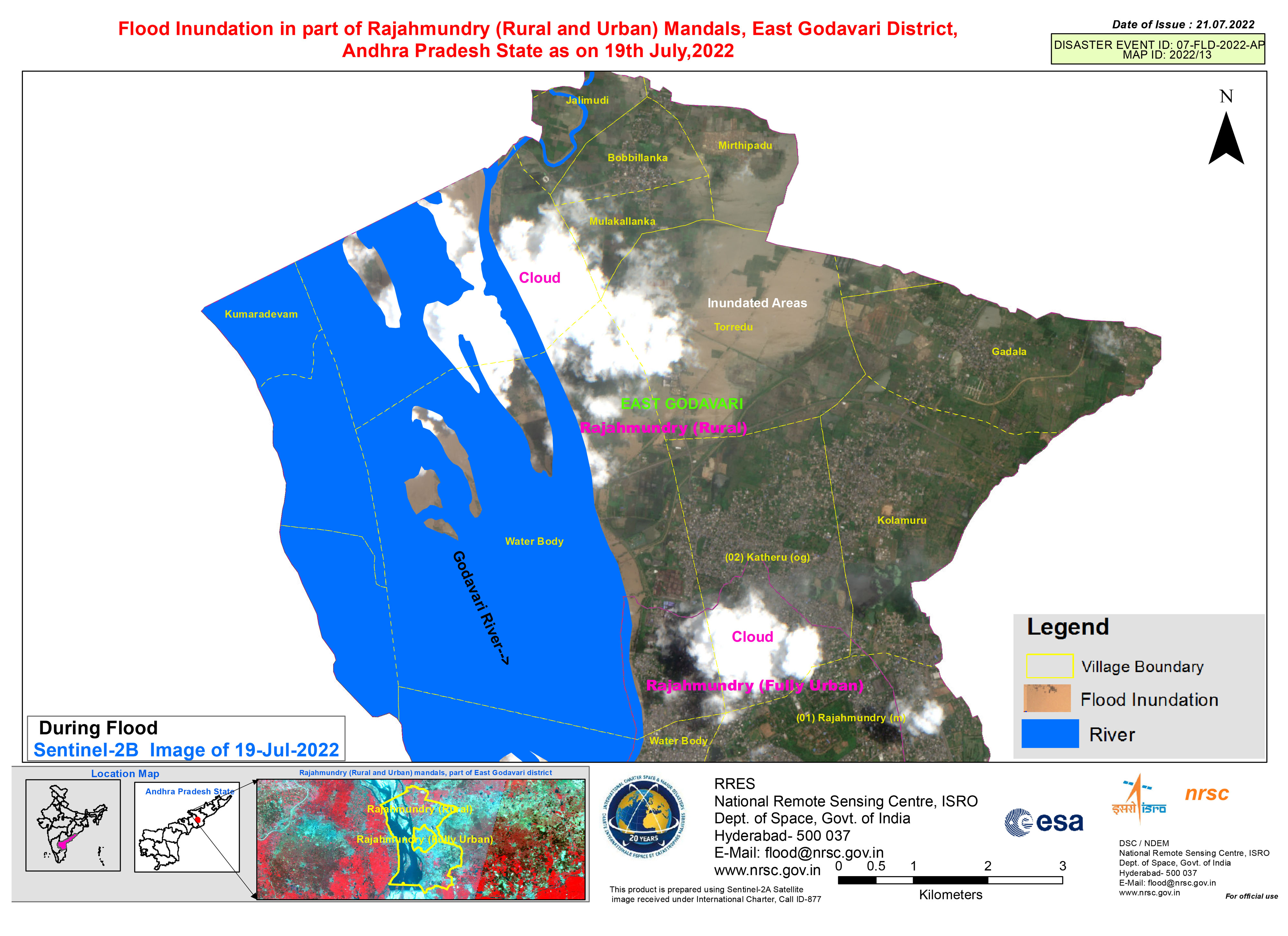
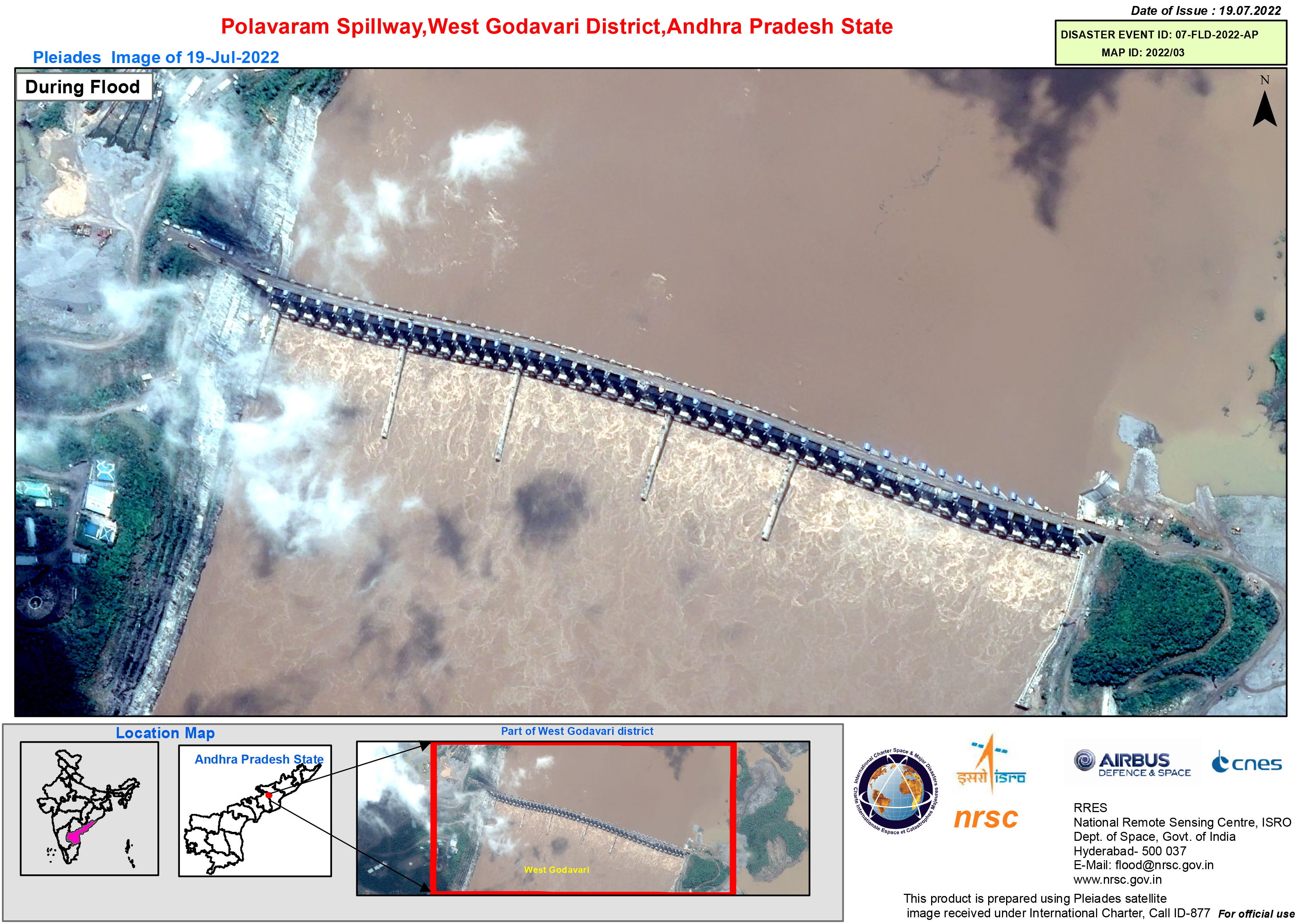
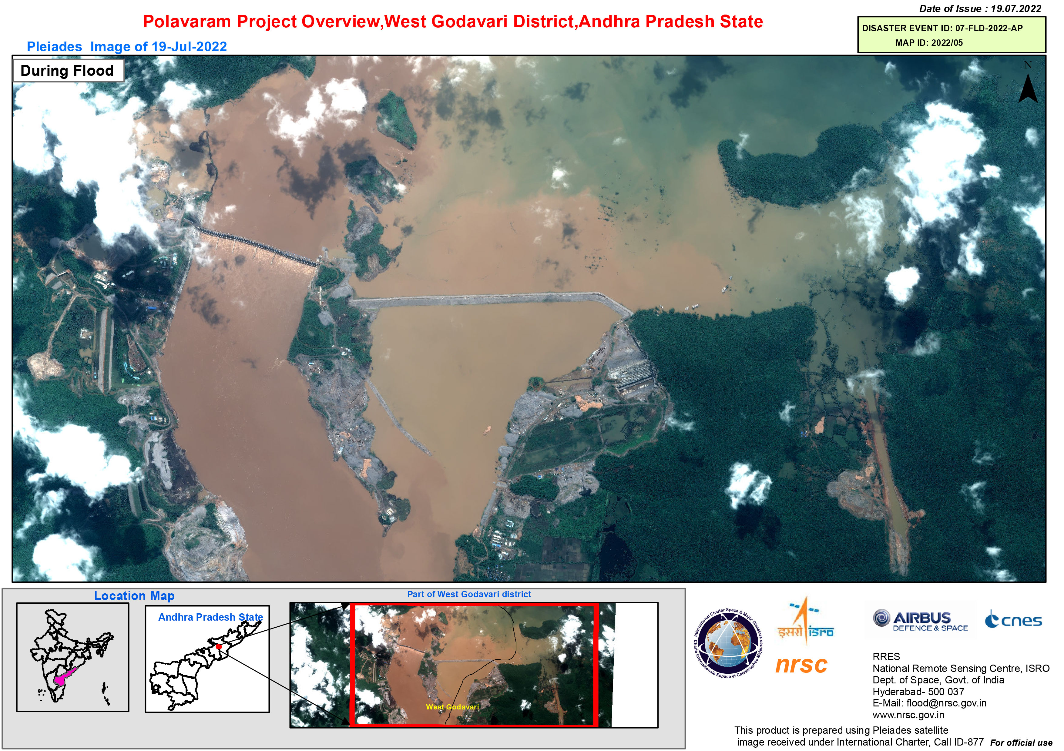
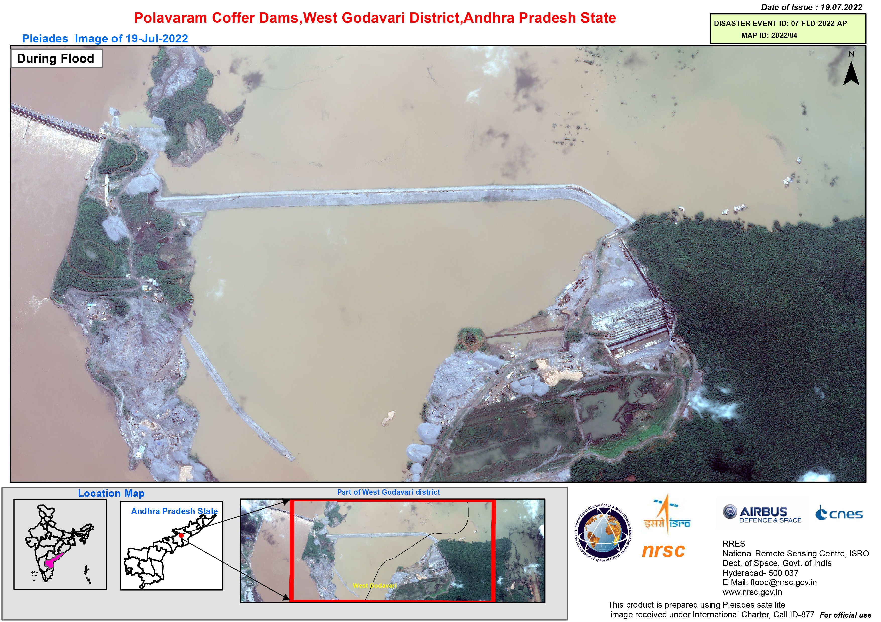
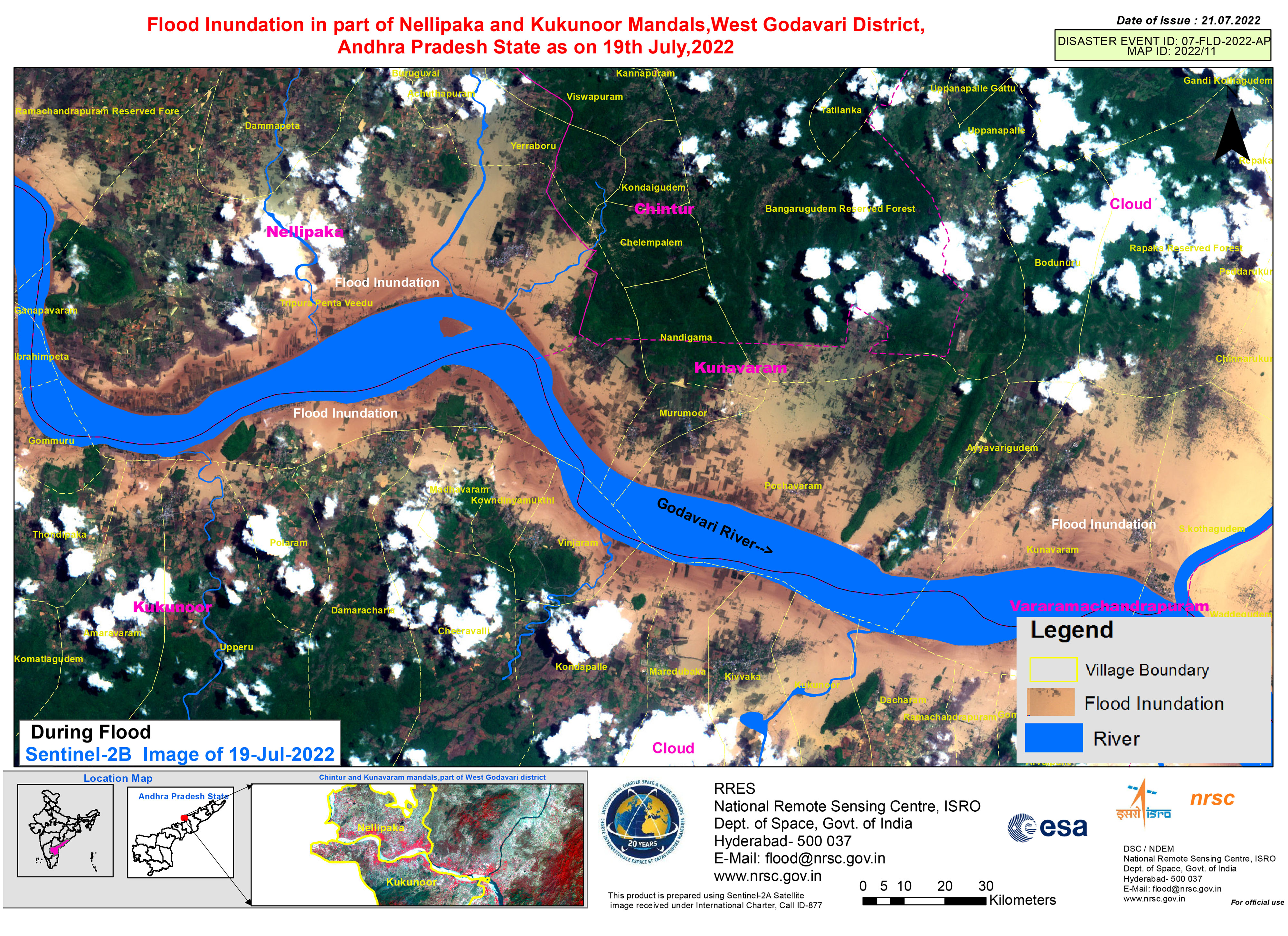
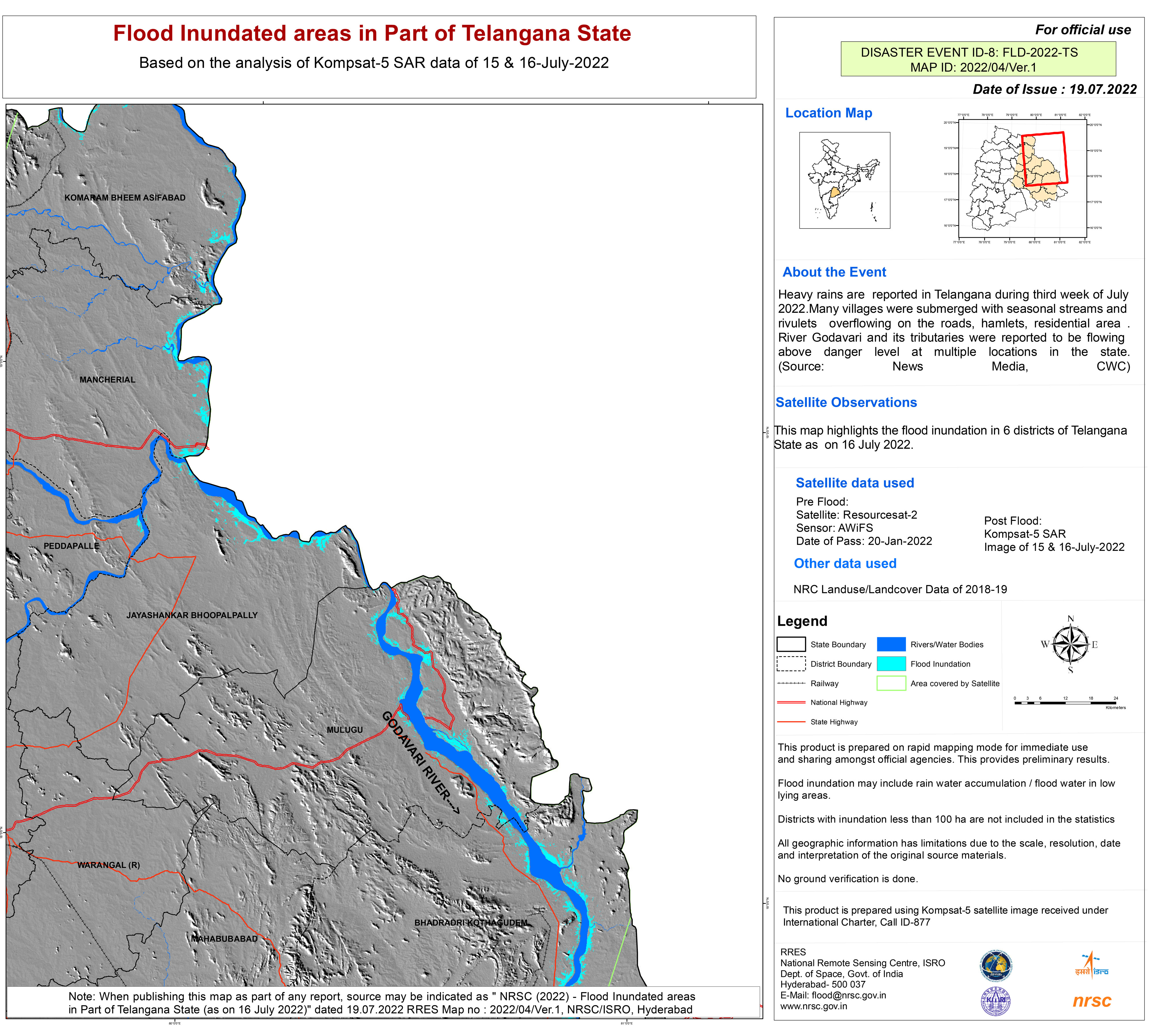
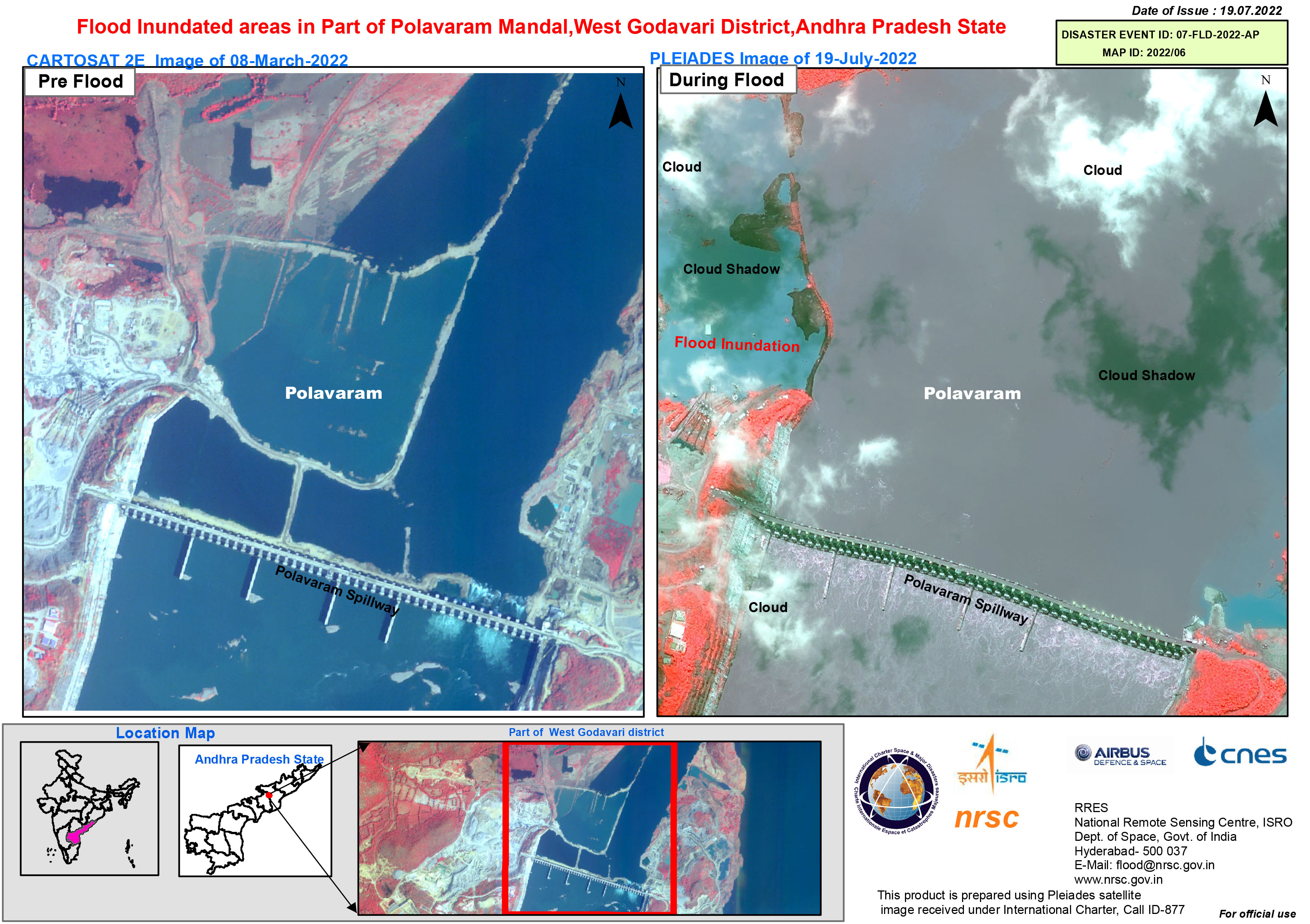
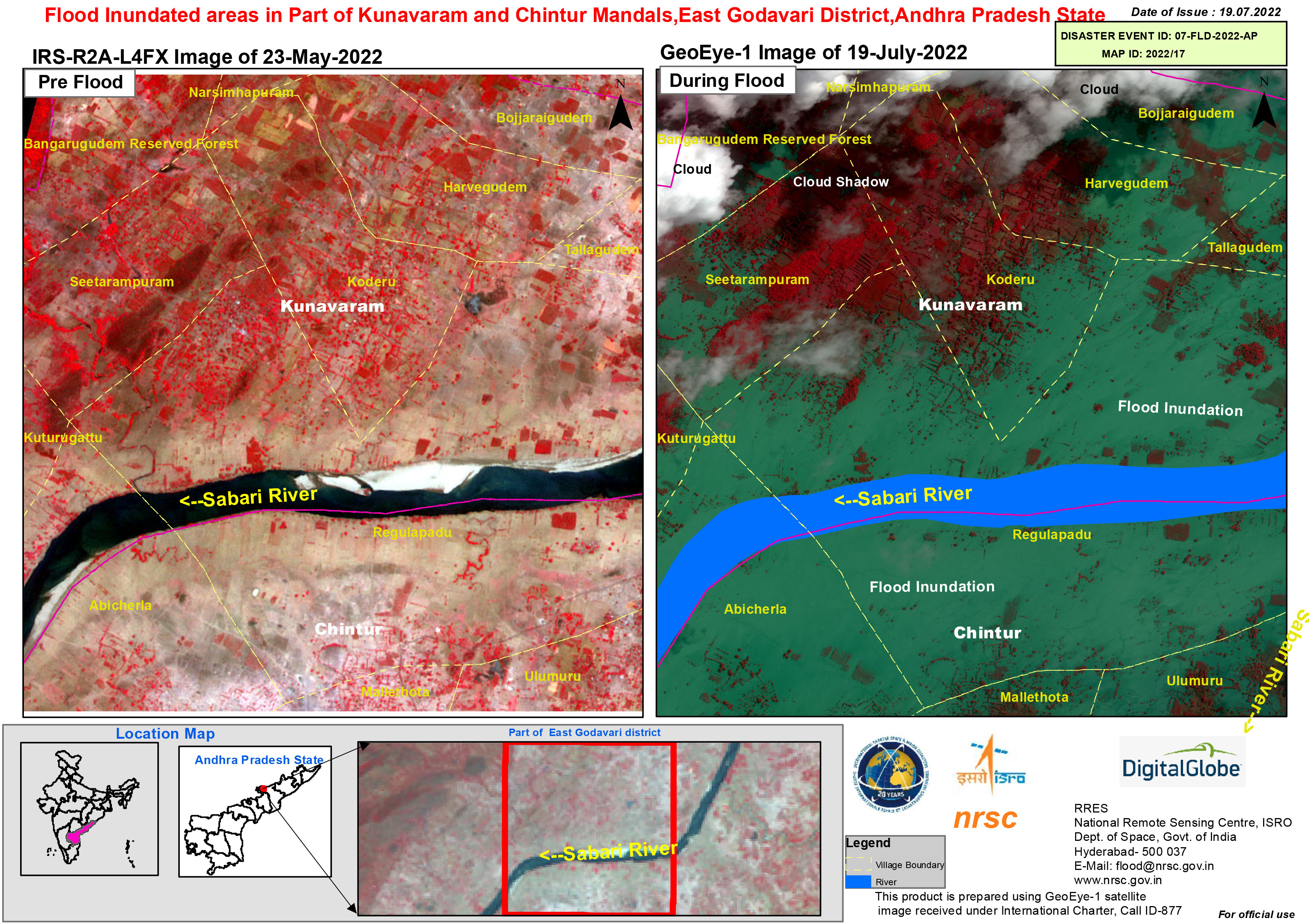
Flood in India
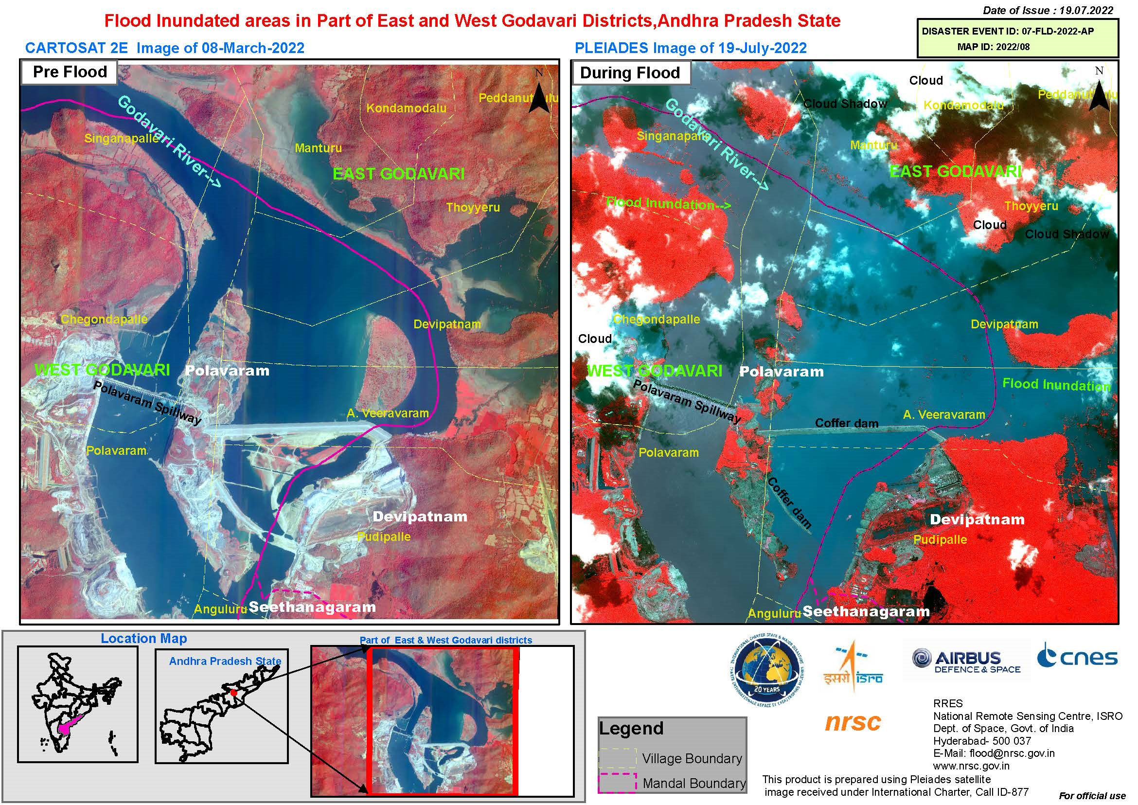
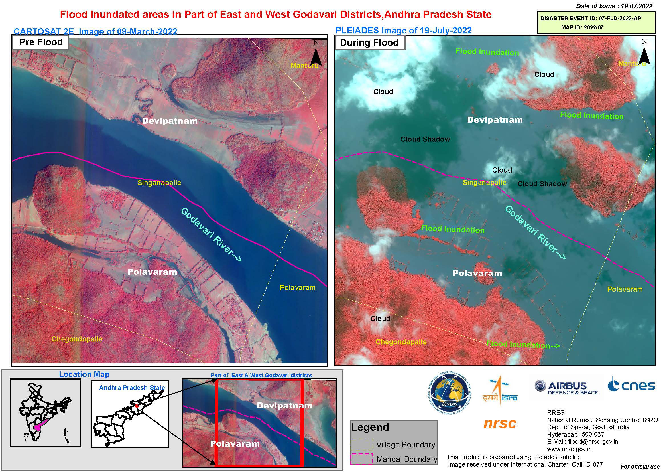
Torrential rain caused floods in India's Andhra Pradesh state.
The rain caused water levels in the Godovari River to rise, flooding nearby villages. Almost 10,000 people were evacuated from the affected villages and rescue efforts were made for people who remained trapped in some locations.
The flood waters also caused disruption in cities such as Rajasthan and Delhi, flooding streets. Agriculture has been affected, too, with some farms inundated and crops washed away.
| 事件类型: | Flood |
| 事件地点: | India |
| 启动宪章的日期: | 2022-07-14 |
| 宪章启动时间: | 16:04 |
| 宪章启动时区: | UTC+05:30 |
| 宪章要求者: | ISRO |
| 启动ID: | 764 |
| 项目经理: | NRSC |
Products


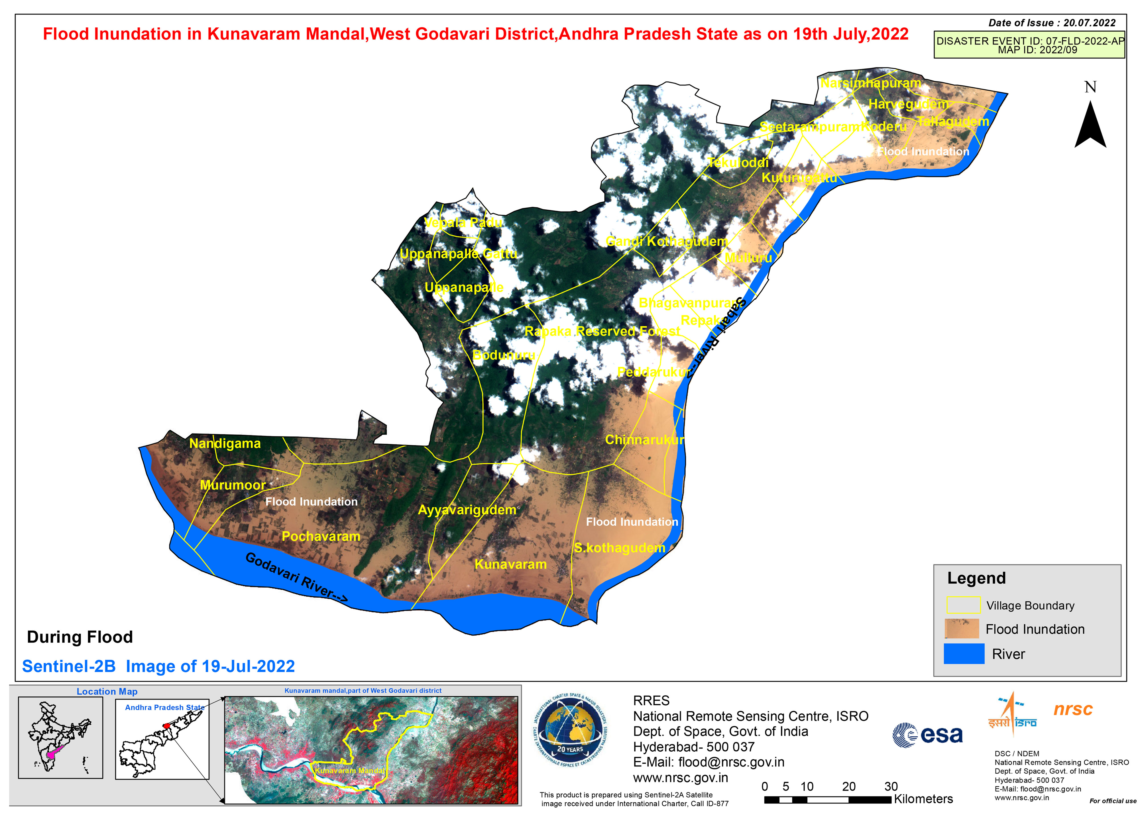
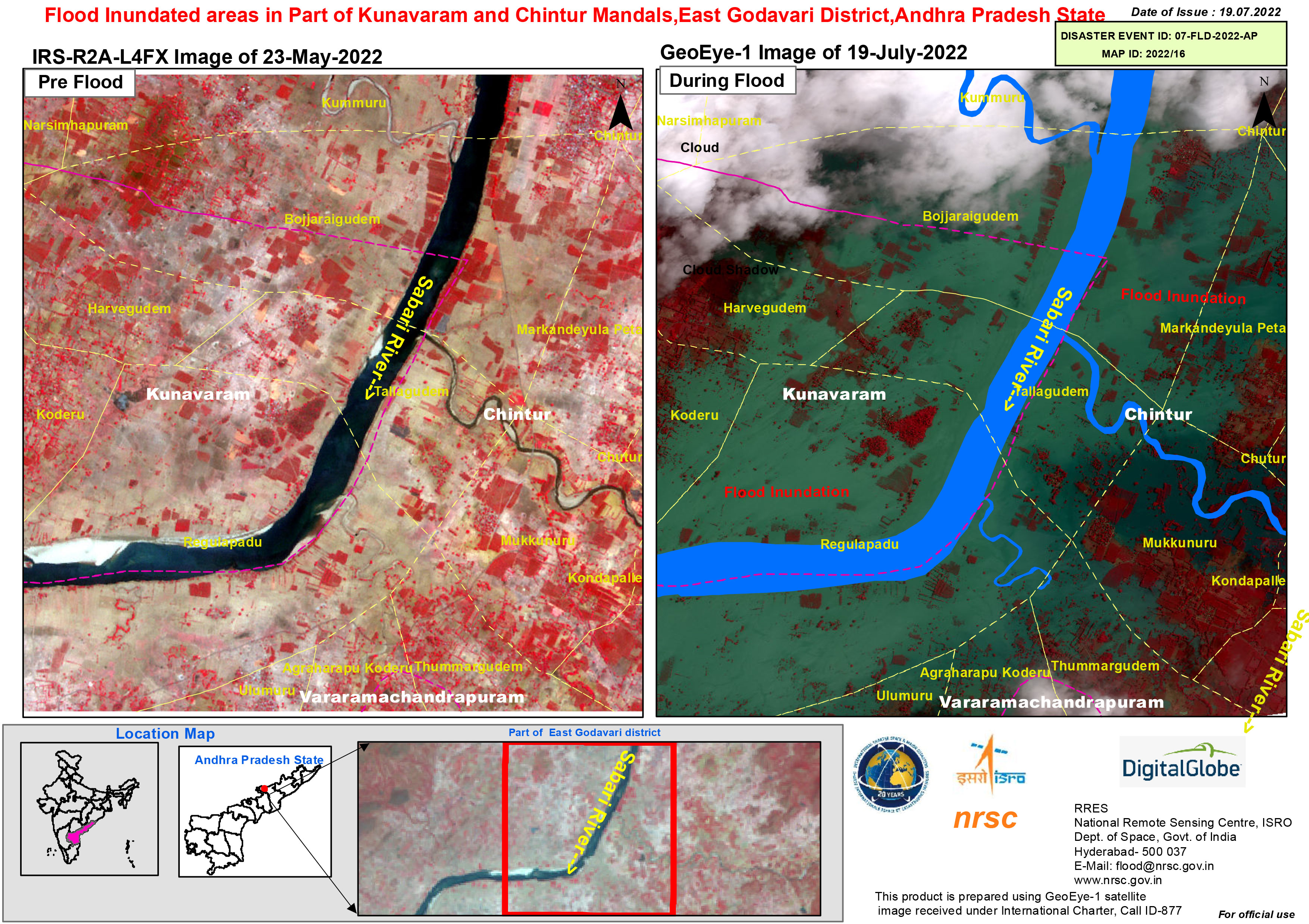
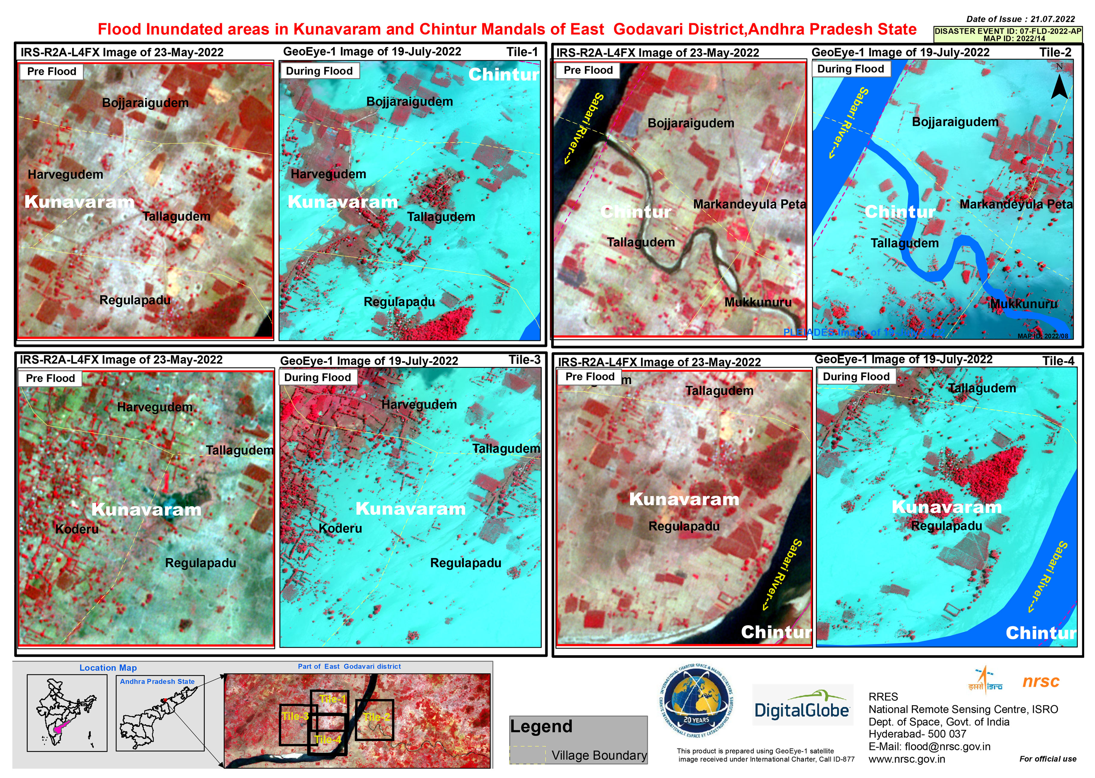
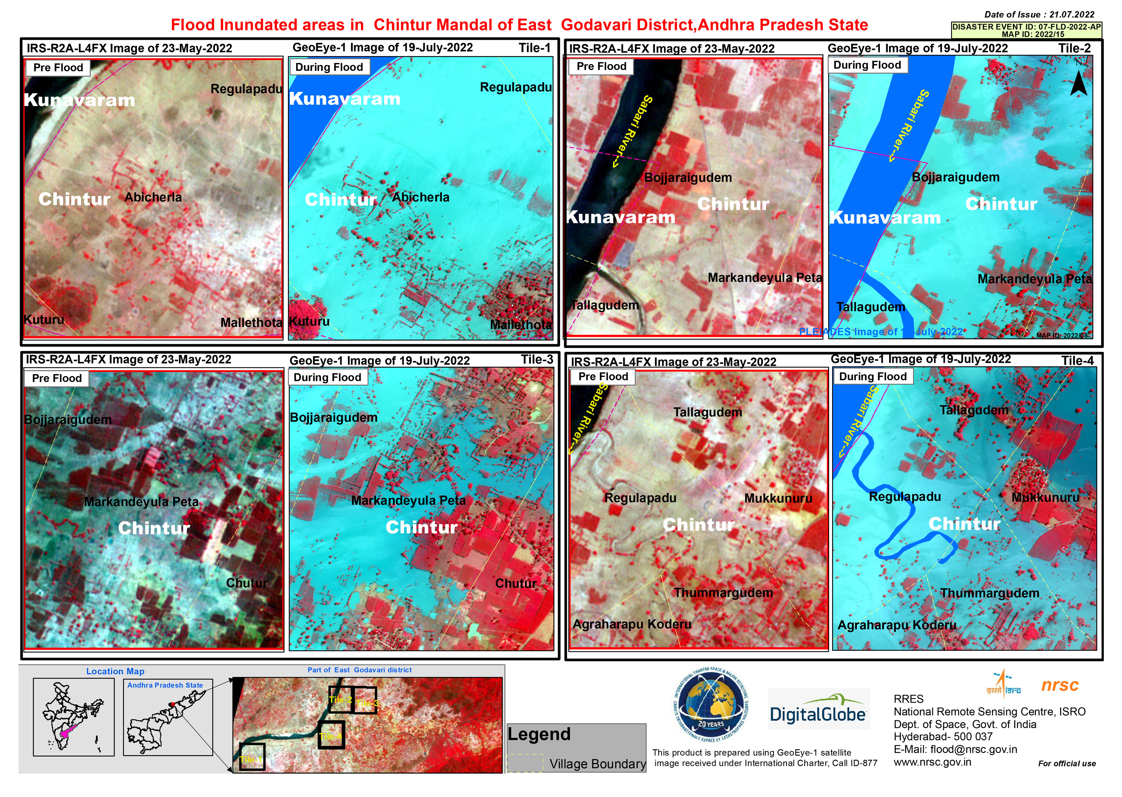
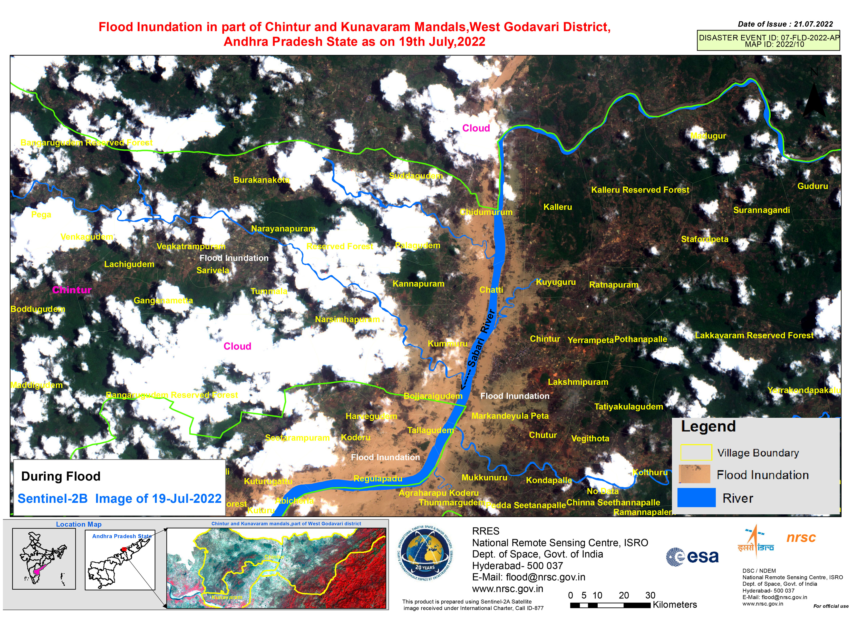
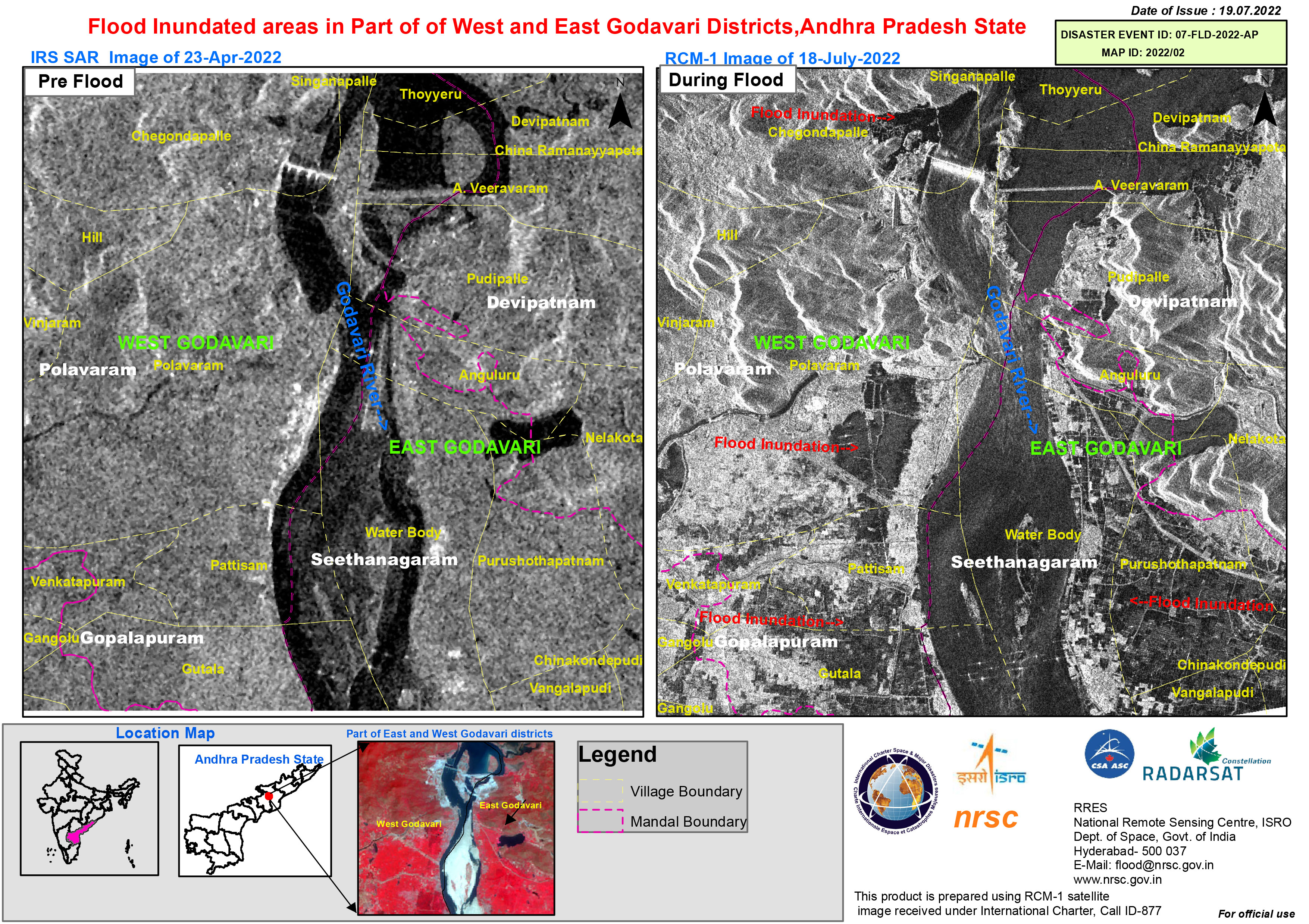
Flood inundated areas in part of of West and East Godavari Districts, Andhra Pradesh State
版权: RADARSAT Constellation Mission Imagery © Government of Canada (2022) - RADARSAT is an official mark of the Canadian Space Agency
Map produced by National Remote Sensing Centre, ISRO
Information about the Product
已获得: 18/07/2022
源: RCM
类别: Reference Map
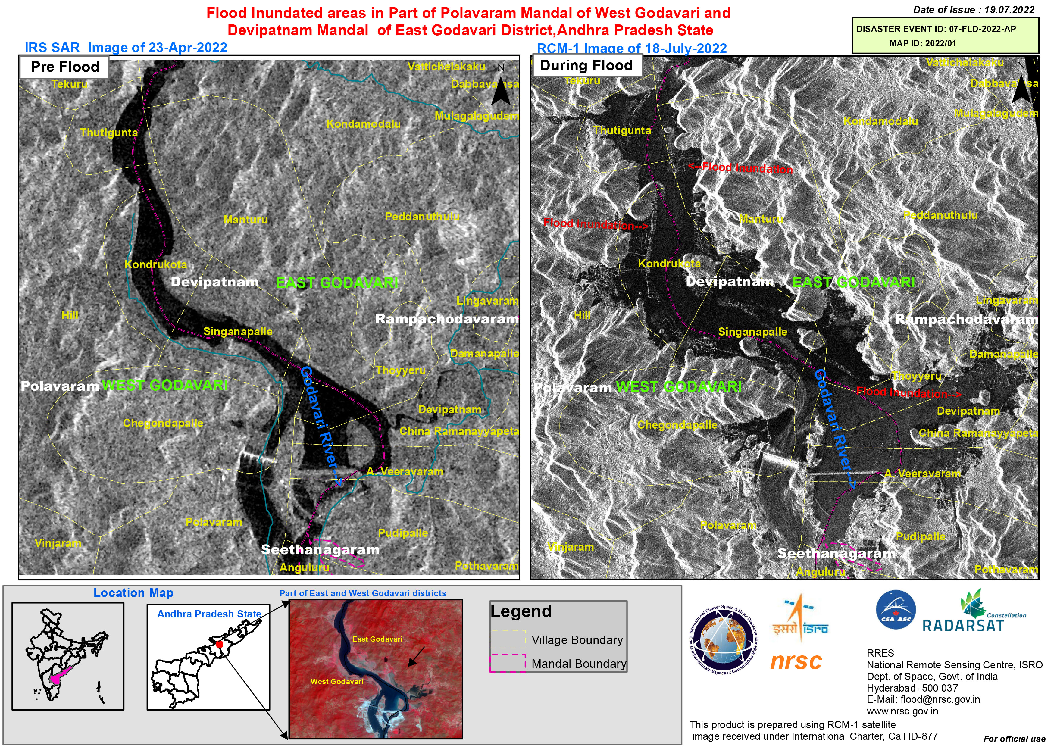
Flood inundated areas in part of Polavaram Mandal of West Godavari and Devipatnam Mandal of East Godavari District, Andhra Pradesh State
版权: RADARSAT Constellation Mission Imagery © Government of Canada (2022) - RADARSAT is an official mark of the Canadian Space Agency.
Map produced by National Remote Sensing Centre, ISRO.
Information about the Product
已获得: 18/07/2022
源: RCM
类别: Reference Map
 返回完整的响应档案

