 English
 Spanish
 French
 Chinese
 Russian
 Portuguese
 Latest Activation
Charter activations
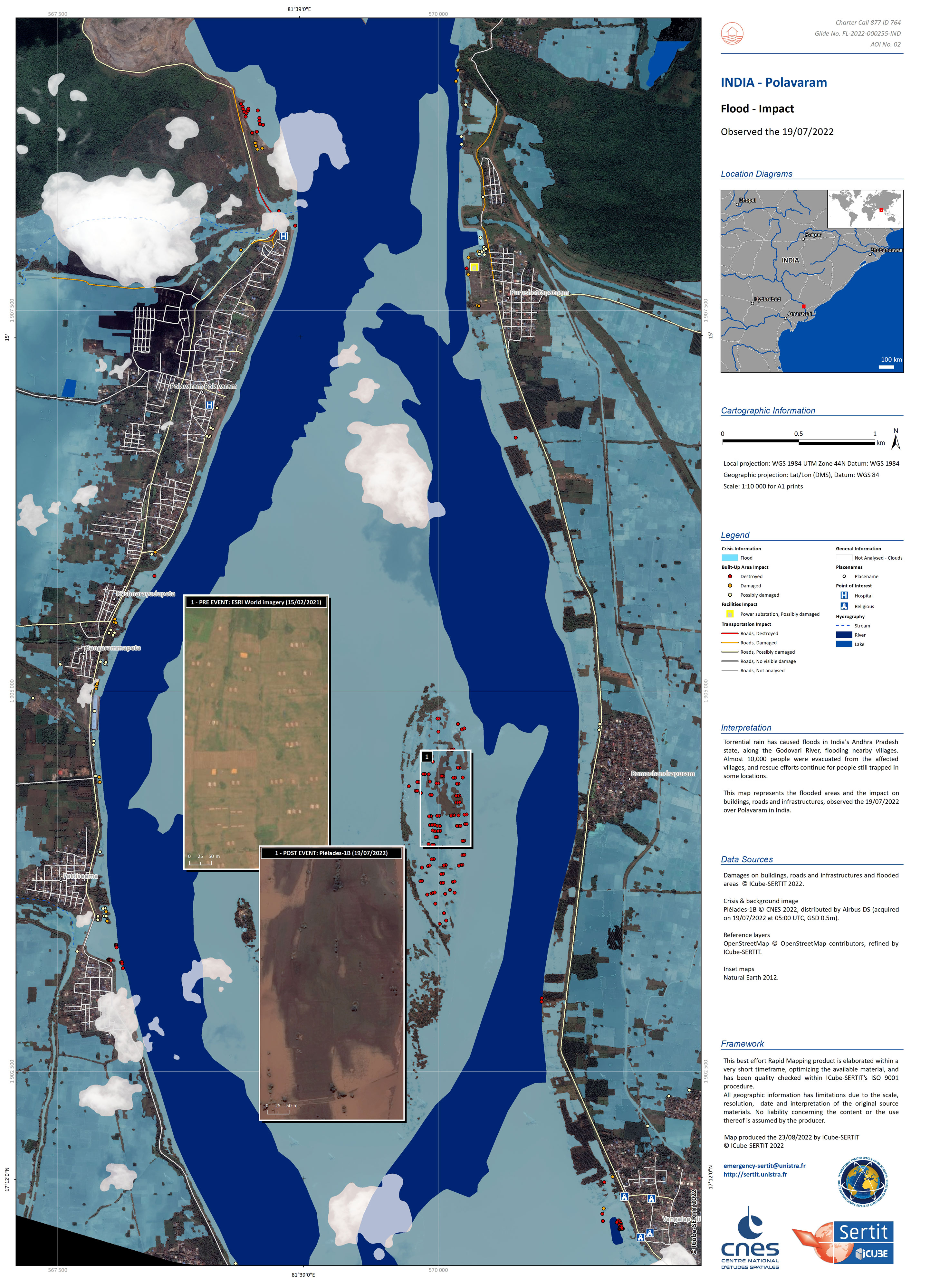
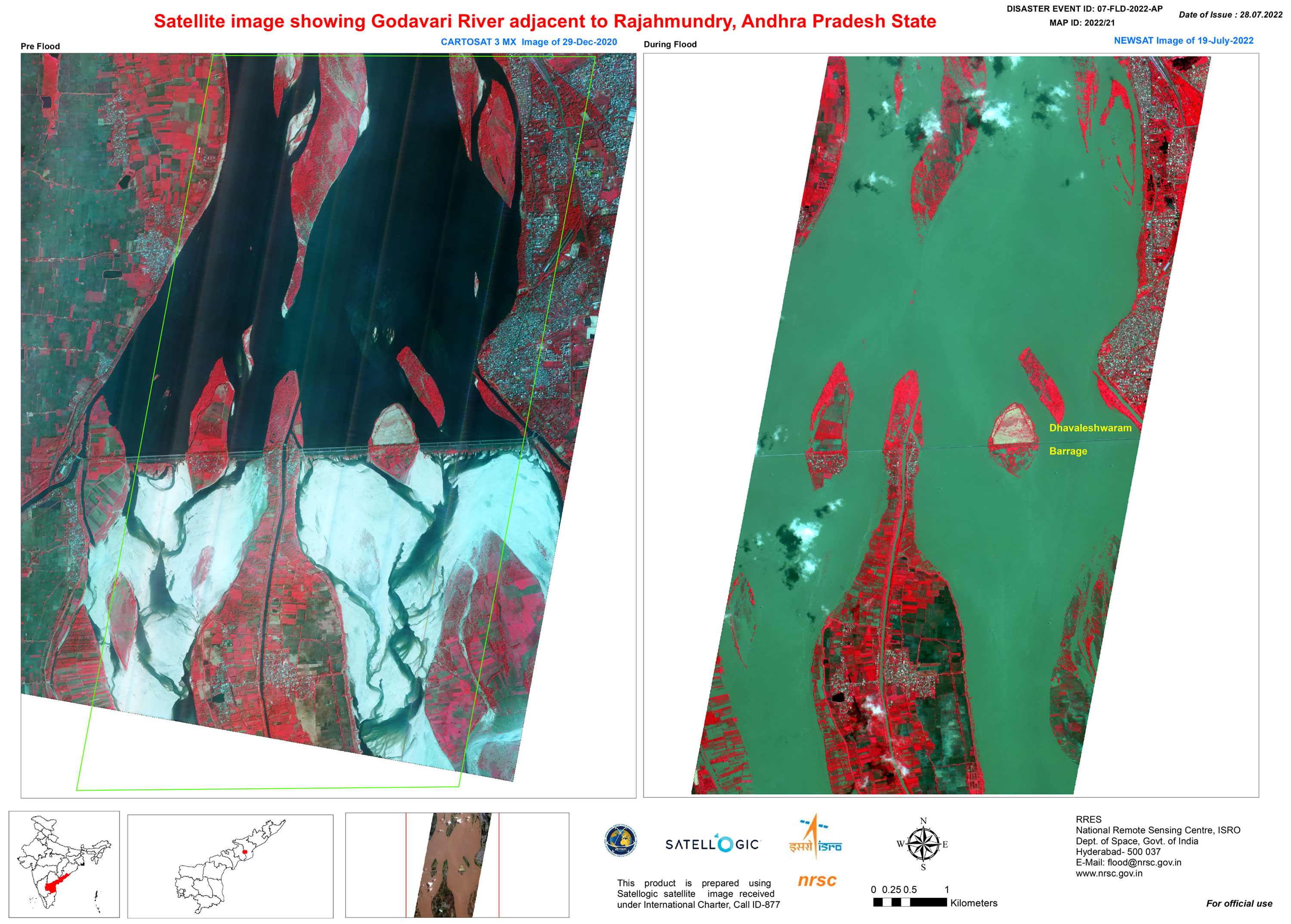
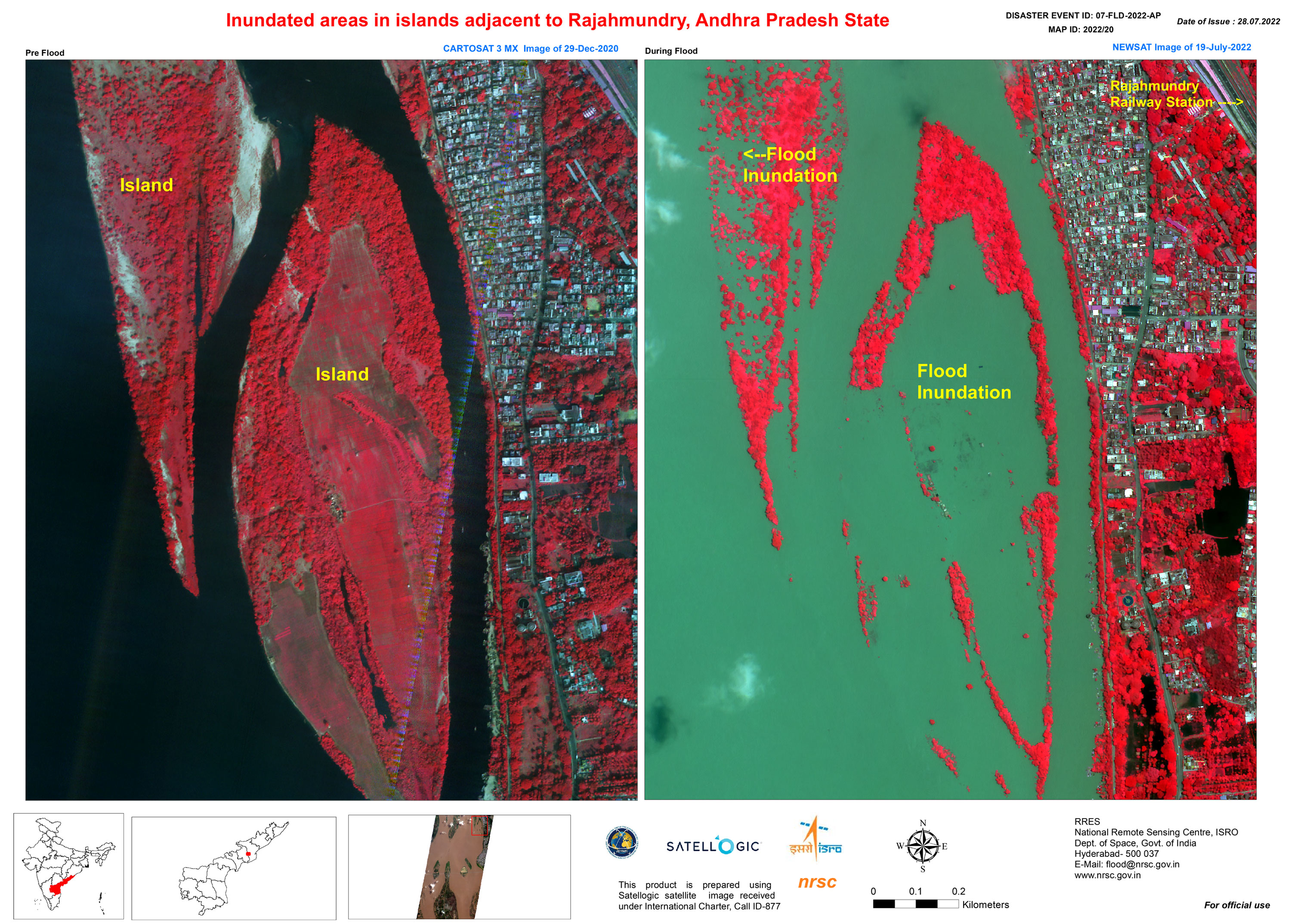
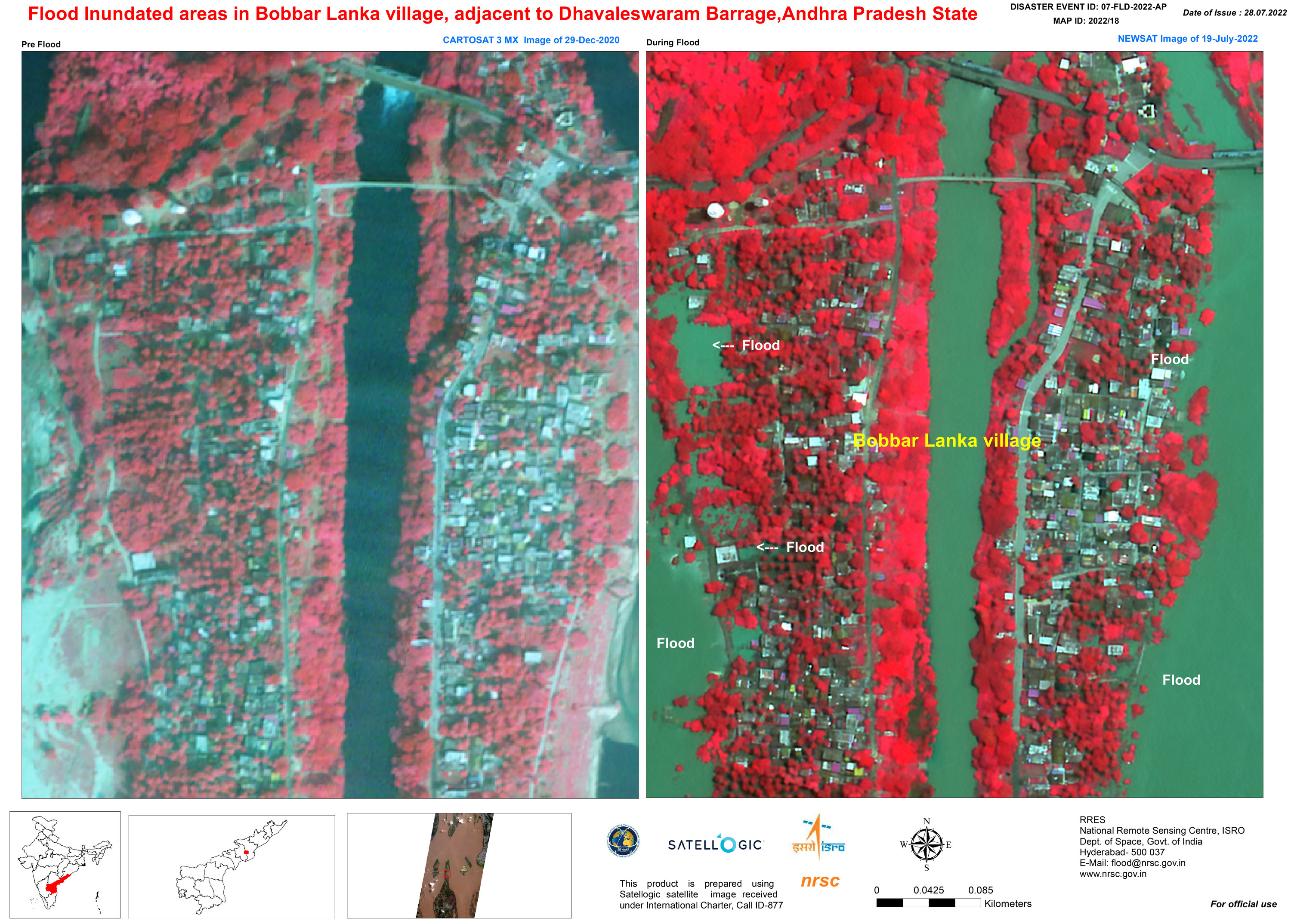
Flood in India
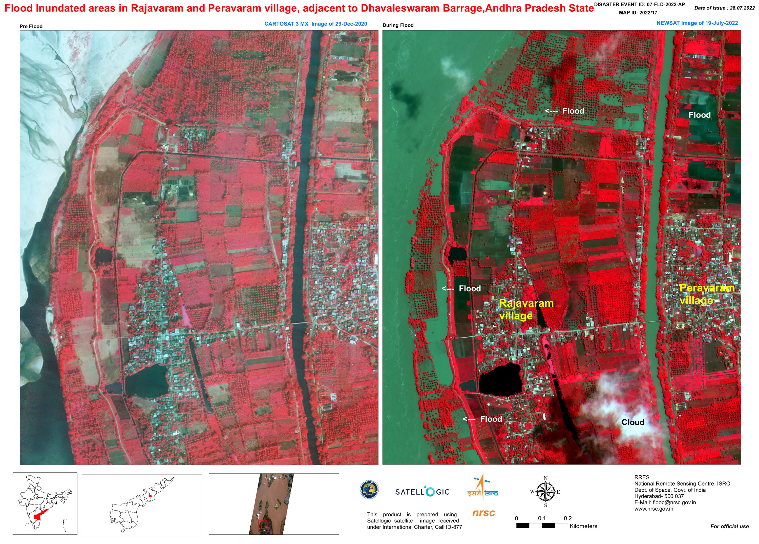
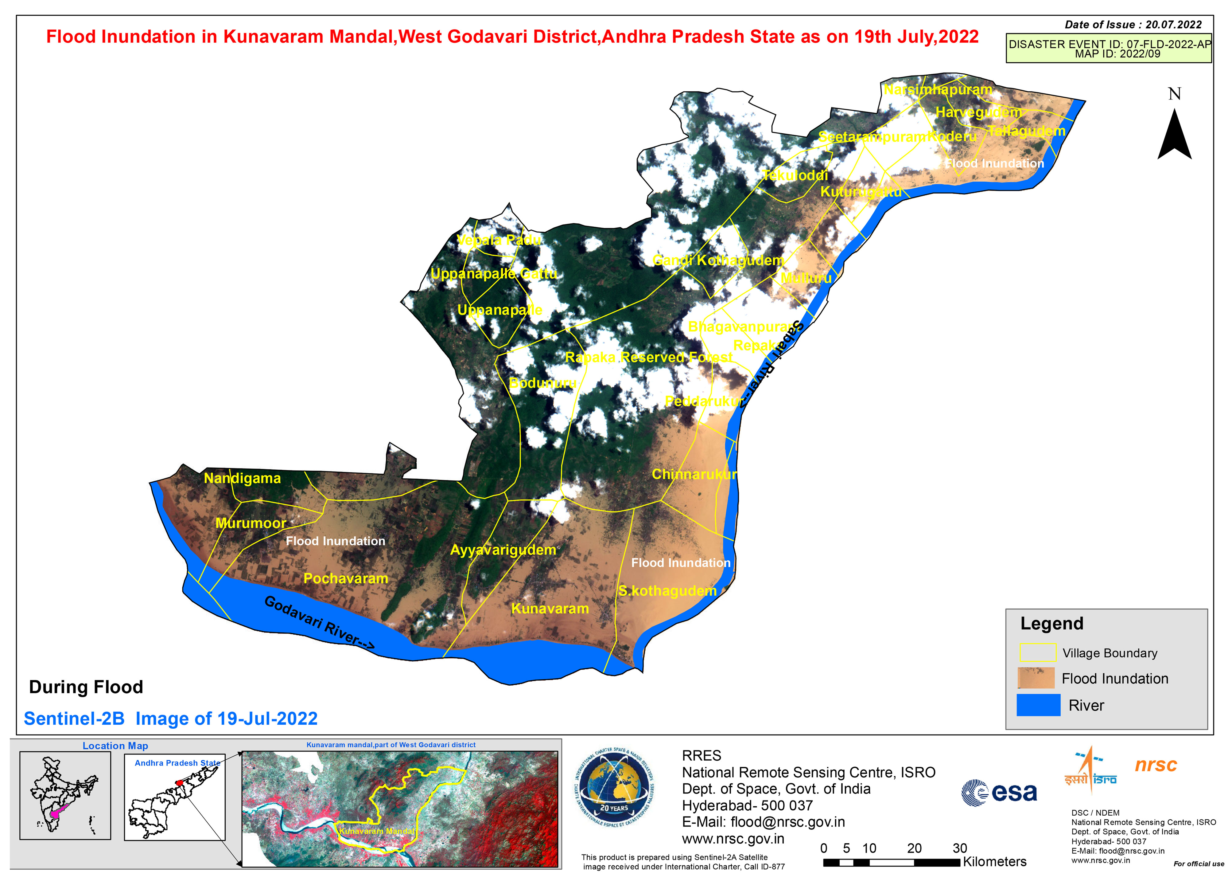
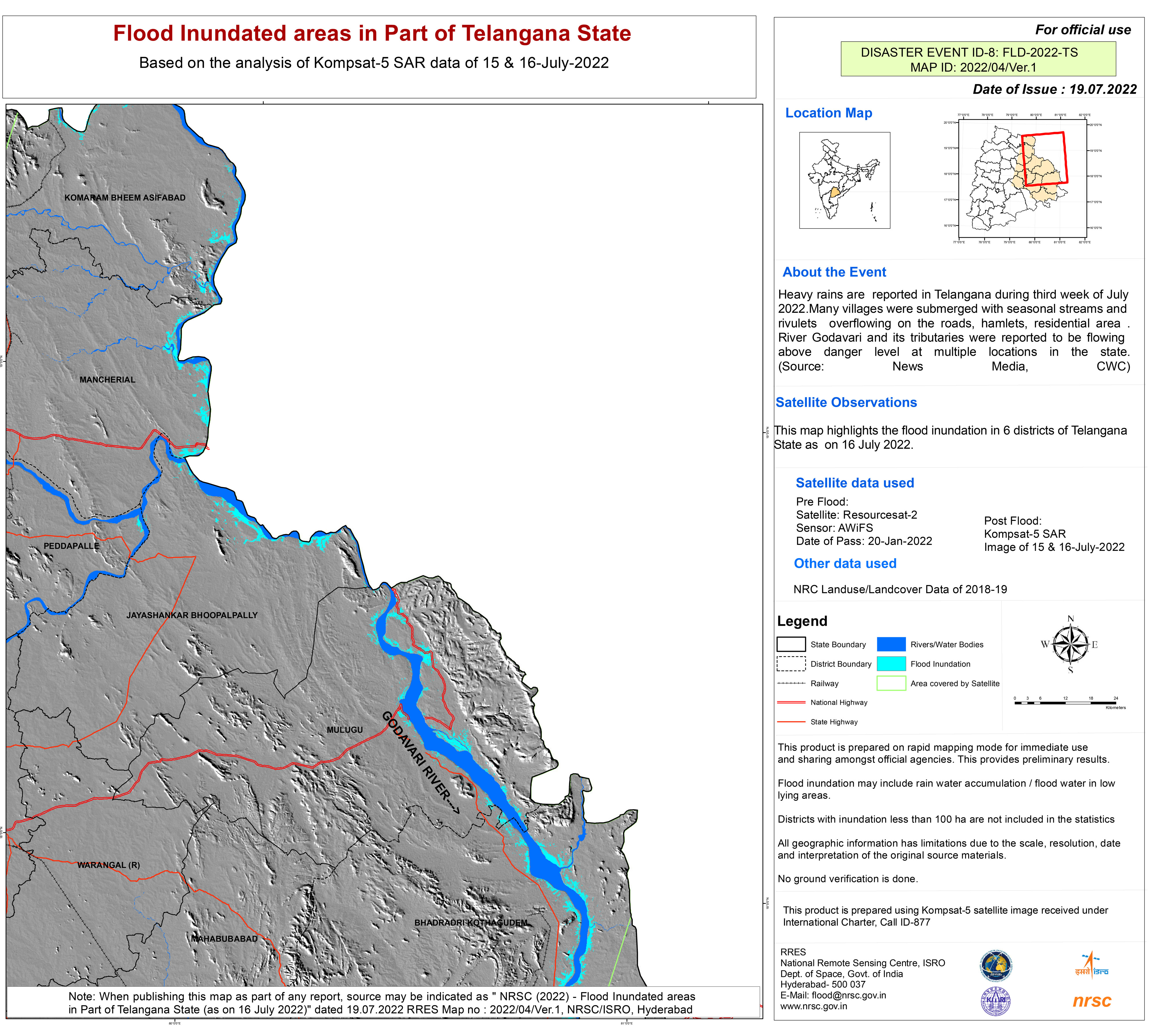
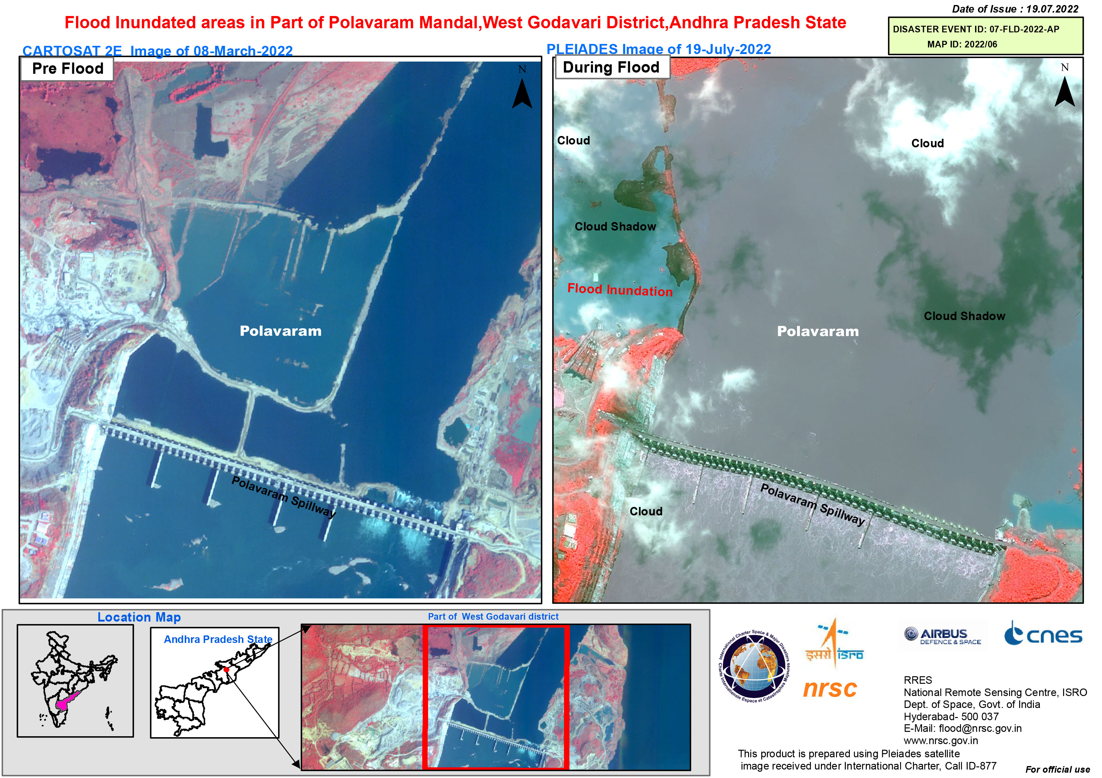
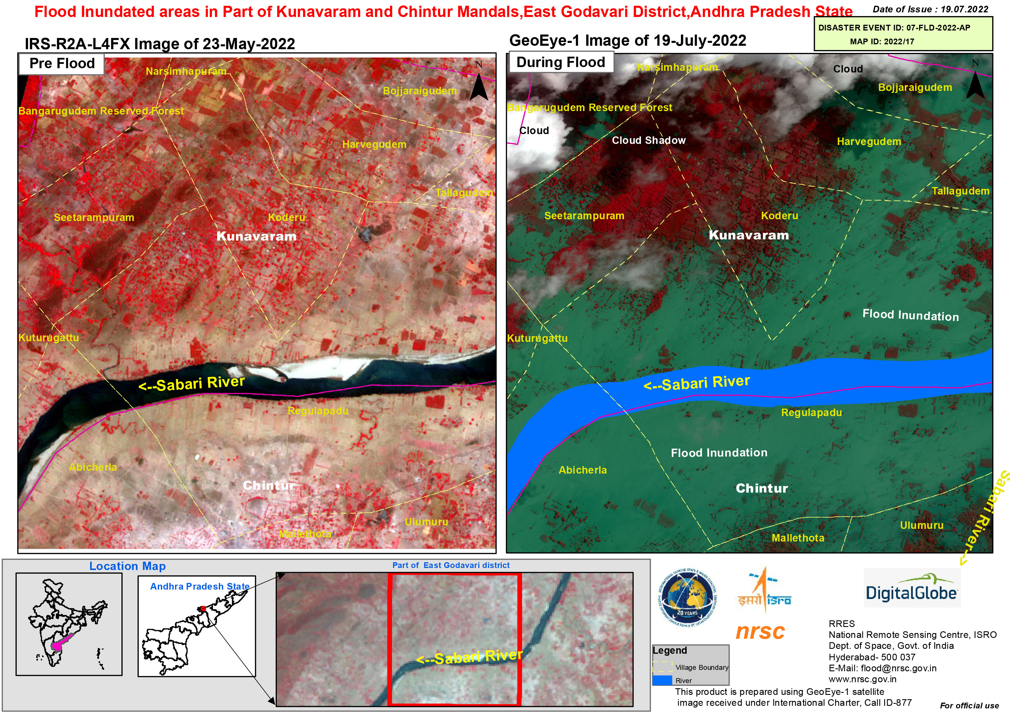
Torrential rain caused floods in India's Andhra Pradesh state.
The rain caused water levels in the Godovari River to rise, flooding nearby villages. Almost 10,000 people were evacuated from the affected villages and rescue efforts were made for people who remained trapped in some locations.
The flood waters also caused disruption in cities such as Rajasthan and Delhi, flooding streets. Agriculture has been affected, too, with some farms inundated and crops washed away.
| Tipo de evento: | Flood |
| Local do evento: | India |
| Data da Ativação da Carta: | 2022-07-14 |
| Tempo de Ativação da Carta: | 16:04 |
| Zona de Tempo da Ativação da Carta: | UTC+05:30 |
| Requisitante da Carta: | ISRO |
| ID da Ativação: | 764 |
| Gerenciamento de projeto: | NRSC |
Products


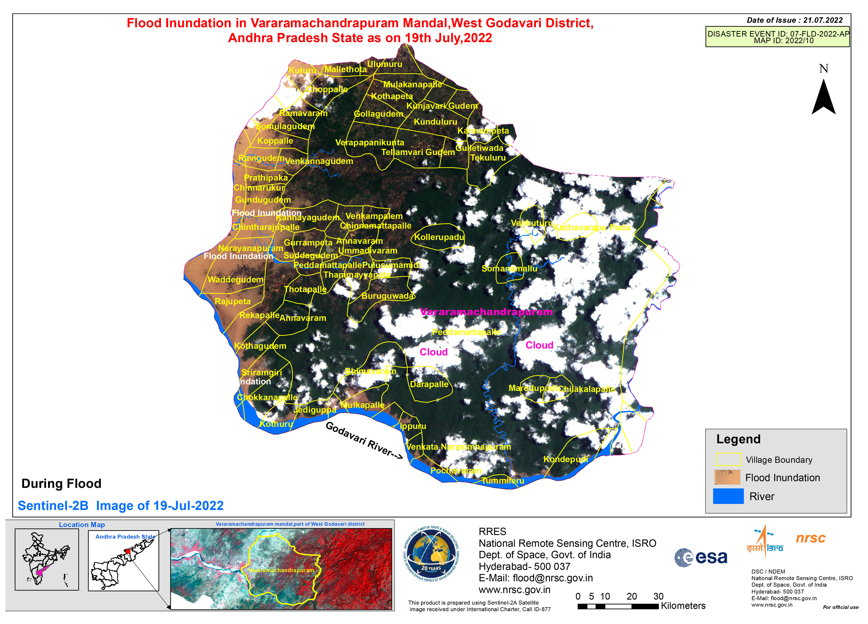
Flood inundation in Vararamachandrapuram Mandal, West Godavari District, Andhra Pradesh State
Direitos autorais: Contains modified Copernicus Sentinel data (2022)
Map produced by the National Remote Sensing Centre, ISRO
Information about the Product
Adquirida: 19/07/2022
Fonte: Sentinel-2
Categoria: Reference Map
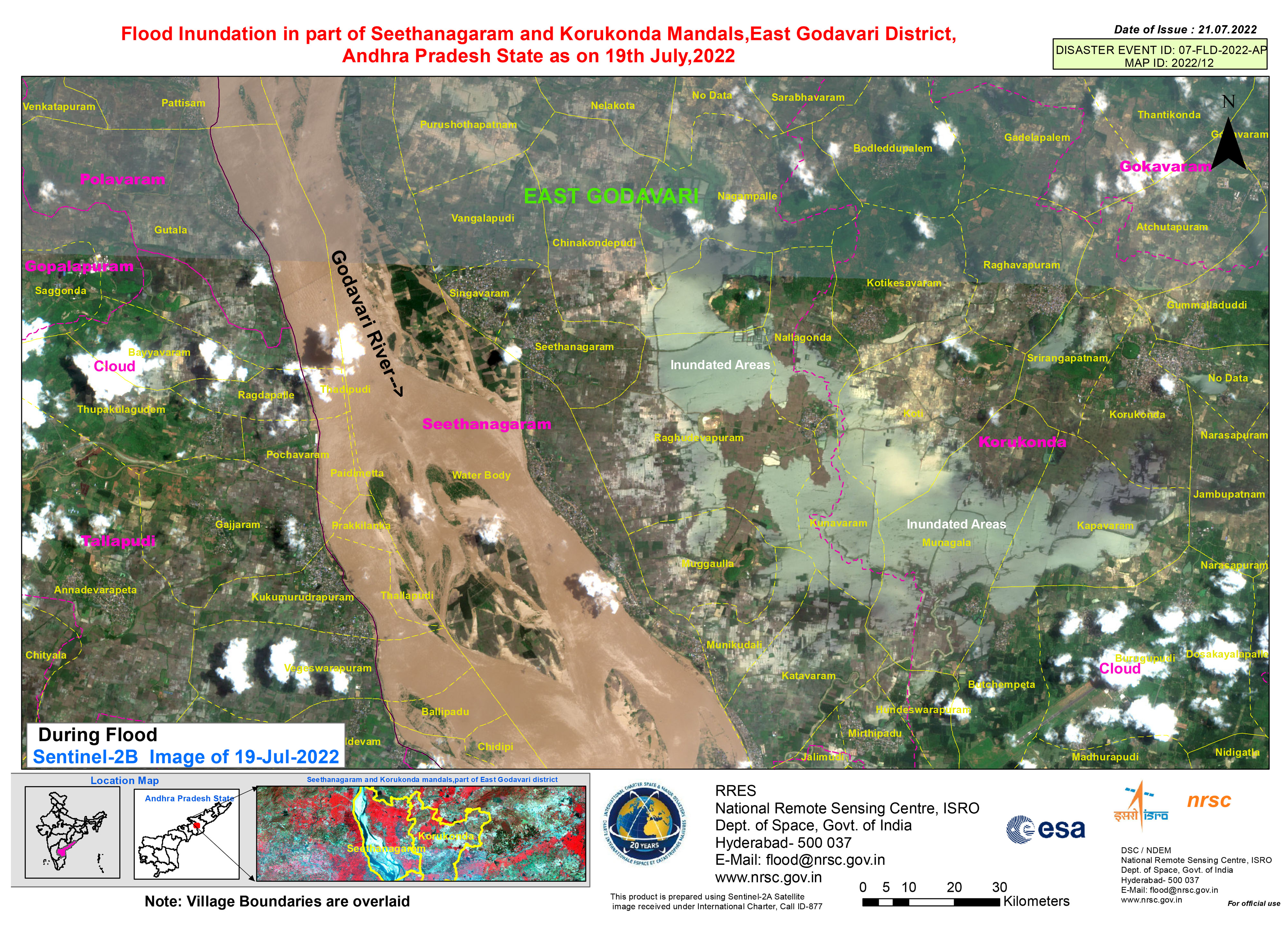
Flood inundation in part of Seethanagaram and Korukonda Mandals,East Godavari District, Andhra Pradesh
Direitos autorais: Contains modified Copernicus Sentinel data (2022)
Map produced by National Remote Sensing Centre, ISRO
Information about the Product
Adquirida: 19/07/2022
Fonte: Sentinel-2
Categoria: Reference Map
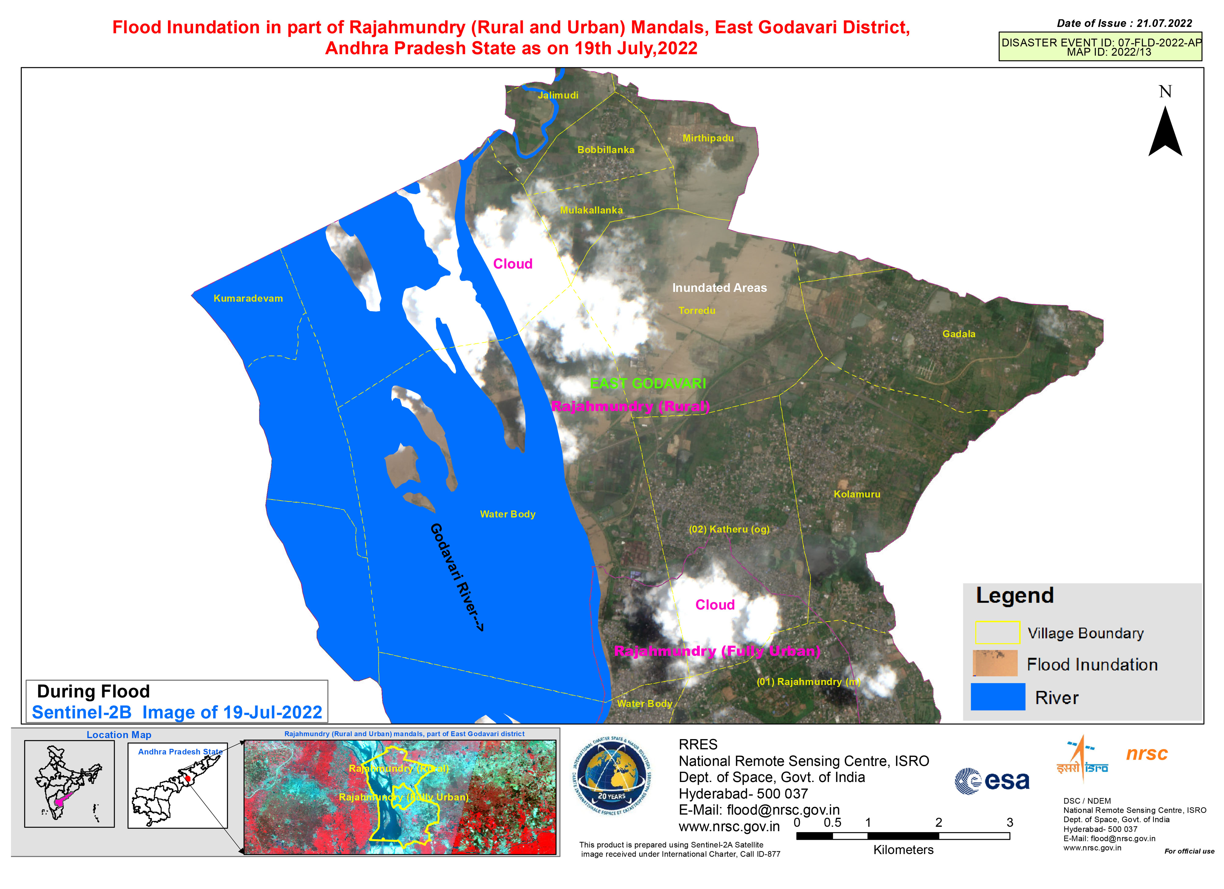
Flood inundation in part of Rajahmundry (Rural and Urban) Mandals, East Godavari District, Andhra Pradesh State
Direitos autorais: Contains modified Copernicus Sentinel data (2022)
Map produced by National Remote Sensing Centre, ISRO
Information about the Product
Adquirida: 19/07/2022
Fonte: Sentinel-2
Categoria: Reference Map
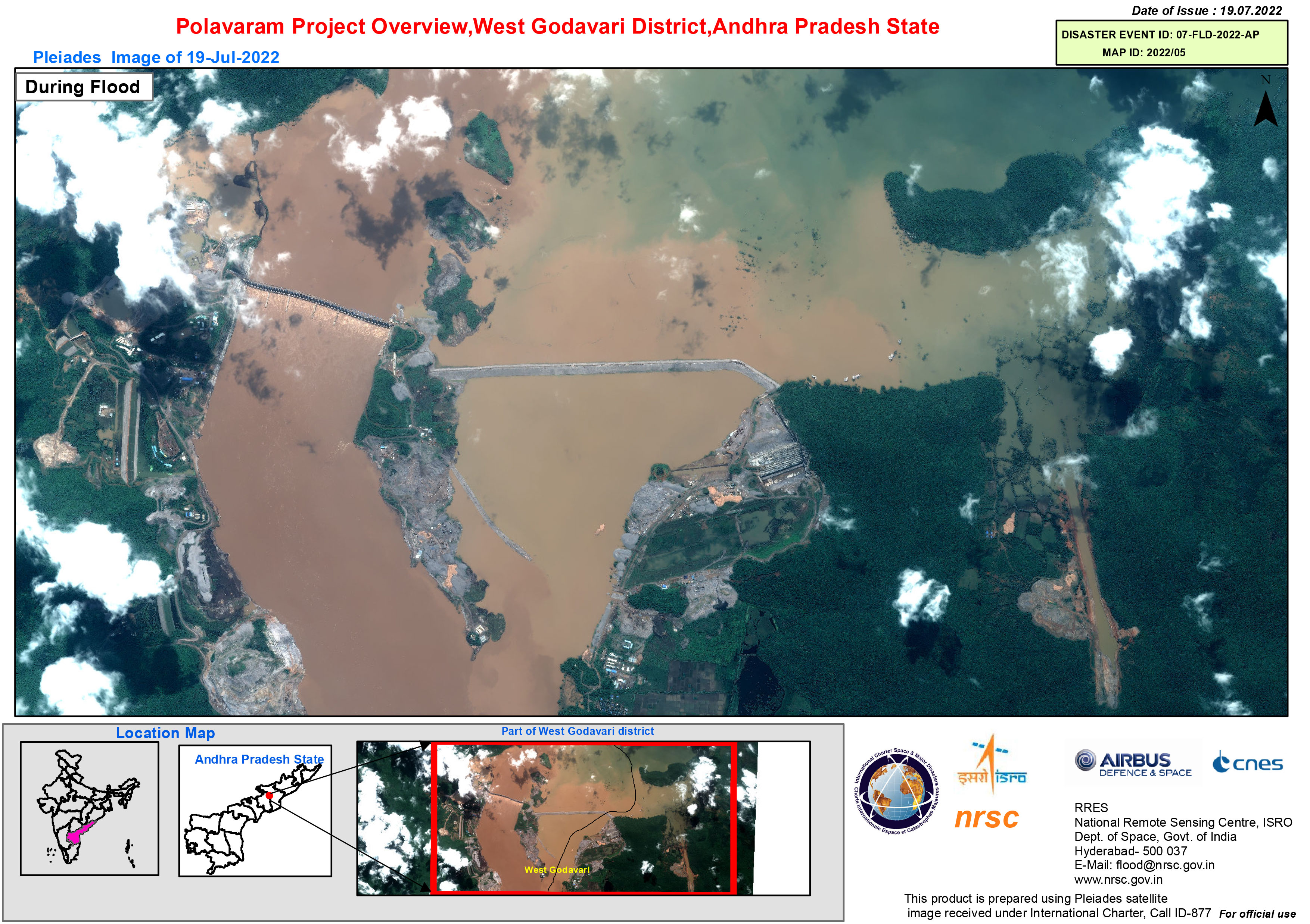
Polavaram Project Overview, West Godavari District, Andhra Pradesh State
Direitos autorais: Includes Pleiades material © CNES (2022), Distribution Airbus DS.
Map produced by National Remote Sensing Centre, ISRO.
Information about the Product
Adquirida: 19/07/2022
Fonte: Pleiades
Categoria: Reference Map
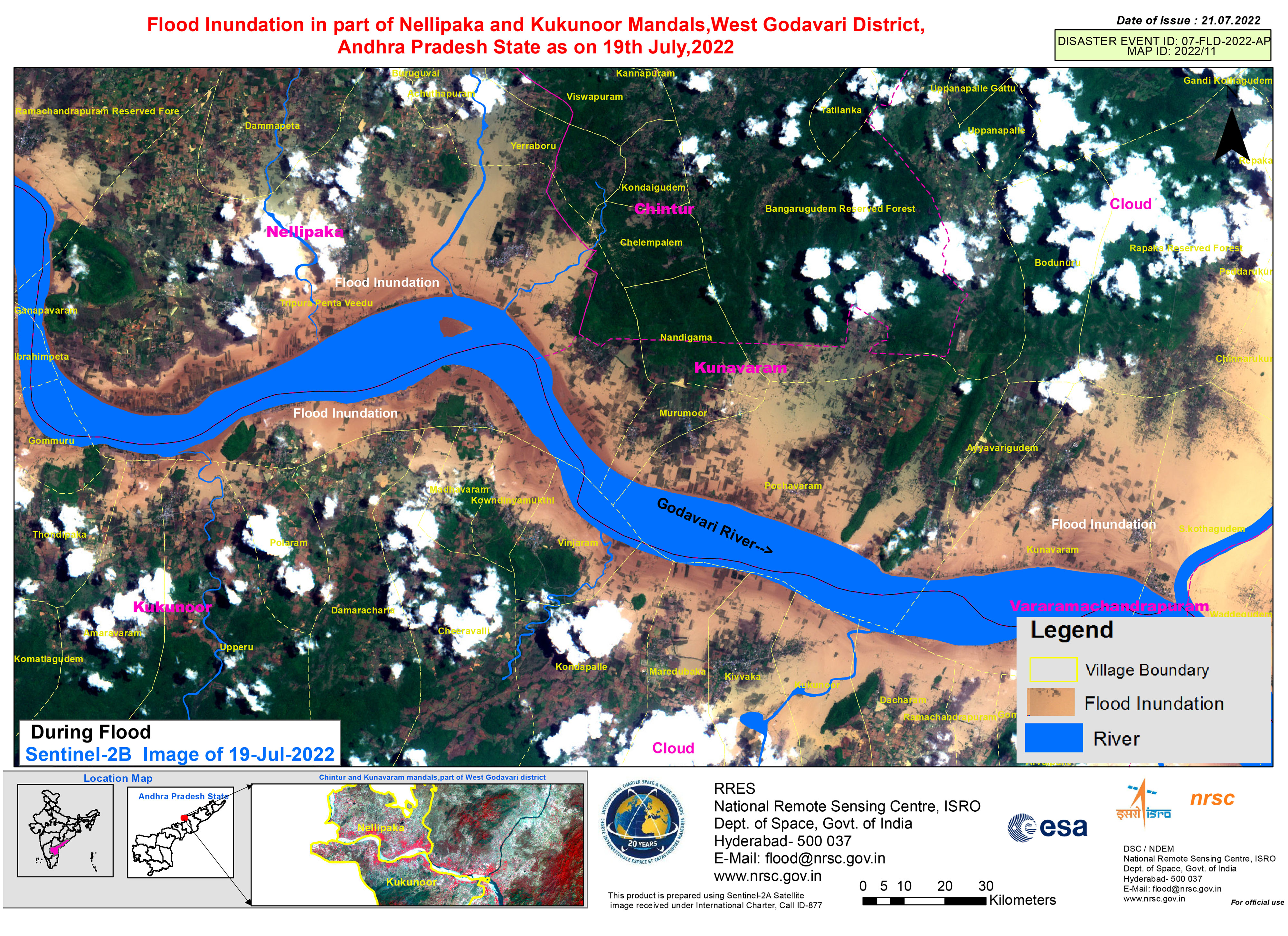
Flood inundation in part of Nellipaka and Kukunoor Mandals, West Godavari District, Andhra Pradesh State
Direitos autorais: Contains modified Copernicus Sentinel data (2022)
Map produced by National Remote Sensing Centre, ISRO
Information about the Product
Adquirida: 19/07/2022
Fonte: Sentinel-2
Categoria: Reference Map
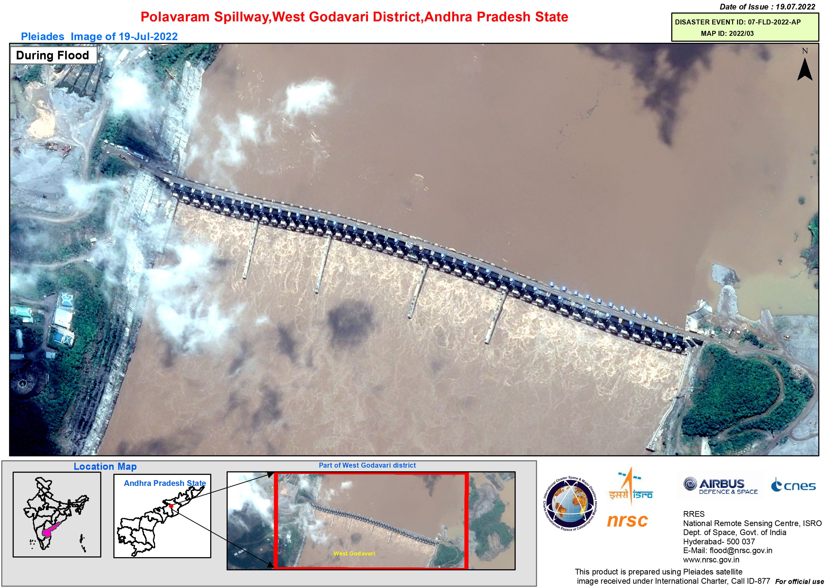
Flood inundated areas in part of Polavaram Mandal, West Godavari District, Andhra Pradesh State
Direitos autorais: Includes Pleiades material © CNES (2022), Distribution Airbus DS.
Map produced by National Remote Sensing Centre, ISRO
Information about the Product
Adquirida: 19/07/2022
Fonte: Pleiades
Categoria: Reference Map
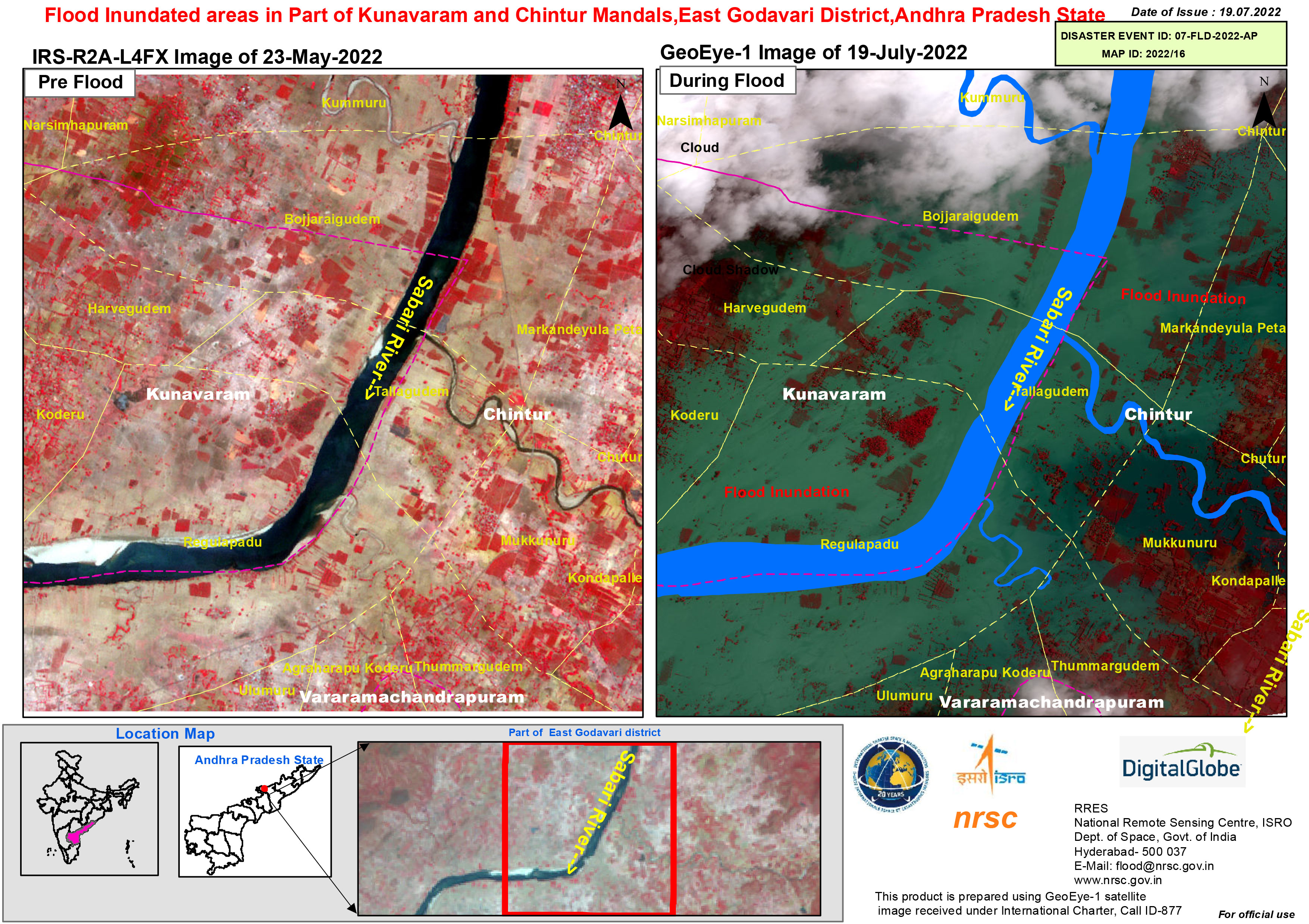
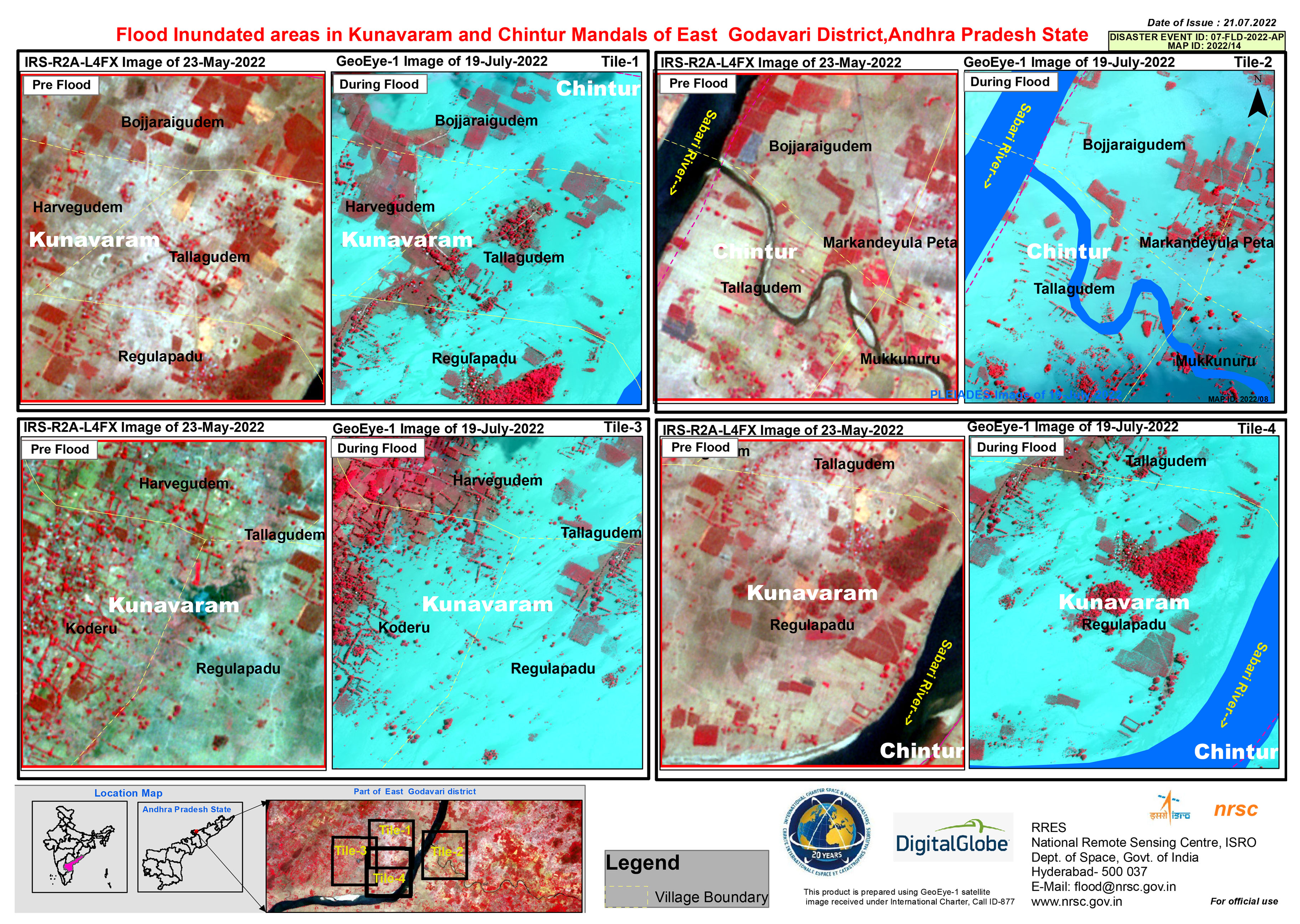
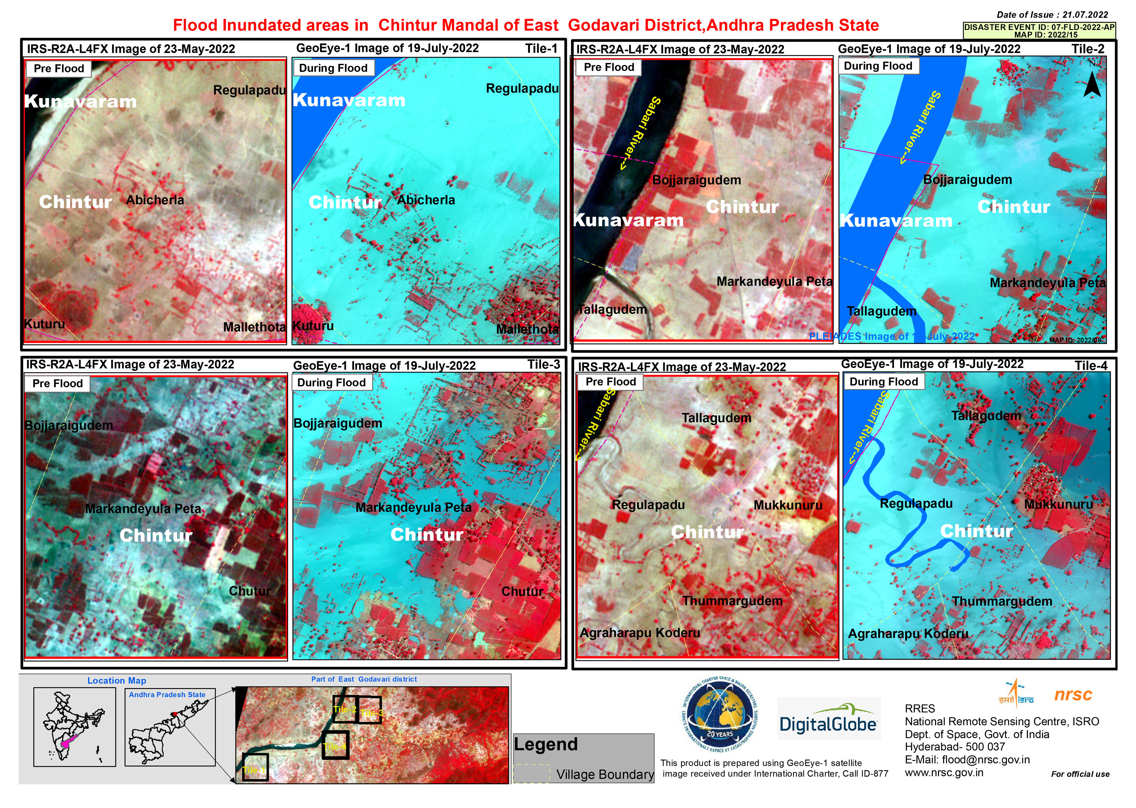
Flood inundated areas in Part of Kunavaram and Chintur Mandals, East Godavari District, Andhra Pradesh State
Direitos autorais: © 2004 GeoEye
NextView License
Map produced by National Remote Sensing Centre, ISRO
Information about the Product
Adquirida: 19/07/2022
Fonte: GeoEye-1
Categoria: Reference Map
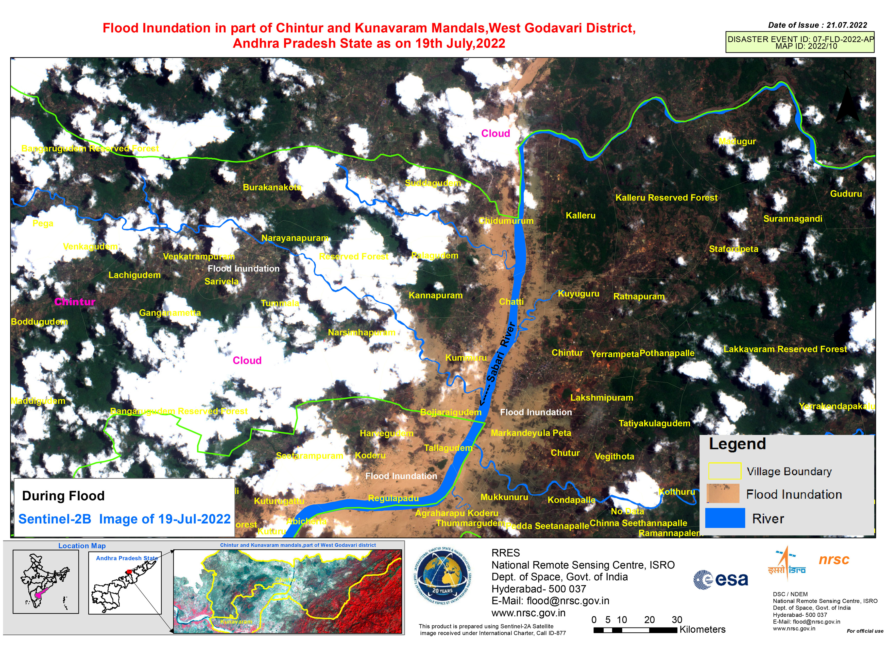
Flood inundation in part of Chintur and Kunavaram Mandals, West Godavari District, Andhra Pradesh State
Direitos autorais: Contains modified Copernicus Sentinel data (2022)
Map produced by National Remote Sensing Centre, ISRO
Information about the Product
Adquirida: 19/07/2022
Fonte: Sentinel-2
Categoria: Reference Map
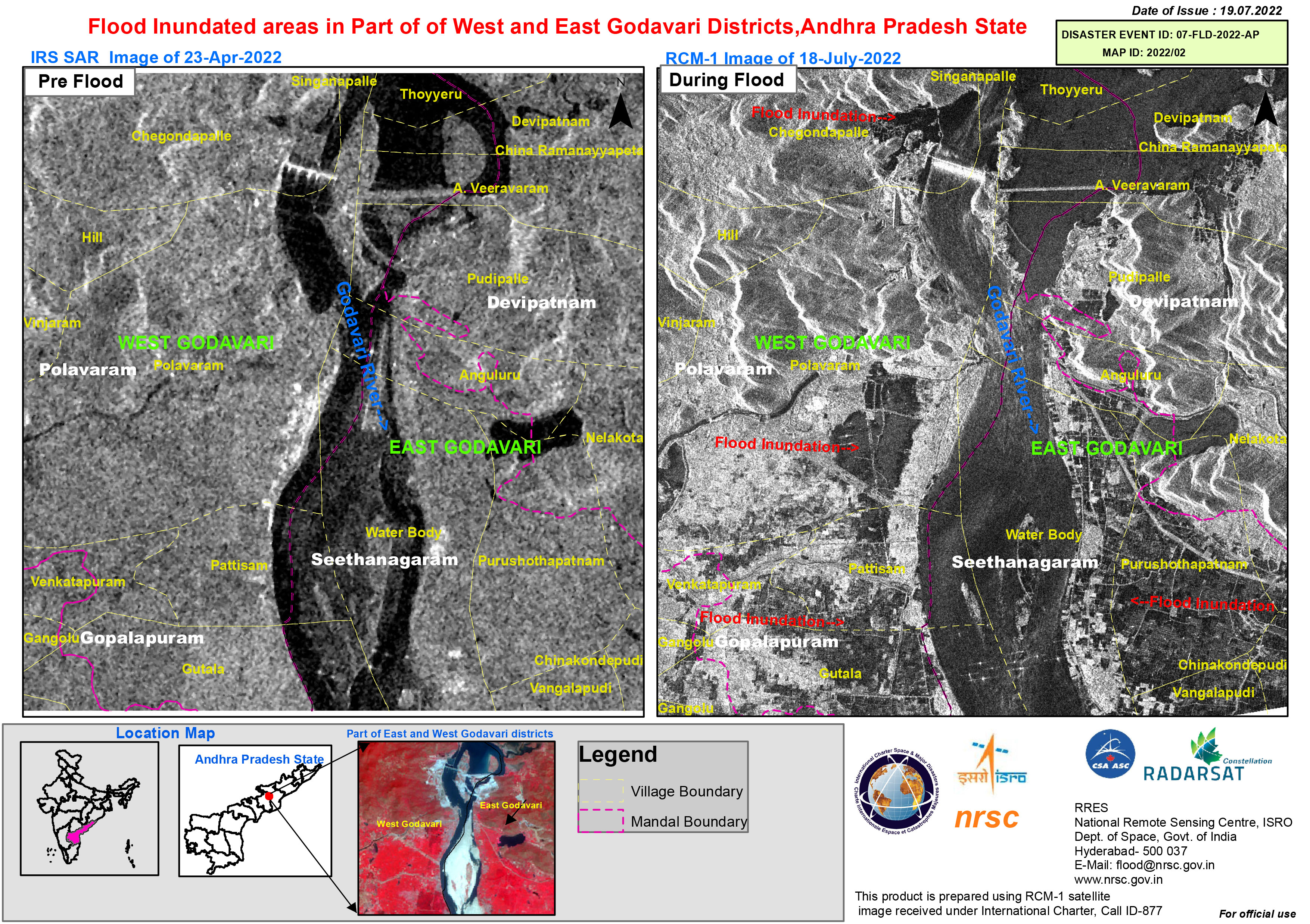
Flood inundated areas in part of of West and East Godavari Districts, Andhra Pradesh State
Direitos autorais: RADARSAT Constellation Mission Imagery © Government of Canada (2022) - RADARSAT is an official mark of the Canadian Space Agency
Map produced by National Remote Sensing Centre, ISRO
Information about the Product
Adquirida: 18/07/2022
Fonte: RCM
Categoria: Reference Map
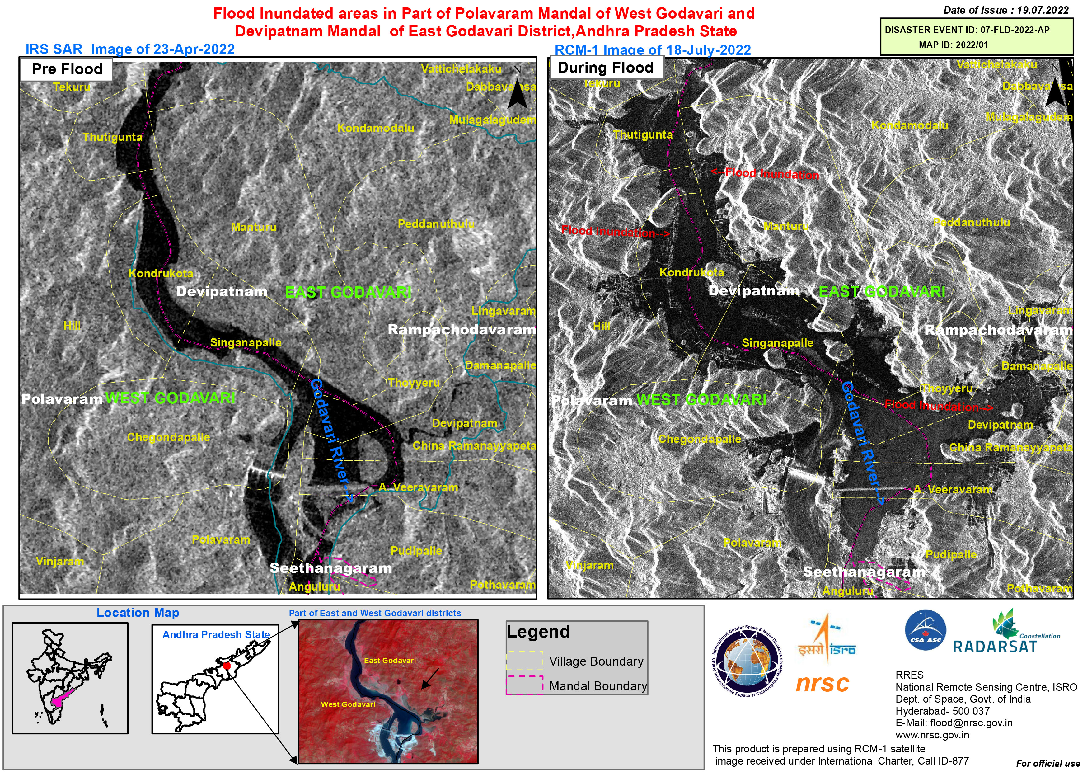
Flood inundated areas in part of Polavaram Mandal of West Godavari and Devipatnam Mandal of East Godavari District, Andhra Pradesh State
Direitos autorais: RADARSAT Constellation Mission Imagery © Government of Canada (2022) - RADARSAT is an official mark of the Canadian Space Agency.
Map produced by National Remote Sensing Centre, ISRO.
Information about the Product
Adquirida: 18/07/2022
Fonte: RCM
Categoria: Reference Map
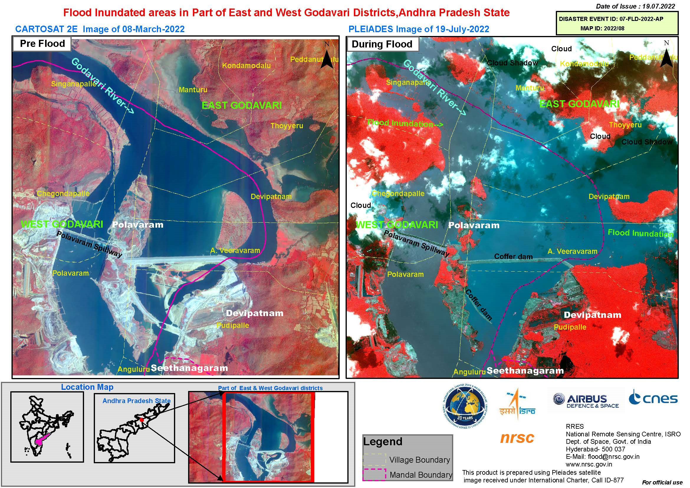
Flood inundated areas in part of East and West Godavari Districts, Andhra Pradesh State
Direitos autorais: Includes Pleiades material © CNES (2022), Distribution Airbus DS.
Map produced by National Remote Sensing Centre, ISRO.
Information about the Product
Adquirida: 19/07/2022
Fonte: Pleiades
Categoria: Reference Map
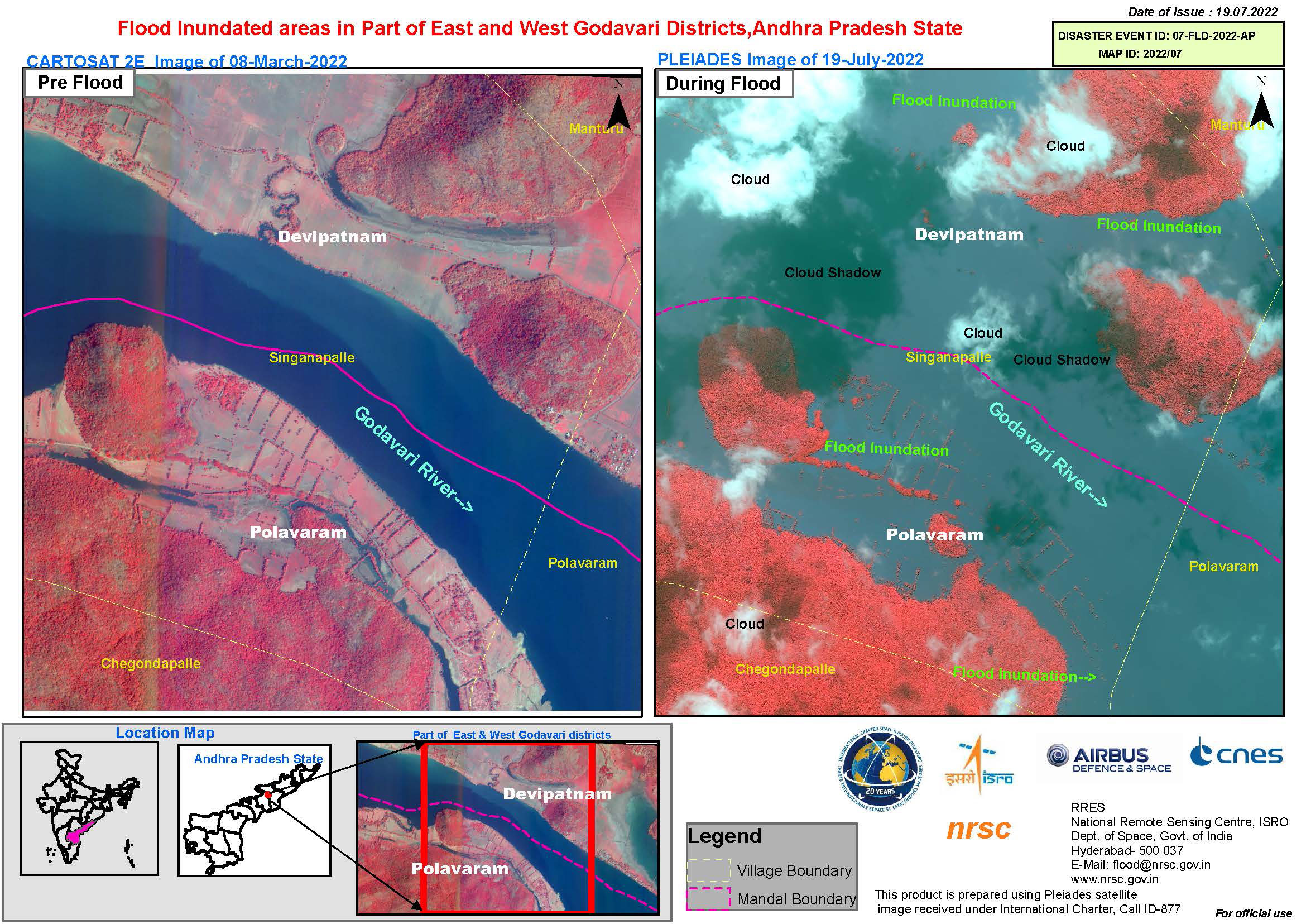
 Voltar ao arquivo completo da Ativação

