 English
 Spanish
 French
 Chinese
 Russian
 Portuguese
 最新宪章启动
Charter activations
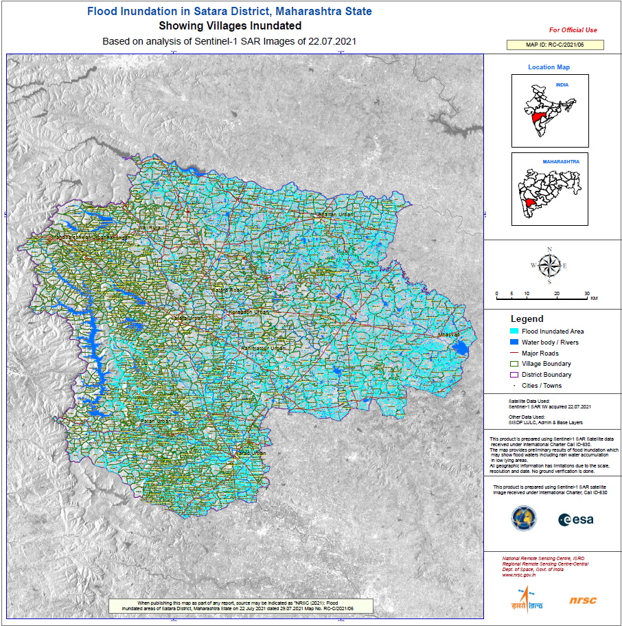
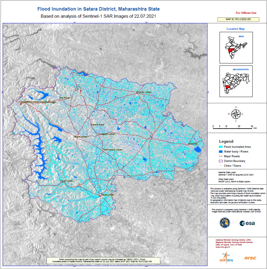
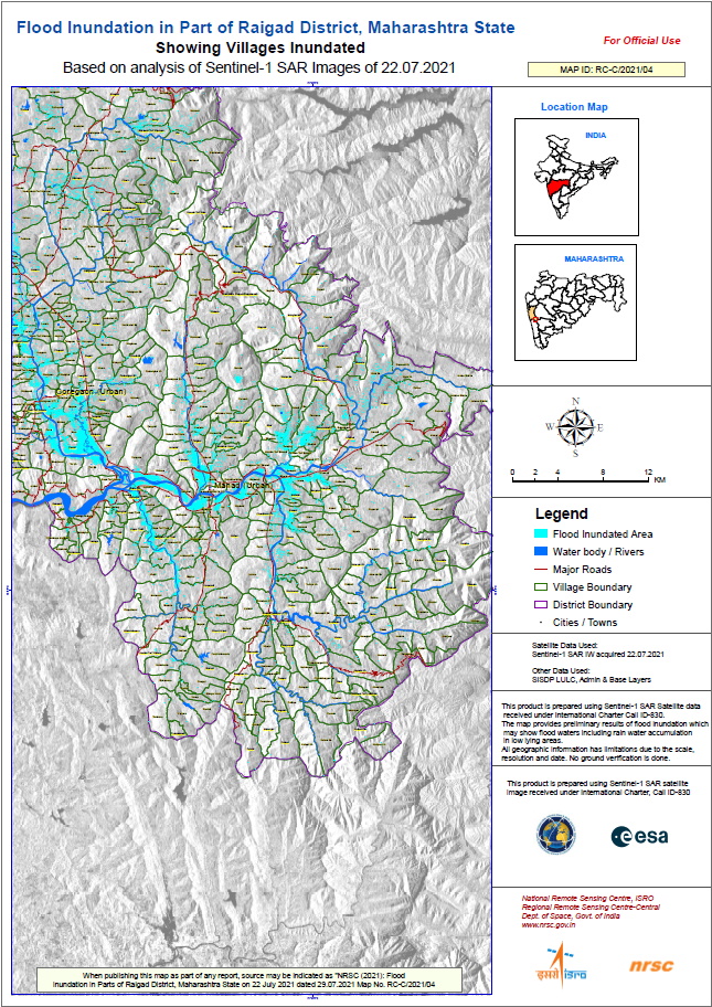
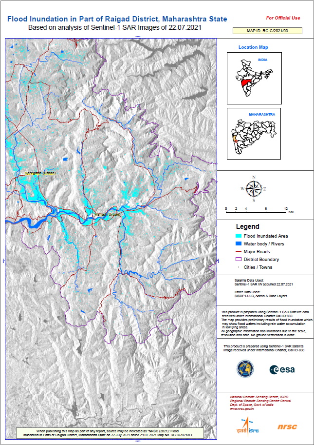
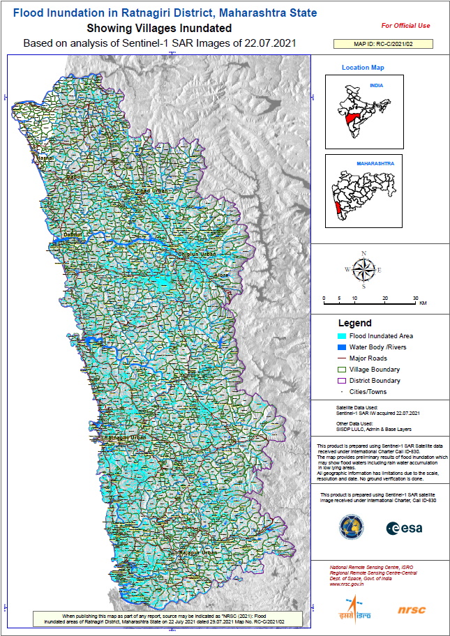
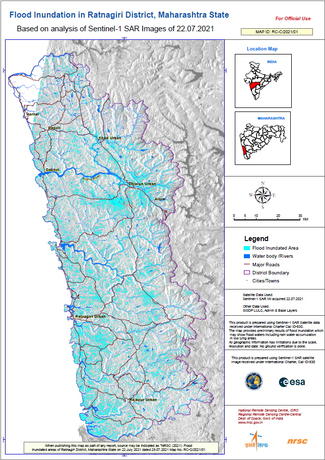
Flooding in India
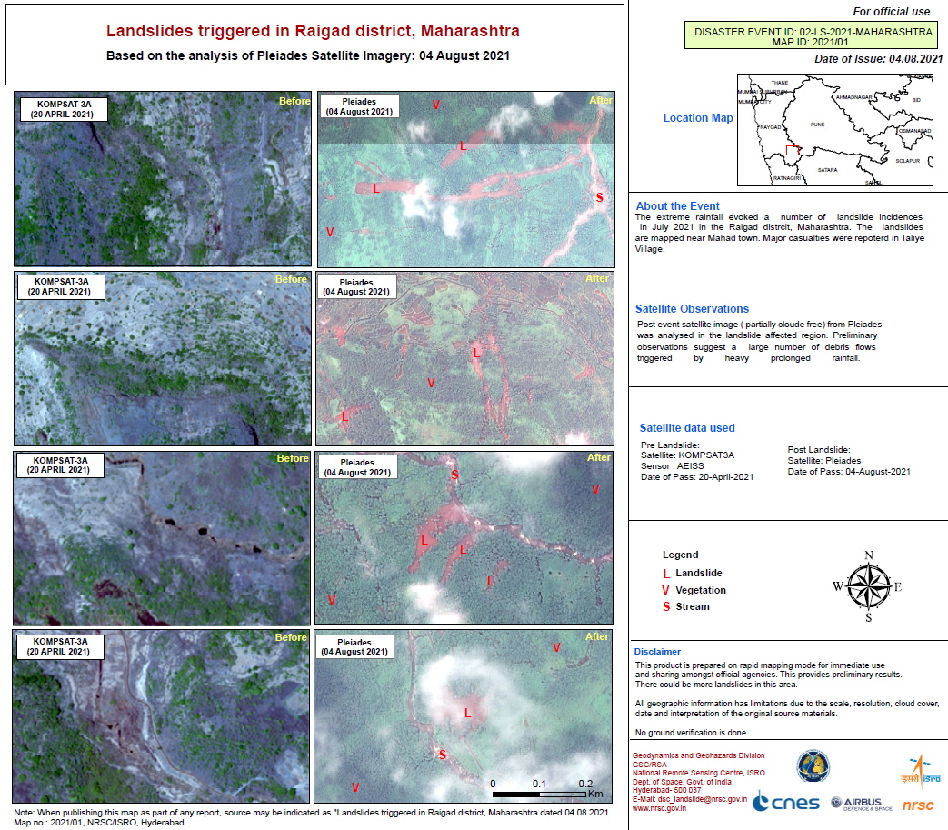
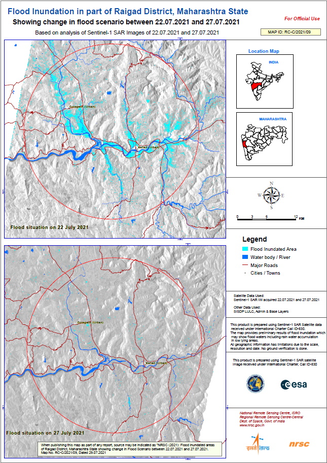
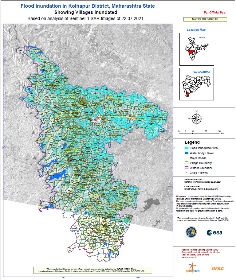
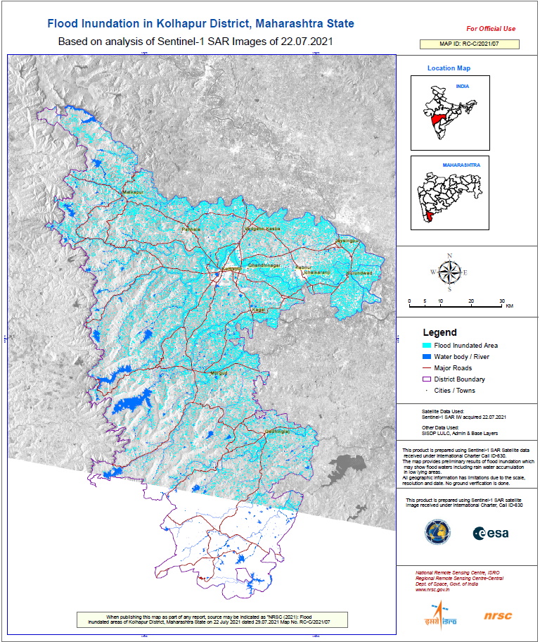
Over the last three days, the Pune and Konkan divisions in the Maharashtra state have witnessed torrential rains that triggered landslides and floods in some areas. The toll from rain-related incidents in the state has risen to 112 while 99 people remain missing as of Saturday evening, according to a state government release.
The National Disaster Response Force has deployed its teams for rescue efforts in Maharashtra.
| 事件类型: | Floods |
| 事件地点: | India |
| 启动宪章的日期: | 2021-07-26 |
| 宪章启动时间: | 19:45 |
| 宪章启动时区: | UTC+05:30 |
| 宪章要求者: | ISRO |
| 启动ID: | 723 |
| 项目经理: | ISRO |
Products

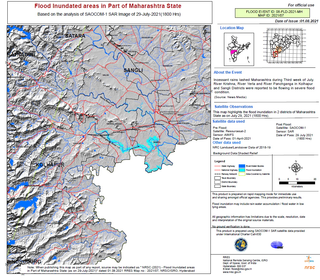
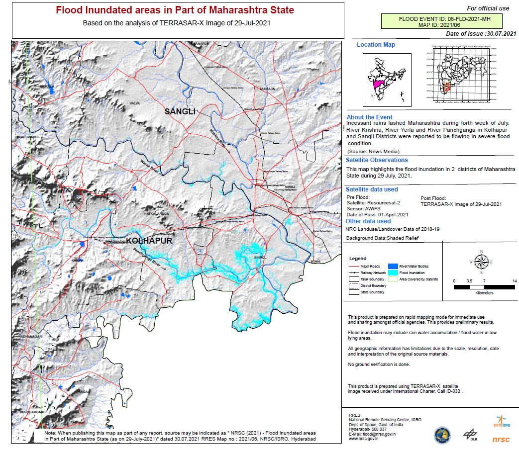
Flood inundated areas in part of Maharashtra State
版权: © DLR e.V. (2021), Distribution Airbus DS Geo GmbH
ResourceSat-2 data and products © ISRO (2021) - All rights reserved
Map produced by NRSC / ISRO
Information about the Product
已获得: ResourceSat-2: 01/04/2021
TerraSAR-X: 29/07/2021
源: TerraSAR-X / ResourceSat-2
类别: Delineation Map
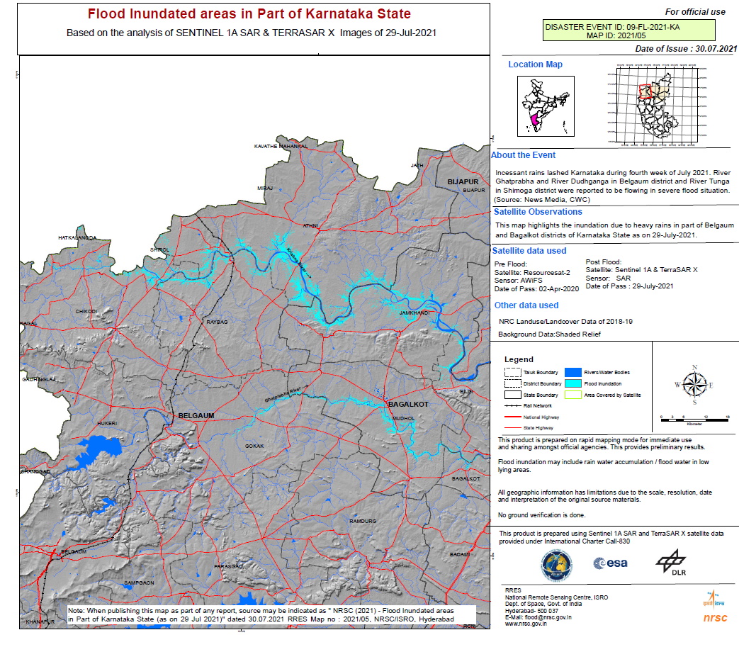
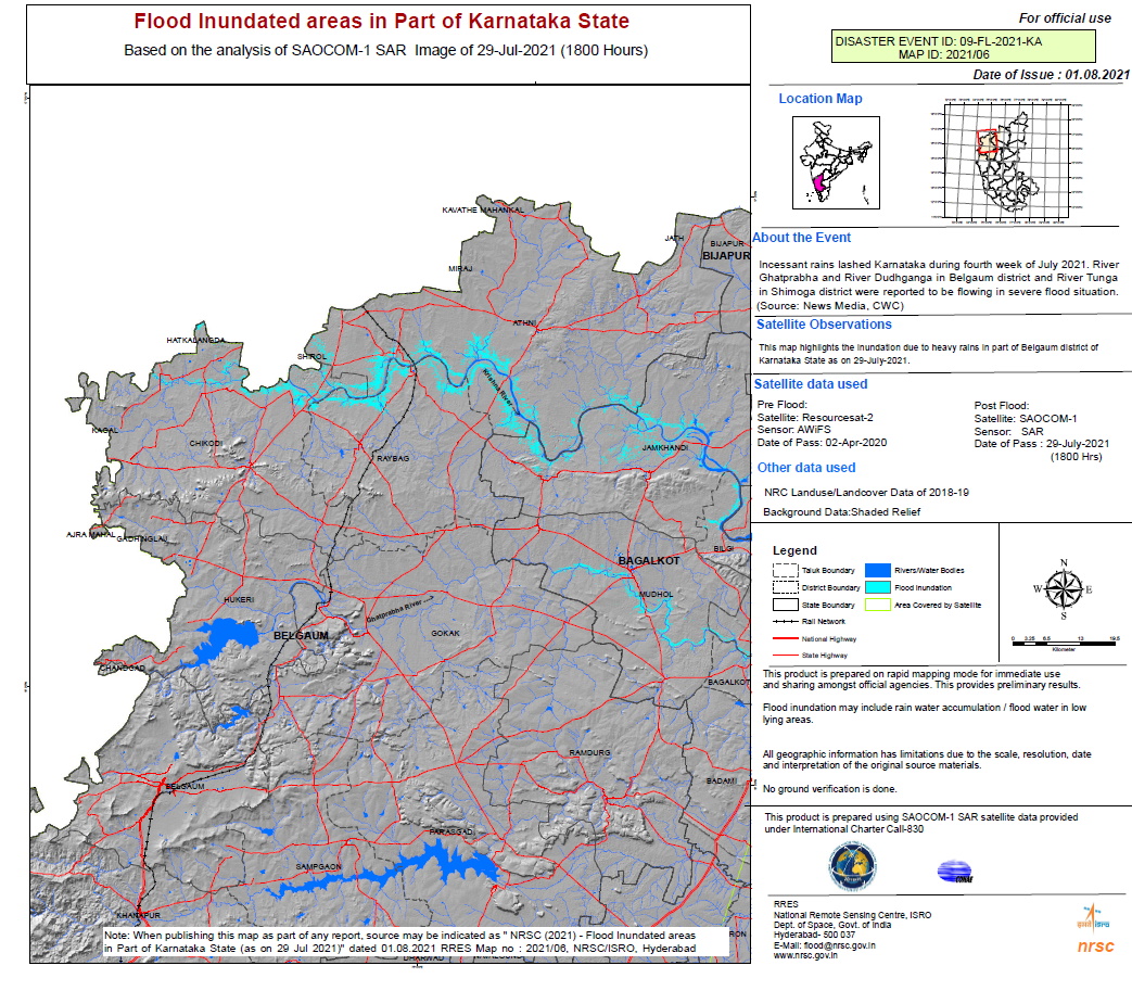
Flooded areas in part of Karnataka State
版权: © DLR e.V. (2021), Distribution Airbus DS Geo GmbH
ResourceSat-2 data and products © ISRO (2020) - All rights reserved
Contains modified Copernicus Sentinel data (2021)
Map produced by NRSC / ISRO
Information about the Product
已获得: ResourceSat-2: 02/04/2020
TerraSAR-X and Sentinel-1: 29/07/2021
源: Sentinel-1 / TerraSAR-X / ResourceSat-2
类别: Delineation Map
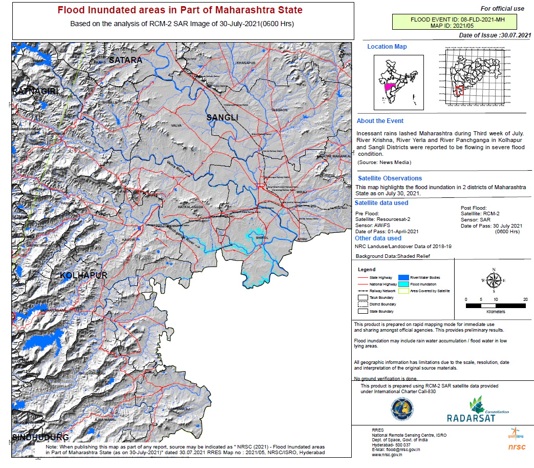
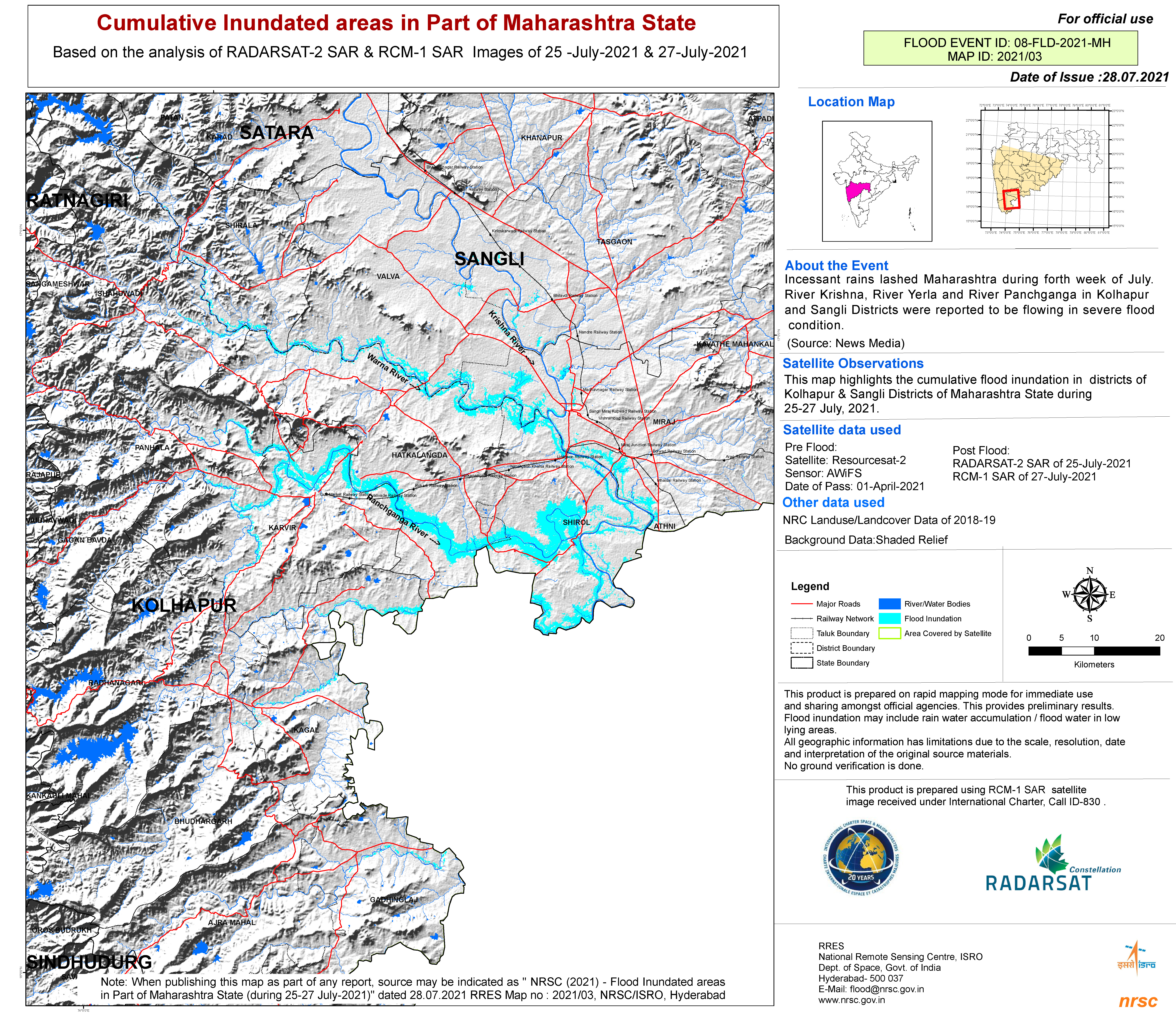
Cumulative inundated areas in part of Maharashtra State
版权: RADARSAT Constellation Mission Imagery © Government of Canada (2021) - RADARSAT is an official mark of the Canadian Space Agency
RADARSAT-2 Data and Products © Maxar Technologies Ltd. (2021) – All Rights Reserved. RADARSAT is an official mark of the Canadian Space Agency
Map produced by NRSC/ISRO
Information about the Product
已获得: RCM: 27/07/2021
RADARSAT-2: 25/07/2021
源: RCM / RADARSAT-2
类别: Delineation Map
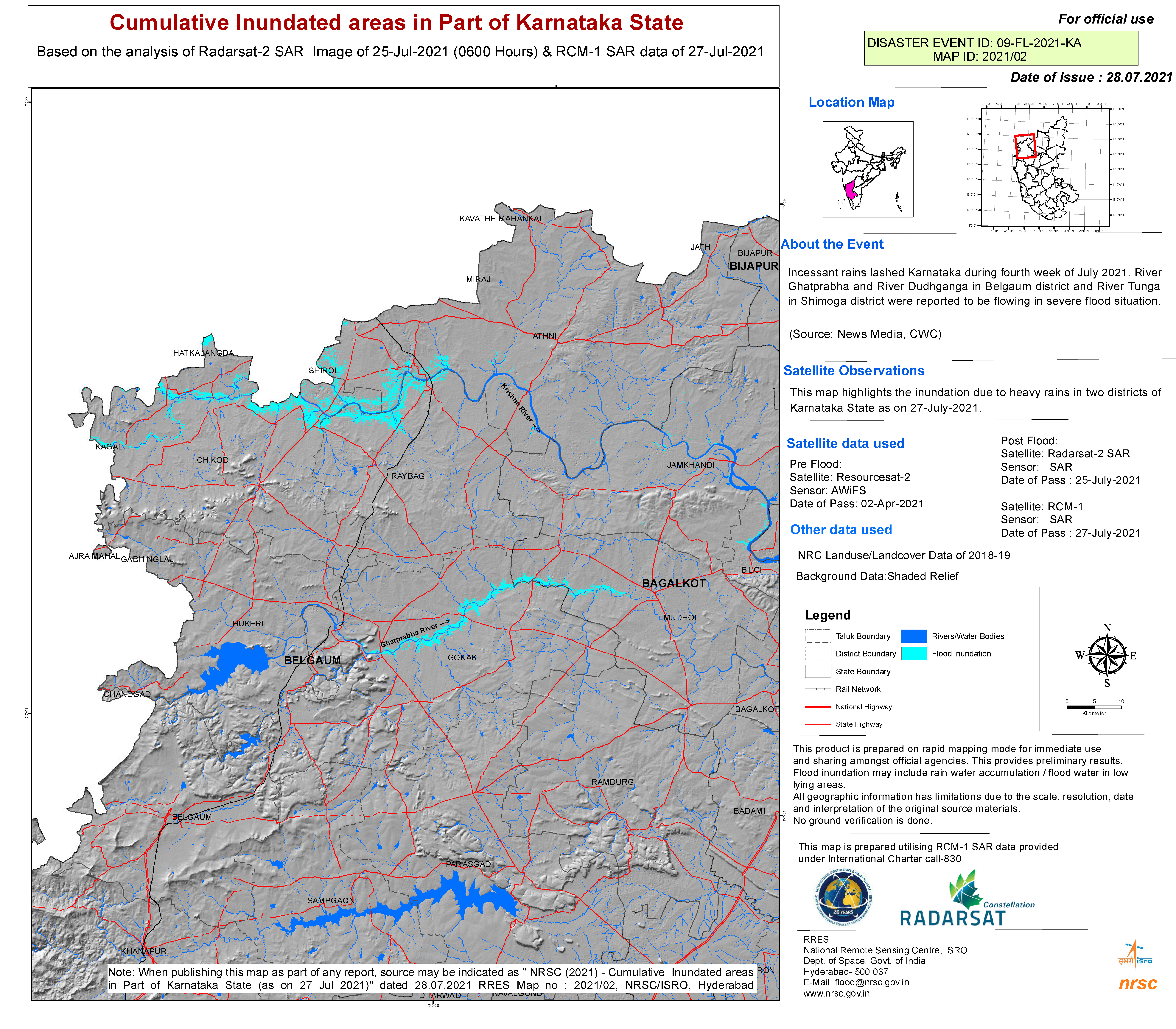
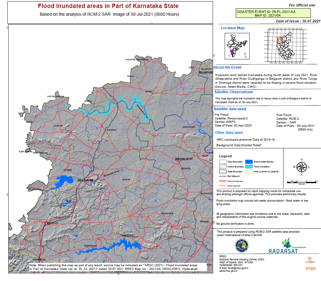
Cumulative inundated areas in part of Karnataka State
版权: RADARSAT Constellation Mission Imagery © Government of Canada (2021) - RADARSAT is an official mark of the Canadian Space Agency
RADARSAT-2 Data and Products © Maxar Technologies Ltd. (2021) – All Rights Reserved. RADARSAT is an official mark of the Canadian Space Agency
Map produced by NRSC/ISRO
Information about the Product
已获得: RCM: 27/07/2021
RADARSAT-2: 25/07/2021
源: RCM / RADARSAT-2
类别: Reference Map
 返回完整的响应档案

