 English
 Spanish
 French
 Chinese
 Russian
 Portuguese
 Последняя Активация
Charter activations
Flooding in India
Over the last three days, the Pune and Konkan divisions in the Maharashtra state have witnessed torrential rains that triggered landslides and floods in some areas. The toll from rain-related incidents in the state has risen to 112 while 99 people remain missing as of Saturday evening, according to a state government release.
The National Disaster Response Force has deployed its teams for rescue efforts in Maharashtra.
| Тип события: | Floods |
| Место события: | India |
| Date of Charter Activation: | 2021-07-26 |
| Время активации Хартии: | 19:45 |
| TЧасовой пояс в районе активации Хартии: | UTC+05:30 |
| Запрос на активацию поступил от: | ISRO |
| Номер активации: | 723 |
| Менеждер проекта от: | ISRO |
Products
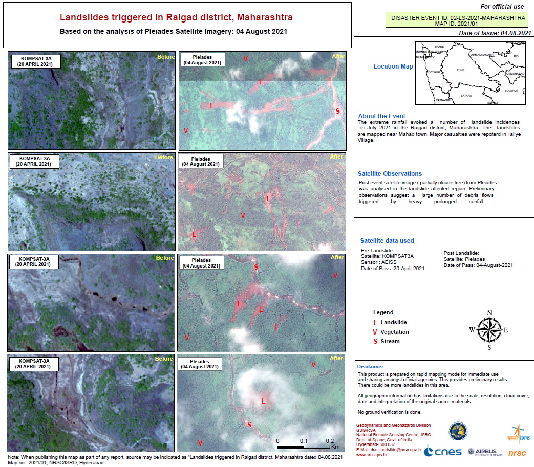
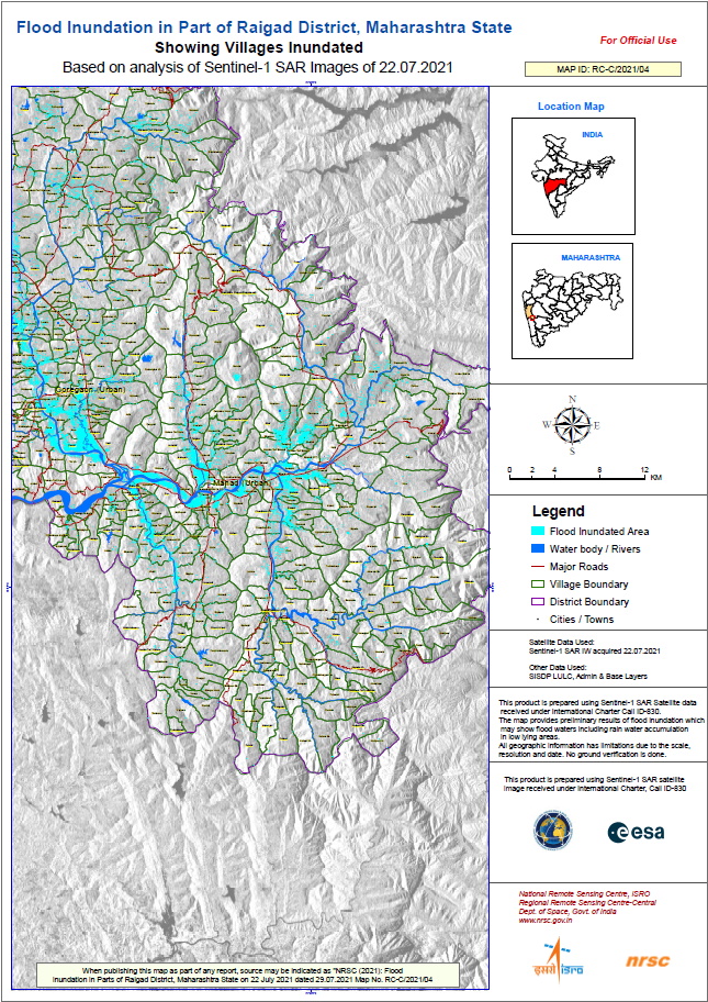
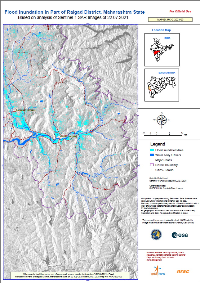
Landslides in Raigad district, Maharashtra
Авторские права: Includes Pleiades material © CNES (2021), Distribution Airbus DS.
© KARI (2021).
Map produced by NRSC / ISRO
Information about the Product
Получено: Pleiades: 04/08/2021
KOMPSAT-3: 20/04/2021
Источник: Pleiades / KOMPSAT-3
Категория: Delineation Map
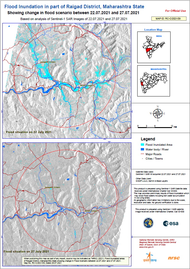
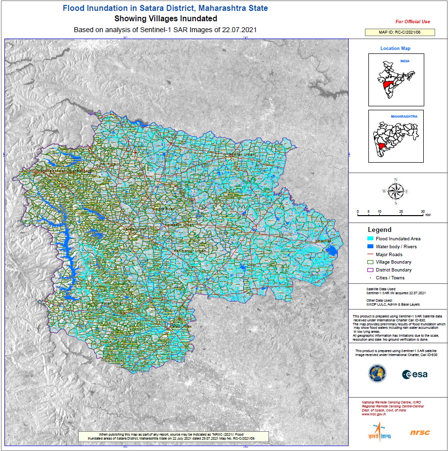
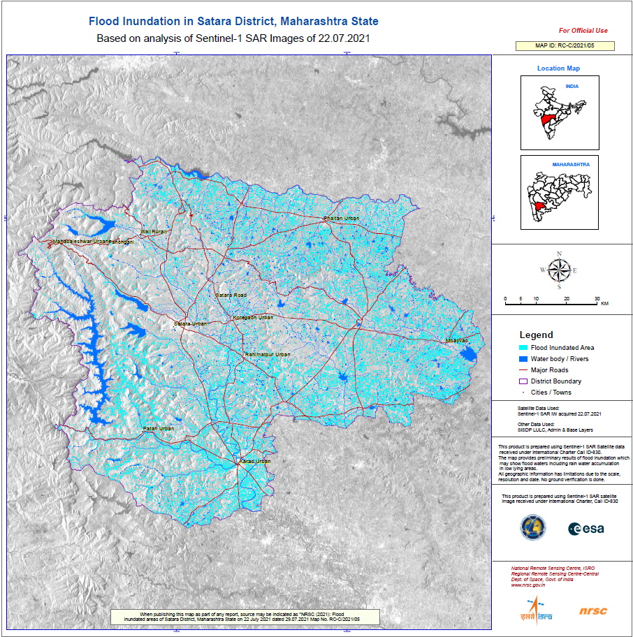
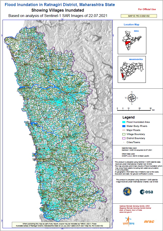
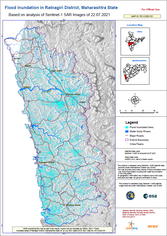

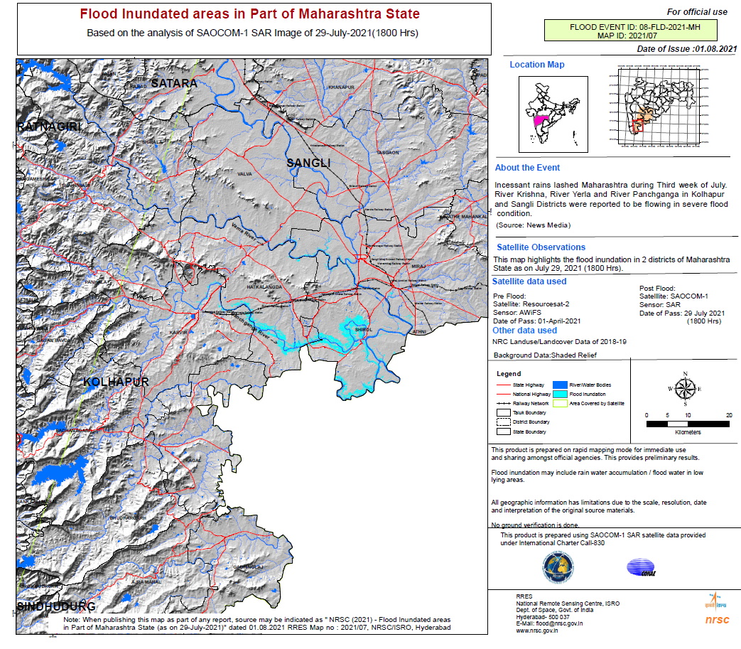
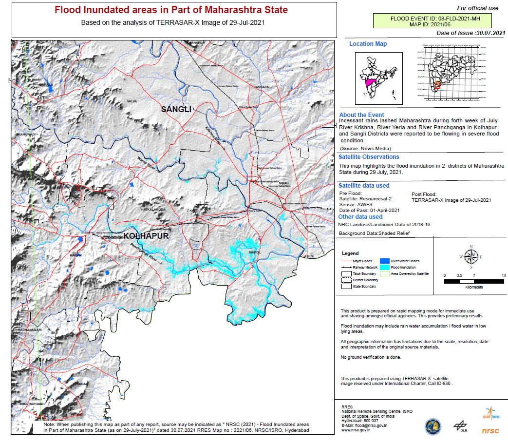
Flood inundated areas in part of Maharashtra State
Авторские права: © DLR e.V. (2021), Distribution Airbus DS Geo GmbH
ResourceSat-2 data and products © ISRO (2021) - All rights reserved
Map produced by NRSC / ISRO
Information about the Product
Получено: ResourceSat-2: 01/04/2021
TerraSAR-X: 29/07/2021
Источник: TerraSAR-X / ResourceSat-2
Категория: Delineation Map
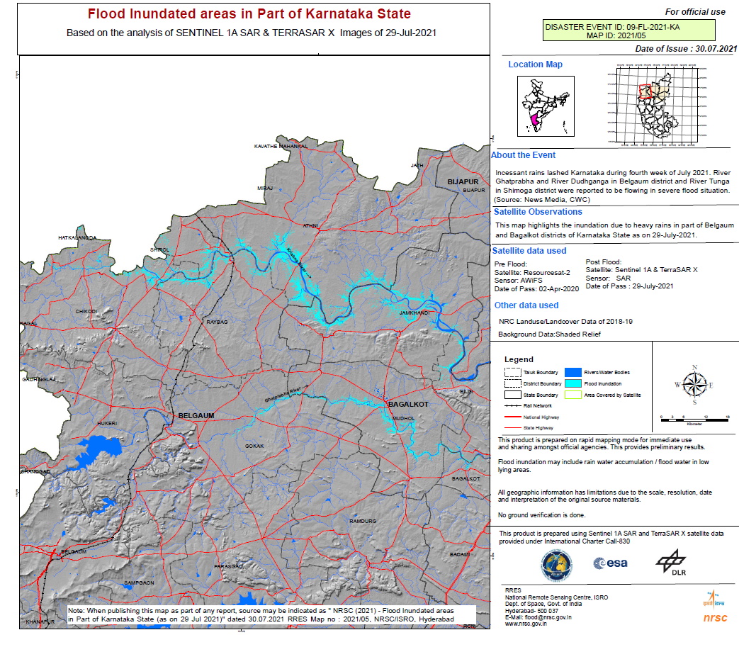
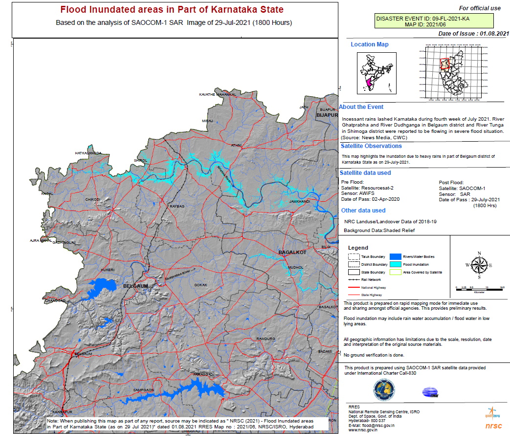
Flooded areas in part of Karnataka State
Авторские права: © DLR e.V. (2021), Distribution Airbus DS Geo GmbH
ResourceSat-2 data and products © ISRO (2020) - All rights reserved
Contains modified Copernicus Sentinel data (2021)
Map produced by NRSC / ISRO
Information about the Product
Получено: ResourceSat-2: 02/04/2020
TerraSAR-X and Sentinel-1: 29/07/2021
Источник: Sentinel-1 / TerraSAR-X / ResourceSat-2
Категория: Delineation Map
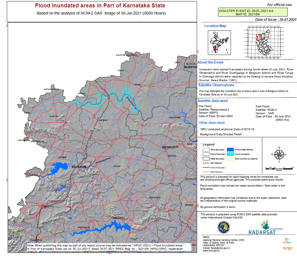
Flooded areas in part of Karnataka State
Авторские права: RADARSAT Constellation Mission Imagery © Government of Canada (2021) - RADARSAT is an official mark of the Canadian Space Agency
Map produced by NRSC / ISRO
Information about the Product
Получено: 30/07/2021
Источник: RCM
Категория: Delineation Map
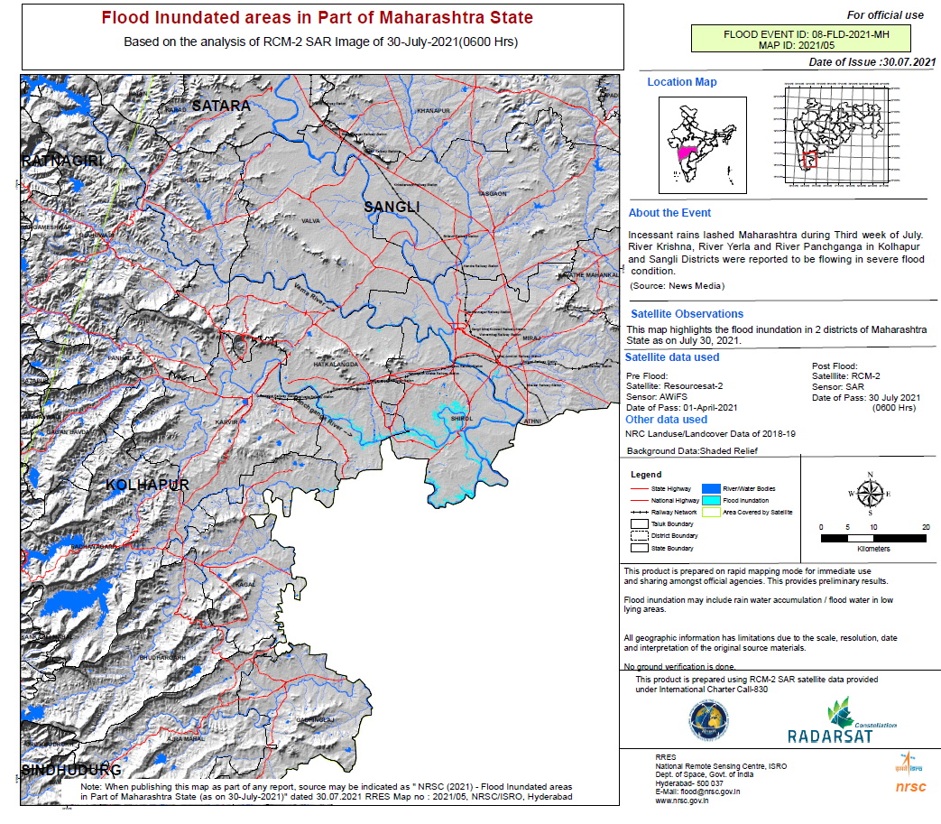
Flooded areas in parts of Maharashtra State
Авторские права: RADARSAT Constellation Mission Imagery © Government of Canada (2021) - RADARSAT is an official mark of the Canadian Space Agency
Map produced by NRSC / ISRO
Information about the Product
Получено: 30/07/2021
Источник: RCM
Категория: Delineation Map
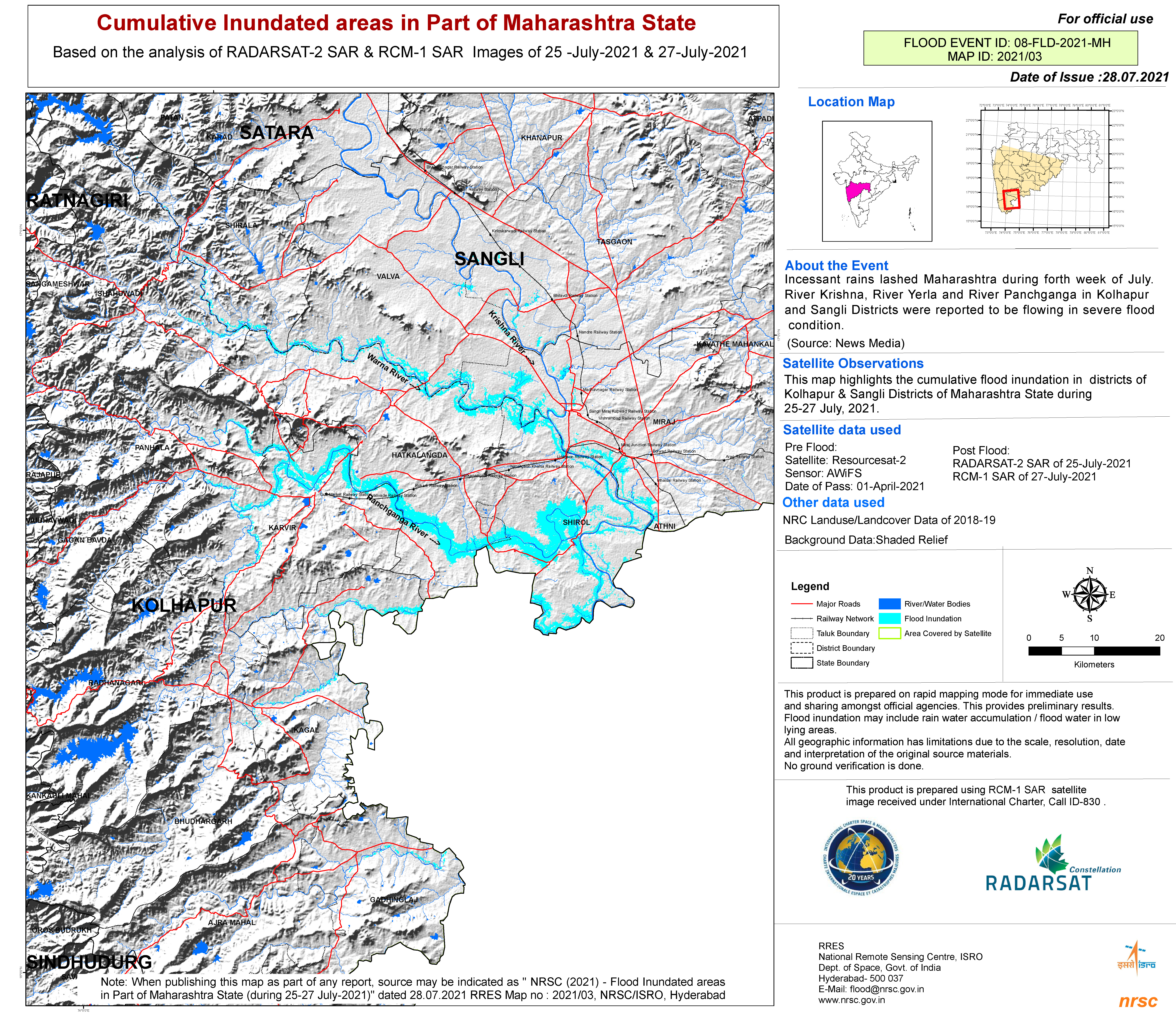
Cumulative inundated areas in part of Maharashtra State
Авторские права: RADARSAT Constellation Mission Imagery © Government of Canada (2021) - RADARSAT is an official mark of the Canadian Space Agency
RADARSAT-2 Data and Products © Maxar Technologies Ltd. (2021) – All Rights Reserved. RADARSAT is an official mark of the Canadian Space Agency
Map produced by NRSC/ISRO
Information about the Product
Получено: RCM: 27/07/2021
RADARSAT-2: 25/07/2021
Источник: RCM / RADARSAT-2
Категория: Delineation Map
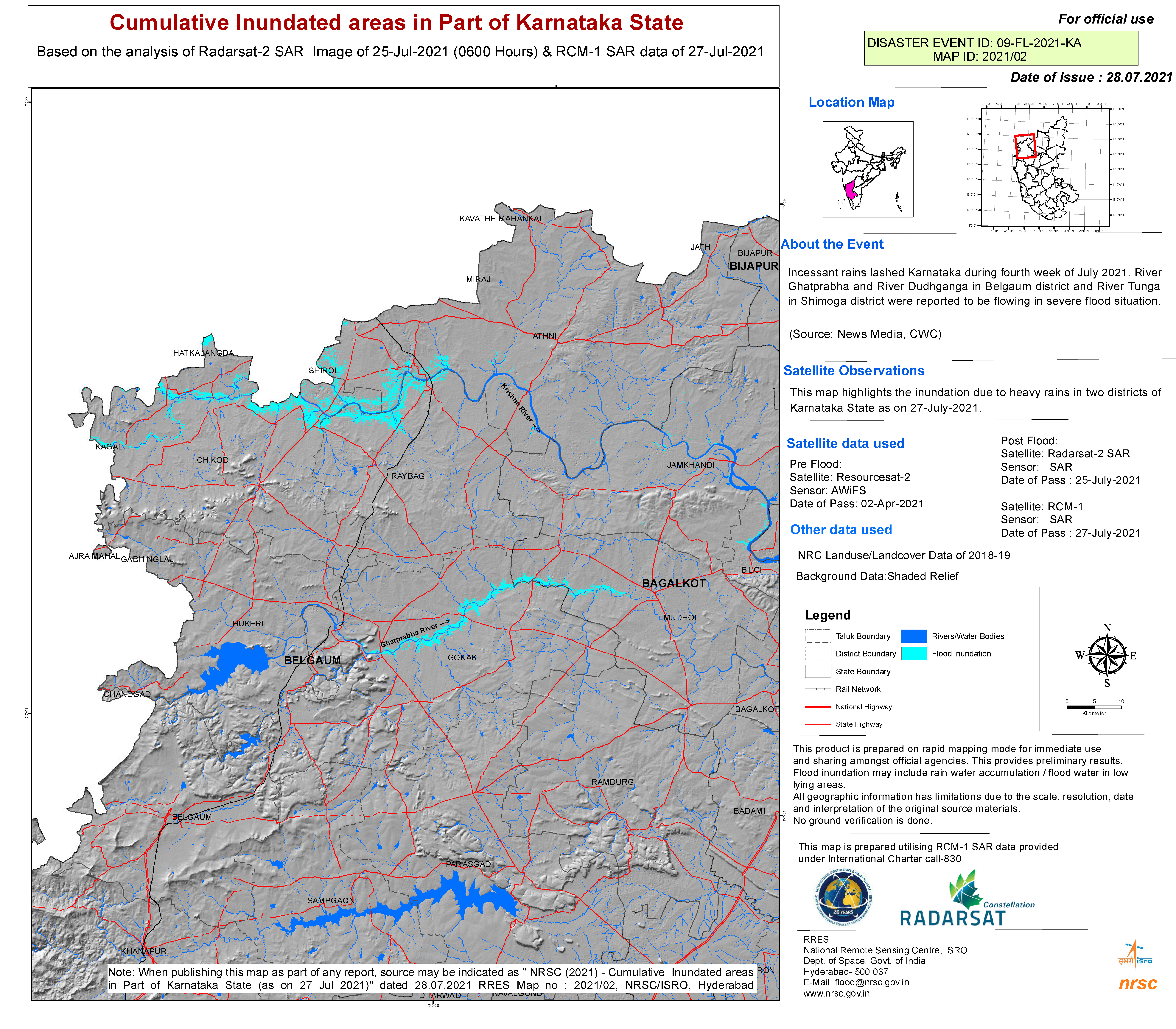
Cumulative inundated areas in part of Karnataka State
Авторские права: RADARSAT Constellation Mission Imagery © Government of Canada (2021) - RADARSAT is an official mark of the Canadian Space Agency
RADARSAT-2 Data and Products © Maxar Technologies Ltd. (2021) – All Rights Reserved. RADARSAT is an official mark of the Canadian Space Agency
Map produced by NRSC/ISRO
Information about the Product
Получено: RCM: 27/07/2021
RADARSAT-2: 25/07/2021
Источник: RCM / RADARSAT-2
Категория: Reference Map
 Вернуться к полному архиву активаций

