 English
 Spanish
 French
 Chinese
 Russian
 Portuguese
 最新宪章启动
Charter activations
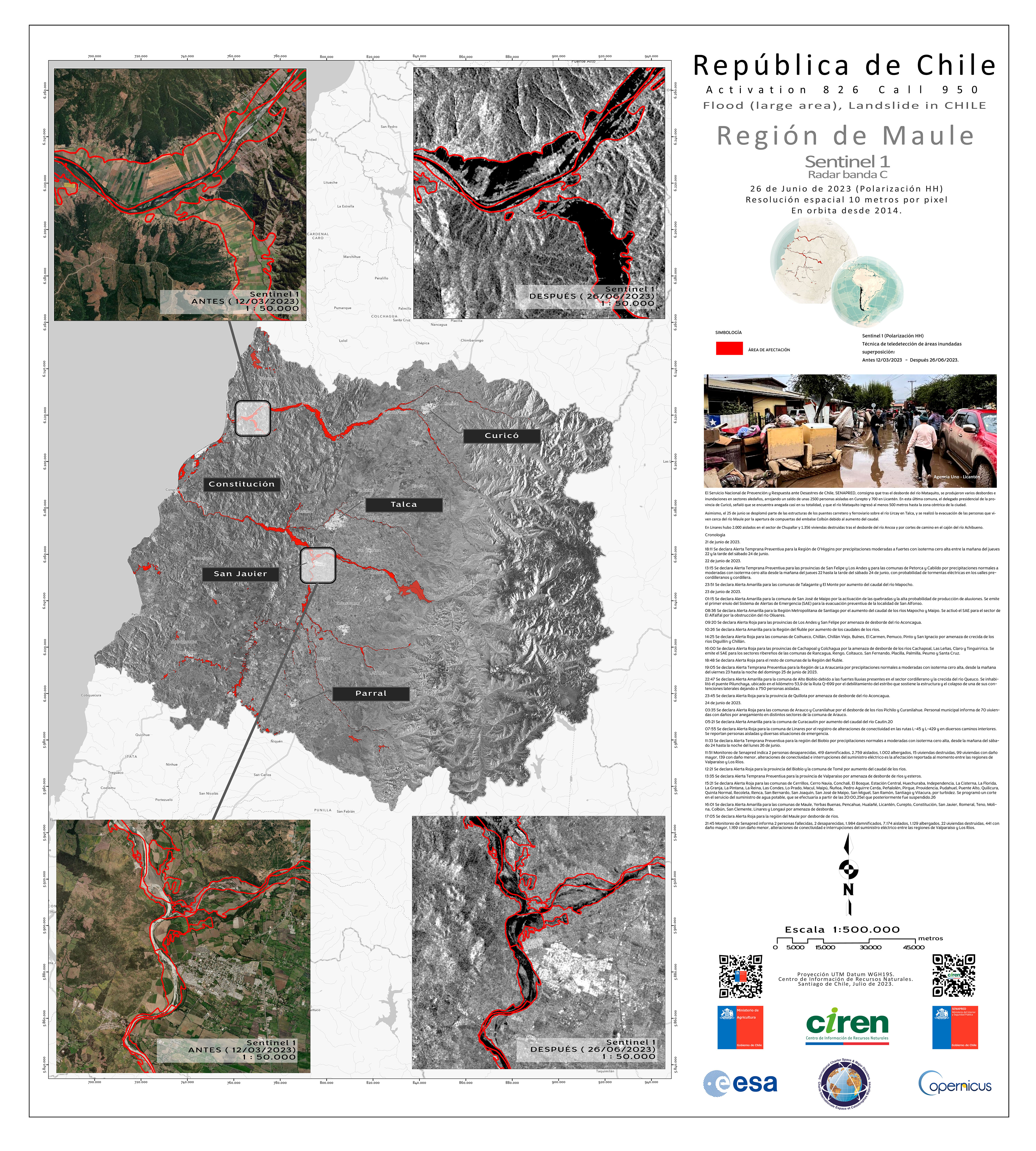
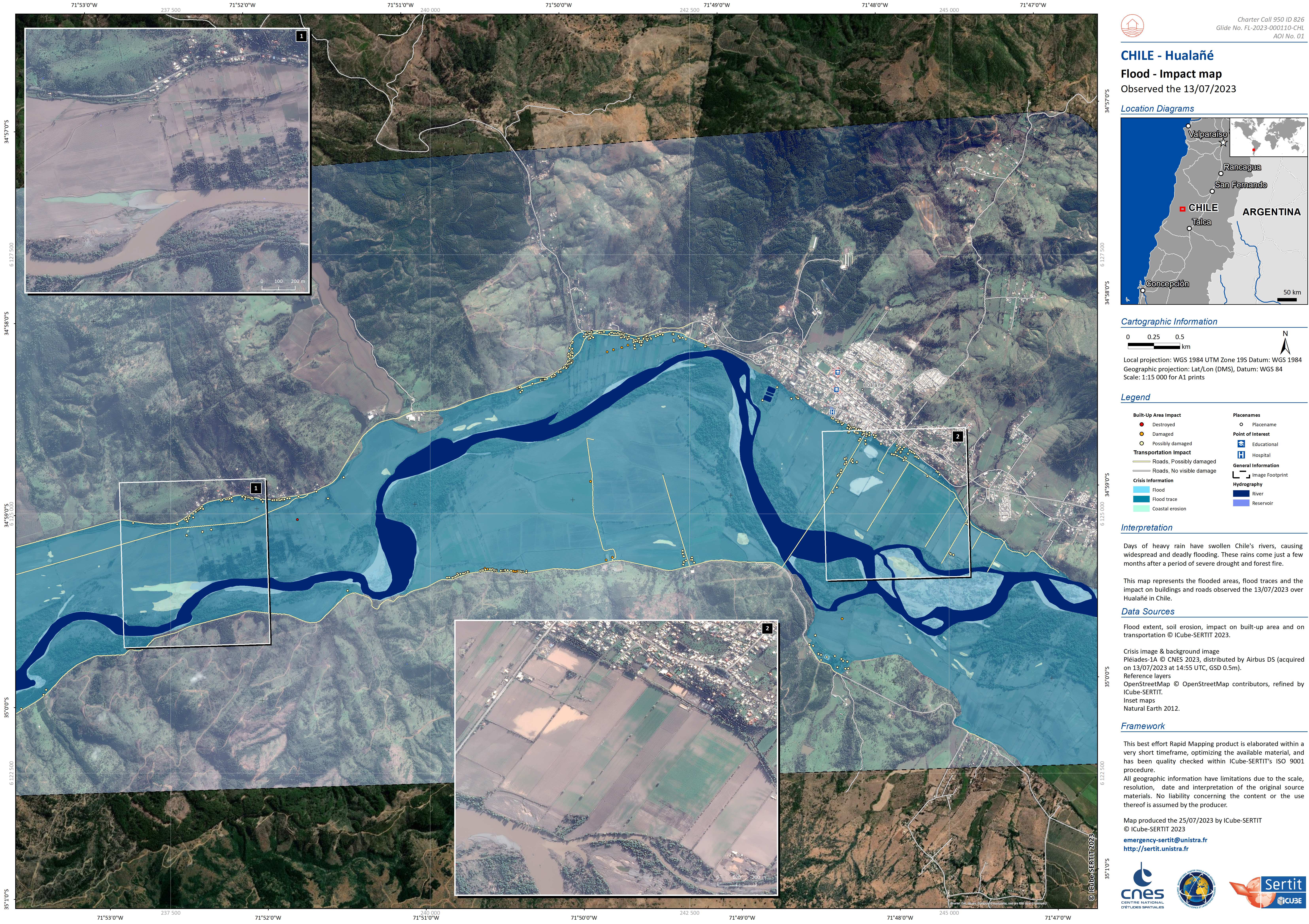
Flooding in Chile
Days of heavy rainfall swelled Chile's rivers, causing deadly widespread floods as the country sees the worst weather front in a decade.
The deluge blocked roads, prompted an evacuation in the centre of the country and a red alert has been issued by The Meteorological Directorate of Chile in some regions, warning of further heavy rains and the possibility of landslides.
The rains come just a few months after a period of wildfires amid a severe drought that destroyed hundreds of homes and left dozens of people dead.
| 事件类型: | Floods |
| 事件地点: | Chile |
| 启动宪章的日期: | 2023-06-28 |
| 宪章启动时间: | 15:21 |
| 宪章启动时区: | UTC-04:00 |
| 宪章要求者: | Ministry of Interior and Public Safety (ONEMI) |
| 启动ID: | 826 |
| 项目经理: | Marcelo Duran (Natural Resources Information Center (CIREN)) |
Products
Areas affected by Flooding and Landslides in the O'Higgins Region, El Guapi, Chile
版权: © DLR e.V. (2010), Distribution Airbus DS Geo GmbH.
Map produced by the Natural Resources Information Centre (CIREN).
Information about the Product
已获得: 12/03/2023, 27/06/2023, 30/06/2023, 05/07/2023
源: TerraSAR-X
类别: Delineation Map
Areas affected by Flooding and Landslides in the BioBio Region, Concepcion, Chile
版权: RADARSAT-2 Data and Products © Maxar Technologies Ltd. (2023) – All Rights Reserved.
RADARSAT is an official mark of the Canadian Space Agency.
Map produced by the Natural Resources Information Centre (CIREN).
Information about the Product
已获得: 22/07/2023
源: RADARSAT-2
类别: Delineation Map
 返回完整的响应档案

