 English
 Spanish
 French
 Chinese
 Russian
 Portuguese
 最新宪章启动
Charter activations
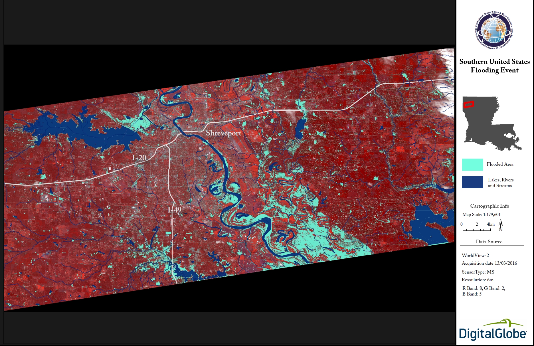
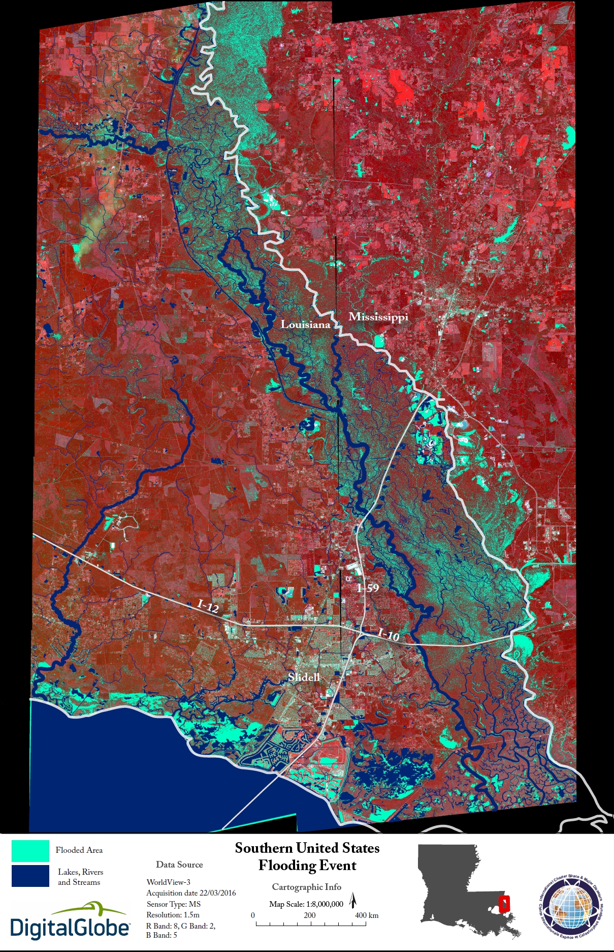
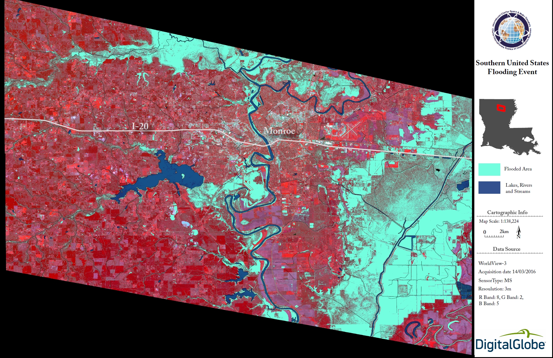
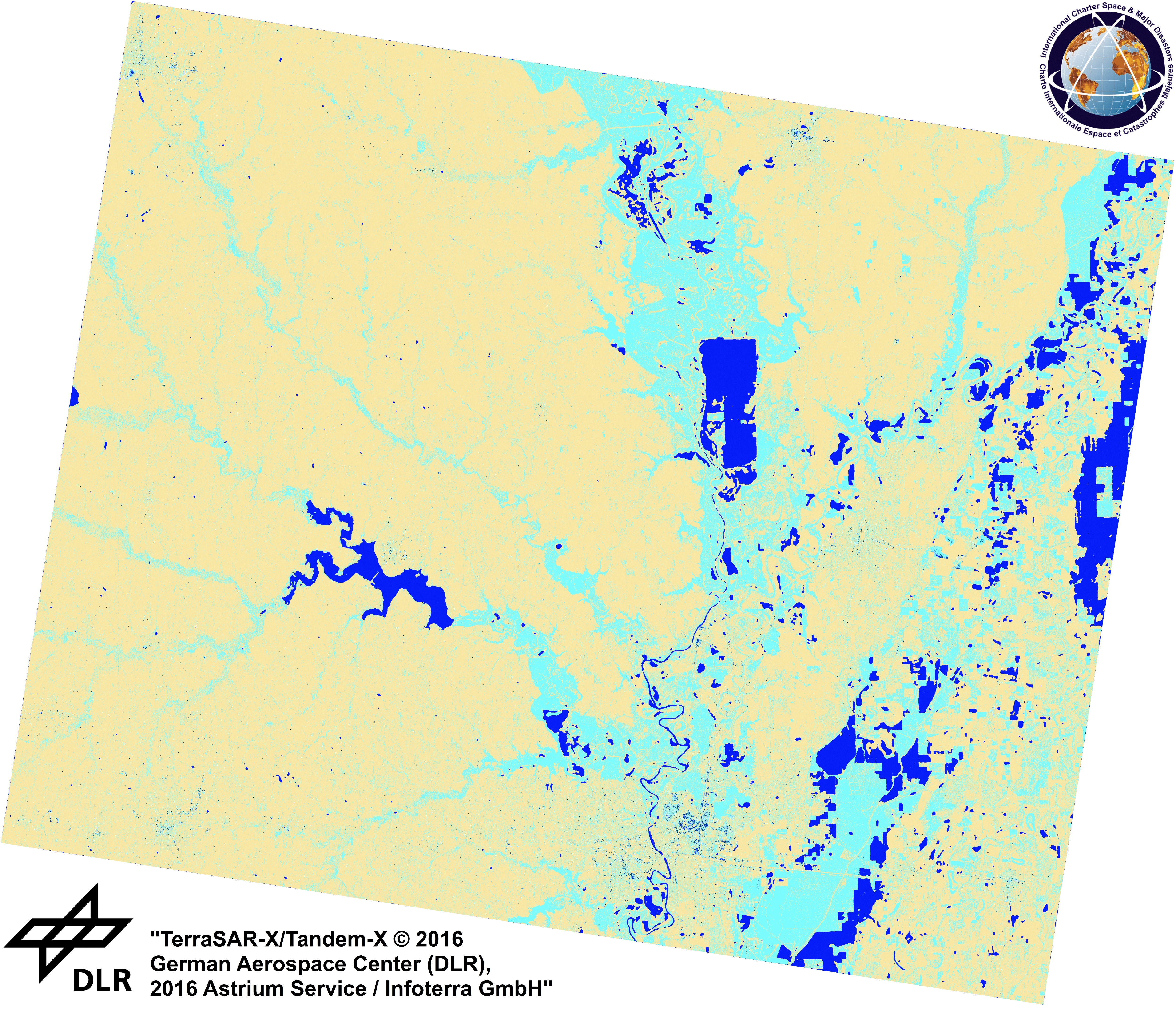
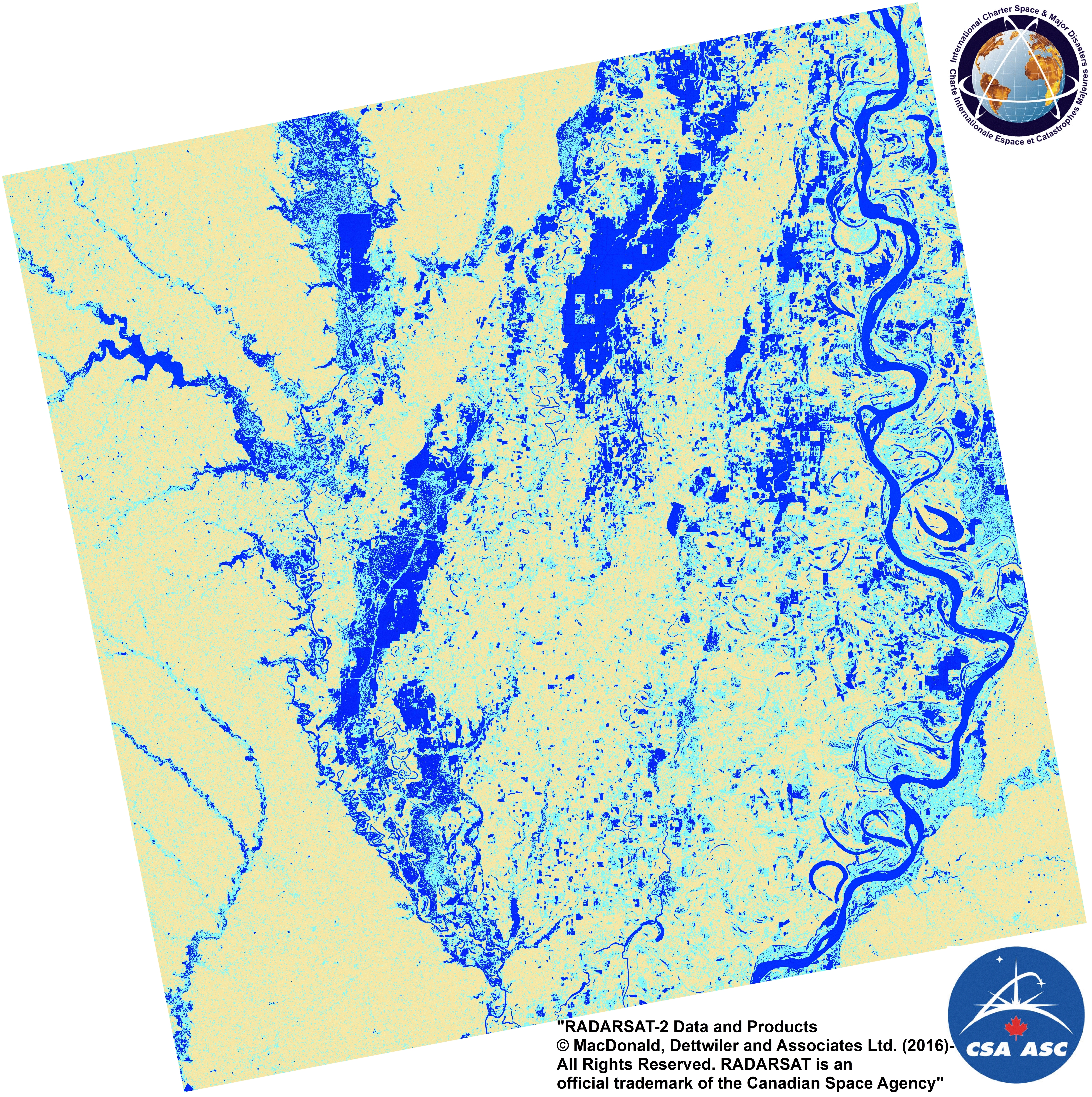
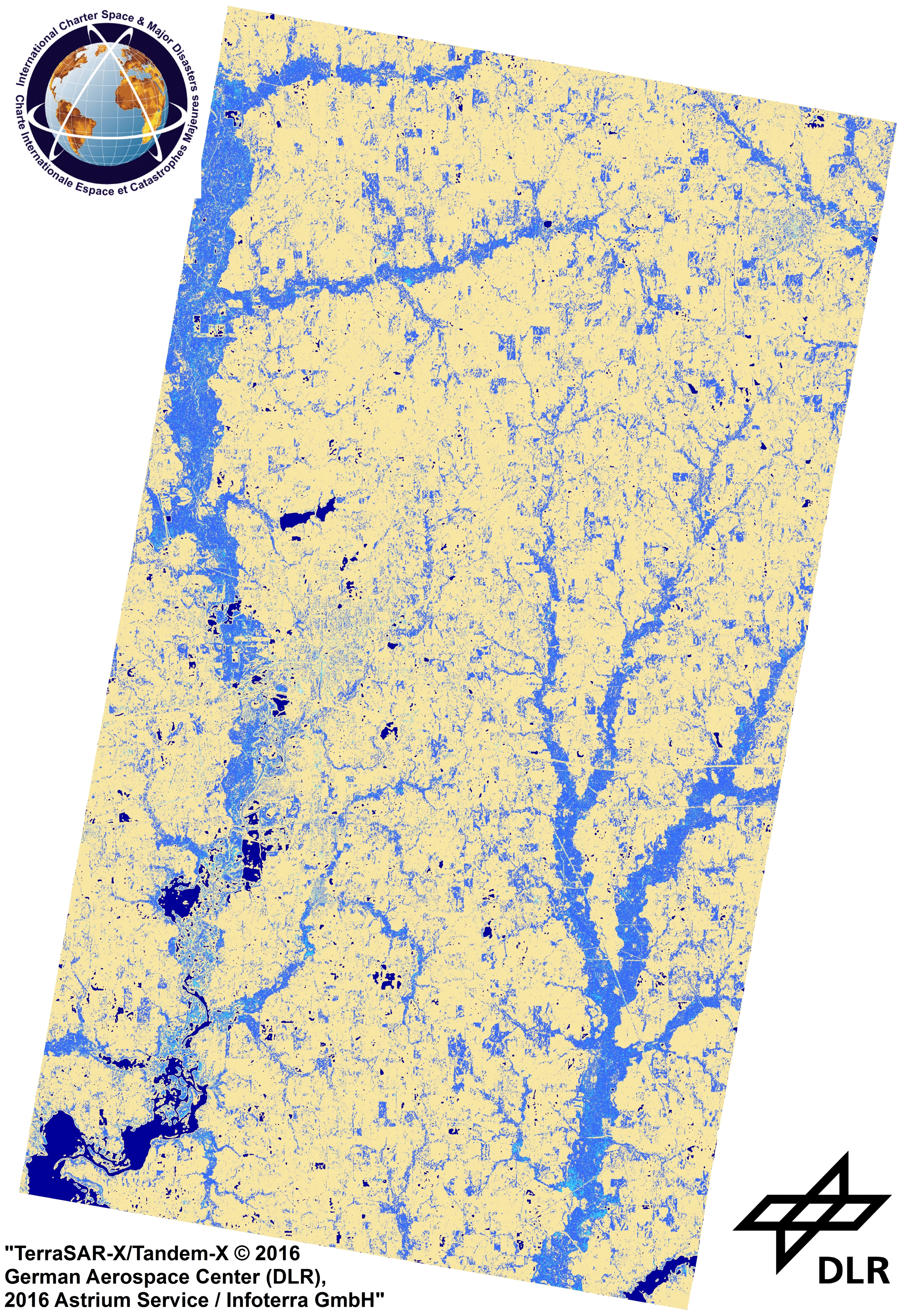
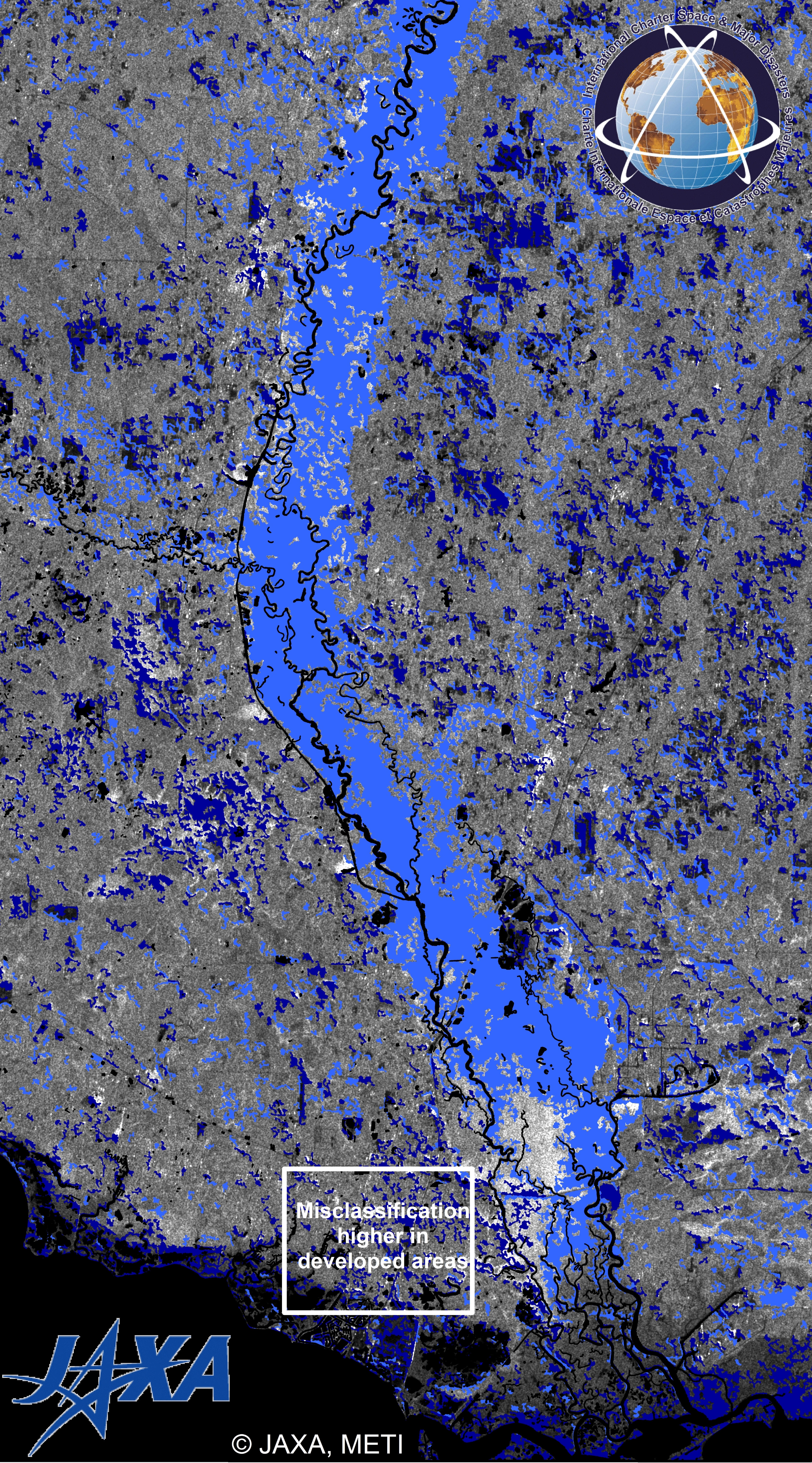
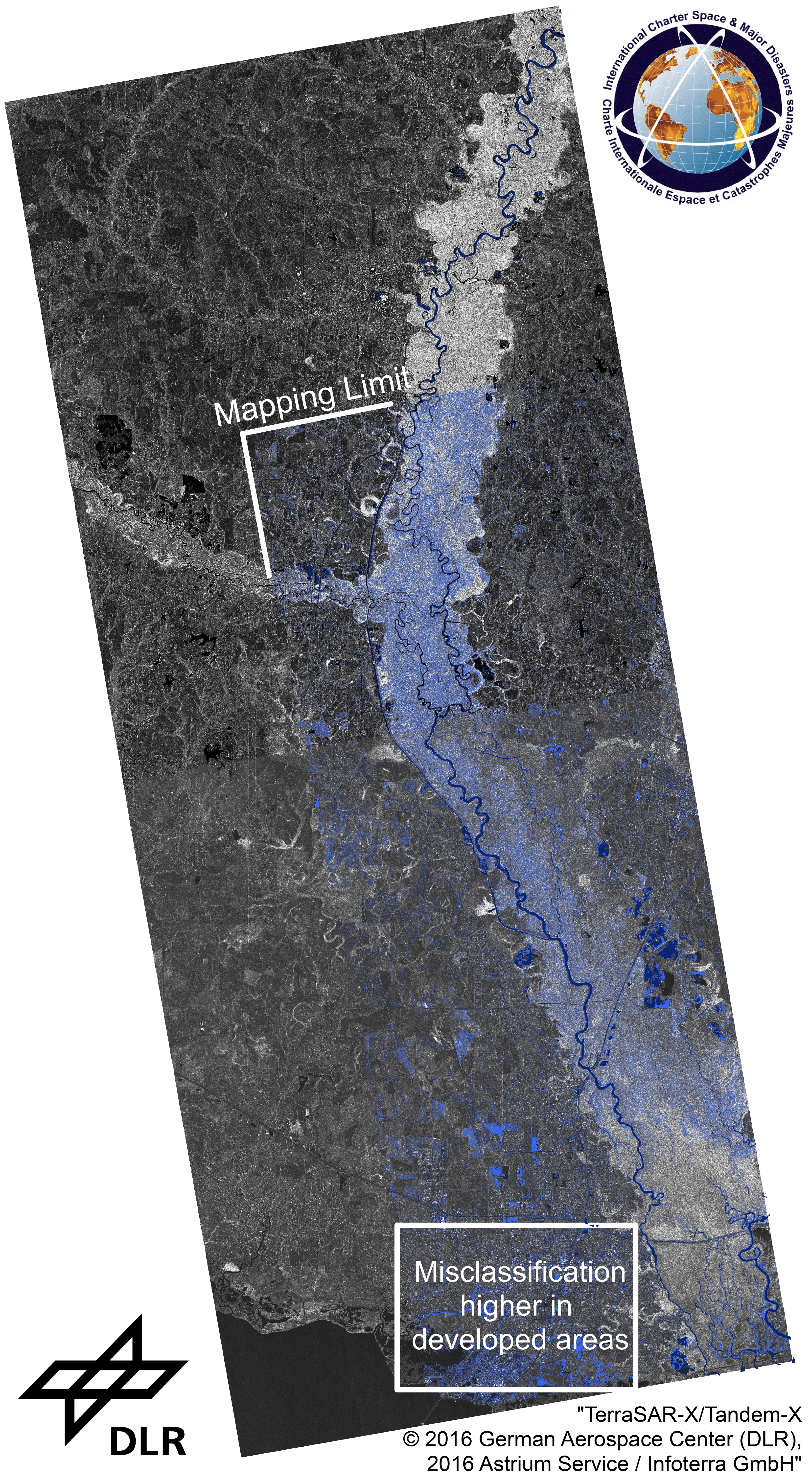
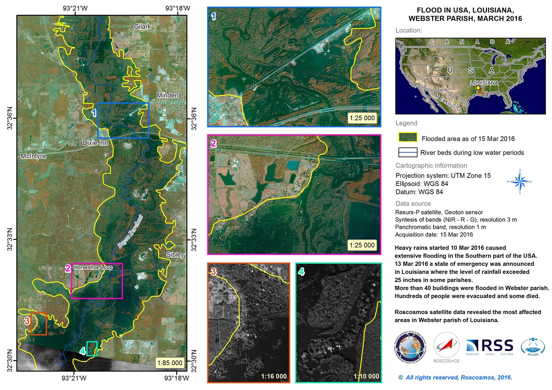
美国洪水
美国南部数日的大雨造成了前所未有的洪水灾害,并从田纳西州向德克萨斯州蔓延。
数以千计的民众深受洪水灾害的影响,大雨预计将持续一段时间。造成洪水灾害的原因是由于缓慢移动的风暴穿过该地区,带来了大雨、大风和冰雹。
路易斯安那州宣布了重大灾害已造成数人遇难,数千家园被毁。
密西西比州进入了紧急状态,数百座家园受到毁坏。大约300人已被疏散。
在德克萨斯州,德维尔市已被洪水包围。由于水位上涨过高,无法抵达市区,1200名市民只能乘船或直升飞机进入该市区。
阿肯色州的11个郡也已被宣布为灾害地区。
大雨导致受灾州郡的河水水位上涨至前所未有的水平。色宾河、博格法拉亚河和小河的水位均创下二三十年来的历史记录。色宾河部分地区水位可能达到35英寸(10米),将打破1884年以来的记录。
洪水已损坏或摧毁了该地区的部分道路,这些道路在洪水的肆虐下已经崩塌。救灾人员和国民警卫队正在尽力疏散数千民众,国家当局呼吁民众不要返回到洪水地区,直至达到安全状态。
| 事件类型: | 洪水 |
| 事件地点: | 美国 |
| 启动宪章的日期: | 2016年3月11日 |
| 宪章启动时间: | 17:36:54 |
| 宪章启动时区: | UTC-06:00 |
| 宪章要求者: | 美国地质调查局代表美国联邦应急管理署 |
| 项目经理: | 美国地质调查局 |
Products
 返回完整的响应档案

