 English
 Spanish
 French
 Chinese
 Russian
 Portuguese
 Последняя Активация
Charter activations
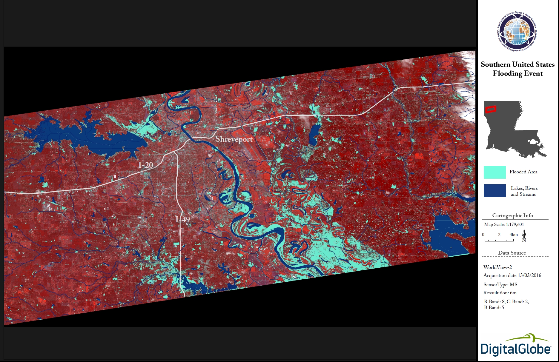
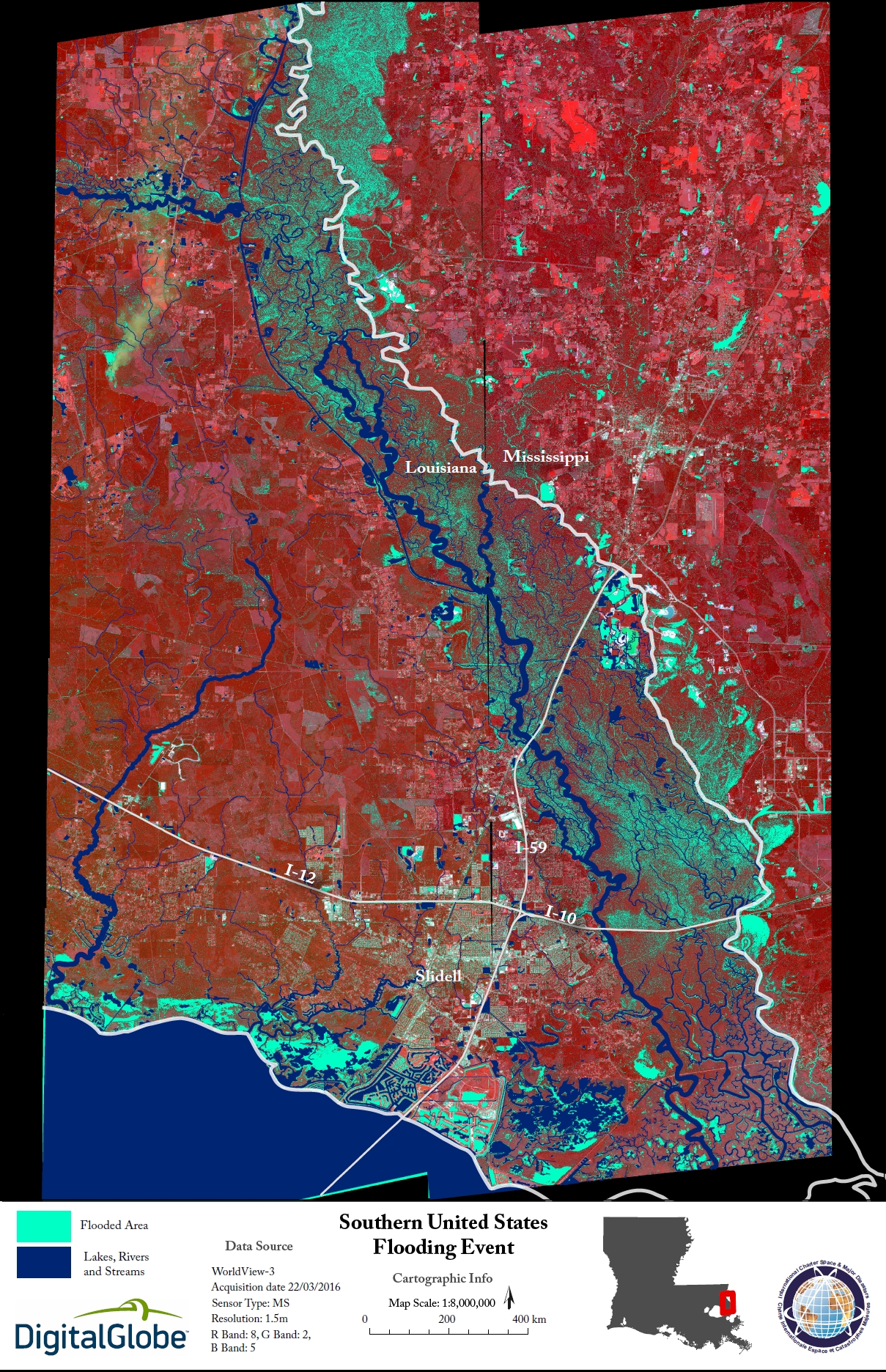
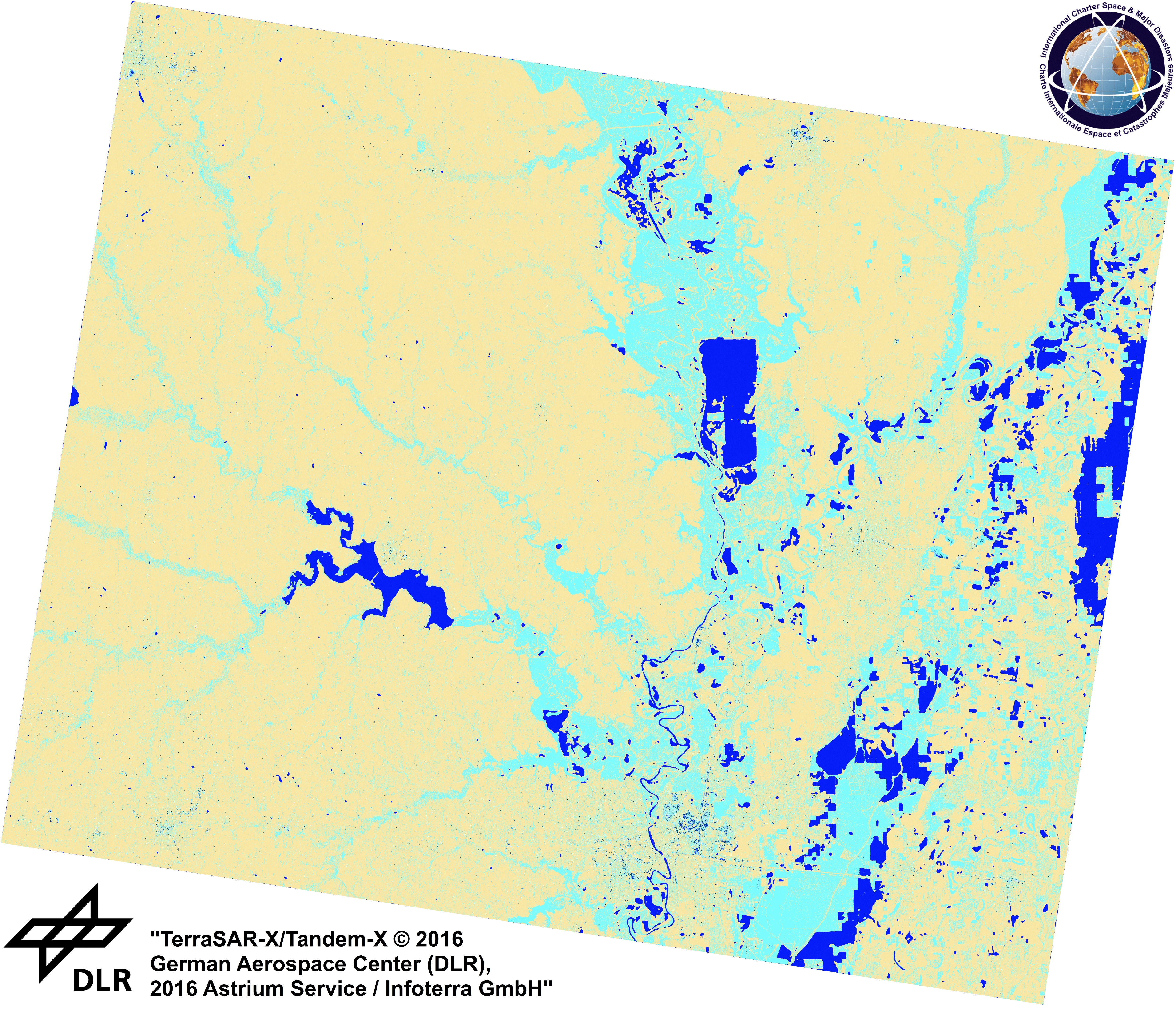
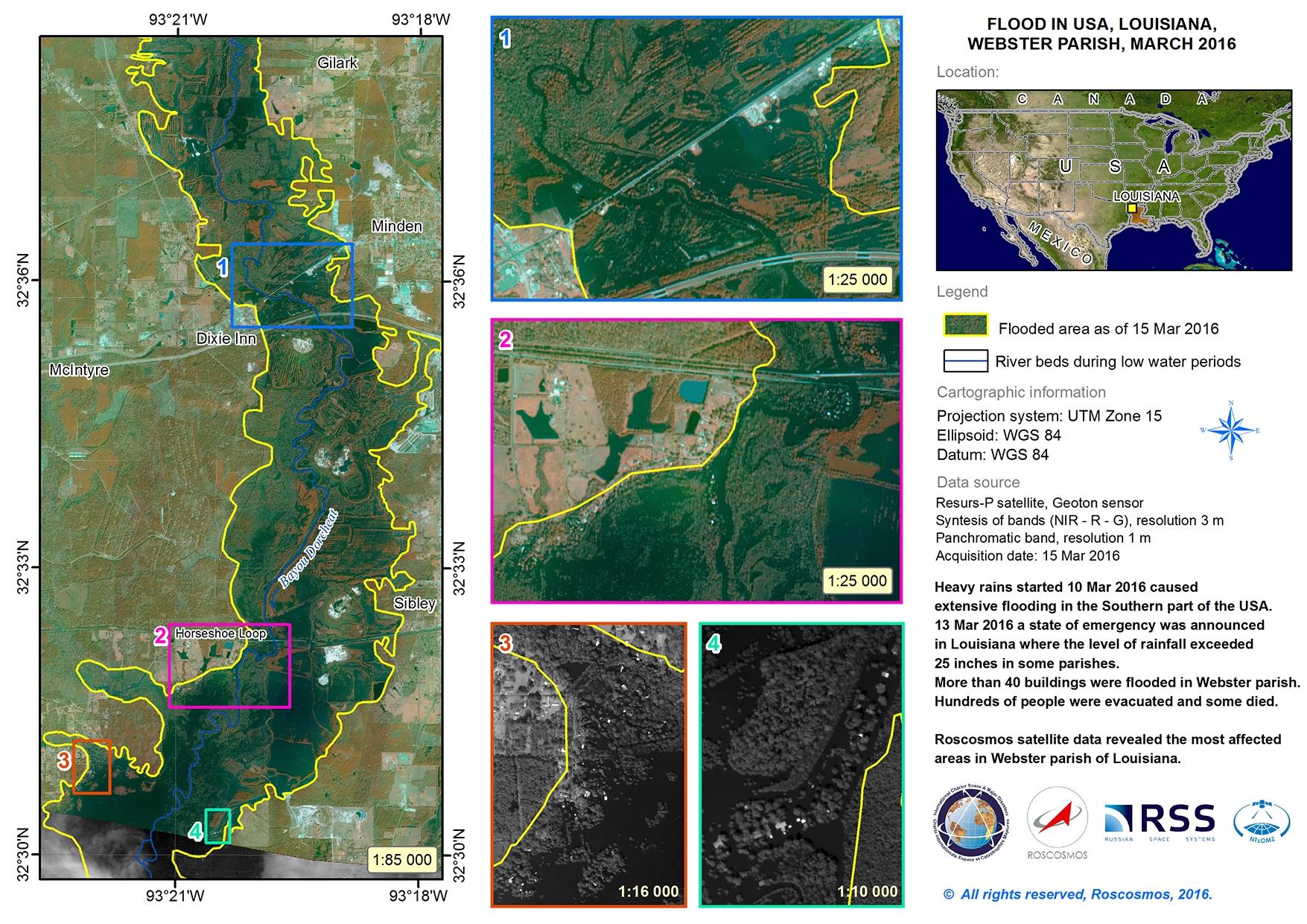
Flood in the United States
Days of heavy rainfall in the southern United States have caused record levels of flooding, stretching from Tennessee to Texas.
Thousands of people have been affected by the disaster and the rain is expected to continue for several more days. It is the result of a slow-moving storm that is passing over the region, bringing heavy rain, wind and hail.
A major disaster has been declared in Louisiana where several people have been killed, and thousands of homes damaged.
Mississippi is under a state of emergency and has suffered damage to hundreds of homes. Approximately 300 people have been evacuated in the state.
In Texas, the town of Deweyville has been left isolated by the flooding. Water levels are so high that it is impossible to reach the town, and its 1200 residents, by anything other than boats or helicopters.
Eleven counties in Arkansas have also been declared disaster areas.
The rain has caused rivers in the affected states to rise to record levels. The Sabine, Bogue Falaya and Little Rivers have each broken records stretching back twenty or thirty years. There are concerns that parts of the Sabine River may reach water levels as high as 35 feet (10 m), breaking records set in 1884.
The flooding has damaged or destroyed parts of some roads in the area, as they have crumbled apart under the torrent of water. Relief workers and the National Guard have been striving to evacuate thousands of people, and authorities have urged people not to return to flooded areas until it is safe.
| Тип события: | Flood |
| Место события: | United States of America |
| Date of Charter Activation: | 11 March 2016 |
| Время активации Хартии: | 17:36:54 |
| TЧасовой пояс в районе активации Хартии: | UTC-06:00 |
| Запрос на активацию поступил от: | USGS on behalf of FEMA |
| Менеждер проекта от: | USGS |
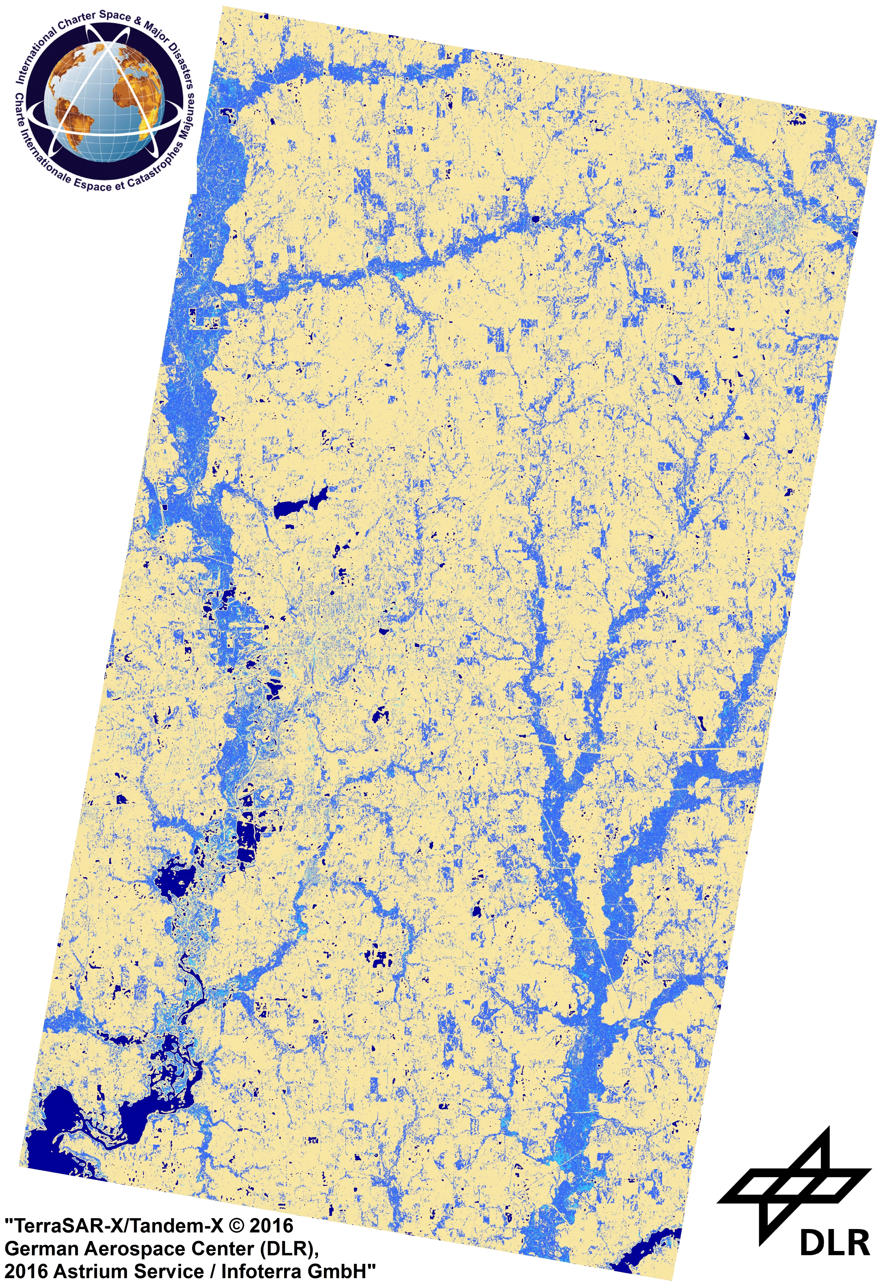
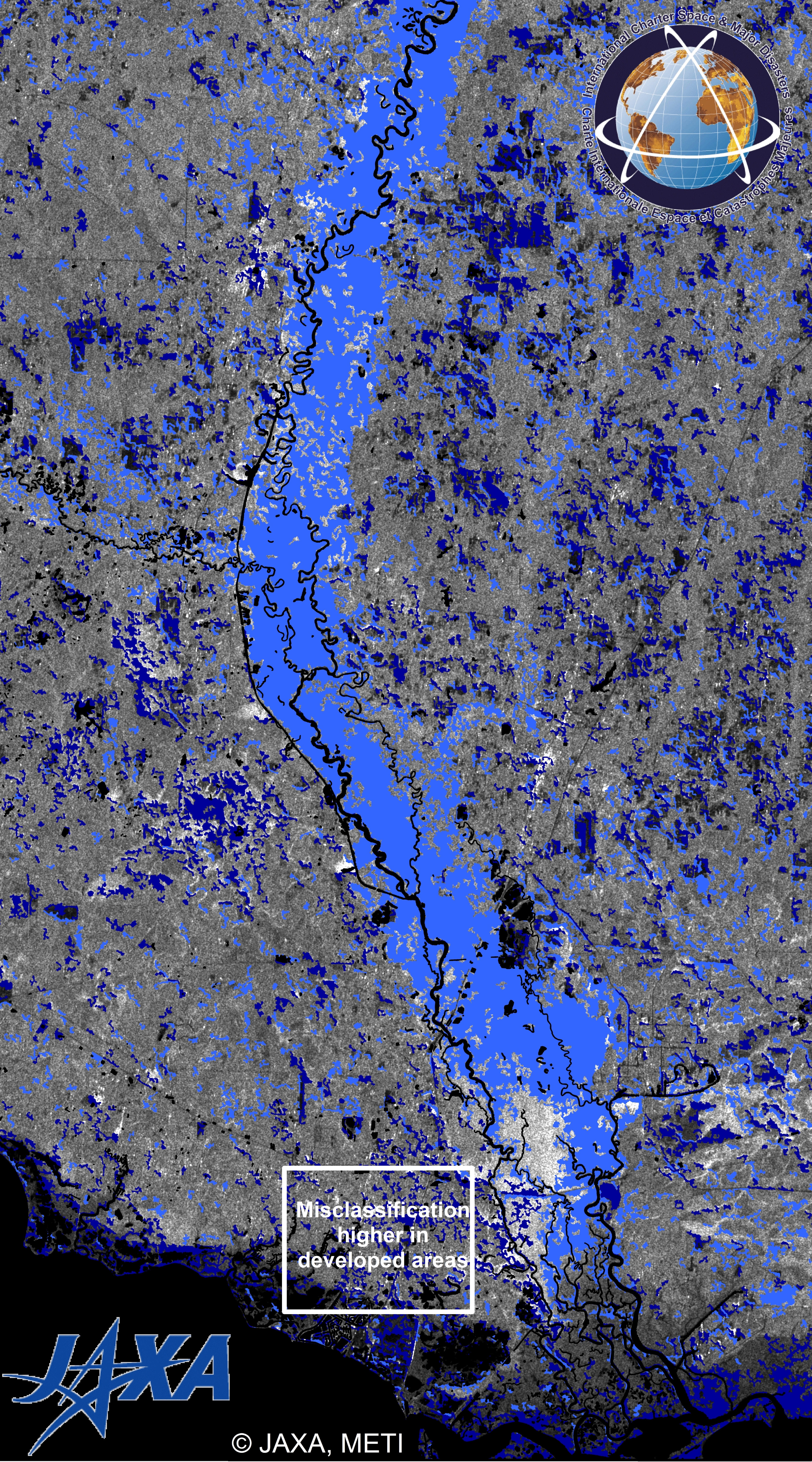
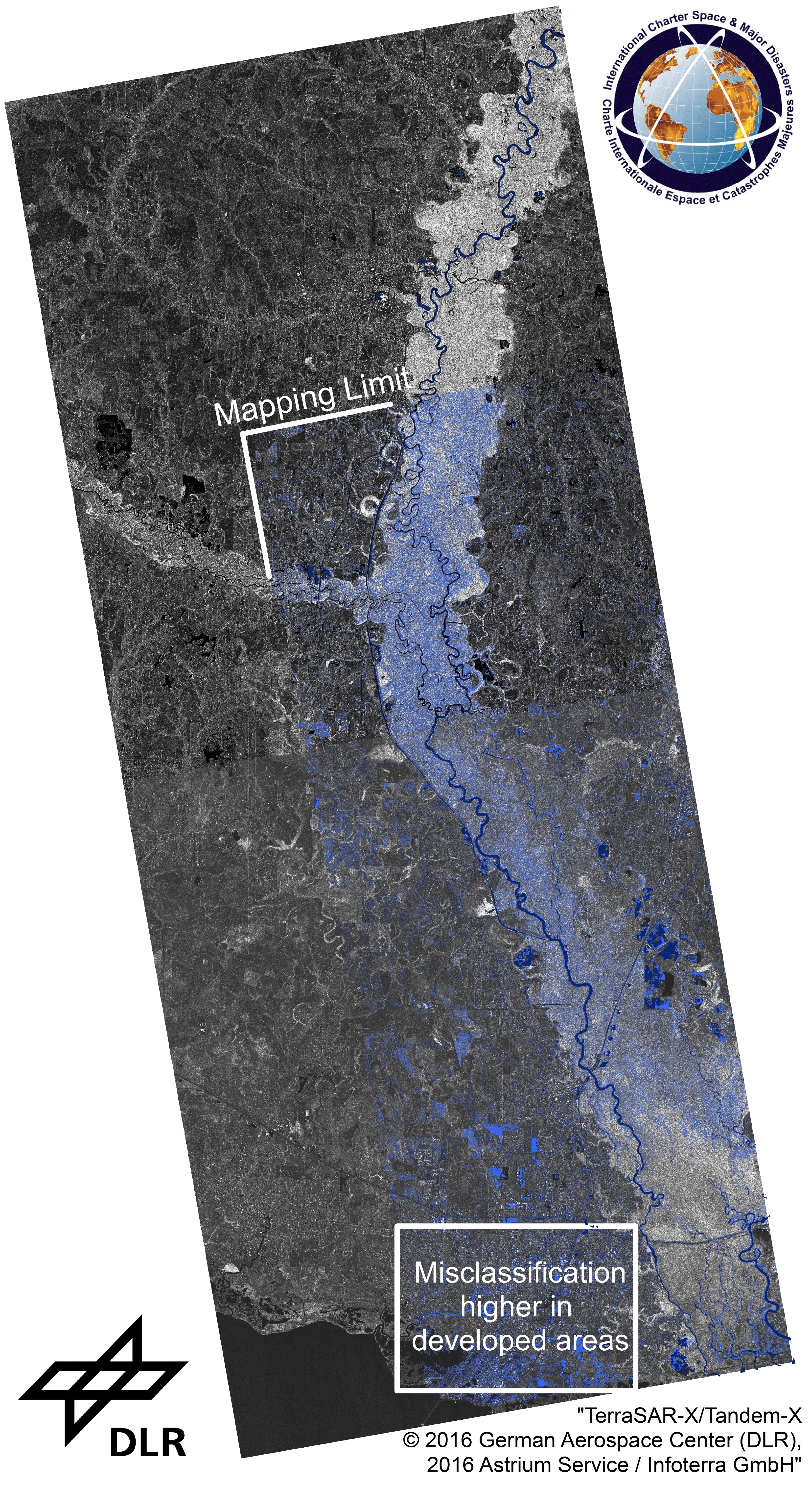
Products
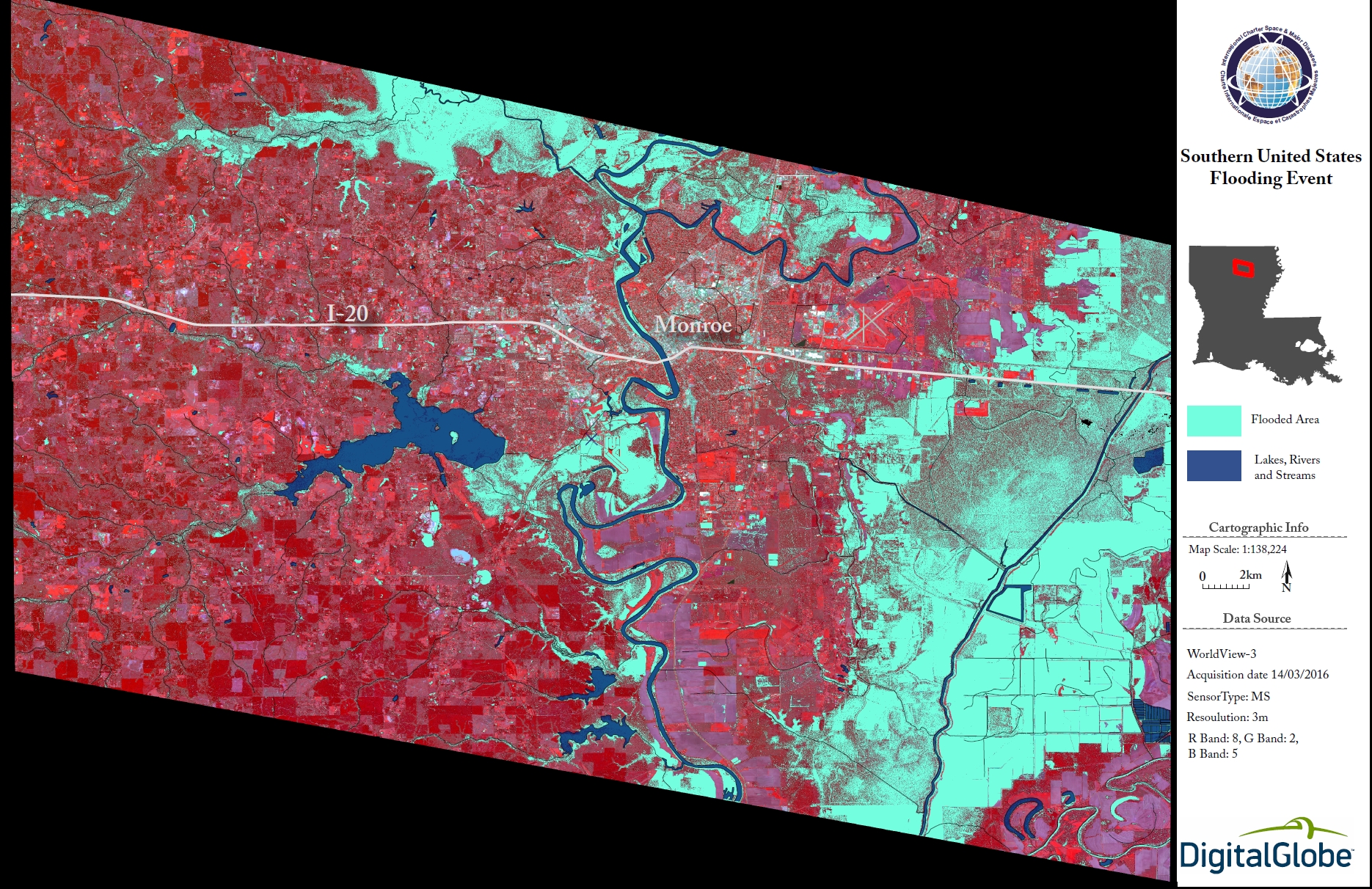
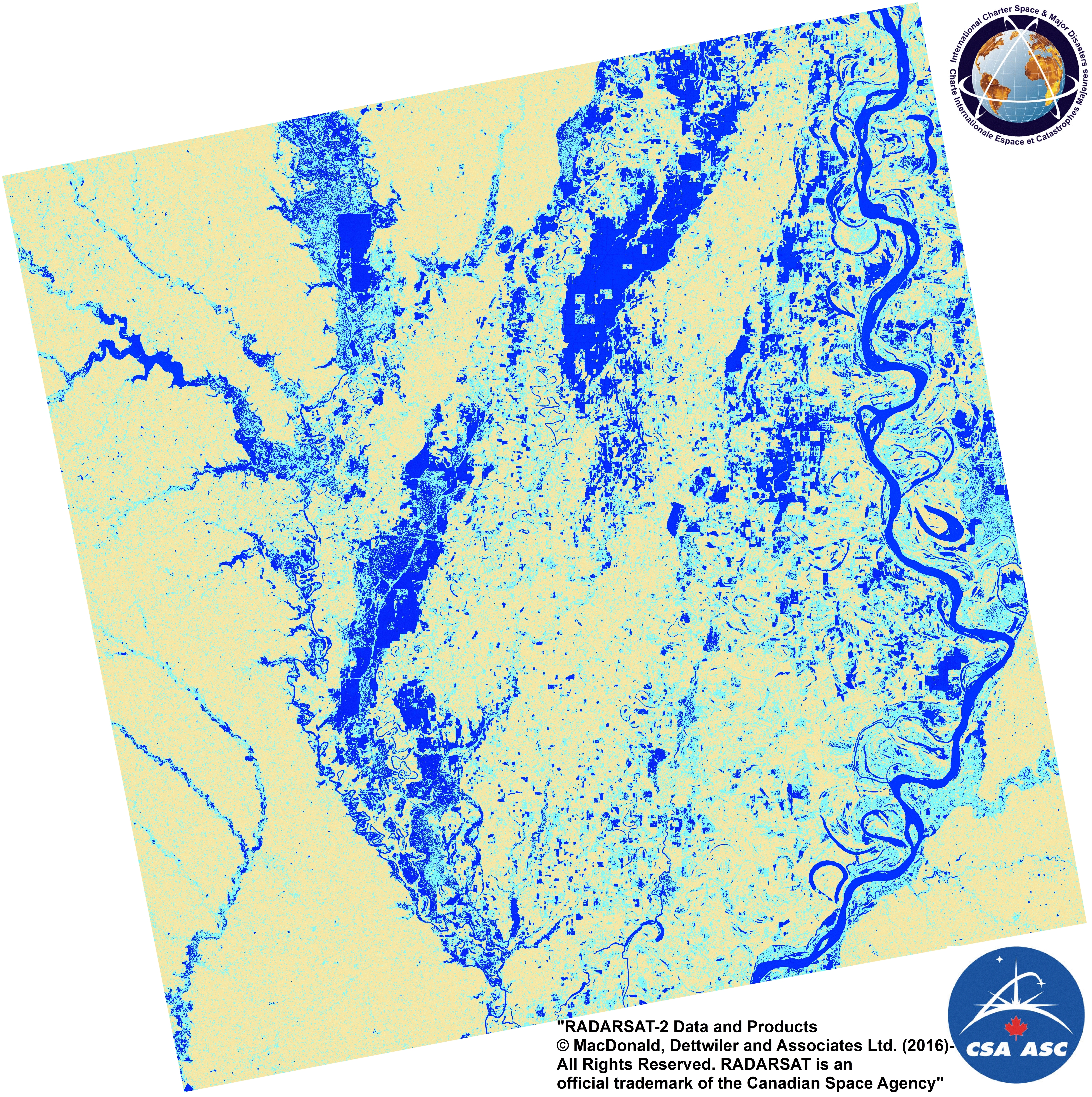
Surface flooding in Monroe, northeast Louisiana
Авторские права: RADARSAT-2 Data and Products © MacDonald, Dettwiler and Associates Ltd. (2016) - All Rights Reserved. RADARSAT is an official trademark of the Canadian Space Agency.
Map produced by USGS
Information about the Product
Получено: 19/03/2016
Источник: RADARSAT-2
 Вернуться к полному архиву активаций

