 English
 Spanish
 French
 Chinese
 Russian
 Portuguese
 最新宪章启动
Charter activations
马拉维洪水
持续暴雨已造成马拉维2015年1月期间的洪灾。
据估计,灾难已造成75000人被迫离开家园,至少50个人死亡。
洪水已经对马拉维的15个地区造成了影响。马拉维总统宣布国家处于受灾状态,并呼吁其他国家的援助,指出洪水的规模超过了他们可以单独控制的范围。
灾难还对马拉维的作物造成了重大损失,上涨的洪水破坏了田地。马拉维依赖于他们的农业,这场灾难后,他们担心国家未来的粮食供给。
由于洪水已经切断了进入的公路和铁路线,所以一些社区也因洪水被孤立起来。
| 事件类型: | 洪水 |
| 事件地点: | 马拉维 |
| 启动宪章的日期: | 2015年1月8日 |
| 宪章启动时间: | 16:26:00 |
| 宪章启动时区: | UTC+01:00 |
| 宪章要求者: | 马拉维灾害管理局 |
| 项目经理: | 德国宇航局 |
Products
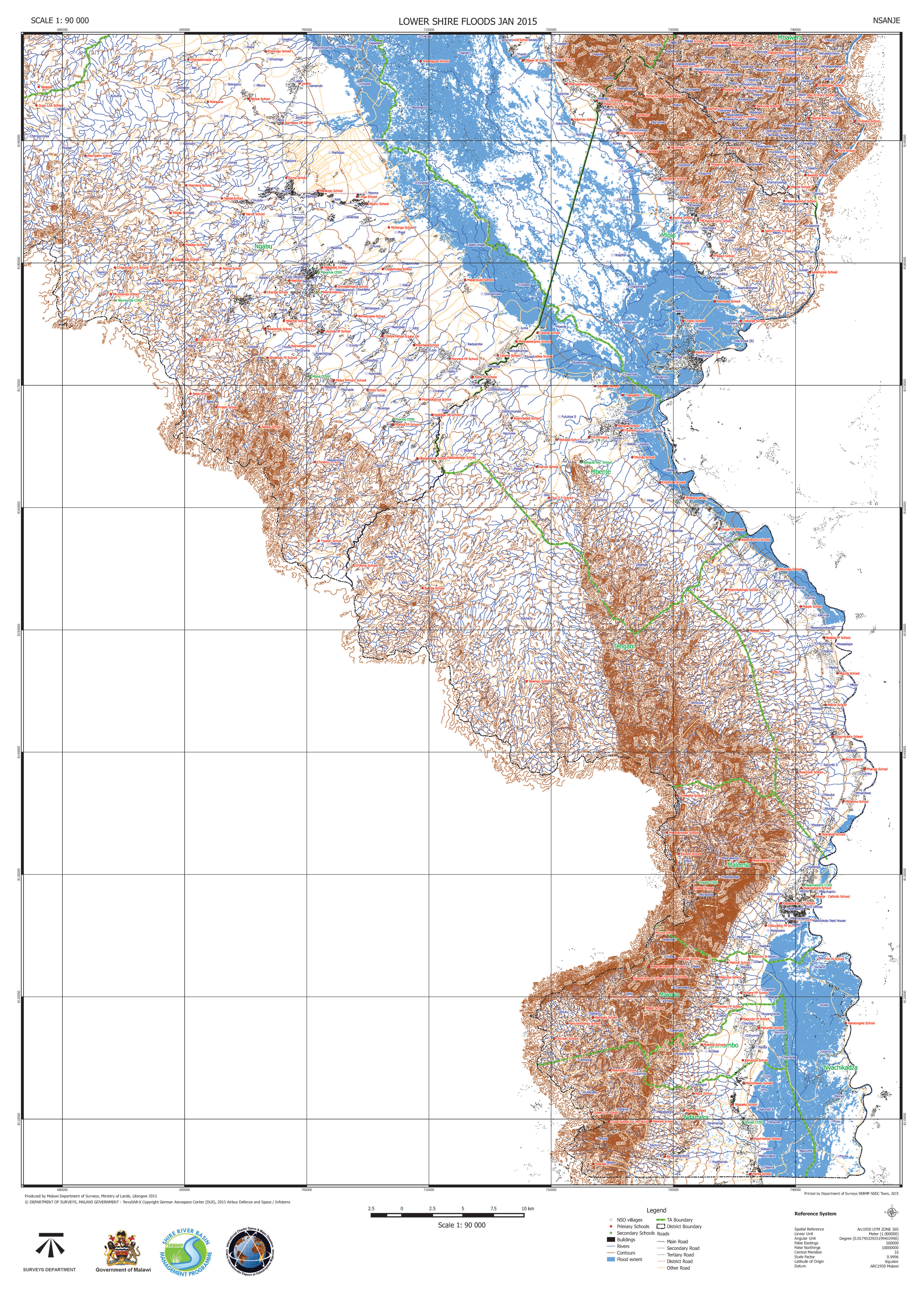
Lower Shire Floods in Nsanje, Malawi
版权: RADARSAT-2 Data and Products © MacDonald, Dettwiler and Associates Ltd. (2015) - All Rights Reserved. RADARSAT is an official trademark of the Canadian Space Agency.
Map produced by Malawi Department of Surveys, Ministry of Lands
Information about the Product
已获得: 13/01/2015
源: RADARSAT-2

Lower Shire Floods in Chikwawa, Malawi
版权: RADARSAT-2 Data and Products © MacDonald, Dettwiler and Associates Ltd. (2015) - All Rights Reserved. RADARSAT is an official trademark of the Canadian Space Agency.
Map produced by Malawi Department of Surveys, Ministry of Lands
Information about the Product
已获得: 13/01/2015
源: RADARSAT-2
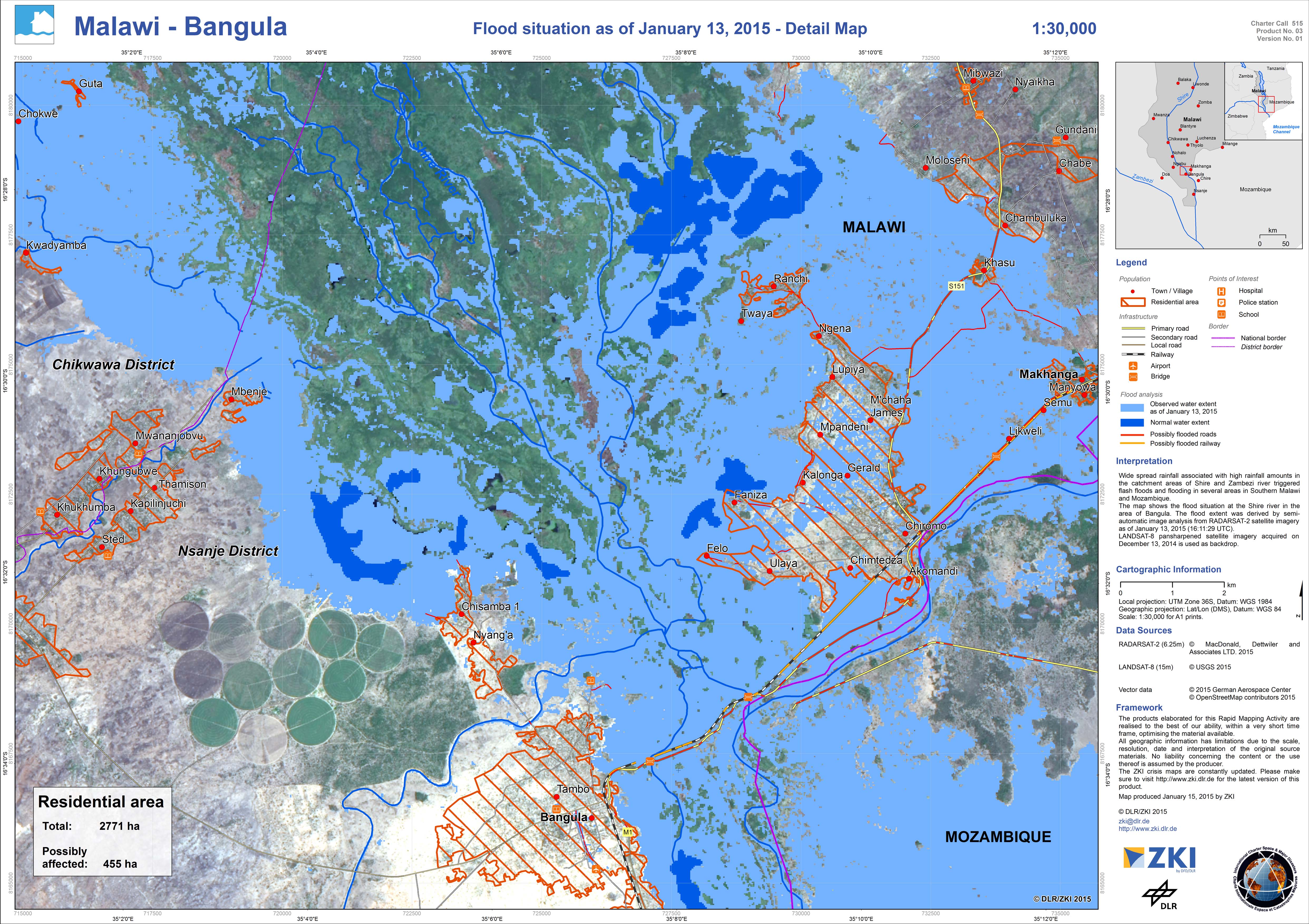
Detail map - Flood situation in Bangula, Malawi
版权: RADARSAT-2 Data and Products © MacDonald, Dettwiler and Associates Ltd. (2015) - All Rights Reserved. RADARSAT is an official trademark of the Canadian Space Agency.
Landsat 8 data and products © USGS (2015) - All rights reserved
Map produced by DLR/ZKI
Information about the Product
已获得: RADARSAT-2: 13/01/2015
Landsat 8: 13/12/2014
源: RADARSAT-2 / Landsat 8
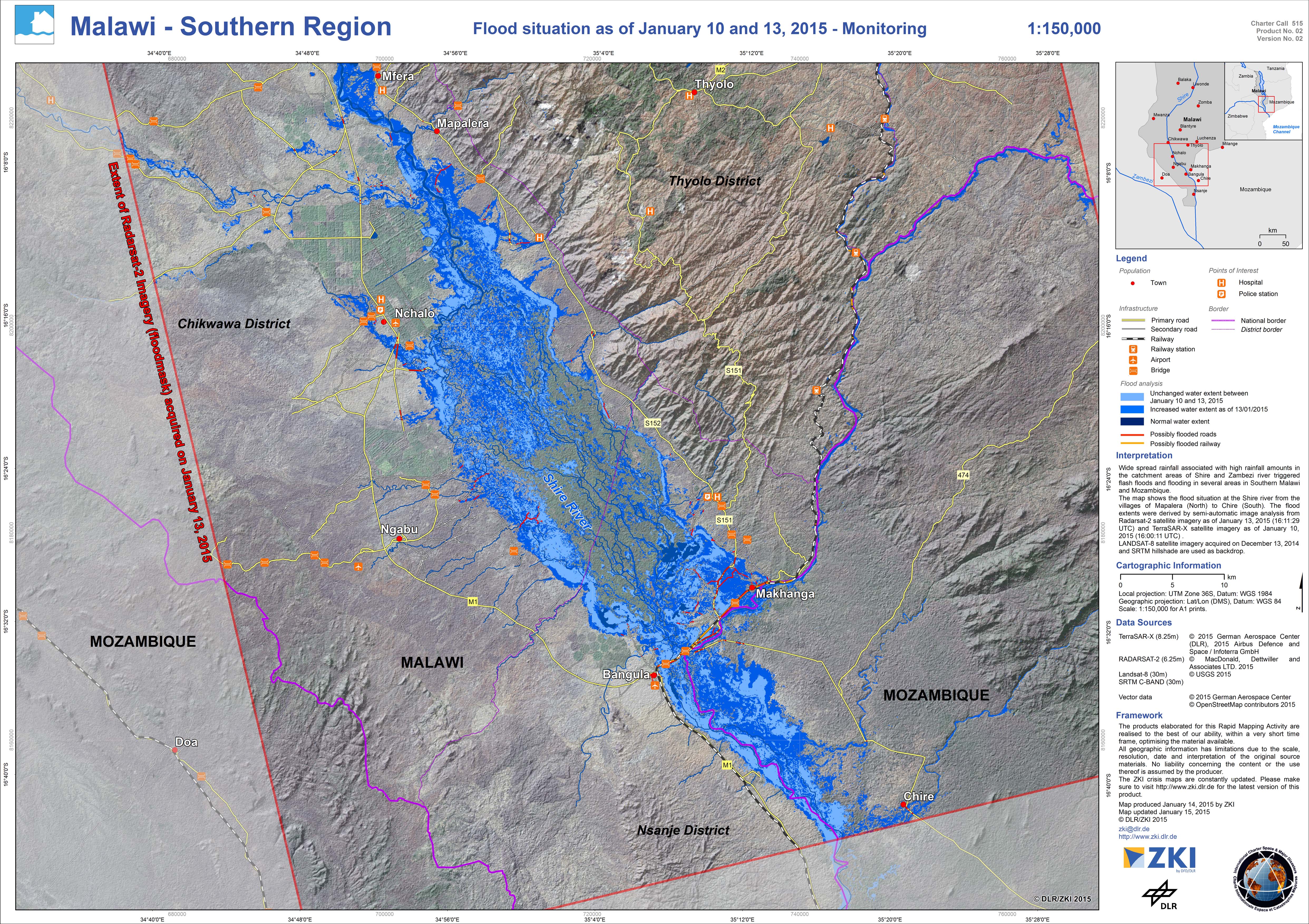
Monitoring map - Flood situation in southern region of Malawi
版权: RADARSAT-2 Data and Products © MacDonald, Dettwiler and Associates Ltd. (2015) - All Rights Reserved. RADARSAT is an official trademark of the Canadian Space Agency.
TerraSAR-X © German Aerospace Center (DLR), 2015 Airbus Defence and Space / Infoterra GmbH
Landsat 8 data and products © USGS (2015) - All rights reserved
Map produced by DLR/ZKI
Information about the Product
已获得: RADARSAT-2: 13/01/2015
TerraSAR-X: 10/01/2015
Landsat 8: 13/12/2014
源: RADARSAT-2 / TerraSAR-X / Landsat 8
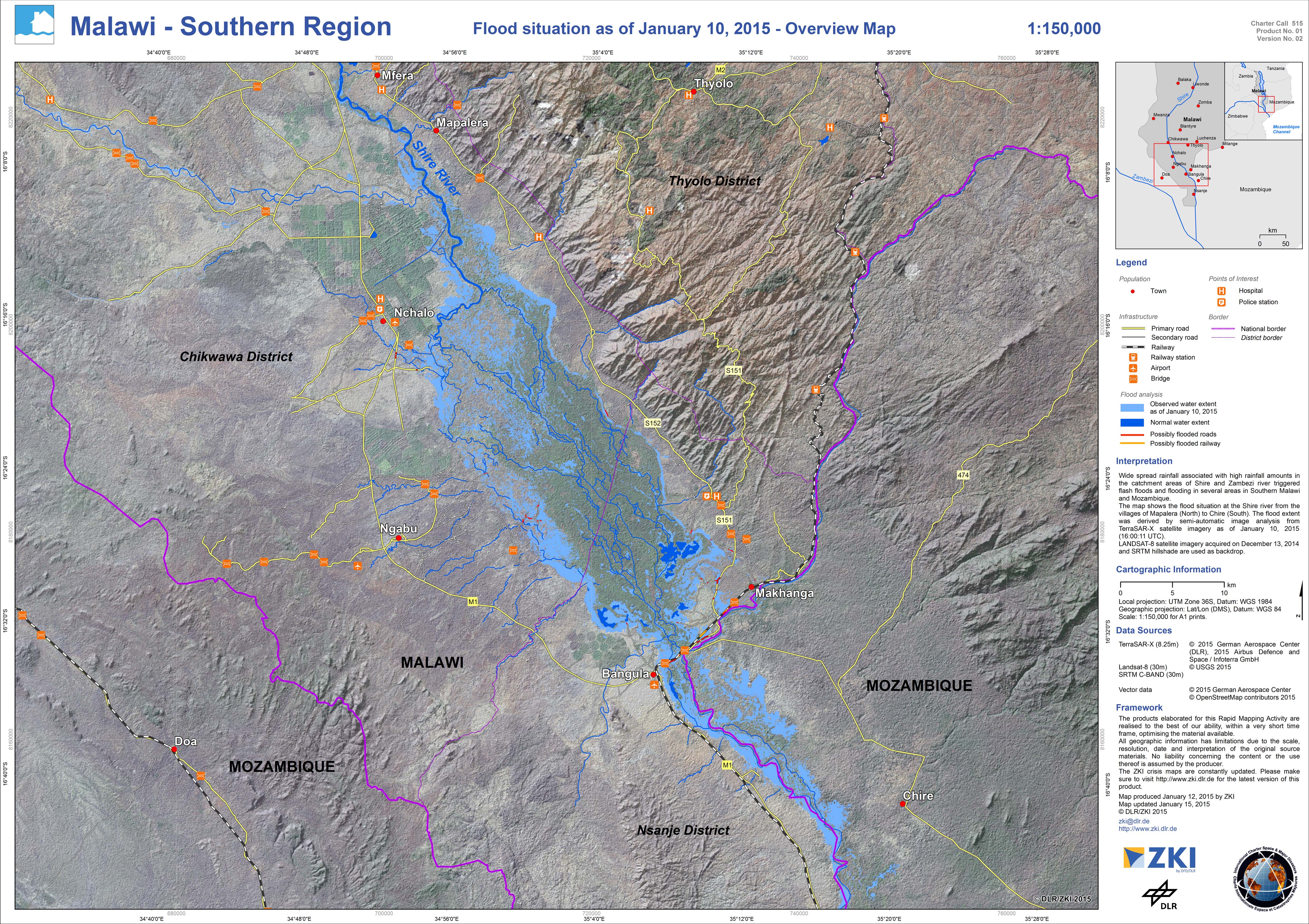
Overview map - Flood situation in southern region of Malawi
版权: TerraSAR-X © German Aerospace Center (DLR), 2015 Airbus Defence and Space / Infoterra GmbH
Landsat 8 data and products © USGS (2015) - All rights reserved
Map produced by DLR/ZKI
Information about the Product
已获得: TerraSAR-X: 10/01/2015
Landsat 8: 13/12/2014
源: TerraSAR-X / Landsat 8
 返回完整的响应档案

