 English
 Spanish
 French
 Chinese
 Russian
 Portuguese
 Последняя Активация
Charter activations
Flood in Malawi
Ongoing torrential weather has been causing flooding in Malawi throughout January 2015.
It's estimated that 75,000 people have been forced from their homes by the disaster, and at least fifty have died.
The flooding has impacted half of Malawi; 15 of the nation's 28 districts. Malawi's president has declared a national state of disaster and appealed for aid from other countries, stating that the scale of the flooding was more than they could manage alone.
The disaster has also taken a toll on Malawi's crops, damaging or destroying fields with the rising flood waters. Malawi is dependent on their agriculture and there are concerns for the nation's future food supply following this disaster.
Some communities have also been left isolated by the flooding, as the flood waters have cut off access to roads and railway lines.
| Тип события: | Floods |
| Место события: | Malawi |
| Date of Charter Activation: | 08 January 2015 |
| Время активации Хартии: | 16:26:00 |
| TЧасовой пояс в районе активации Хартии: | UTC+01:00 |
| Запрос на активацию поступил от: | Department of Disaster Management Affairs of Malawi |
| Менеждер проекта от: | DLR |
Products
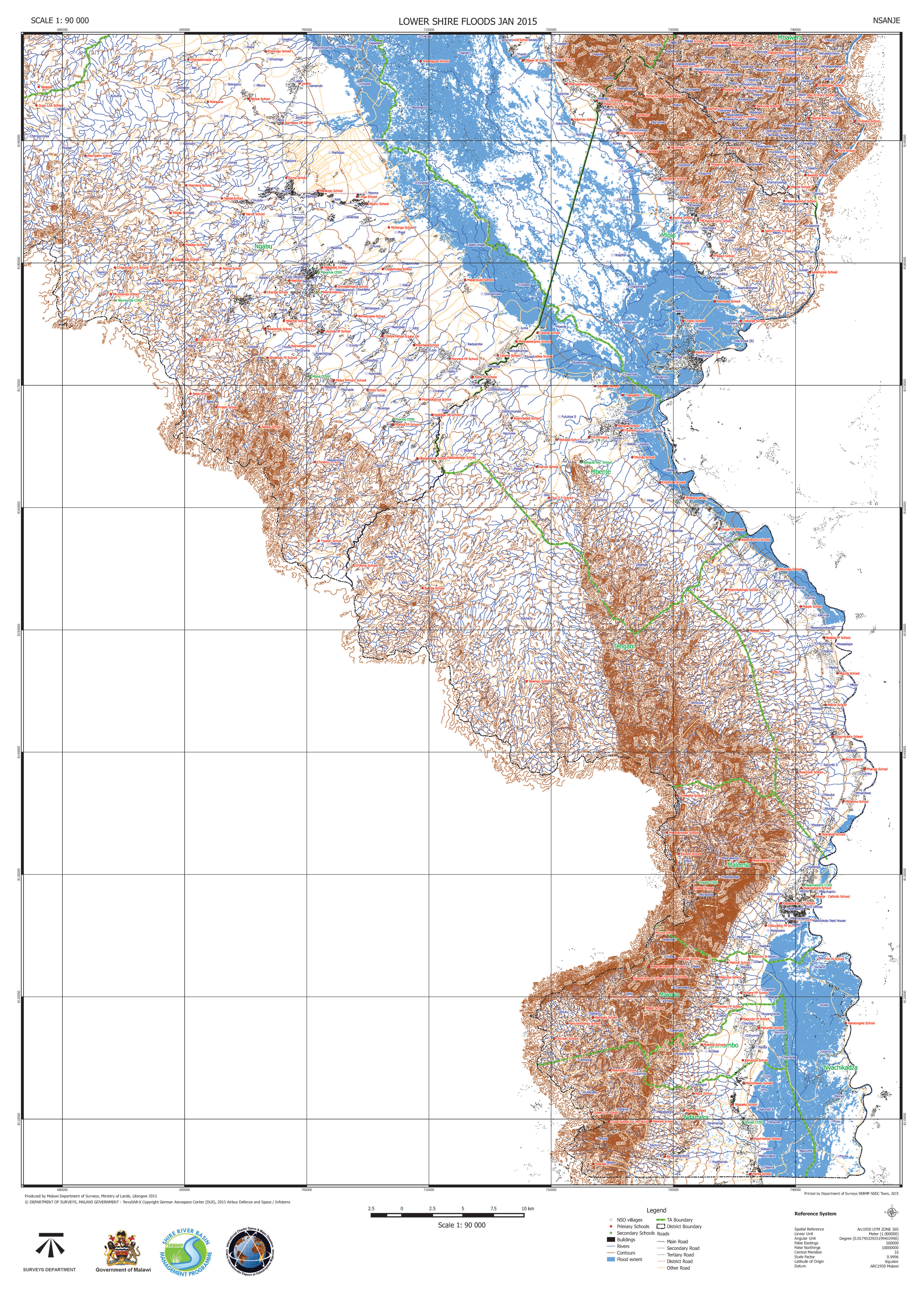
Lower Shire Floods in Nsanje, Malawi
Авторские права: RADARSAT-2 Data and Products © MacDonald, Dettwiler and Associates Ltd. (2015) - All Rights Reserved. RADARSAT is an official trademark of the Canadian Space Agency.
Map produced by Malawi Department of Surveys, Ministry of Lands
Information about the Product
Получено: 13/01/2015
Источник: RADARSAT-2

Lower Shire Floods in Chikwawa, Malawi
Авторские права: RADARSAT-2 Data and Products © MacDonald, Dettwiler and Associates Ltd. (2015) - All Rights Reserved. RADARSAT is an official trademark of the Canadian Space Agency.
Map produced by Malawi Department of Surveys, Ministry of Lands
Information about the Product
Получено: 13/01/2015
Источник: RADARSAT-2
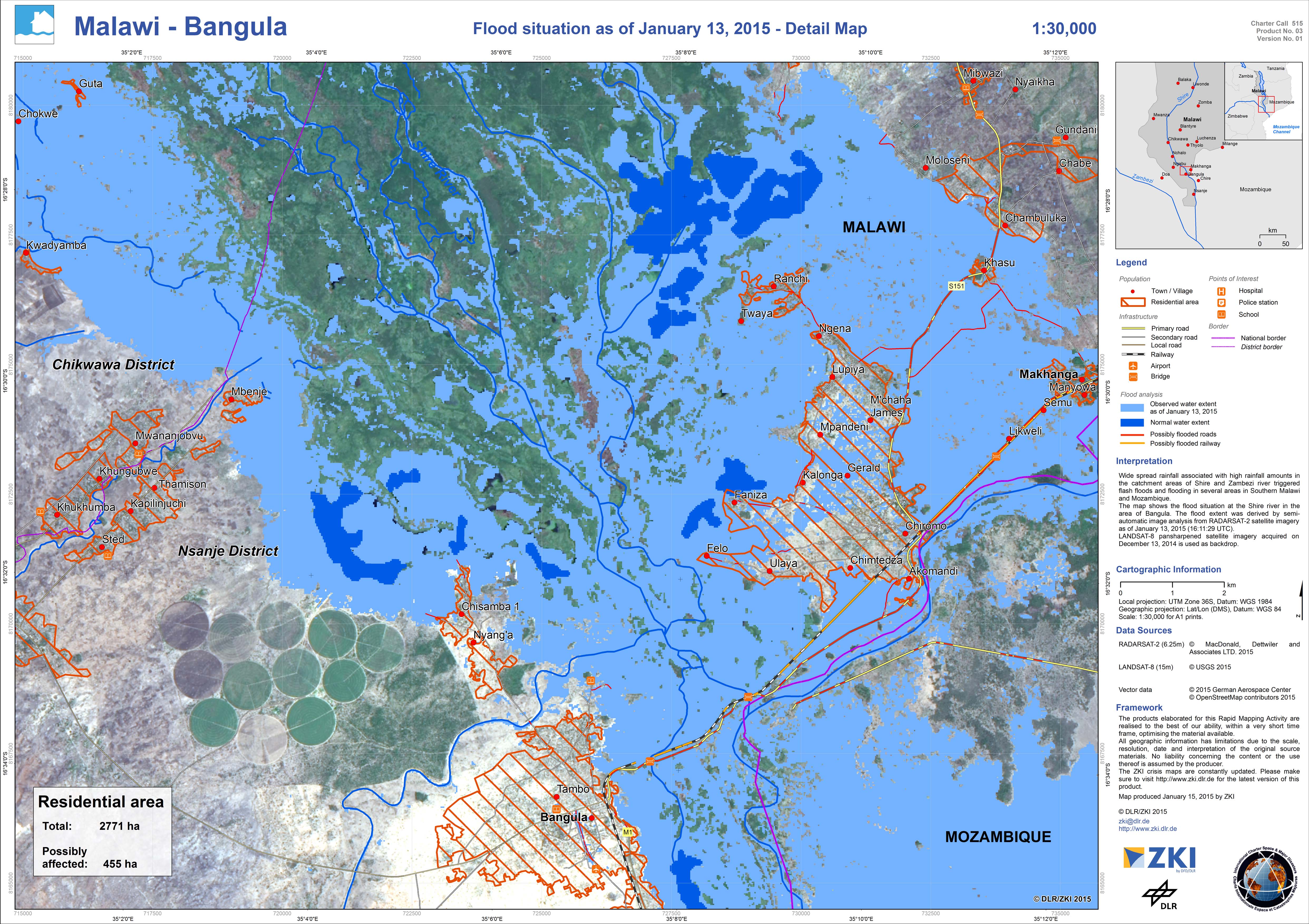
Detail map - Flood situation in Bangula, Malawi
Авторские права: RADARSAT-2 Data and Products © MacDonald, Dettwiler and Associates Ltd. (2015) - All Rights Reserved. RADARSAT is an official trademark of the Canadian Space Agency.
Landsat 8 data and products © USGS (2015) - All rights reserved
Map produced by DLR/ZKI
Information about the Product
Получено: RADARSAT-2: 13/01/2015
Landsat 8: 13/12/2014
Источник: RADARSAT-2 / Landsat 8
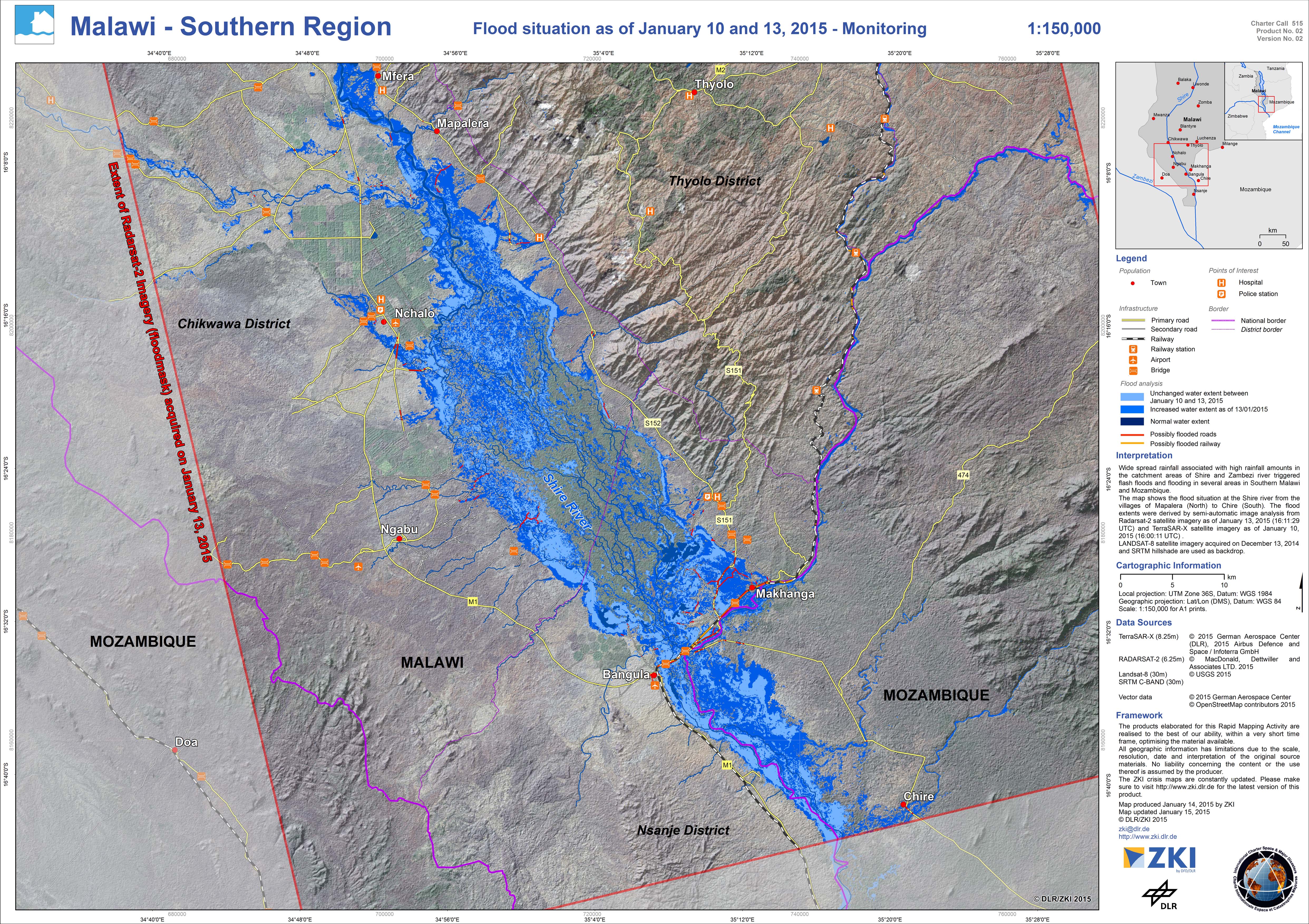
Monitoring map - Flood situation in southern region of Malawi
Авторские права: RADARSAT-2 Data and Products © MacDonald, Dettwiler and Associates Ltd. (2015) - All Rights Reserved. RADARSAT is an official trademark of the Canadian Space Agency.
TerraSAR-X © German Aerospace Center (DLR), 2015 Airbus Defence and Space / Infoterra GmbH
Landsat 8 data and products © USGS (2015) - All rights reserved
Map produced by DLR/ZKI
Information about the Product
Получено: RADARSAT-2: 13/01/2015
TerraSAR-X: 10/01/2015
Landsat 8: 13/12/2014
Источник: RADARSAT-2 / TerraSAR-X / Landsat 8
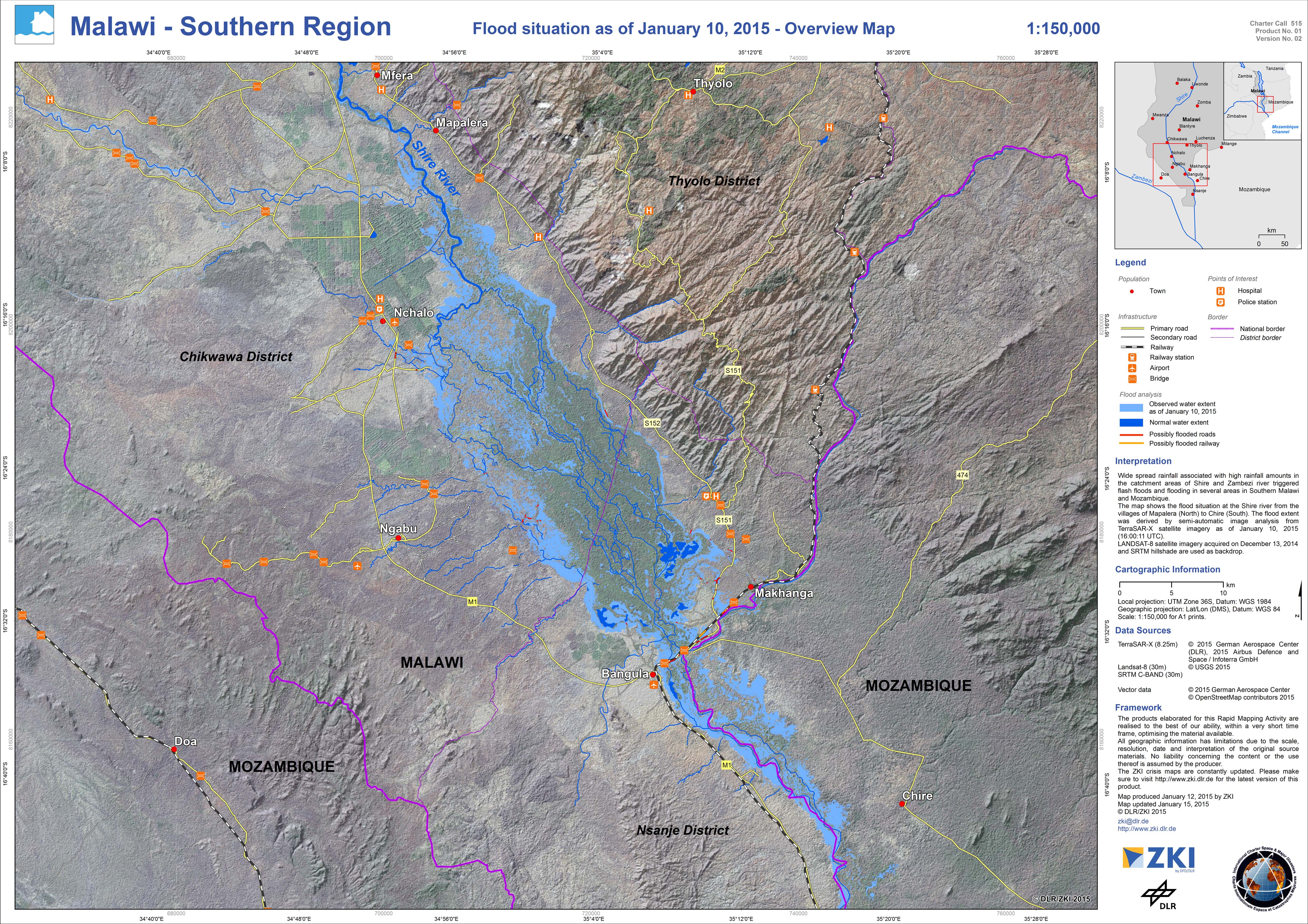
Overview map - Flood situation in southern region of Malawi
Авторские права: TerraSAR-X © German Aerospace Center (DLR), 2015 Airbus Defence and Space / Infoterra GmbH
Landsat 8 data and products © USGS (2015) - All rights reserved
Map produced by DLR/ZKI
Information about the Product
Получено: TerraSAR-X: 10/01/2015
Landsat 8: 13/12/2014
Источник: TerraSAR-X / Landsat 8
 Вернуться к полному архиву активаций

