 English
 Spanish
 French
 Chinese
 Russian
 Portuguese
 最新宪章启动
Charter activations
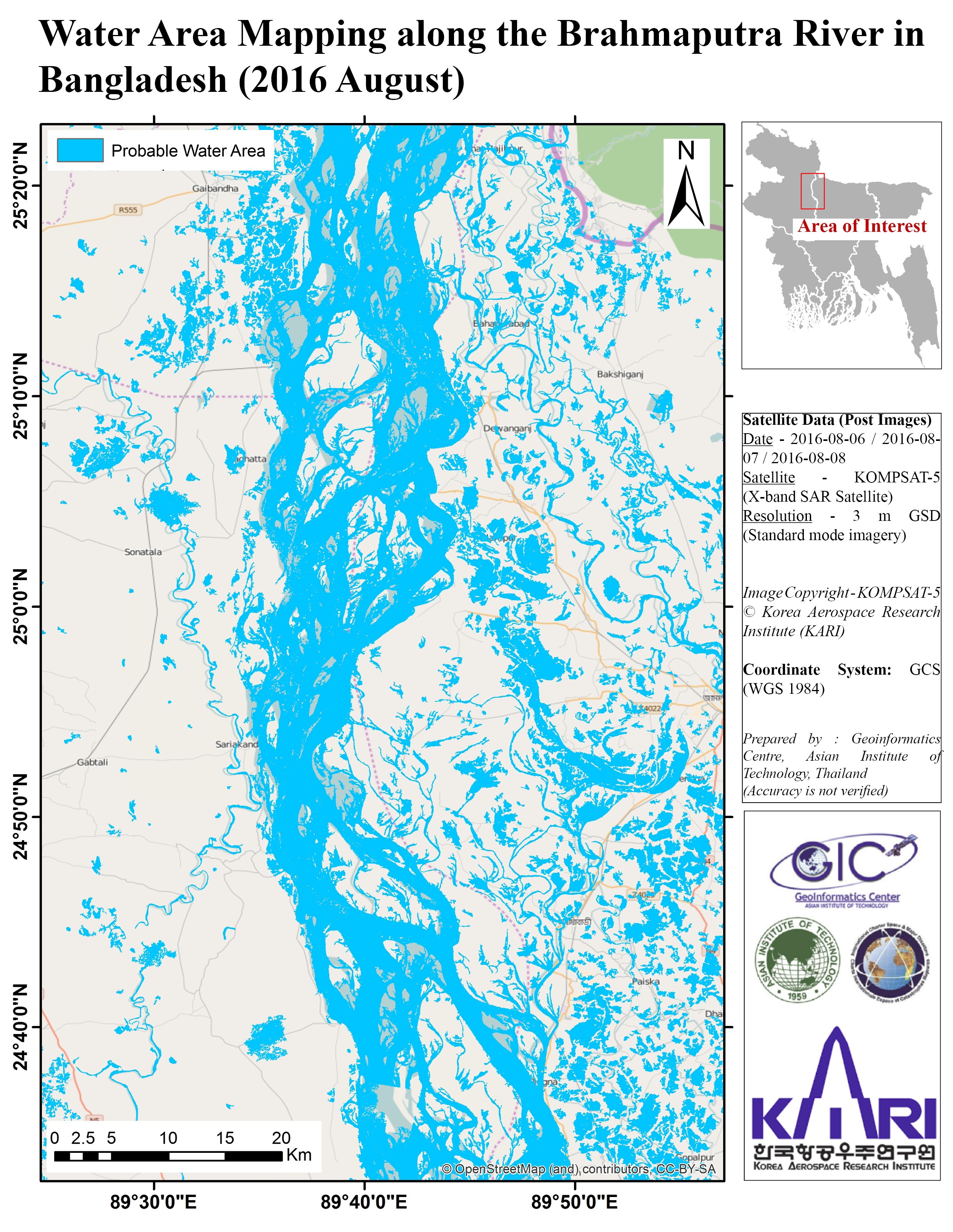
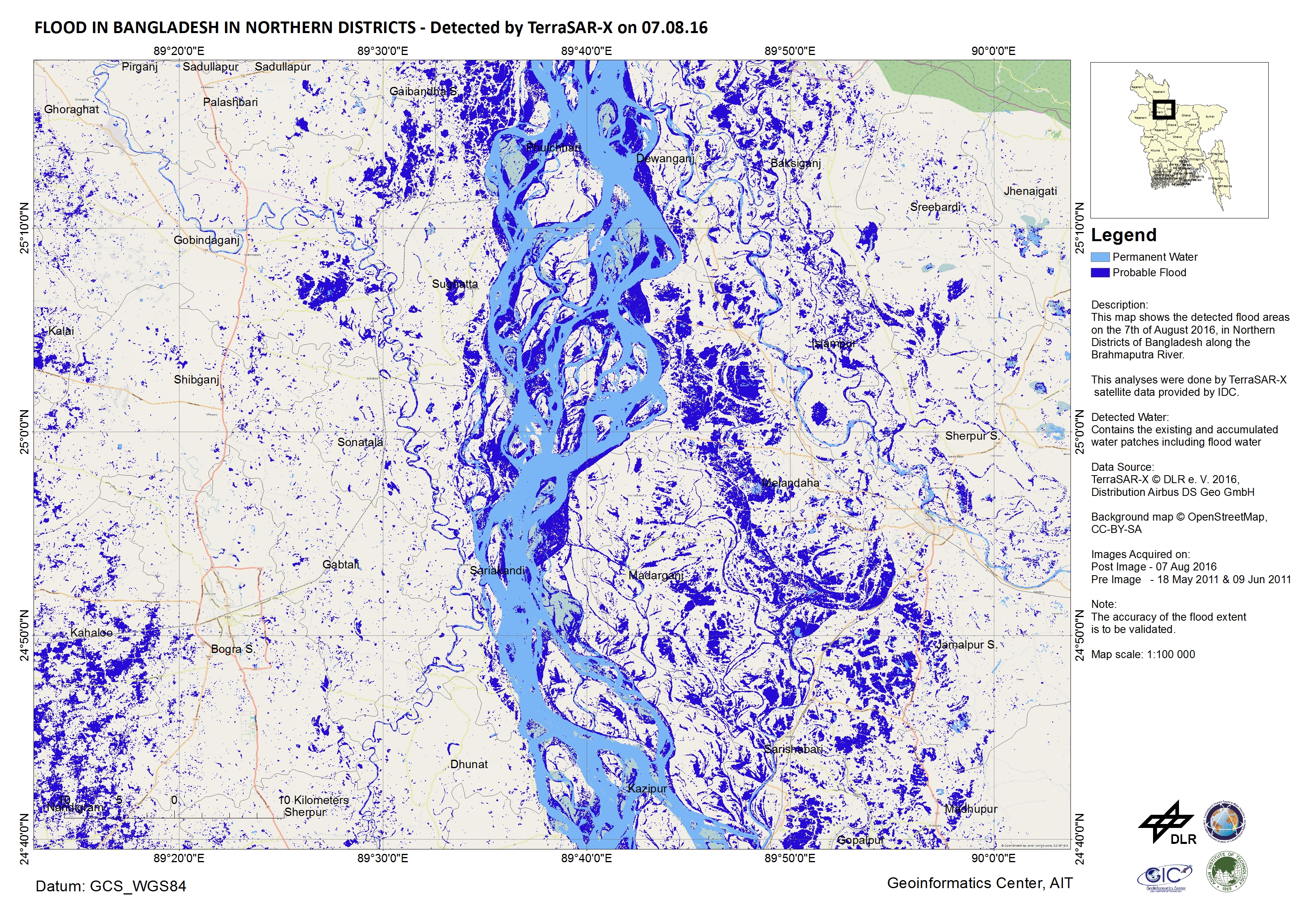
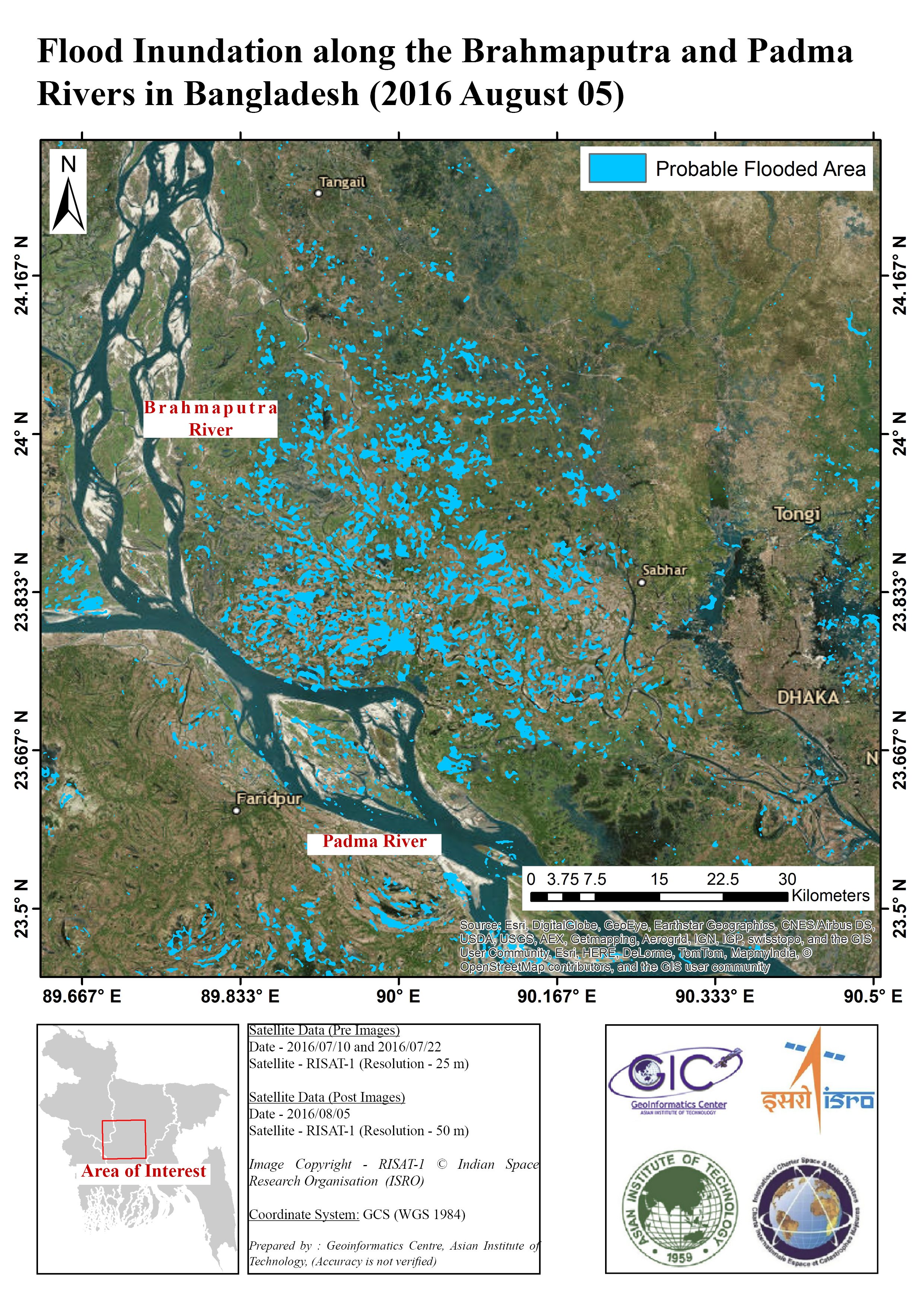
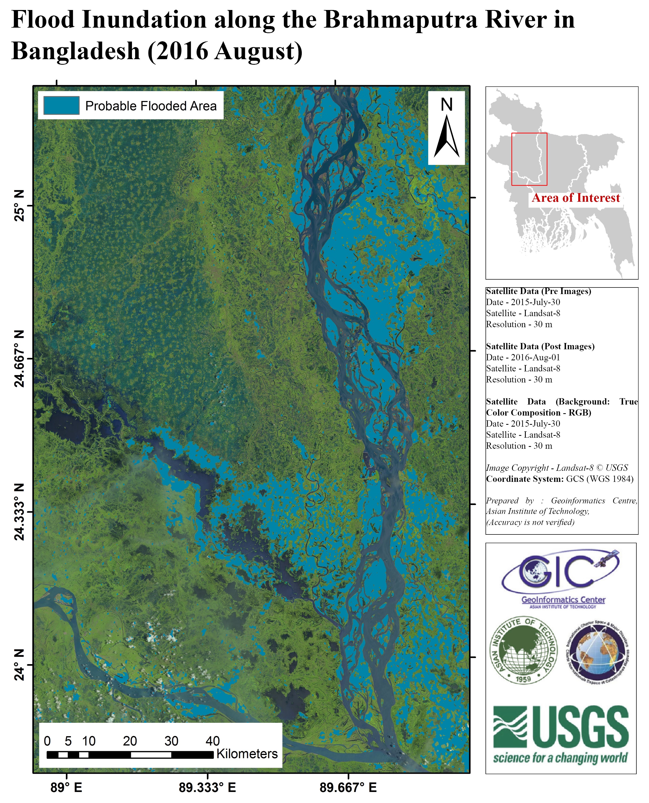
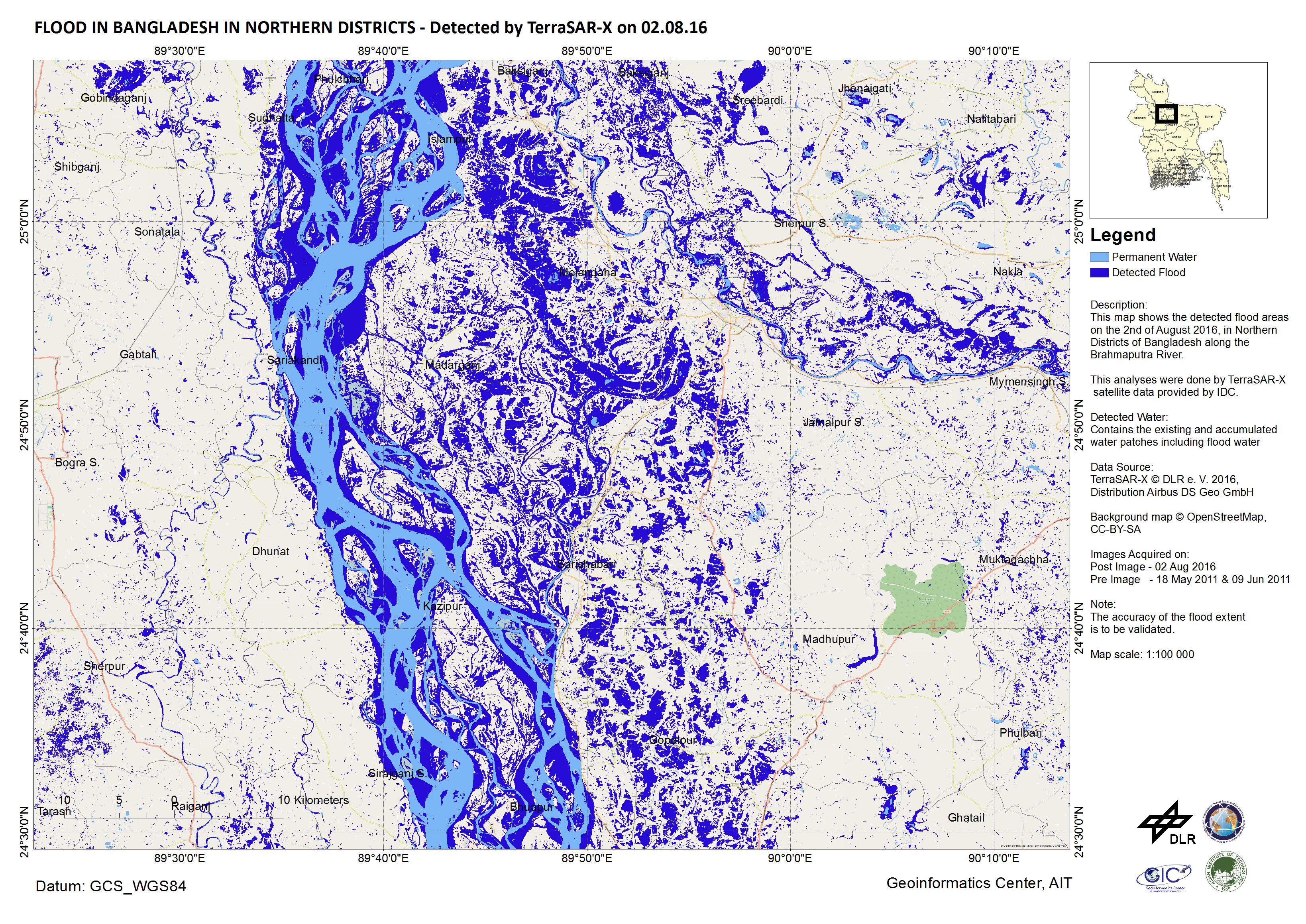
孟加拉国洪水
洪水袭击了孟加拉国,已造成十六人遇难。
估计有150万人受到洪灾的影响,该地区连续几天连降暴雨。
暴雨影响了该地区其他几个国家,造成了诸如穿越孟加拉国的布拉马普特拉河等河流泛滥。布拉马普特拉河、恒河(当地称为Padma)和梅克纳河是亚洲最大的三条河流,三条河流在孟加拉国相会,形成孟加拉三角洲,这意味着洪水正在流向孟加拉国下游。贾木纳河、苏尔玛河、库什亚拉河和达拉河都达到危险的高水位,淹没了该国的居民区。还有人担心恒河可能会上涨,造成拉杰巴里县、马尼格甘杰县、蒙希甘杰县和沙里亚德布尔县的洪灾。
主要河流的水位预计在接下来的几天内将开始下降,气象预报预计孟加拉国在此期间将不会有大雨。
尽管情况有可能得到改善,但估计有数千所房屋和数百个村庄已被淹没。数百人因洪水而孤立无援,在一些地方,道路和铁路线都被封锁。
政府已经为受灾的灾民建立了70个疏散避难所,但其他许多地区仍然面临着获得清洁水和食物的困难。洪水还对农作物造成了破坏,特别是阿曼水稻秧苗田受灾严重。
洪灾开始于该国东北部,现在正在向孟加拉国中南部地区蔓延,沿河流下坡流淌。
| 事件类型: | 洪水 |
| 事件地点: | 孟加拉国 |
| 启动宪章的日期: | 2016年8月1日 |
| 宪章启动时间: | 10:05:00 |
| 宪章启动时区: | UTC+09:00 |
| 宪章要求者: | 亚洲减灾中心(ADRC)代表孟加拉国空间研究与遥感组织(SPARRSO) |
| 项目经理: | 亚洲理工学院 (AIT) |
Products
 返回完整的响应档案

