 English
 Spanish
 French
 Chinese
 Russian
 Portuguese
 最新宪章启动
Charter activations
阿根廷洪水
美国南部五十年来最严重的洪水袭击了阿根廷,阿根廷25000人已被疏散。
洪水泛滥的原因是厄尔尼诺现象,它给巴拉圭,乌拉圭和巴拿马运河带来严重的暴雨和水位上涨。
巴拉圭、乌拉圭、阿根廷、巴西等地区受到洪水的广泛影响。
在阿根廷,有2人在洪水中丧生,其他受到洪水影响的人们目前还不清楚什么时候能回到他们的家里。据估计可能还需要几个月的时间,因为洪水几乎完全淹没了一些房屋,水污染了下水道。
城市中受灾最严重的地区是阿根廷的康科迪亚、戈雅和巴拿马,但其他许多地区也受到影响。
| 事件类型: | 洪水 |
| 事件地点: | 阿根廷 |
| 启动宪章的日期: | 2015年12月28日 |
| 宪章启动时间: | 15:00:00 |
| 宪章启动时区: | UTC+01:00 |
| 宪章要求者: | 国家民事保护中心 |
| 项目经理: | CONAE |
Products
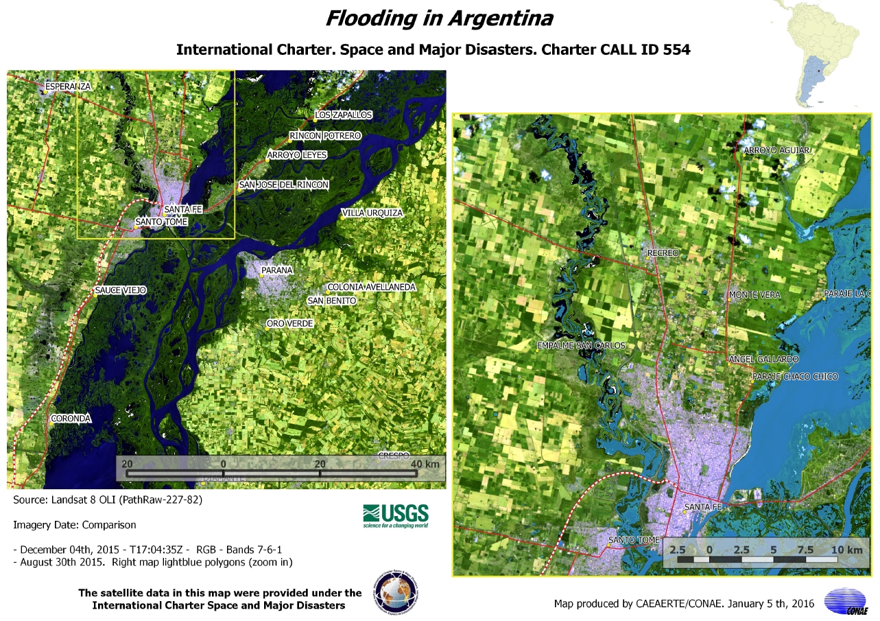
Flooding along the Paraná River at Santa Fe and Paraná in Argentina
版权: WorldView-2 and 3 © DigitalGlobe 2016
Landsat 8 data and products © USGS (2015) - All rights reserved
Map produced by CONAE
Information about the Product
已获得: WorldView-2 and 3: 02/02/2016
Landsat 8: 04/12/2015
源: WorldView-2 and 3 / Landsat 8
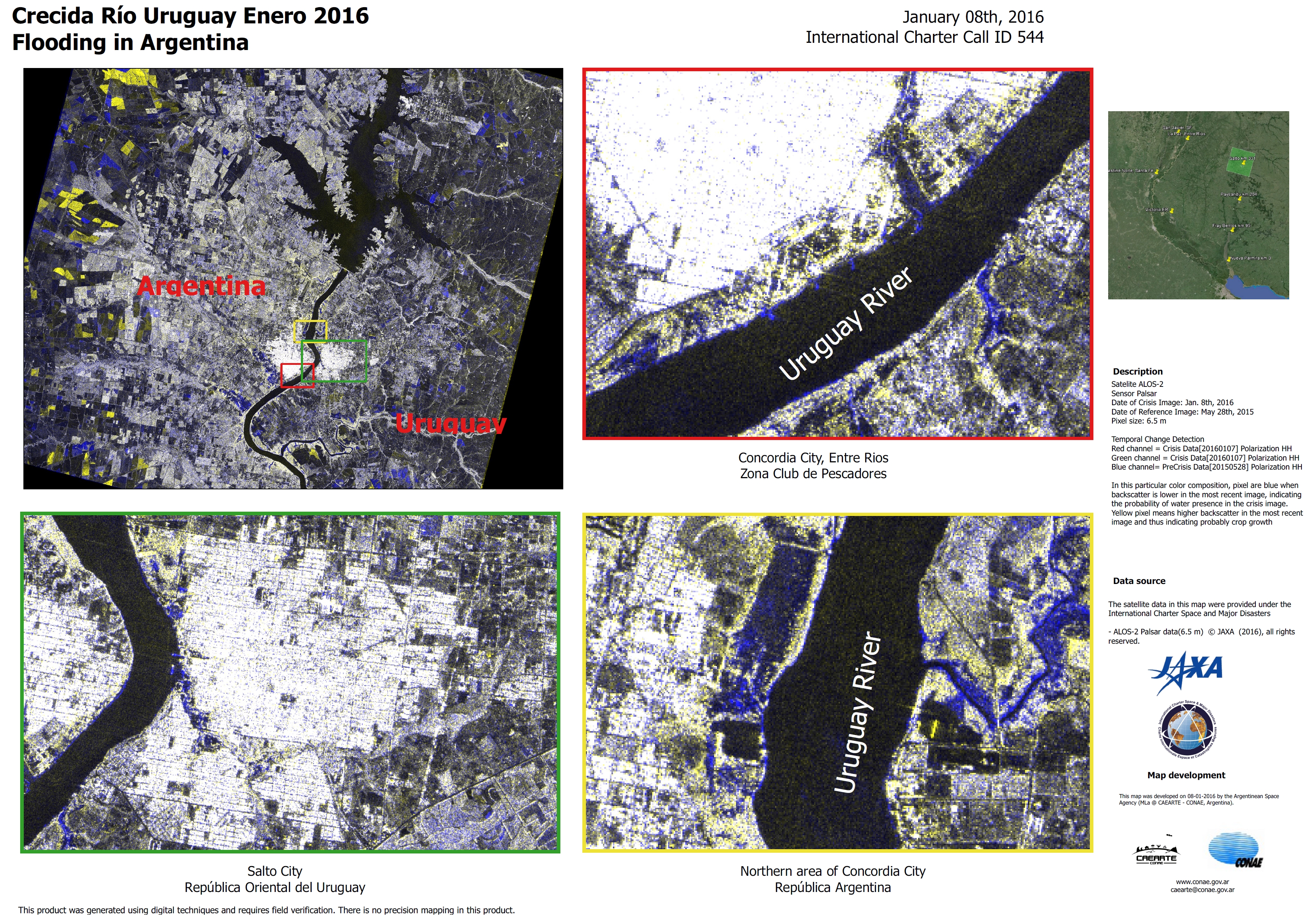
Flooding along the Paraguay River in Argentina
版权: RISAT-1 data and products © ISRO (2016) - All rights reserved
ResourceSat-2 data and products © ISRO (2016) - All rights reserved
Map produced by CONAE
Information about the Product
已获得: RISAT-1: 01/01/2016
ResourceSat-2: 08/01/2016
源: RISAT-1 / ResourceSat-2
Flooding at Paranà, Santa Fe and Colastine Norte, Argentina
版权: RADARSAT-2 Data and Products © MacDonald, Dettwiler and Associates Ltd. (2015) - All Rights Reserved. RADARSAT is an official trademark of the Canadian Space Agency.
Map produced by CONAE
Information about the Product
已获得: 31/12/2015
源: RADARSAT-2
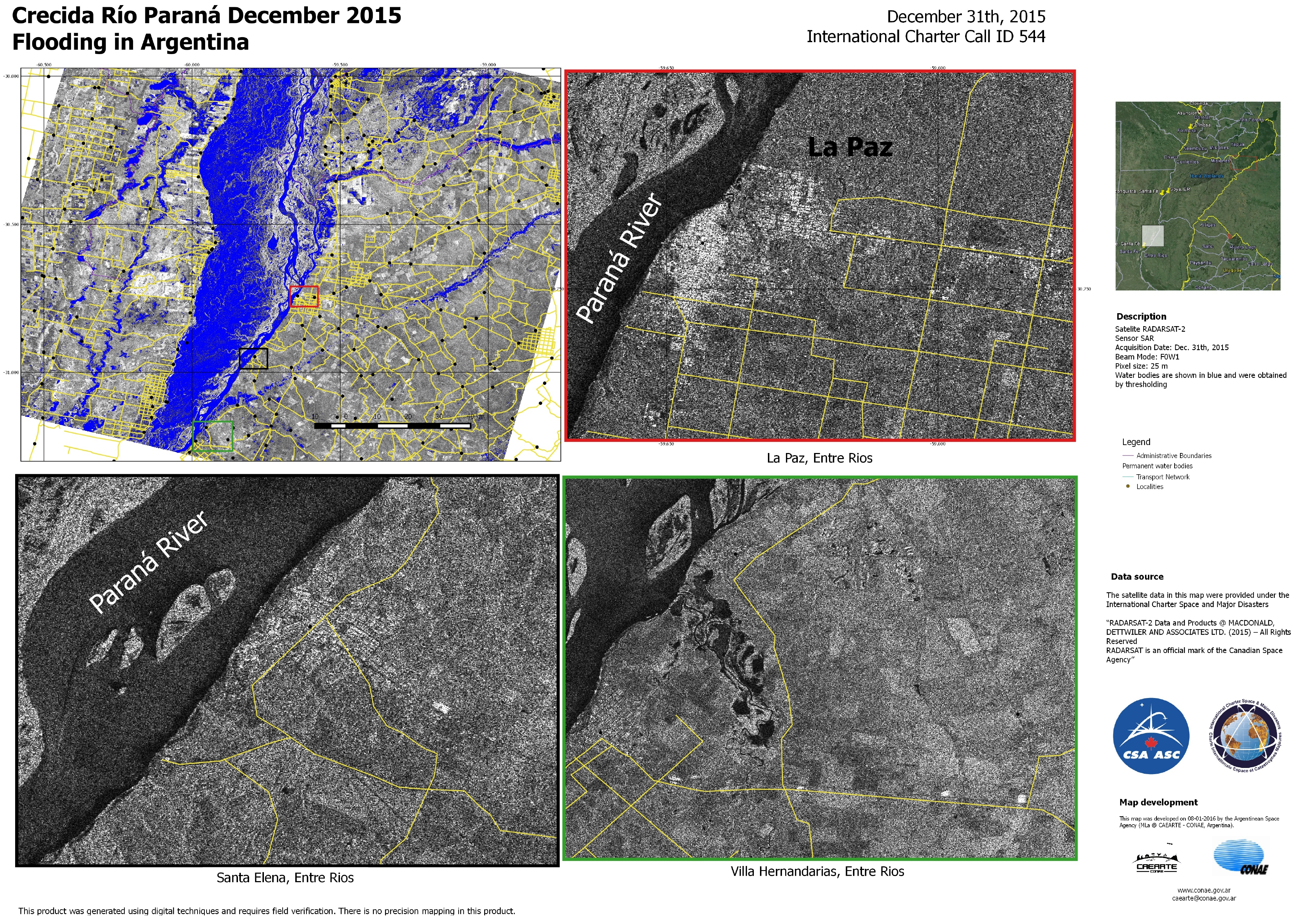
Flooding at La Paz, Santa Elena and Villa Hernandarias, Argentina
版权: RADARSAT-2 Data and Products © MacDonald, Dettwiler and Associates Ltd. (2015) - All Rights Reserved. RADARSAT is an official trademark of the Canadian Space Agency.
Map produced by CONAE
Information about the Product
已获得: 31/12/2015
源: RADARSAT-2
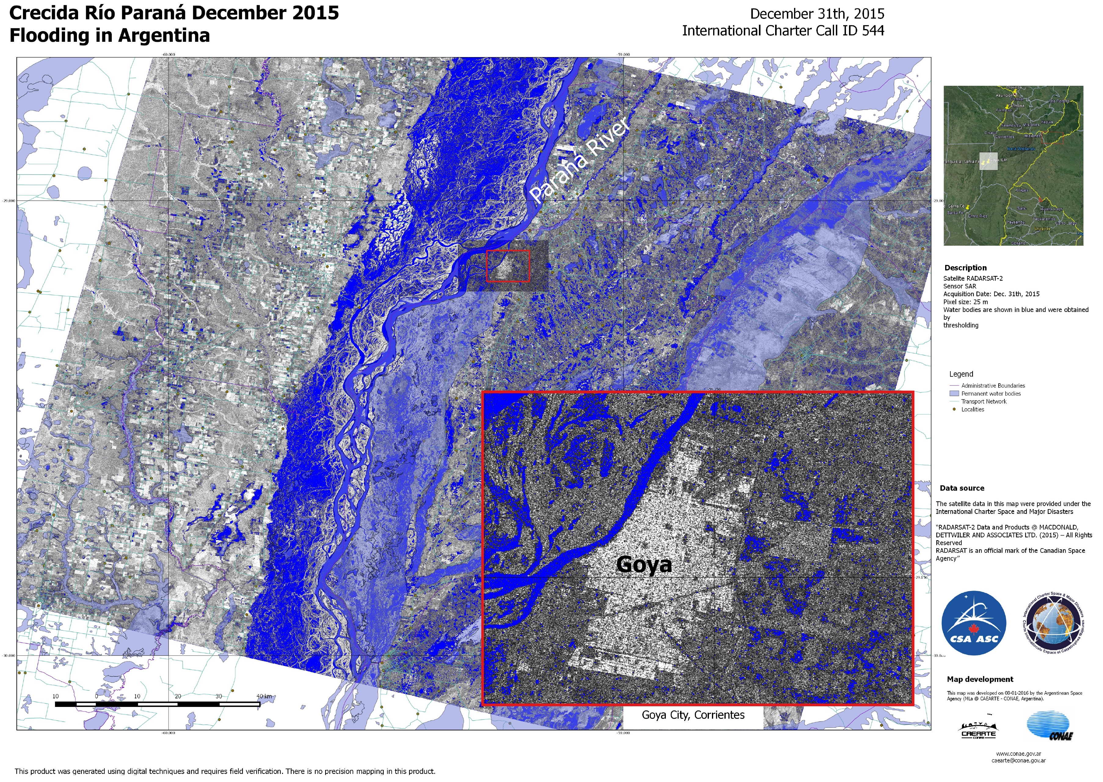
Flooding along the Paranà River at Goya in Argentina
版权: RADARSAT-2 Data and Products © MacDonald, Dettwiler and Associates Ltd. (2015) - All Rights Reserved. RADARSAT is an official trademark of the Canadian Space Agency.
Map produced by CONAE
Information about the Product
已获得: 31/12/2015
源: RADARSAT-2
Flooding at the city of Santa Fe in Argentina
版权: Pleiades © CNES 2016 - Distribution: Airbus Defence and Space, all rights reserved
Landsat 8 data and products © USGS (2015) - All rights reserved
Map produced by CONAE
Information about the Product
已获得: Pleiades: 01/01/2016
Landsat 8: 31/08/2015
源: Pleiades / Landsat 8

 返回完整的响应档案

