 English
 Spanish
 French
 Chinese
 Russian
 Portuguese
 Последняя Активация
Charter activations
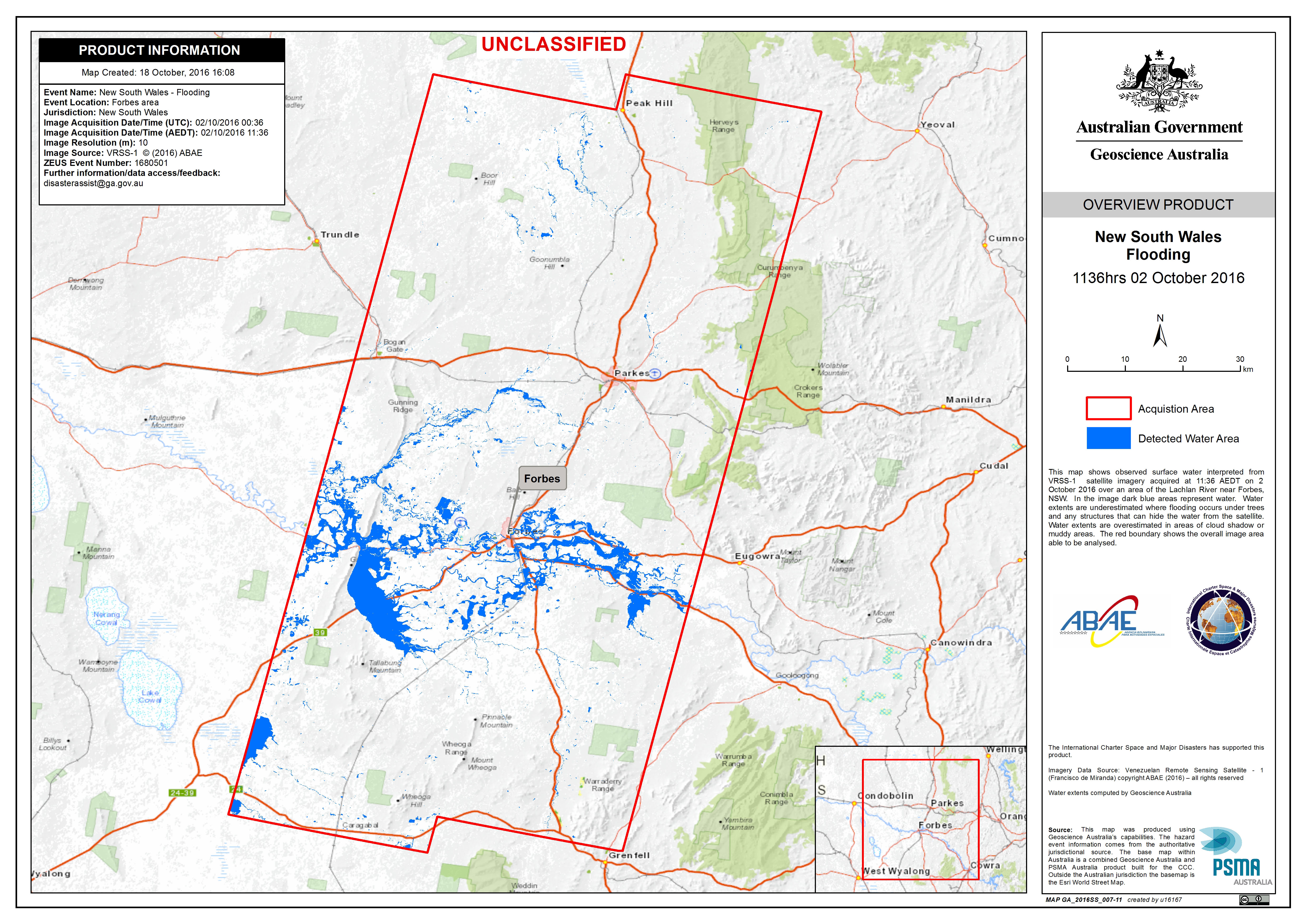
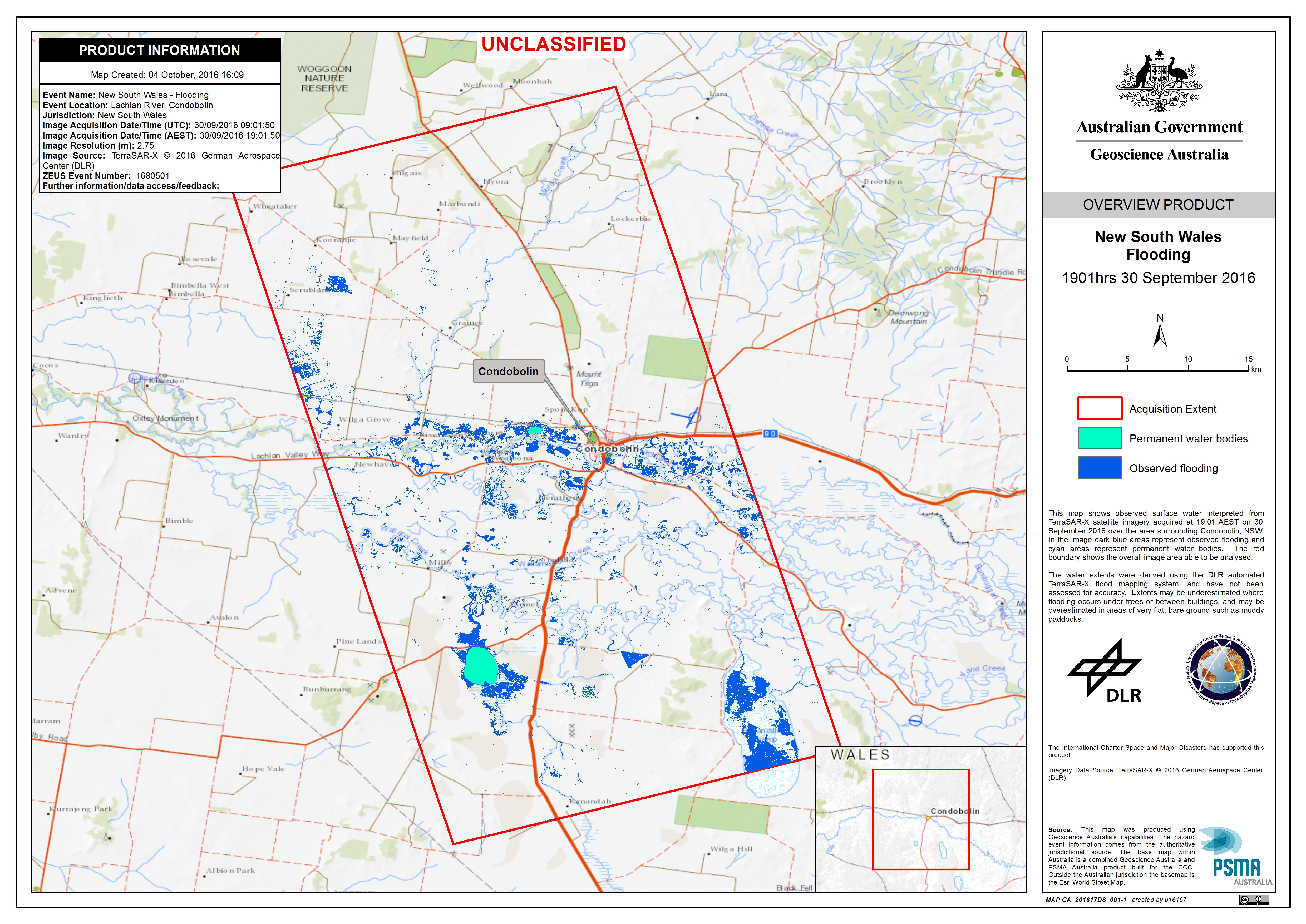
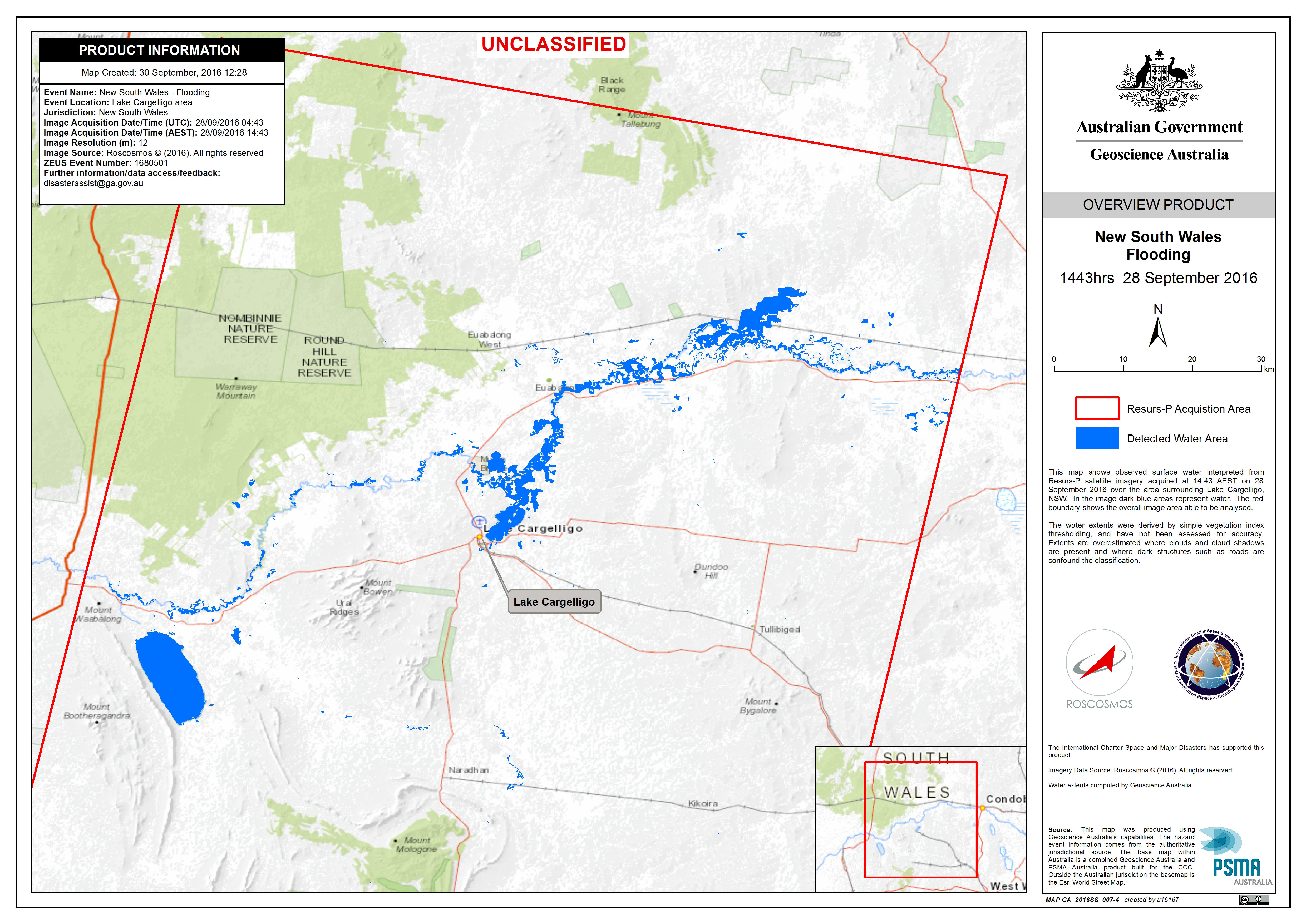
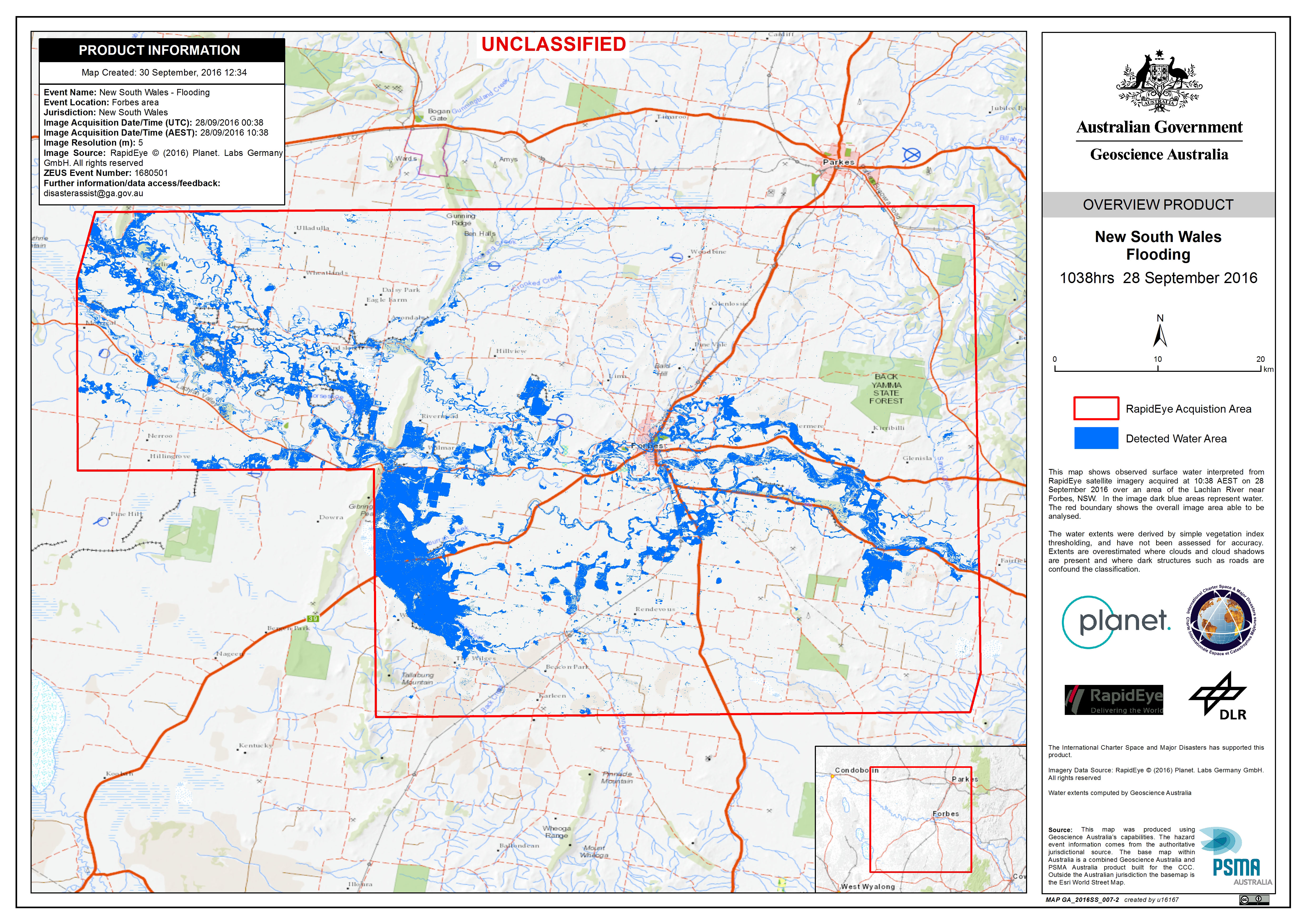
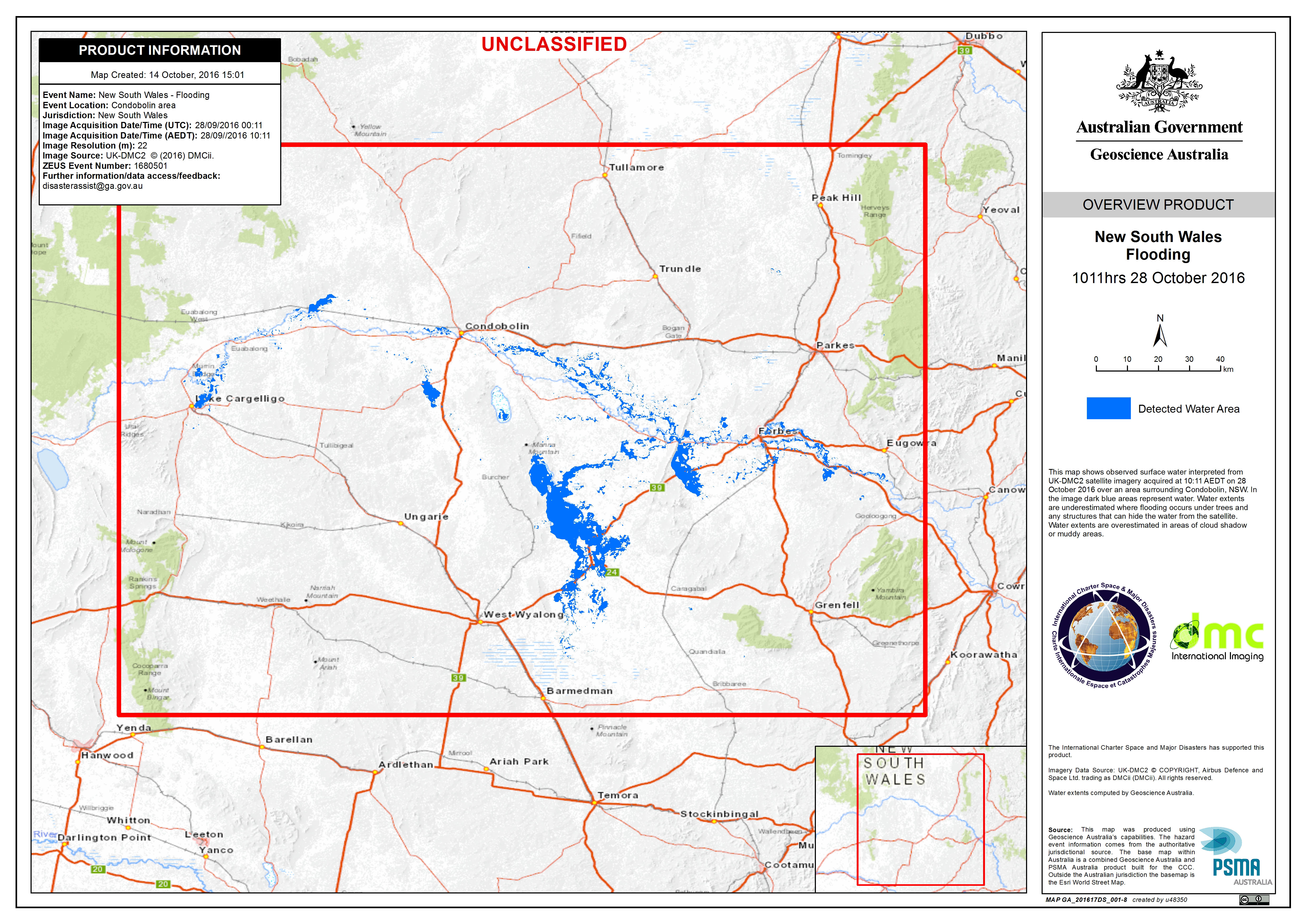
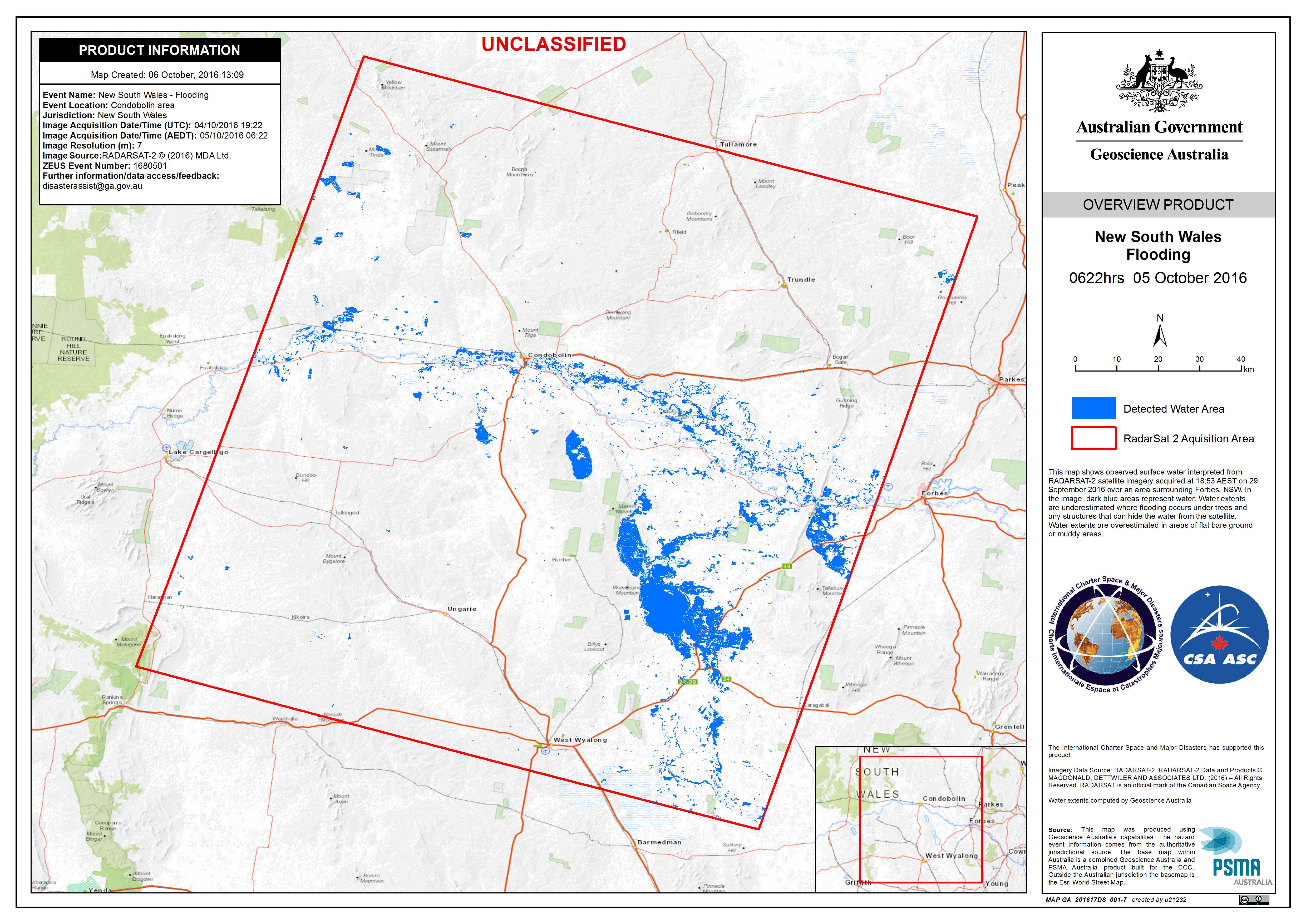
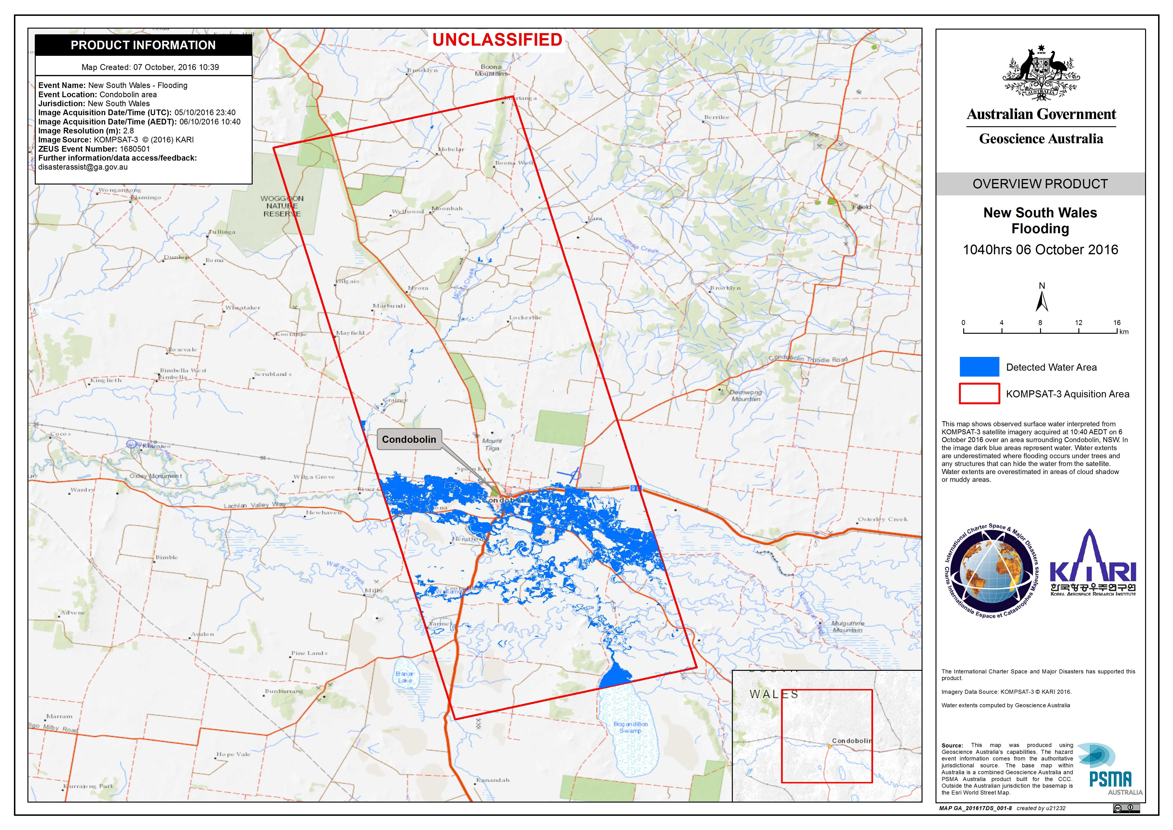
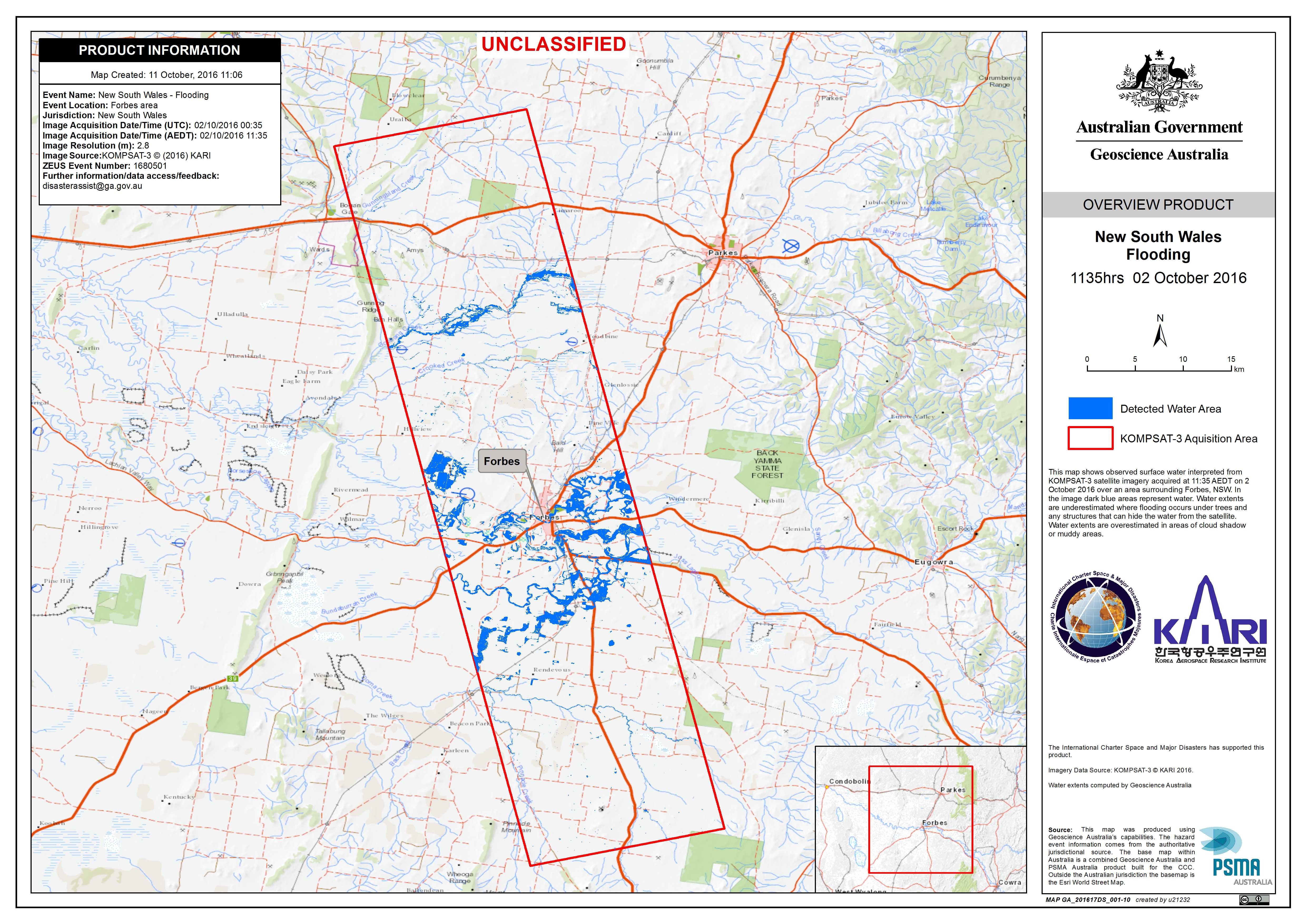
Flood in Australia
Heavy rain throughout the month of September has caused flash flooding along the Lachlan River in Australia.
The floods are affecting two towns in New South Wales, Forbes and Condobolin, and residents have been advised to evacuate. A thousand people have already been evacuated from Forbes and at Condobolin barricades are being erected in an attempt to reduce the impact of the oncoming flood waters.
The flooding at Forbes is reportedly the worst the area has experienced in over twenty years and the situation is expected to worsen over the next week as more rain is forecast. Over 100 buildings have been inundated so far.
The disaster is taking a toll on farming communities in the area, as crops are inundated by the floods. The harvest normally takes place in November, but it is not yet known what the full extent of the damage to the crops are. Thousands of cattle have been evacuated to safer areas until the water levels recede.
| Тип события: | Flood |
| Место события: | Australia |
| Date of Charter Activation: | 26 September 2016 |
| Время активации Хартии: | 09:11:56 |
| TЧасовой пояс в районе активации Хартии: | UTC+02:00 |
| Запрос на активацию поступил от: | Geoscience Australia |
| Менеждер проекта от: | Geoscience Australia |
Products

Flooding in Forbes, New South Wales
Авторские права: RADARSAT-2 Data and Products © MacDonald, Dettwiler and Associates Ltd. (2016) - All Rights Reserved. RADARSAT is an official trademark of the Canadian Space Agency.
Map produced by Geoscience Australia
Information about the Product
Получено: 29/09/2016
Источник: RADARSAT-2


Flood at Eubalong
Авторские права: Landsat 8 data and products © USGS (2016) - All rights reserved
Pleiades © CNES 2016 - Distribution: Airbus Defence and Space, all rights reserved
Map © European Union
Information about the Product
Получено: Landsat 8: 15/08/2016 and 23/09/2016
Pleiades: 28/09/2016
Источник: Landsat 8 / Pleiades
Flood in Forbes
Авторские права: Sentinel-2 © Copernicus Sentinel data 2016
Pleiades © CNES (2016). Distribution Airbus Defence and Space. All rights reserved.
Map produced by Geoscience Australia
Information about the Product
Получено: Sentinel-2: 21/08/2016
Pleiades: 28/09/2016
Источник: Sentinel-2 / Pleiades

 Вернуться к полному архиву активаций

