 English
 Spanish
 French
 Chinese
 Russian
 Portuguese
 Latest Activation
Charter activations
Flood in Australia following Cyclone Lam
Cyclone Lam impacted the north of Australia on 20 February 2015, bringing floods and damaging winds to the Northern Territory.
Lam made landfall in the Northern Territory as a Category Four storm, first arriving at Elcho Island just off the coast, and moving south-west to the mainland near Ramingining at 02:00 (local time). Communications were severed with Elcho Island as Lam passed over, and it has been reported that the island suffered heavy damage from the storm
Lam weakened considerably to a Category Two storm as it moved inland, but is believed to have caused widespread damage in its wake. Despite the damage, no casualties or injuries have been reported.
Many residents, who had warning of the impending storm, evacuated from the areas at risk, and those temporarily unable to return to their homes due to the damage are currently in emergency shelters.
Though Lam has weakened, it is expected to bring more rain and high tides to the area.
The Australian Bureau of Meteorology has the latest tracking information on the two storms.
| Type of Event: | Flood |
| Location of Event: | Queensland, Australie |
| Date of Charter Activation: | 20 February 2015 |
| Time of Charter Activation: | 03:23:24 |
| Time zone of Charter Activation: | UTC+01:00 |
| Charter Requestor: | Geoscience Australia |
Products
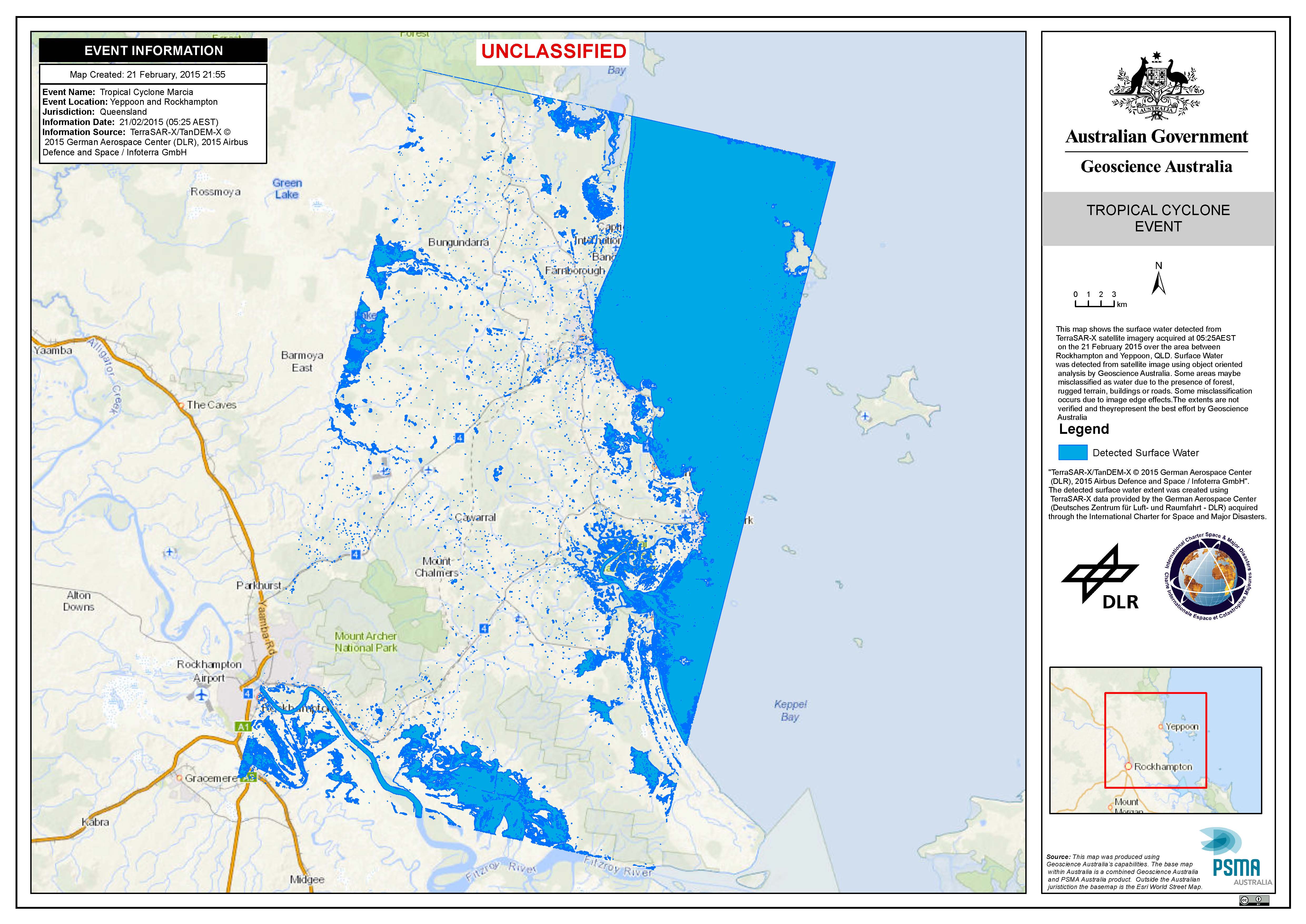
Surface water in Yeppoon and Rockhampton in Australia following Tropical Cyclone Marcia.
Copyright: TerraSAR-X/TanDEM-X © German Aerospace Center (DLR), 2015 Airbus Defence and Space / Infoterra GmbH
Map produced by Geoscience Australia
Information about the Product
Acquired: 21/02/2015
Source: TerraSAR-X/TanDEM-X
 Back to the full activation archive

