 English
 Spanish
 French
 Chinese
 Russian
 Portuguese
 Latest Activation
Charter activations
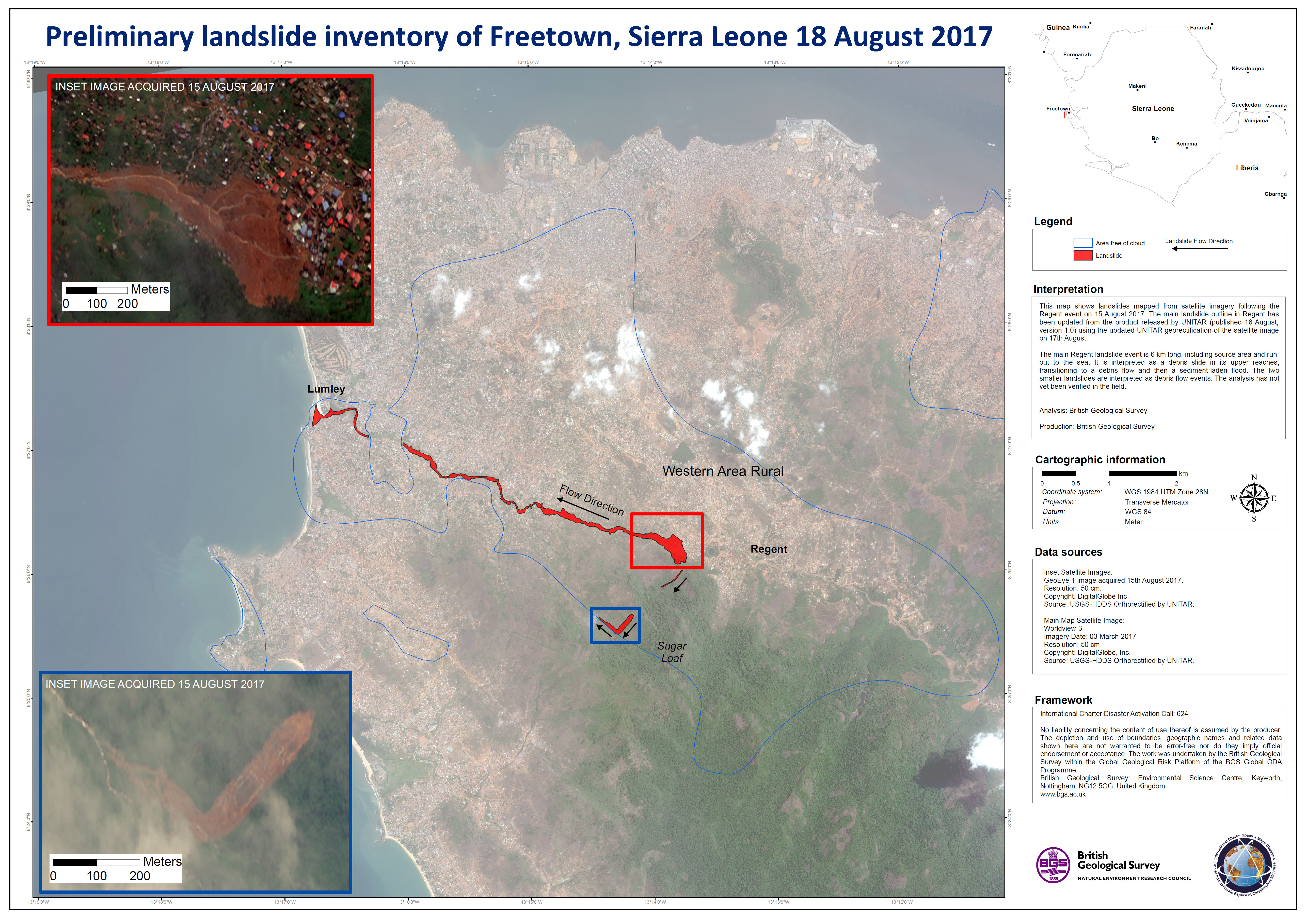
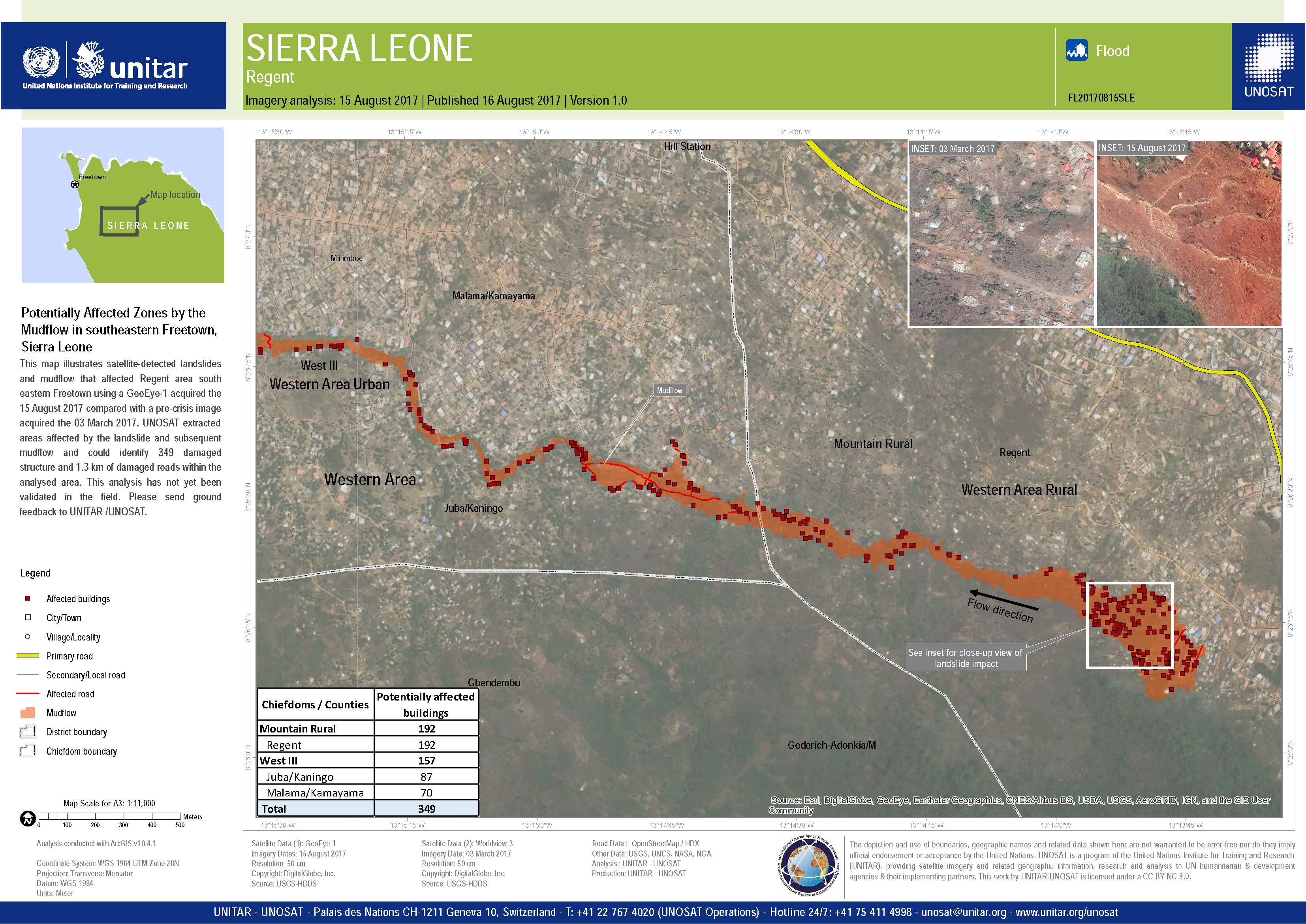
Flood in Sierra Leone
Heavy rain has caused floods and mudslides in Sierra Leone, leaving almost 500 dead.
The disaster has particularly affected Freetown, the country's capital. Part of the Sugar Loaf Mountain collapsed on the edge of the city in the Regent area, flooding and burying dozens of homes under mud.
Flooding began during the night on 14 August, leaving people with little to no warning as flood waters and mud swept into the streets of Freetown. More than 3000 people were left homeless and 10,000 have been forced to evacuate. Authorities have urged thousands more to evacuate from areas at risk of further landslides.
Rescue operations are ongoing but Freetown is already struggling to cope with the scope of the damage and loss of life which is expected to rise over the coming days.
| Tipo de evento: | Flood |
| Local do evento: | Sierra Leone |
| Data da Ativação da Carta: | 15 August 2017 |
| Tempo de Ativação da Carta: | 11:28:00 |
| Zona de Tempo da Ativação da Carta: | UTC+02:00 |
| Requisitante da Carta: | UNOOSA on behalf of FAO Sierra Leone Office and UN Country Team |
| ID da Ativação: | 546 |
| Gerenciamento de projeto: | UNITAR/UNOSAT |
Products
 Voltar ao arquivo completo da Ativação

