 English
 Spanish
 French
 Chinese
 Russian
 Portuguese
 Latest Activation
Charter activations
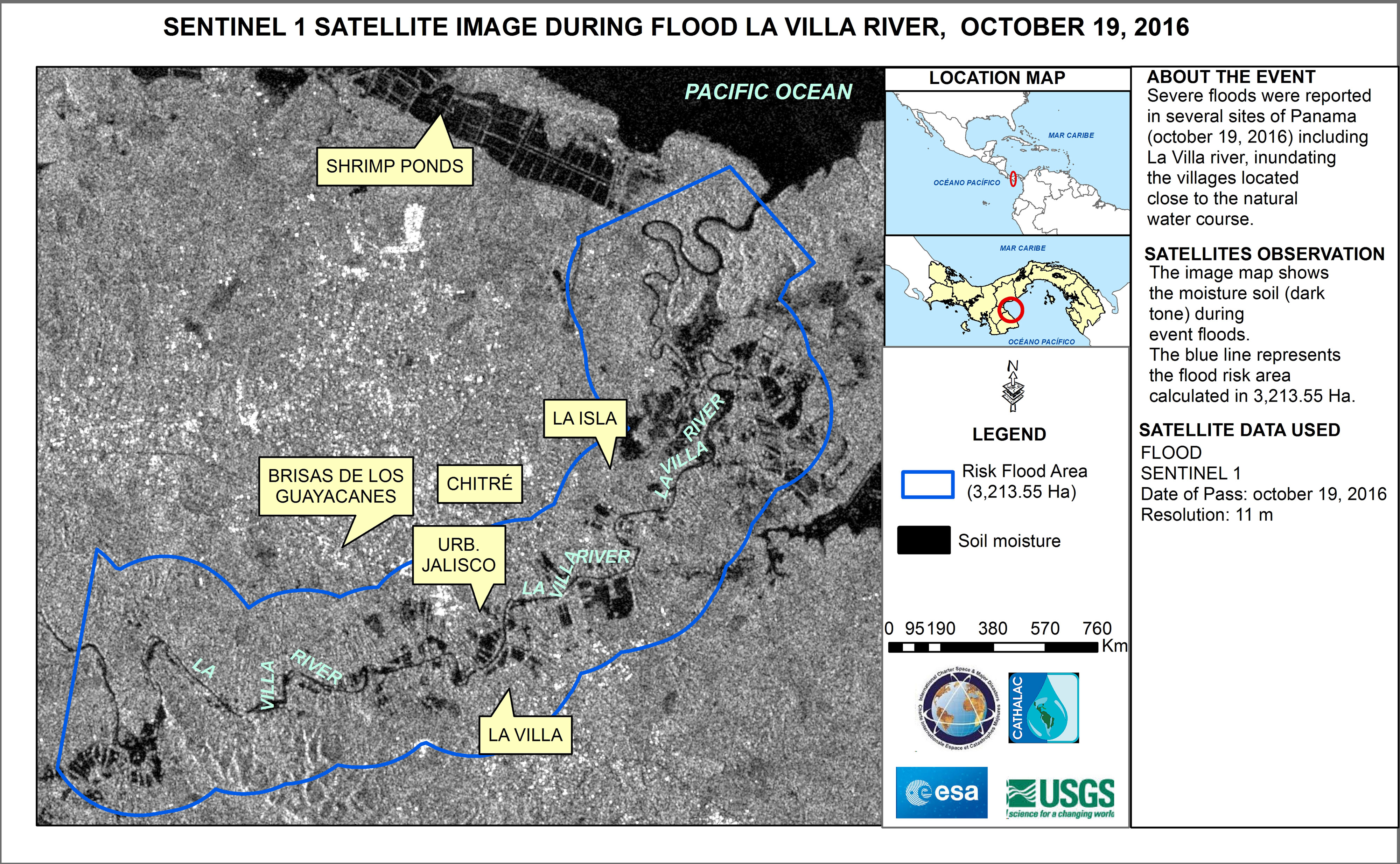
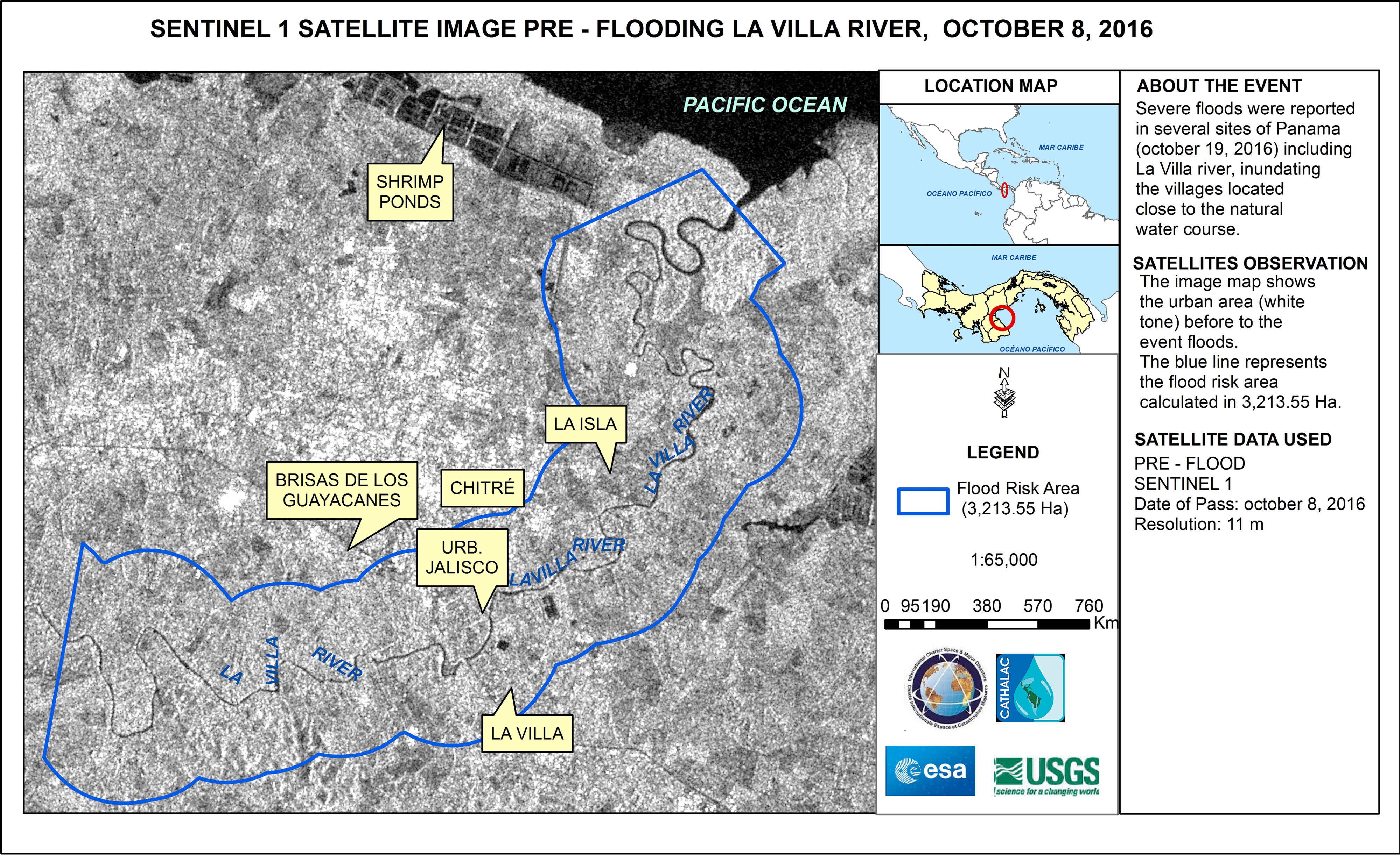
Flood in Panama
Heavy rain has caused widespread flooding in Panama, in particular the province of Darien and Tonosi. More than 3000 people have been displaced as the National Police began to evacuate families in the worst affected areas.
Hundreds of people have been left homeless in what has been described as the worst flooding the area has experienced in years. There are also concerns that water levels in the La Villa River are very high, posing a threat to the bridge that connects Los Santos and Herrera provinces. People living near the river have been evacuated to remove them from risk.
| Tipo de evento: | Flood |
| Local do evento: | Panama |
| Data da Ativação da Carta: | 20 October 2016 |
| Tempo de Ativação da Carta: | 23:27:41 |
| Zona de Tempo da Ativação da Carta: | UTC+02:00 |
| Requisitante da Carta: | USGS on behalf of CATHALAC |
| Gerenciamento de projeto: | CATHALAC |
Products

 Voltar ao arquivo completo da Ativação

