 English
 Spanish
 French
 Chinese
 Russian
 Portuguese
 Latest Activation
Charter activations
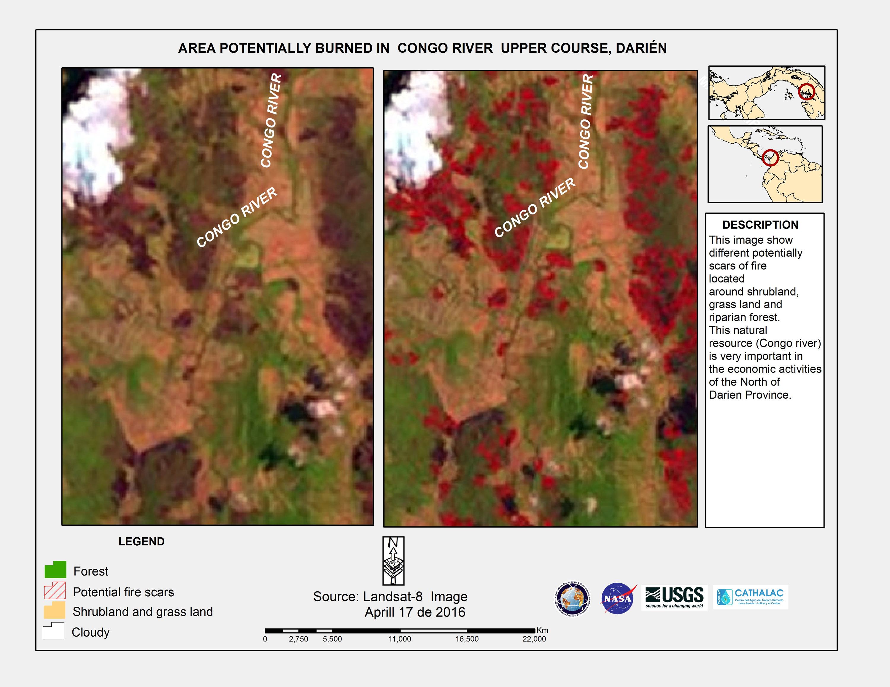
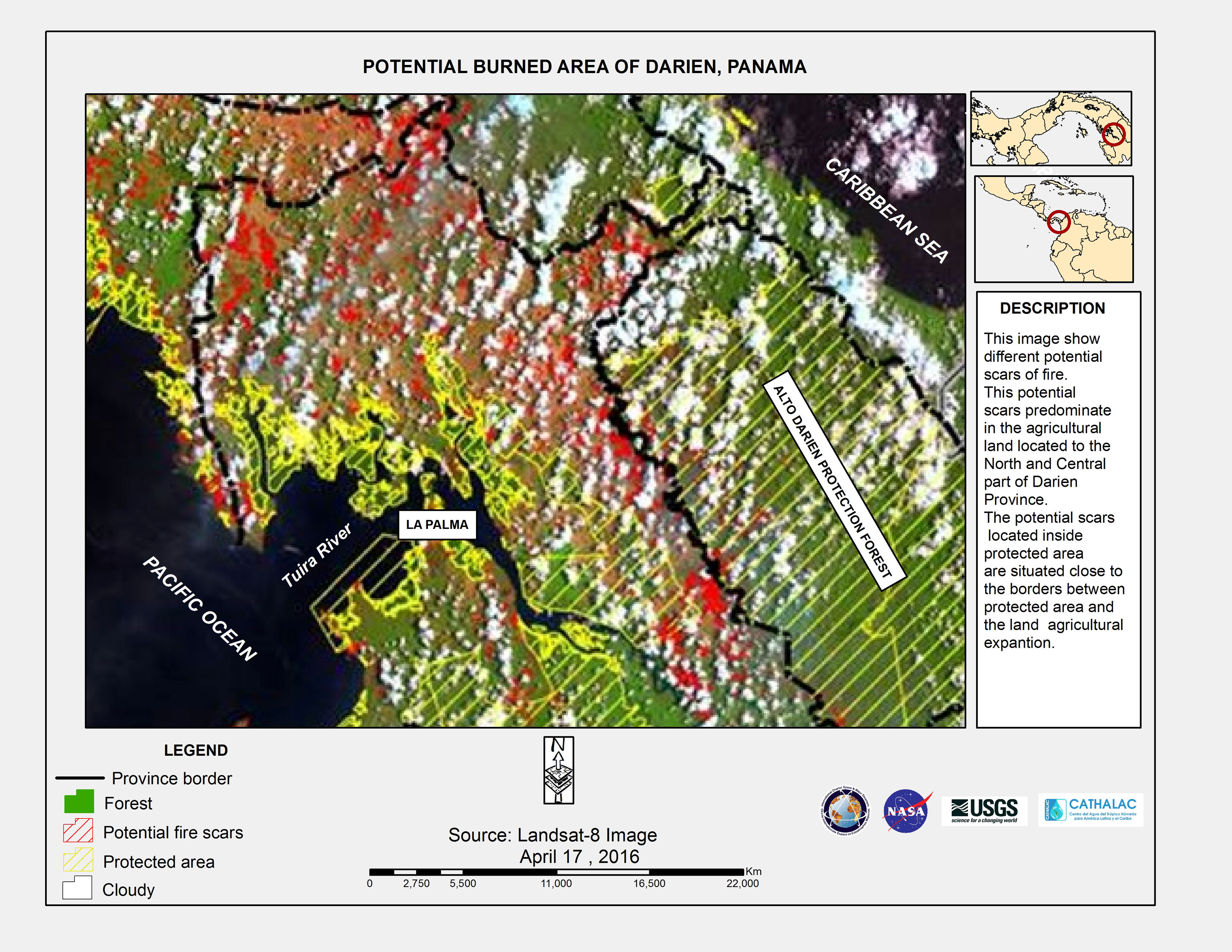
Fire in Panama
Forest fires have been burning in Darien Province, Panama, for the past two weeks.
Hundreds of people are working to stop the spread of the fires and keep them away from inhabited areas.
The fire started in a dry forest near the village of Garachiné, and the fires have been approaching the village since then, prompting concerns for the people living there.
While efforts were made to stop the spread of the fire for several days, it spread out of control of the fire fighters on the ground in Darien National Park and has grown in size since then.
The government of Panama has sought more people and international aid in extinguishing the fires. The United States have provided a helicopter to help deploy water from above to combat the fire and other fire fighting vehicles have been deployed.
| Type of Event: | Fire |
| Location of Event: | Panama |
| Date of Charter Activation: | 17 April 2016 |
| Time of Charter Activation: | 19:37:34 |
| Time zone of Charter Activation: | UTC+02:00 |
| Charter Requestor: | USGS on behalf of Panama Ministry of Environment |
| Project Management: | Cathalac |
Products
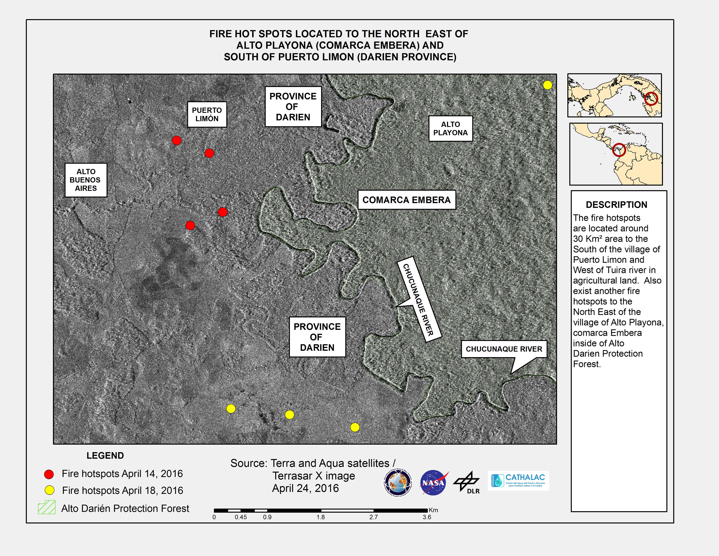
Fire hot spots located to the north east of Alto Playona (Comarca Embera) and south of Puerto Limon in Darien Province, Panama
Copyright: Terra and Aqua © NASA
TerraSAR-X © DLR e. V. 2016, Distribution: Airbus DS Geo GmbH
Map produced by CATHALAC
Information about the Product
Acquired: 14/04/2016, 18/04/2016 and 24/04/2016
Source: Terra / Aqua / TerraSAR-X
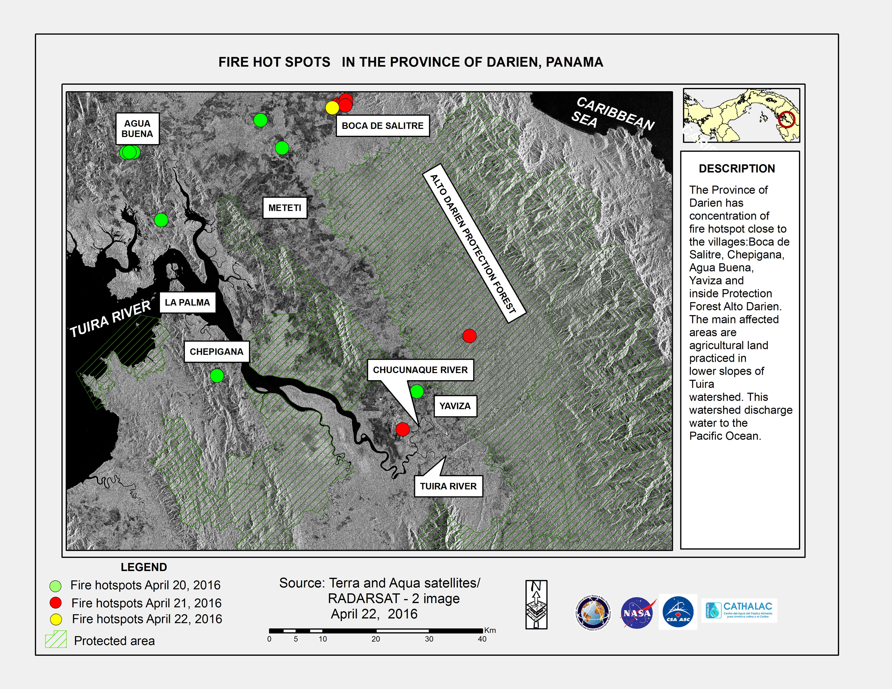
Fire hot spots in Darien Province, Panama
Copyright: Terra and Aqua © NASA
RADARSAT-2 Data and Products © MacDonald, Dettwiler and Associates Ltd. (2016) - All Rights Reserved. RADARSAT is an official trademark of the Canadian Space Agency.
Map produced by CATHALAC
Information about the Product
Acquired: 20/04/2016, 21/04/2016 and 22/04/2016
Source: Terra / Aqua / RADARSAT-2
 Back to the full activation archive

