最小化 最新宪章启动

Charter activations

Flooding in Sri Lanka

At least 16 people have died in floods and mudslides in Sri Lanka following more than a week of heavy rain, officials have communicated.

The disaster management center said more than 5,000 people have been displaced from their homes and have taken shelter in relatives' homes or in government-run relief centers.

The months of October and November are usually monsoon season in the northeastern part of Sri Lanka. However, higher-than-usual rainfall has been reported in most parts of the country this year.

事件地点:Sri Lanka
启动宪章的日期:2021-11-12
宪章启动时间:12:55
宪章启动时区:UTC+01:00
宪章要求者:ADRC on behalf of Disaster Management Center (Sri Lanka)
启动ID:737
项目经理:JAXA

Products

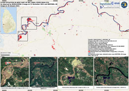
Flood situation in West part of Sri Lanka

版权: © ((2021) DigitalGlobe, Inc., Longmont CO USA 80503. DigitalGlobe and the DigitalGlobe logos are trademarks of DigitalGlobe, Inc. The use and/or dissemination of this data and/or of any product in any way derived there from are restricted. Unauthorized use and/or dissemination is prohibited
Map produced by UE Geoinformation Systems

Information about the Product

已获得: 21/11/2021

源: WorldView-2

类别: Reference Map
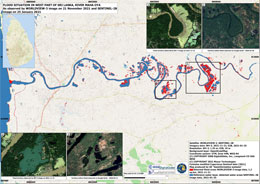
Flood situation in West part of Sri Lanka

版权: © (2021) DigitalGlobe, Inc., Longmont CO USA 80503. DigitalGlobe and the DigitalGlobe logos are trademarks of DigitalGlobe, Inc. The use and/or dissemination of this data and/or of any product in any way derived there from are restricted. Unauthorized use and/or dissemination is prohibited
Map produced by UE Geoinformation Systems

Information about the Product

已获得: 21/11/2021

源: WorldView-3

类别: Reference Map

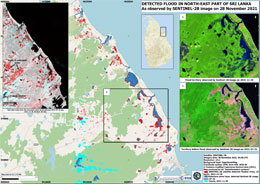
Detected flood in north-east part of Sri Lanka

版权: Contains modified Copernicus Sentinel data (2021)
Map produced by UE Geoinformation Systems

Information about the Product

已获得: 28/11/2021

源: Sentinel-2

类别: Reference Map

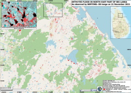
Detected Flood in North Eastern Province, Sri Lanka

版权: Contains modified Copernicus Sentinel data (2021)
Map produced by Geo-Information Systems

Information about the Product

已获得: 21/11/2021

源: Sentinel-2

类别: Reference Map

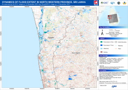
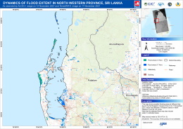
Dynamics of Flood Extent in North Western Province, Sri Lanka

版权: © JAXA
© DLR e.V. (2021), Distribution Airbus DS Geo GmbH
Map produced by GIC-AIT

Information about the Product

已获得: ALOS-2: 12/11/2021
TerraSAR-X: 17/11/2021

源: ALOS-2 / TerraSAR-X

类别: Delineation Monitoring Maps

Dynamics of Flood Extent in North Western Province, Sri Lanka

版权: © DLR e.V. (2021), Distribution Airbus DS Geo GmbH
© JAXA
Map produced by GIC-AIT

Information about the Product

已获得: ALOS-2: 12/11/2021
TerraSAR-X: 17/11/2021

源: TerraSAR-X / ALOS-2

类别: Delineation Monitoring Maps

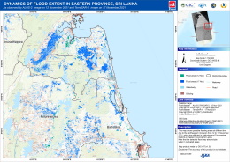
Dynamics of Flood Extent in Eastern Province, Sri Lanka

版权: © JAXA
© DLR e.V. (2021), Distribution Airbus DS Geo GmbH
Map produced by GIC - AIT

Information about the Product

已获得: ALOS-2: 12/11/2021
TerraSAR-X: 17/11/2021

源: ALOS-2 / TerraSAR-X

类别: Delineation Monitoring Maps

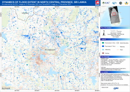
Dynamics of Flood Extent in North Central Province, Sri Lanka

版权: © DLR e.V. (2021), Distribution Airbus DS Geo GmbH
© JAXA
Map produced by GIC-AIT

Information about the Product

已获得: TerraSAR-X: 17/11/2021
ALOS-2: 12/11/2021

源: TerraSAR-X / ALOS-2

类别: Delineation Monitoring Maps

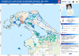
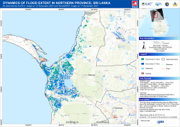
Dynamics of Flood Extent in Northern Province, Sri Lanka

版权: © DLR e.V. (2021), Distribution Airbus DS Geo GmbH
© JAXA
Map produced by GIC-AIT

Information about the Product

已获得: TerraSAR-X: 17/11/2021
ALOS-2: 12/11/2021

源: TerraSAR-X / ALOS-2

类别: Delineation Monitoring Maps

Dynamics of Flood Extent in Northern Province, Sri Lanka

版权: © JAXA
© DLR e.V. (2021), Distribution Airbus DS Geo GmbH
Map produced by GIC-AIT

Information about the Product

已获得: ALOS-2: 12/11/2021
TerraSAR-X: 17/11/2021

源: ALOS-2 / TerraSAR-X

类别: Delineation Monitoring Maps

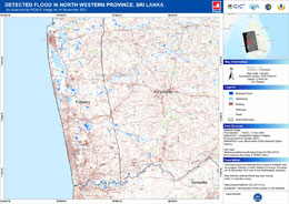
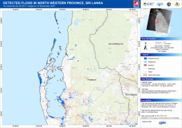
Detected flood in North Western Province, Sri Lanka

版权: RADARSAT Constellation Mission Imagery © Government of Canada (2021) - RADARSAT is an official mark of the Canadian Space Agency
Map produced by GIC-AIT

Information about the Product

已获得: 14/11/2021

源: RCM

类别: Delineation Monitoring Maps

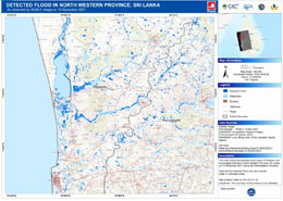
Detected flood in North Western Province, Sri Lanka

版权: RADARSAT Constellation Mission Imagery © Government of Canada (2021) - RADARSAT is an official mark of the Canadian Space Agency
Map produced by GIC-AIT

Information about the Product

已获得: 14/11/2021

源: RCM

类别: Delineation Monitoring Maps

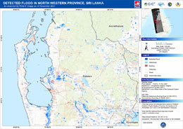
Detected flood in North western Province, Sri Lanka

版权: RADARSAT Constellation Mission Imagery © Government of Canada (2021) - RADARSAT is an official mark of the Canadian Space Agency
Map produced by GIC-AIT

Information about the Product

已获得: 14/11/2021

源: RCM

类别: Delineation Monitoring Maps

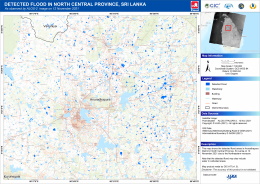
Detected flooding in North Central Province, Sri Lanka

版权: © JAXA
Map produced by GIC-AIT

Information about the Product

已获得: 12/11/2021

源: ALOS-2

类别: Delineation Map

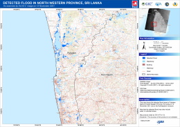
Detected flooding in North Western Province, Sri Lanka

版权: © JAXA
Map produced by GIC-AIT

Information about the Product

已获得: 12/11/2021

源: ALOS-2

类别: Delineation Map

Detected flooding in North Western Province, Sri Lanka

版权: © JAXA
Map produced by GIC-AIT

Information about the Product

已获得: 12/11/2021

源: ALOS-2

类别: Delineation Map

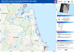
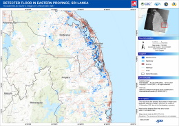
Detected flooding in Eastern Province Sri Lanka

版权: © JAXA
Map produced by GIC-AIT

Information about the Product

已获得: 12/11/2021

源: ALOS-2

类别: Delineation Map

Detected flooding in Eastern Province, Sri Lanka

版权: © JAXA
Map produced by GIC-AIT

Information about the Product

已获得: 12/11/2021

源: ALOS-2

类别: Delineation Map

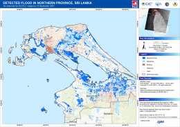
Detected flooding in Northern Province, Sri Lanka

版权: © JAXA
Map produced by GIC-AIT

Information about the Product

已获得: 12/11/2021

源: ALOS-2

类别: Delineation Map

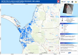
Detected flooding in Northern Province, Sri Lanka

版权: © JAXA
Map produced by GIC-AIT

Information about the Product

已获得: 12/11/2021

源: ALOS-2

类别: Delineation Map

返回完整的响应档案