 English
 Spanish
 French
 Chinese
 Russian
 Portuguese
 最新宪章启动
Charter activations
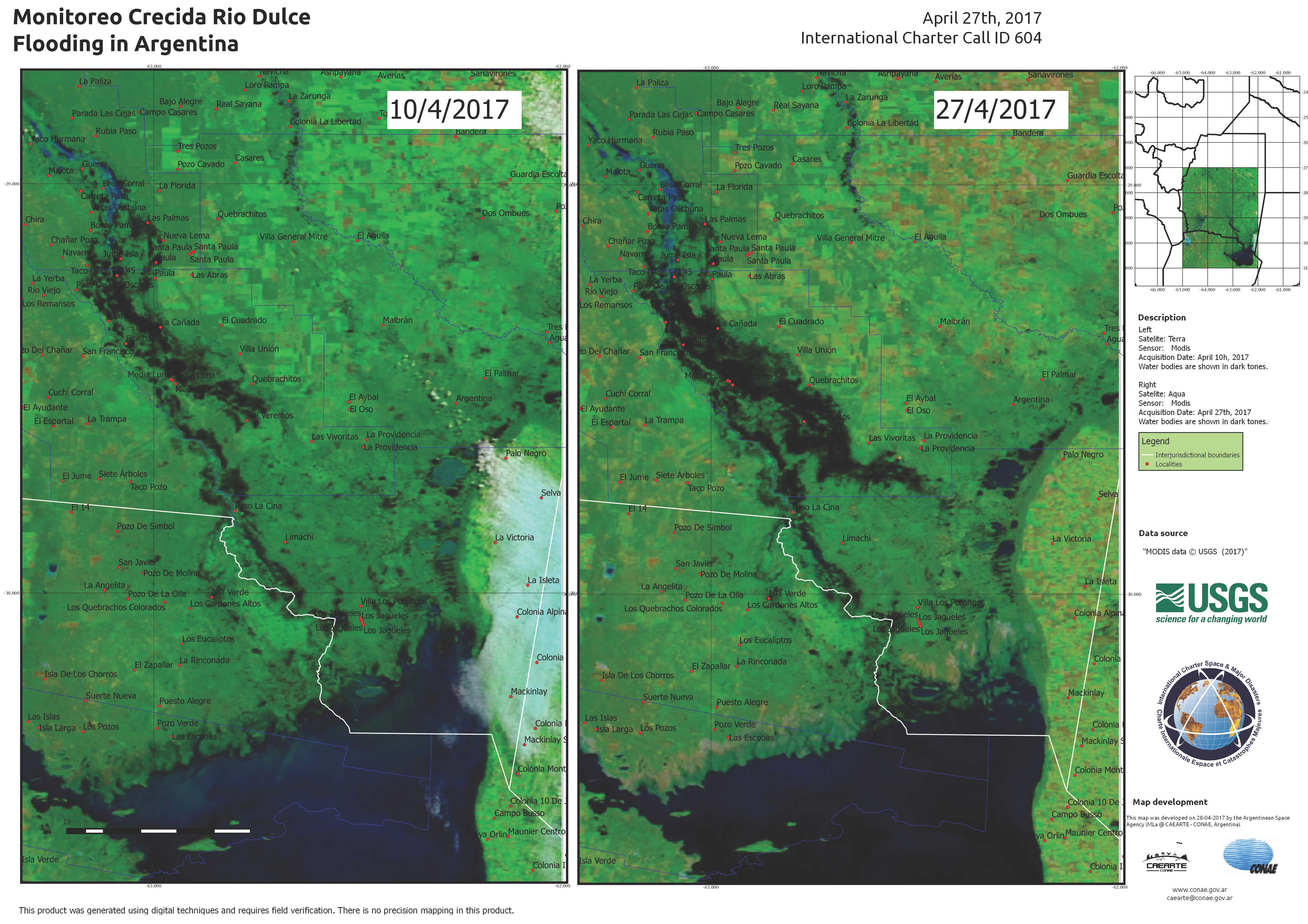
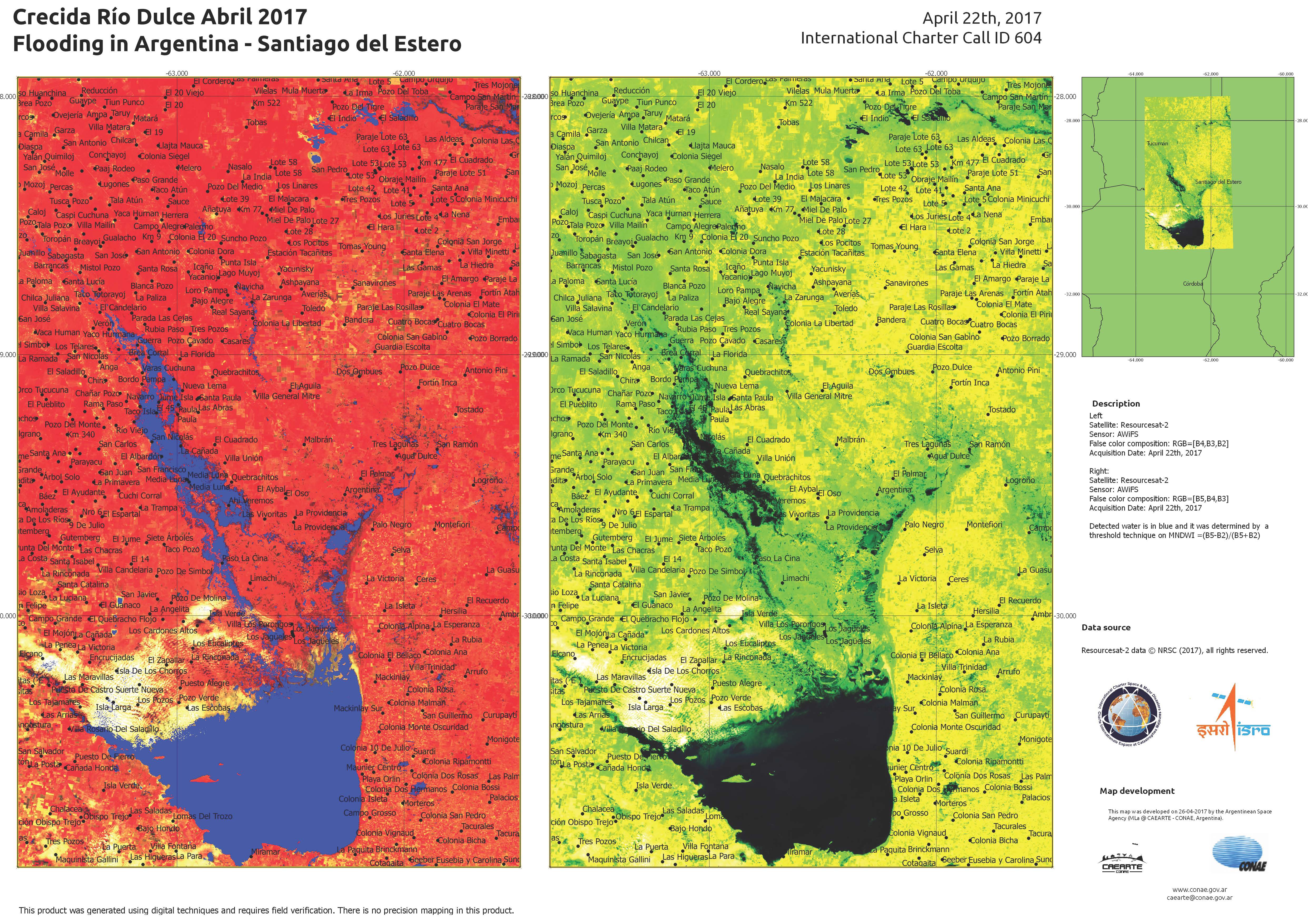
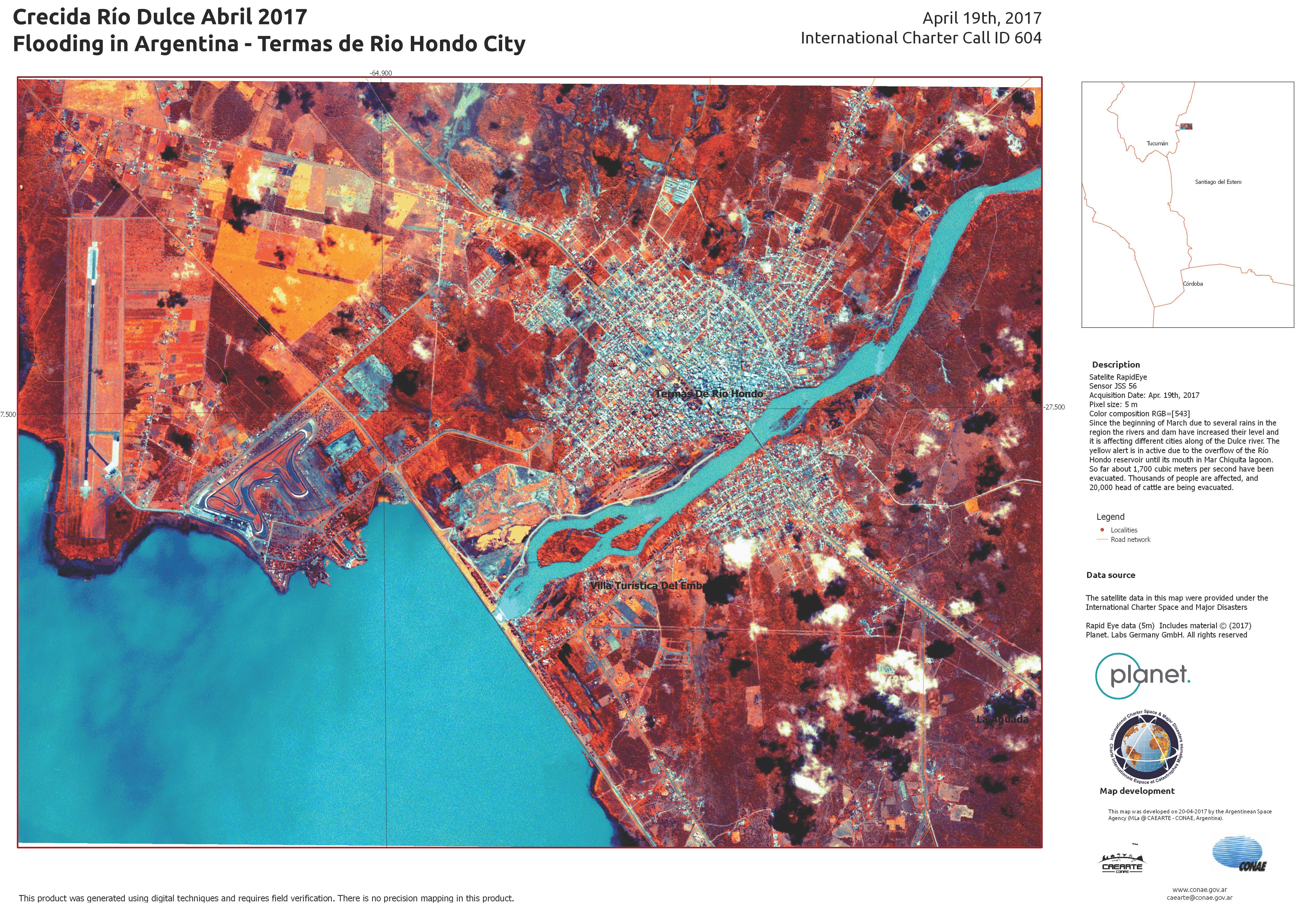
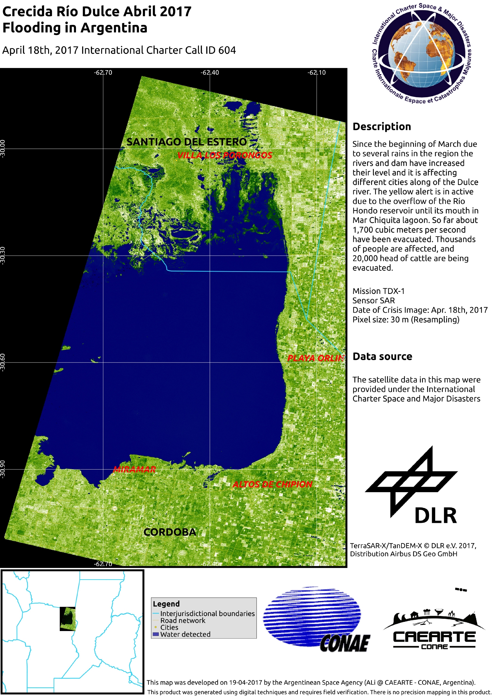
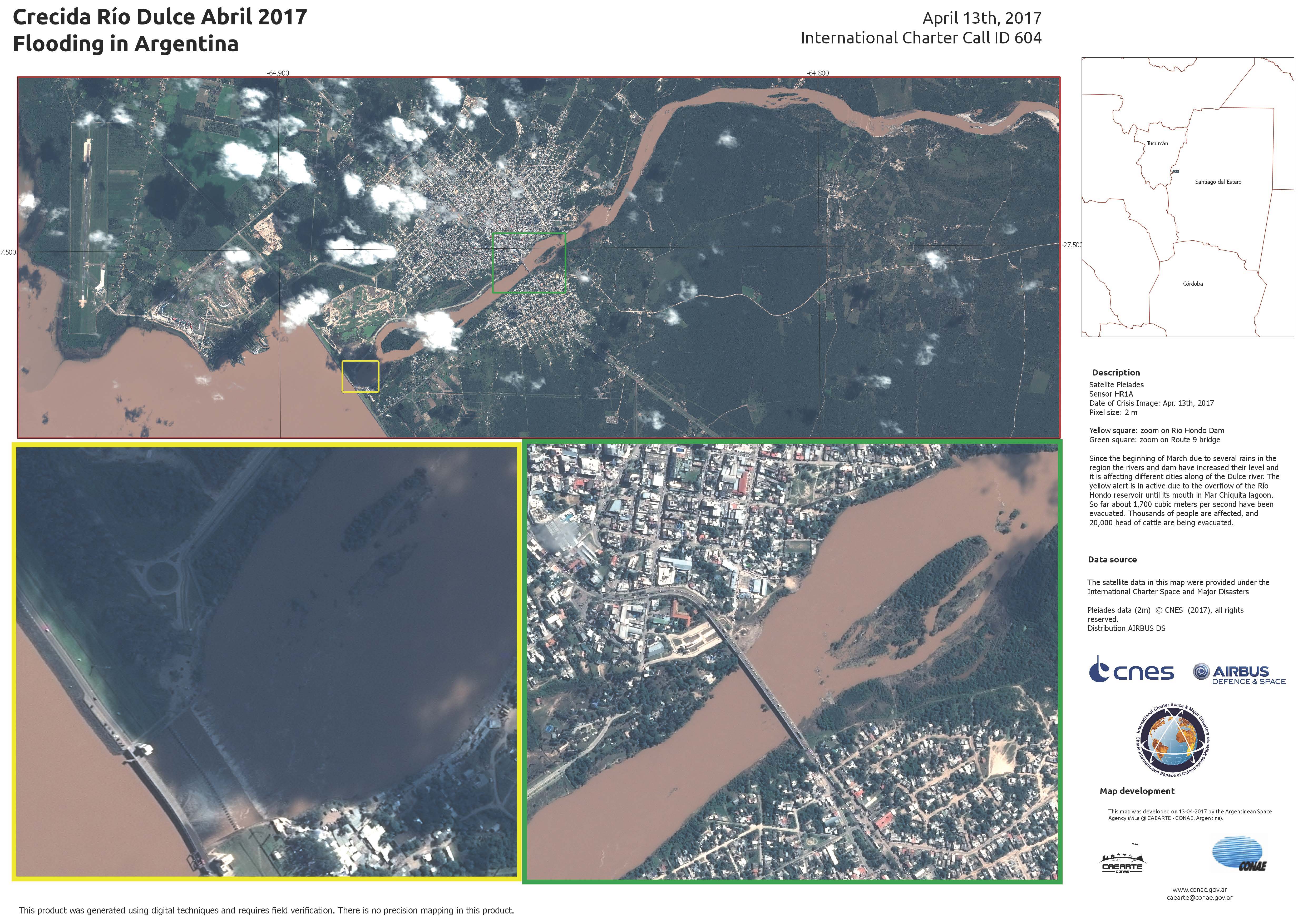
阿根廷洪水
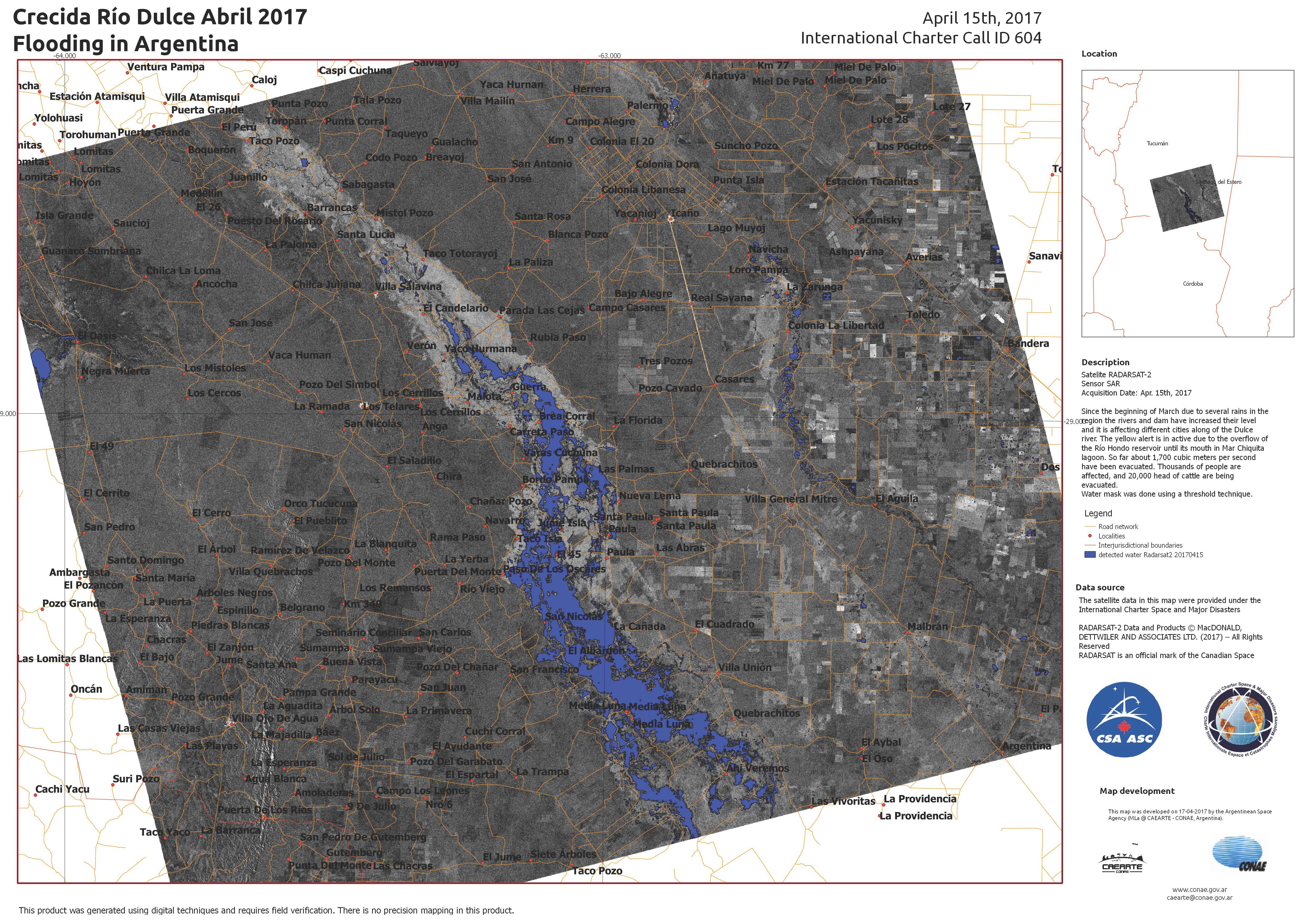
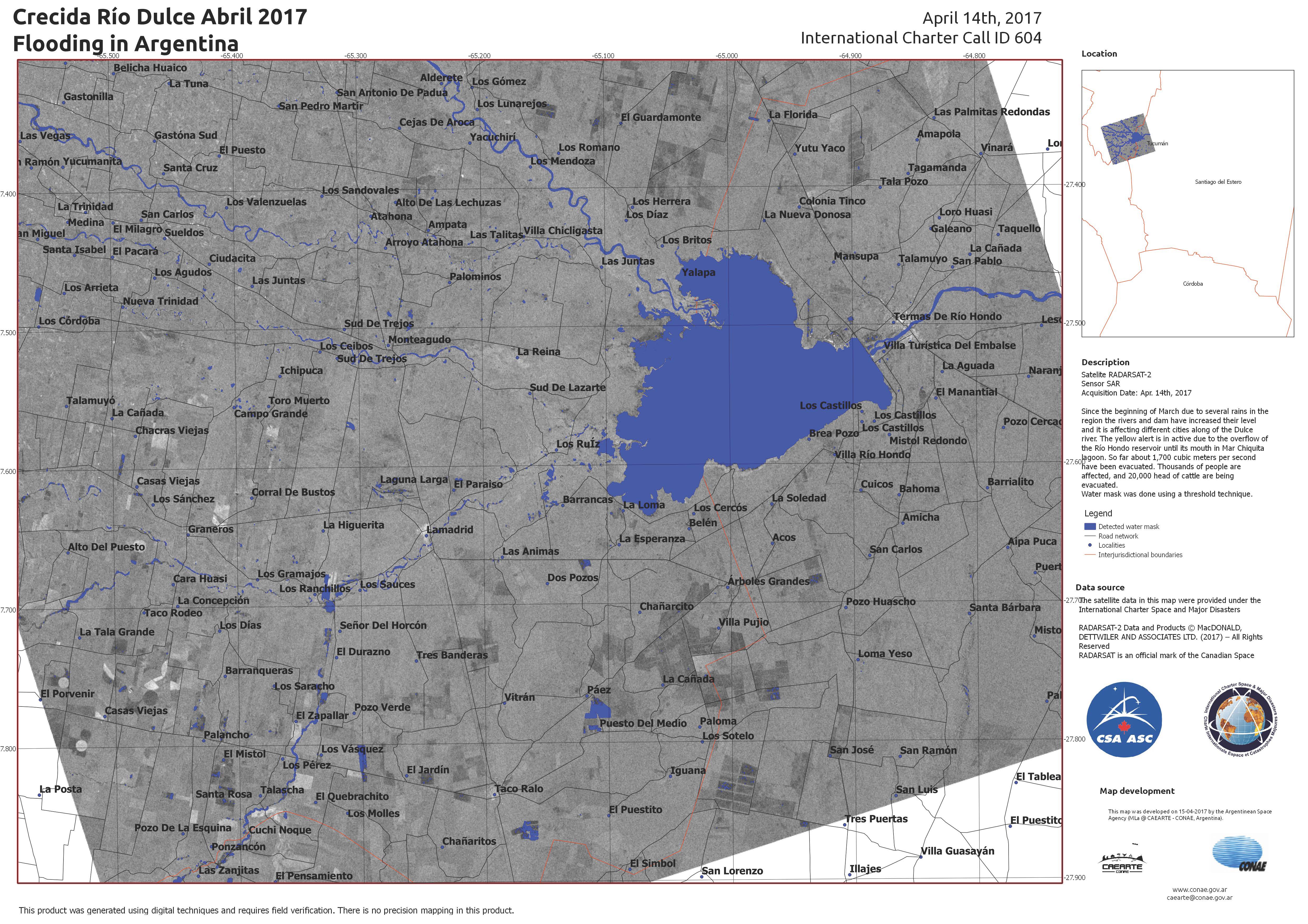
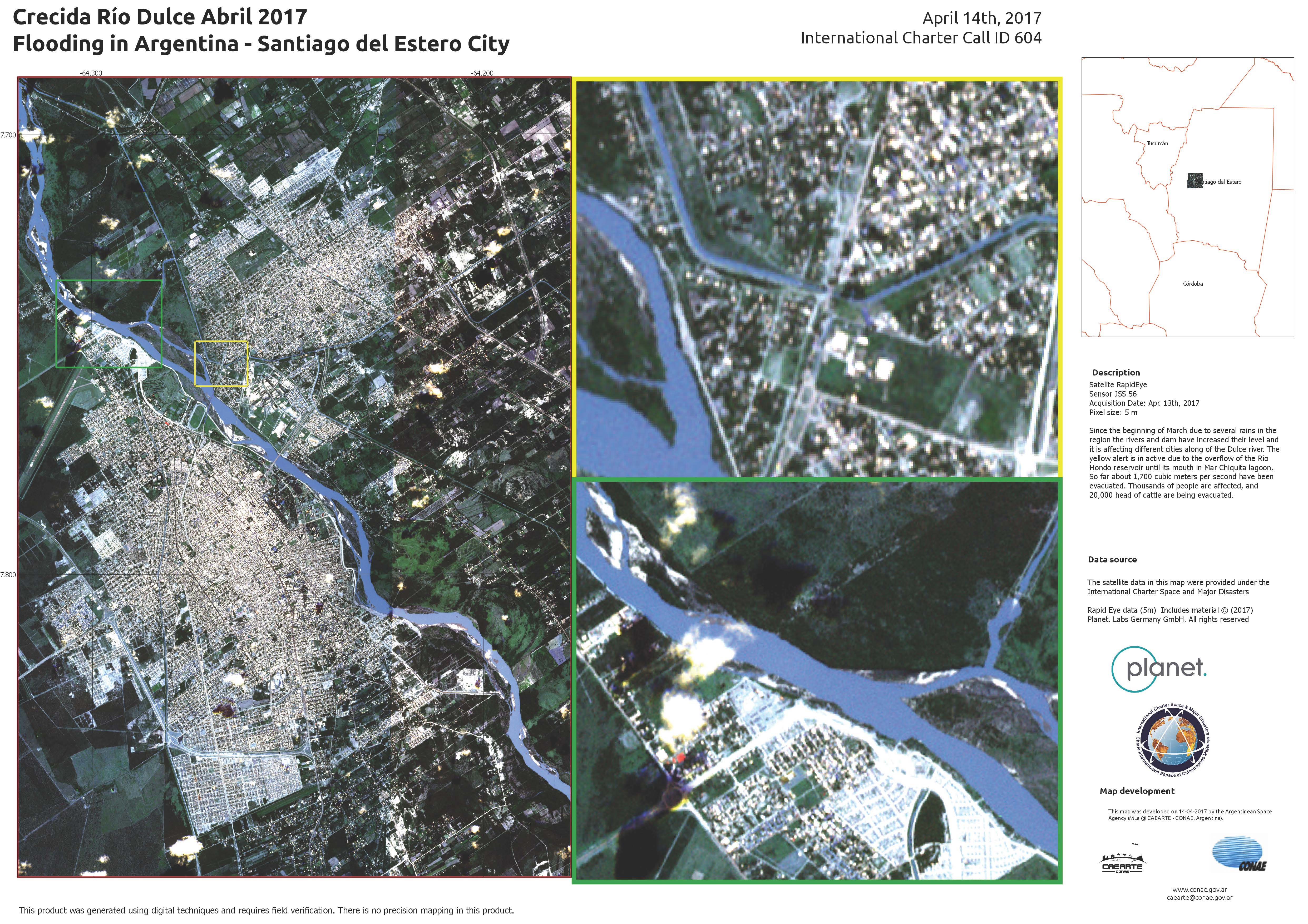
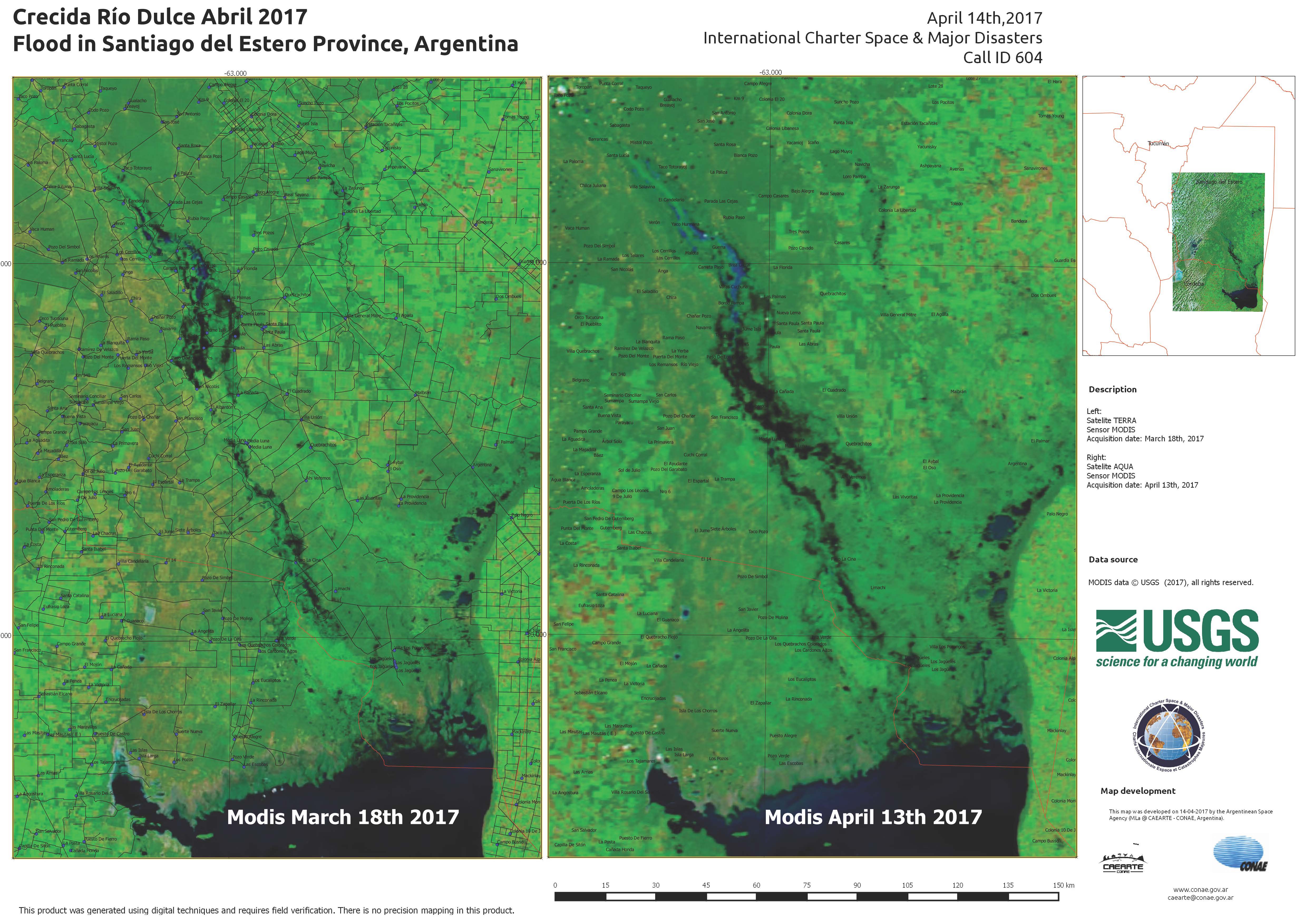
阿根廷暴雨导致洪灾,迫使数千人撤离。
暴雨于三月底开始,已经导致杜尔塞河和奇科河溢流,对该地区的城市造成了影响。
里瓦达维亚市尤其受灾严重。估计有80%的城市在不到一周的时间里遭遇了一年的降雨量,已经被洪水和泥石流毁坏。城市的桥梁和道路被冲毁或中断,大部分城市充斥着泥和水。
位于阿根廷北部的里奥洪多水库也出现黄色警戒,表示出现溢流。
| 事件类型: | 洪水 |
| 事件地点: | 阿根廷 |
| 启动宪章的日期: | 2017年4月12日 |
| 宪章启动时间: | 19:30:00 |
| 宪章启动时区: | UTC+02:00 |
| 宪章要求者: | 阿根廷国家民事保护秘书处 – 阿根廷SIFEM安全部 |
| 启动ID: | 525 |
| 项目经理: | CONAE(阿根廷航天局) |
Products


 返回完整的响应档案

