 English
 Spanish
 French
 Chinese
 Russian
 Portuguese
 Последняя Активация
Charter activations
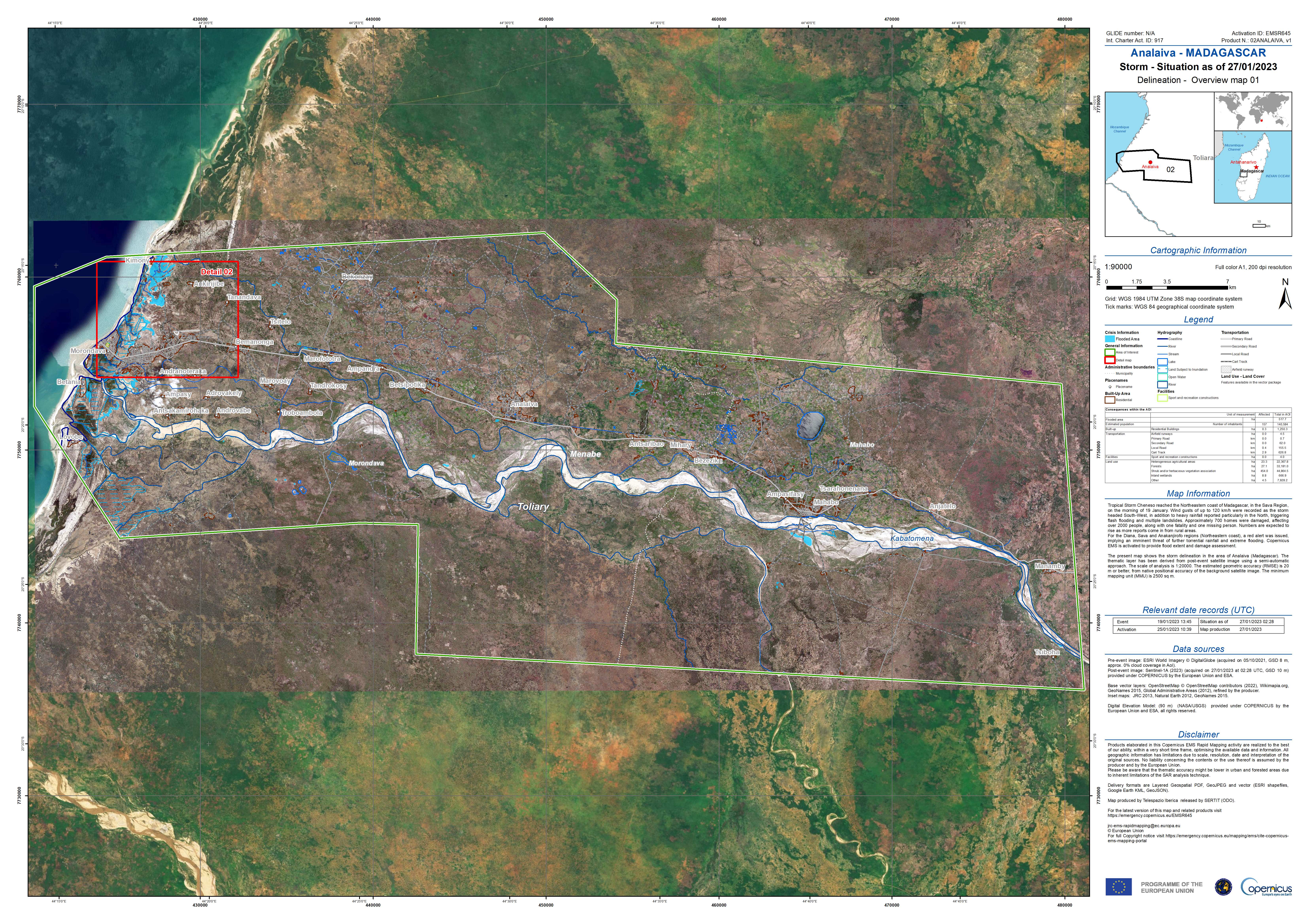
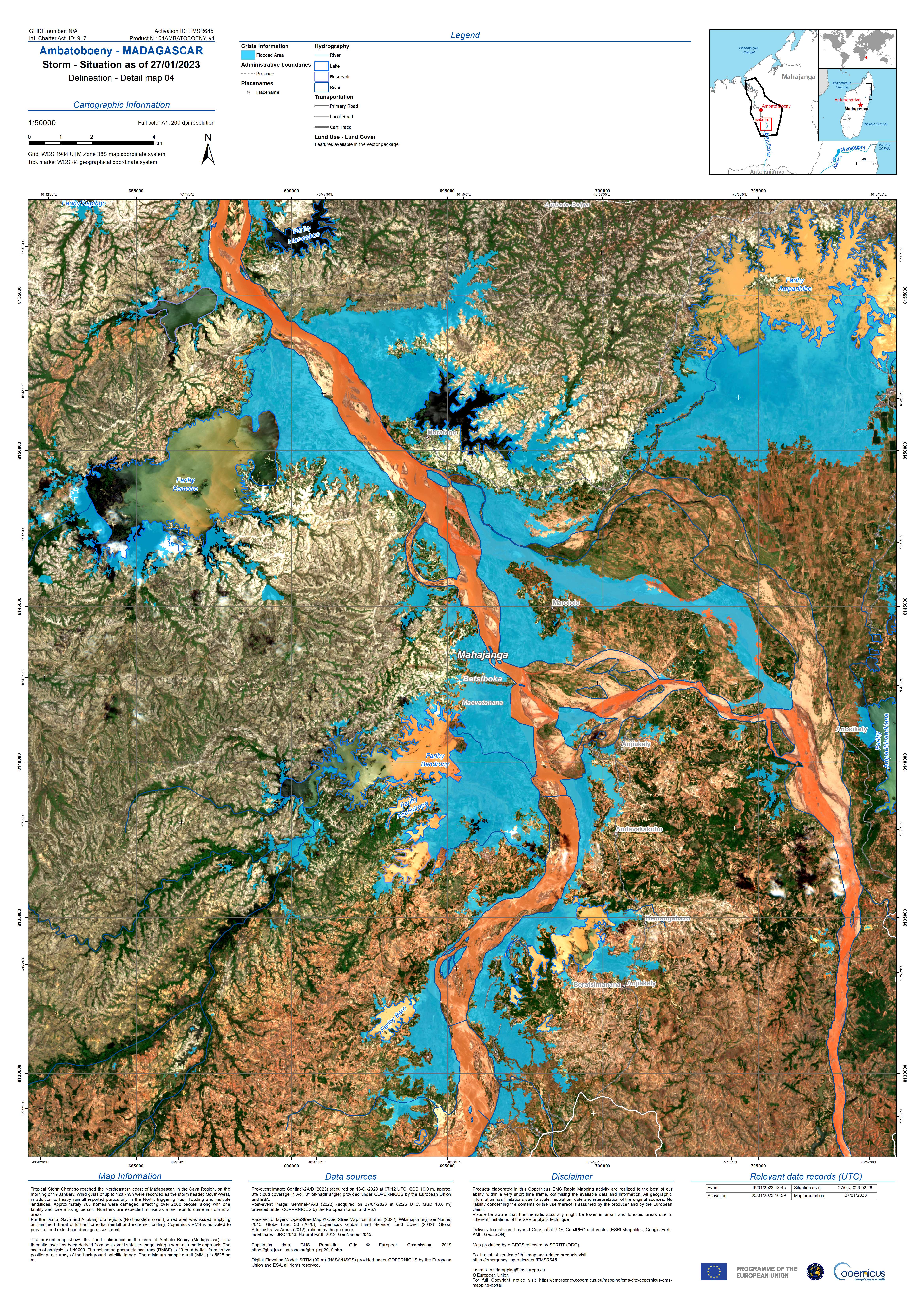
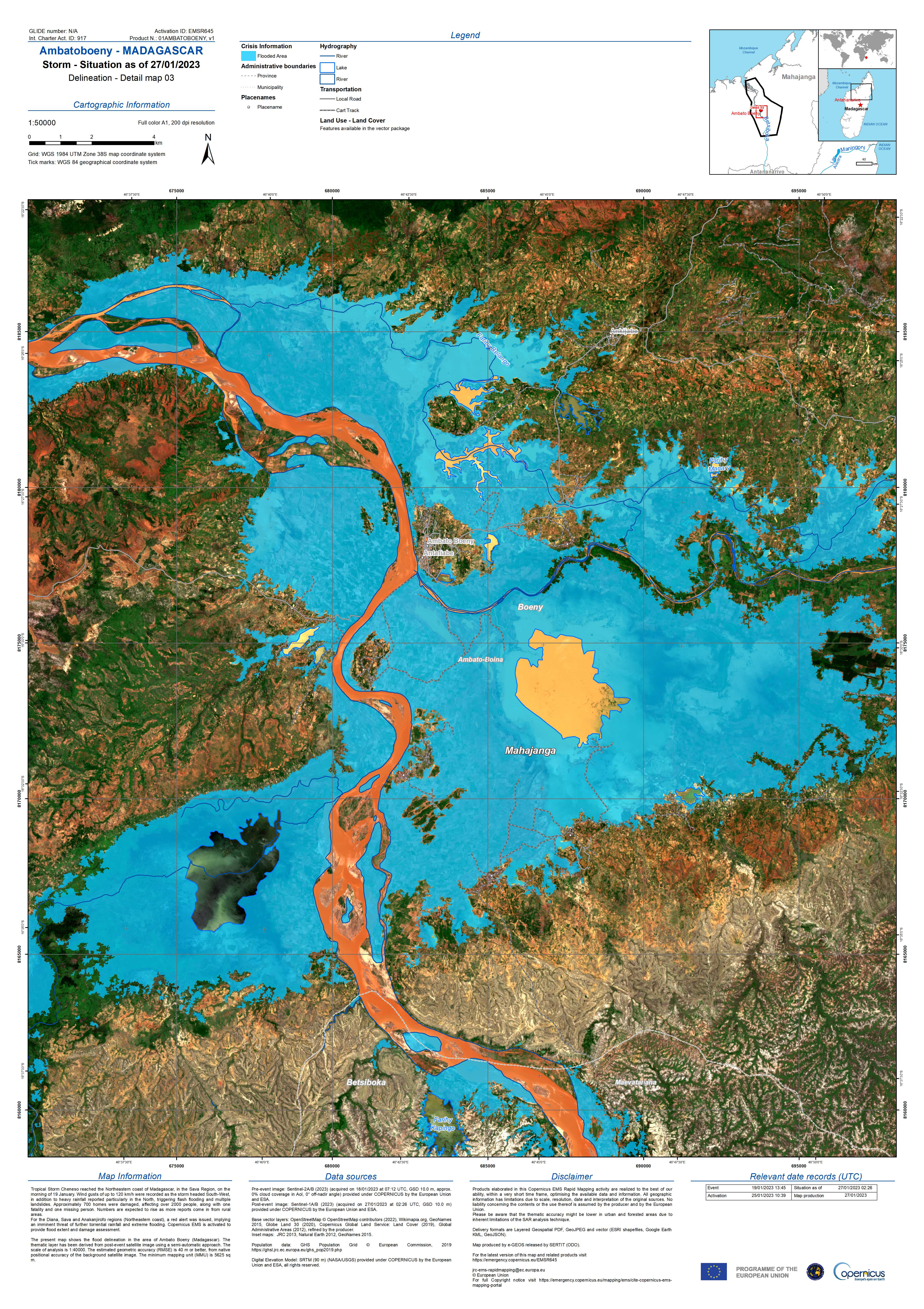
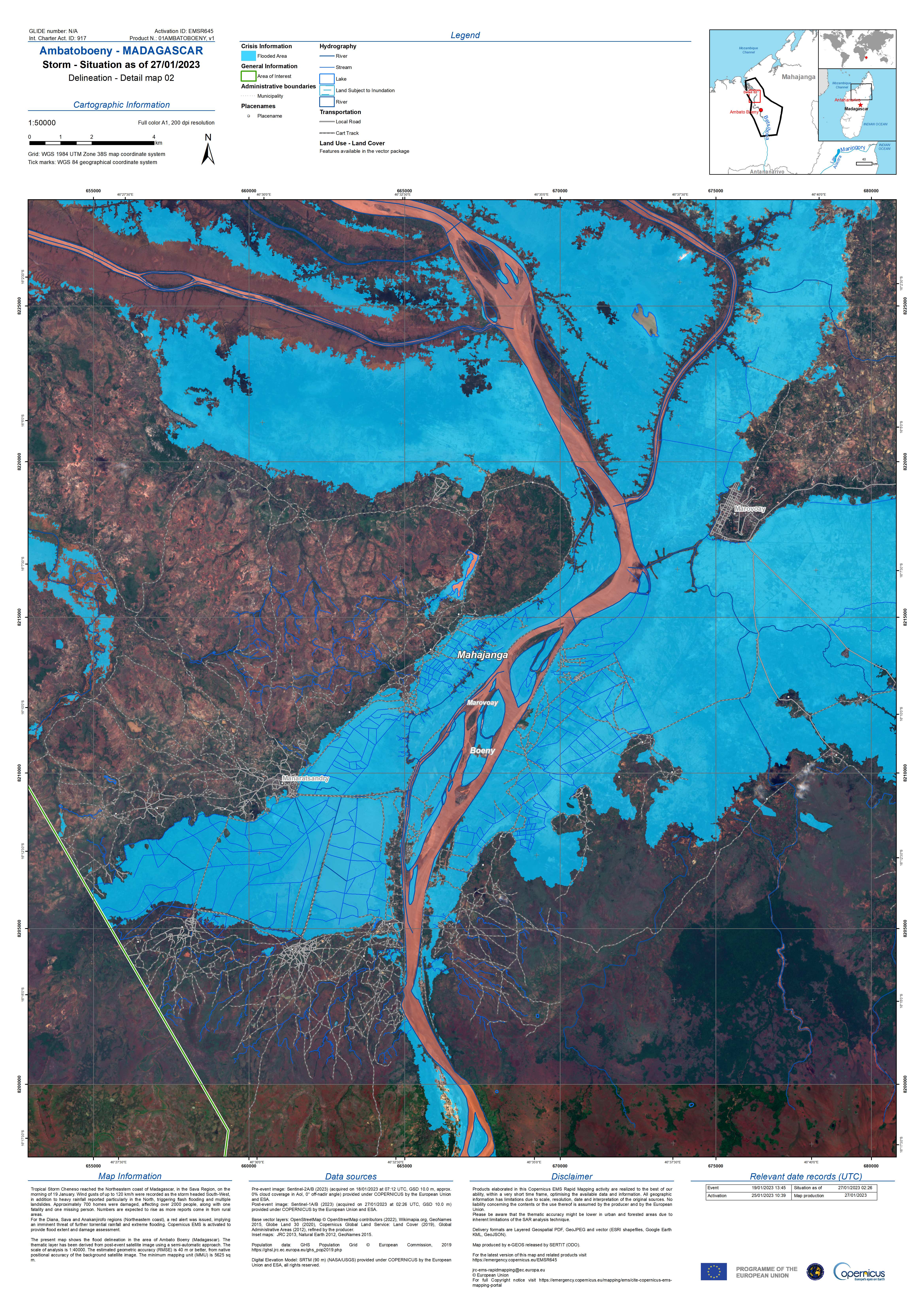
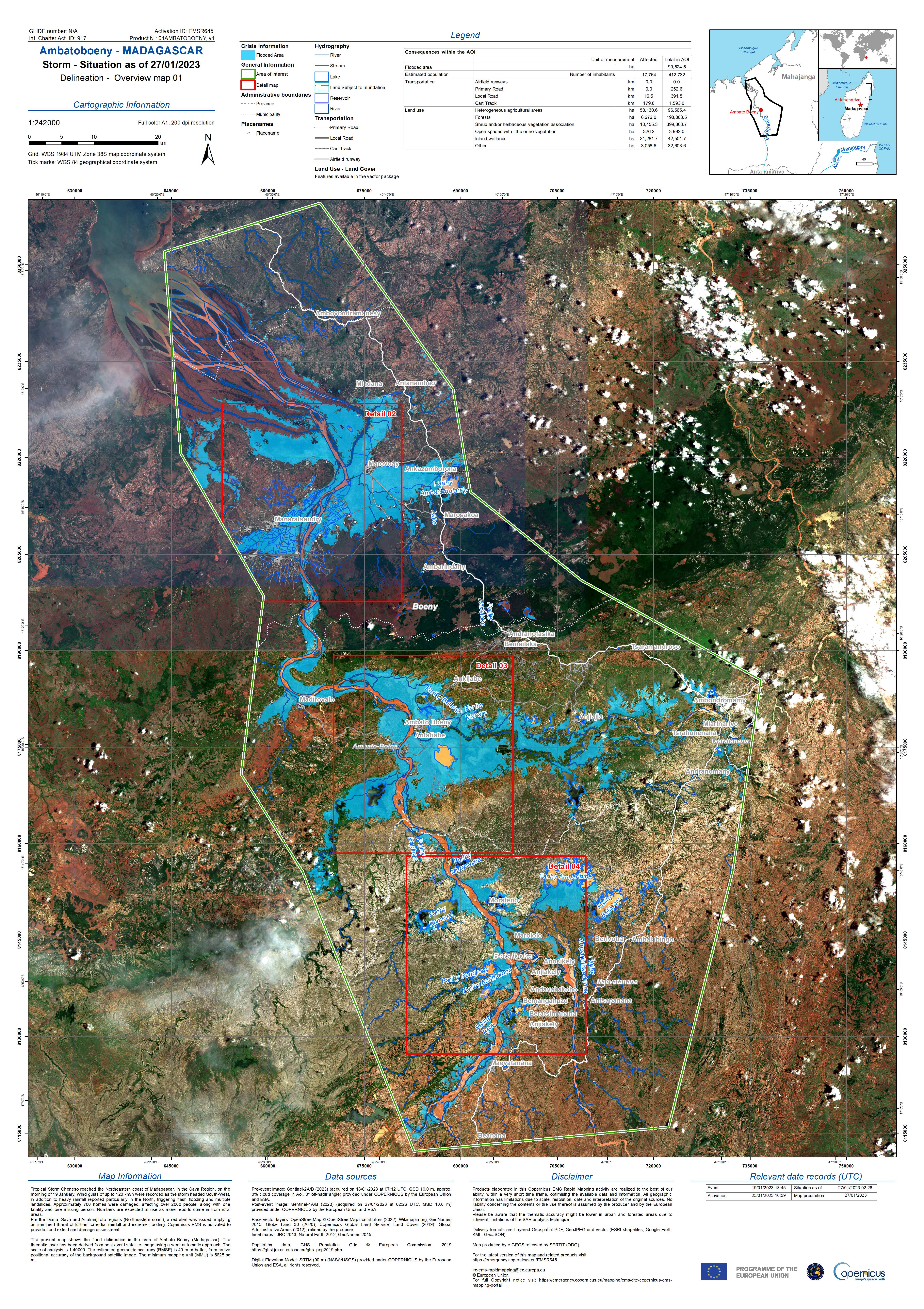
Tropical Storm Cheneso in Madagascar
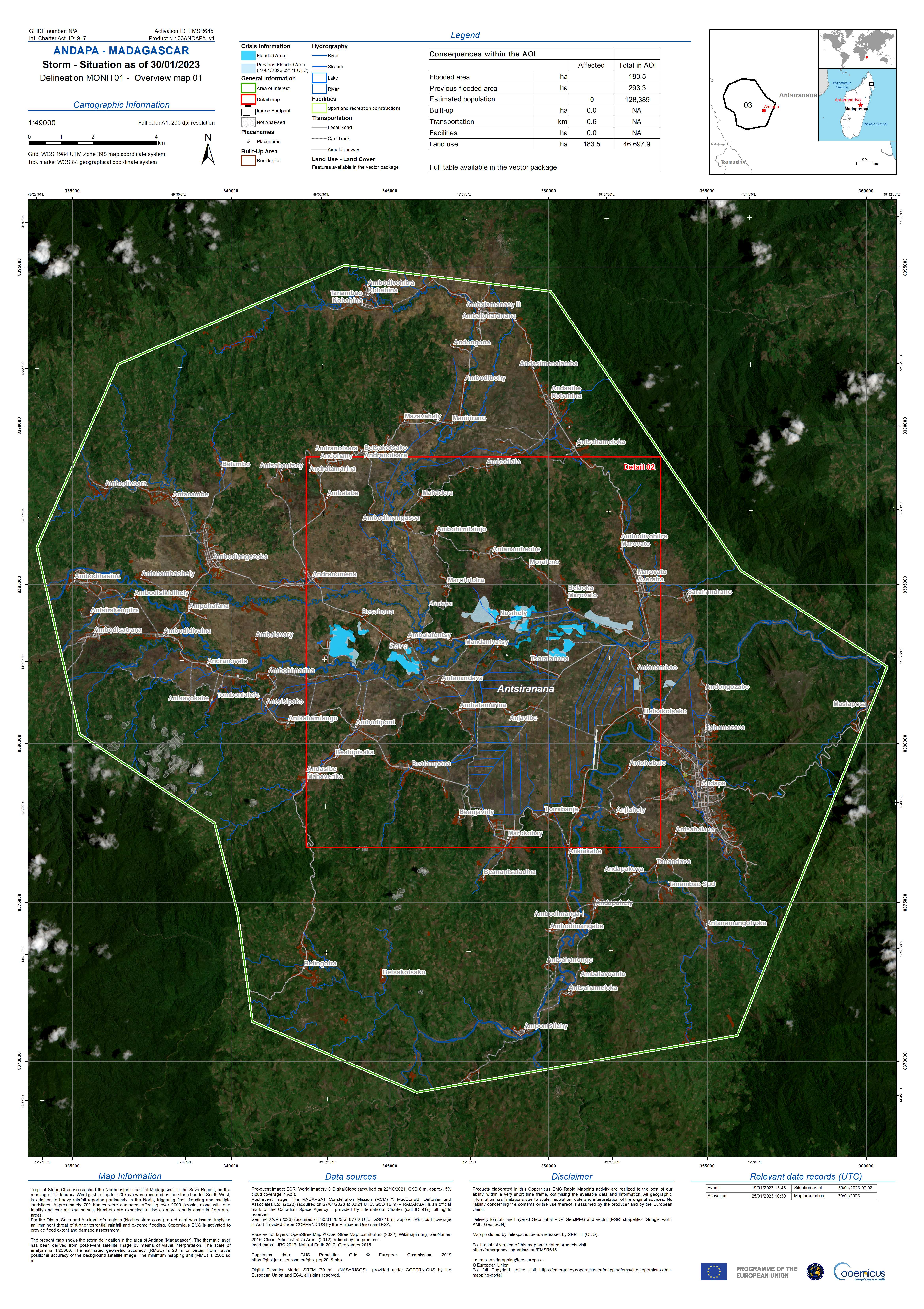
Tropical Storm Cheneso reached the North-Eastern Coast of Madagascar, in the Sava Region, on morning of 19 January 2023.
Average winds of 90 km/h and wind gusts of up to 120 km/h were recorded as the storm headed South-West along the island in addition to reports of heavy rainfall particularly in the North which triggered flash flooding and, consequently, multiple landslides.
Approximately 700 homes have been damaged, affecting over 2000 people, along with one fatality and one missing person although the number of affected is expected to rise as more reports and damage assessments come in from rural areas.
The Diana, Sava and Anakanjirofo regions along the North-Eastern coasts have been issued with a red alert, which implies that there is an imminent threat of further torrential rainfall and extreme flooding. Cheneso is Madagascar's first tropical storm of the current cyclone season.
Related News and Resources:
| Тип события: | Tropical Storm, Floods, Landslide |
| Место события: | Madagascar |
| Date of Charter Activation: | 2023-01-24 |
| Время активации Хартии: | 10:55 |
| TЧасовой пояс в районе активации Хартии: | UTC+01:00 |
| Запрос на активацию поступил от: | Bureau National de Gestion des Risques et des Catastrophes (BNGRC) Route du Mausolée Antanimora 101 Antananarivo Madagascar (BNGRC) |
| Номер активации: | 795 |
| Менеждер проекта от: | ICube-SERTIT |
| act-value-adders: | Copernicus EMS Sitraka Ranoeliarivao |
| Activation handled in collaboration with Copernicus Emergency Management Service |
Products
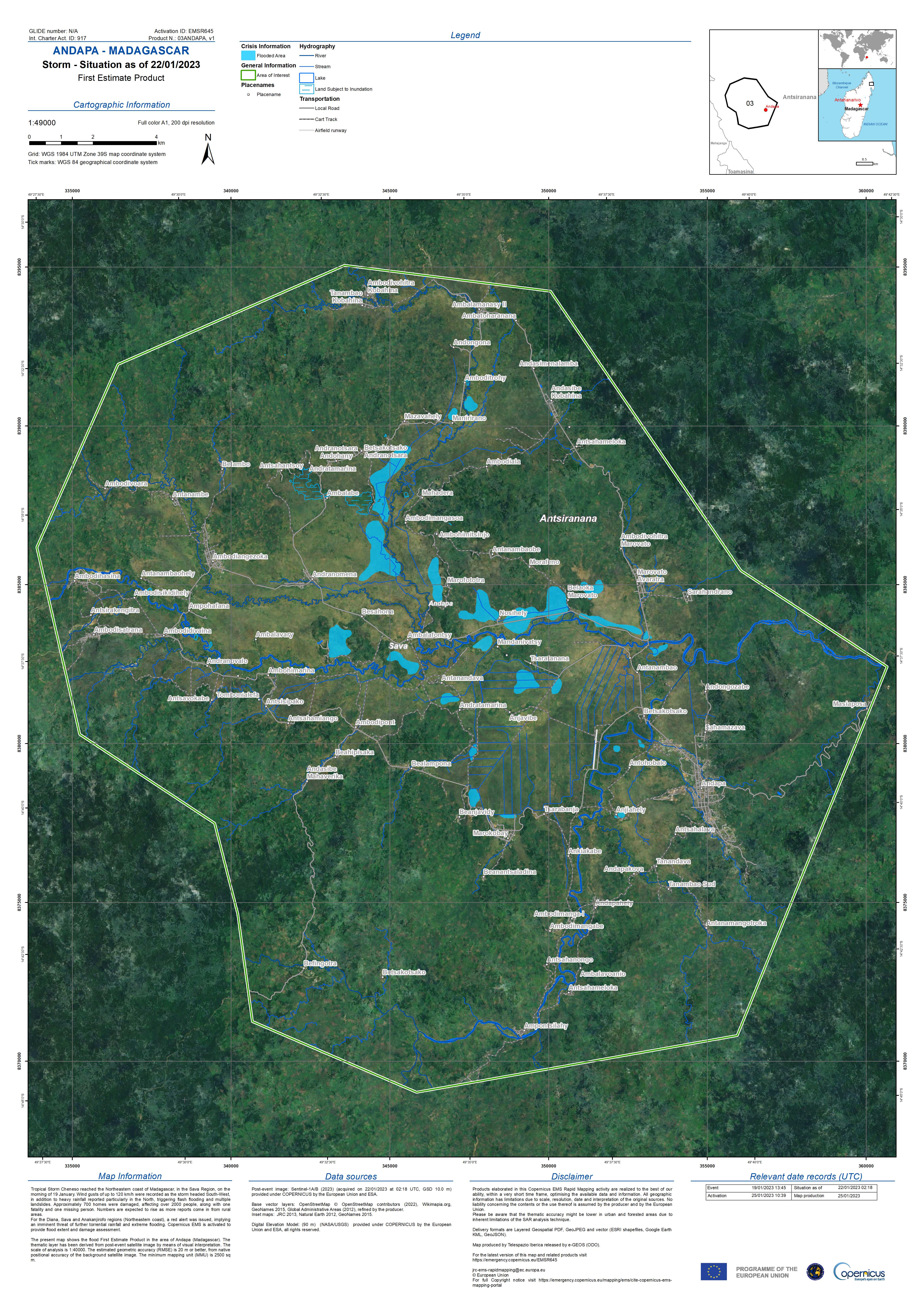
Map showing Flooding in Andapa, Madagascar
Авторские права: Contains modified Copernicus Sentinel data (2023)
RADARSAT Constellation Mission Imagery © Government of Canada (2023) - RADARSAT is an official mark of the Canadian Space Agency.
Map produced by Telespazio Iberica.
Information about the Product
Получено: Sentinel-2: 30/01/2023
RCM: 27/01/2023
Источник: Sentinel-2 and RCM
Категория: Delineation Monitoring Maps
Overview Map of Flooding in Andapa, Madagascar
Авторские права: RADARSAT Constellation Mission Imagery © Government of Canada (2023) - RADARSAT is an official mark of the Canadian Space Agency.
Contains modified Copernicus Sentinel data (2023)
Map produced by Telespazio Iberica.
Information about the Product
Получено: RCM: 27/01/2023
Sentinel-2: 30/01/2023
Источник: RCM and Sentinel-2
Категория: Delineation Monitoring Maps

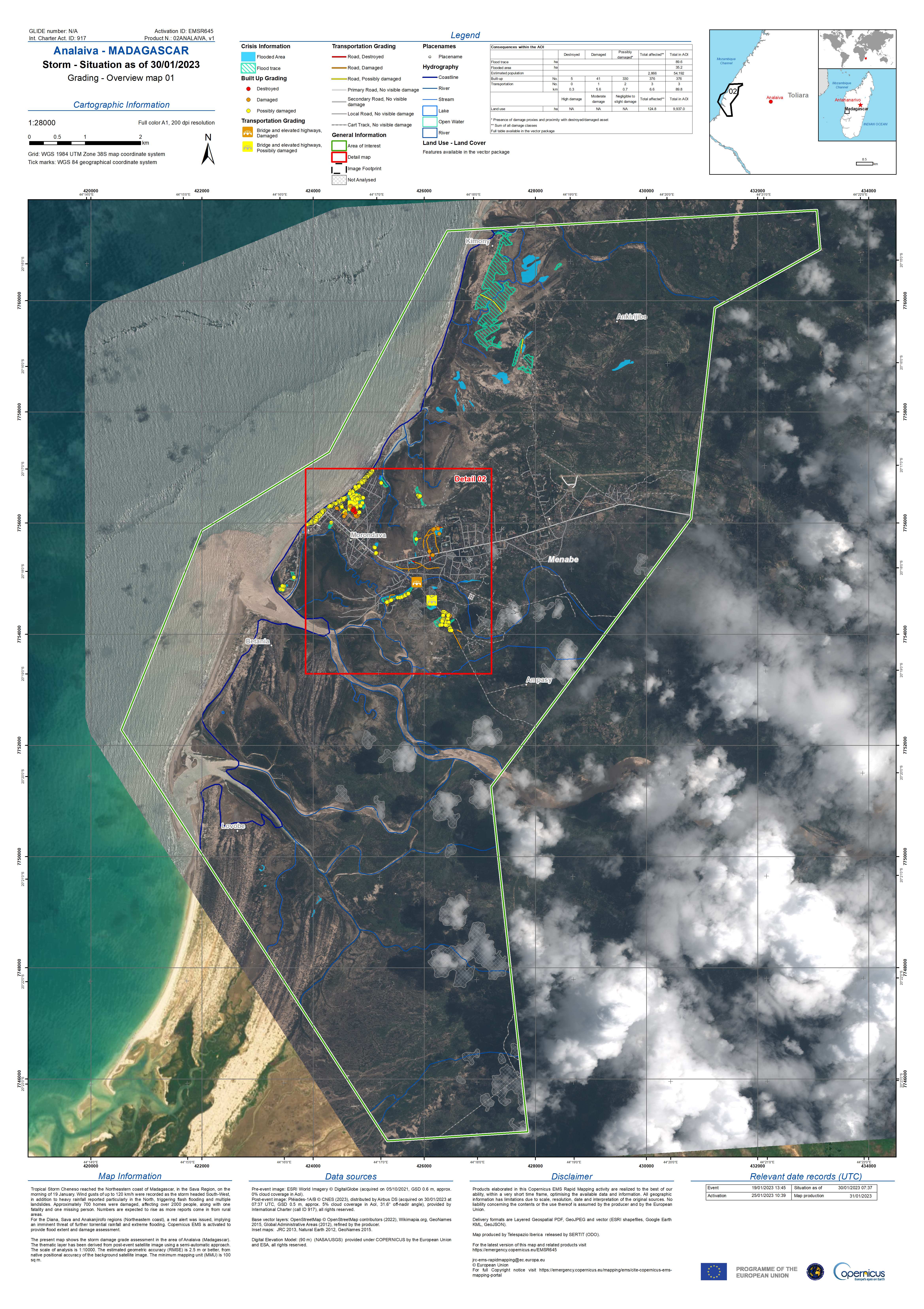
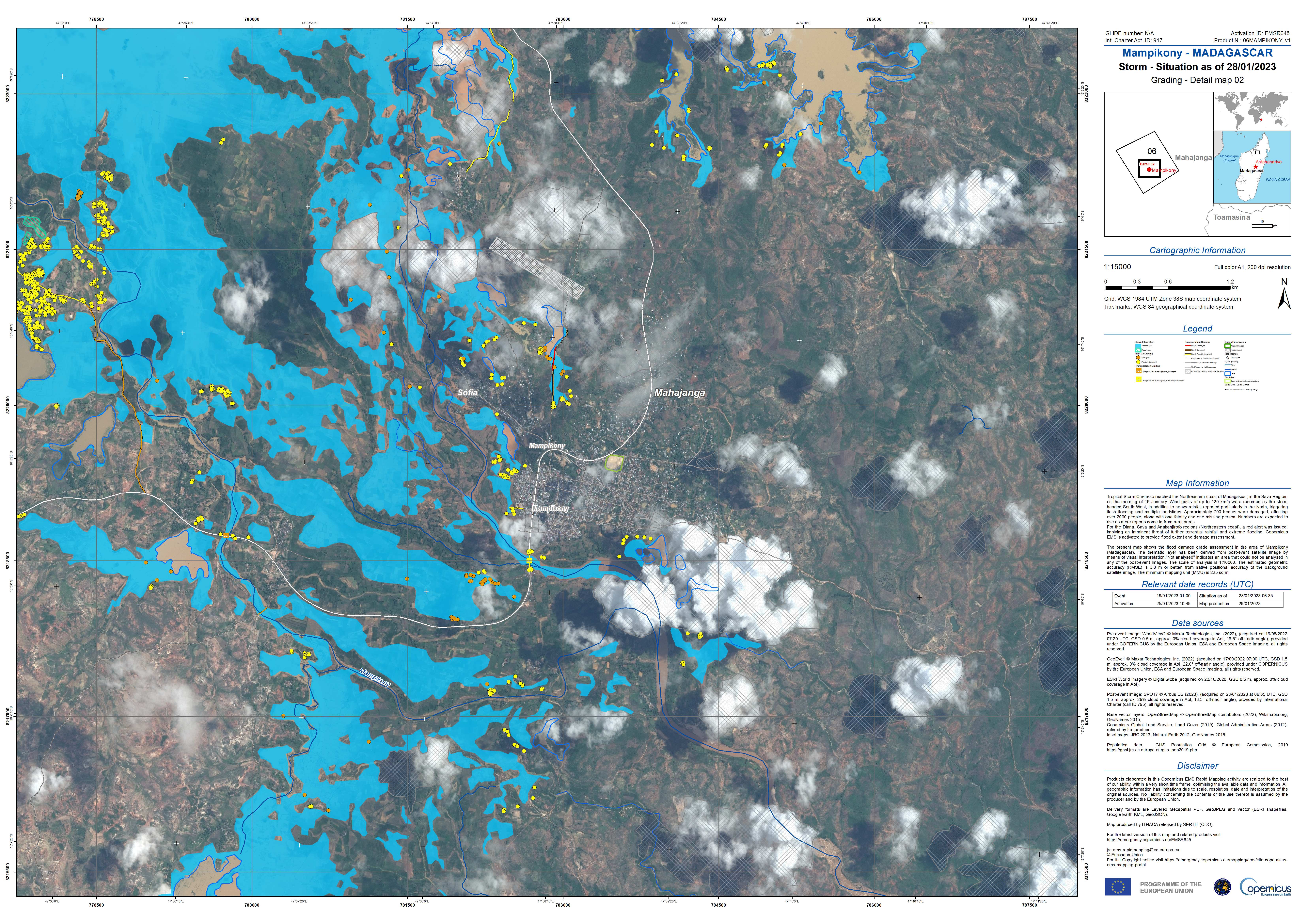
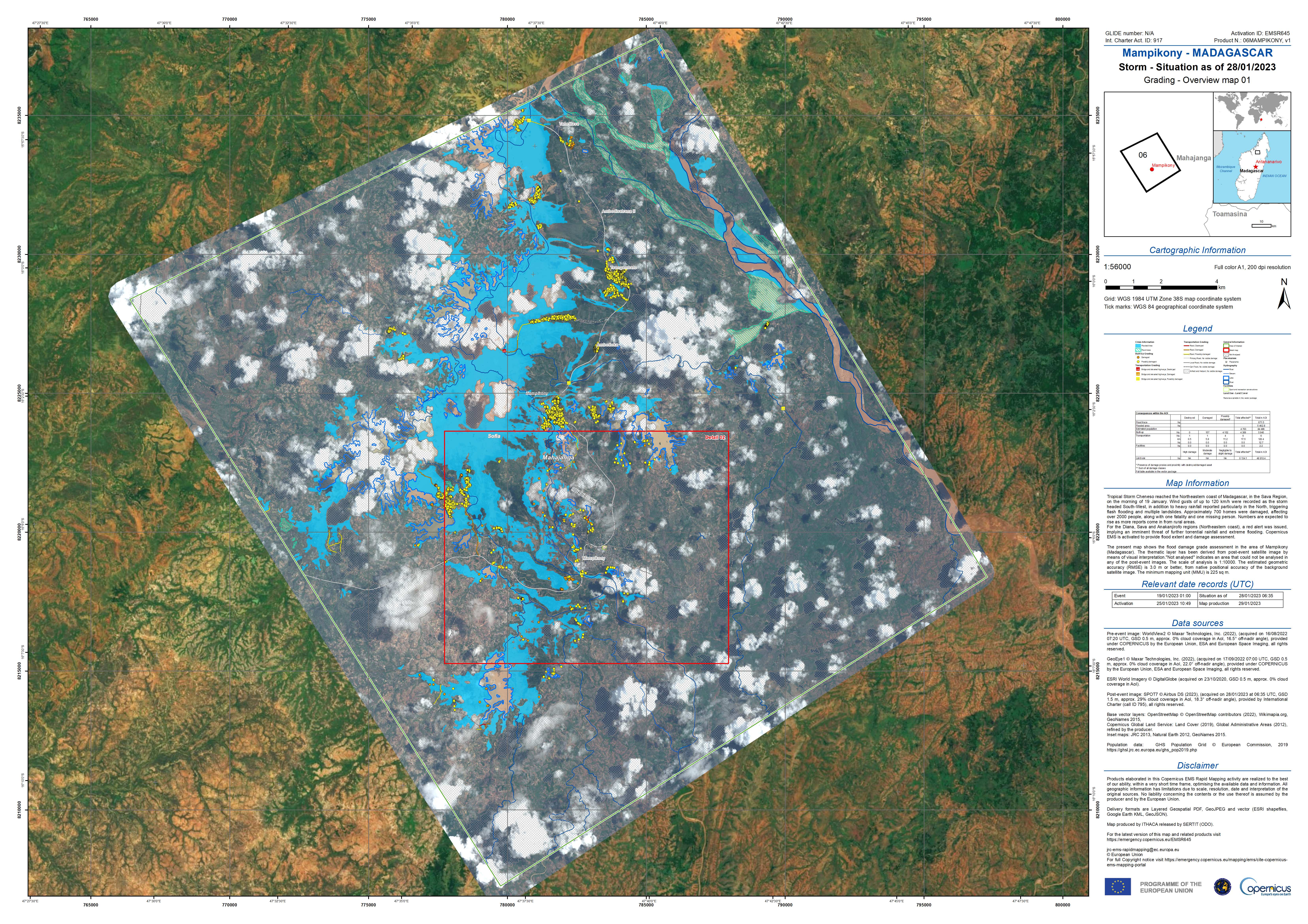
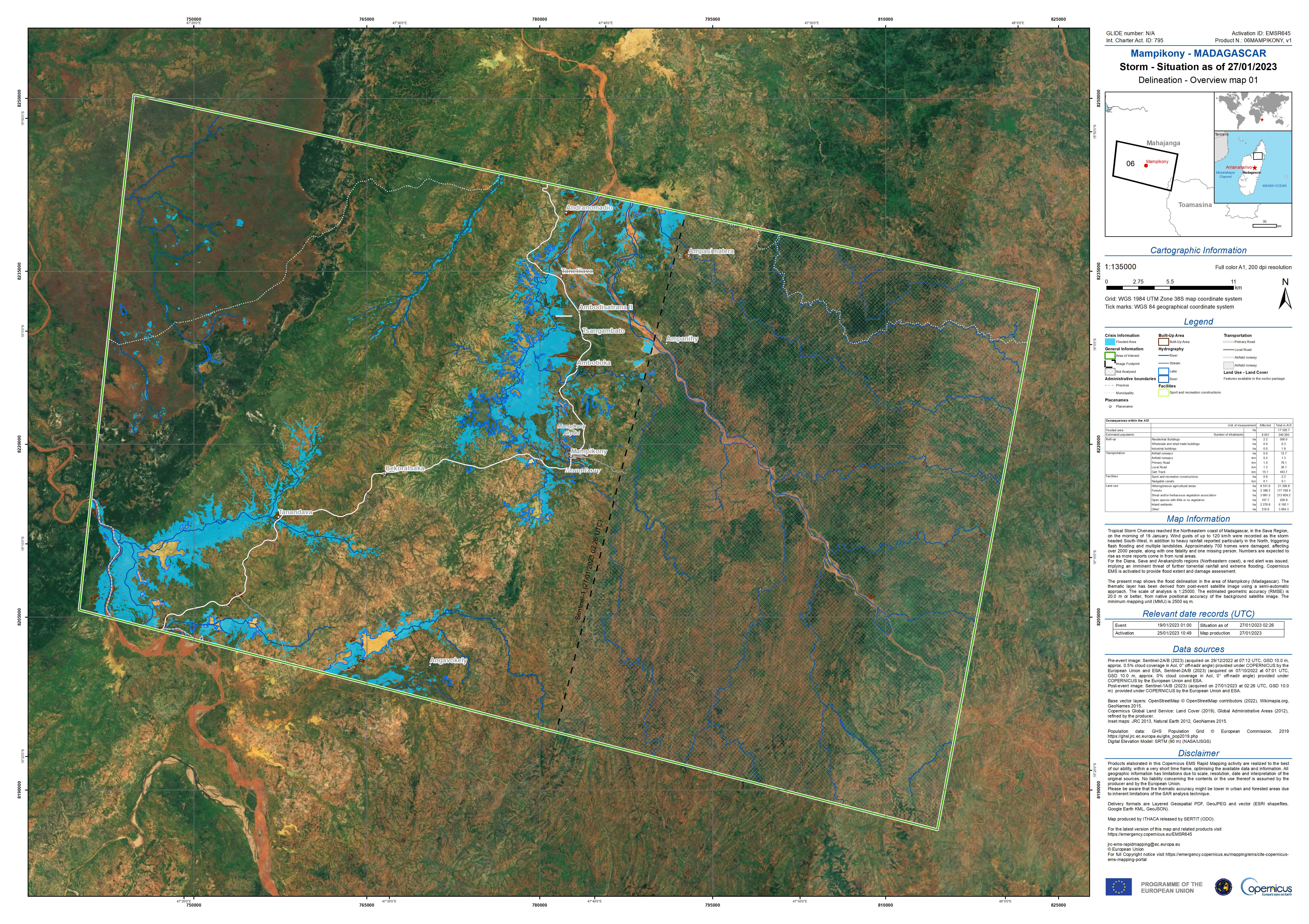
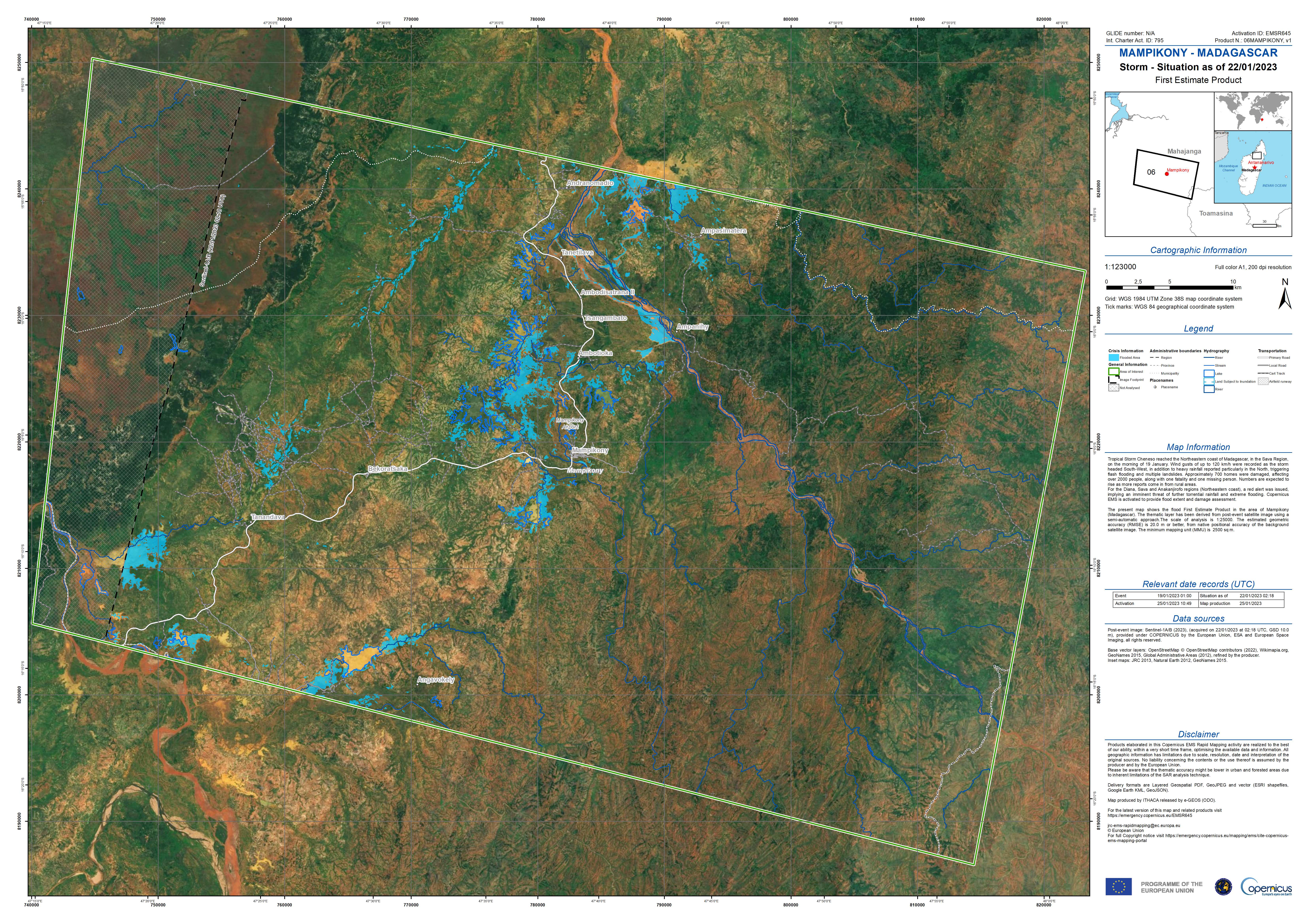
Grading Map showing Flooding in Mampikony, Madagascar
Авторские права: WorldView-2 © Maxar Technologies, Inc. (2023)
GeoEye-1 © 2004 GeoEye NextView License
Includes material © AIRBUS DS (2023)
Map produced by e-GEOS.
Information about the Product
Получено: WorldView-2: 16/08/2022
GeoEye-1: 17/09/2022
SPOT-7: 28/01/2023
Источник: WorldView-2, GeoEye-1 and SPOT-7
Категория: Grading Map

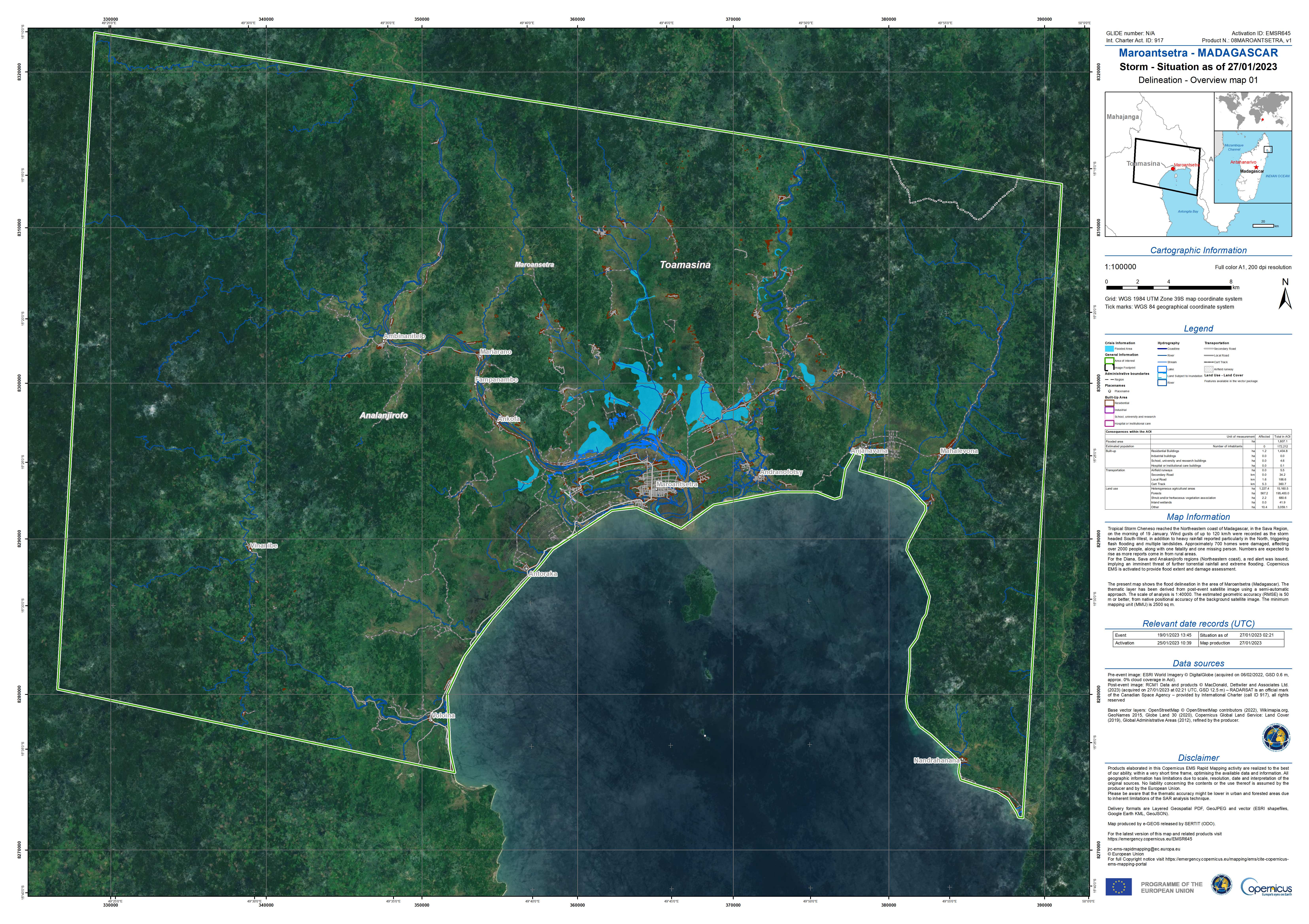
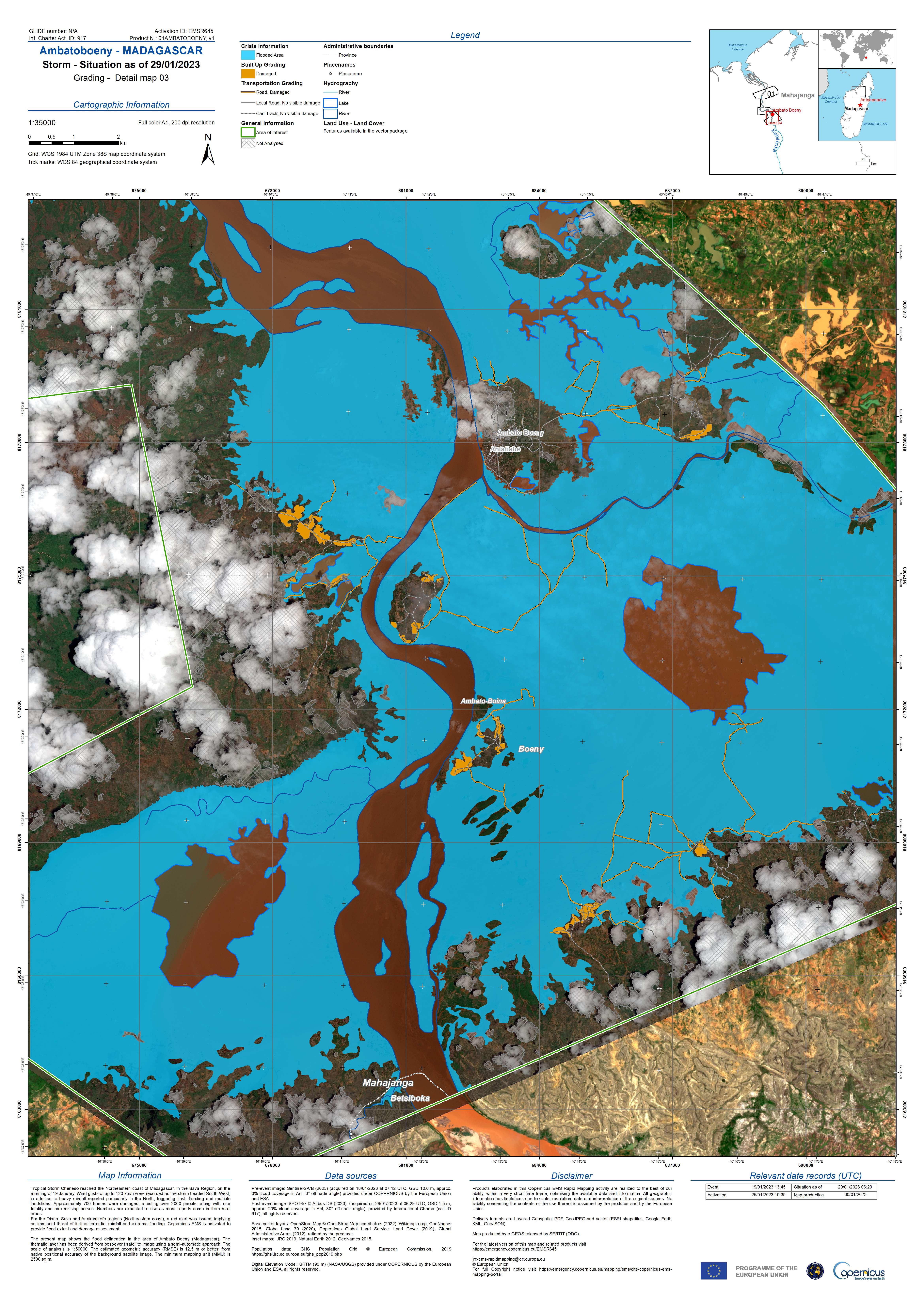
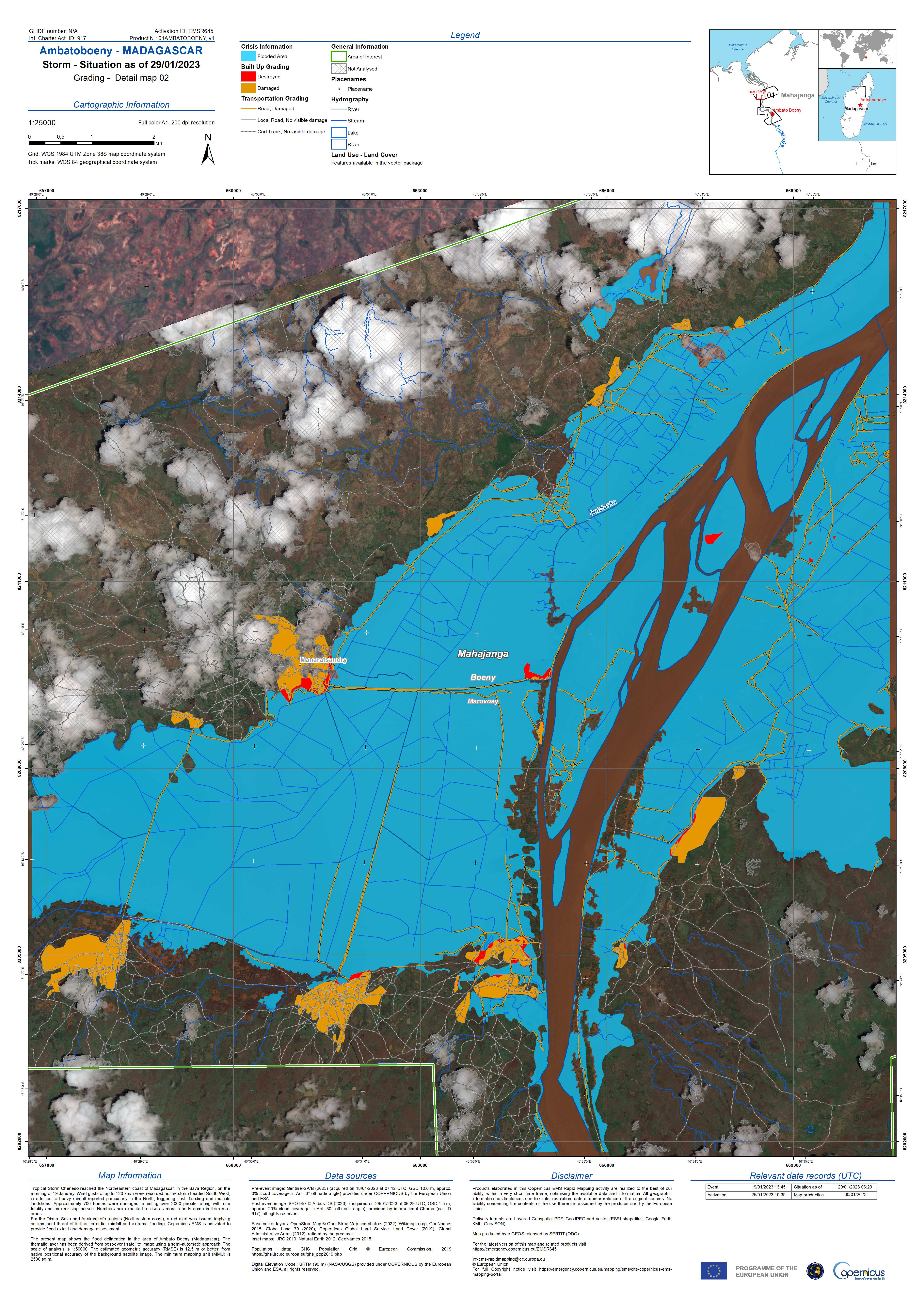
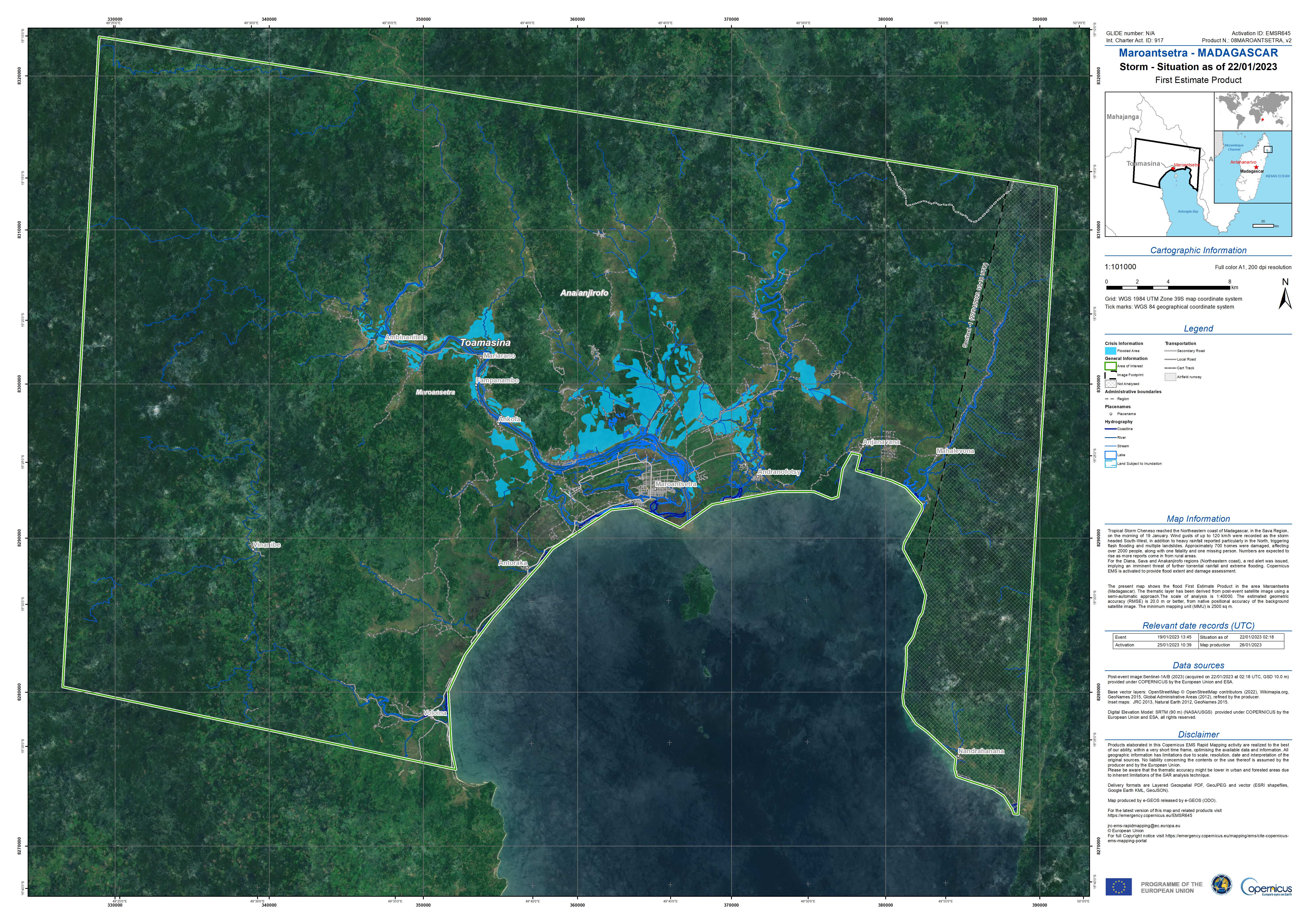
Delineation Map showing Flooding in Maroantsetra, Madagascar
Авторские права: RADARSAT Constellation Mission Imagery © Government of Canada (2023)
RADARSAT is an official mark of the Canadian Space Agency.
Map produced by e-GEOS.
Information about the Product
Получено: 27/01/2023
Источник: RCM
Категория: Delineation Map
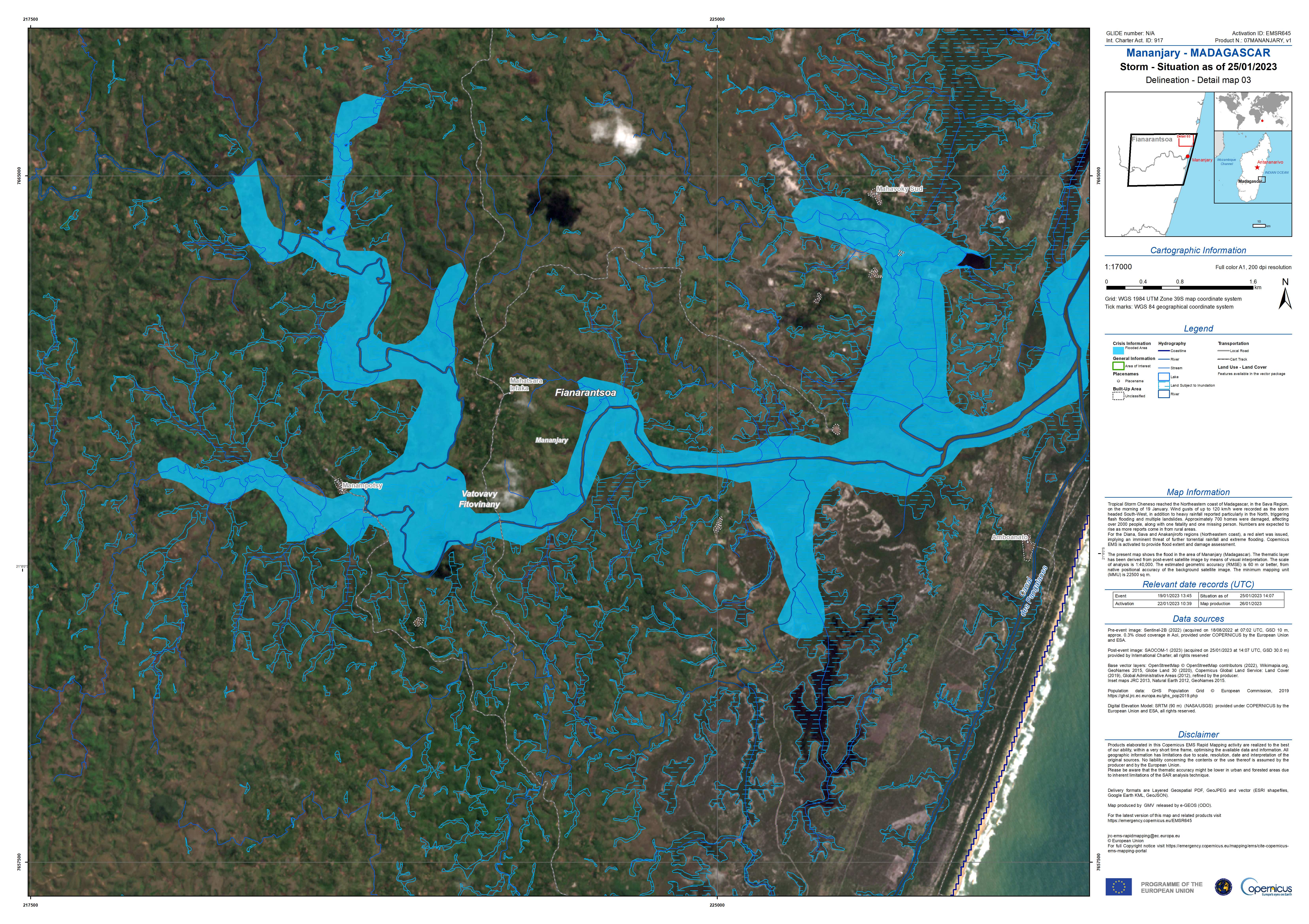
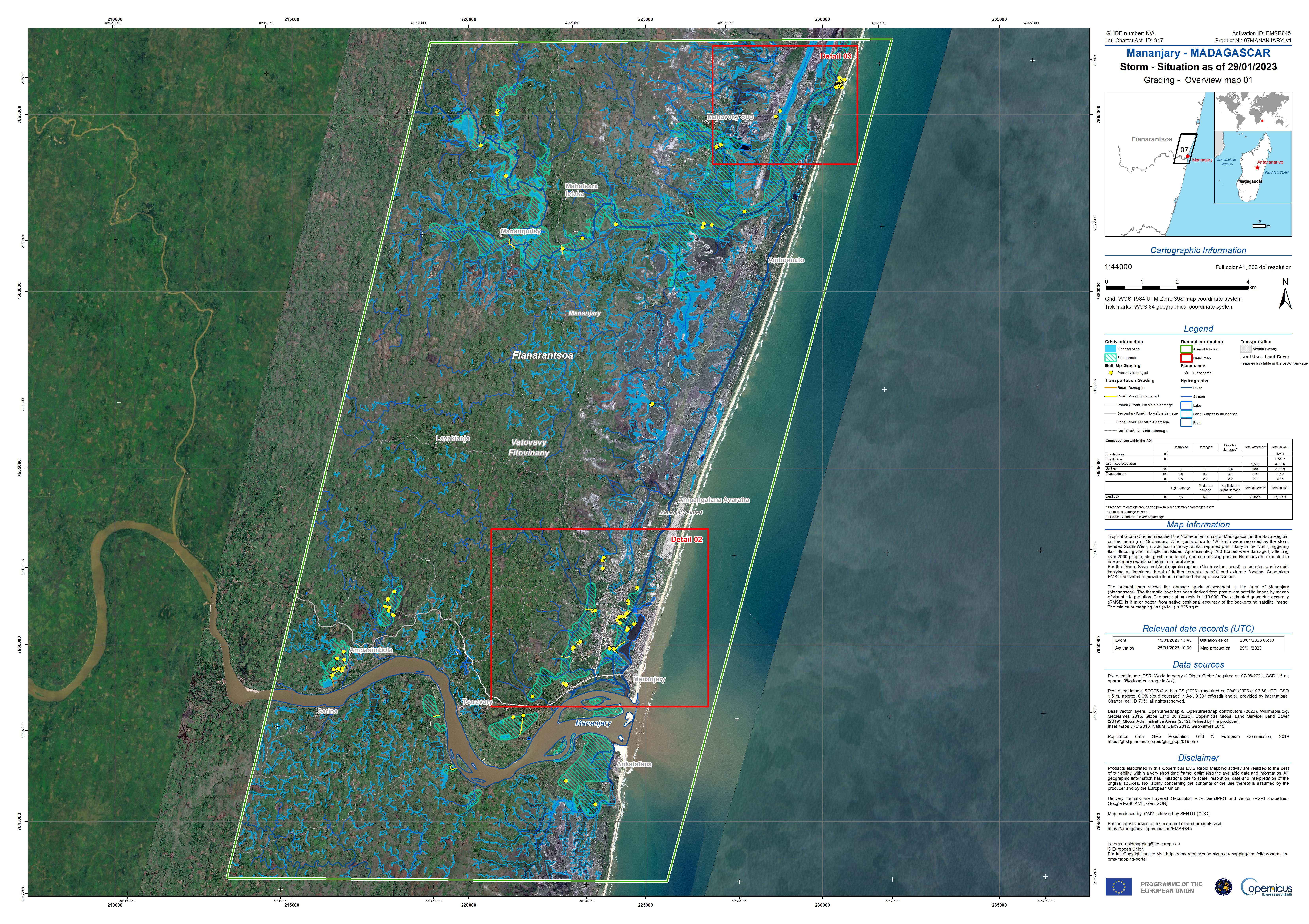
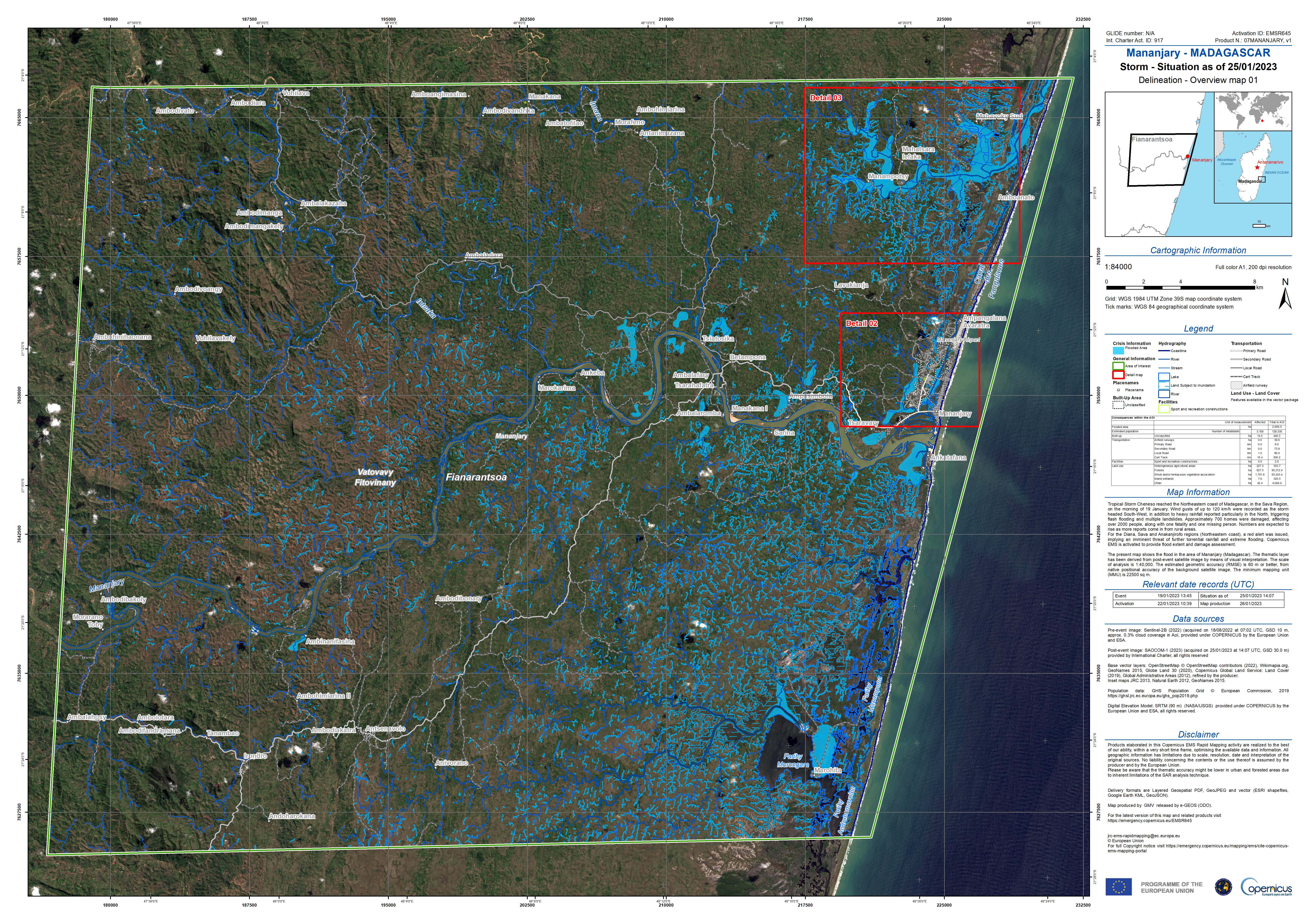
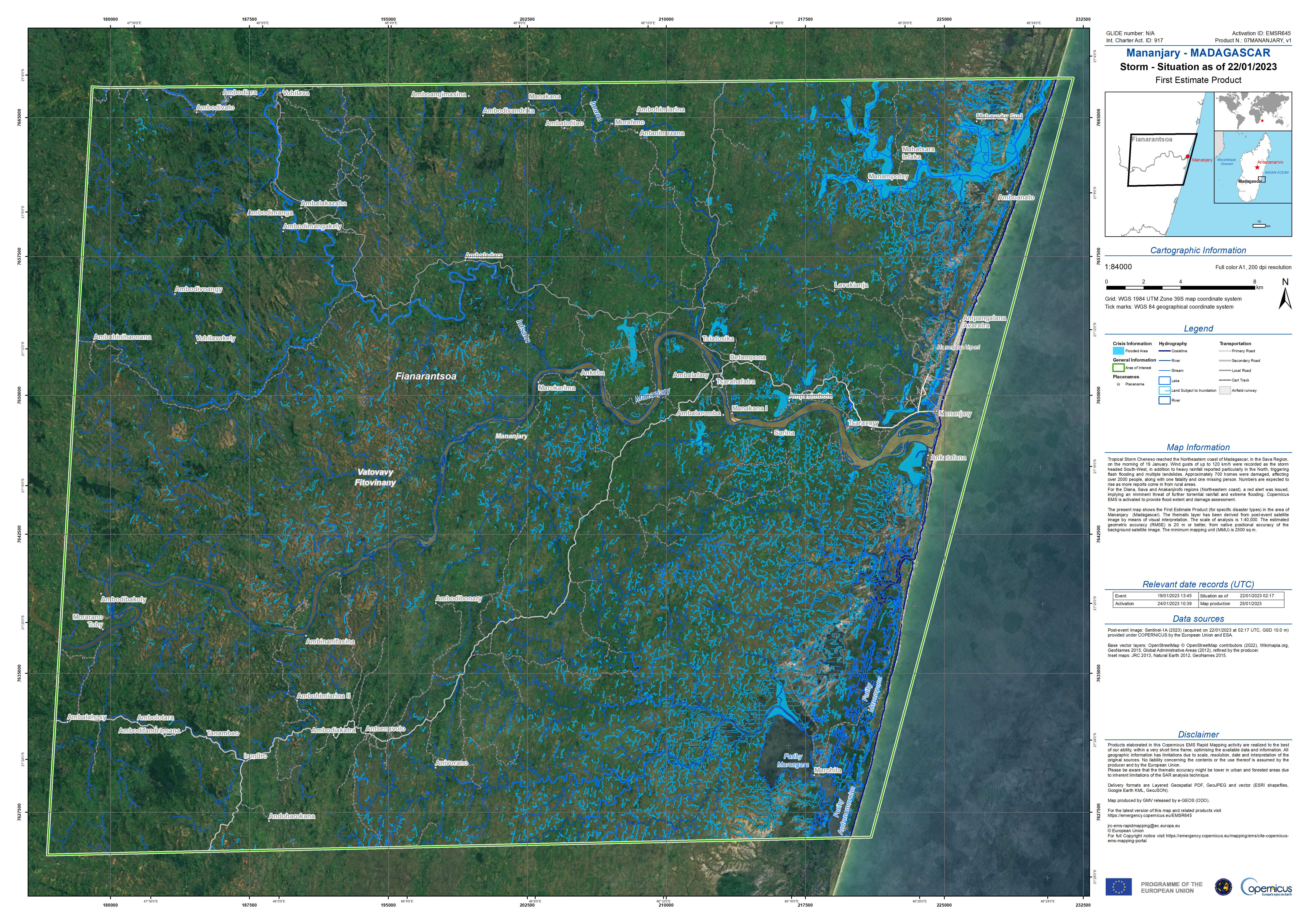
Delineation Map showing Flooding in Mananjary, Madagascar
Авторские права: SAOCOM © CONAE (2023)
Contains modified Copernicus Sentinel data (2022)
Map produced by e-GEOS.
Information about the Product
Получено: Sentinel-2: 18/08/2022
SAOCOM-1: 25/01/2023
Источник: Sentinel-2 and SAOCOM-1
Категория: Delineation Map
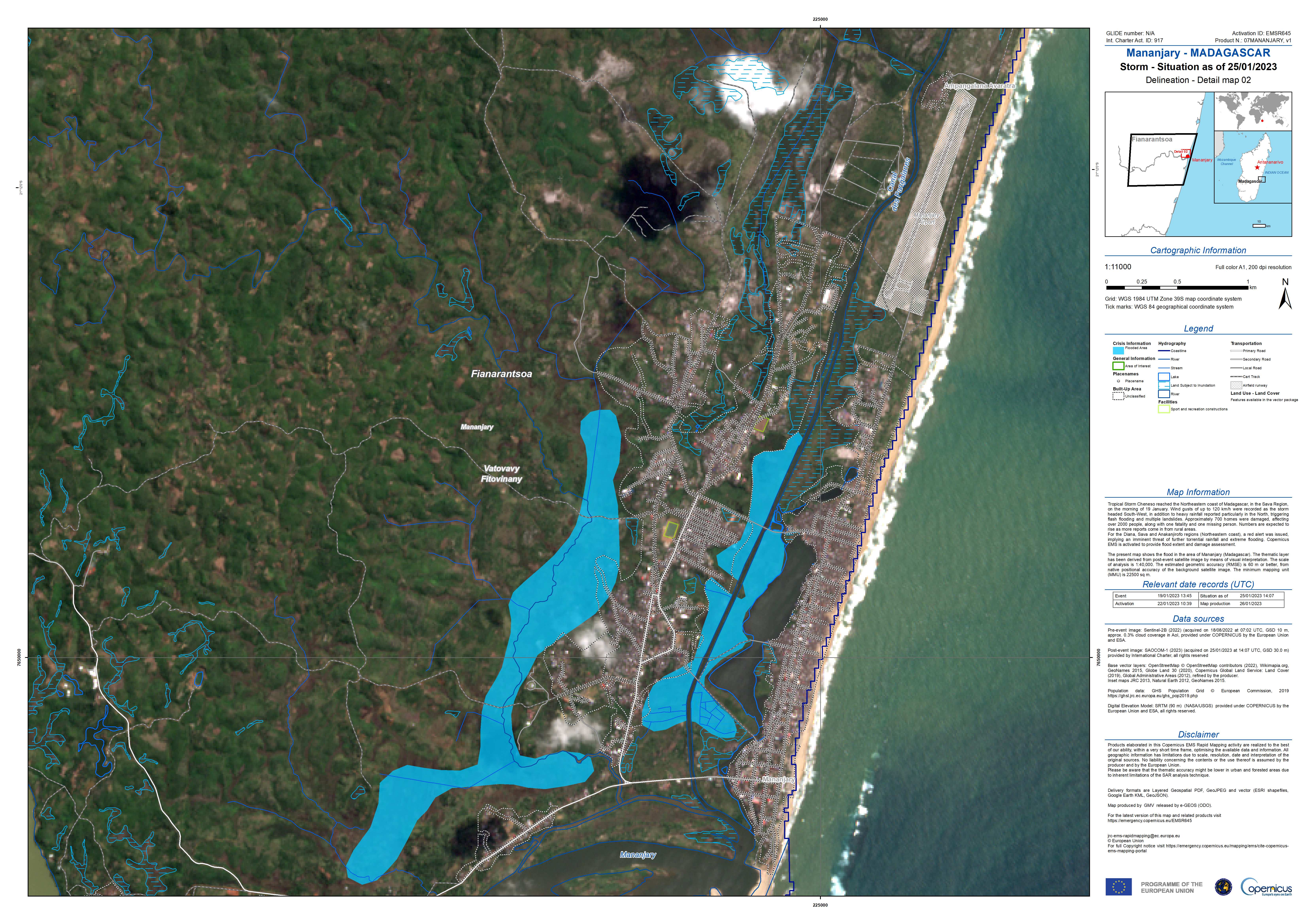
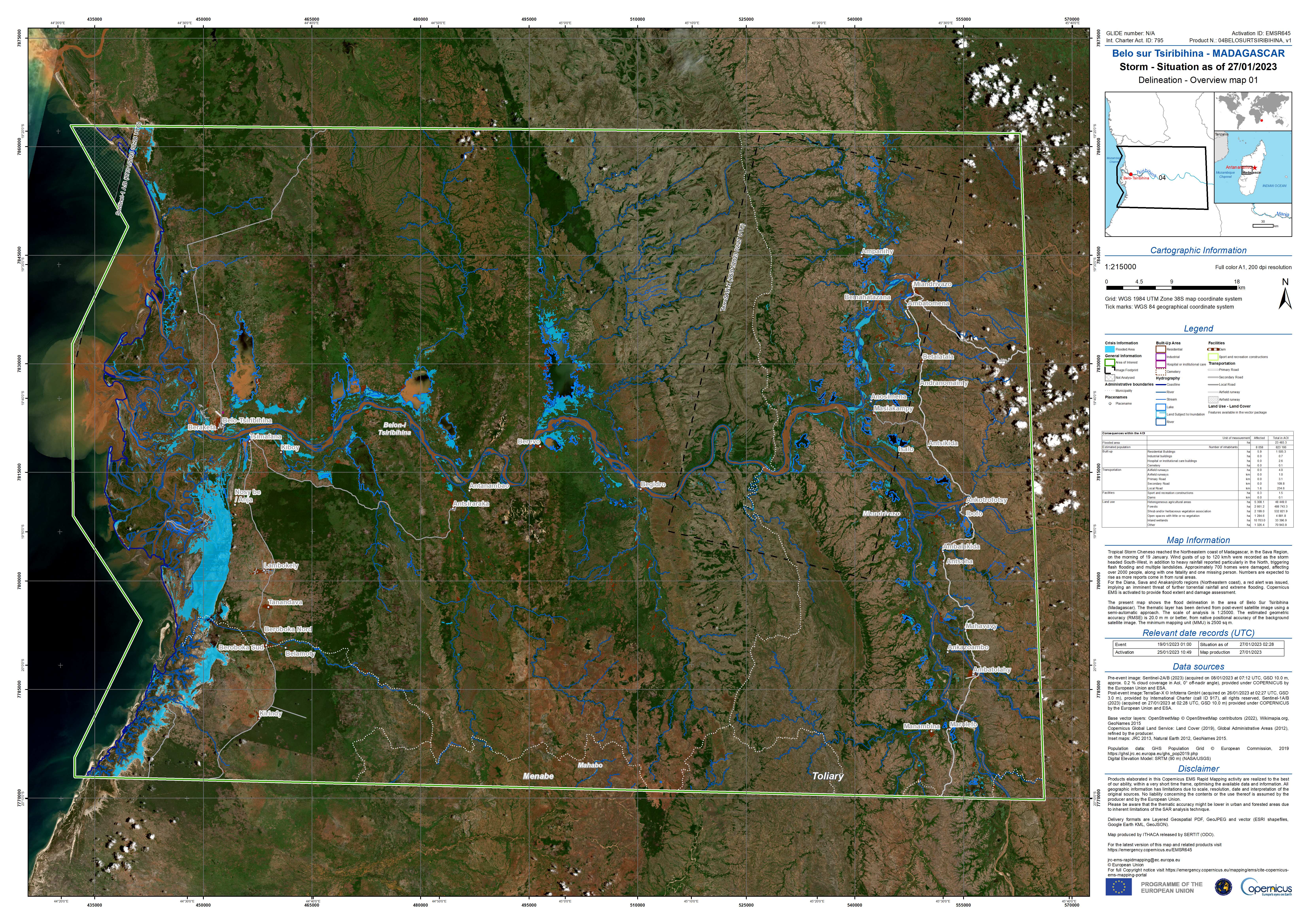
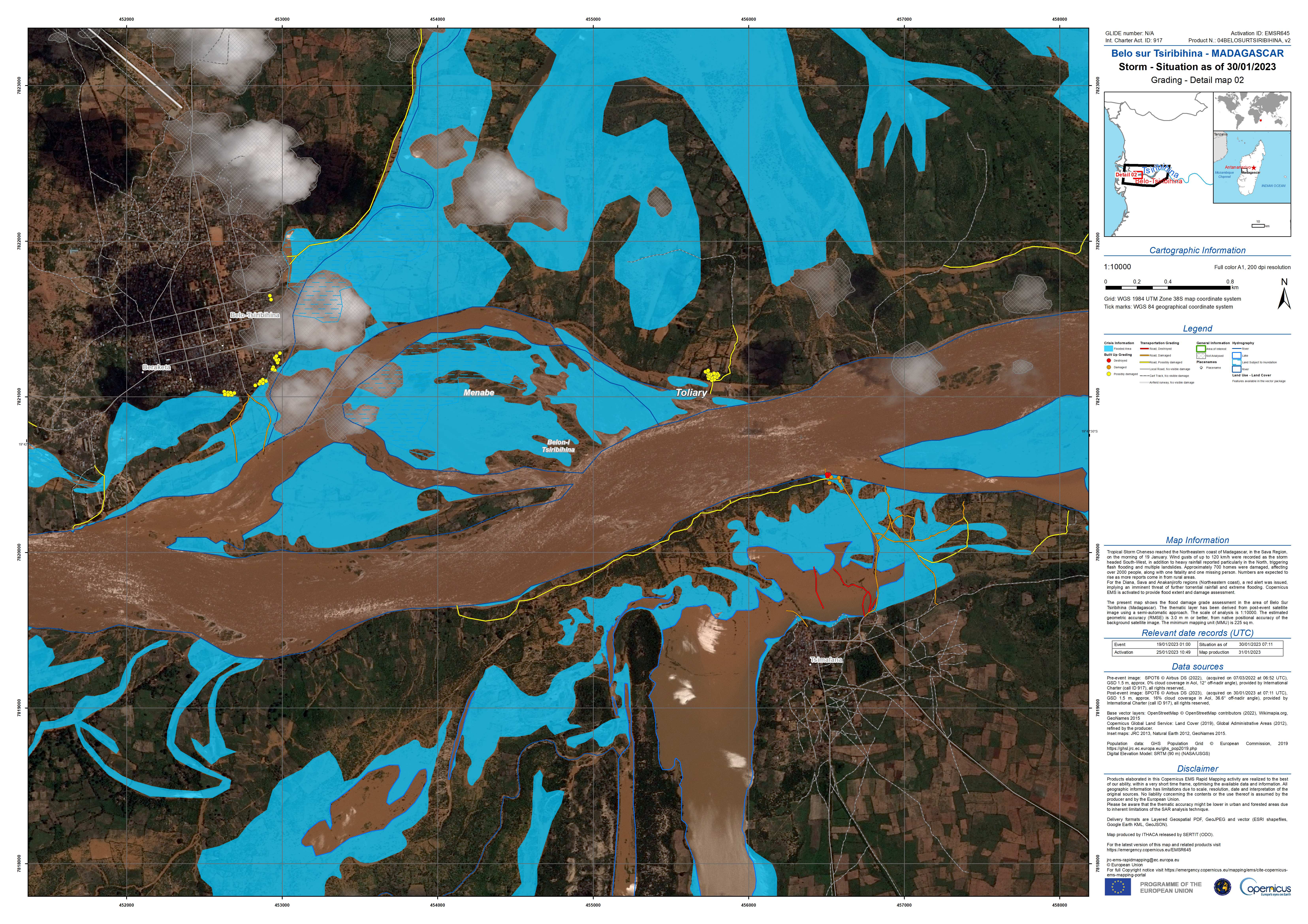
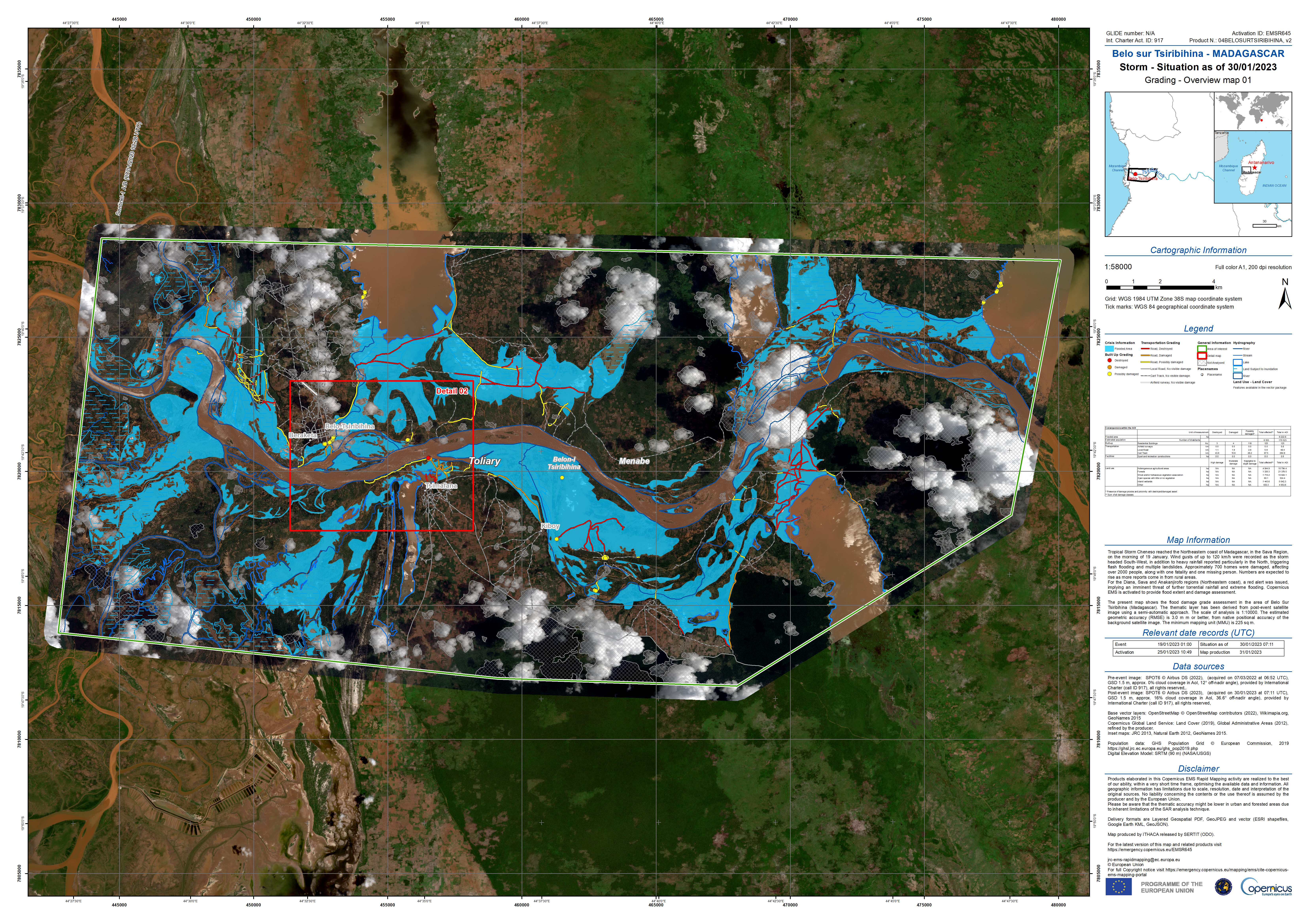
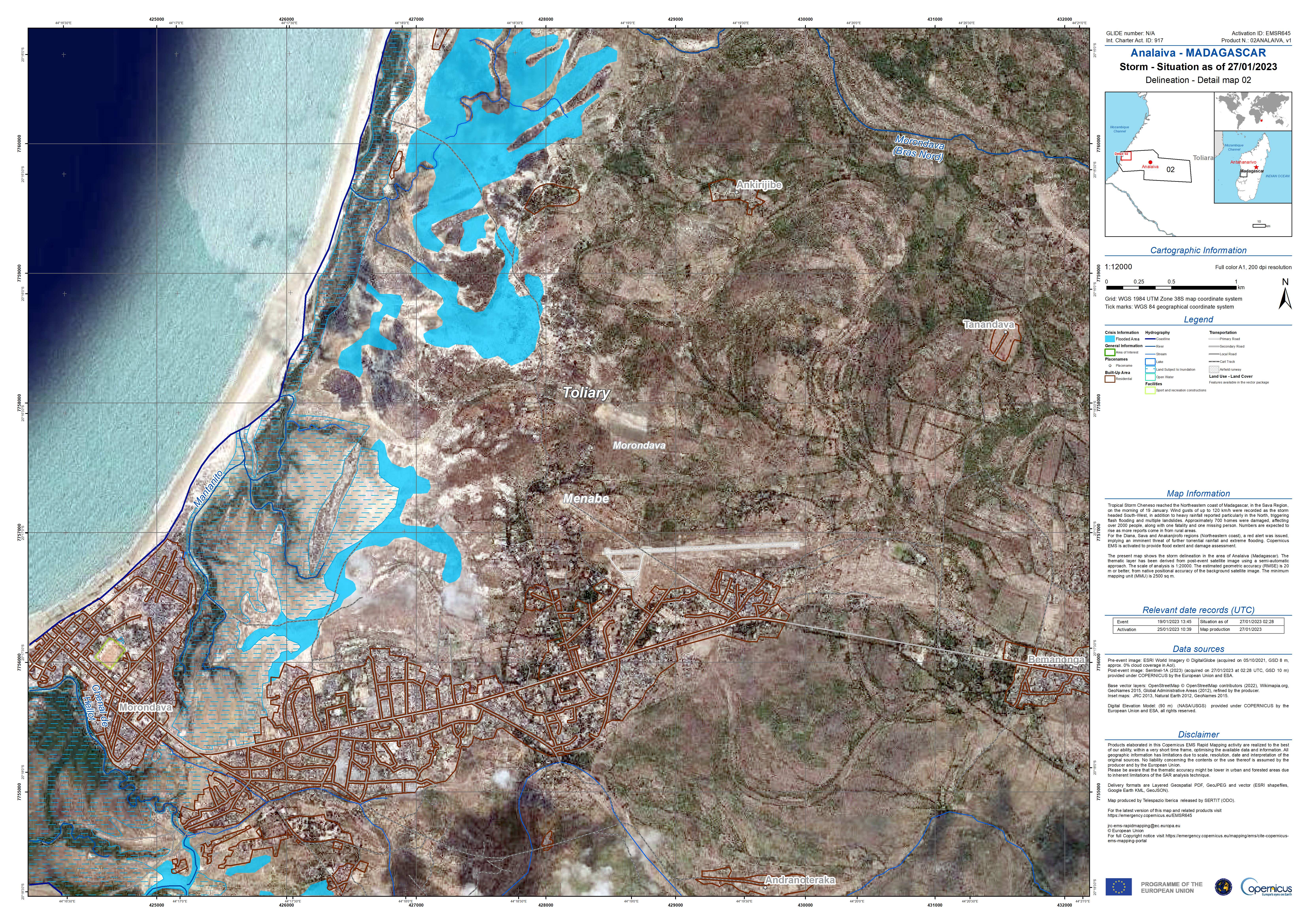
Delineation Map showing Flooding in Belo-sur-Tsiribihina, Madagascar
Авторские права: Contains modified Copernicus Sentinel data (2023)
TerraSAR-X © DLR e.V. (2023), Distribution Airbus DS Geo GmbH.
Map produced by e-GEOS.
Information about the Product
Получено: Sentinel-2: 08/01/2023
TerraSAR-X: 26/01/2023
Источник: Sentinel-2 and TerraSAR-X
Категория: Delineation Map

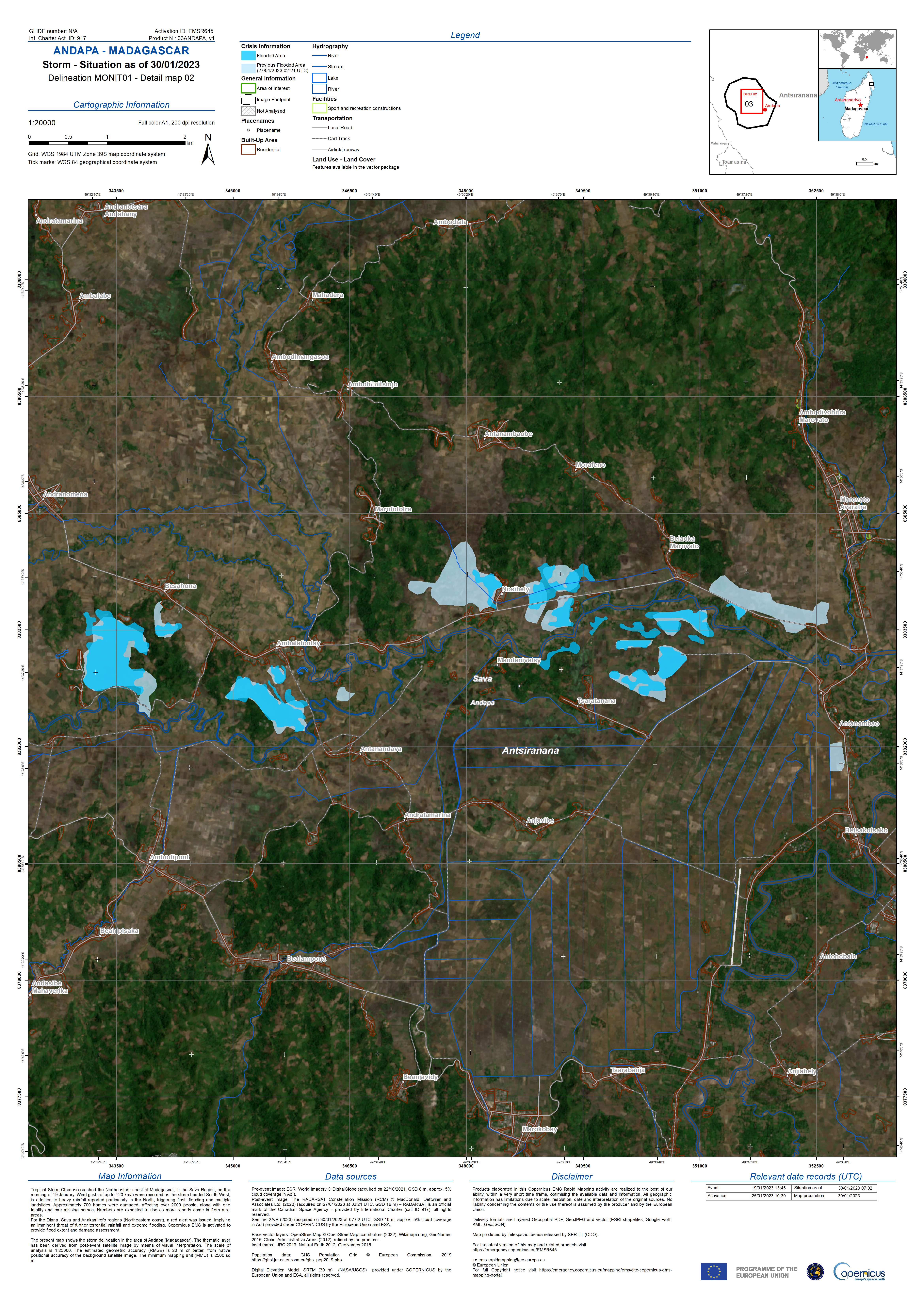
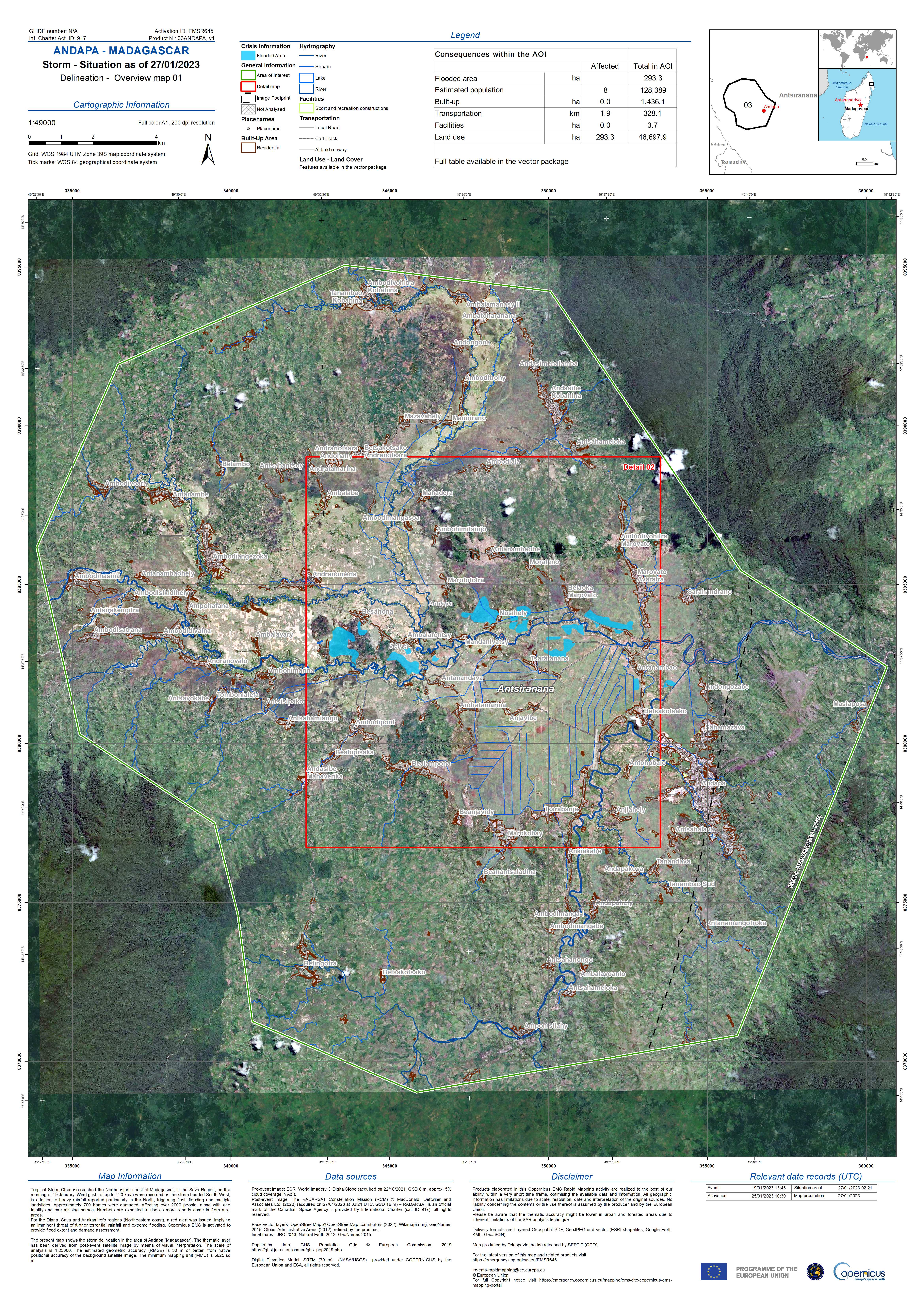
Delineation Map showing Flooding in Andapa, Madagascar
Авторские права: RADARSAT Constellation Mission Imagery © Government of Canada (2023)
RADARSAT is an official mark of the Canadian Space Agency.
Map produced by e-GEOS.
Information about the Product
Получено: 27/01/2023
Источник: RCM
Категория: Delineation Map
 Вернуться к полному архиву активаций

