 English
 Spanish
 French
 Chinese
 Russian
 Portuguese
 Последняя Активация
Charter activations
Floods in Türkiye
Heavy rains over the Marmara Region affected the districts of Silivri, Catalca, B. Cekmece, K. Cekmece and Bakirkoy in Istanbul. By the afternoon of 9 September, 31 casualties were reported, along with missing people.
| Тип события: | Floods |
| Место события: | Türkiye |
| Date of Charter Activation: | 10/09/2009 |
| Запрос на активацию поступил от: | Ministry of Public Works and Settlement - General Directorate of Disaster Affairs, Türkiye |
| Менеждер проекта от: | CNES in collaboration with the SAFER project in the framework of the GMES initiative |
Products
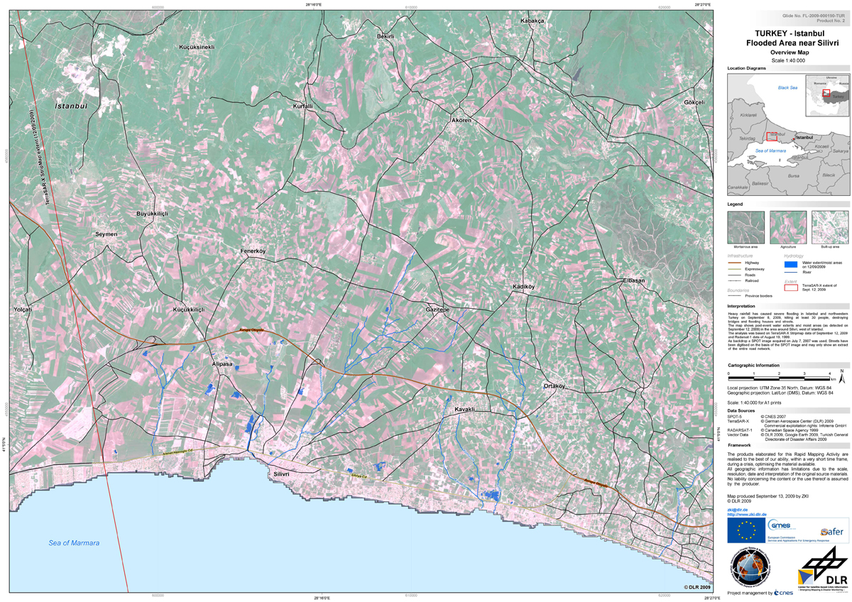
Satellite map of the flooded area around Silivri west of Istanbul, Türkiye, of September 12, 2009
Авторские права: CNES 2007, German Aerospace Center (DLR) 2009
Canadian Space Agency 1999
Image processing, map created 13/09/2009 by ZKI © DLR 2009
Information about the Product
Получено: 12/09/2009, 19/08/2009 and 07/07/2007
Источник: TerraSAR-X, RADARSAT-1 and SPOT-5
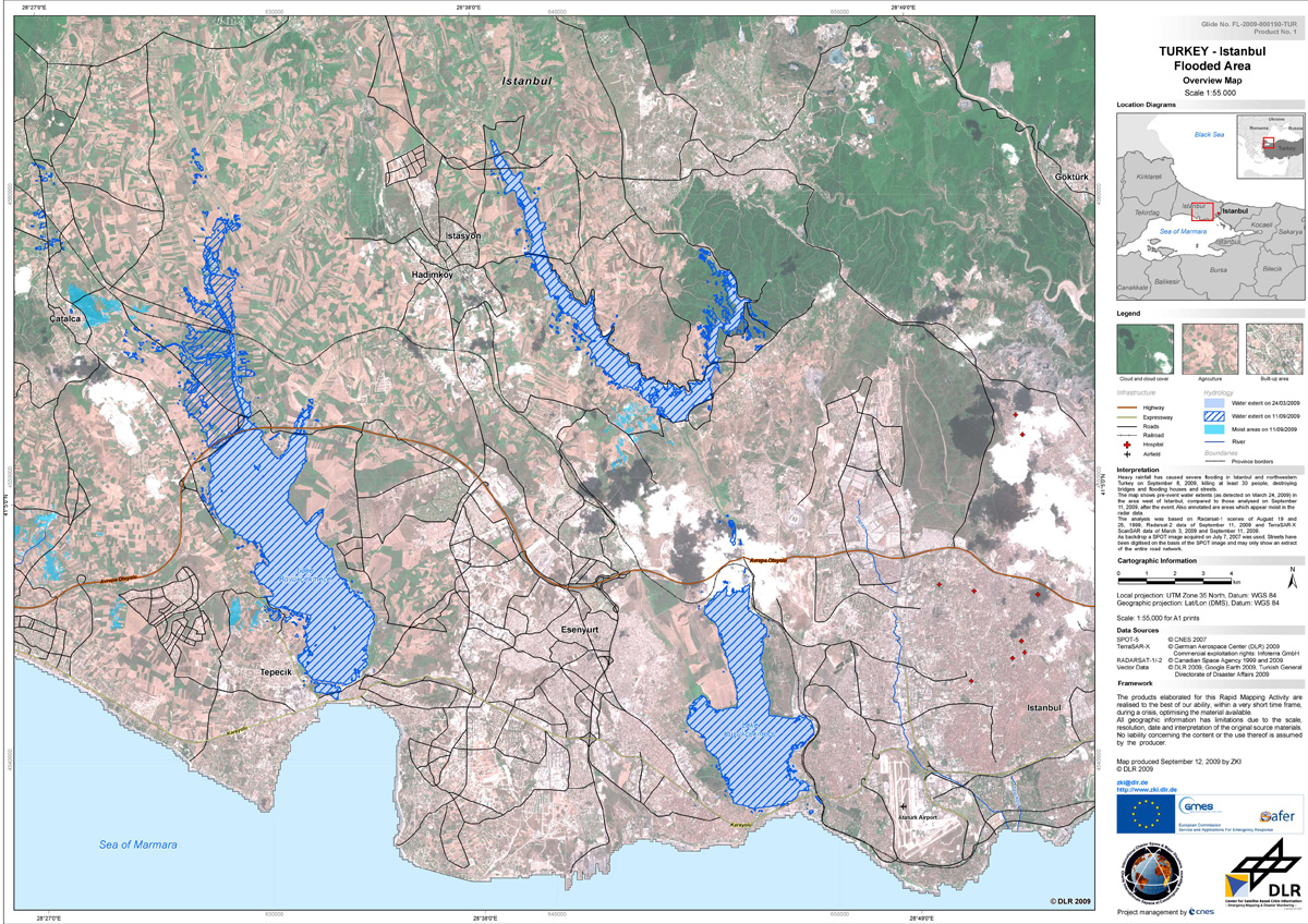
Satellite map of the flooded area west of Istanbul, Türkiye, of September 11, 2009
Авторские права: CNES 2007; German Aerospace Center (DLR) 2009;
Canadian Space Agency 1999 and 2009
Image processing, map created 12/09/2009 by ZKI © DLR 2009
Information about the Product
Получено: 19 and 22/08/1999; 11/09/2009; 3/03/2009; 11/09/2009 and 7/07/2007
Источник: Radarsat-1; Radarsat-2; TerraSAR-X and SPOT-5
 Вернуться к полному архиву активаций

