 English
 Spanish
 French
 Chinese
 Russian
 Portuguese
 Последняя Активация
Charter activations
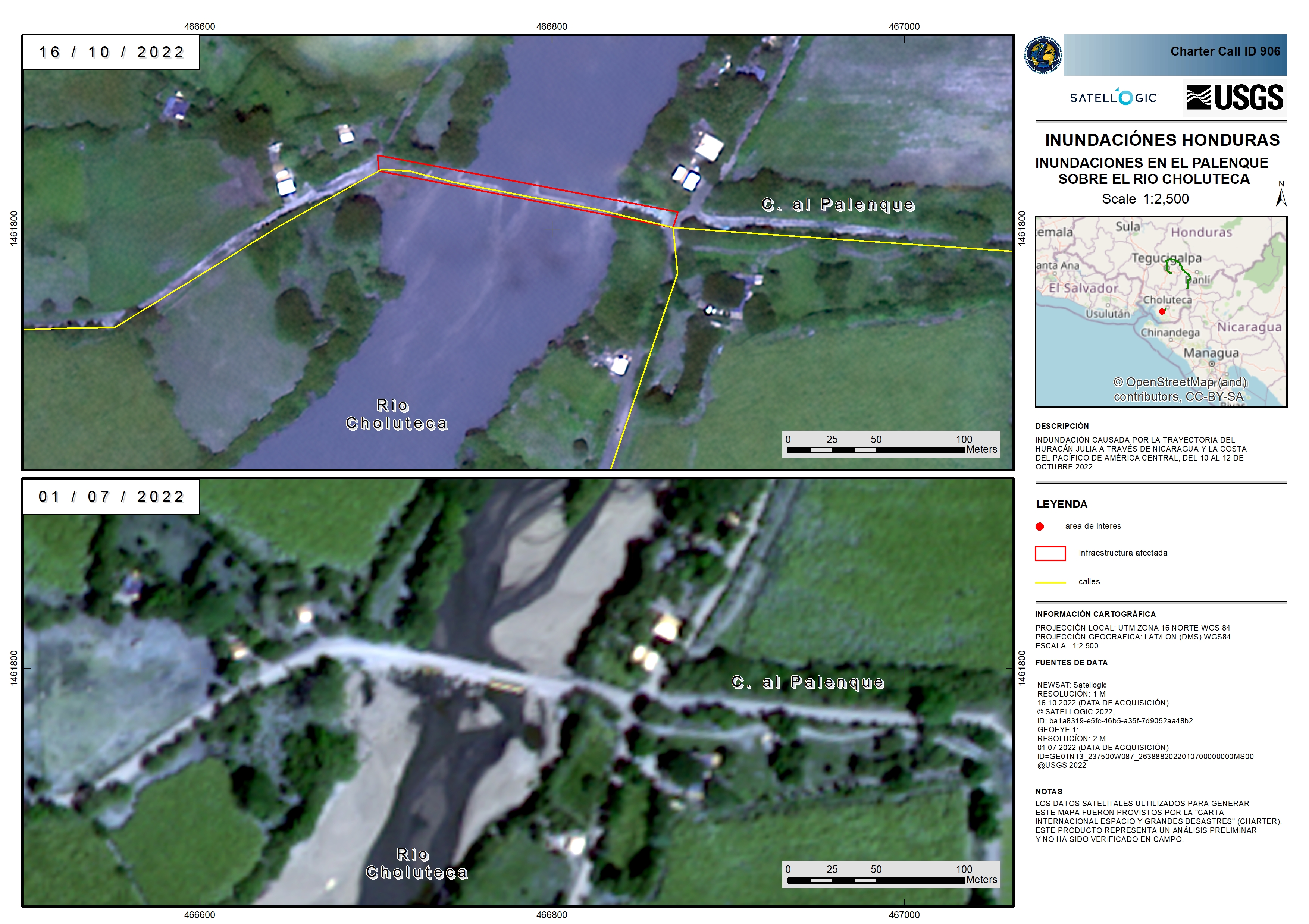
Hurricane Julia in Honduras
Hurricane Julia was a deadly tropical cyclone that caused significant impacts in Central America as a Category 1 hurricane in October 2022
It was the fifth Atlantic hurricane of the year, it made landfall in Nicaragua as a Category 1 storm on Sunday 9 October and subsequently moved through Honduras, El Salvador, and Guatemala.
Julia knocked out power across large swaths of Central America, which left many areas with no electricity. The Government of Honduras opened more than 1,137 shelters nationwide and a red alert, the highest level of warning, was issued for 10 of Honduras's 18 departments.
The hurricane caused at least 28 deaths with more than 13,000 families being forced to evacuate.
| Место события: | Honduras |
| Date of Charter Activation: | 2022-10-12 |
| Время активации Хартии: | 11:54 |
| TЧасовой пояс в районе активации Хартии: | UTC-06:00 |
| Запрос на активацию поступил от: | COPECO |
| Номер активации: | 786 |
| Менеждер проекта от: | Alexander Ariza (UNSPIDER) |
| act-value-adders: | Manoel Araújo Sousa Júnior (Federal University of Santa Maria) Silvia Pardi LaCruz (Federal University of Santa Maria) |
Products
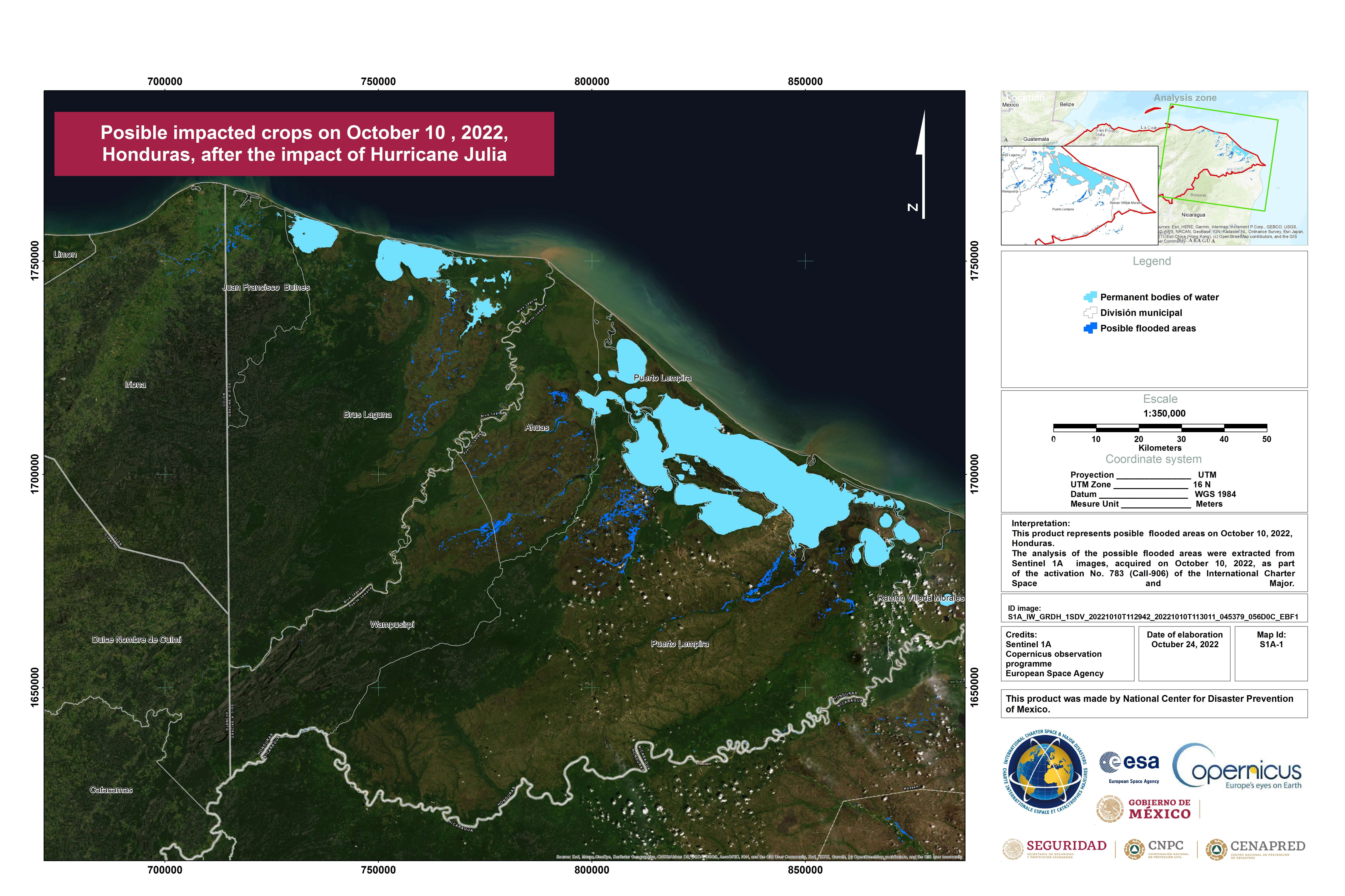
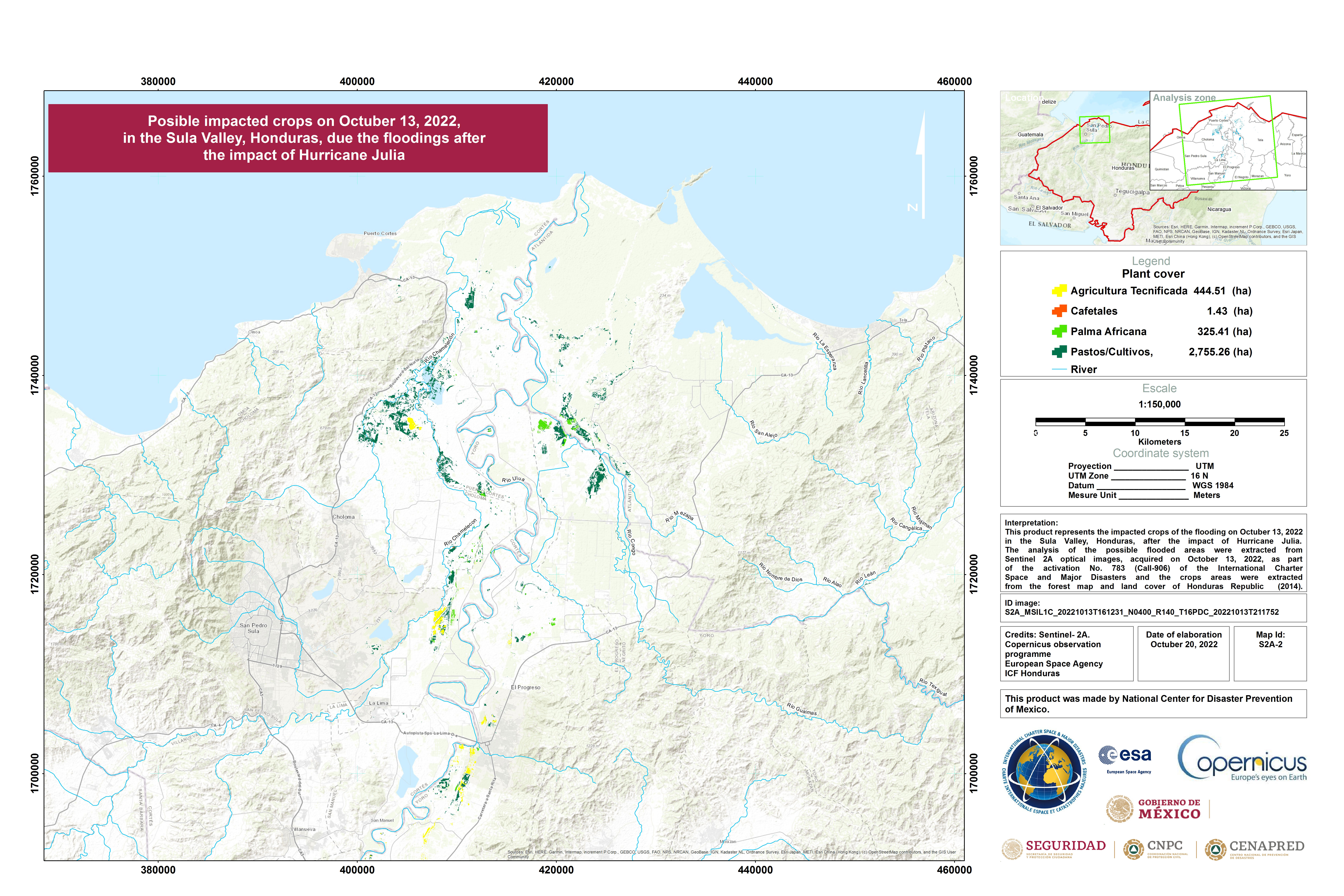
Possible impacted crops in Honduuras, after the impact of Hurricane Julia
Авторские права: Contains modified Copernicus Sentinel data (2022)
Map produced by the National Centre for Disaster Prevention of Mexico
Information about the Product
Получено: 10/10/2022
Источник: Sentinel-1
Категория: Delineation Map
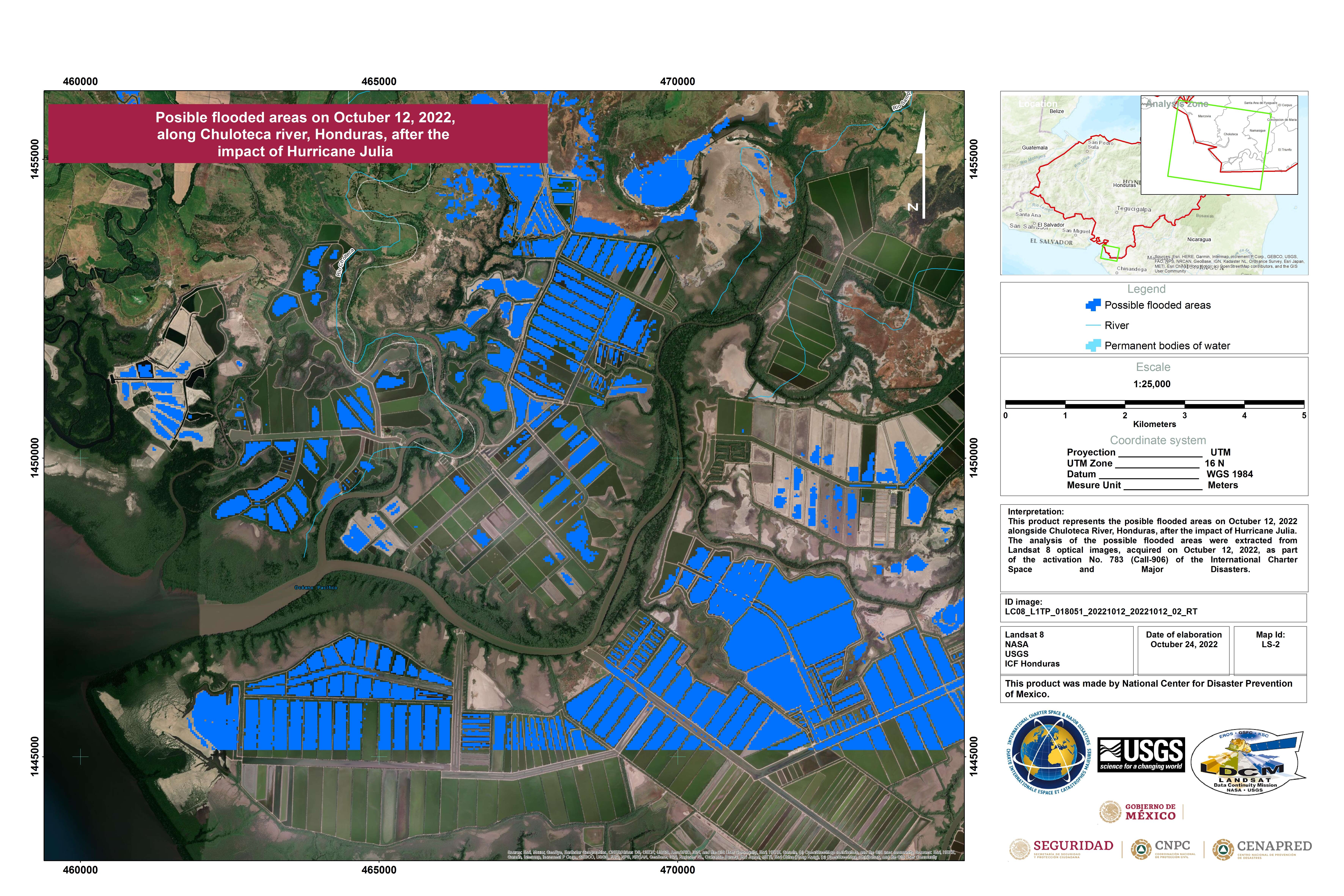
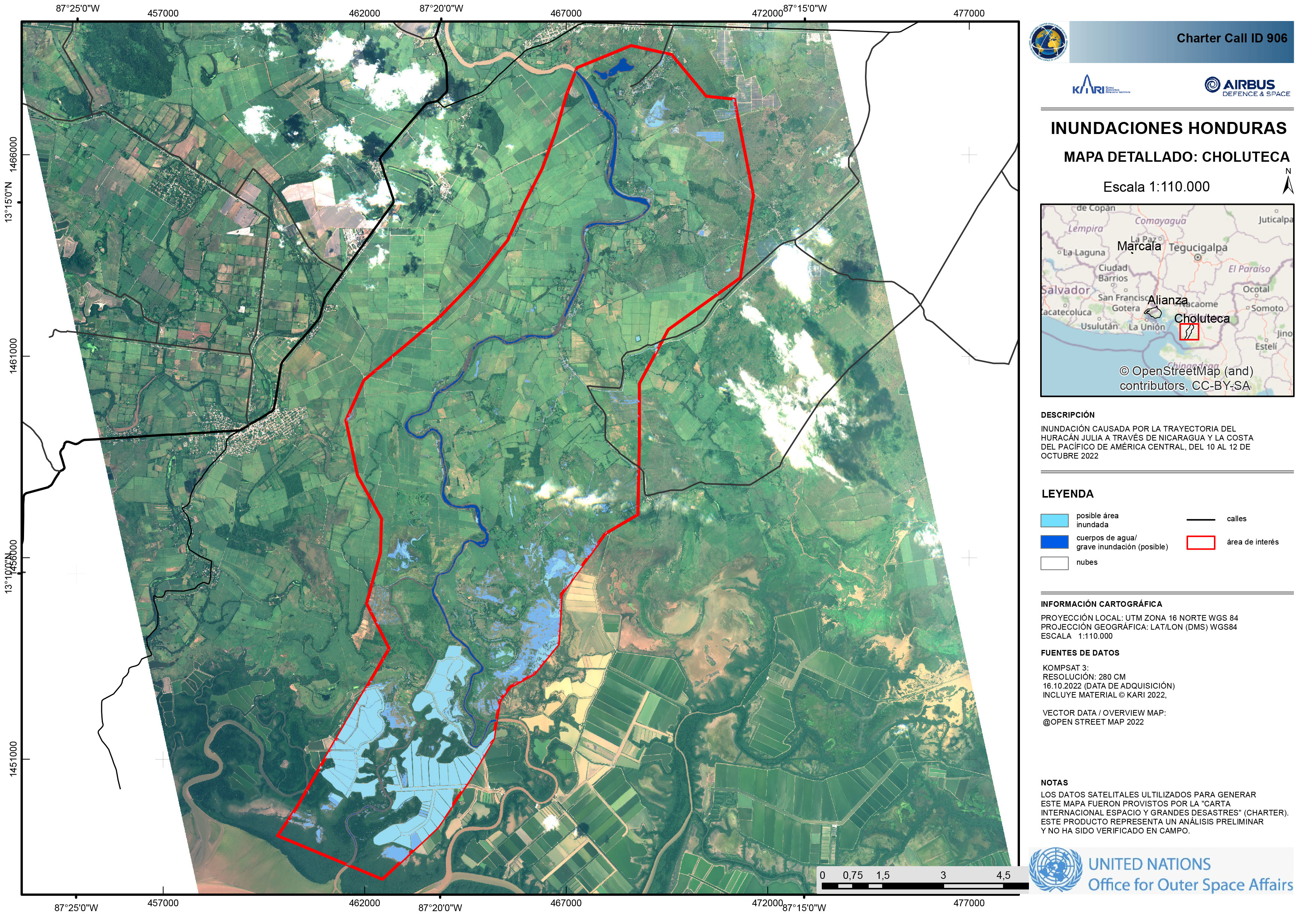
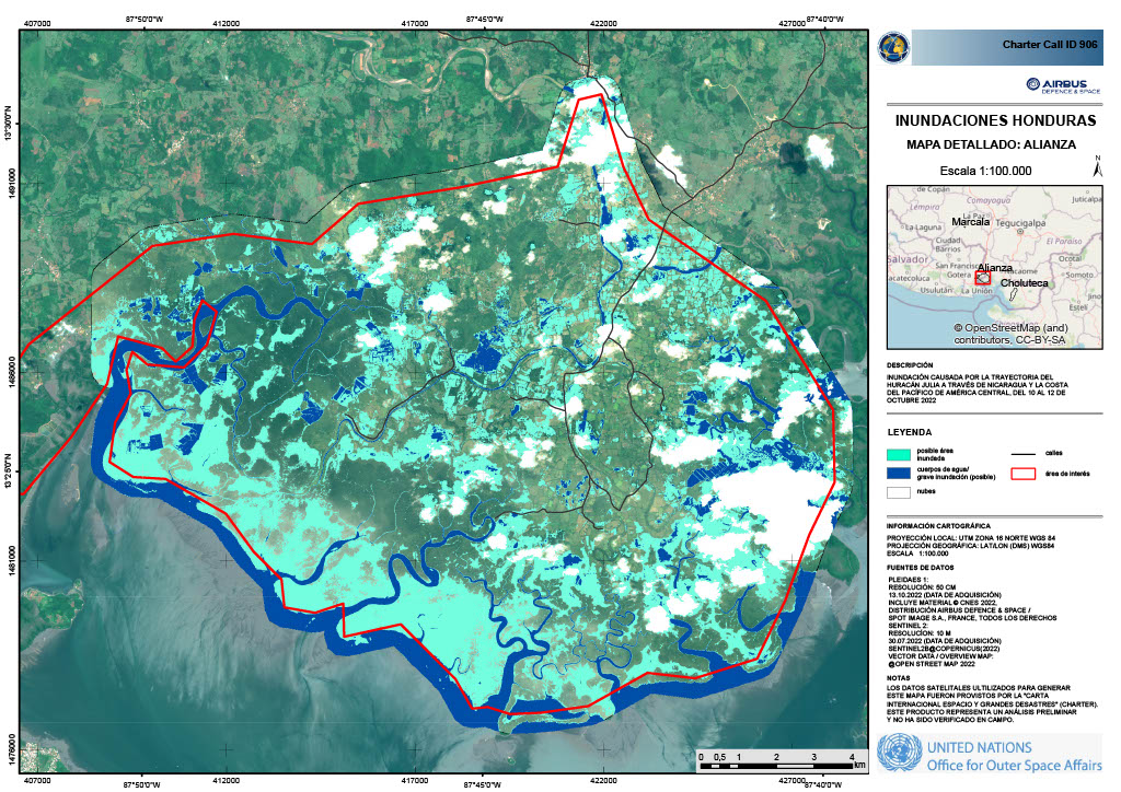
Possible flooded areas along Choluteca river, Honduras, after the impact of Hurricane Julia
Авторские права: USGS/NASA Landsat Program
Map produced by the National Center for Fisaster Prevention of Mexico
Information about the Product
Получено: 12/10/2022
Источник: Landsat 8
Категория: Delineation Map
Possible impact on the cultivation areas in the Sula Valley after Hurricane Julia
Авторские права: Contains modified Copernicus Sentinel data (2022)
Map produced by National center for disaster prevention of Mexico
Information about the Product
Получено: 13/09/2022
Источник: Sentinel-2
Категория: Delineation Map
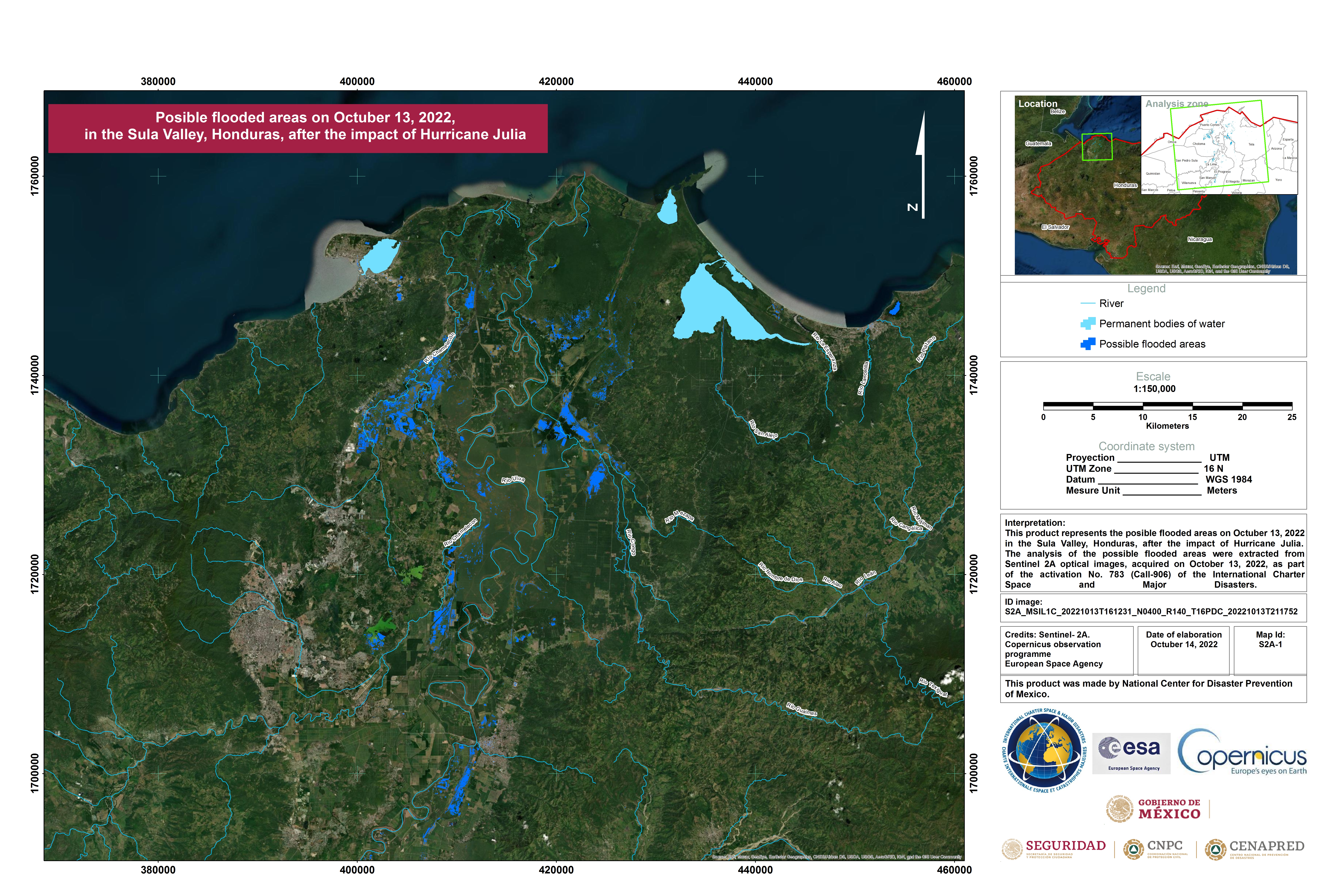
Possible flooded areas on 13 October 2022 in the Sula Valley, Honduras after the impact of hurricane of Julia.
Авторские права: Contains modified Copernicus Sentinel data (2022)
Map produced by The National Centre for Disaster Prevention of Mexico
Information about the Product
Получено: 13/10/2022
Источник: Sentinel-2
Категория: Delineation Map
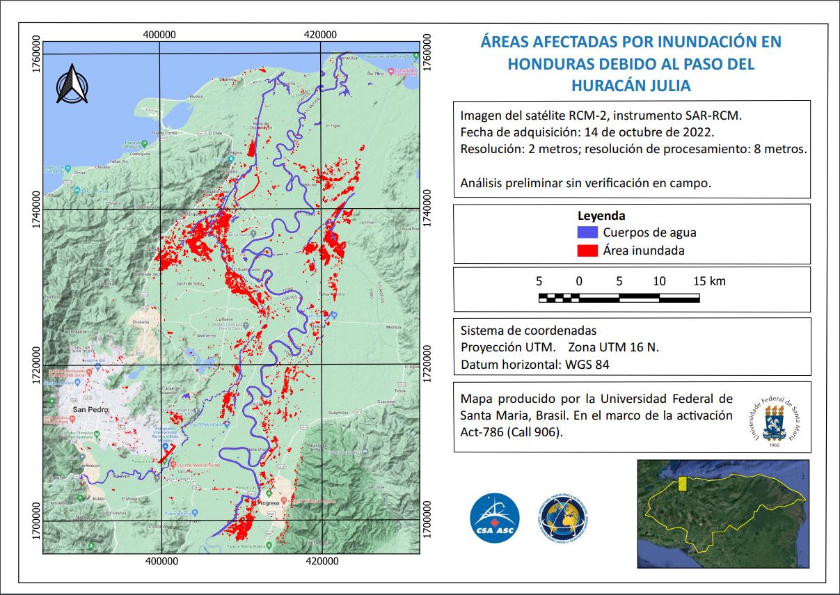
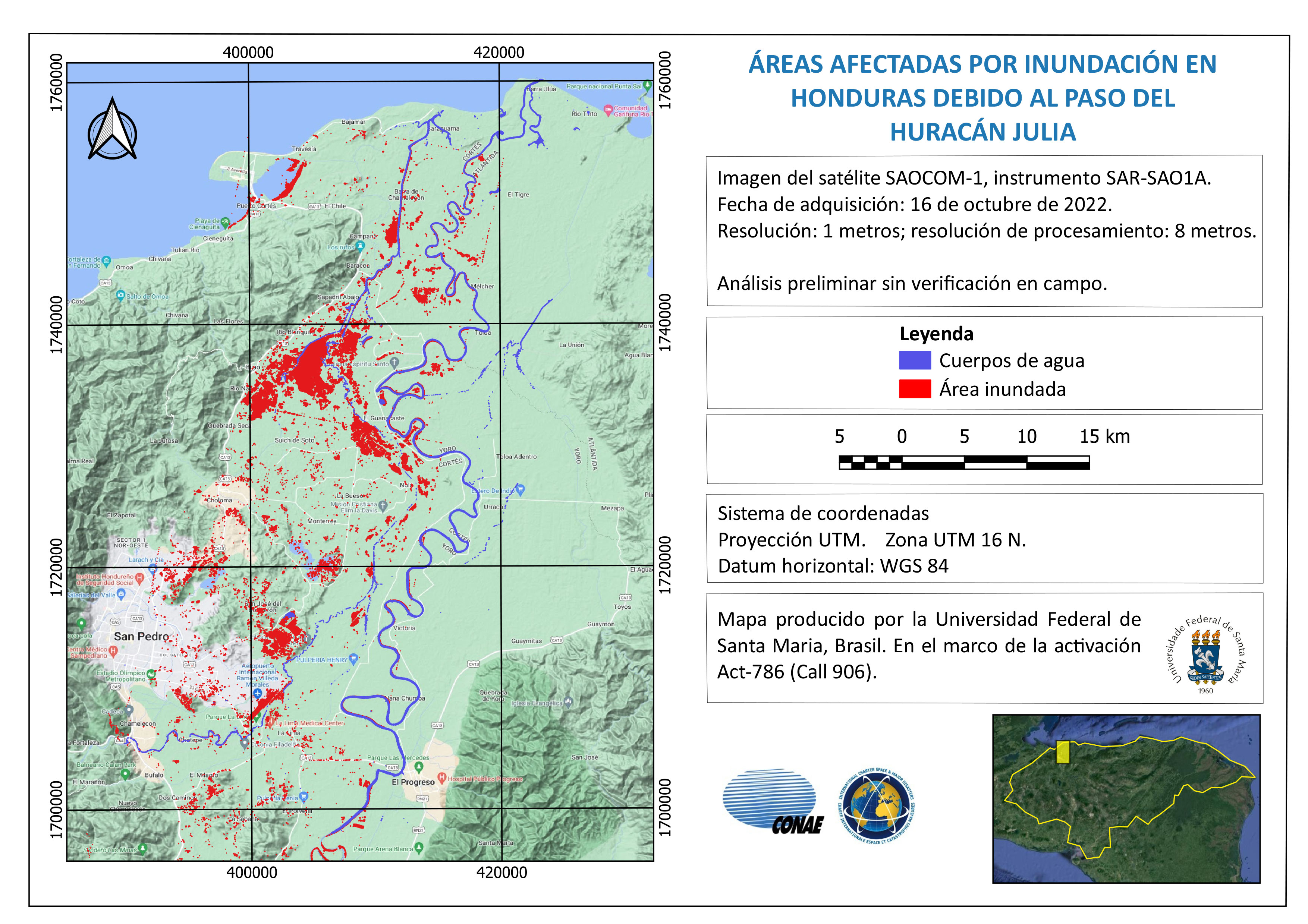
Flooded areas in Honduras
Авторские права: RADARSAT Constellation Mission Imagery © Government of Canada (2022) - RADARSAT is an official mark of the Canadian Space Agency
Map produced by the Federal University of Santa Maria, Brazil
Information about the Product
Получено: 14/10/2022
Источник: RCM
Категория: Reference Map
 Вернуться к полному архиву активаций

