 English
 Spanish
 French
 Chinese
 Russian
 Portuguese
 Последняя Активация
Charter activations
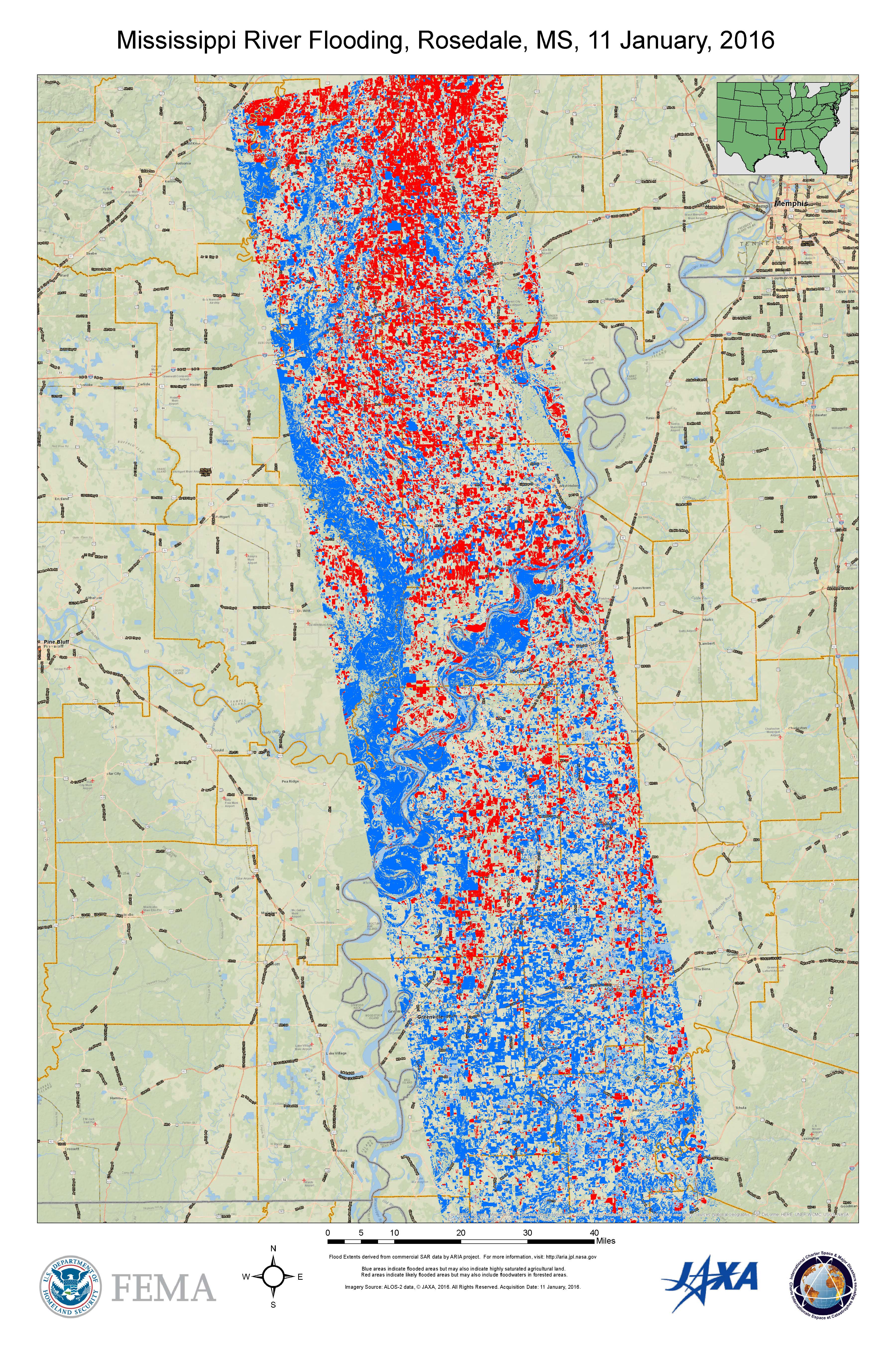
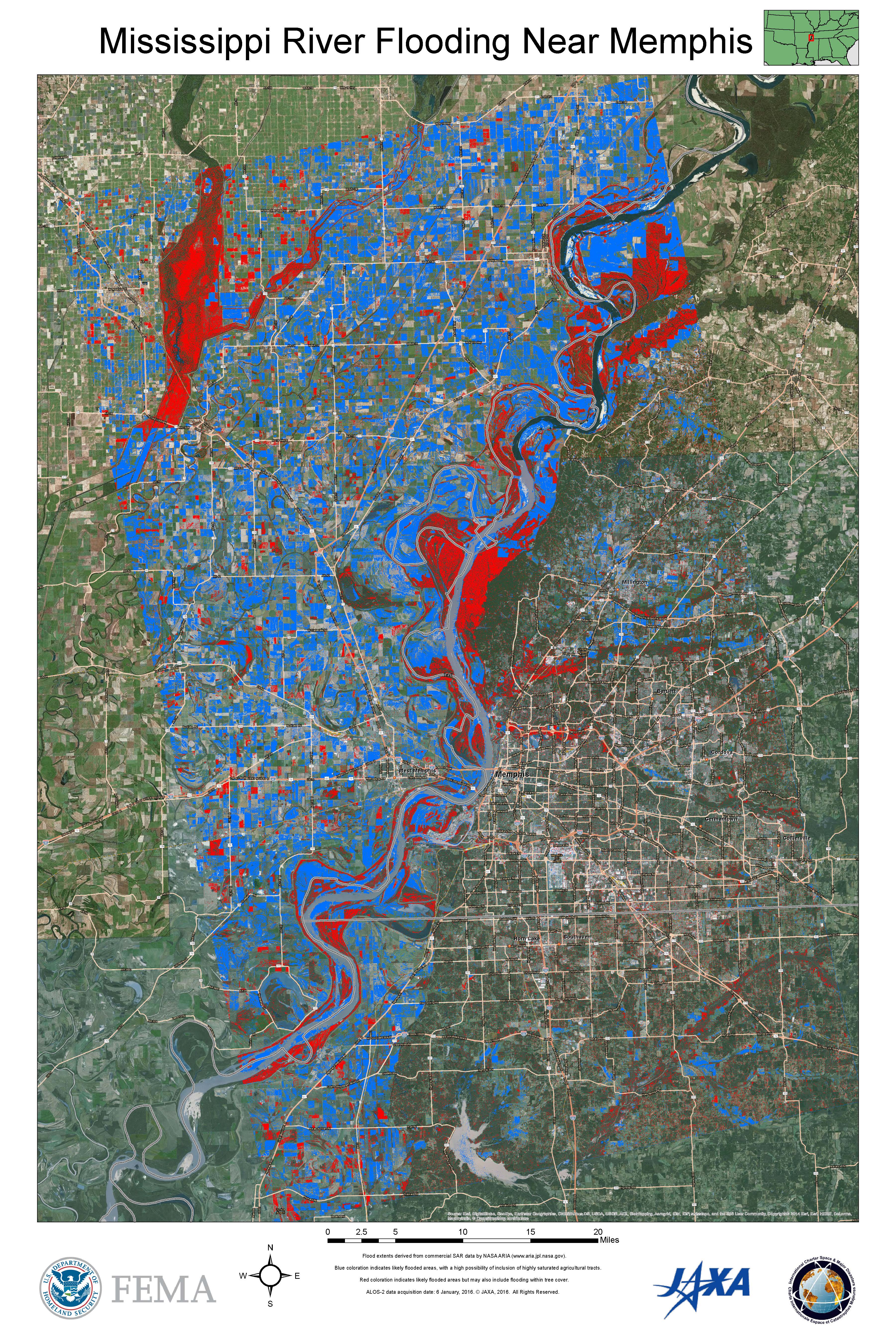
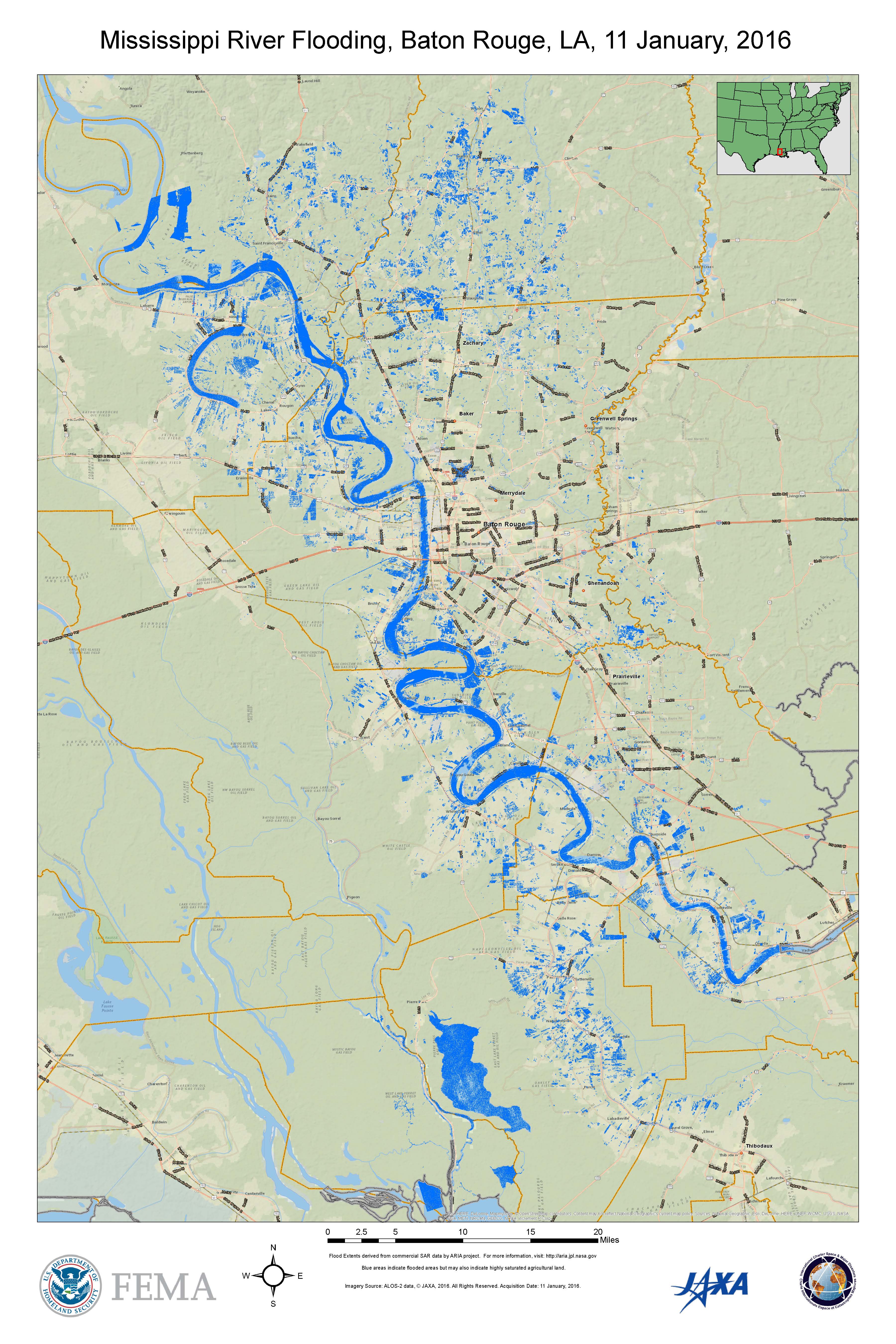
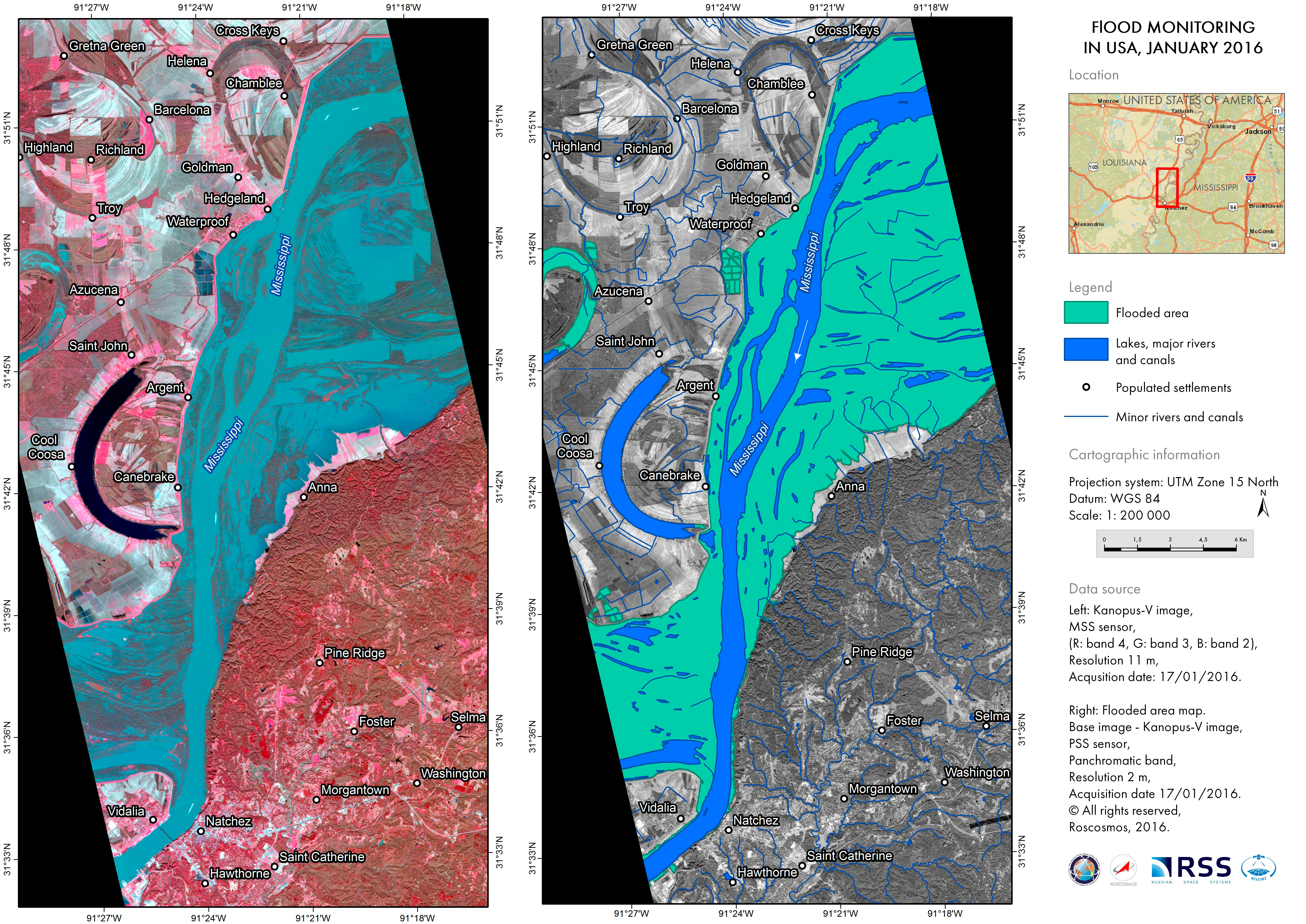
Flood in the United States
Three days of heavy rain have caused widespread flooding in the United States, stretching from Illinois down to Mississippi.
31 people have died and thousands have been forced to evacuate.
The states which have suffered flooding include: Illinois, Missouri, Oklahoma, Arkansas and Mississippi, and flood warnings are in place for the neighbouring states of Louisiana and Tennessee.
Large parts of the United States have suffered from storms recently, and major flooding has occurred along the Ohio, Mississippi, Meramec and Arkansas Rivers.
This flooding has swept downstream along the rivers toward the south and is expected to continue until the middle of January.
In parts of Missouri, however, the flood waters have begun to recede, leaving residents to begin the long process of recovering their homes.
| Тип события: | Flood |
| Место события: | United States of America |
| Date of Charter Activation: | 3 January 2016 |
| Время активации Хартии: | 16:10:51 |
| TЧасовой пояс в районе активации Хартии: | UTC-06:00 |
| Запрос на активацию поступил от: | USGS on behalf of FEMA |
| Менеждер проекта от: | USGS |
Products
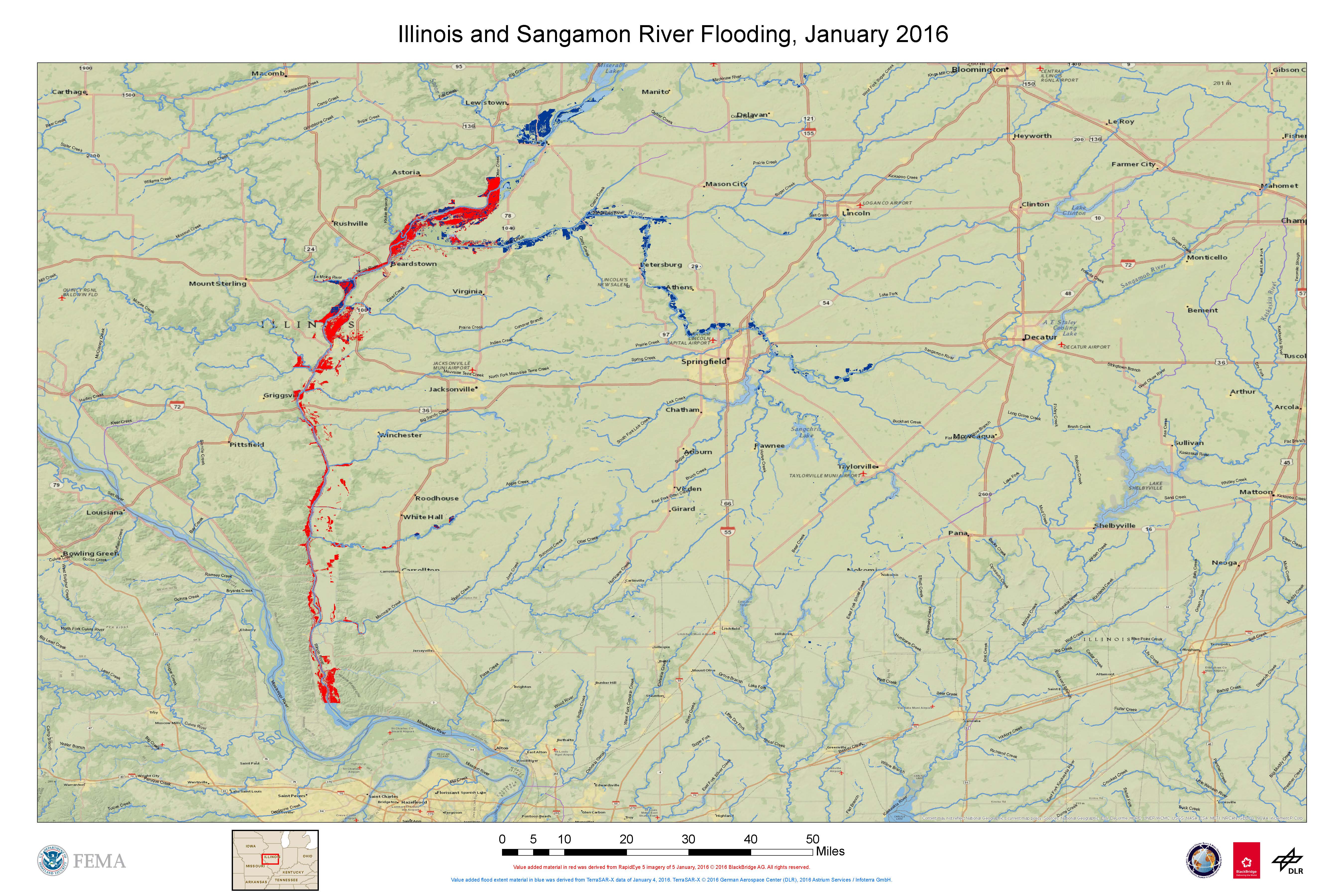
Flooding along the Illinois and Sangamon Rivers
Авторские права: RapidEye © BlackBridge AG 2016 - All rights reserved
TerraSAR-X © DLR e. V. 2016, Distribution: Airbus DS Geo GmbH
Map produced by FEMA
Information about the Product
Получено: RapidEye: 05/01/2016
TerraSAR-X: 04/01/2016
Источник: RapidEye / TerraSAR-X
 Вернуться к полному архиву активаций

