 English
 Spanish
 French
 Chinese
 Russian
 Portuguese
 Последняя Активация
Charter activations
Flood in Sri Lanka
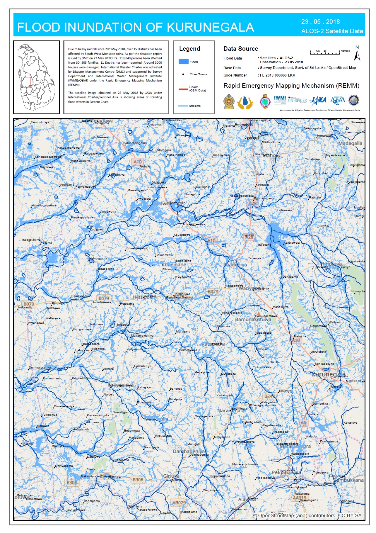
Monsoon rains in Sri Lanka have killed eight people, with 172 more people requiring rescue by the armed forces. Eight districts have been affected as up to 150mm of rain fell across the country.
Adverse weather conditions have closed roads and displaced many people prompting the government to deploy members of the army to provide emergency evacuation and relief efforts. Power supplies have been interrupted in many areas across the country as flood waters and falling trees took down power lines.
As the heavy rain continued, landslide warnings have been issued across several districts while 'red alert' flood warnings were issued to people in four districts living alongside major rivers.
| Тип события: | Flood |
| Место события: | Sri Lanka |
| Date of Charter Activation: | 2018-05-21 |
| Время активации Хартии: | 20:49 |
| TЧасовой пояс в районе активации Хартии: | UTC+02:00 |
| Запрос на активацию поступил от: | Disaster Management Centre, Sri Lanka |
| Номер активации: | 573 |
| Менеждер проекта от: | Disaster Management Centre, Sri Lanka |
Products
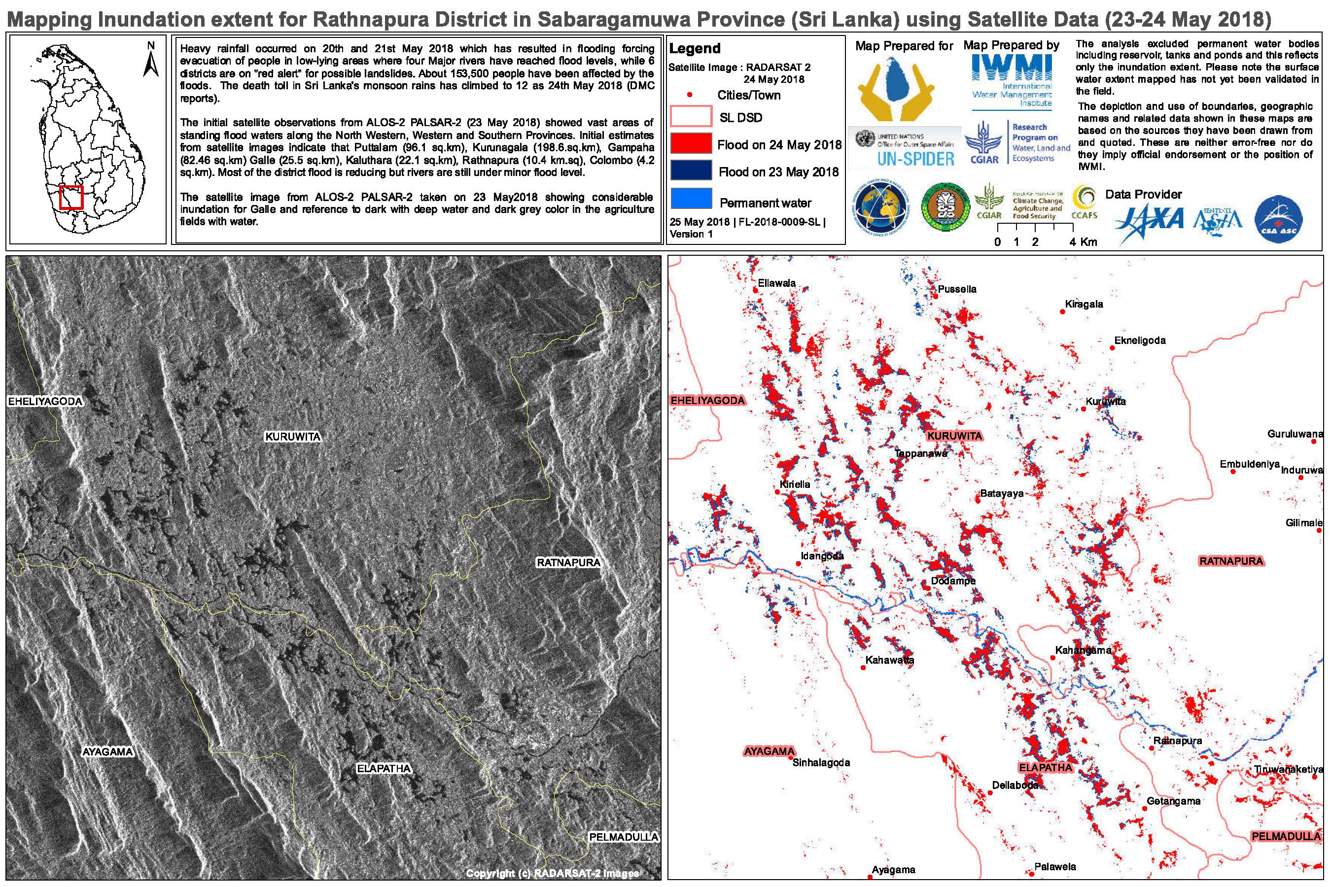
Flood mapping extent for Rathnapura District, Sabaragumuwa Province Sri Lanka
Авторские права: RADARSAT-2 Data and Products © Maxar Technologies Ltd. (2018) - All Rights Reserved. RADARSAT is an official trademark of the Canadian Space Agency.
Map produced by IWMI
Information about the Product
Получено: 23/05/2018-24/0/2018
Источник: RADARSAT-2
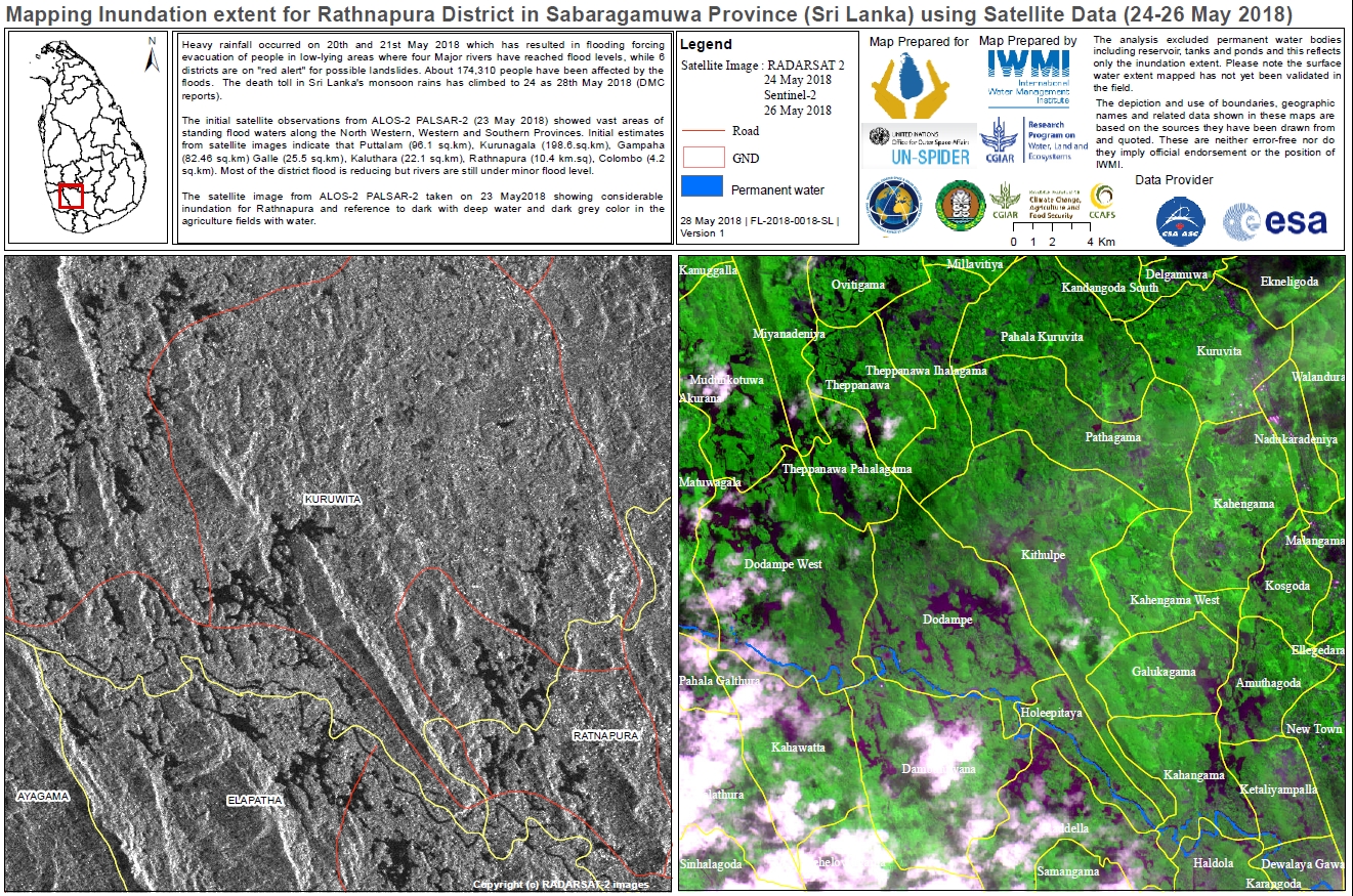
Flood mapping extent for Rathnapura District, Sri Lanka
Авторские права: ALOS-2 © JAXA (2018) All rights reserved
RADARSAT-2 Data and Products © Maxar Technologies Ltd. (2018) - All Rights Reserved. RADARSAT is an official trademark of the Canadian Space Agency.
Sentinel-2 © Copernicus Sentinel data (2018)
Map produced by IWMI
Information about the Product
Получено: ALOS: 23/05/2018
RADARSAT-2: 24/05/2018
Sentinel-2: 26/05/2018
Источник: ALOS-2 / RADARSAT-2 / Sentinel-2
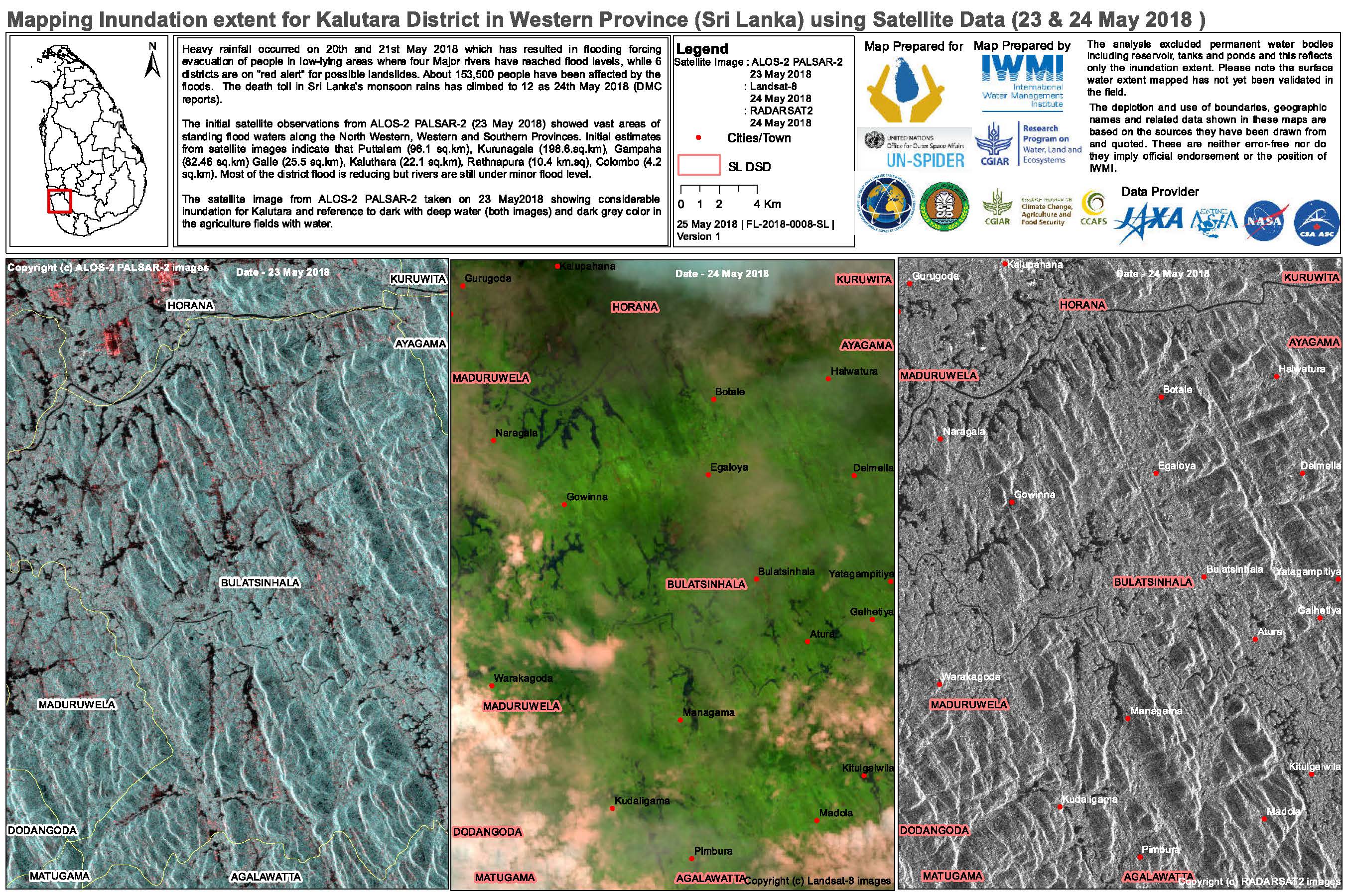
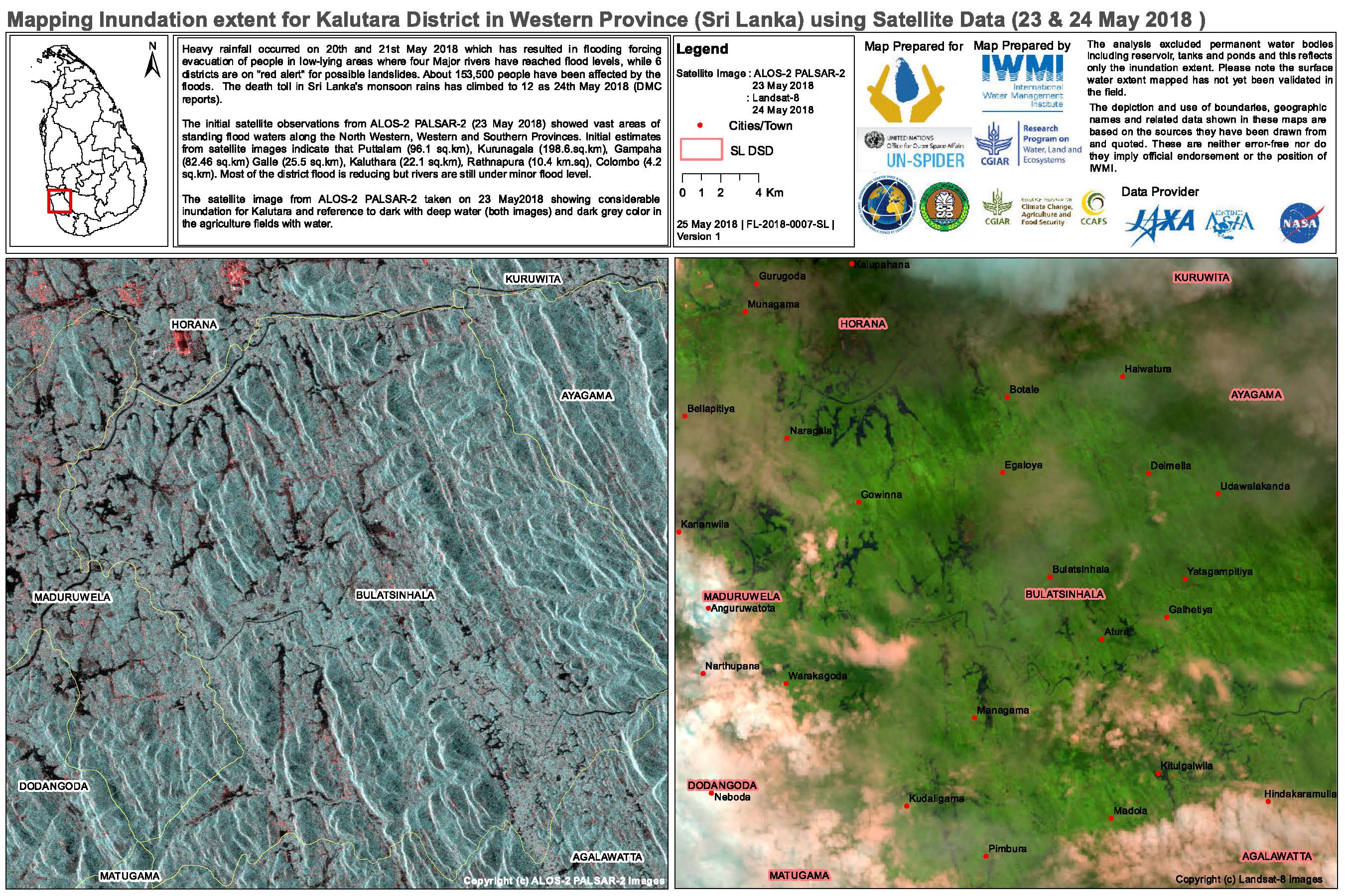
Flood mapping extent for Kalutara District, Western Province, Sri Lanka
Авторские права: ALOS © JAXA (2018) All rights reserved
Landsat 8 data and products © USGS (2018) - All rights reserved
RADARSAT-2 Data and Products © Maxar Technologies Ltd. (2018) - All Rights Reserved. RADARSAT is an official trademark of the Canadian Space Agency.
Map produced by IWMI
Information about the Product
Получено: ALOS: 23/05/2018
Landsat 8: 24/05/2018
RADARSAT-2: 24/05/2018
Источник: ALOS-2 / Landsat 8 / RADARSAT-2
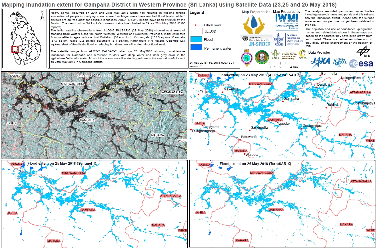
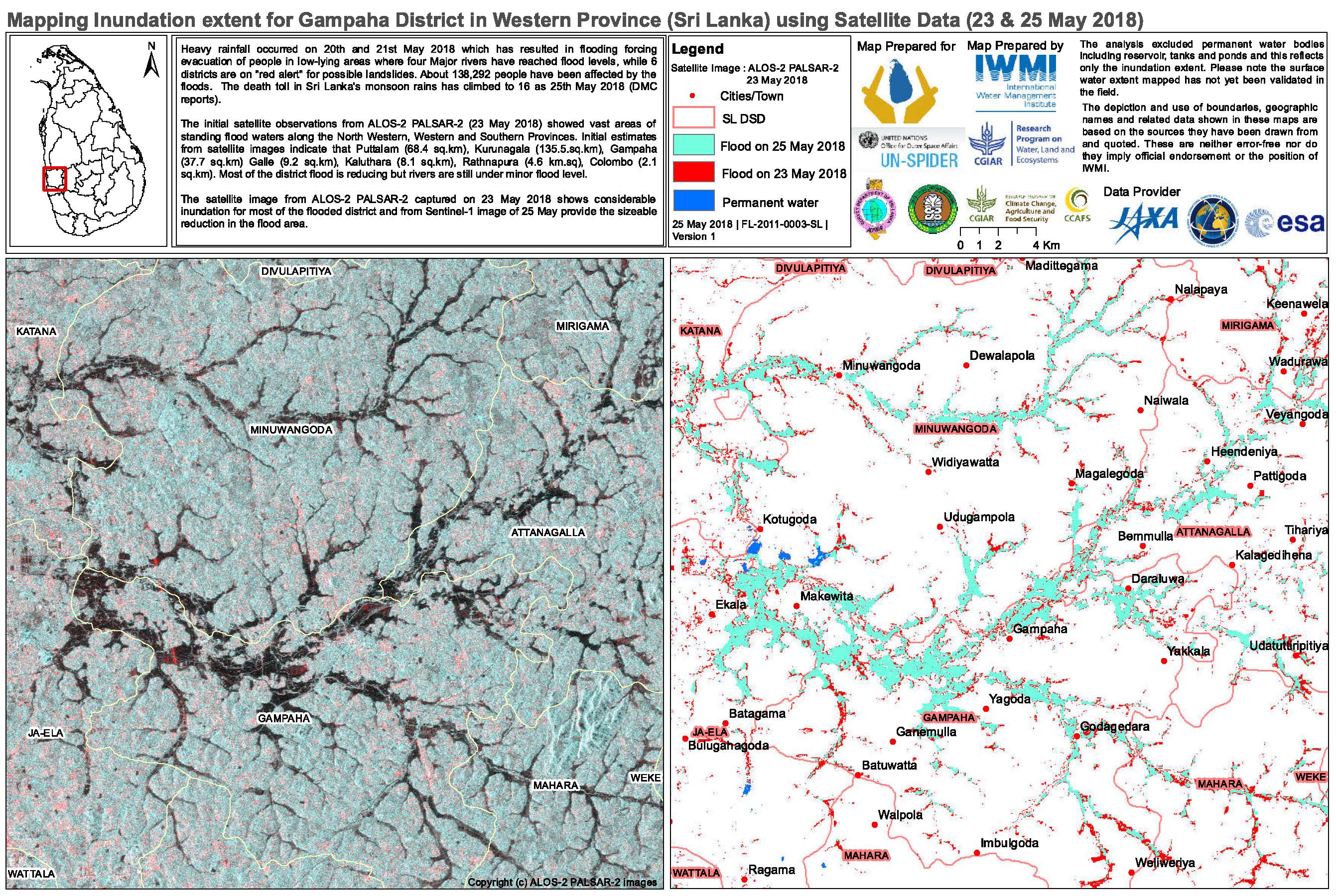
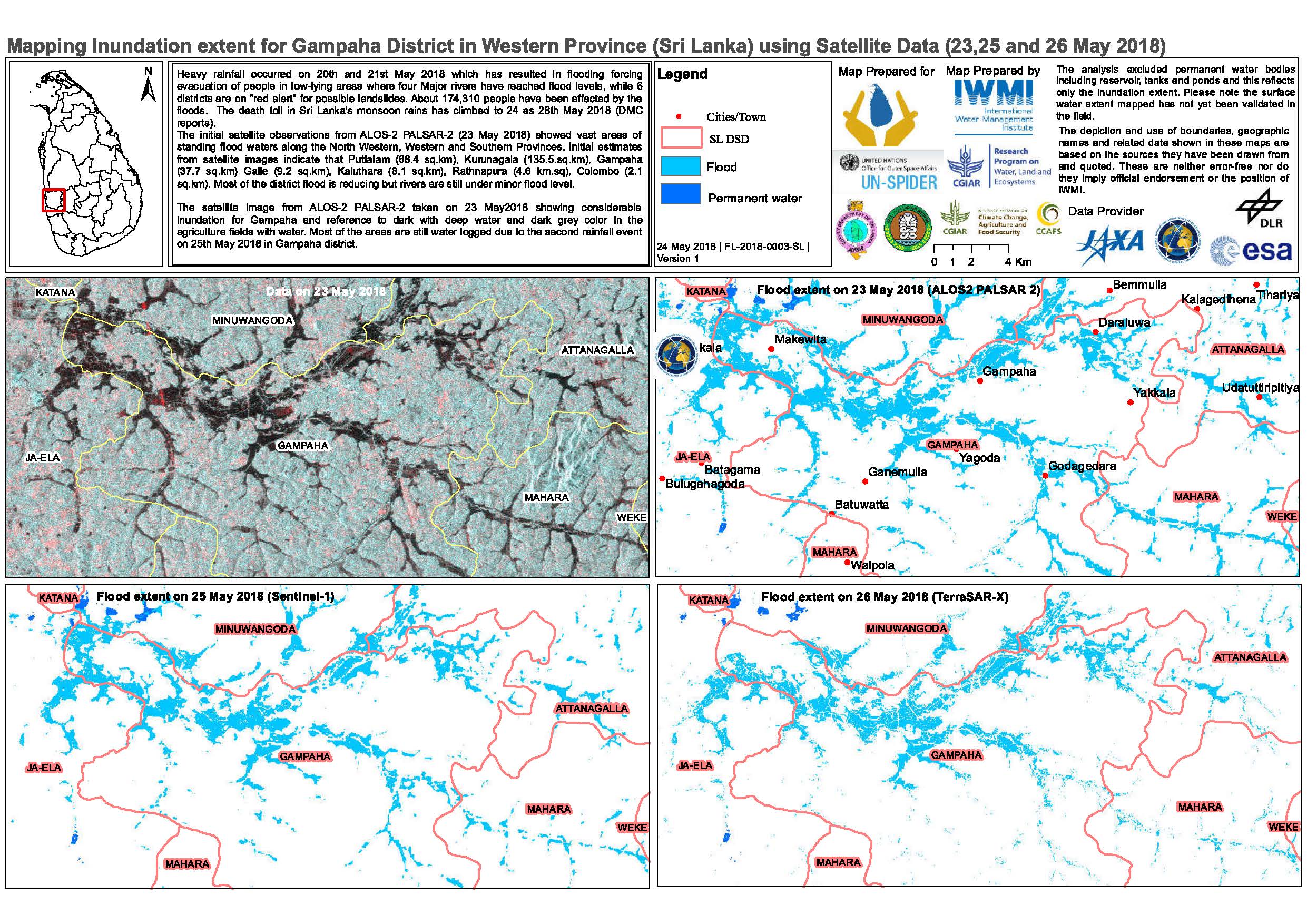
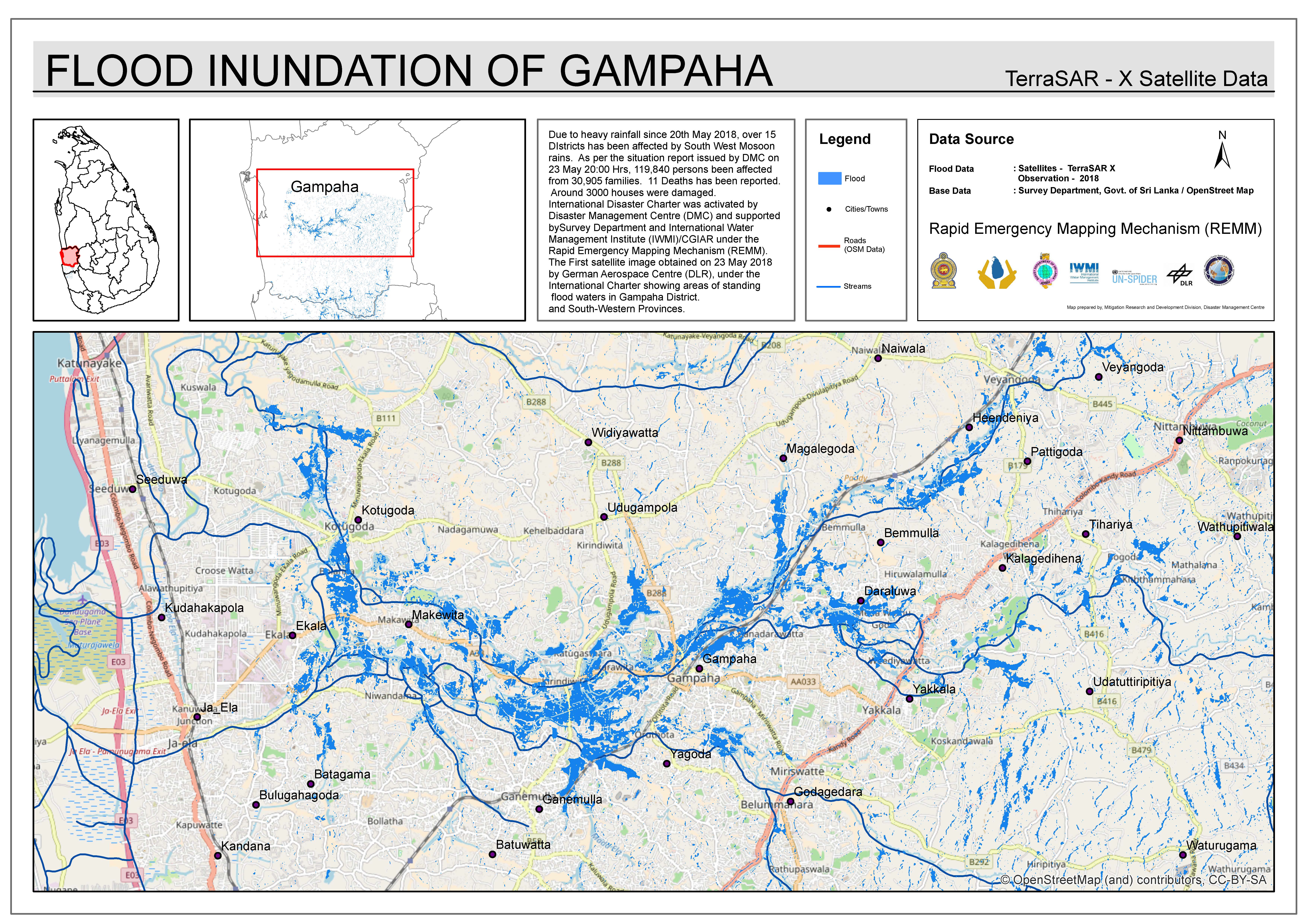
Flood mapping extent for Gampaha District, Sri Lanka
Авторские права: ALOS © JAXA (2018) All rights reserved
Sentinel-1 © Copernicus Sentinel data (2018)
TerraSAR-X © DLR e. V. 2018, Distribution: Airbus DS Geo GmbH
Map produced by IWMI
Information about the Product
Получено: ALOS-2: 23/05/2018
Sentinel-1: 25/05/2018
TerraSAR-X: 26/05/2018
Источник: ALOS-2 / Sentinel-1 / TerraSAR-X
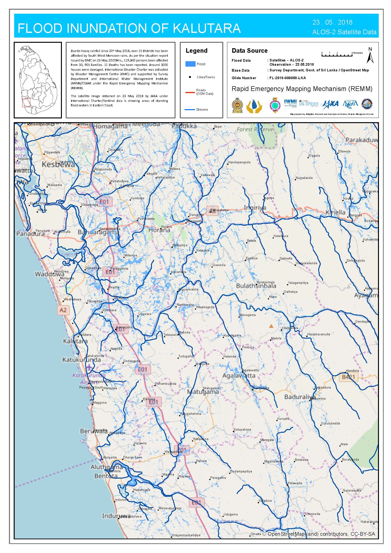
Flood mapping extent in Kalutara District, Sri Lanka
Авторские права: ALOS © JAXA (2018) All rights reserved
Landsat 8 data and products © USGS (2018) - All rights reserved
Map produced by IWMI
Information about the Product
Получено: ALOS-2: 23/05/2018
Landsat 8: 25/05/2018
Источник: ALOS-2 / Landsat 8
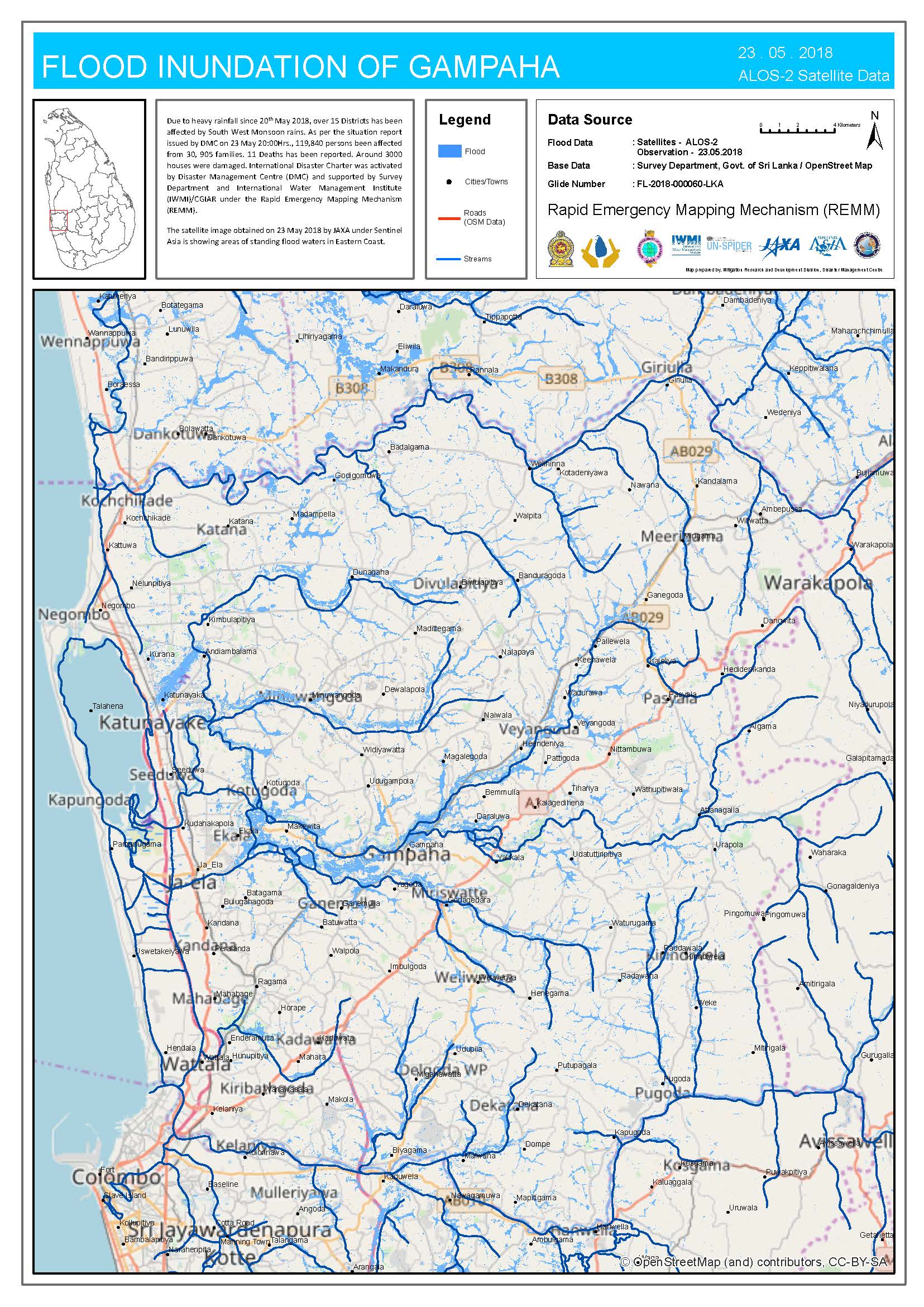
Flooding in Gampaha District, Sri Lanka
Авторские права: ALOS © JAXA (2018) All rights reserved
Sentinel-1 © Copernicus Sentinel data (2018)
TerraSAR-X © DLR e. V. 2018, Distribution: Airbus DS Geo GmbH
Map produced by IWMI
Information about the Product
Получено: ALOS-2: 23/05/2018
Sentinel-1: 25/05/2018
TerraSAR-X: 26/05/2018
Источник: ALOS-2/TerraSAR-X /Sentinel-1
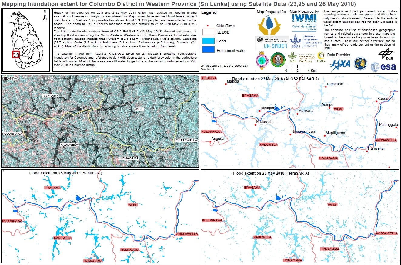
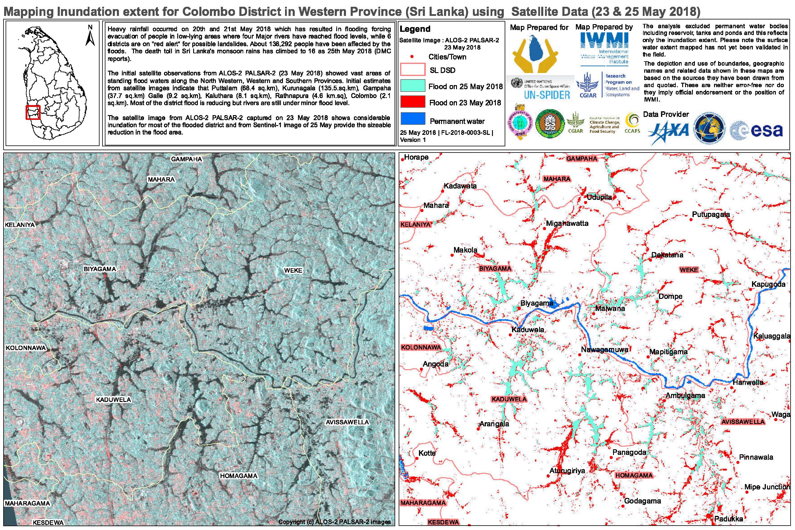
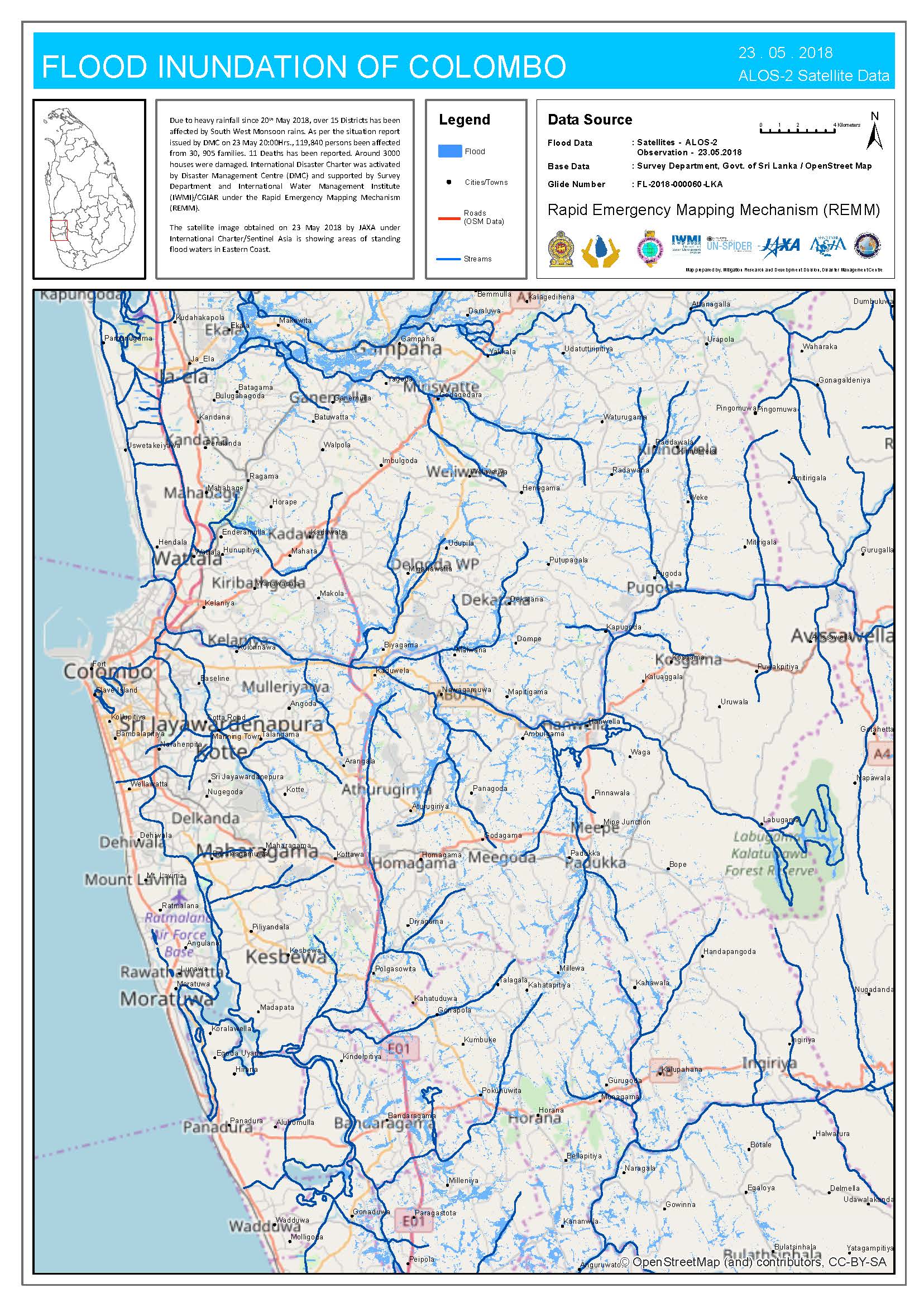
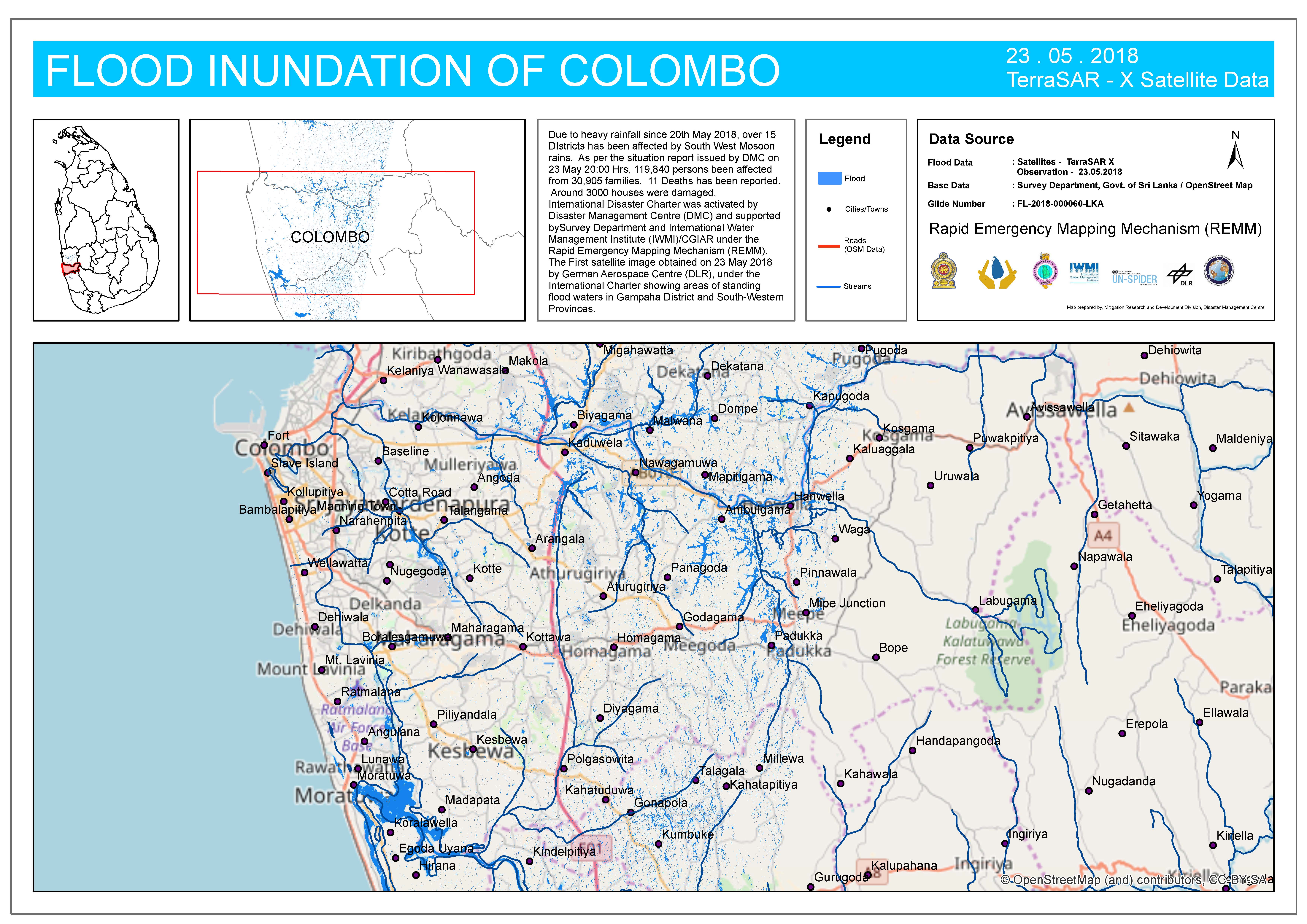
Flood mapping extent for Colombo District, Sri Lanka
Авторские права: ALOS © JAXA (2018) All rights reserved
Sentinel-1 © Copernicus Sentinel data (2018)
TerraSAR-X © DLR e. V. 2018, Distribution: Airbus DS Geo GmbH
Map produced by IWMI
Information about the Product
Получено: ALOS-2: 23/05/2018
Sentinel-1: 25/05/2018
TerraSAR-X: 26/05/2018
Источник: ALOS-2 / Sentinel-1 / TerraSAR-X
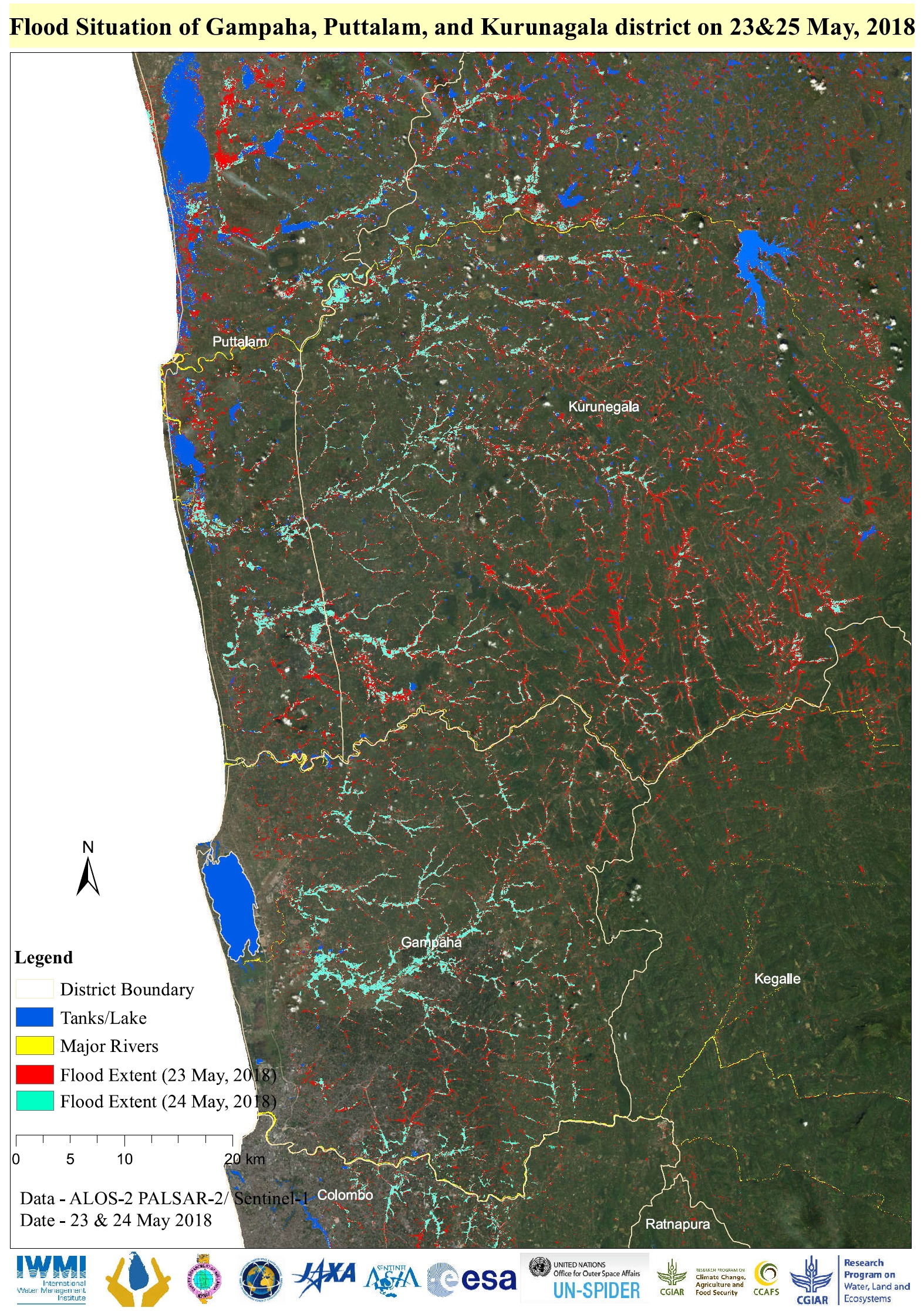
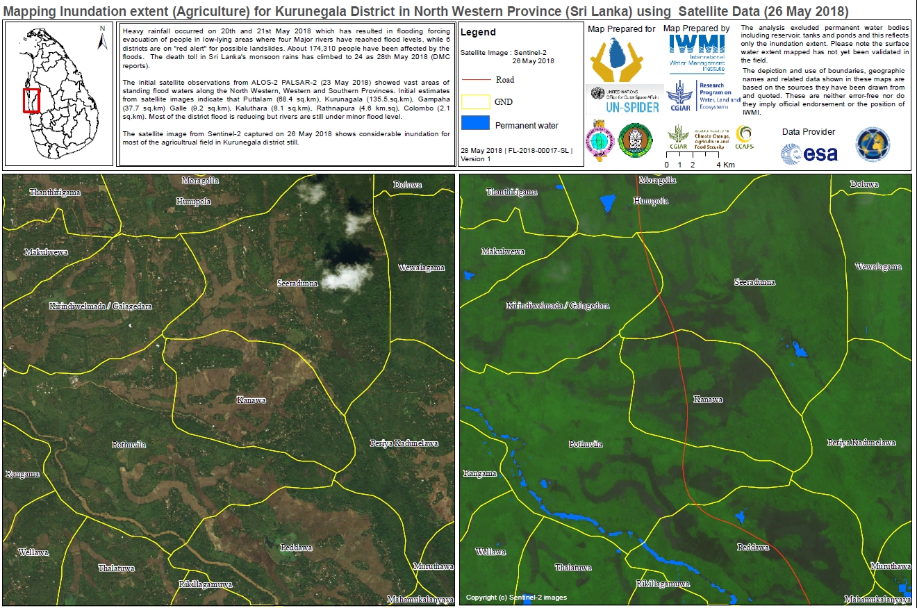
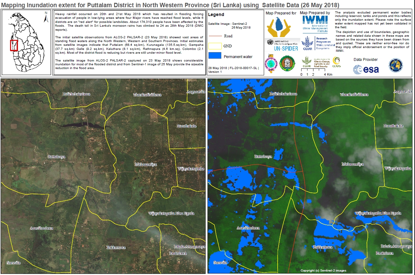
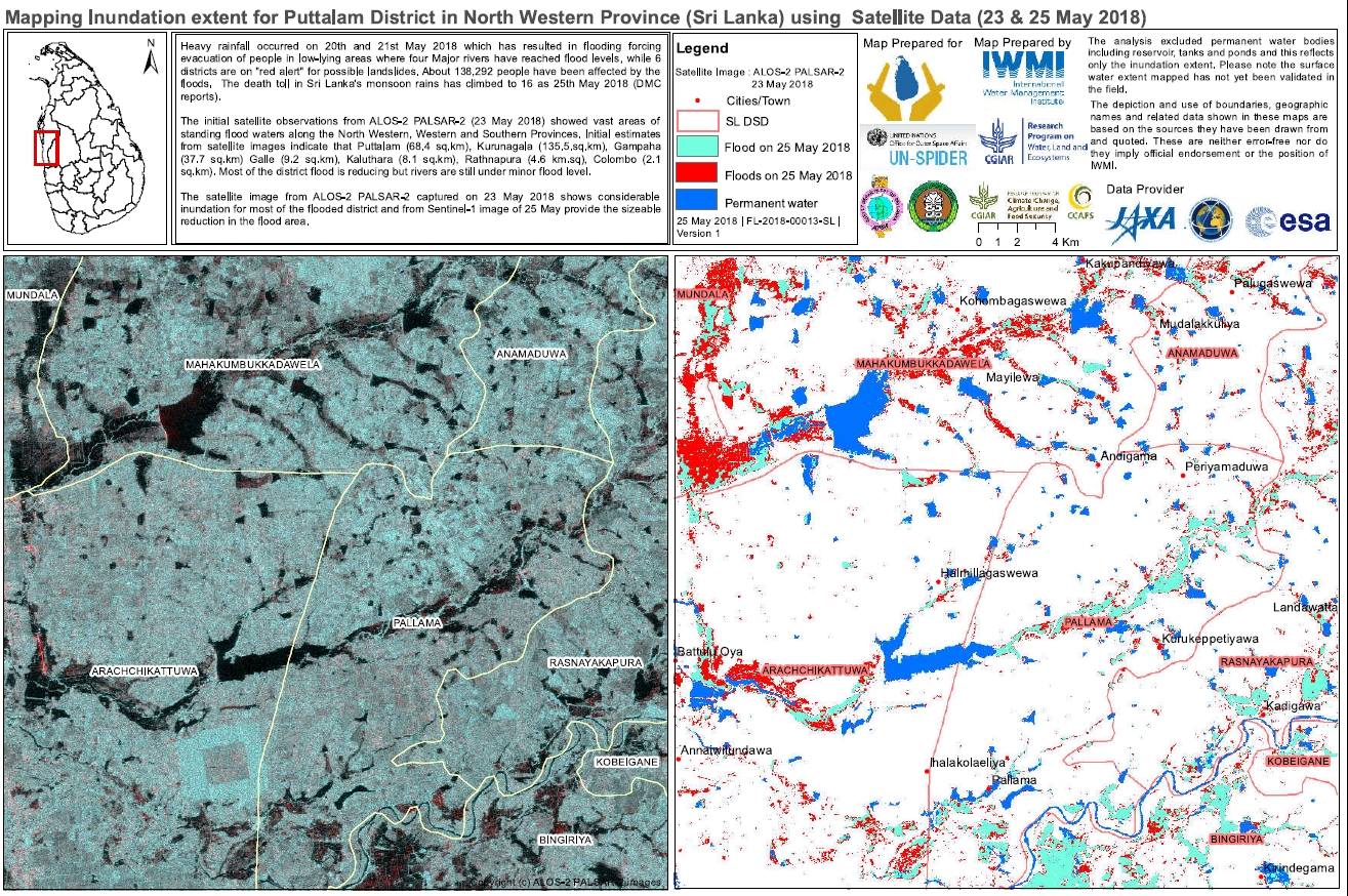
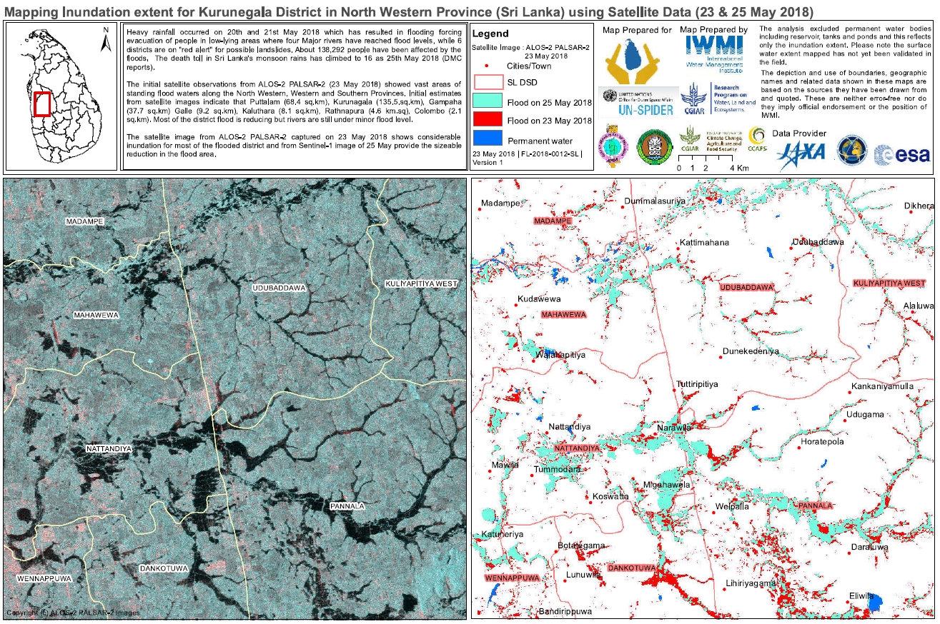
Flood situation of Gampaha, Puttalam and Kurunagala District, Sri Lanka
Авторские права: ALOS-2 © JAXA (2018) All rights reserved
Sentinel-1 © Copernicus Sentinel data (2018)
Map produced by IWMI
Information about the Product
Получено: ALOS-2: 23/05/2018
Sentinel-1: 24/05/2018
Источник: ALOS-2 / Sentinel-1
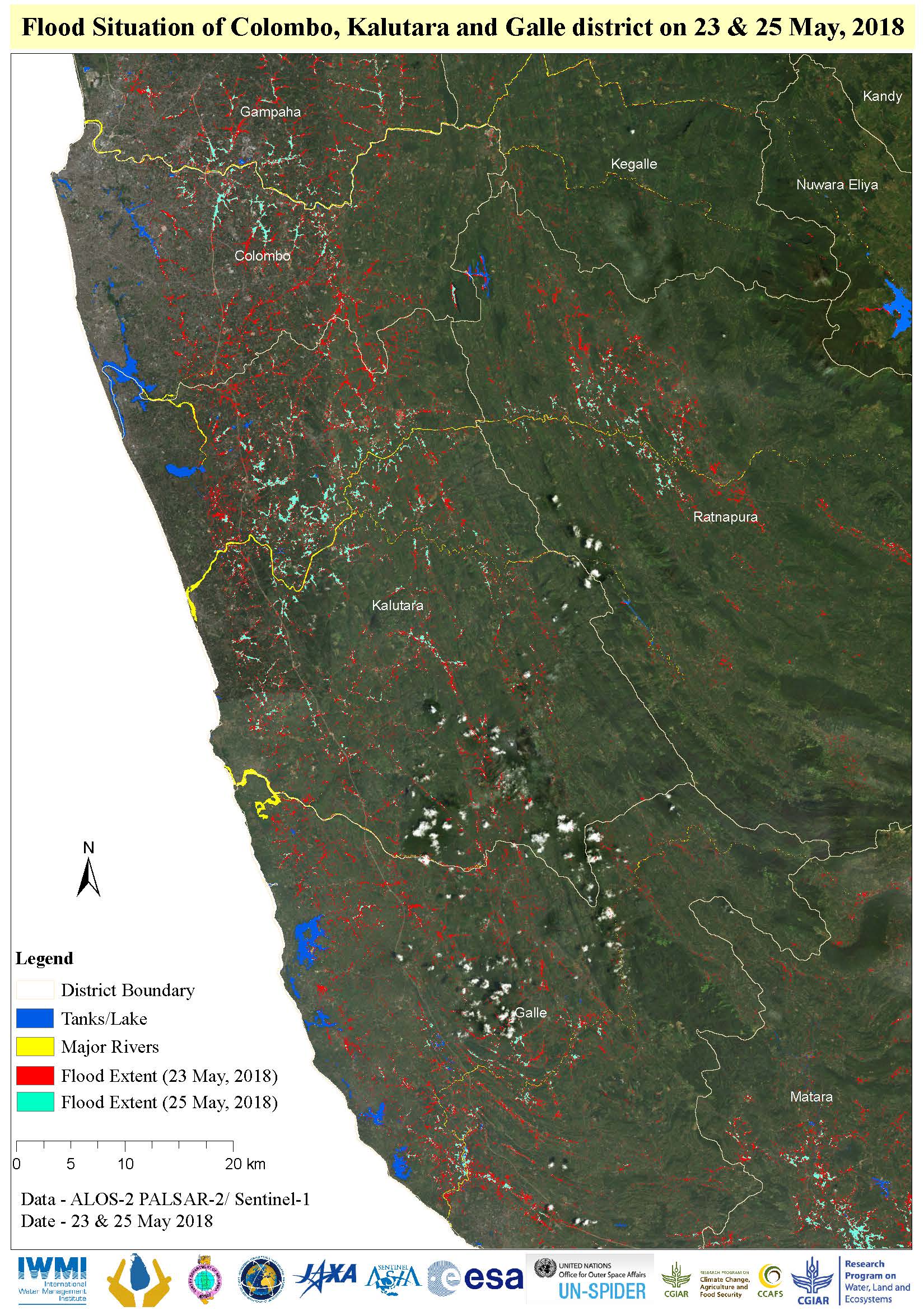
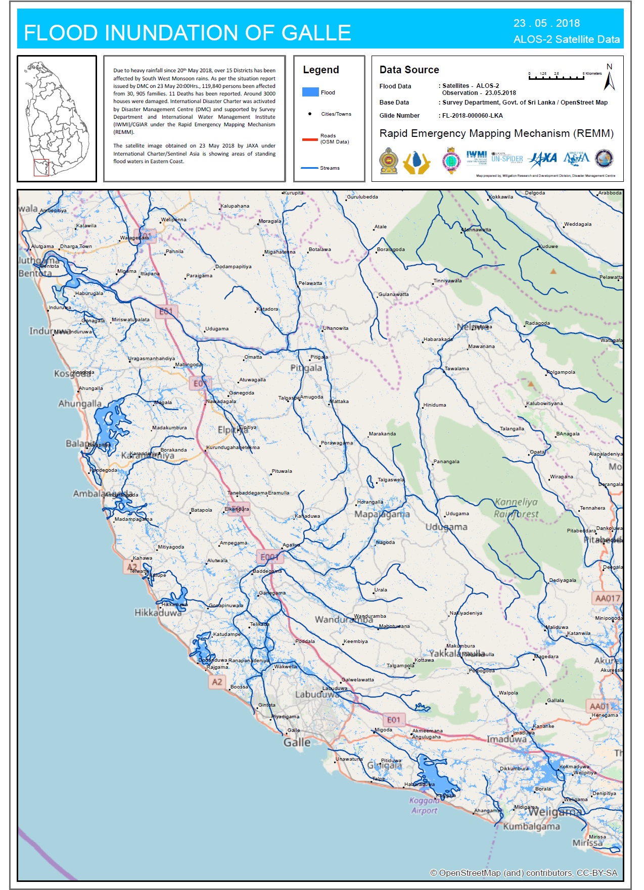
Flooding in Colombo, Kalutara and Galle District, Sri Lanka
Авторские права: ALOS-2 © JAXA (2018) All rights reserved
Sentinel-1 © Contains modified Copernicus Sentinel data (2018)
Map produced by IWMI
Information about the Product
Получено: ALOS-2: 23/05/18
Sentinel-1: 25/05/18
Источник: ALOS-2 / Sentinel-1
 Вернуться к полному архиву активаций

