 English
 Spanish
 French
 Chinese
 Russian
 Portuguese
 Последняя Активация
Charter activations
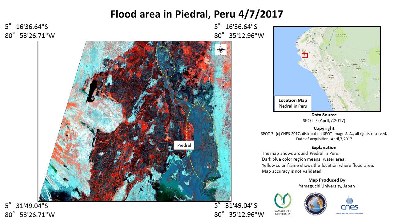
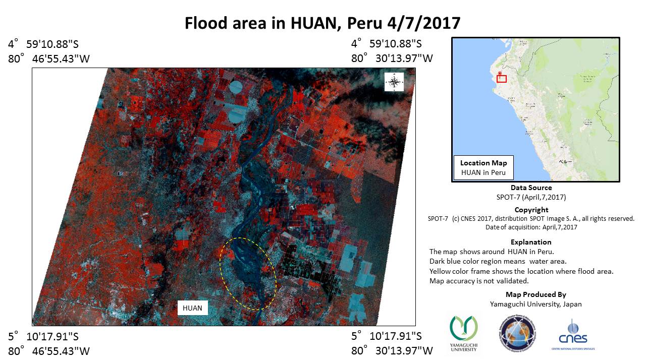
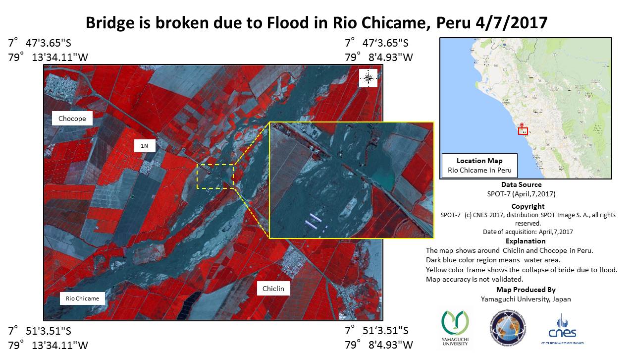
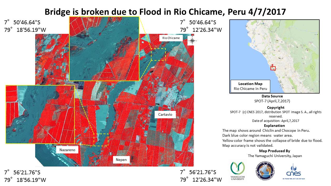
Flood in Peru
Peru is undergoing devastating floods which forecasts suggest could continue until May.
The Civil Protection Agency of Peru reports: 97 people have died, 184,112 people are affected, 30,184 houses were destroyed with more than 180,000 damaged, 232 bridges have been destroyed, 1596 kilometres of road were destroyed, and 35,597 hectares of crops have been lost.
The flooding is the result of a local El Niño weather system which has brought torrential rain to northern Peru since early March.
The cities of Piura, Trujillo and Chiclayo are among those worst affected, but estimates suggest that 800 villages have also been destroyed. The floods have caused mudflows to sweep into some cities, bringing further disruption.
The flood situation was made worse on 26 March, after the Piura River burst its banks, raising the water levels to 1.8 metres in some locations such as the town of Catacaos.
| Тип события: | Flood |
| Место события: | Peru |
| Date of Charter Activation: | 31 March 2017 |
| Время активации Хартии: | 08:30:00 |
| TЧасовой пояс в районе активации Хартии: | UTC+02:00 |
| Запрос на активацию поступил от: | SIFEM Argentina on behalf of Instituto Nacional de Defensa Civil de Perú - INDECI |
| Номер активации: | 523 |
| Менеждер проекта от: | CONIDA |
Products


Change detection map of water bodies in the Chira River valley
Авторские права: RADARSAT-2 Data and Products © MacDonald, Dettwiler and Associates Ltd. (2017) - All Rights Reserved. RADARSAT is an official trademark of the Canadian Space Agency.
Map produced by CONIDA
Information about the Product
Получено: Pre-disaster: 08/03/2016
Post-disaster: 03/04/2017
Источник: RADARSAT-2
Change detection map of water bodies in the Piura River valley
Авторские права: RADARSAT-2 Data and Products © MacDonald, Dettwiler and Associates Ltd. (2017) - All Rights Reserved. RADARSAT is an official trademark of the Canadian Space Agency.
Map produced by CONIDA
Information about the Product
Получено: Pre-disaster: 08/03/2016
Post-disaster: 03/04/2017
Источник: RADARSAT-2
Change detection map of Laguna La Nina in Piura
Авторские права: Resurs-P © ROSCOSMOS (2017) - All rights reserved
SPOT-6 © CNES 2017 - Distribution: Airbus Defence and Space, all rights reserved
PeruSat-1 © CONIDA 2017
Map produced by CONIDA
Information about the Product
Получено: Resurs-P: 01-04-2017
SPOT-6: 17-06-2016
PeruSat-1: 17-03-2017
Источник: Resurs-P /SPOT-6 / PeruSat-1
 Вернуться к полному архиву активаций

