 English
 Spanish
 French
 Chinese
 Russian
 Portuguese
 Последняя Активация
Charter activations
Flood and landslide in India
Jammu and Kashmir State in India is experiencing flooding following several days of heavy rain.
The flooding and resulting landslides have killed 16 people and several hundred people have been evacuated.
The 16 casualties were caused when landslides crushed two houses in Chadoora without any warning. For safety, residents in the area have been evacuated, and other people in the area have been advised to move to higher ground until the situation ends.
In addition, water levels in the Jhelum River have been at a danger level during the rain, and are at risk of overflowing.
Many areas, including the summer capital of the state, Srinigar, have been flooded. While the flood waters have started receding, and the rain has stopped, forecasts suggest there may be more rain in the near future.
| Тип события: | Flood, Landslide |
| Место события: | Jammu and Kashmir State, India |
| Date of Charter Activation: | 30 March 2015 |
| Время активации Хартии: | 12:05:00 |
| TЧасовой пояс в районе активации Хартии: | UTC+02:00 |
| Запрос на активацию поступил от: | ISRO |
| Менеждер проекта от: | National Remote Sensing Centre (NRSC) |
Products
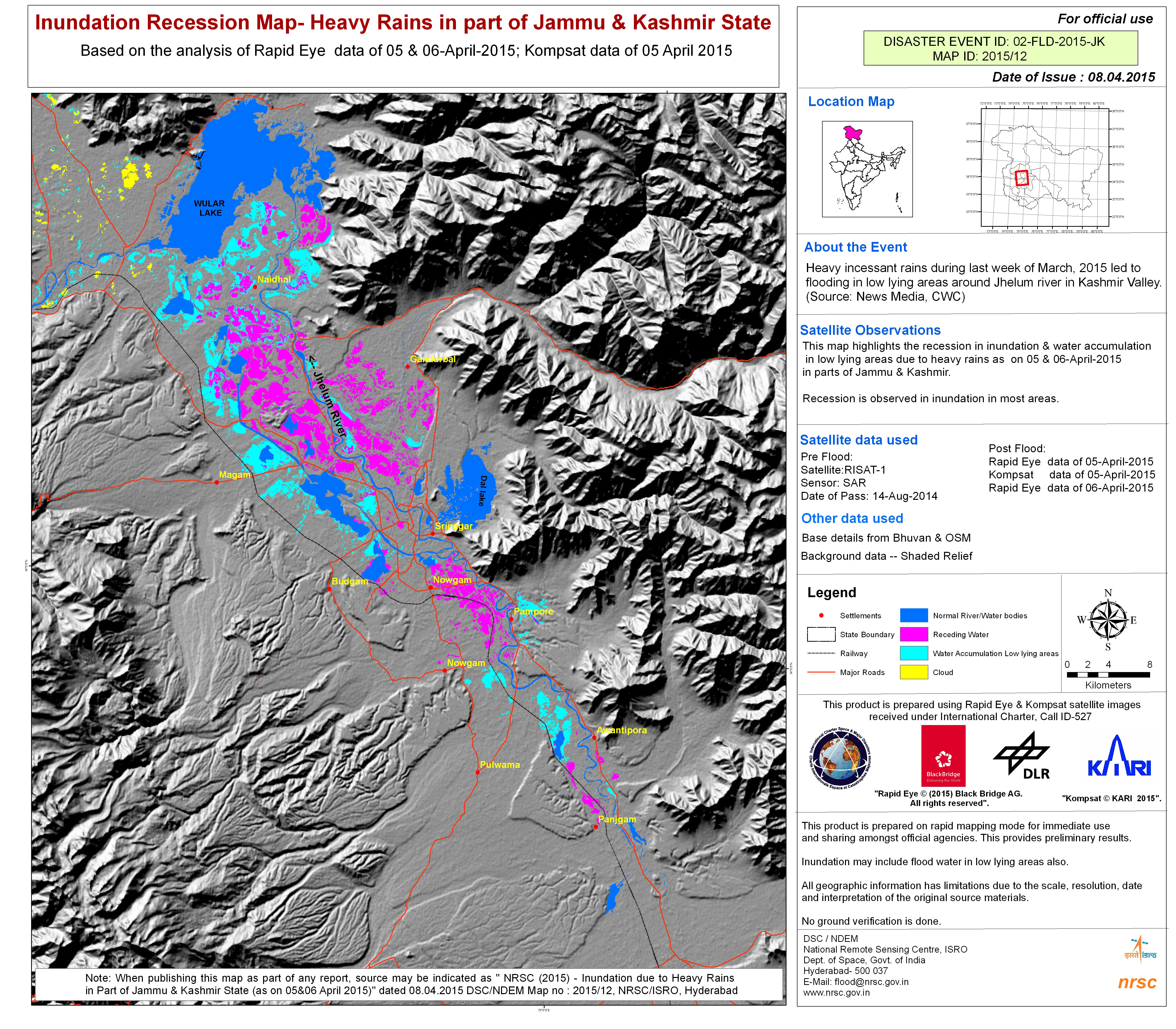
Inundation recession map following heavy rain in Jammu and Kashmir State
Авторские права: RapidEye © BlackBridge AG 2015, all rights reserved
KOMPSAT © KARI 2015
RISAT-1 © Indian Space Research Organisation (ISRO)
Map produced by NRSC
Information about the Product
Получено: RapidEye: 05/04/2015 and 06/04/2015
KOMPSAT: 05/04/2015
RISAT-1: 14/08/2014
Источник: RapidEye / KOMPSAT-3 / RISAT-1
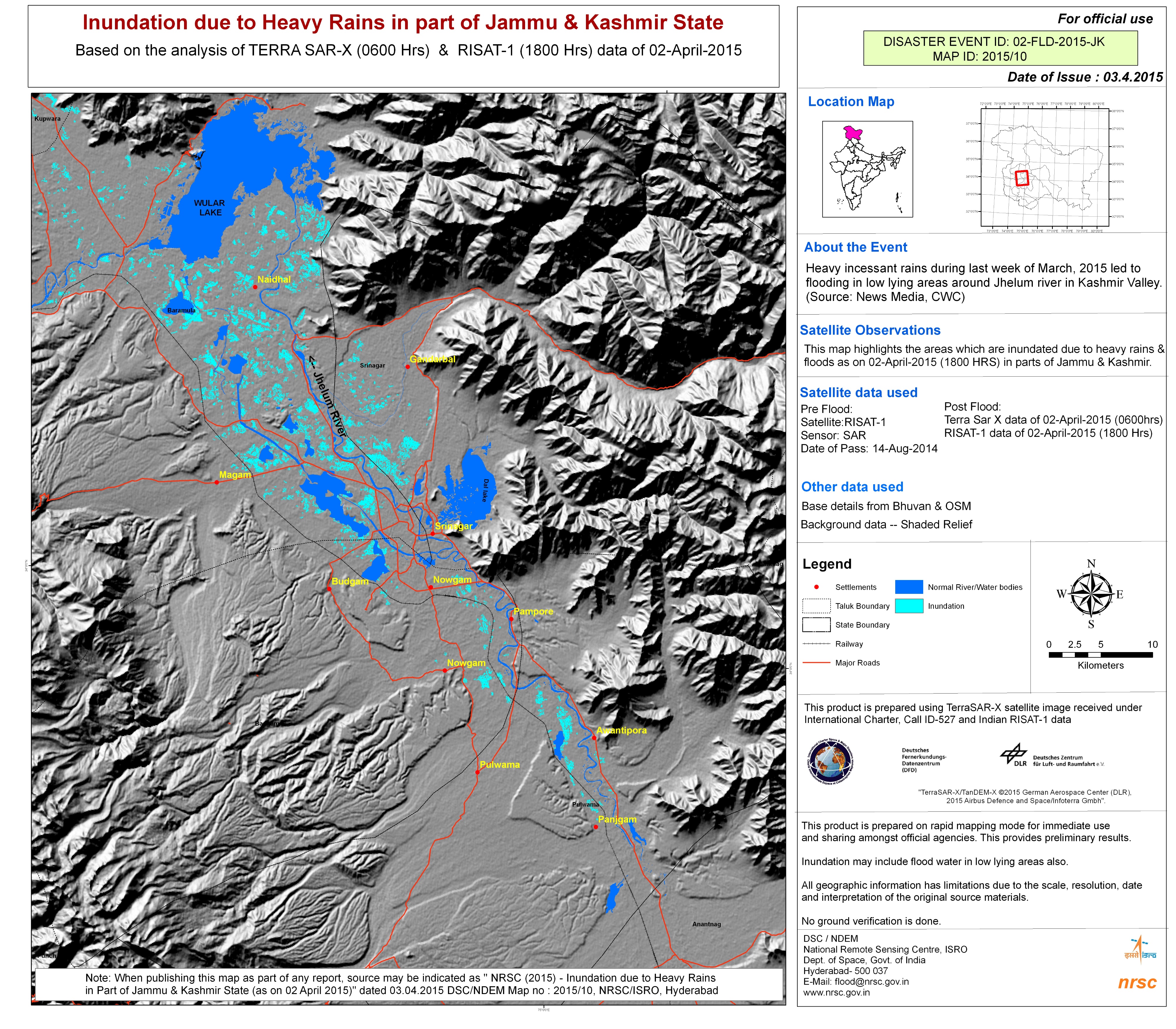
Inundation due to heavy rain in Jammu & Kashmir State, India
Авторские права: RISAT-1 © Indian Space Research Organisation (ISRO)
TerraSAR-X © German Aerospace Center (DLR), 2015 Airbus Defence and Space / Infoterra GmbH
Map produced by NRSC
Information about the Product
Получено: RISAT-1: 14/08/2014 & 02/04/2015
TerraSAR-X: 02/04/2015
Источник: RISAT-1 / TerraSAR-X
 Вернуться к полному архиву активаций

