 English
 Spanish
 French
 Chinese
 Russian
 Portuguese
 Последняя Активация
Charter activations
Flood in Costa Rica
Tropical storm Otto left a trail of devastation over northern parts of Costa Rica as severe rainfall caused widespread flooding and landslides. The storm has claimed at least nine lives and displaced over 6000 people.
Otto made landfall in southern Nicaragua as a category two storm, with wind speeds of 110mph and moved south into northern Costa Rica where a month's worth of rain fell in a few hours. Several small towns and the infrastructure surrounding them were badly affected with high water levels, debris and reports of bridges being destroyed.
Tropical storm Otto is the southernmost and largest forming hurricane to ever hit the region, Costa Rica hasn't been hit by a hurricane since 1851. According to meteorologists the storm could have been caused by unusually high sea surface temperatures of 29C.
| Тип события: | Flood |
| Место события: | Costa Rica |
| Date of Charter Activation: | 28 November 2016 |
| Время активации Хартии: | 16:53:00 |
| TЧасовой пояс в районе активации Хартии: | UTC-06:00 |
| Запрос на активацию поступил от: | USGS on behalf of National Emergency Committee Costa Rica |
| Номер активации: | 515 |
| Менеждер проекта от: | CSA |
Products
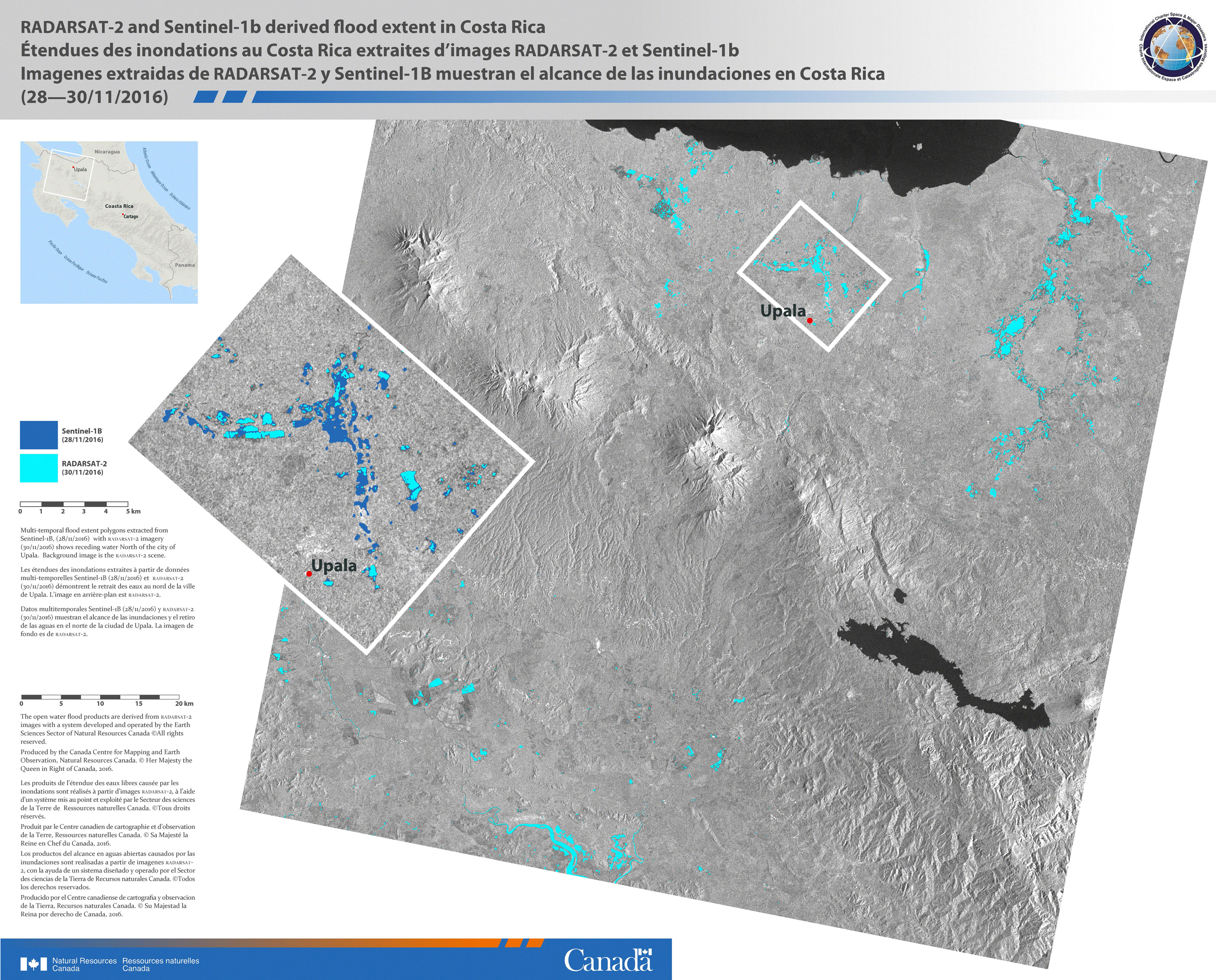
Flood extent in Costa Rica
Авторские права: RADARSAT-2 Data and Products © MacDonald, Dettwiler and Associates Ltd. (2016) - All Rights Reserved. RADARSAT is an official trademark of the Canadian Space Agency.
Sentinel-1B © Contains modified Copernicus Sentinel data (2016)
Map produced by Natural Resources Canada
Information about the Product
Получено: Sentinel-1B: 28/11/2016
RADARSAT-2: 30/11/2016
Источник: RADARSAT-2 / Sentinel-1B
 Вернуться к полному архиву активаций

