 English
 Spanish
 French
 Chinese
 Russian
 Portuguese
 Последняя Активация
Charter activations
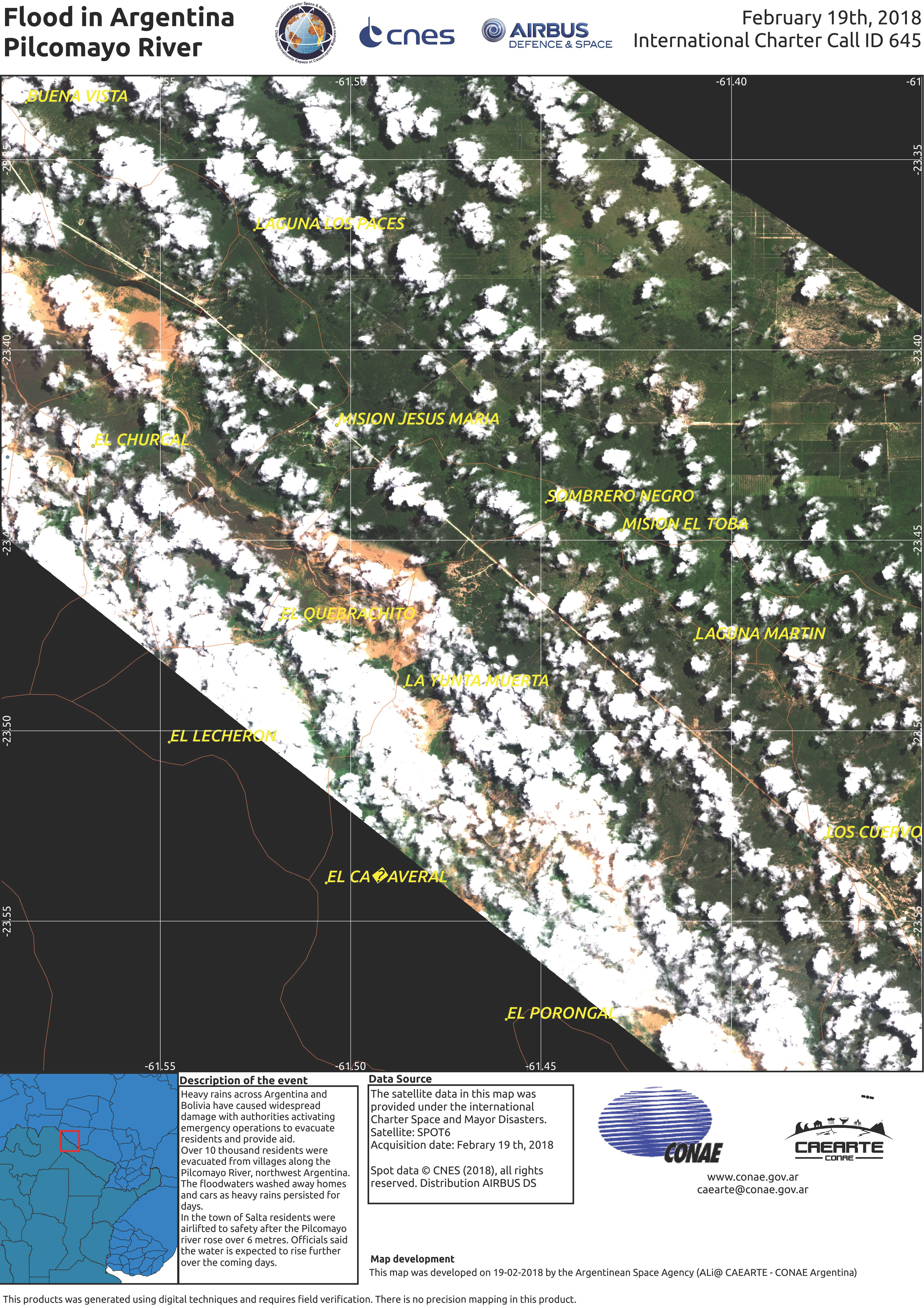
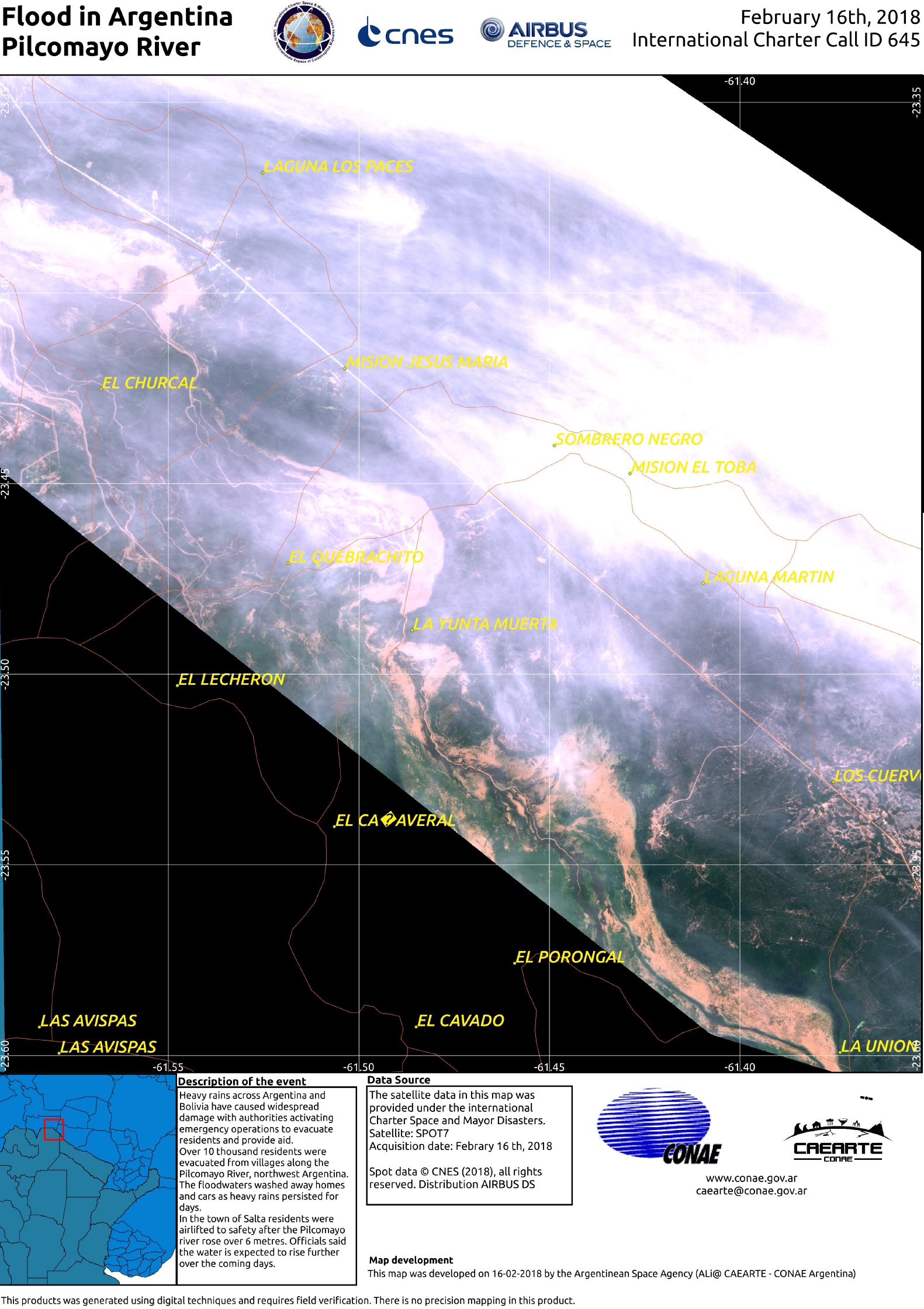
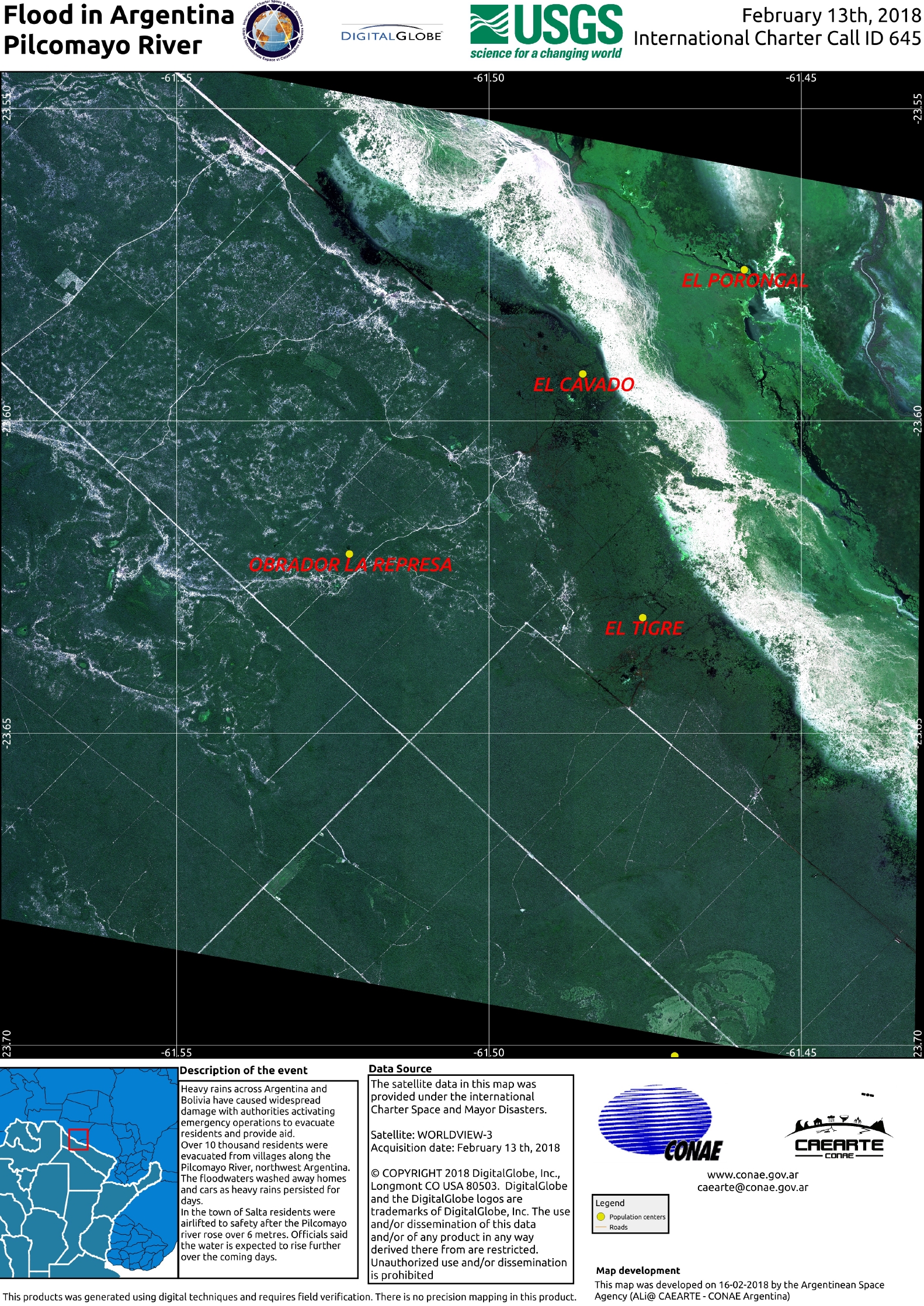
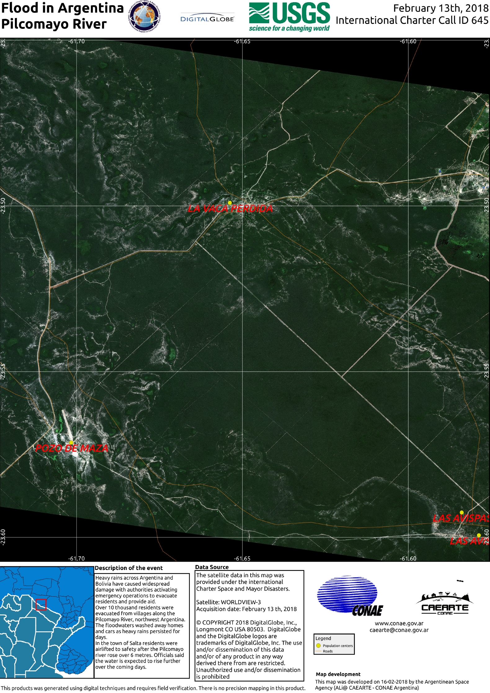
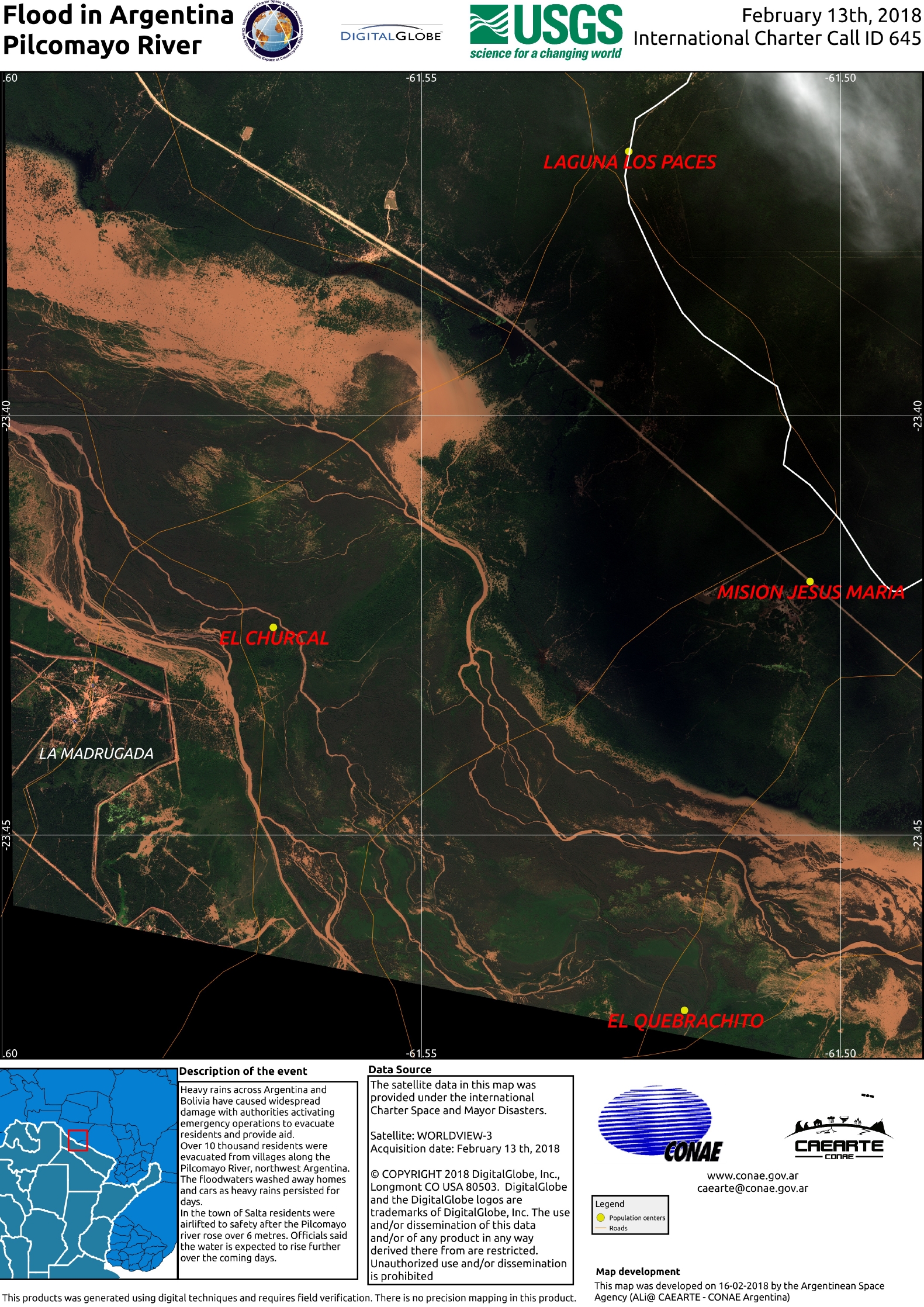
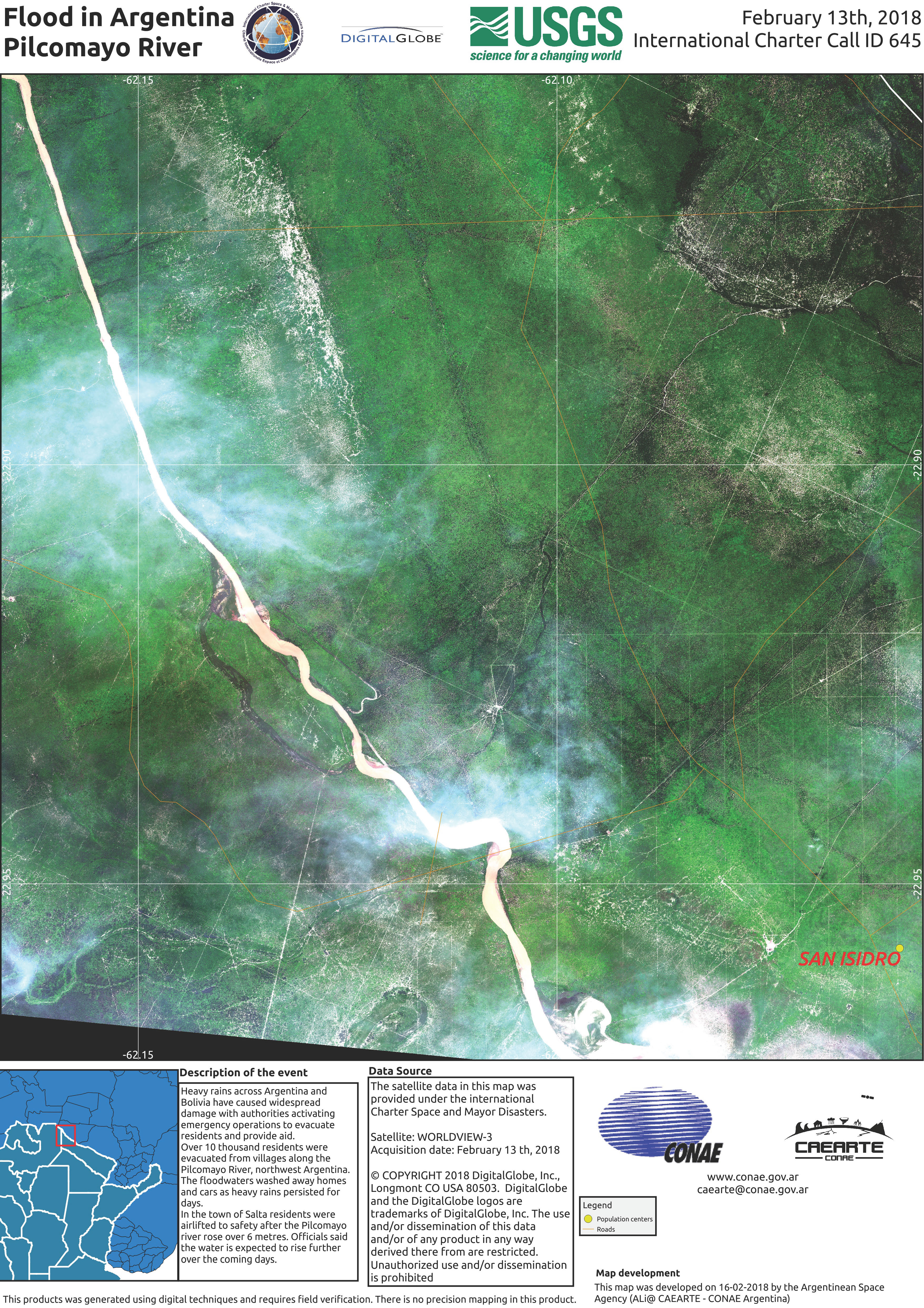
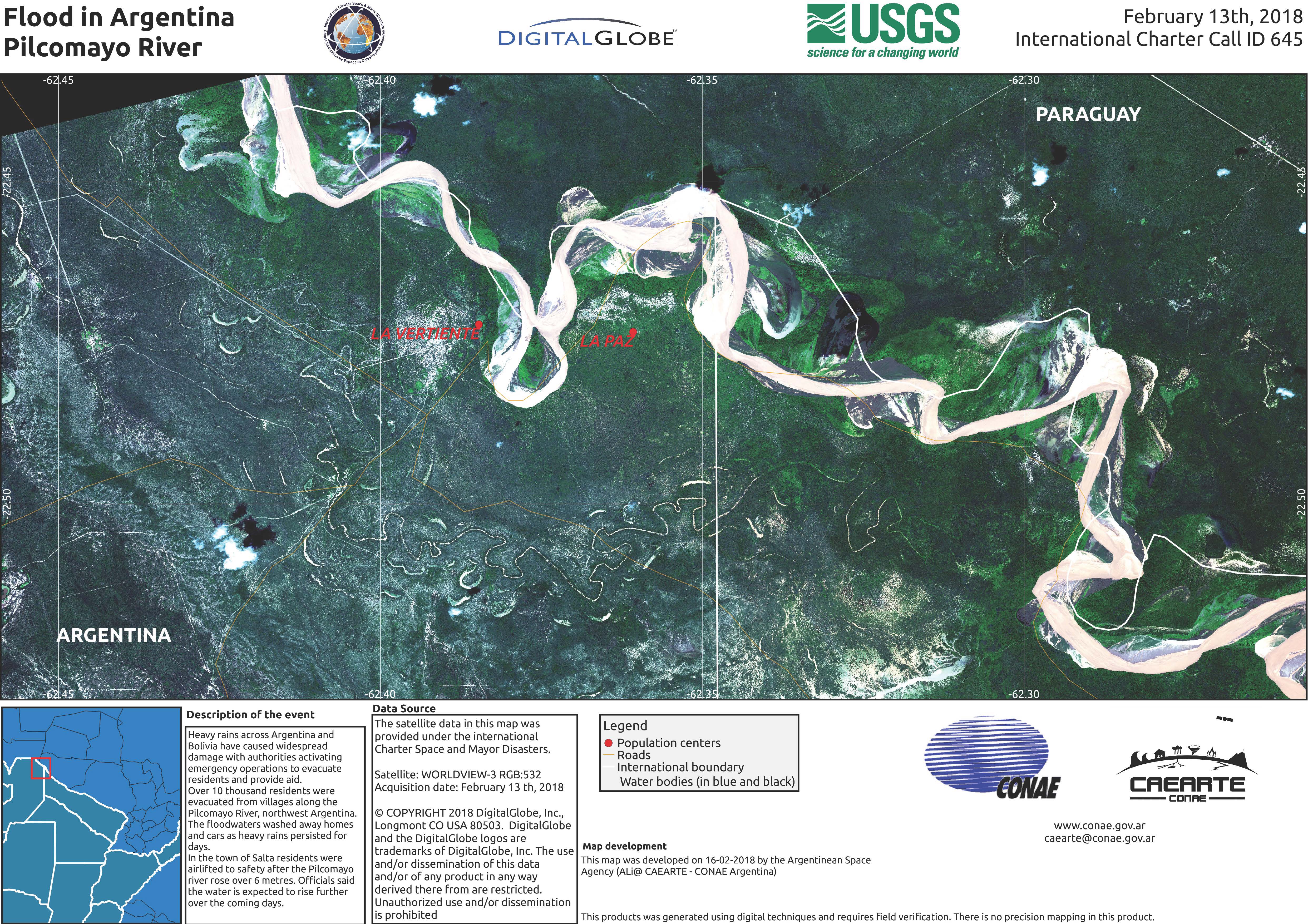
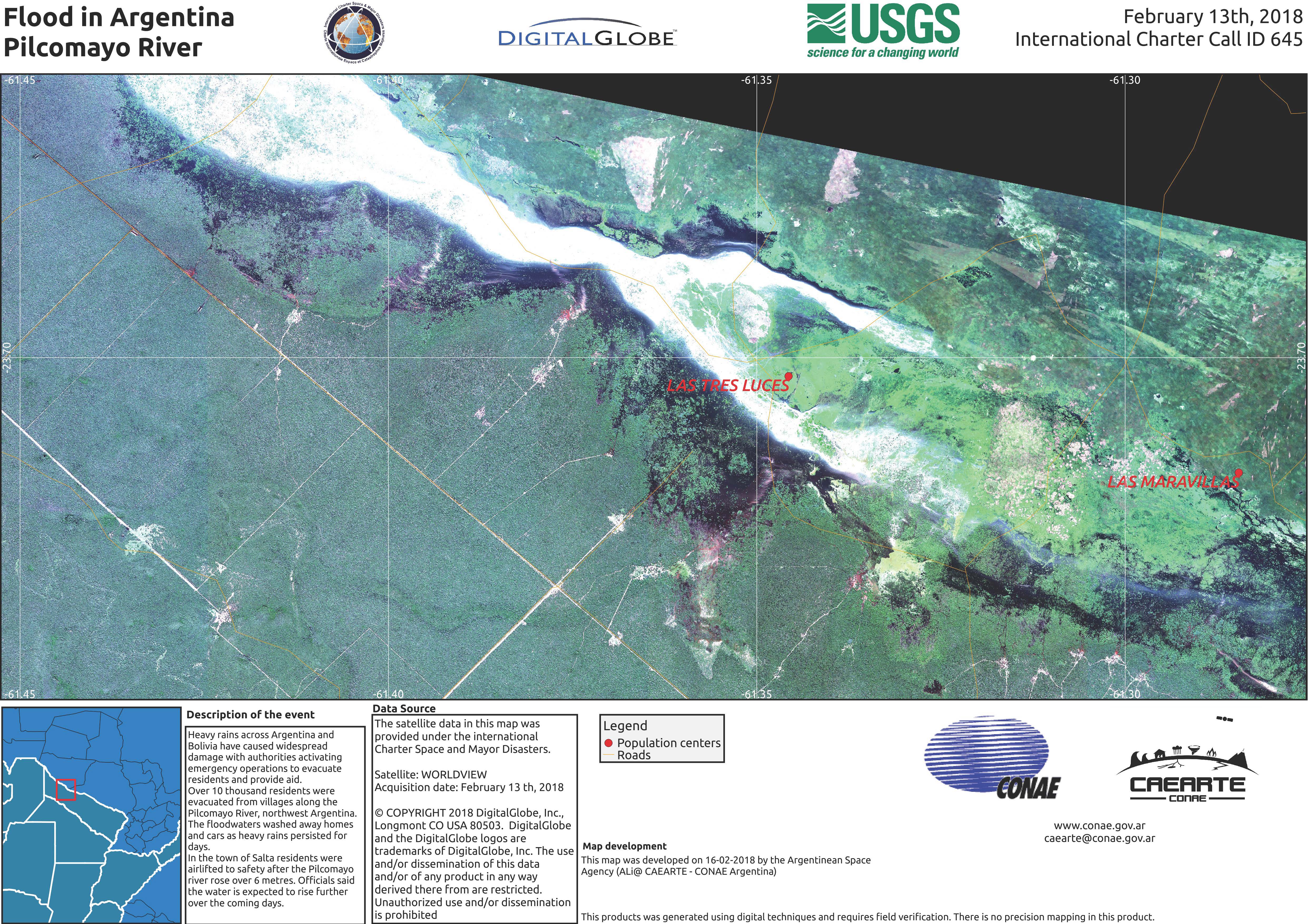
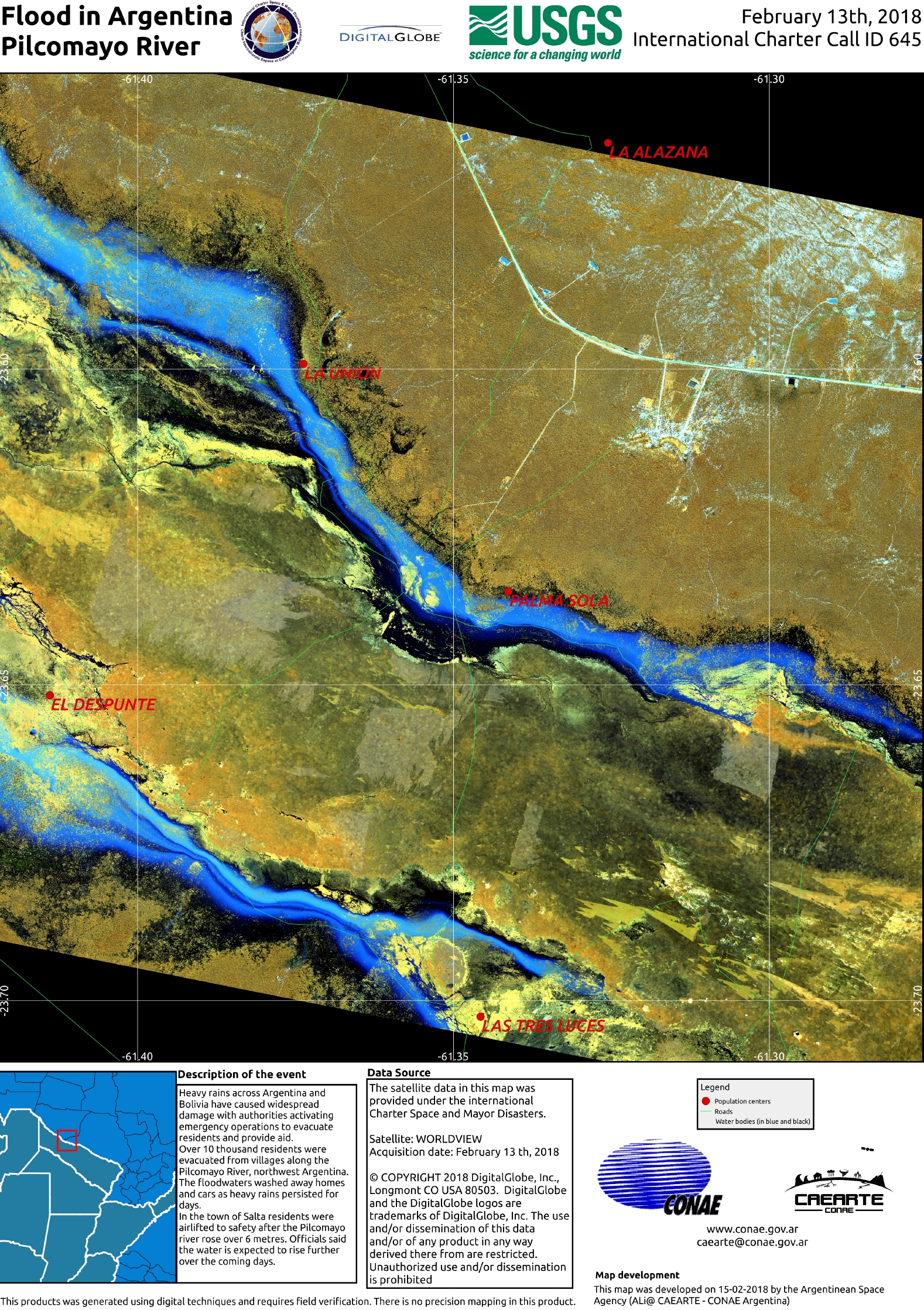
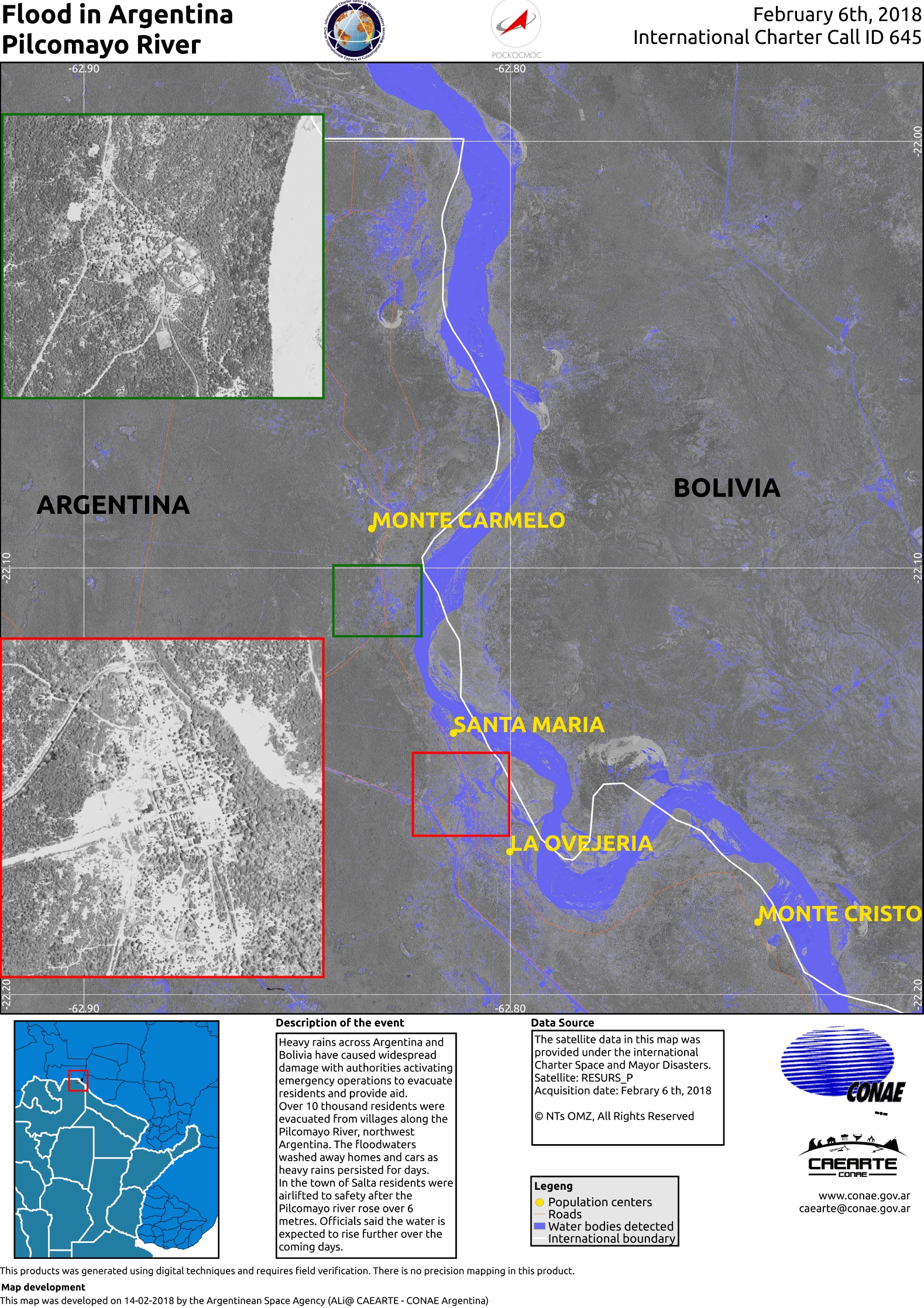
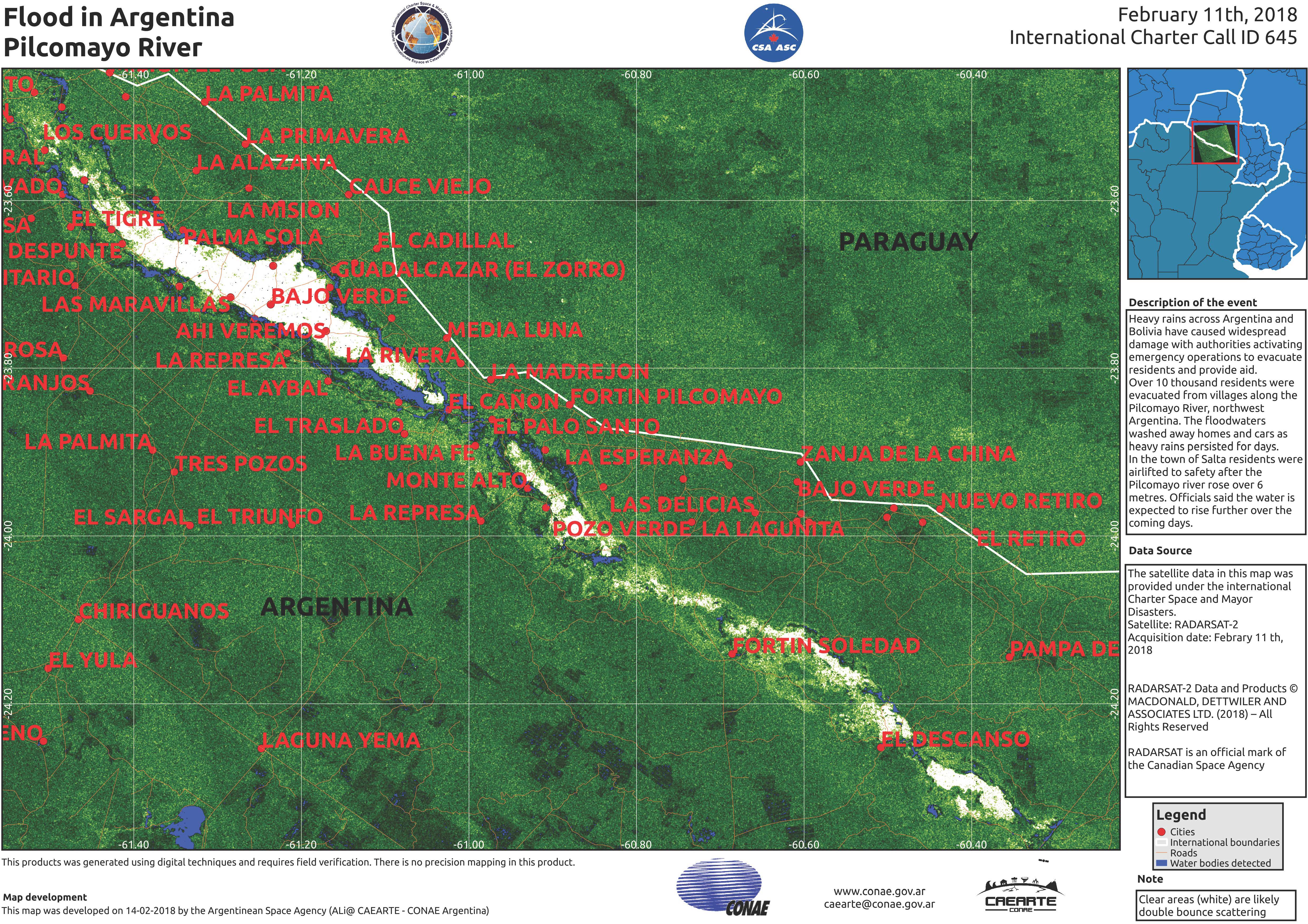
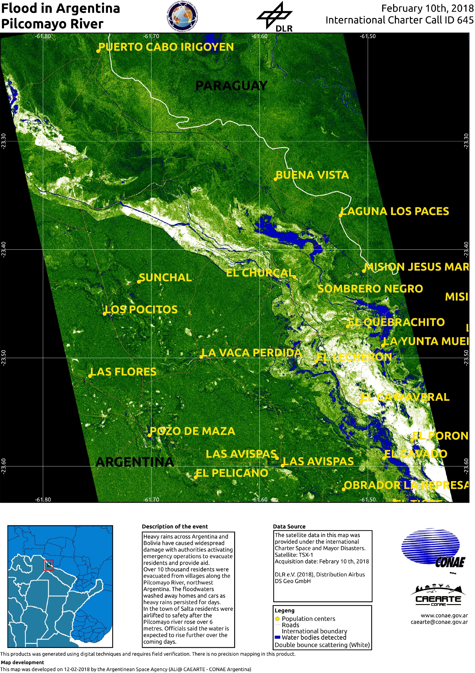
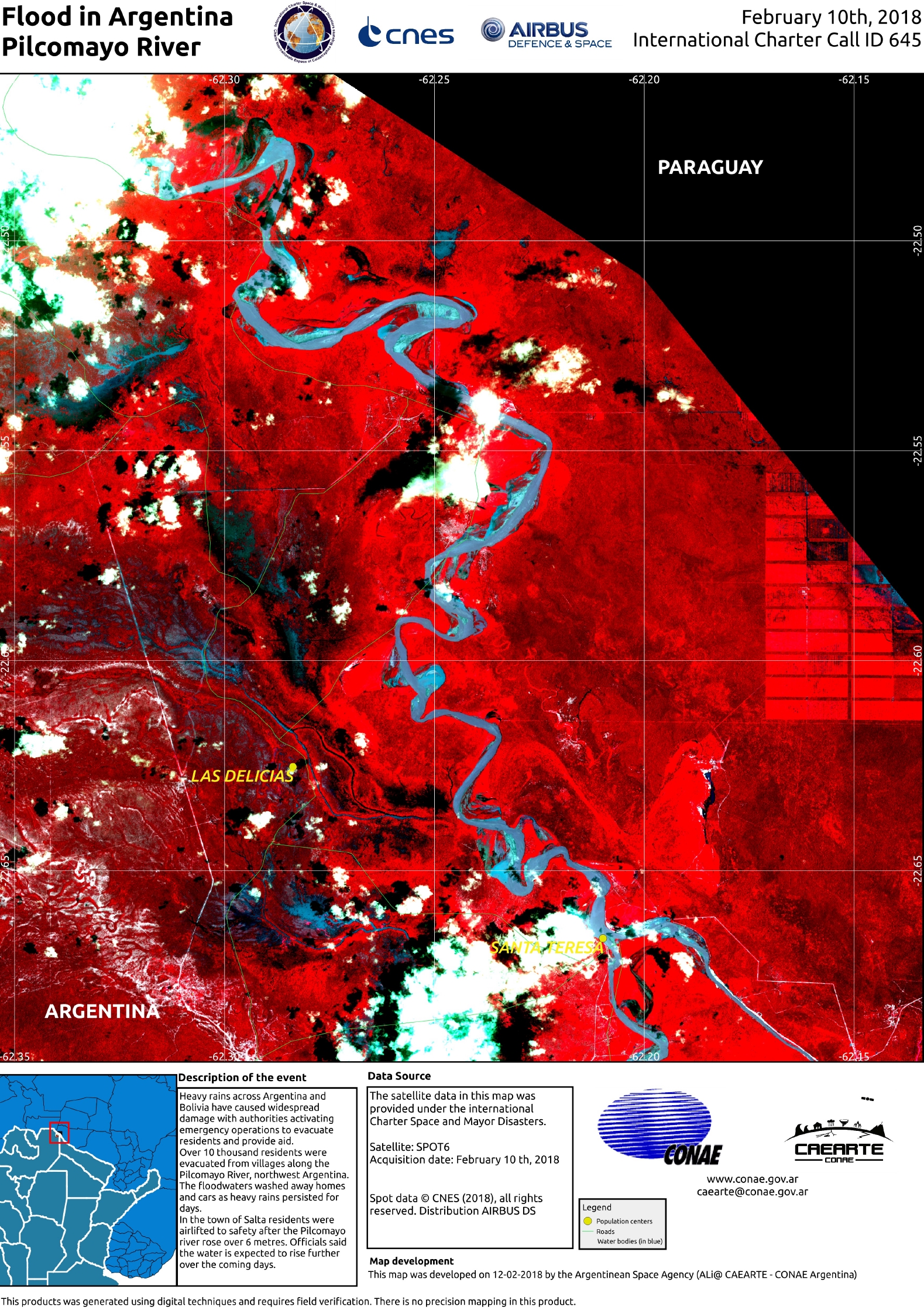
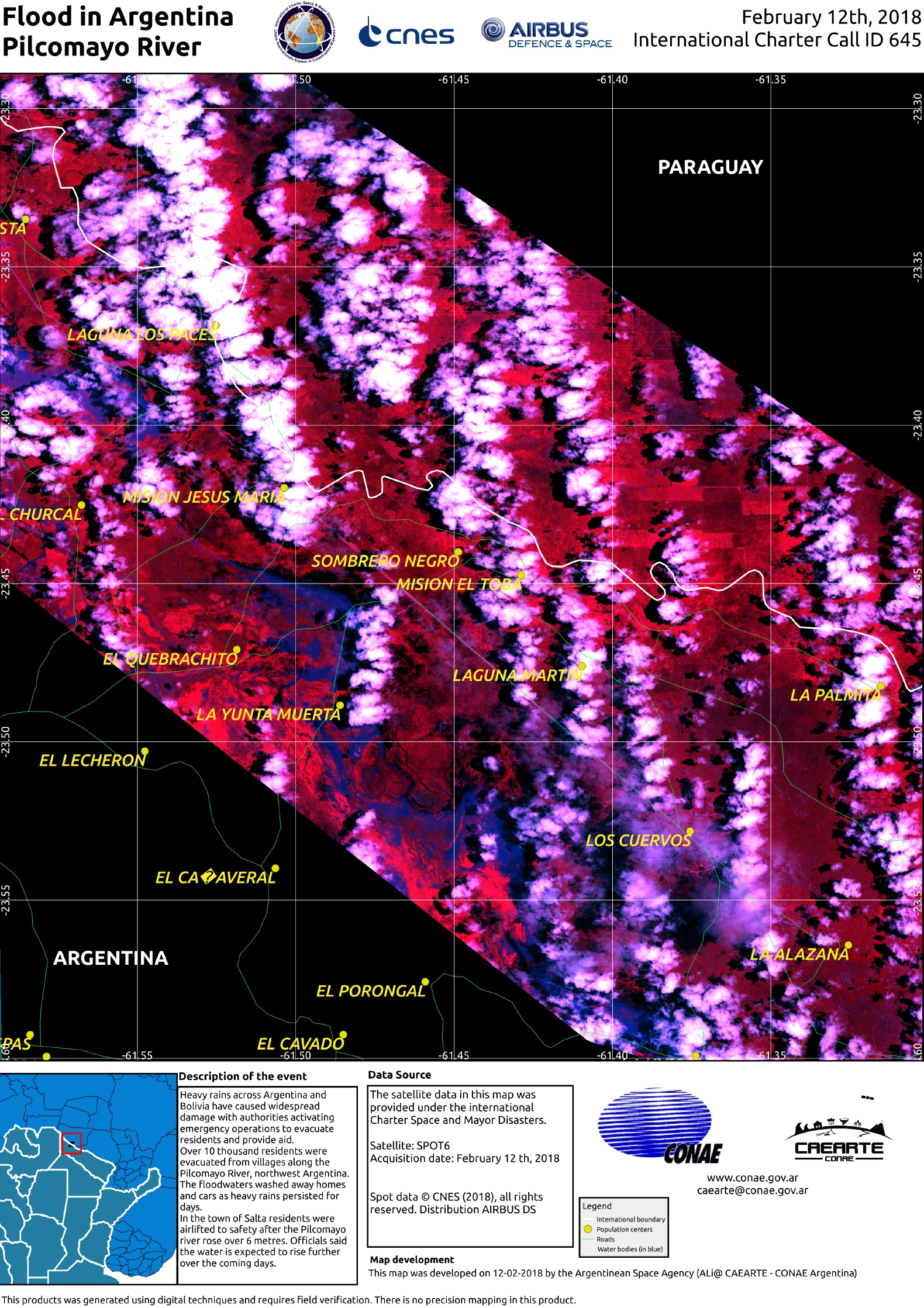
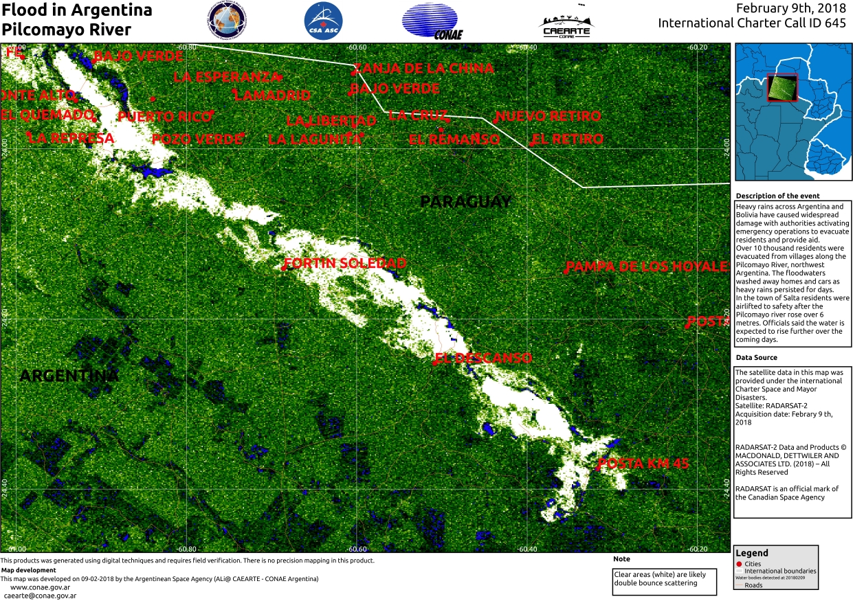
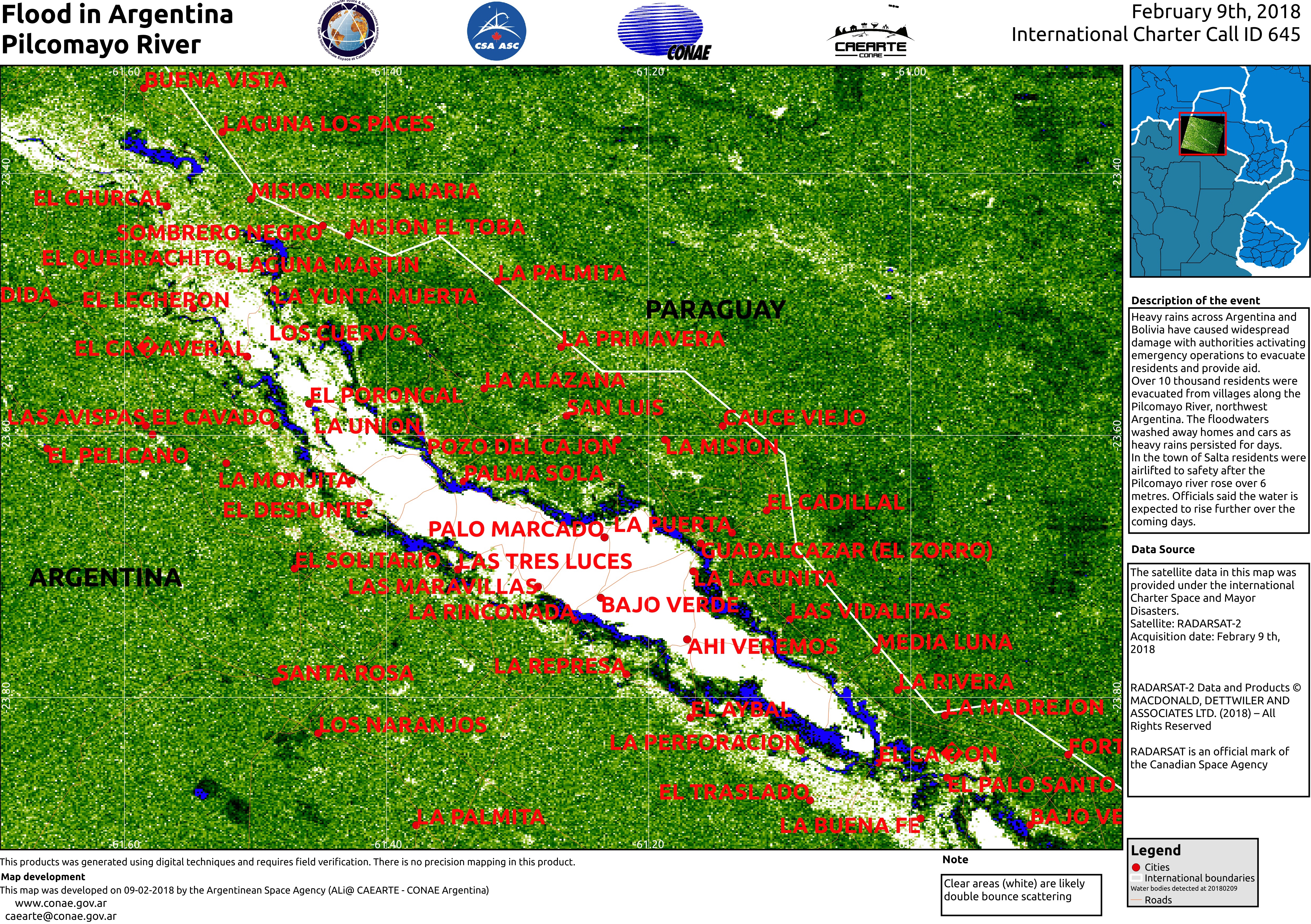
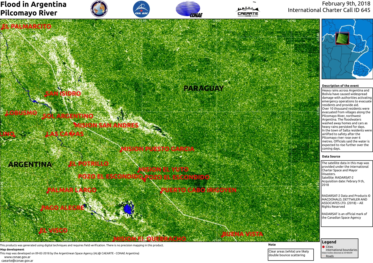
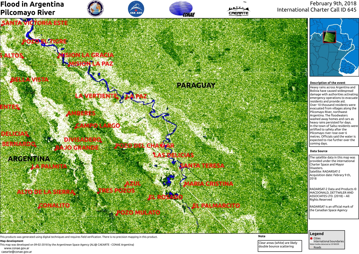
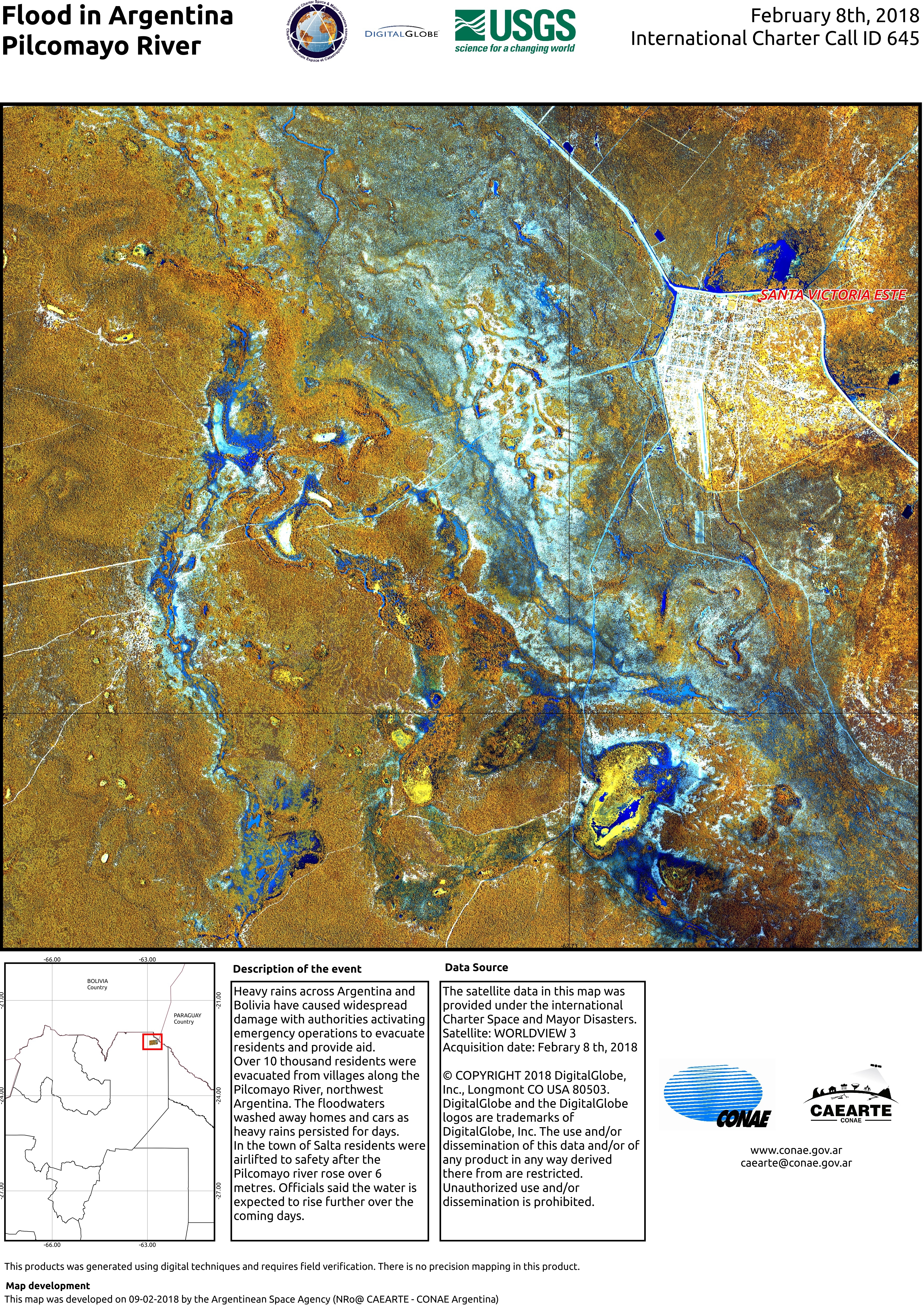
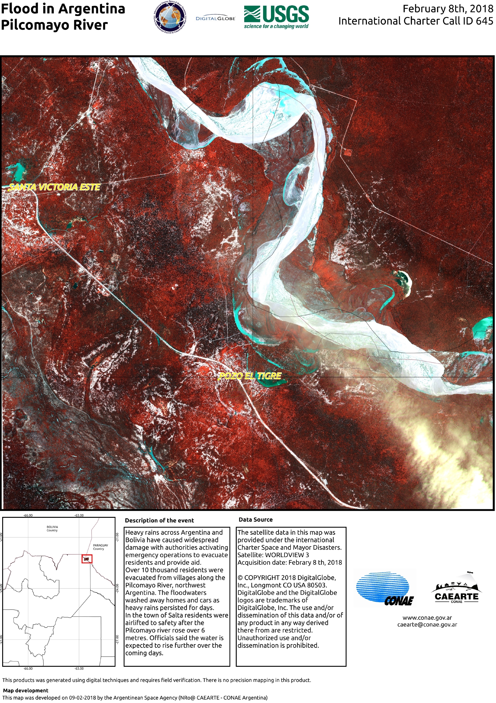
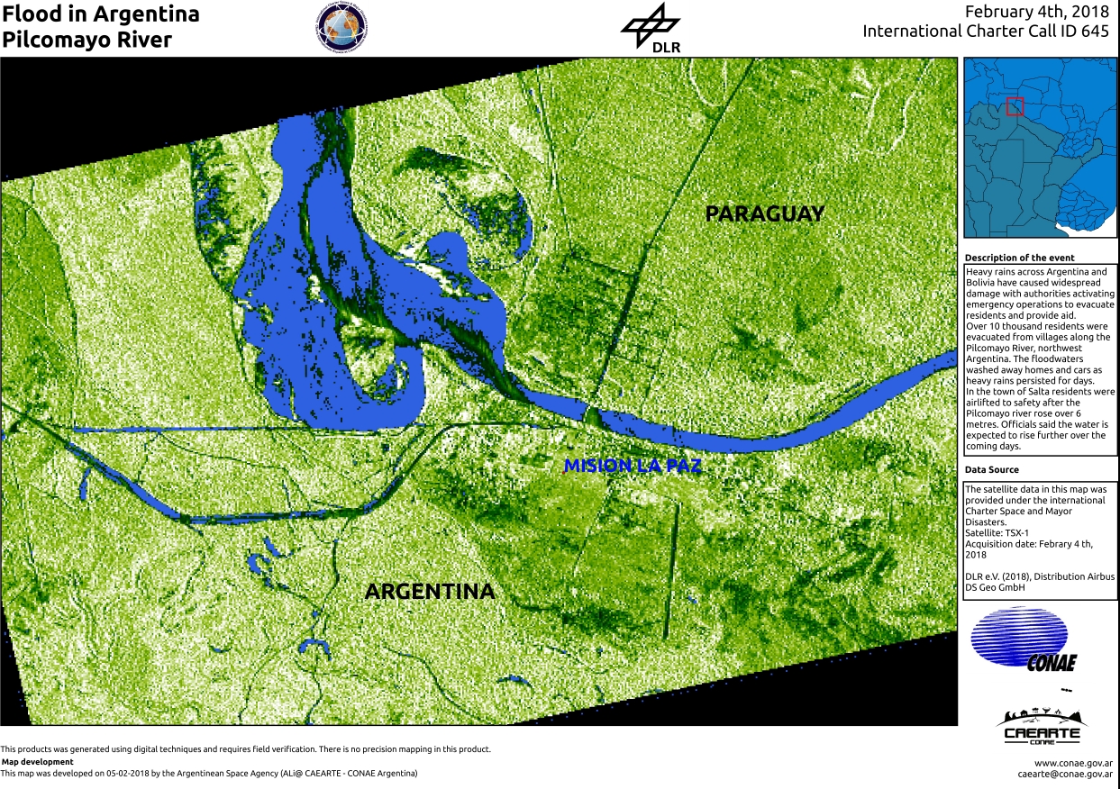
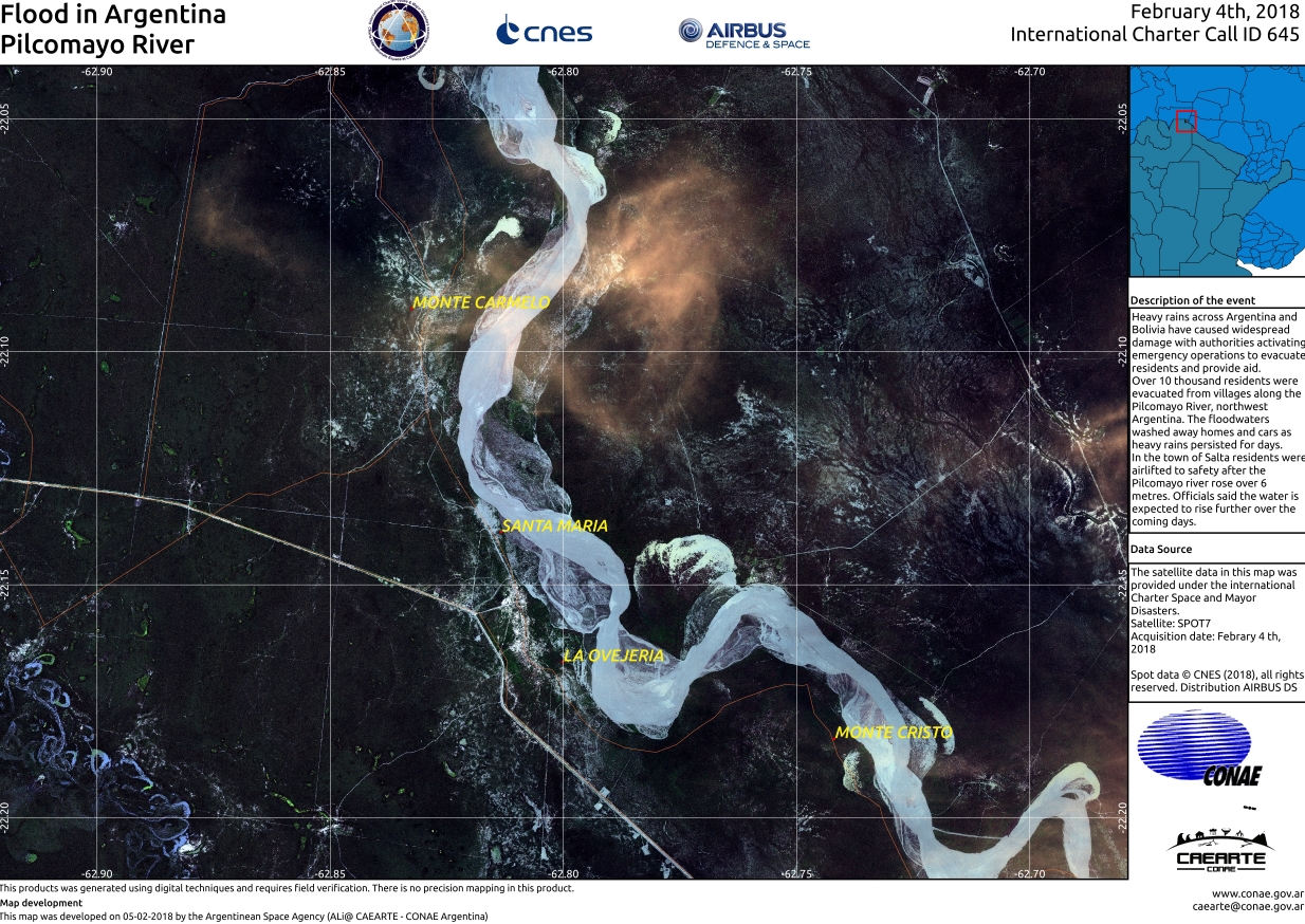
Flood in Argentina
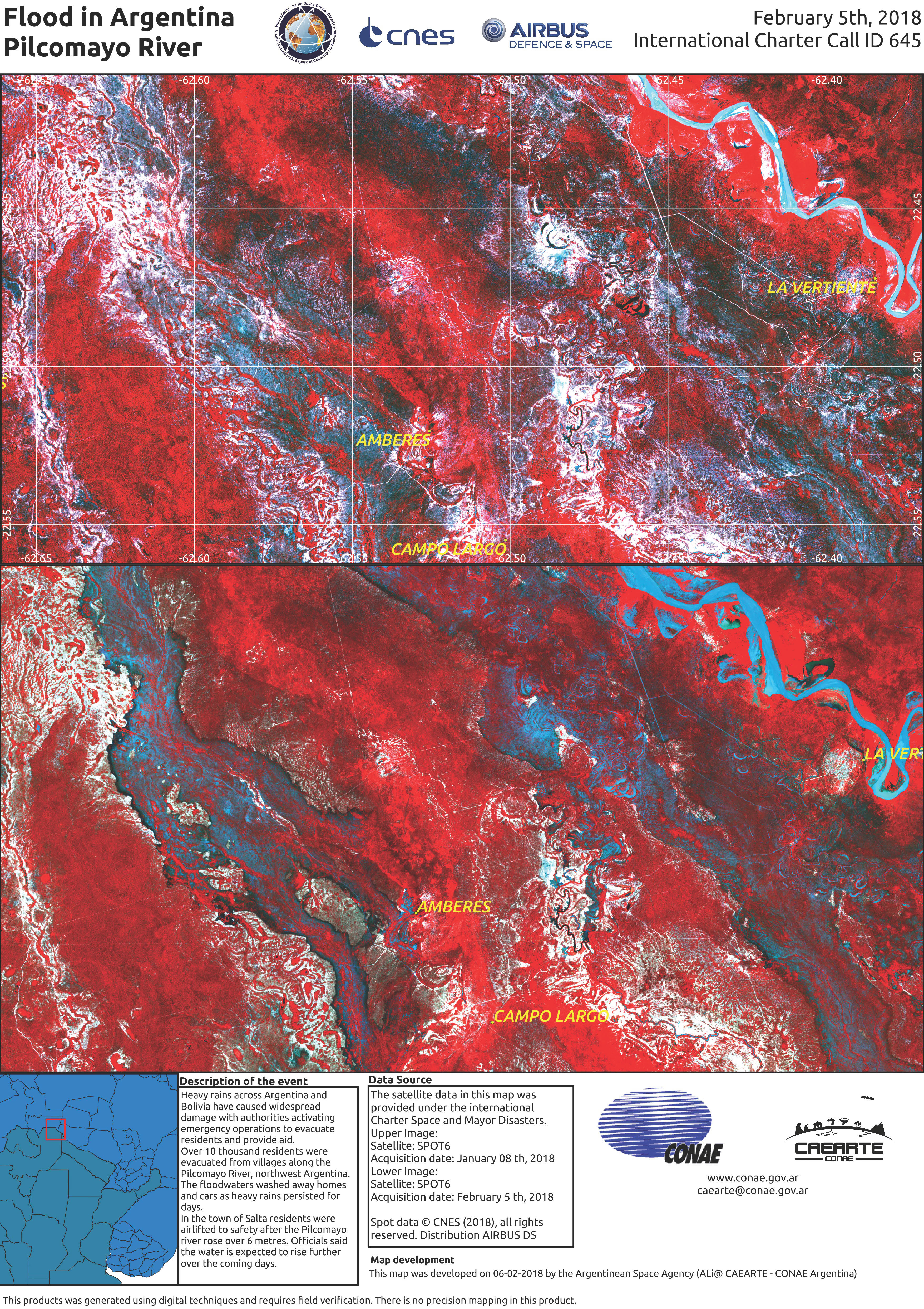
Heavy rains across Argentina and Bolivia have caused widespread damage with authorities activating emergency operations to evacuate residents and provide aid.
Over 10 thousand residents were evacuated from villages along the Pilcomayo River, northwest Argentina. The floodwaters washed away homes and cars as heavy rains persisted for days.
In the town of Salta residents were airlifted to safety after the Pilcomayo river rose over 6 metres. Officials said the water is expected to rise further over the coming days.| Тип события: | Floods |
| Место события: | Argentina |
| Date of Charter Activation: | 2018-02-03 |
| Время активации Хартии: | 04:51 |
| TЧасовой пояс в районе активации Хартии: | UTC+01:00 |
| Запрос на активацию поступил от: | Sec. Nacional de Protección Civil Argentina – Ministerio de Seguridad – SIFEM - ARGENTINA |
| Номер активации: | 564 |
| Менеждер проекта от: | CONAE |
Products
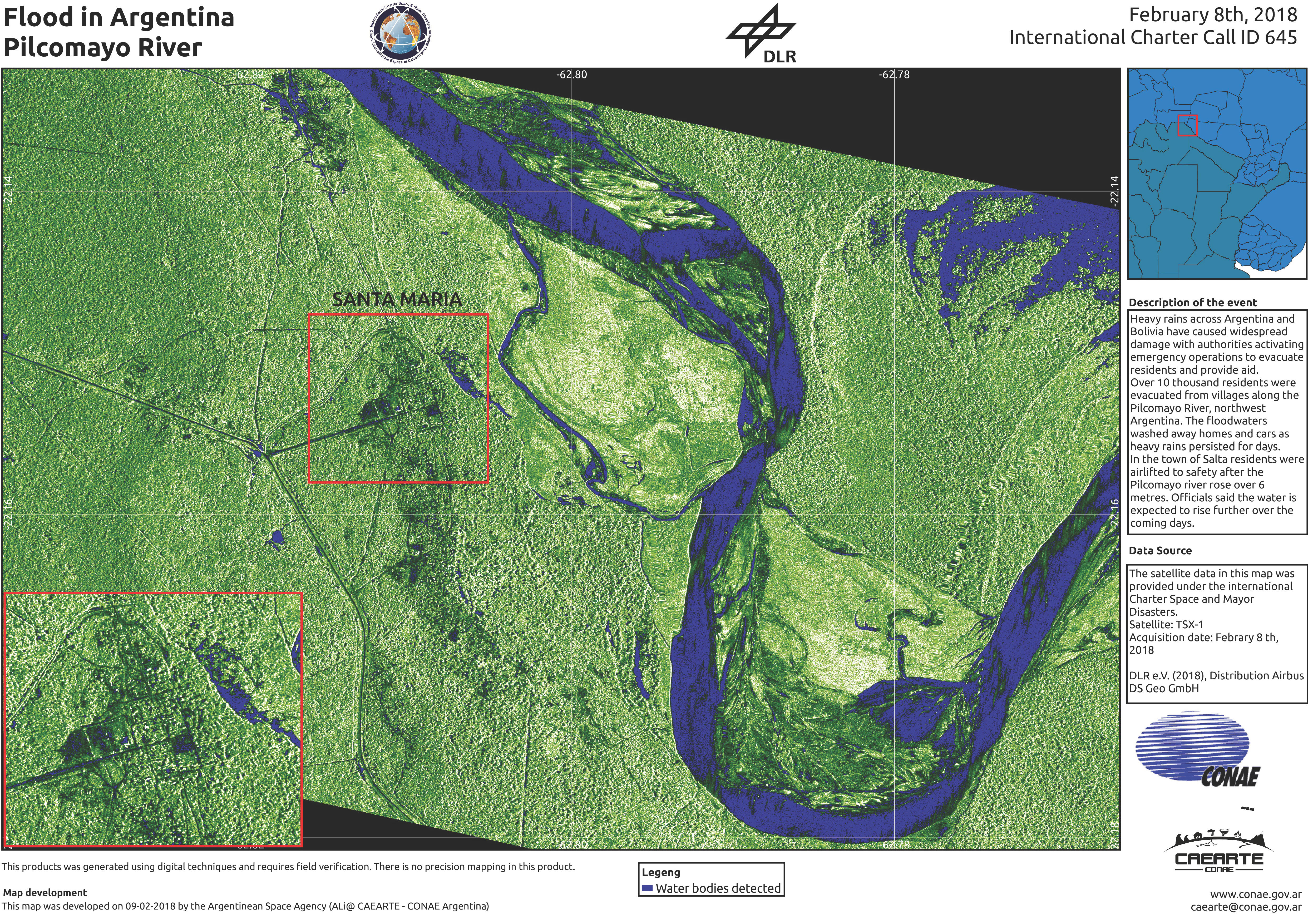
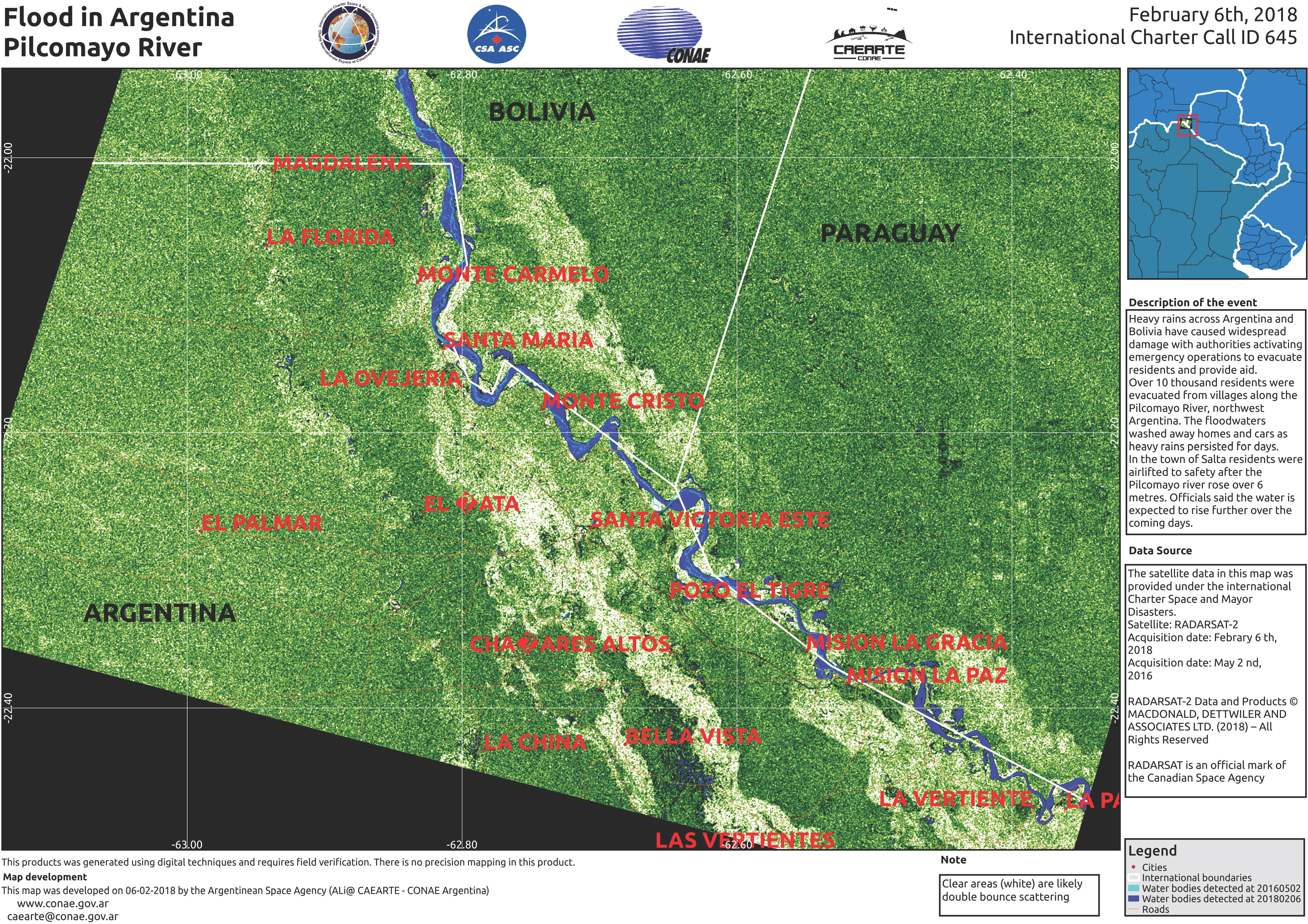
Flooding on the Pilcomayo River
Авторские права: RADARSAT-2 Data and Products © Maxar Technologies Ltd. (2018) - All Rights Reserved. RADARSAT is an official trademark of the Canadian Space Agency.
Map produced by CONAE
Information about the Product
Получено: Pre-disaster: 02/05/2016
Post-disaster: 06/02/2018
Источник: RADARSAT-2
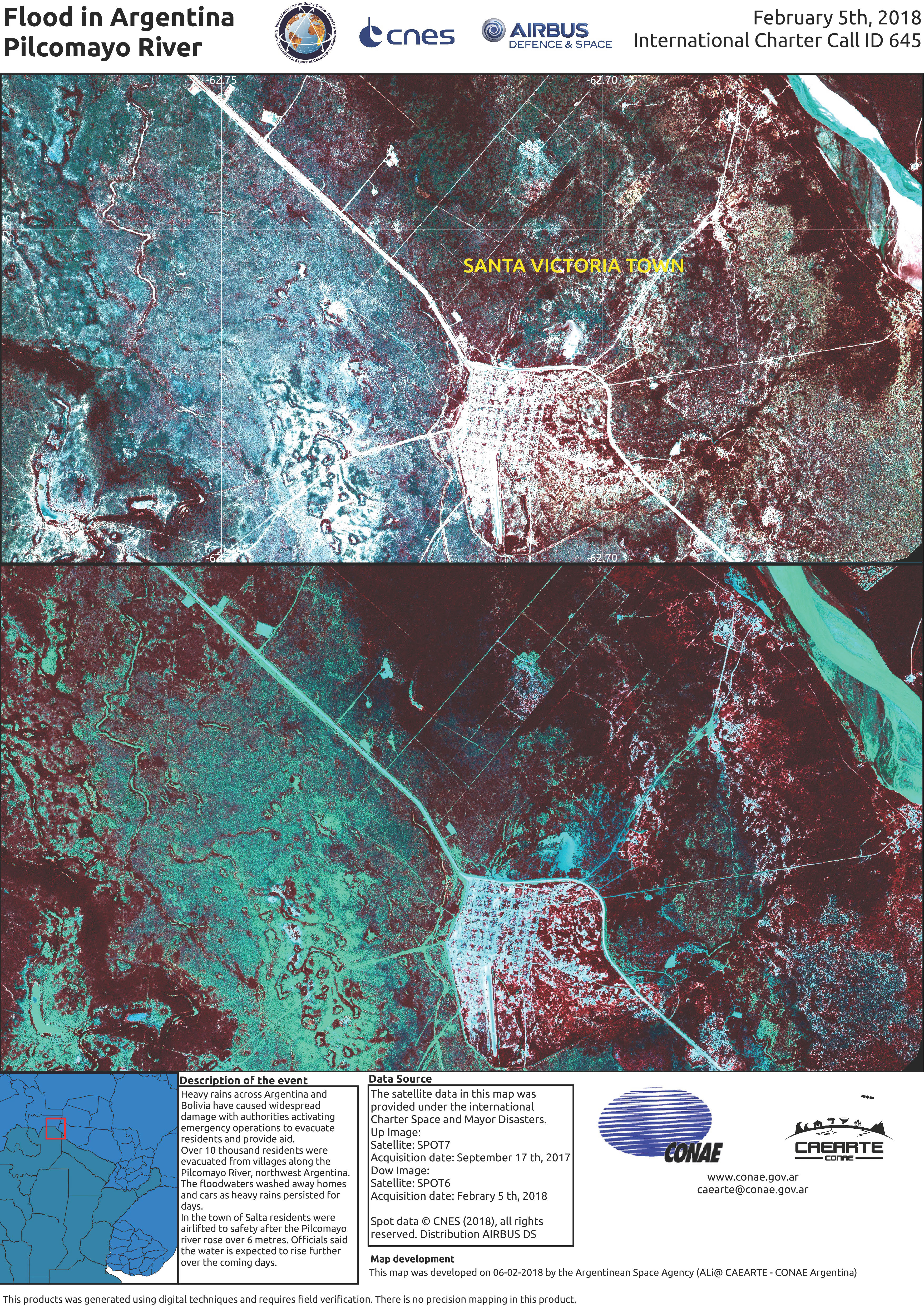
Flooding on the Pilcomayo River at Santa Victoria
Авторские права: SPOT-7 © Airbus DS 2017, all rights reserved
SPOT-6 © CNES 2018 - Distribution: Airbus DS, all rights reserved
Map produced by CONAE
Information about the Product
Получено: SPOT-7: 17/09/2017
SPOT-6: 05/02/2018
Источник: SPOT-7 / SPOT-6
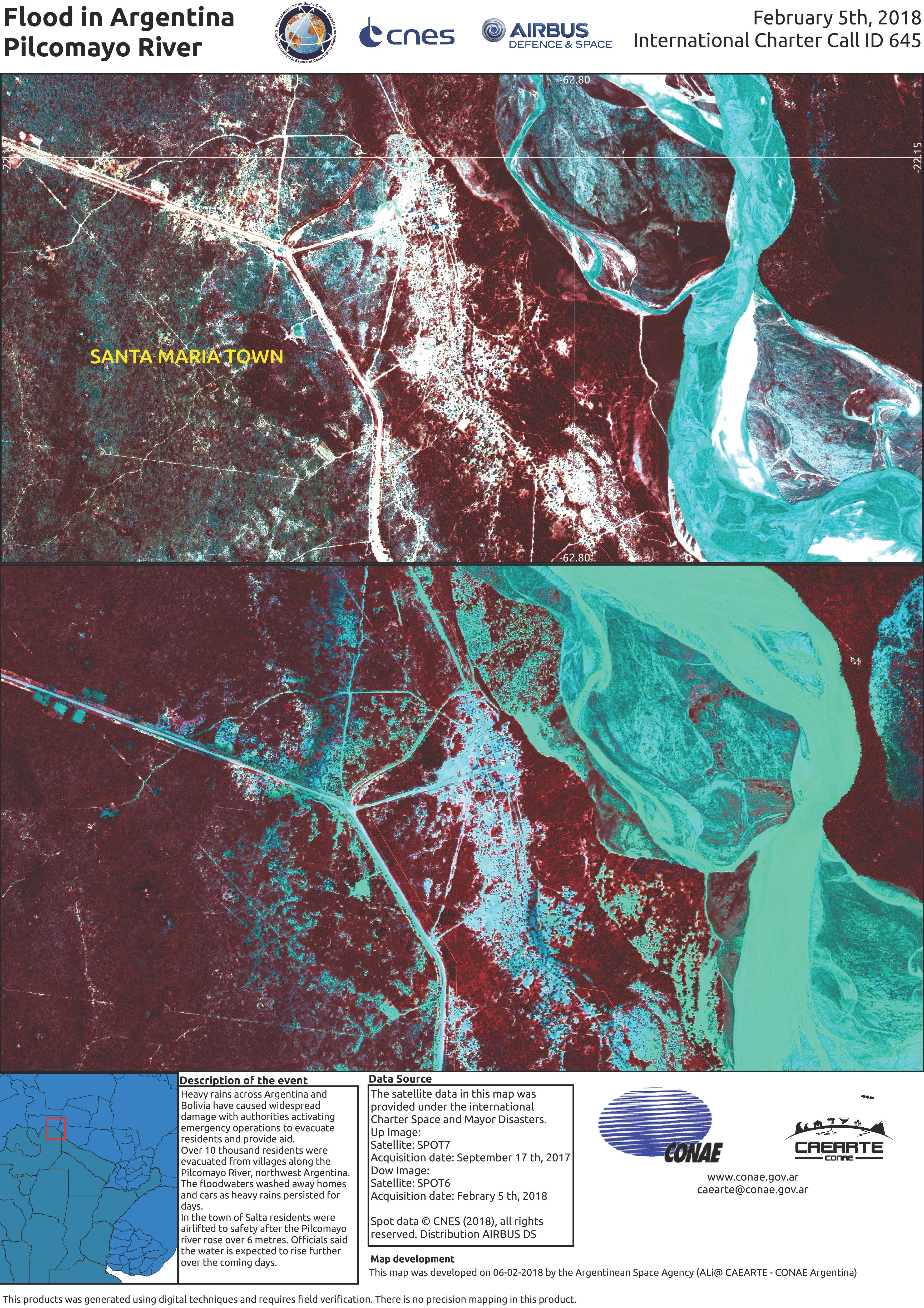
Flooding on the Pilcomayo River at Santa Maria
Авторские права: SPOT-7 © Airbus DS 2017, all rights reserved
SPOT-6 © CNES 2018 - Distribution: Airbus DS, all rights reserved
Map produced by CONAE
Information about the Product
Получено: SPOT-7: 17/09/2017
SPOT-6: 05/02/2018
Источник: SPOT-7 / SPOT-6
 Вернуться к полному архиву активаций

