 English
 Spanish
 French
 Chinese
 Russian
 Portuguese
 Последняя Активация
Charter activations
Flood in Argentina
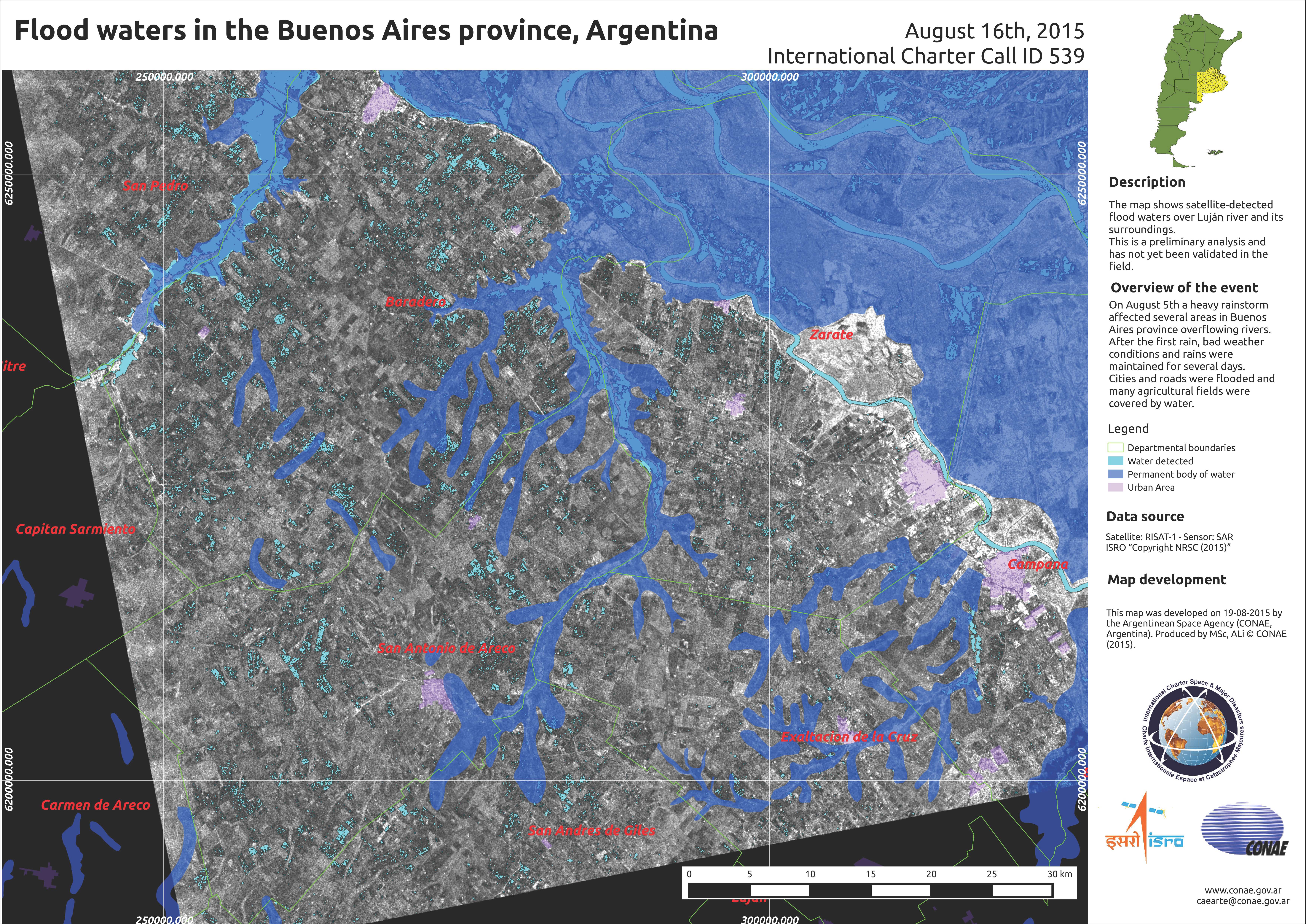
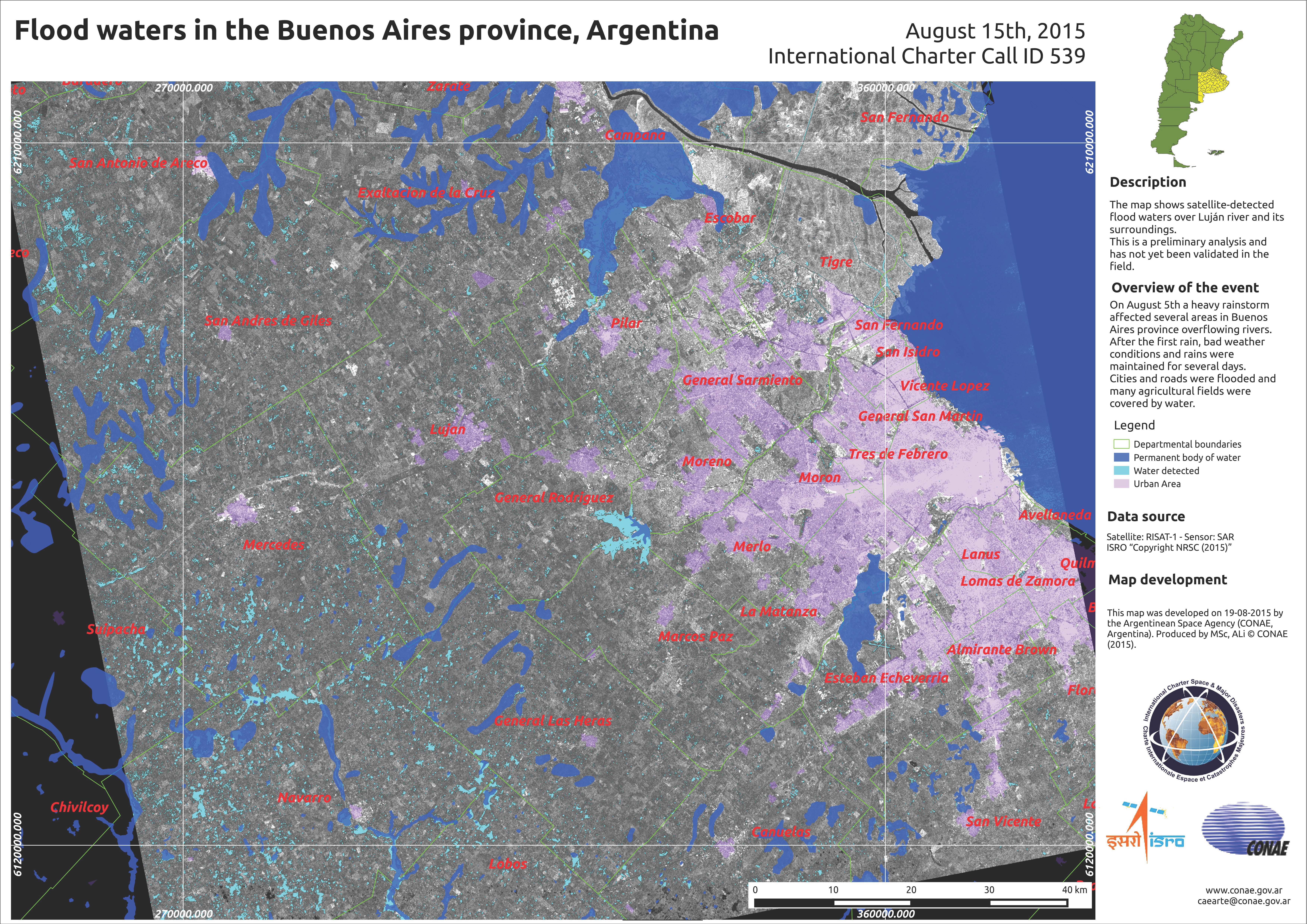
The Pampas Region of Argentina is experiencing floods after days of torrential rain. Three people died and the Buenos Aires Province is particularly affected by the flooding, where over 11 thousand people have been evacuated.
It is estimated that 350 millimetres of rain fell in some areas, and the water levels of the Arrecifes, Areco, Lujan Rivers rose to breaking point, spilling out into the streets of nearby cities, including Areco, Reconquista, Lujan, Arroyo and Pergamino. The water levels in the Arrecifes River rose to nine metres, almost twice its usual level.
Relief and shelter is being provided to the evacuees as they wait for the flood waters to subside. The rain is expected to continue, but at lower levels than that experienced over the past days.
| Тип события: | Flood |
| Место события: | Argentina |
| Date of Charter Activation: | 12 August 2015 |
| Время активации Хартии: | 13:30:00 |
| TЧасовой пояс в районе активации Хартии: | UTC-03:00 |
| Запрос на активацию поступил от: | SIFEM DNPC |
| Менеждер проекта от: | CONAE |
Products
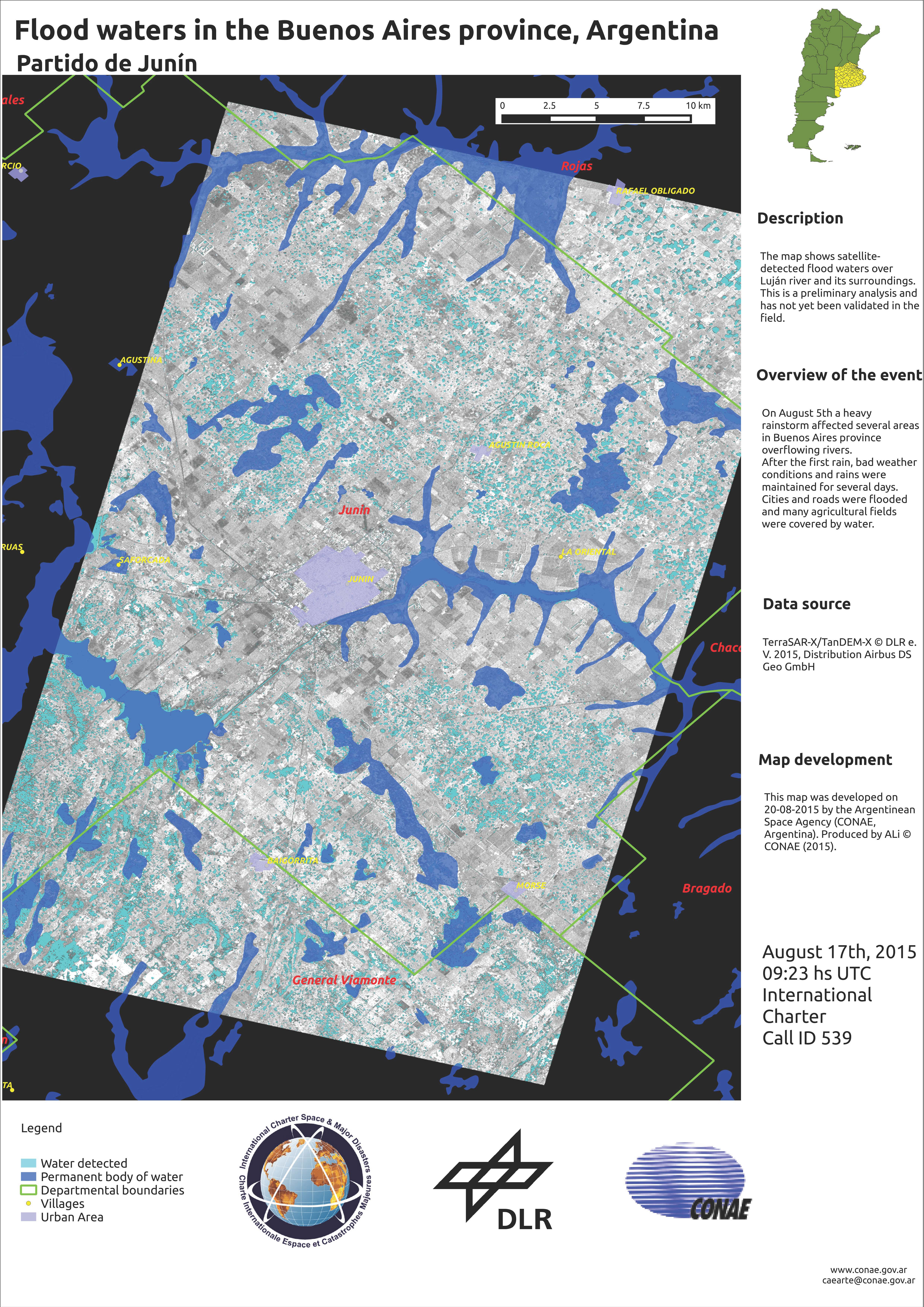
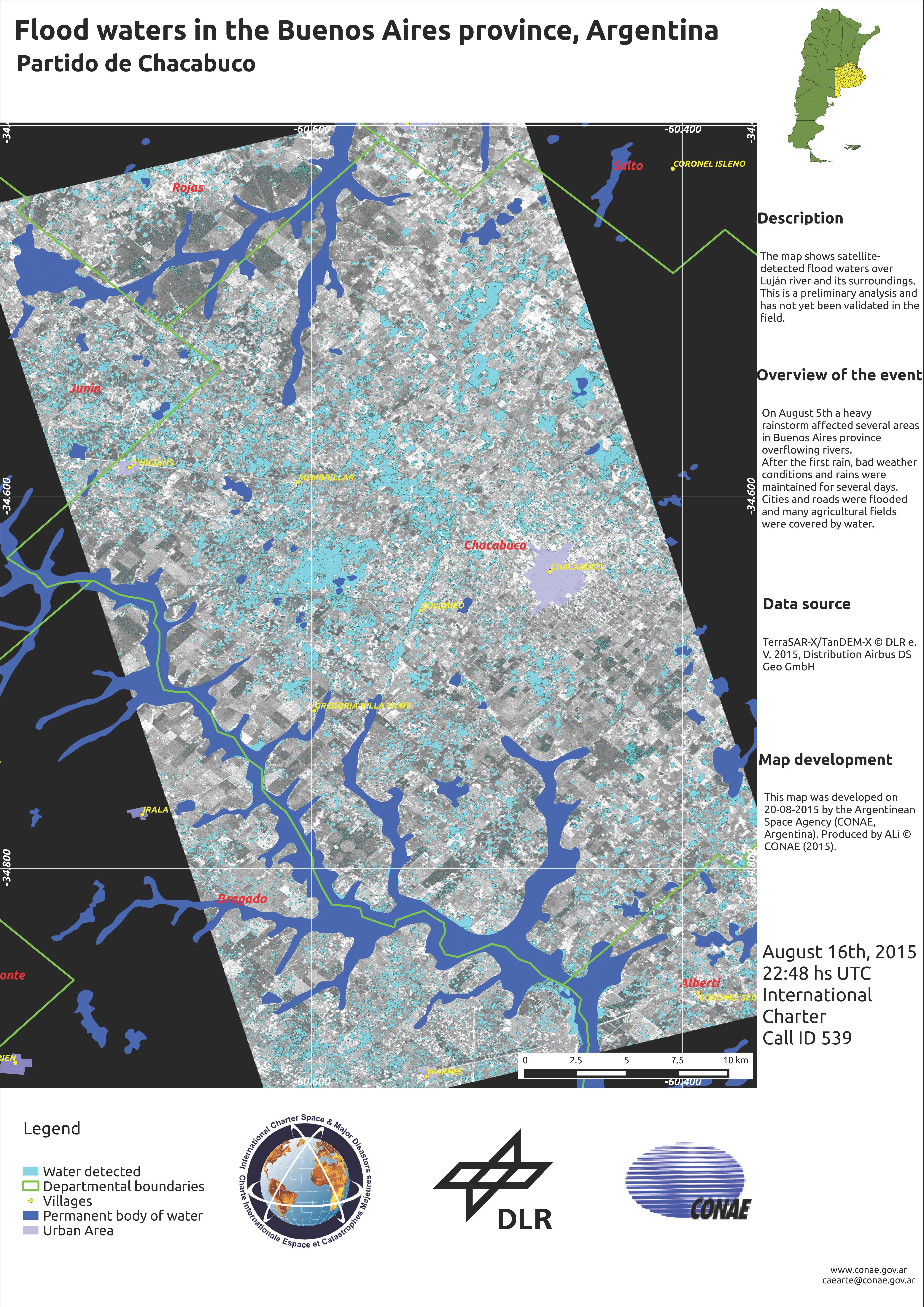
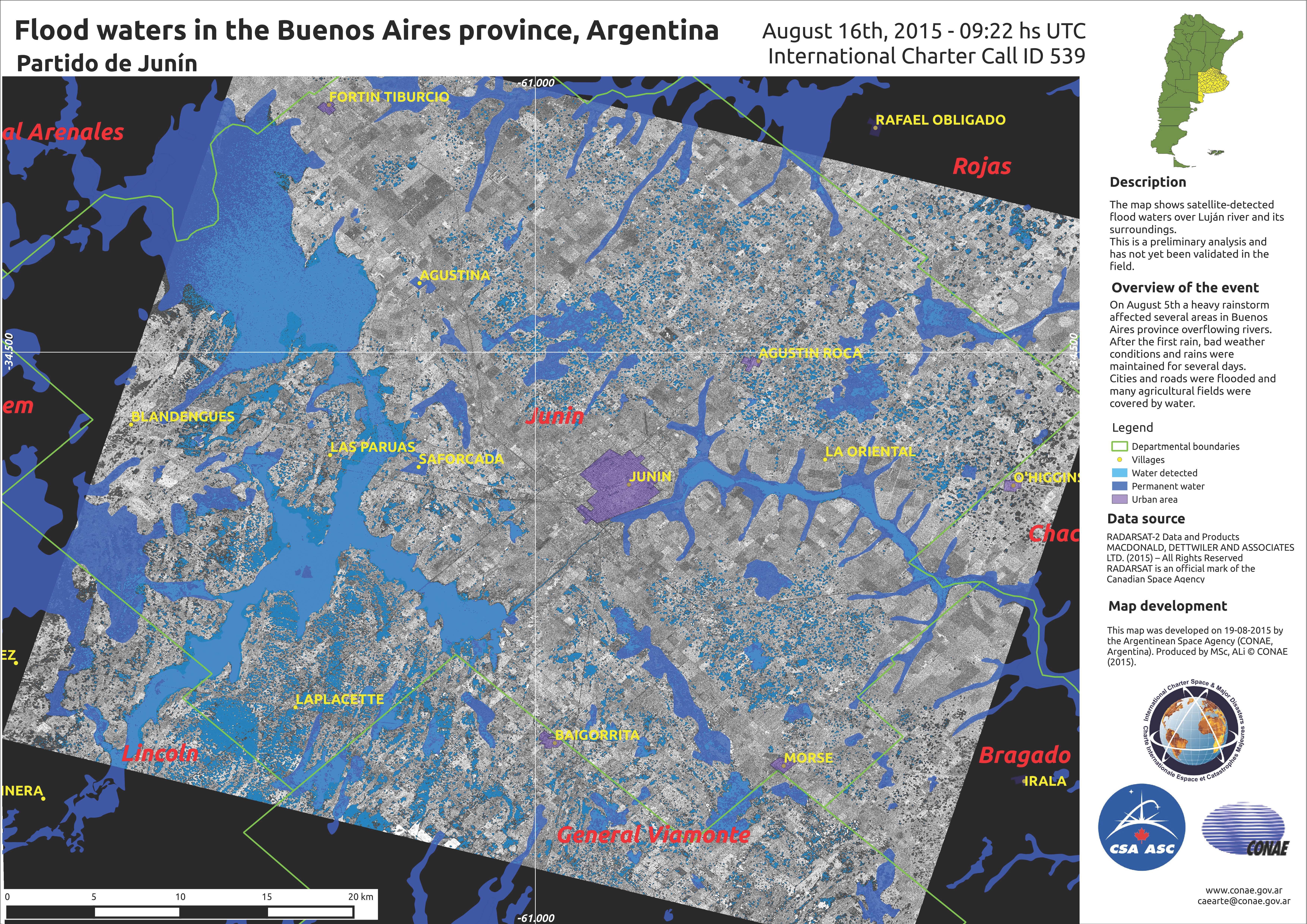
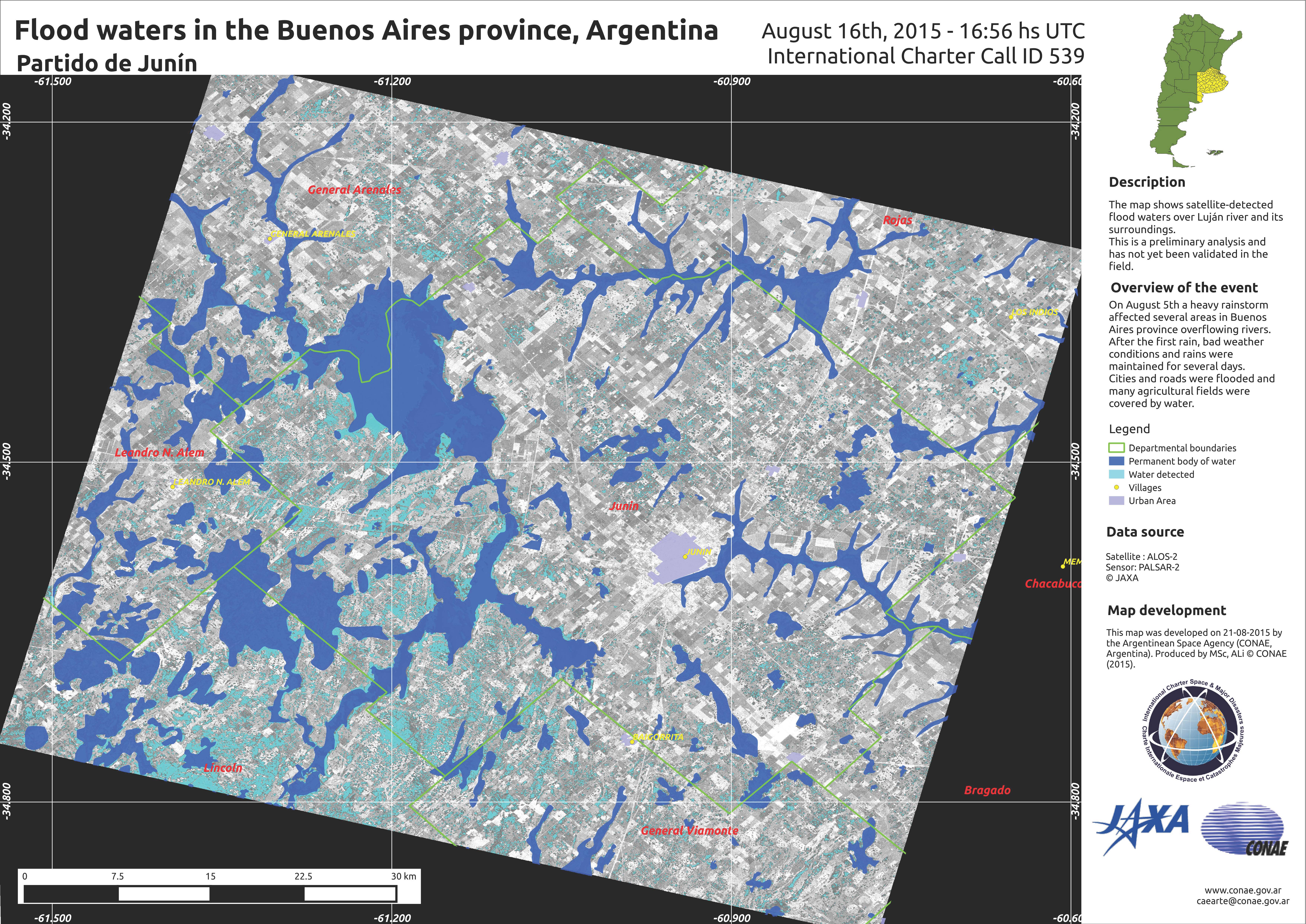
Flood waters over Junin in the Buenos Aires Province, Argentina
Авторские права: RADARSAT-2 Data and Products © MacDonald, Dettwiler and Associates Ltd. (2015) - All Rights Reserved. RADARSAT is an official trademark of the Canadian Space Agency.
Map produced by MSc, ALi © CONAE 2015
Information about the Product
Получено: 09:22 UTC - 16/08/2015
Источник: RADARSAT-2
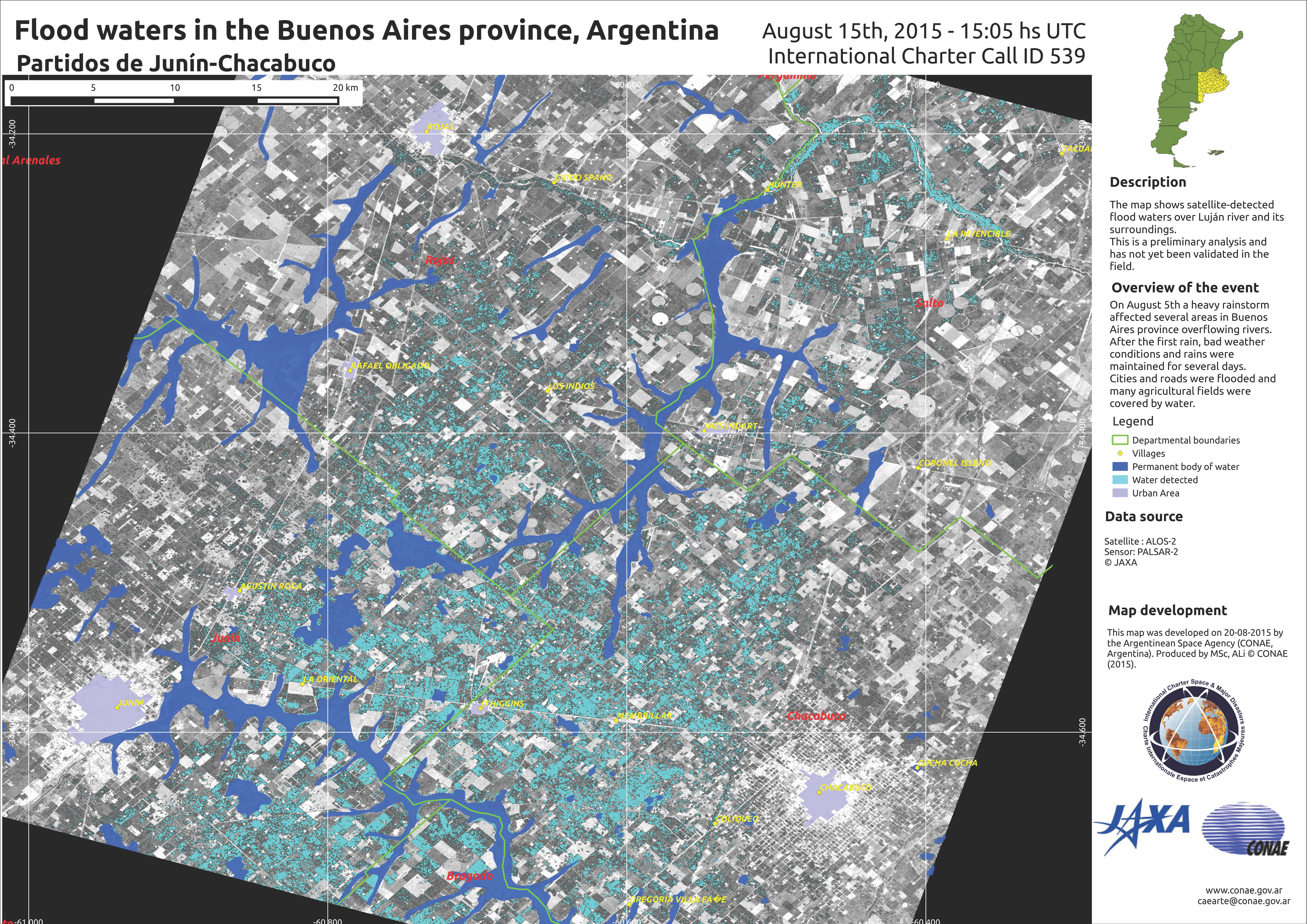

Flood waters over Lujan in the Buenos Aires Province, Argentina
Авторские права: RADARSAT-2 Data and Products © MacDonald, Dettwiler and Associates Ltd. (2015) - All Rights Reserved. RADARSAT is an official trademark of the Canadian Space Agency.
Map produced by MSc, ALi © CONAE 2015
Information about the Product
Получено: 22:36 UTC - 14/08/2015
Источник: RADARSAT-2
 Вернуться к полному архиву активаций

