 English
 Spanish
 French
 Chinese
 Russian
 Portuguese
 Последняя Активация
Charter activations
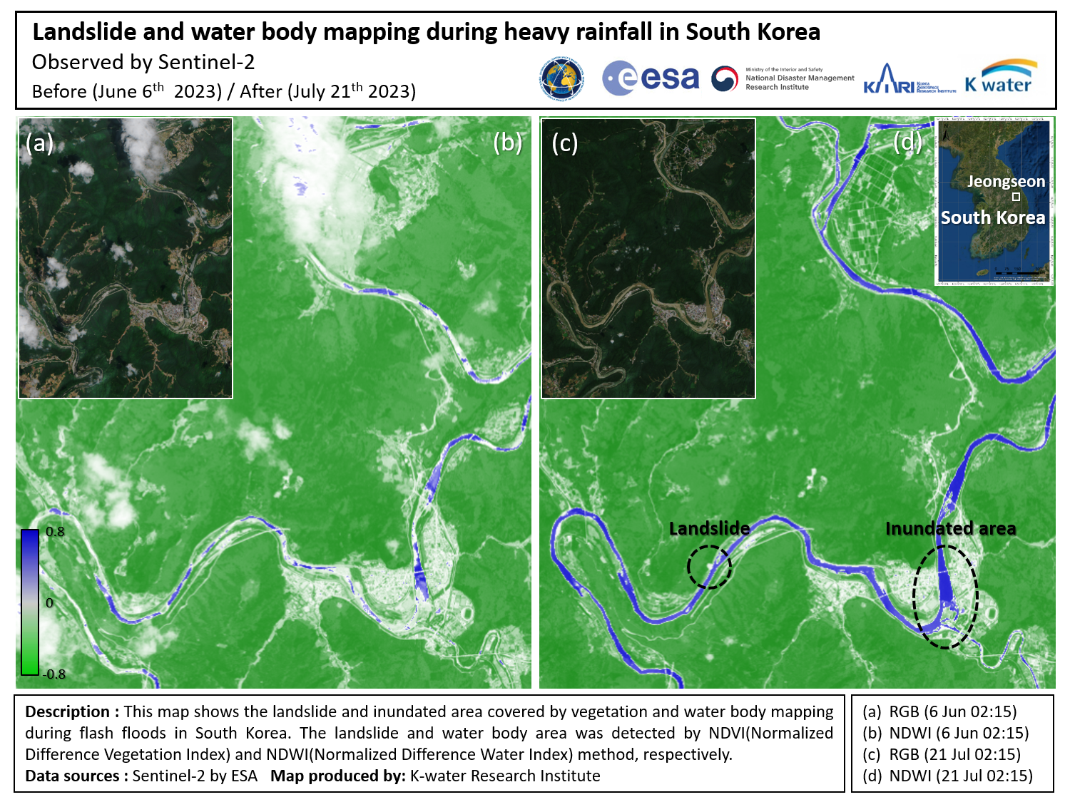
Landslides in South Korea
Due to torrential rainfall in South Korea since the beginning of July, at least 46 people have died and thousands were evacuated.
Most were affected by hillside landslides, which occurred at night, burying houses and villages. According to an official report, more than 190 landslides occurred simultaneously across the country and the most serious landslide damages were reported in Kyeongbuk province.
This activation covers value added products using optical satellite acquisitions over the landslides. Products acquired with SAR data over flooding are available in our related activation.
| Тип события: | Landslides |
| Место события: | South Korea |
| Date of Charter Activation: | 2023-07-20 |
| Время активации Хартии: | 15:24 |
| TЧасовой пояс в районе активации Хартии: | UTC+09:00 |
| Запрос на активацию поступил от: | National Disaster Management Institute (NDMI) |
| Номер активации: | 829 |
| Менеждер проекта от: | Hyun Ok Kim (KARI) |
| act-value-adders: | NDMI Ki-Mook Kang (K-water Research Institute) National Institue of Forest Science Yeji Kim (KARI) |
Products
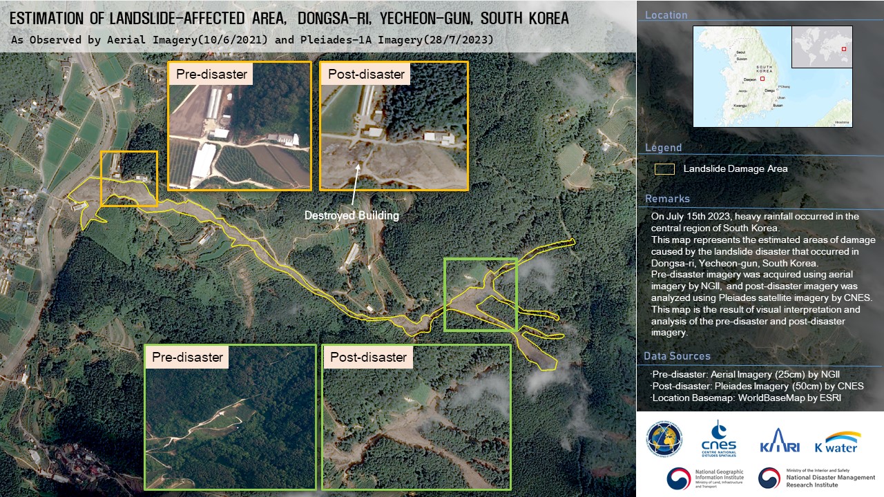
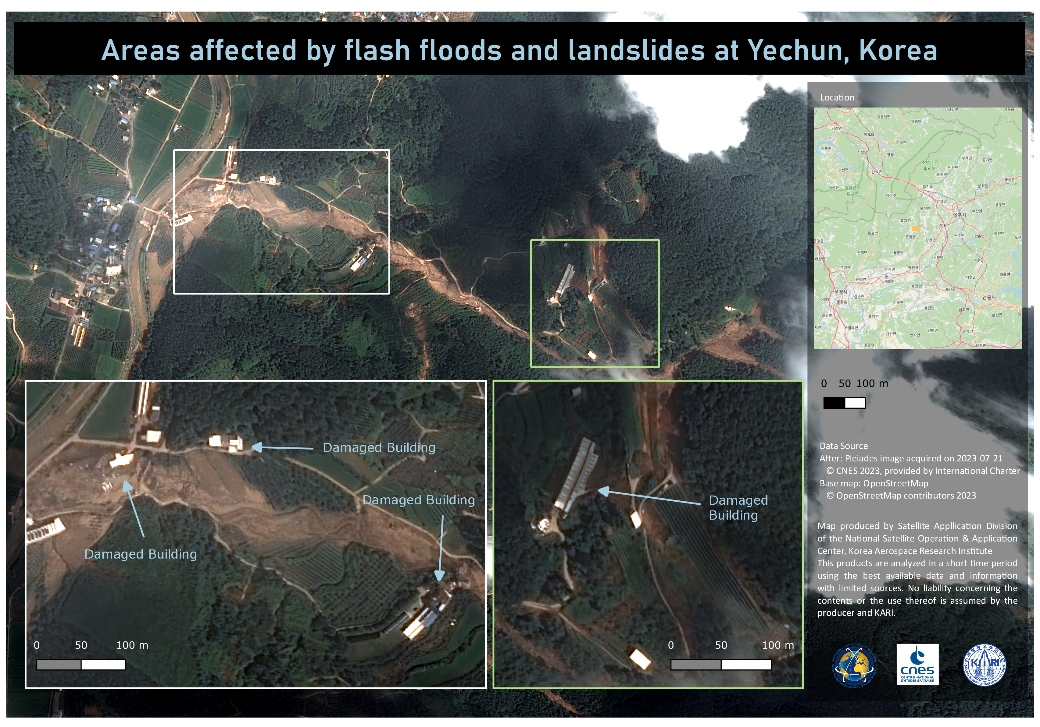
Areas affected by Landslides in Dongsa-ri, Yecheon-gun, South Korea
Авторские права: Includes Pleiades material © CNES (2023), Distribution Airbus DS.
Map produced by the National Disaster Management Research Institute.
Information about the Product
Получено: 28/07/2023
Источник: Pleiades
Категория: Reference Map
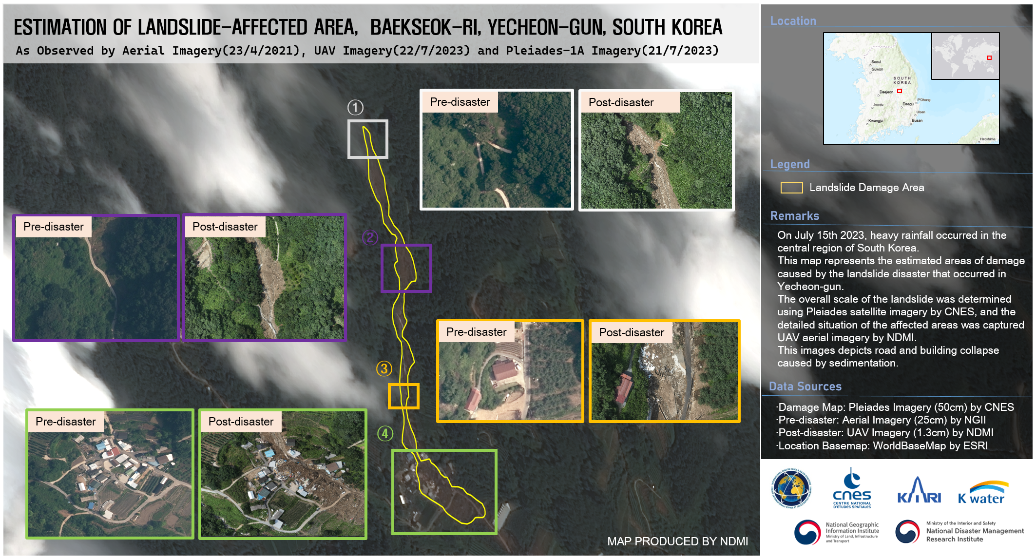
Areas affected by Landslides in Baekseok-ri, Yecheon-gun, South Korea
Авторские права: Includes Pleiades material © CNES (2023), Distribution Airbus DS.
Map produced by the National Disaster Management Research Institute.
Information about the Product
Получено: 22/07/2023
Источник: Pleiades
Категория: Reference Map
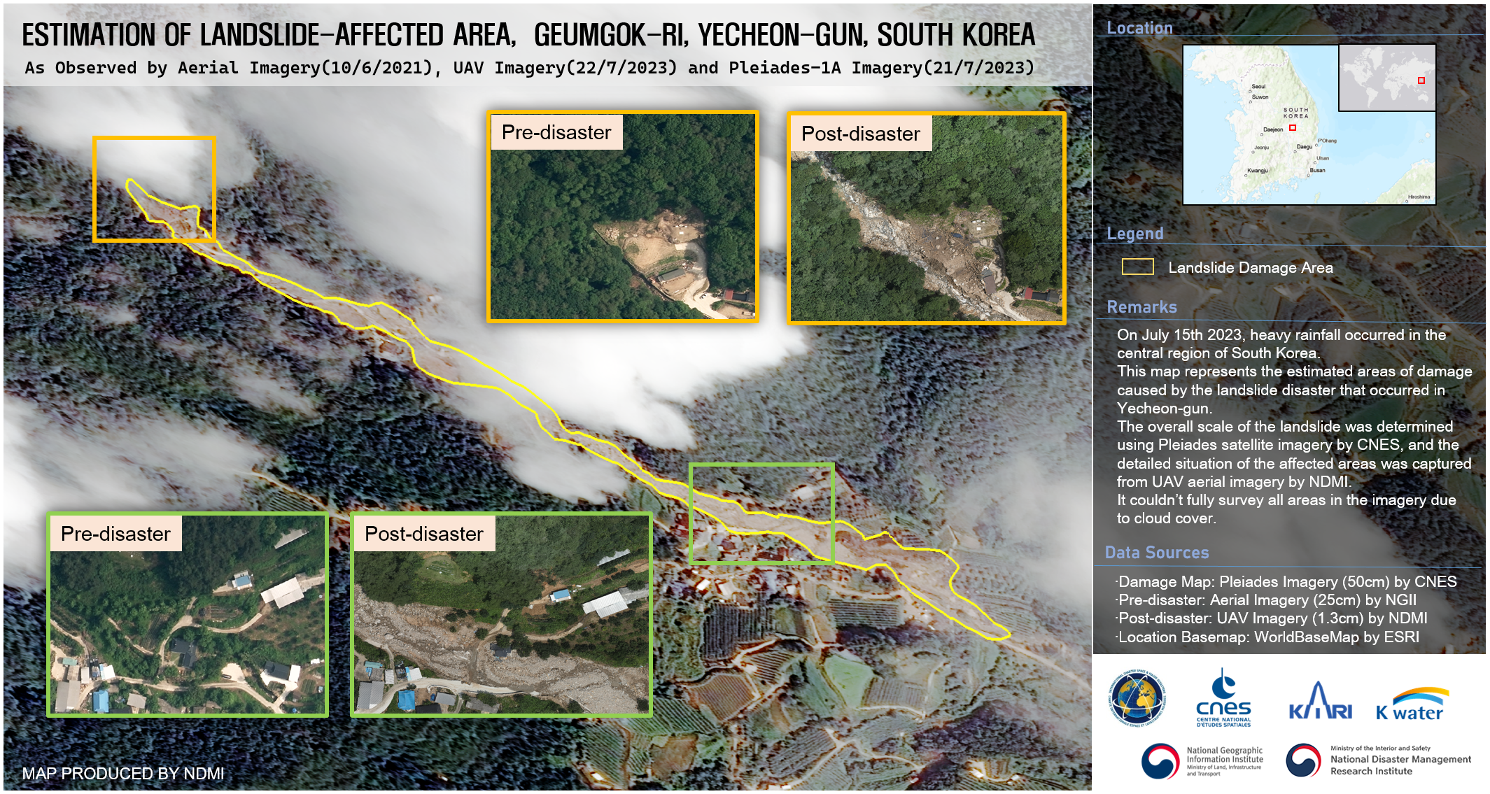
Areas affected by Landslides in Geumgok-ri, Yecheon-gun, South Korea
Авторские права: Includes Pleiades material © CNES (2023), Distribution Airbus DS.
Map produced by the National Disaster Management Research Institute.
Information about the Product
Получено: 21/07/2023
Источник: Pleiades
Категория: Reference Map
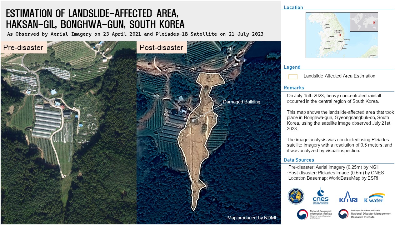
Areas affected by Landslides in Haksan-gil, Bonghwa-gun, South Korea
Авторские права: Includes Pleiades material © CNES (2023), Distribution Airbus DS.
Map produced by the National Disaster Management Research Institute.
Information about the Product
Получено: 21/07/2023
Источник: Pleiades
Категория: Delineation Map
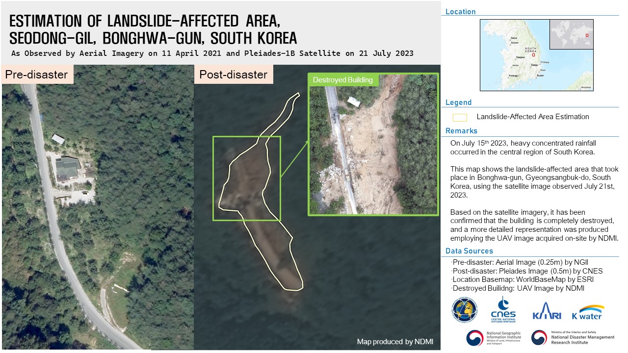
Damage inflicted by a Landslide in Seodong-gil, Bonghwa-gun, South Korea
Авторские права: Includes Pleiades material © CNES (2023), Distribution Airbus DS.
Map produced by the National Disaster Management Research Institute.
Information about the Product
Получено: 21/07/2023
Источник: Pleiades
Категория: Delineation Map
 Вернуться к полному архиву активаций

