 English
 Spanish
 French
 Chinese
 Russian
 Portuguese
 Последняя Активация
Charter activations
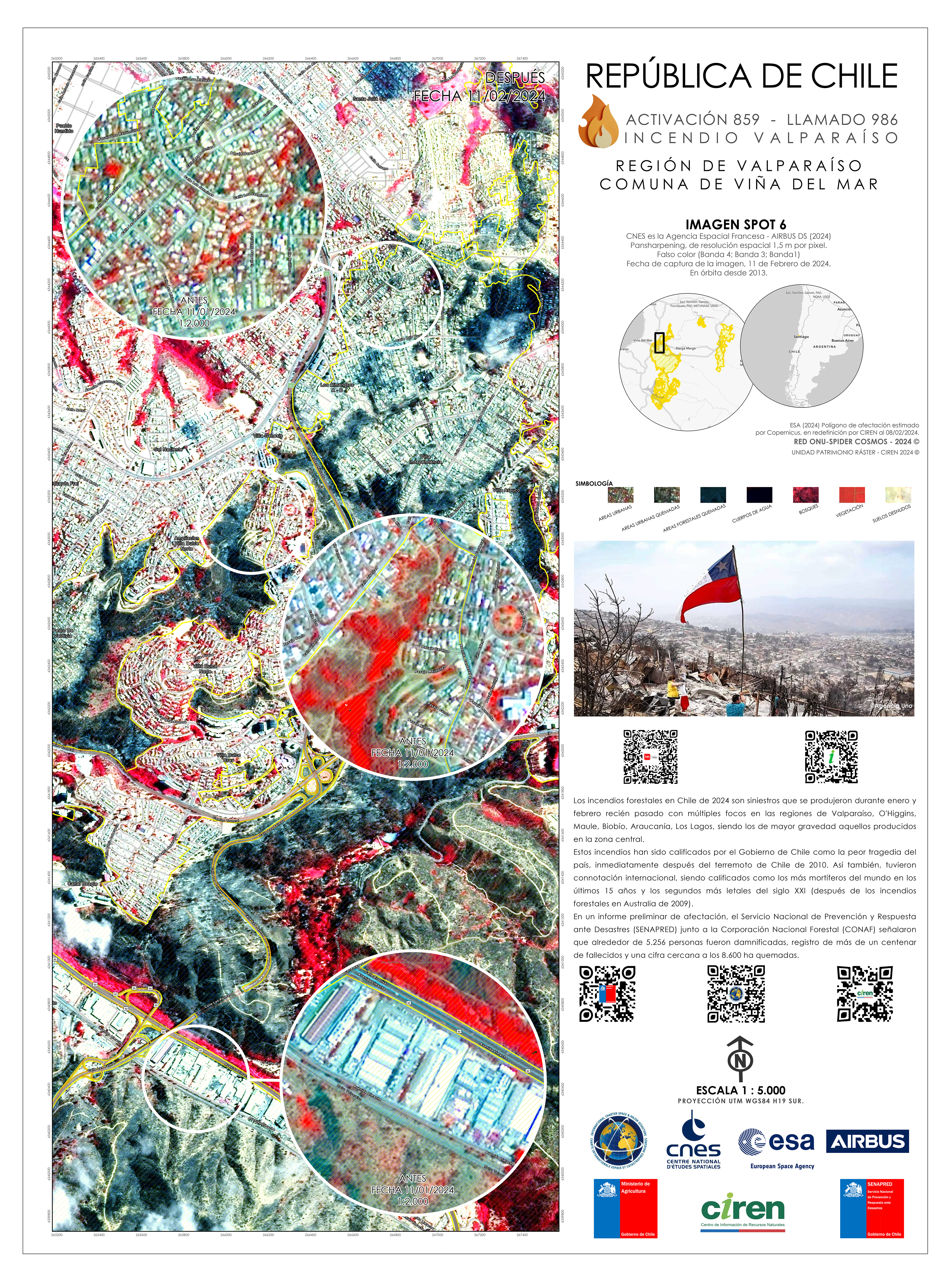
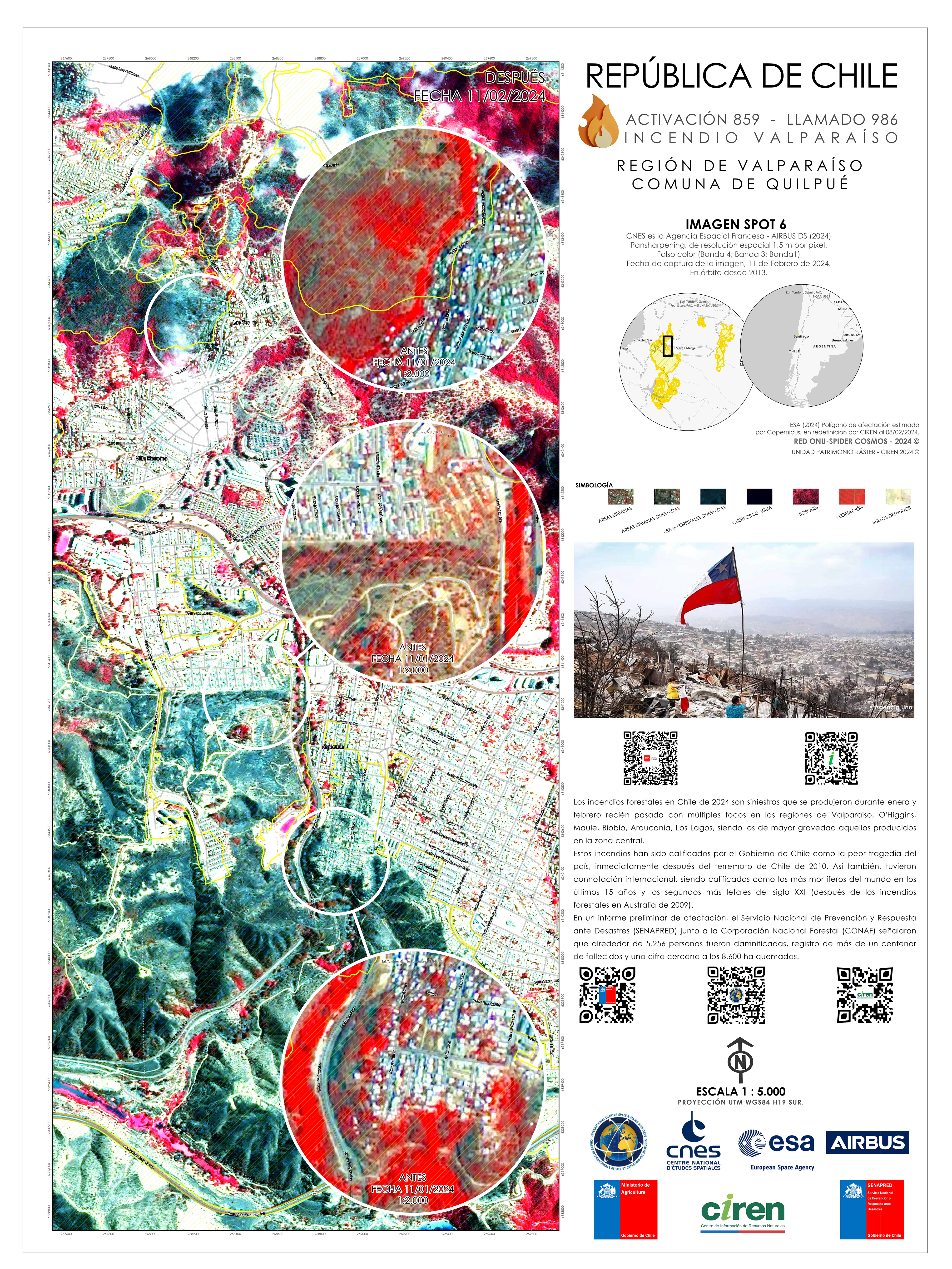
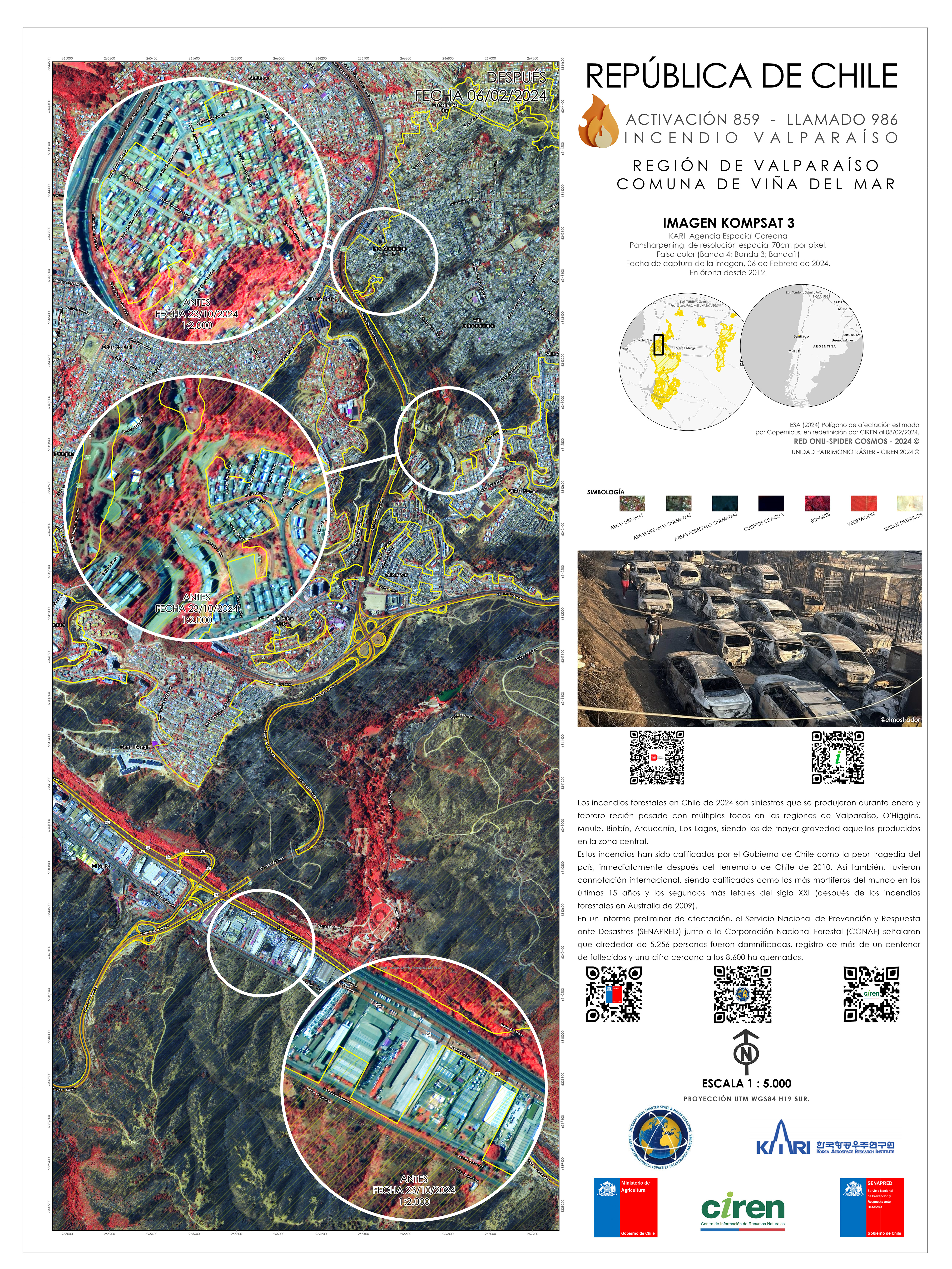
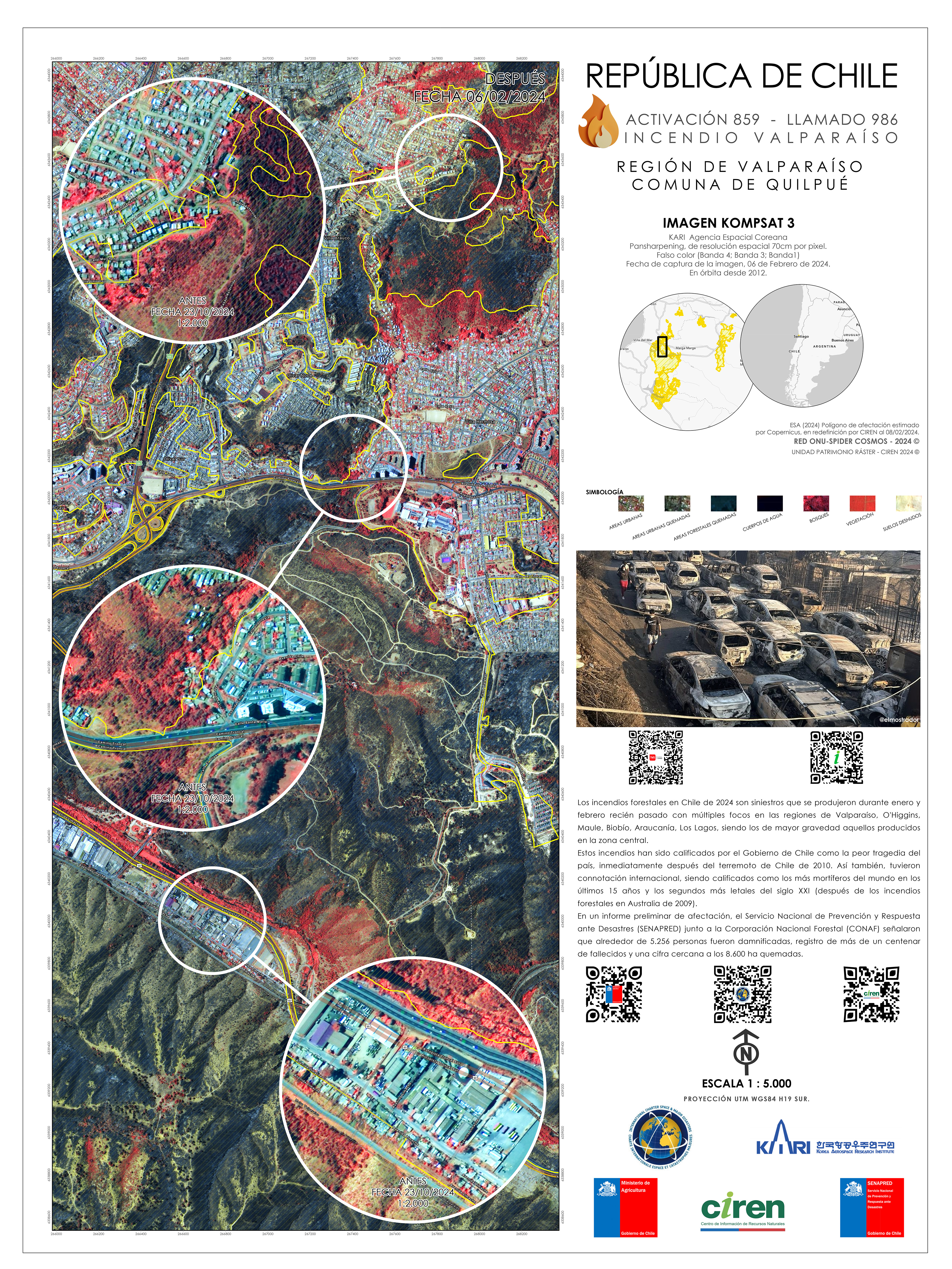
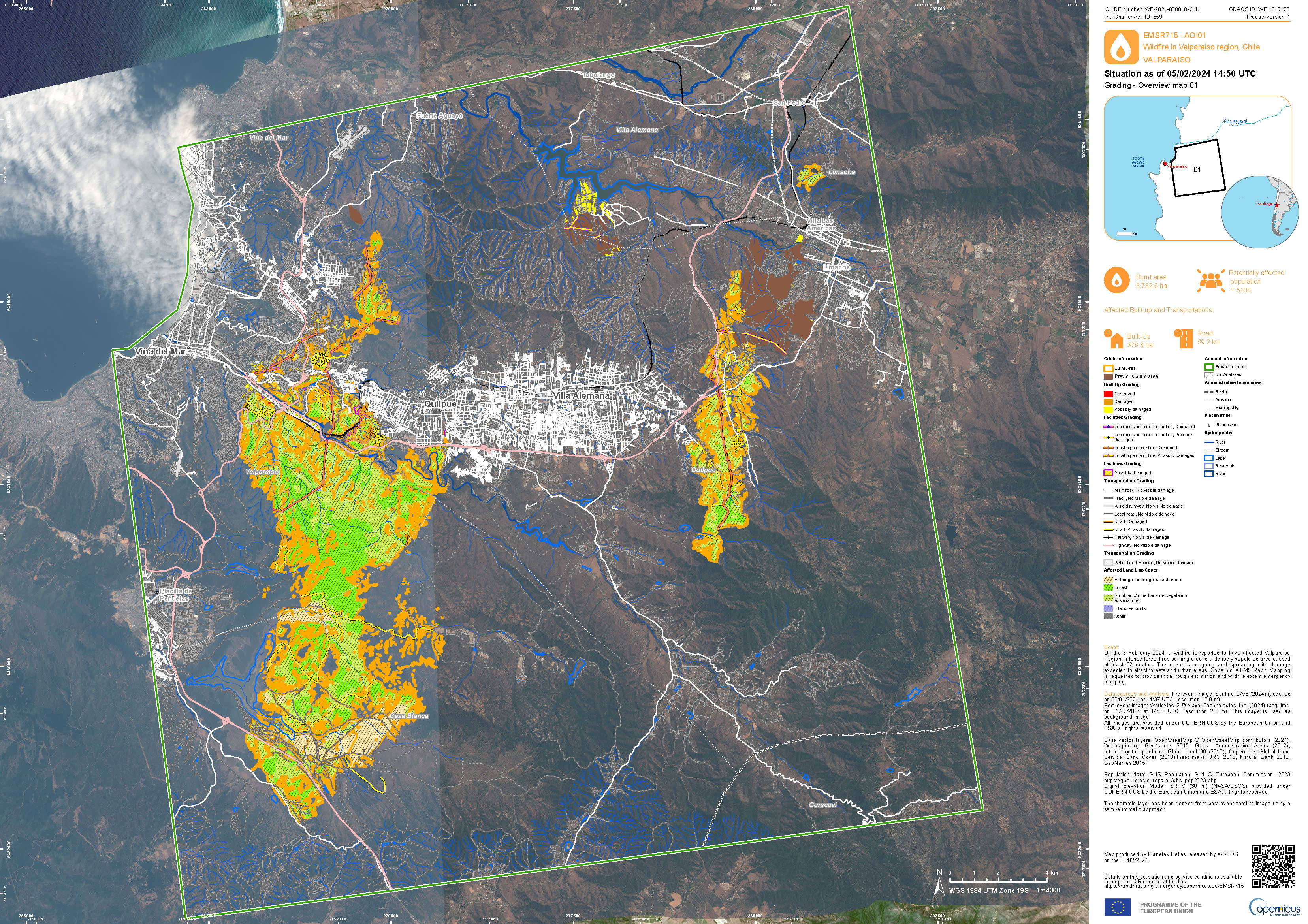
Wildfire in Chile
Wildfires spread across central Chile on 03 February, mainly affecting the region of Valparaíso. At least 3,000 homes were destroyed and the current was 123.
The forest fires broke out near densely populated areas, several blocks of homes and businesses were completely destroyed. Ash covered, burnt out cars lined the streets. Three shelters were set up in the Valparaiso region, where four hospitals and three nursing homes had to be evacuated.
The fires followed a recent heat wave that affected this region of South America, causing droughts and dry conditions in forests. When the fires started, El Niño weather patterns resulted in strong winds which caused the fires to spread. It is estimated that 43,000 hectares were burnt.
| Тип события: | Wildfire |
| Место события: | Chile |
| Date of Charter Activation: | 2024-02-03 |
| Время активации Хартии: | 11:05 |
| TЧасовой пояс в районе активации Хартии: | UTC-03:00 |
| Запрос на активацию поступил от: | SENAPRED |
| Номер активации: | 859 |
| Менеждер проекта от: | Marcelo Duran (Natural Resources Information Center (CIREN)) |
| act-value-adders: | Copernicus EMS (Copernicus EMS) DLR Laercio Massaru Namikawa (INPE) |
| Activation handled in collaboration with Copernicus Emergency Management Service |
Products
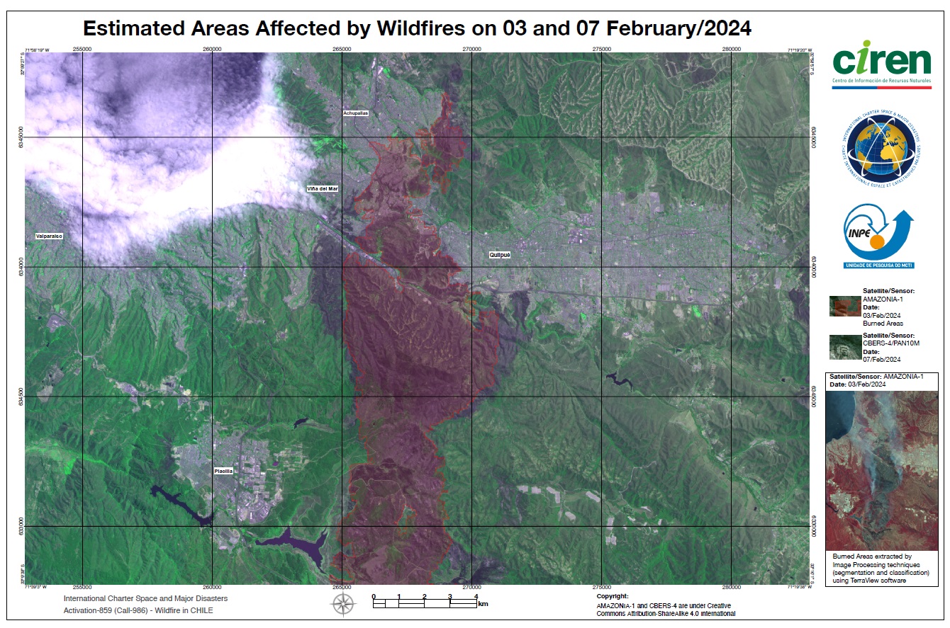
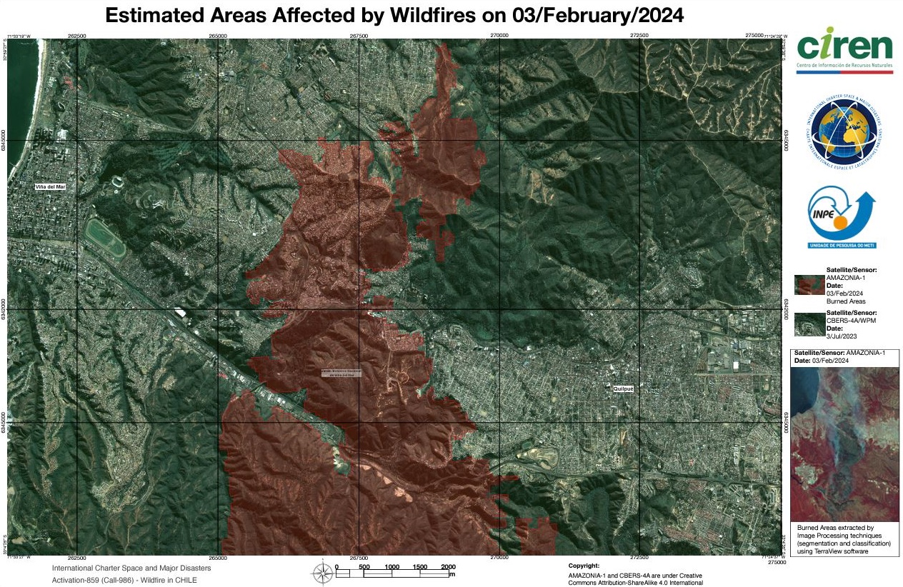
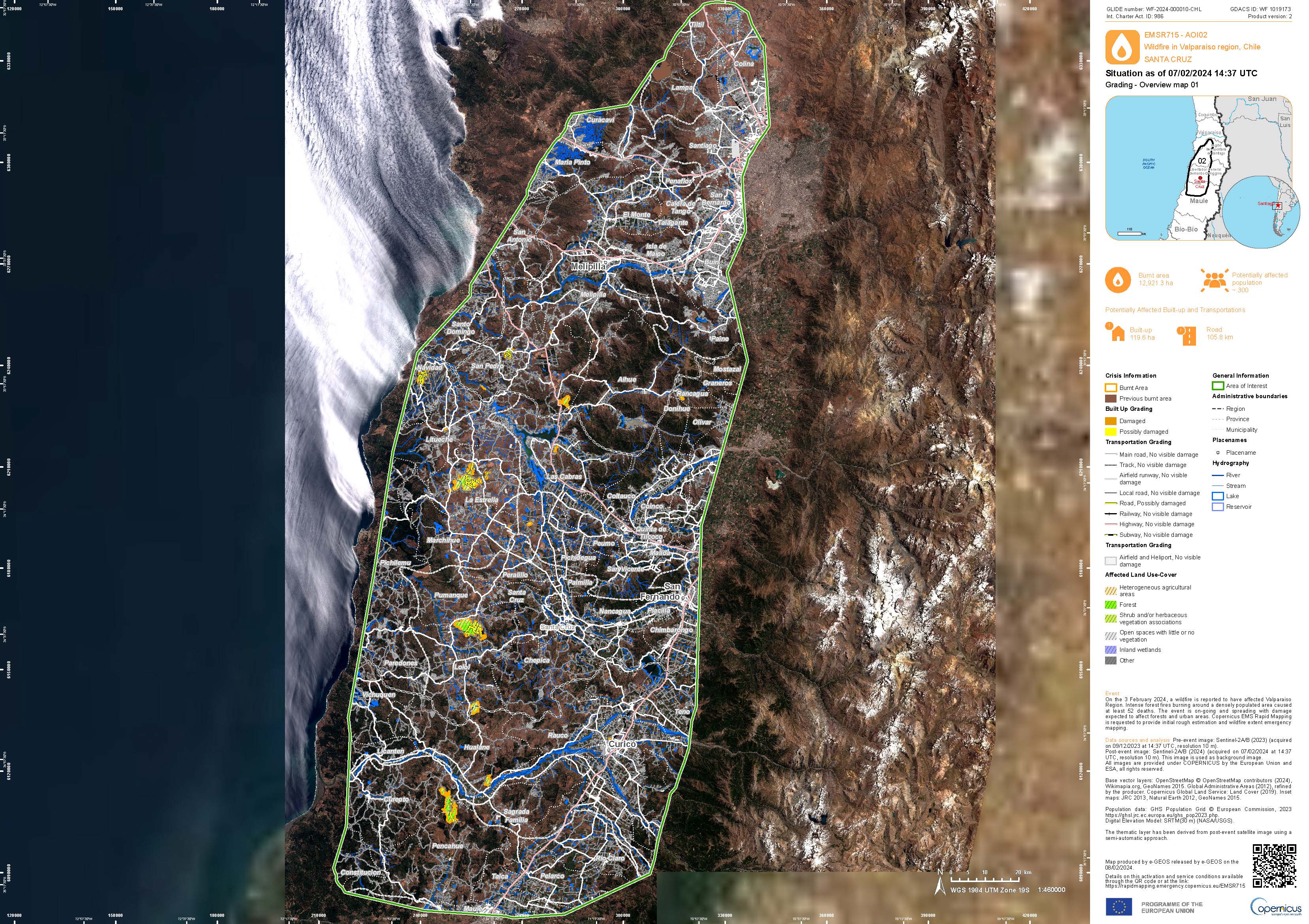
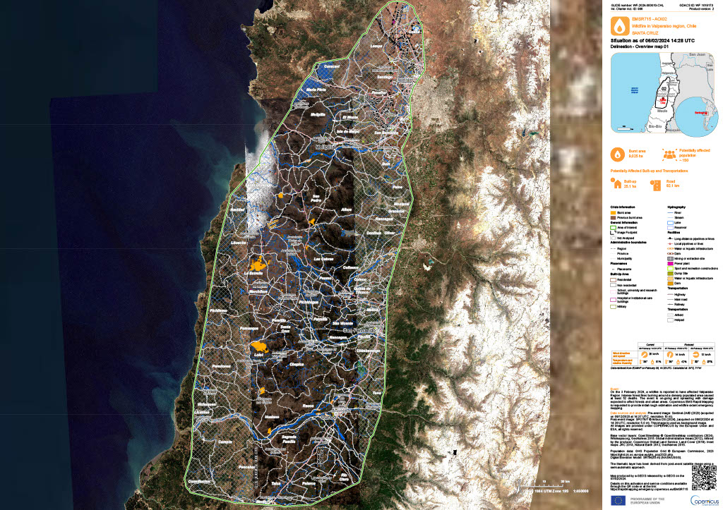
Areas affected by Wildfires in Santa Cruz, Chile
Авторские права: SPOT-6 and 7 © Airbus DS (2024).
Contains modified Copernicus Sentinel data (2024).
Map produced by Copernicus EMS
Information about the Product
Получено: Sentinel-2: 09/12/2023
SPOT-6 and 7: 06/02/2024
Источник: Sentinel-2, SPOT-6 and SPOT-7
Категория: Delineation Map
A Delineation Map showing areas where Wildfires have occurred in the Valparaiso region, Chile
Download the Full Report
Авторские права: Contains modified Copernicus Sentinel data (2023).
WorldView-2 © Maxar Technologies, Inc. (2024)
Map produced by Copernicus EMS
Information about the Product
Получено: Sentinel-2: 08/01/2024
WorldView-2: 05/02/2024
Источник: Sentinel-2 and WorldView-2
Категория: Delineation Map
 Вернуться к полному архиву активаций

