 English
 Spanish
 French
 Chinese
 Russian
 Portuguese
 Последняя Активация
Charter activations
Earthquake in Türkiye
A powerful Earthquake with a magnitude of 7.2 (Mw) shook Eastern Türkiye on Sunday. It was followed by aftershocks with a magnitude of 6.0 and 5.6. Over 250 people have been killed and thousands injured.
The city of Ercis is worst affected with infrastructure and many buildings being badly damaged. Many thousands of people have had to leave buildings and sleep outside in freezing temperatures.
Over 2000 rescue workers are involved in the relief effort, setting up camps for shelter. Fears of more aftershocks in the area prevent people from returning to their homes.
For this activation, value adding support has been provided by the European project GMES SAFER.
| Тип события: | Earthquake |
| Место события: | Türkiye |
| Date of Charter Activation: | 24/10/2011 |
| Запрос на активацию поступил от: | Prime Ministry, Disaster and Emergency Management Presidency of Türkiye (AFAD) |
| Менеждер проекта от: | ZKI/DLR |
Products
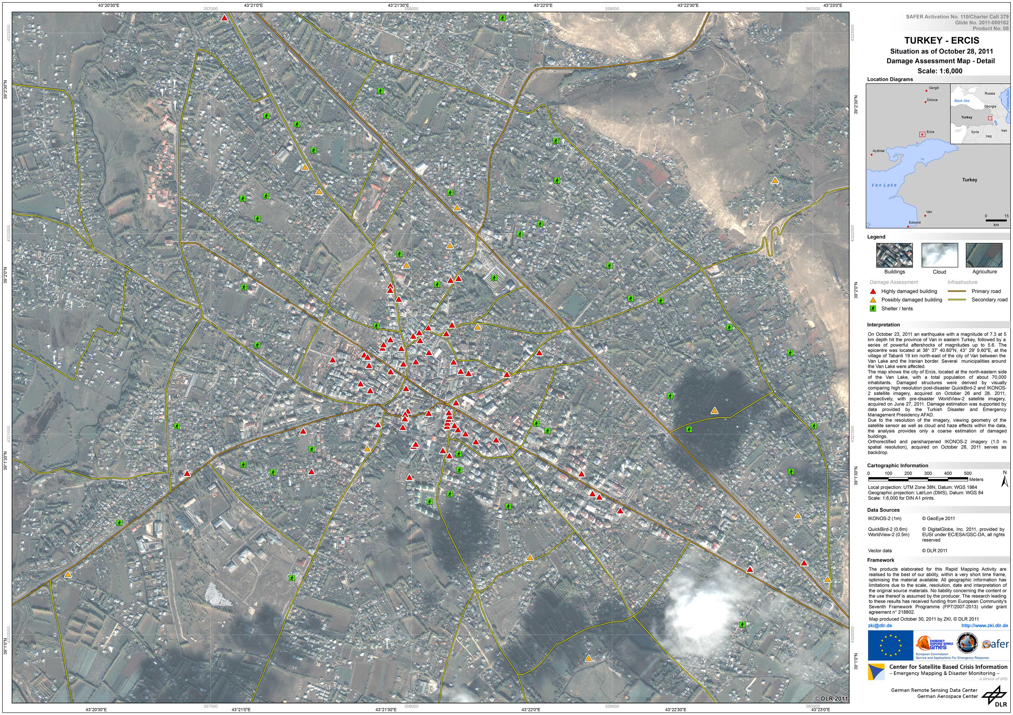
Situation in Ercis - Türkiye
Damage Assessment Map - Detail
Scale: 1:6,000
Авторские права: GeoEye 2011
DigitalGlobe 2011, provided by EUSI under EC/ESA/GSC-DA, all rights reserved
DLR
Map produced by ZKI
Financial supporters: European Commission and the FP7 SAFER Project
Information about the Product
Получено: Pre-disaster: 27/06/11
Post-disaster: 26/10/11 and 28/10/11
Источник: IKONOS-2, QuickBird-2, WorldView-2
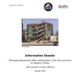
Information Dossier
Damage assessment after earthquake in the Van province in eastern Türkiye
View the PDF of the Information Dossier
Авторские права: DigitalGlobe 2011, provided by EUSI under EC/ESA/GSC-DA, all rights reserved
DLR
Produced by ZKI
Financial supporters: European Commission and the FP7 SAFER Project
Information about the Product
Получено: 26/10/11
Источник: QuickBird-2
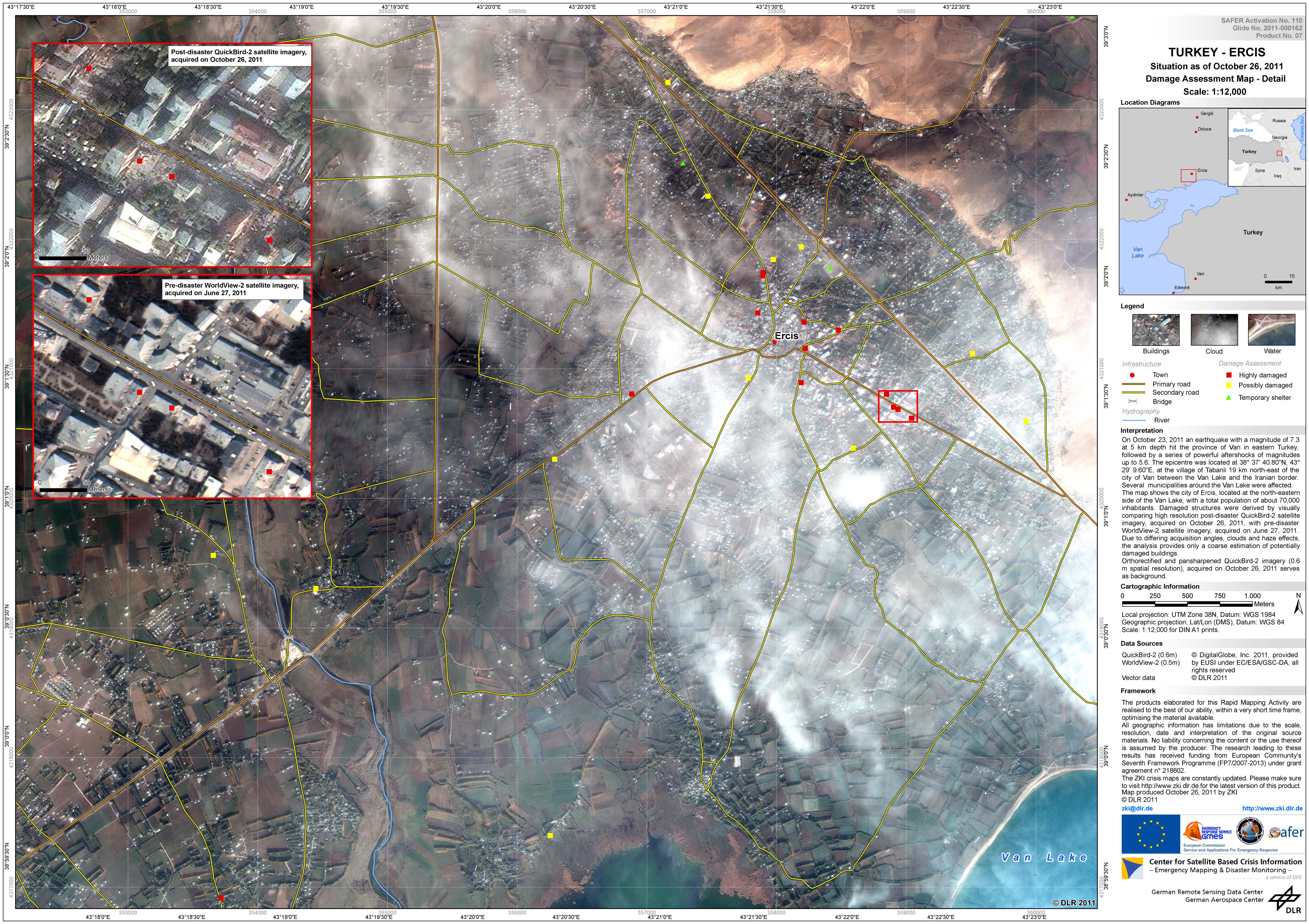
Situation in Ercis - Türkiye
Damage Assessment Map - Detail
Scale: 1:12,000
Авторские права: DigitalGlobe 2011, provided by EUSI under EC/ESA/GSC-DA, all rights reserved
DLR
Map produced by ZKI
Financial supporters: European Commission and the FP7 SAFER Project
Information about the Product
Получено: Pre-disaster: 27/06/11
Post-disaster: 26/10/11
Источник: Pre-disaster: WorldView-2
Post-disaster: QuickBird-2
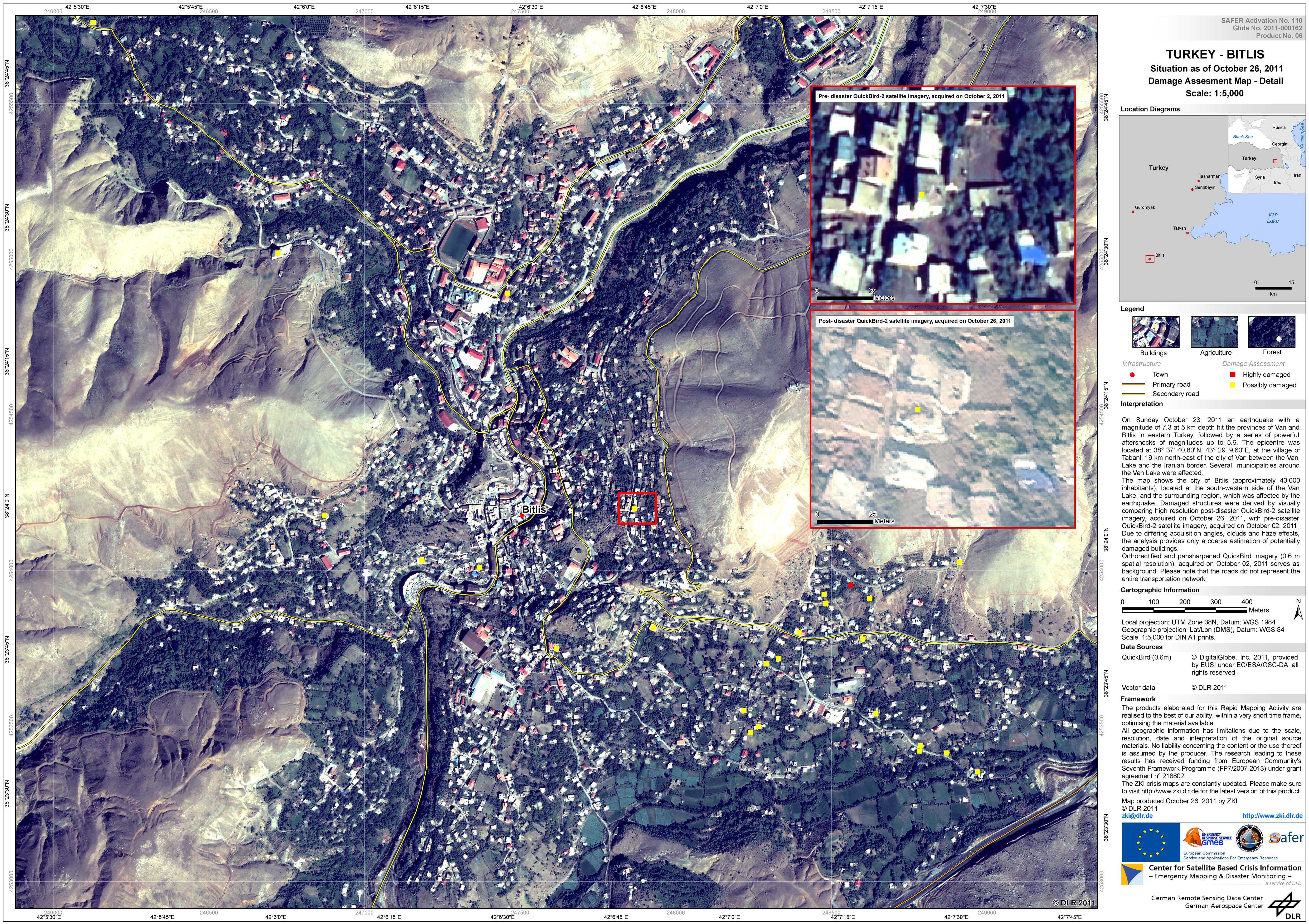
Situation in Bitlis - Türkiye
Damage Assessment Map - Detail
Scale: 1:5,000
Авторские права: DigitalGlobe 2011, provided by EUSI under EC/ESA/GSC-DA, all rights reserved
DLR
Map produced by ZKI
Financial supporters: European Commission and the FP7 SAFER Project
Information about the Product
Получено: Pre-disaster: 02/10/11
Post-disaster: 26/10/11
Источник: QuickBird-2
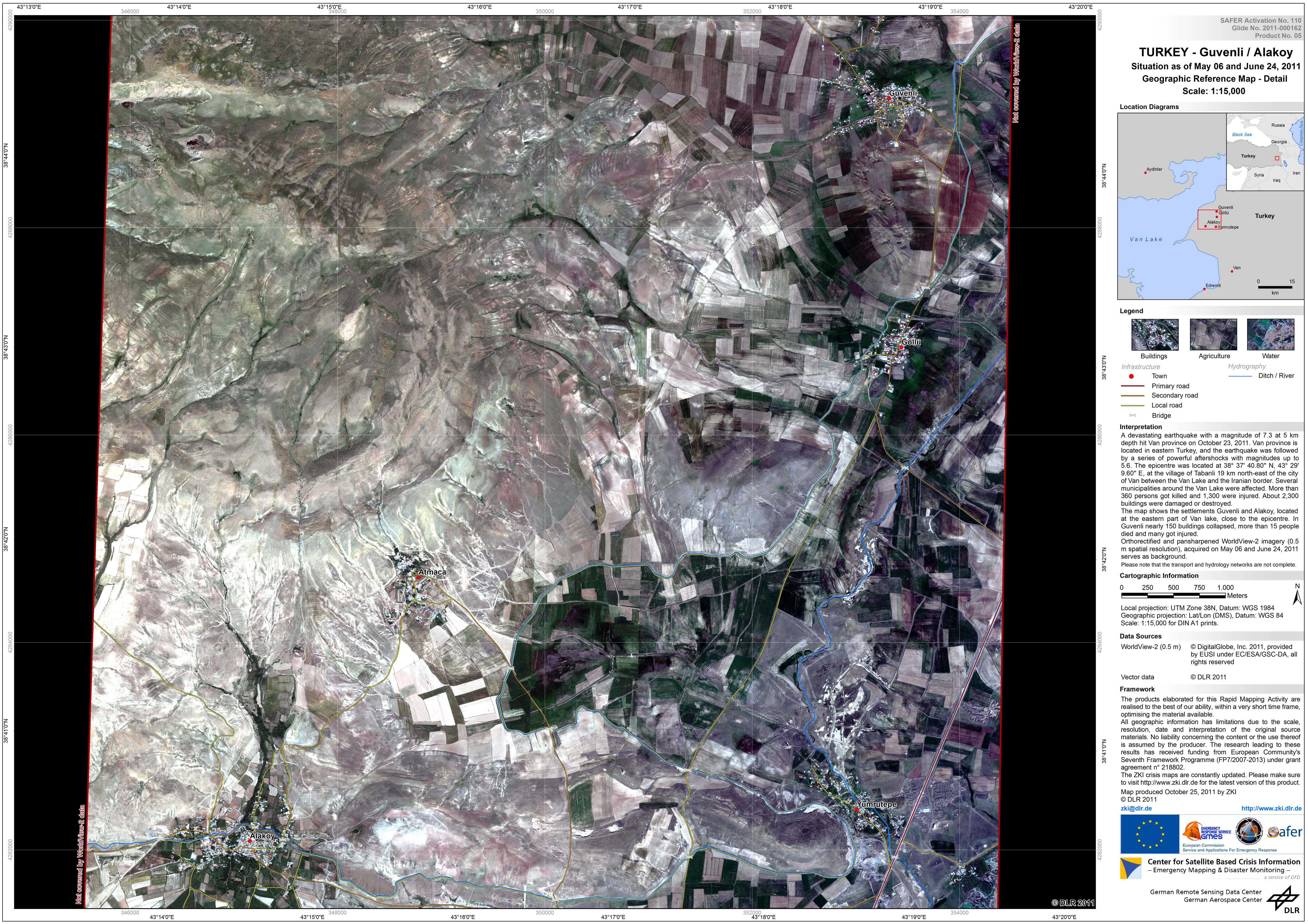
Situation in Guvenli and Alakoy - Türkiye
Geographic Reference Map - Detail
Scale: 1:15,000
Авторские права: DigitalGlobe 2011, provided by EUSI under EC/ESA/GSC-DA, all rights reserved
DLR
Map produced by ZKI
Financial supporters: European Commission and the FP7 SAFER Project
Information about the Product
Получено: 06/05/11 and 24/06/11
Источник: WorldView-2
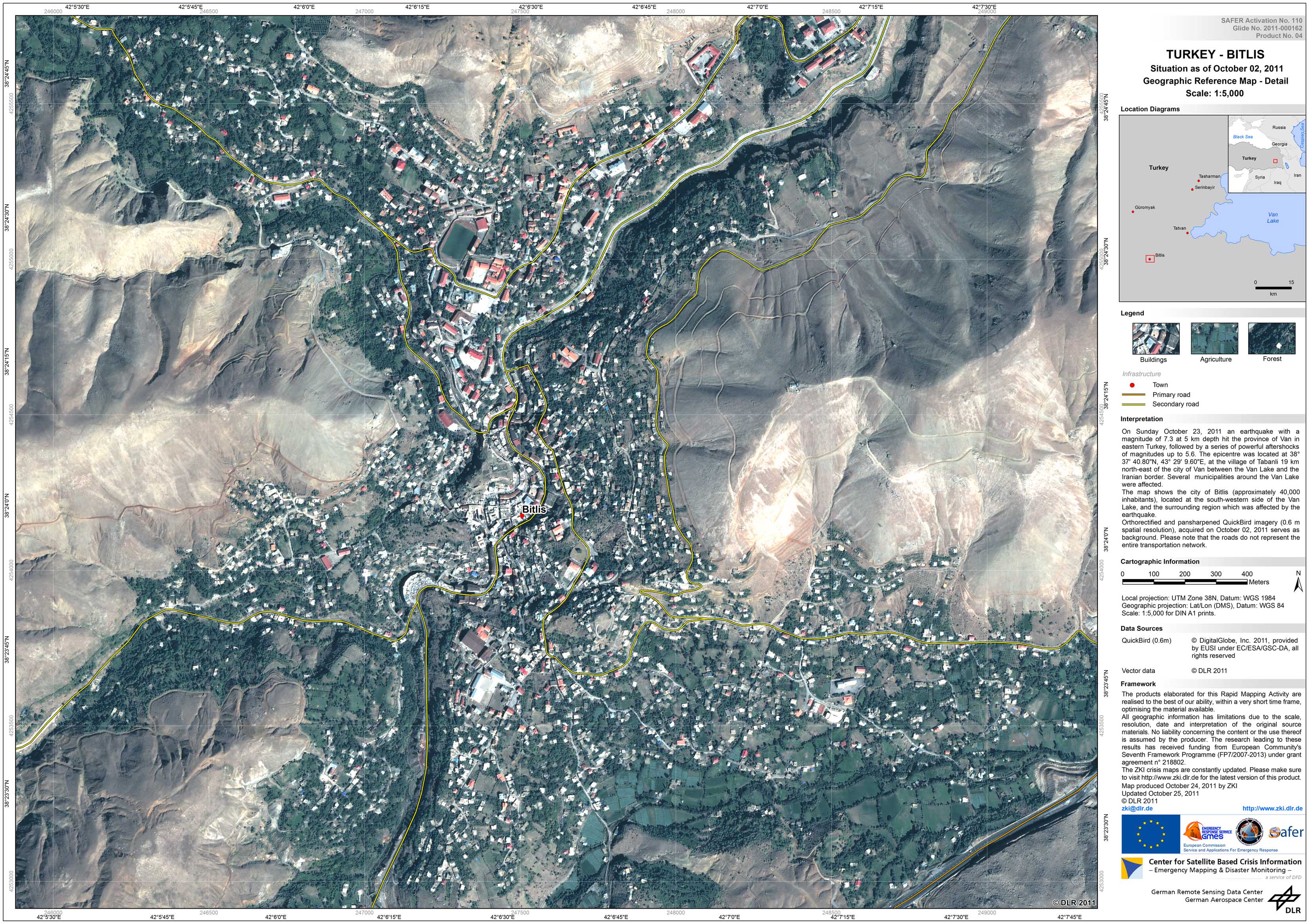
Situation in Bitlis - Türkiye
Geographic Reference Map - Detail
Scale: 1:5,000
Авторские права: DigitalGlobe 2011, provided by EUSI under EC/ESA/GSC-DA, all rights reserved
DLR
Map produced by ZKI
Financial supporters: European Commission and the FP7 SAFER Project
Information about the Product
Получено: 02/10/11
Источник: QuickBird
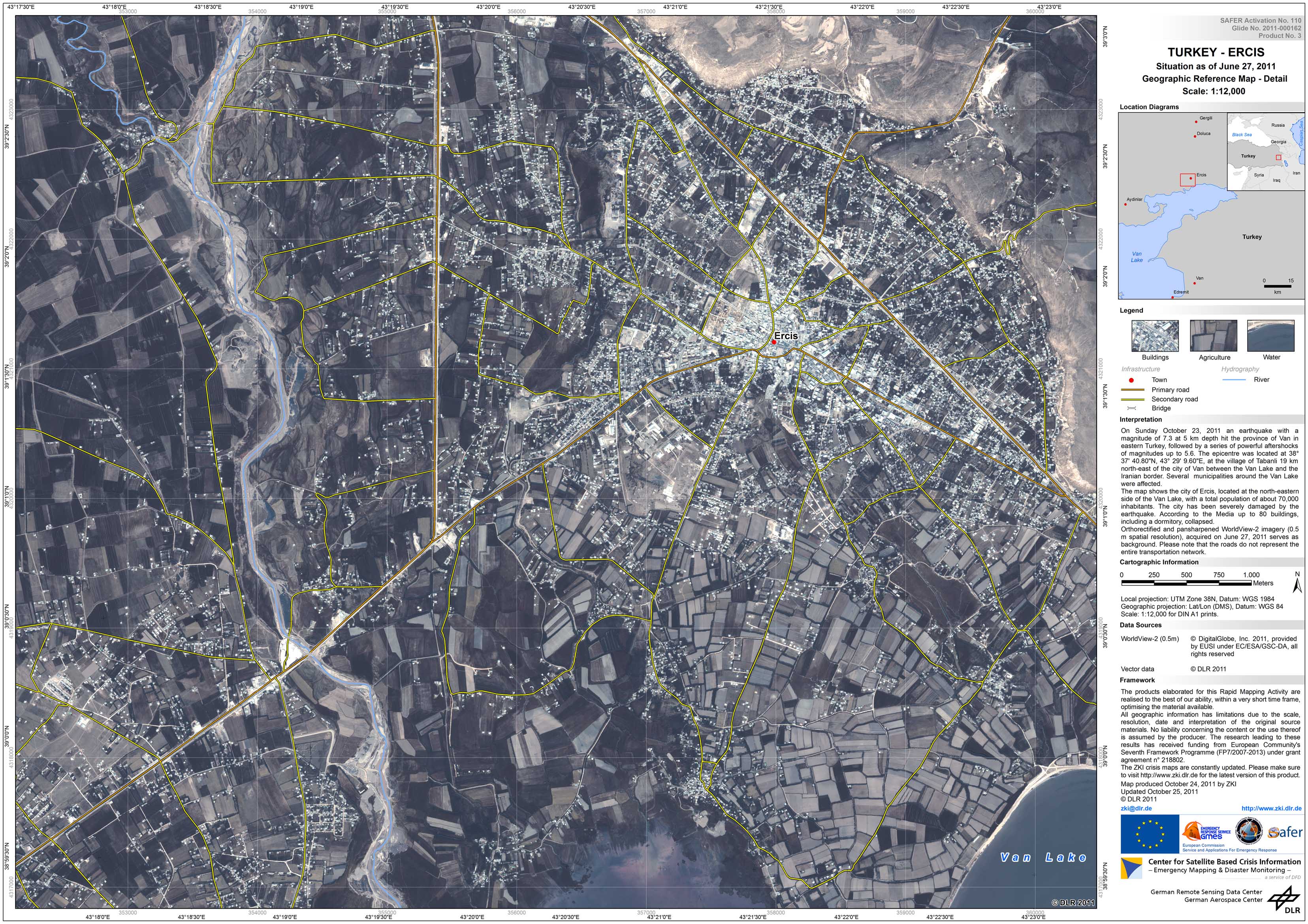
Situation in Ercis - Türkiye
Geographic Reference Map - Detail
Scale: 1:12,000
Авторские права: DigitalGlobe 2011, provided by EUSI under EC/ESA/GSC-DA, all rights reserved
DLR
Map produced by ZKI
Financial supporters: European Commission and the FP7 SAFER Project
Information about the Product
Получено: 27/06/11
Источник: WorldView-2
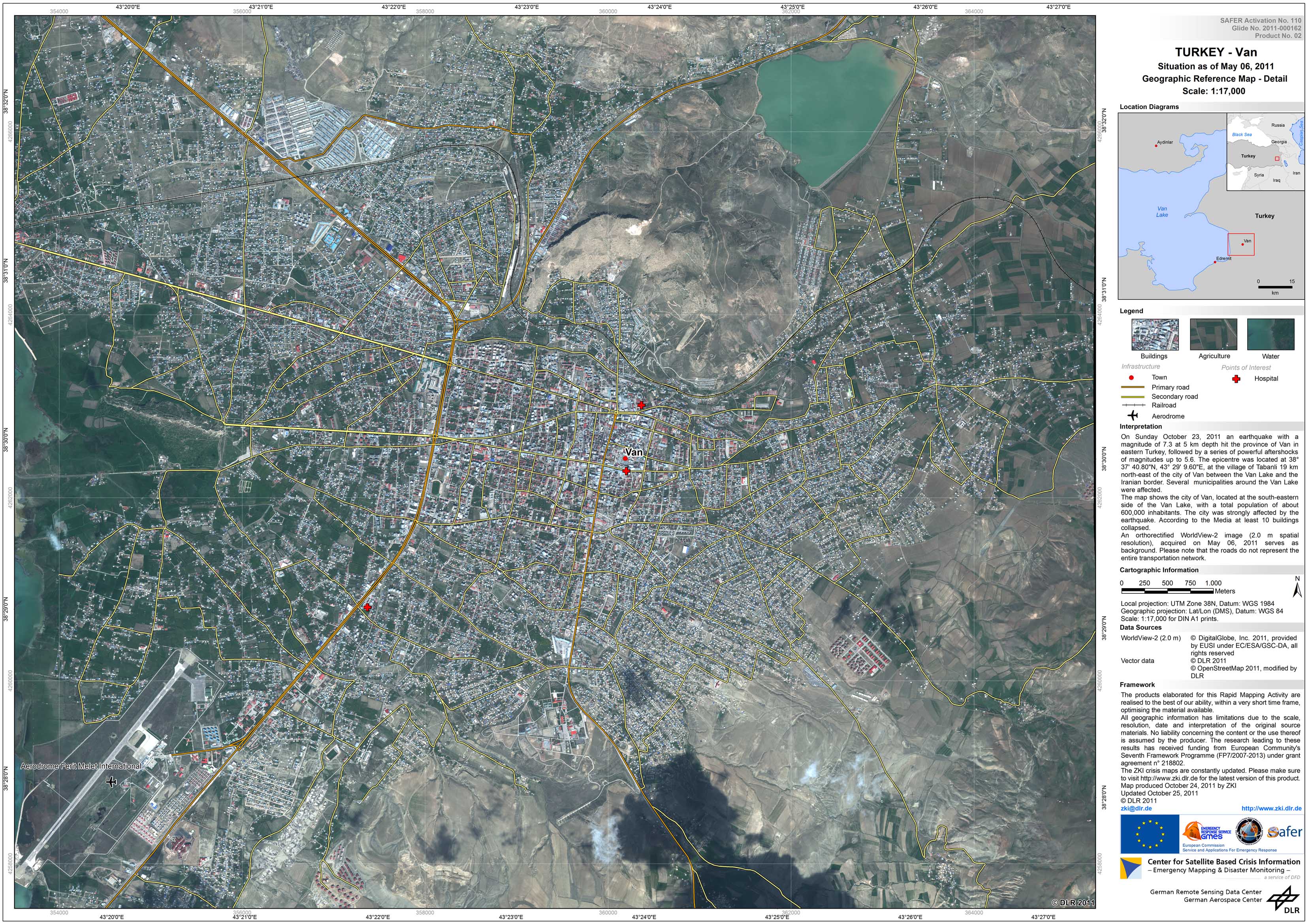
Situation in Van - Türkiye
Geographic Reference Map - Detail
Scale: 1:17,000
Авторские права: DigitalGlobe 2011, provided by EUSI under EC/ESA/GSC-DA, all rights reserved
DLR
Map produced by ZKI
Financial supporters: European Commission and the FP7 SAFER Project
Information about the Product
Получено: 06/05/11
Источник: WorldView-2
 Вернуться к полному архиву активаций

