 English
 Spanish
 French
 Chinese
 Russian
 Portuguese
 Последняя Активация
Charter activations
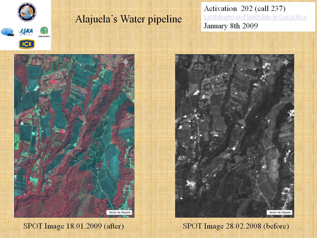
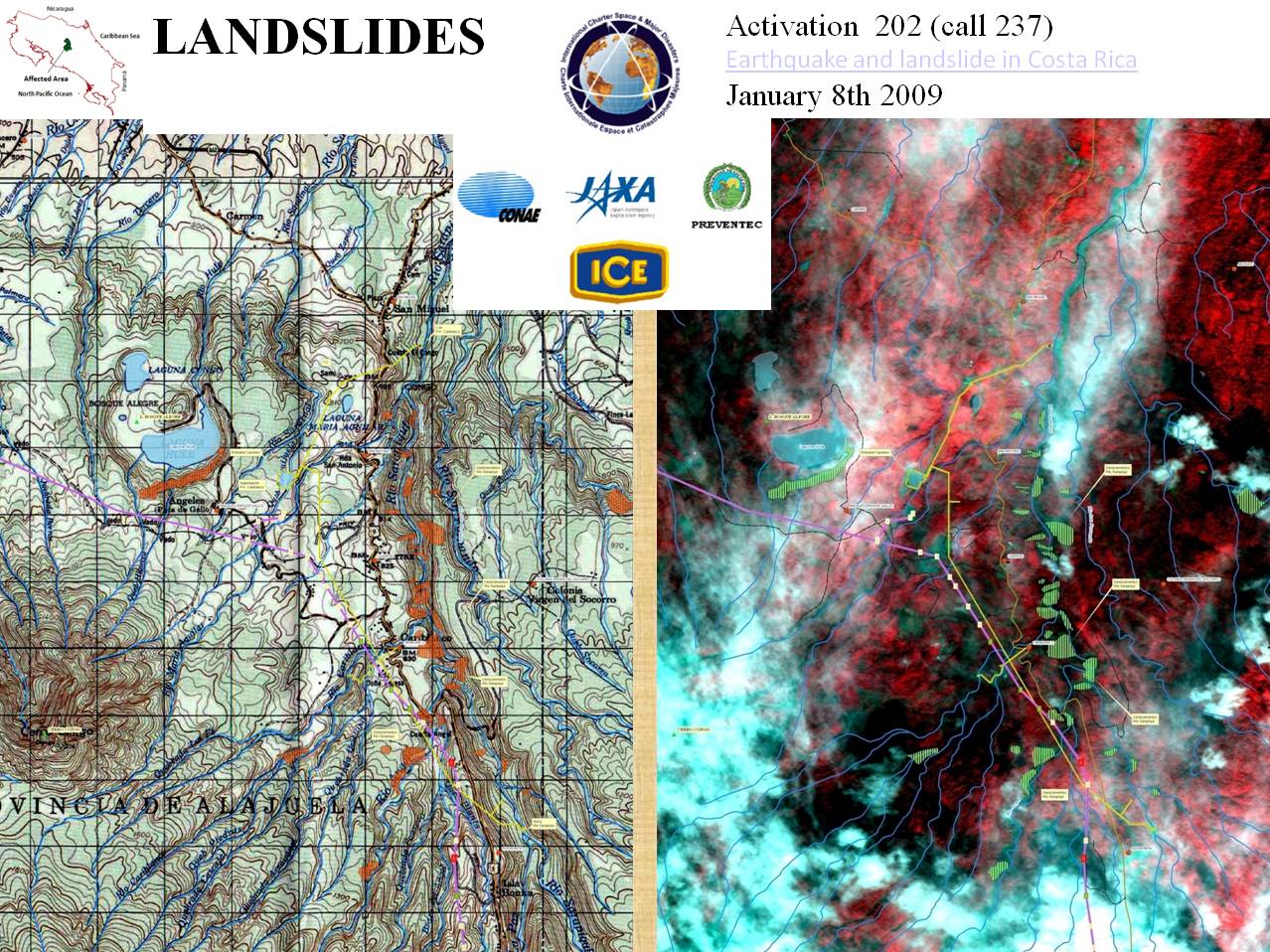
Earthquake and landslide in Costa Rica
A 6.1-magnitude earthquake shook north-central Costa Rica on 8 January and many rural towns have been under serious landslide threat. At least 220 people were injured during the earthquake and 34 people died. Electrical infrastructure and roads were also seriously damaged.
| Тип события: | Earthquake and landslide |
| Место события: | Costa Rica |
| Date of Charter Activation: | 08/01/2009 |
| Запрос на активацию поступил от: | SIFEM (Sistema Federal de Emergencias) |
| Менеждер проекта от: | CONAE |
Products


 Вернуться к полному архиву активаций

