 English
 Spanish
 French
 Chinese
 Russian
 Portuguese
 Latest Activation
Charter activations
Earthquake and eruption of Kīlauea Volcano in the United States
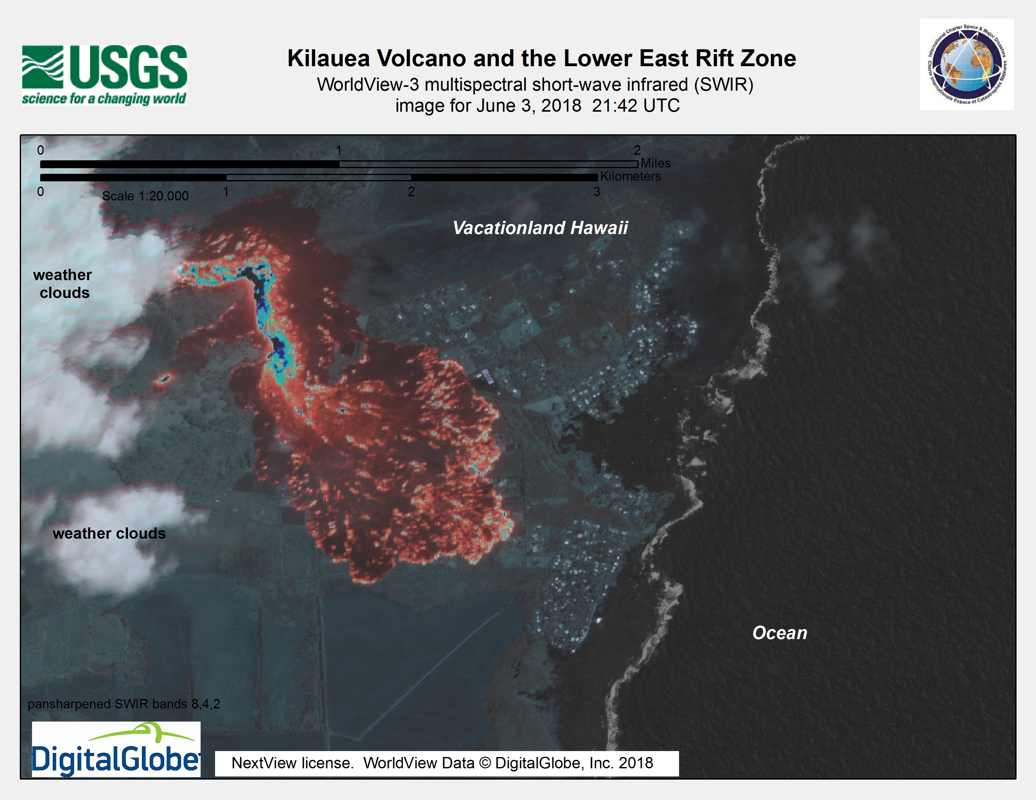
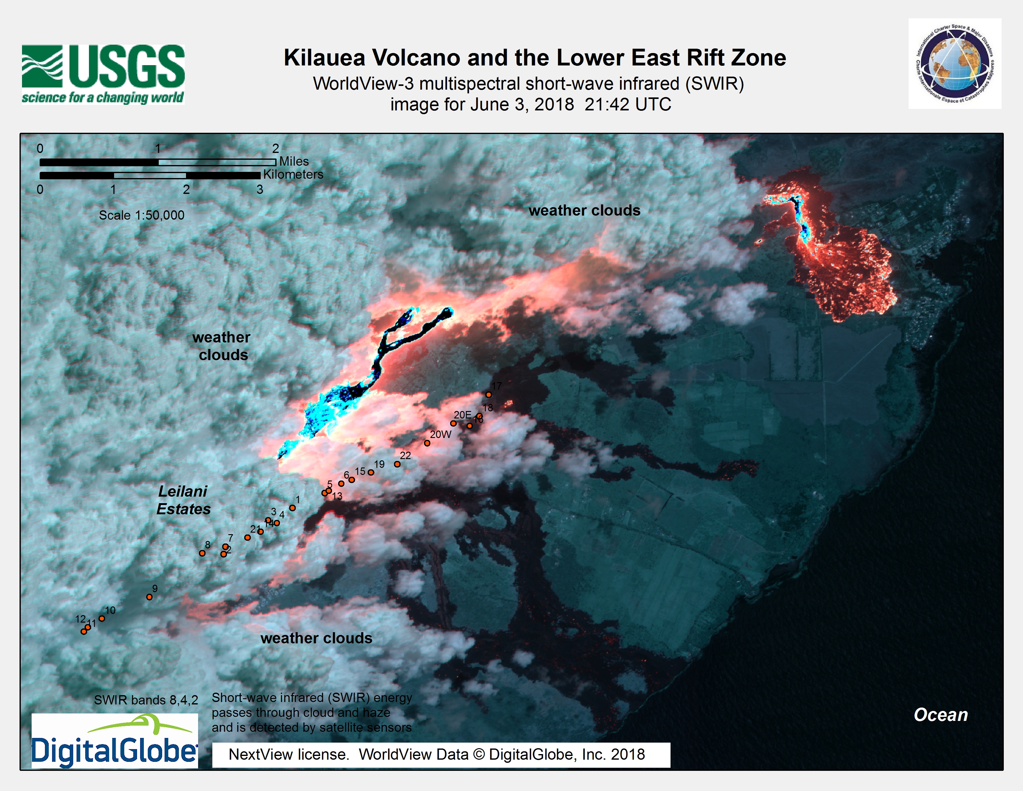
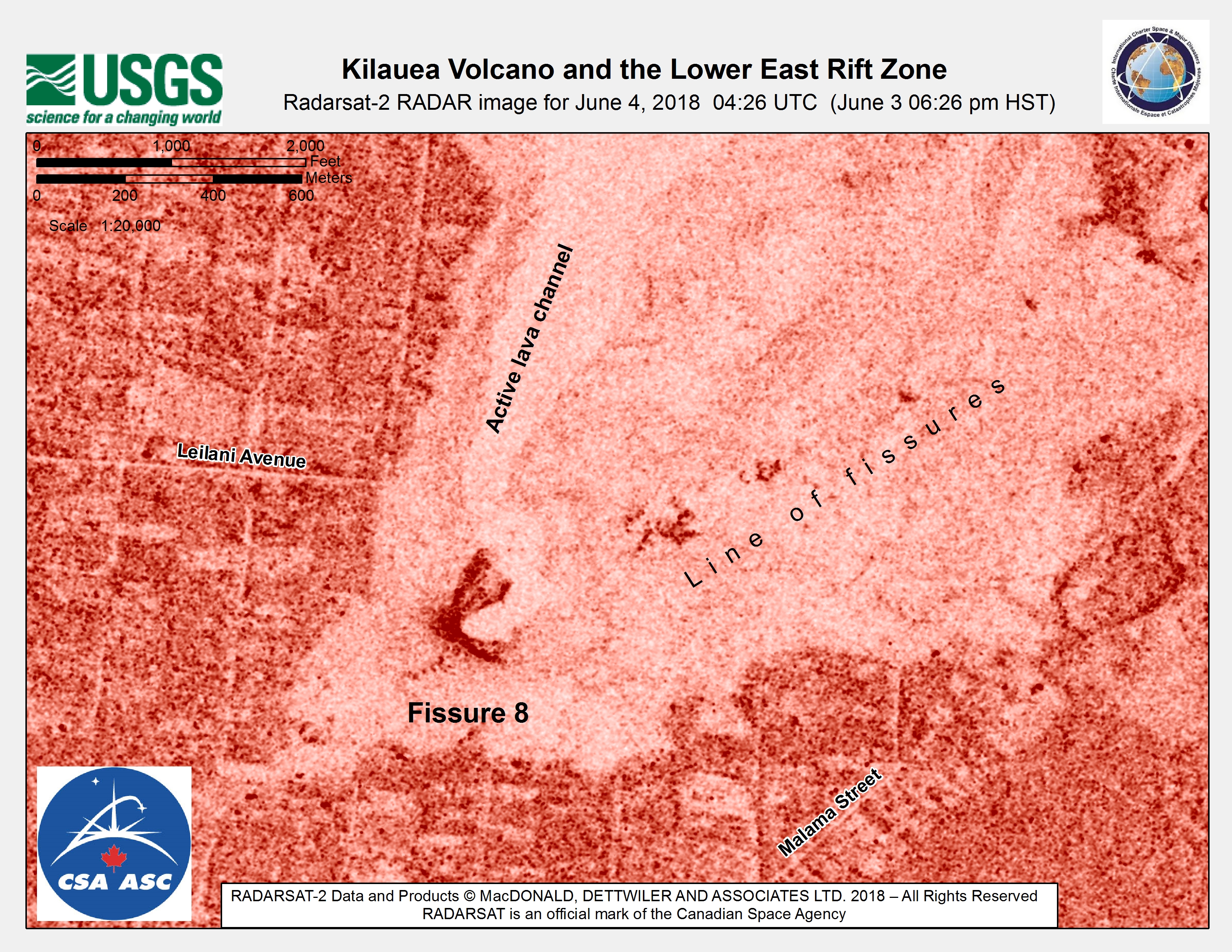
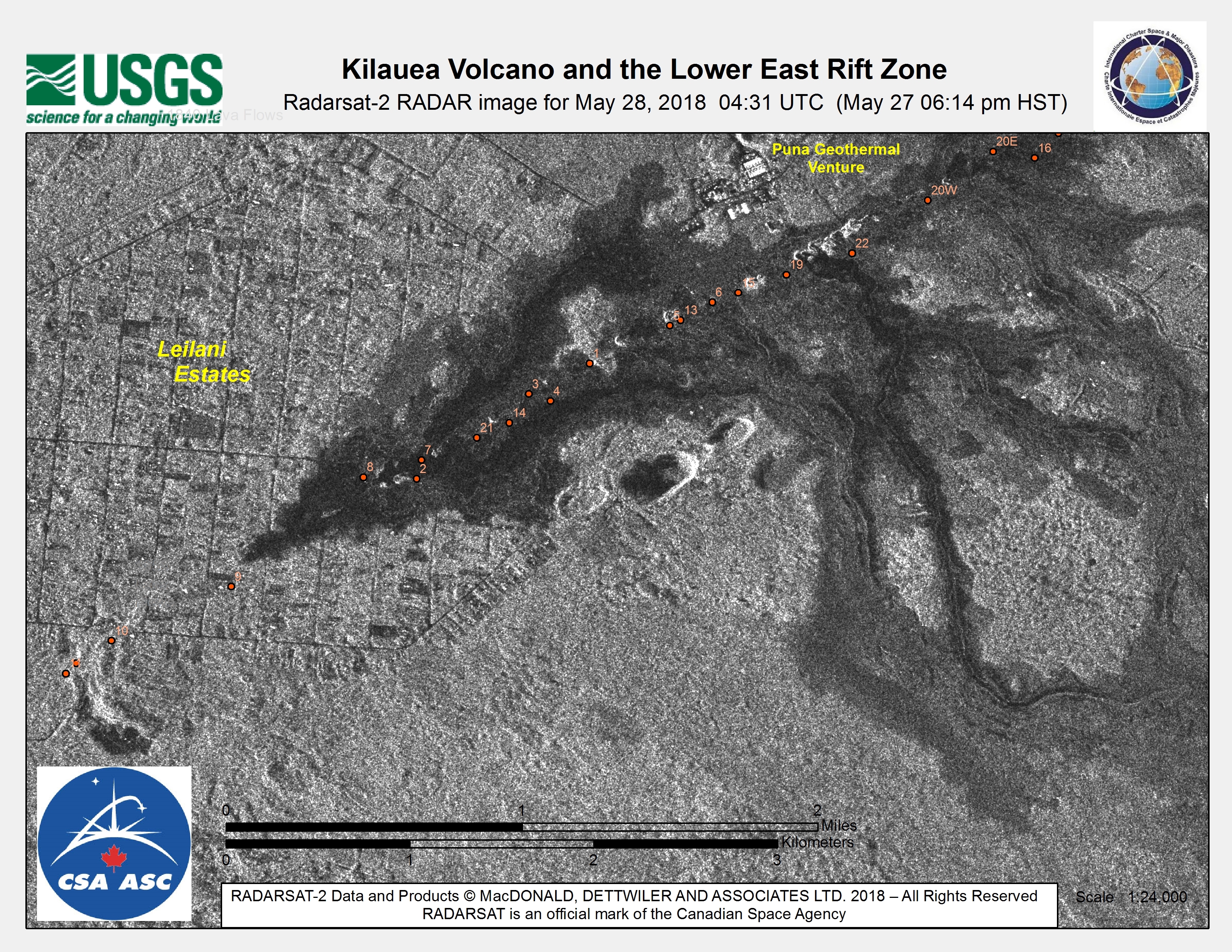
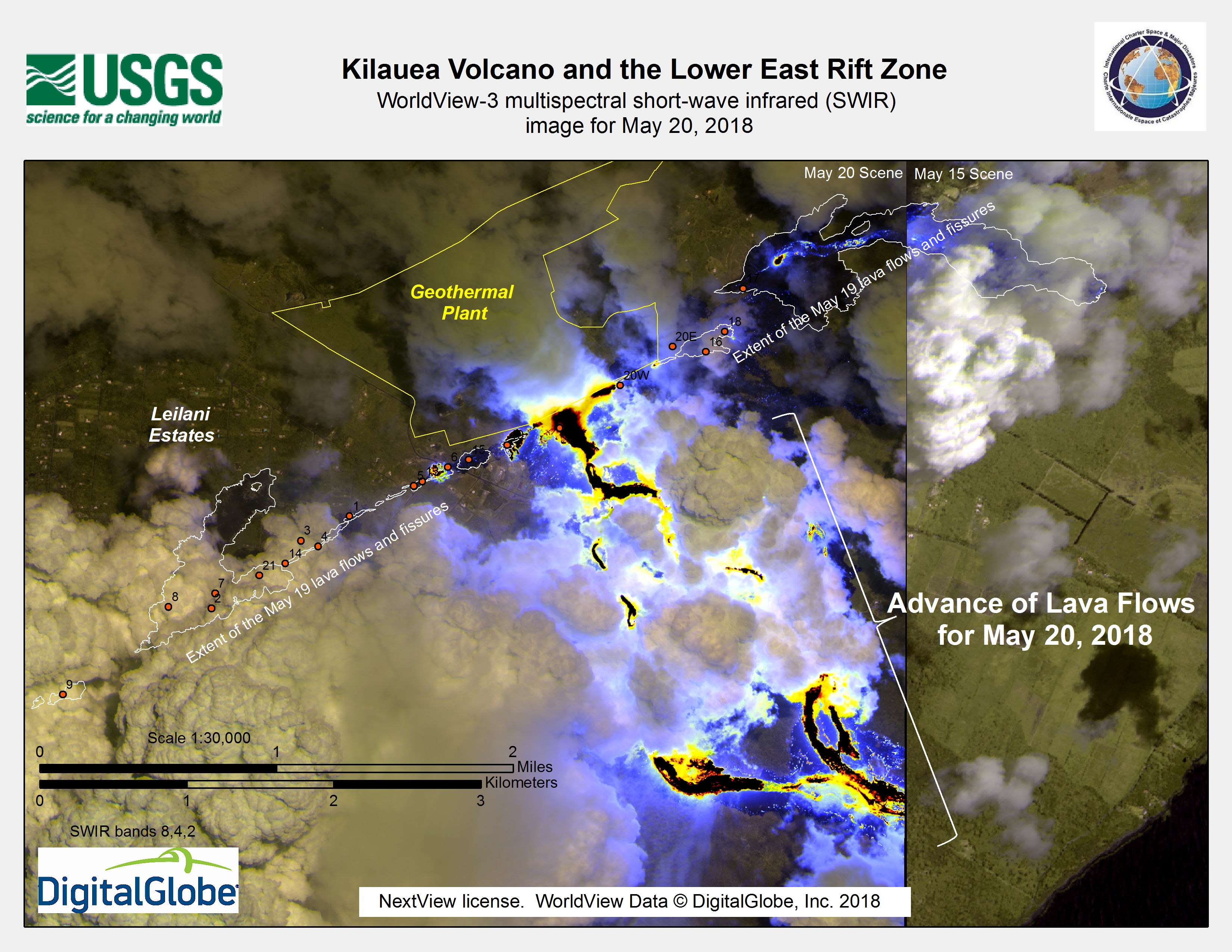
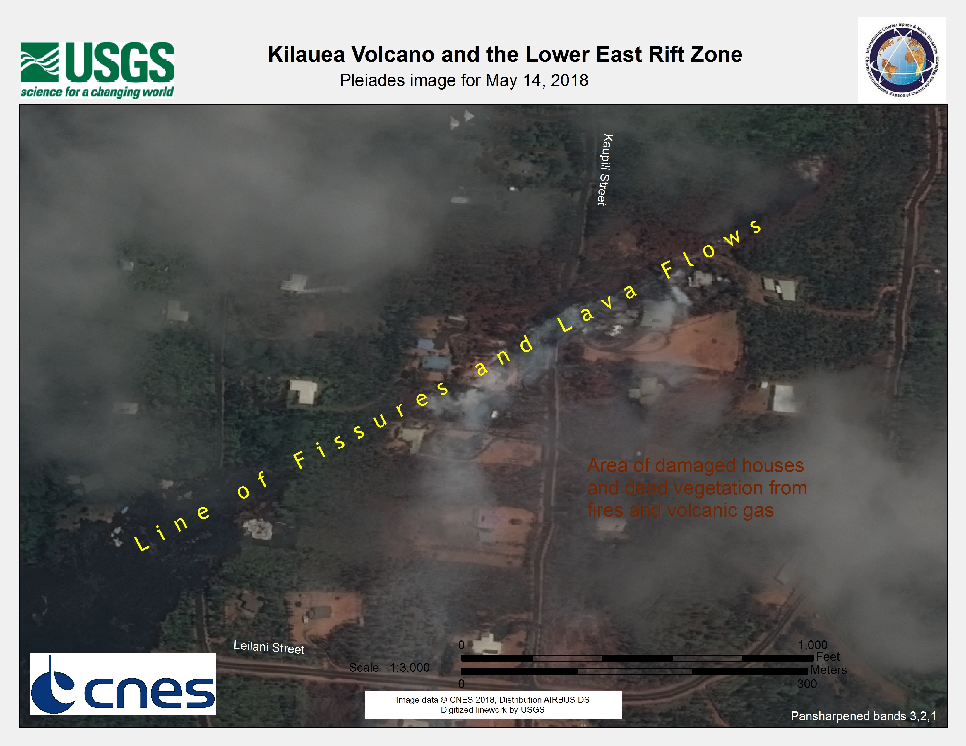
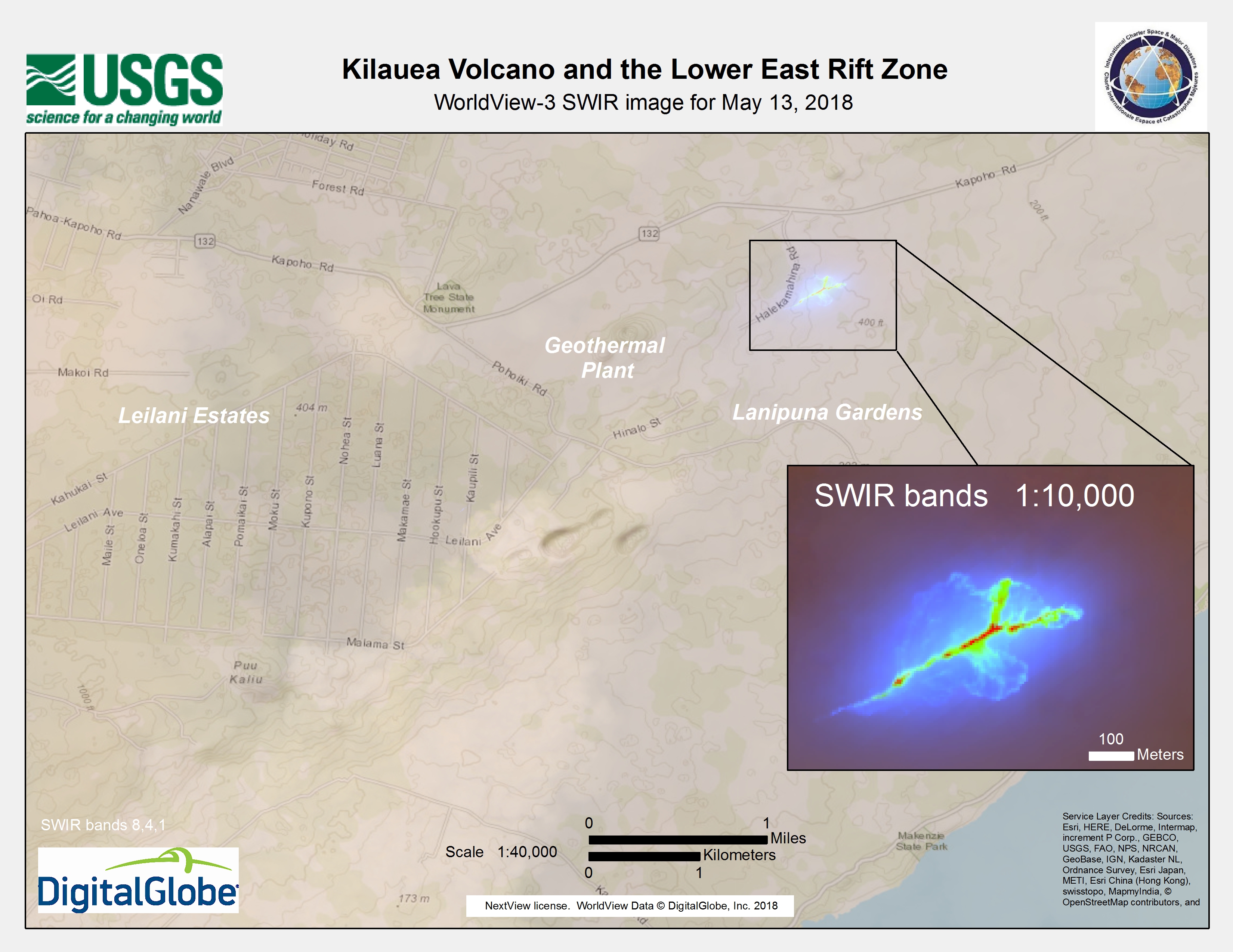
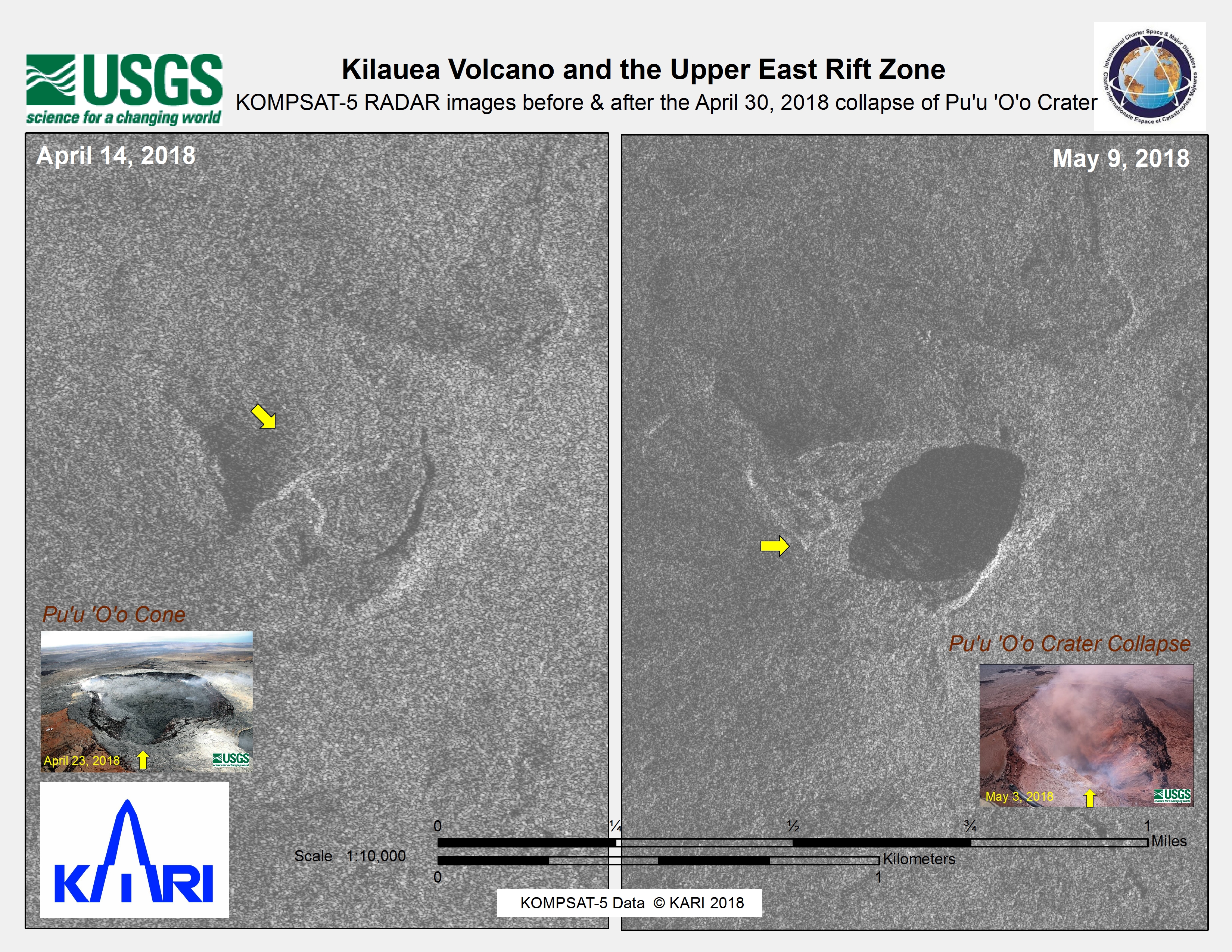
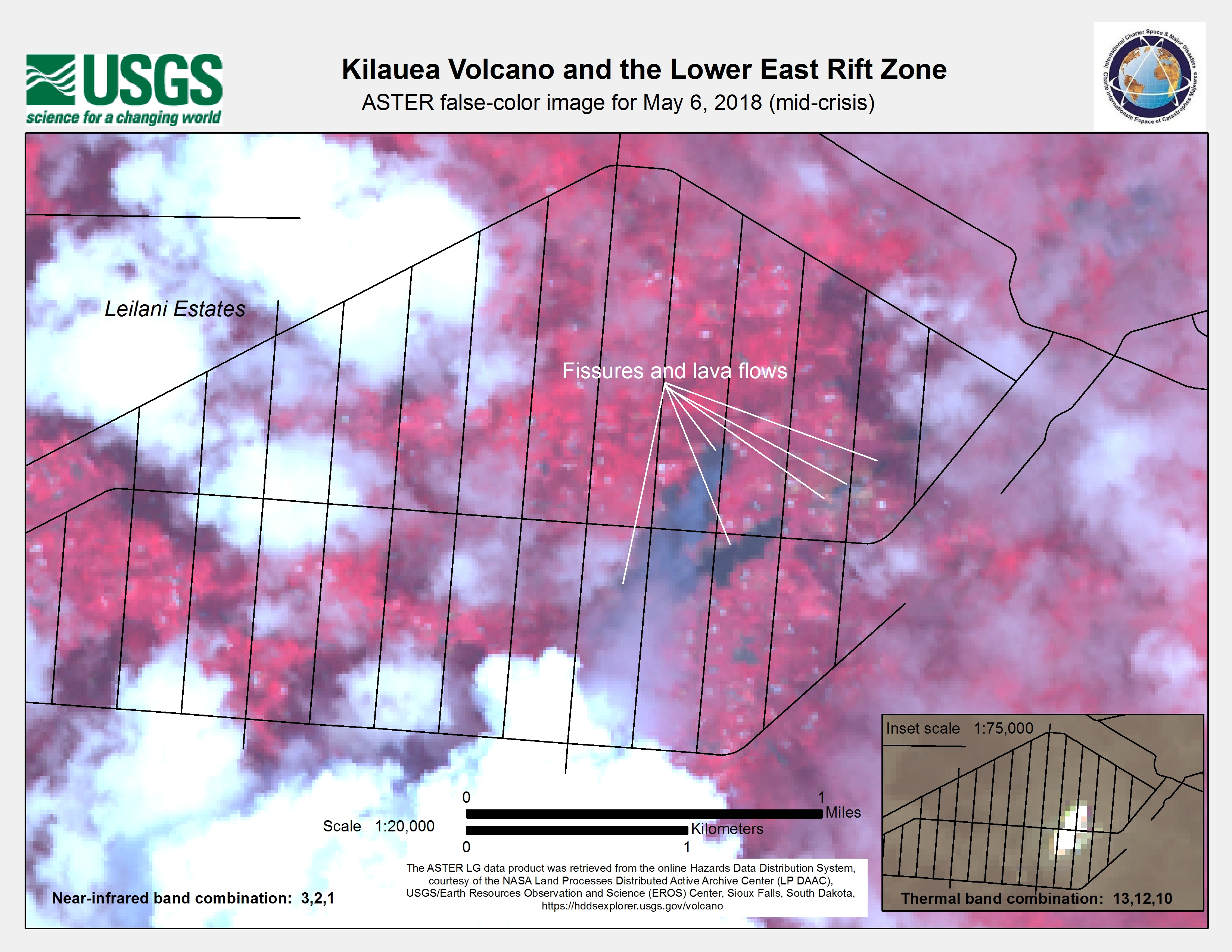
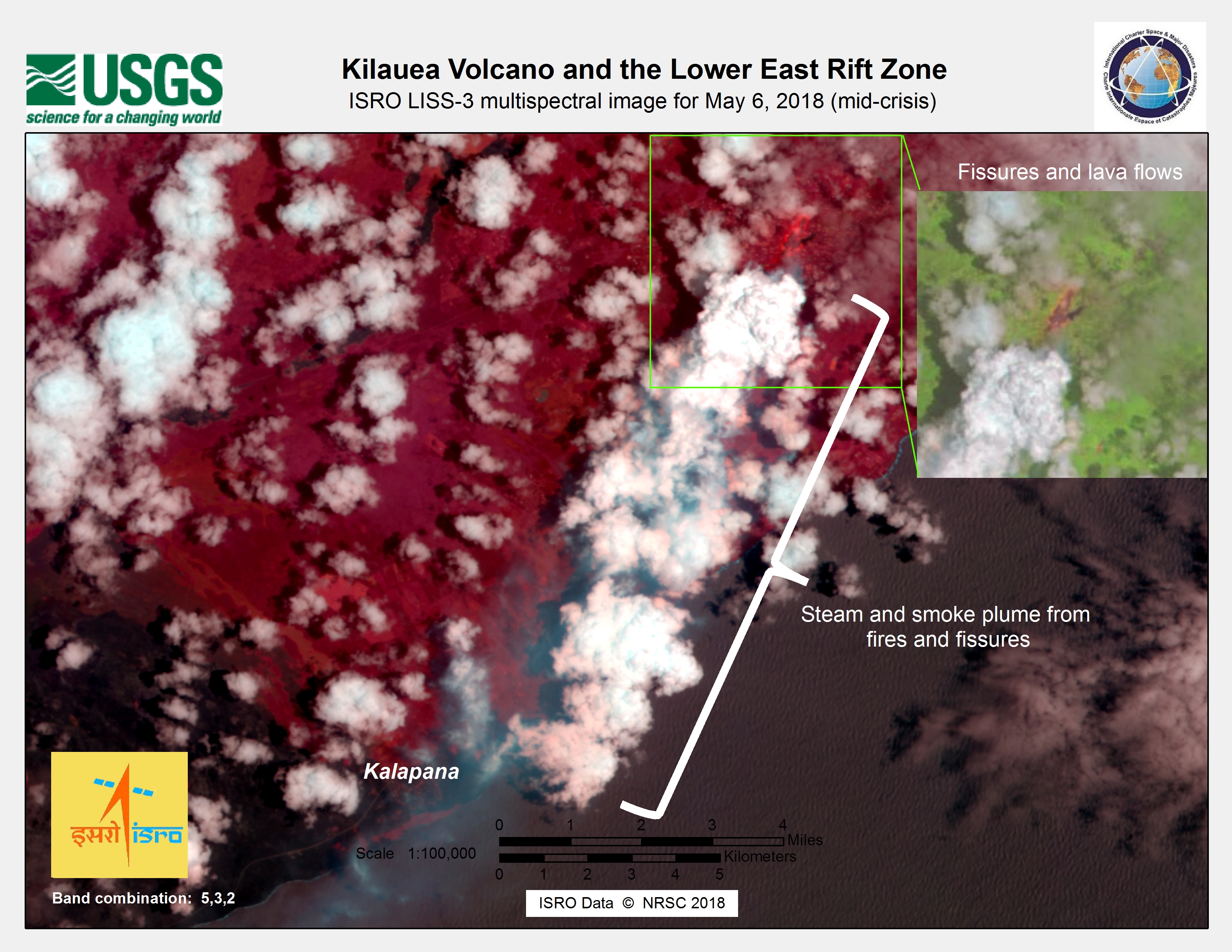
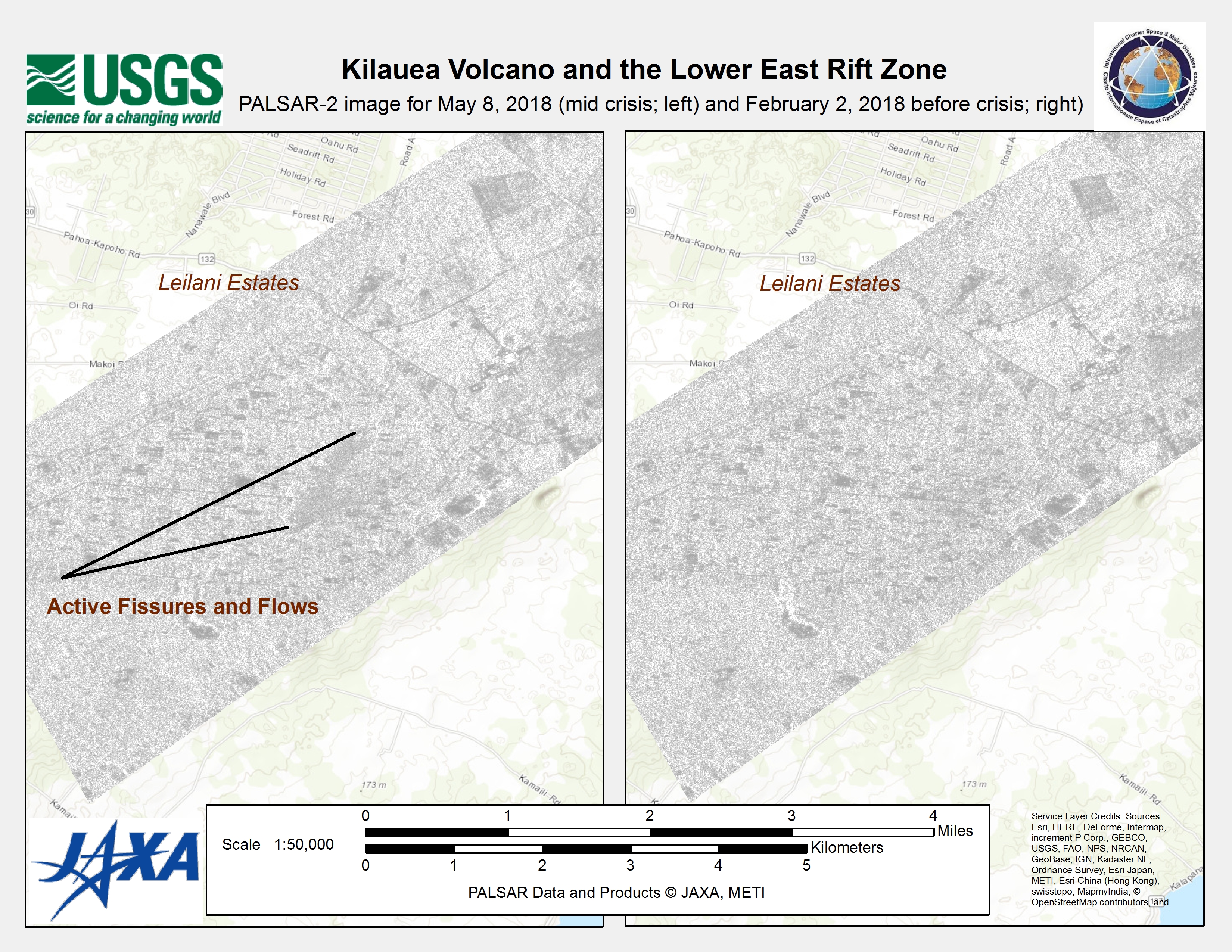
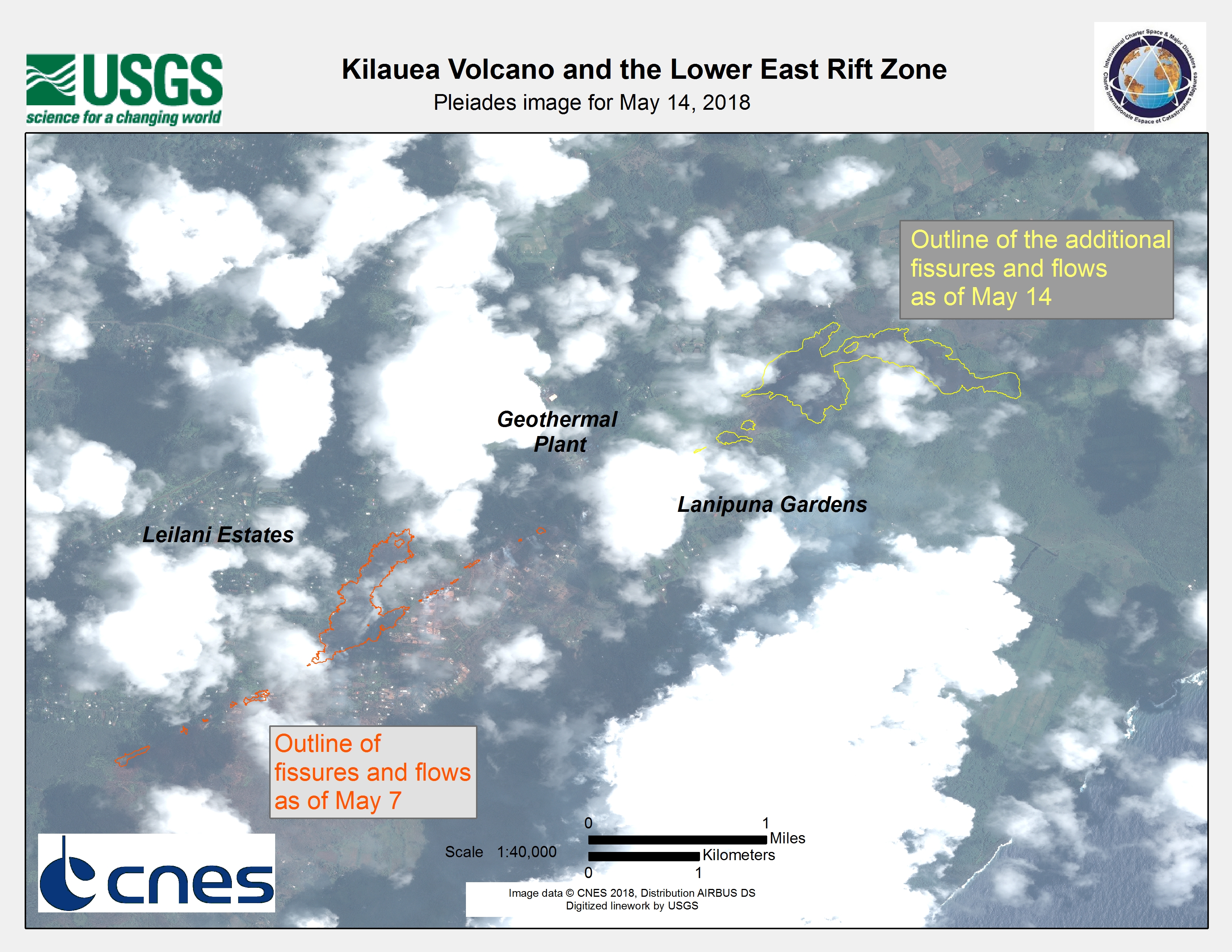
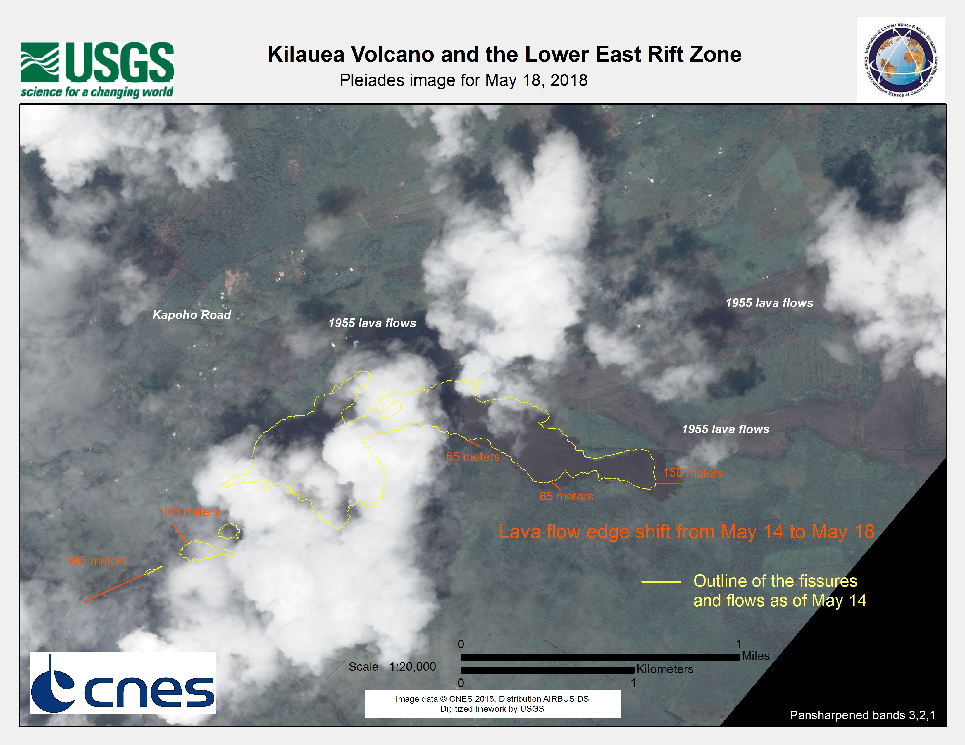
Kīlauea Volcano in Hawaii erupted on 4 May, and the island also experienced a magnitude 6.9 earthquake on the same day. 2000 people were evacuated from the area and hundreds of homes in the path of the eruption were placed at risk, but no casualties were reported.
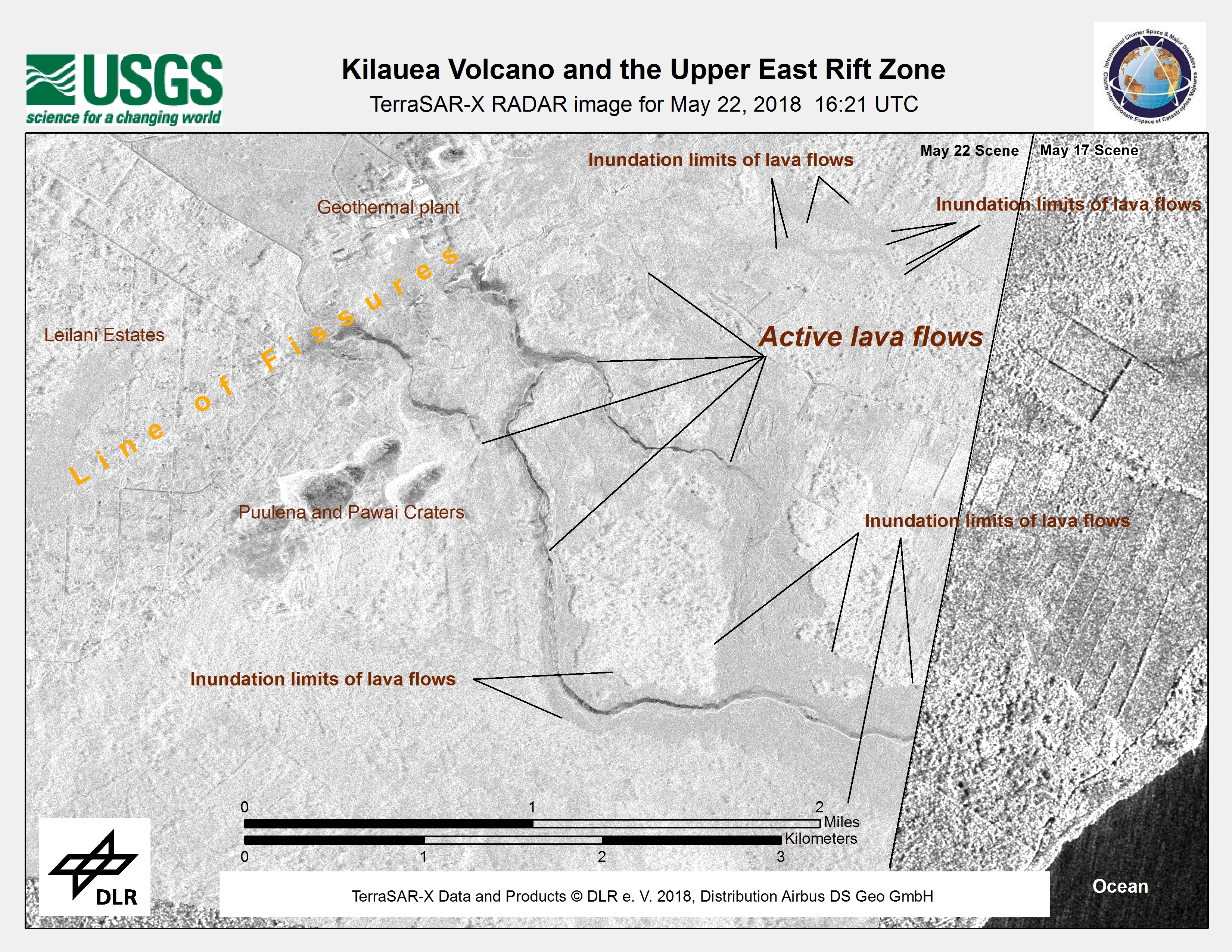
The volcano is located on Hawaii's Big Island, and has been active for decades. Authorities reported that 35 buildings were destroyed in the Leilani Estates and Lanipuna Gardens areas, where 12 fissures and volcanic vents opened in the East Rift Zone of the volcano. Lava erupted as high as 70m from the vents in some areas and caused lava to stream through the streets. The extent of the lava wass reported as 36,000 square metres at the most active fissure.
High quantities of sulphur dioxide from the volcano posed another hazard to residents, as the gas is toxic to breathe. Residents were urged not to return to the affected areas until conditions improved.
Related News and Resources
| Tipo de evento: | Volcano and Earthquake |
| Local do evento: | United States of America |
| Data da Ativação da Carta: | 2018-05-07 |
| Tempo de Ativação da Carta: | 15:14 |
| Zona de Tempo da Ativação da Carta: | UTC-05:00 |
| Requisitante da Carta: | US Geological Survey on behalf of USGS Hawaii Volcano Observatory / Cascades Volcano Observatory |
| ID da Ativação: | 571 |
| Gerenciamento de projeto: | USGS |
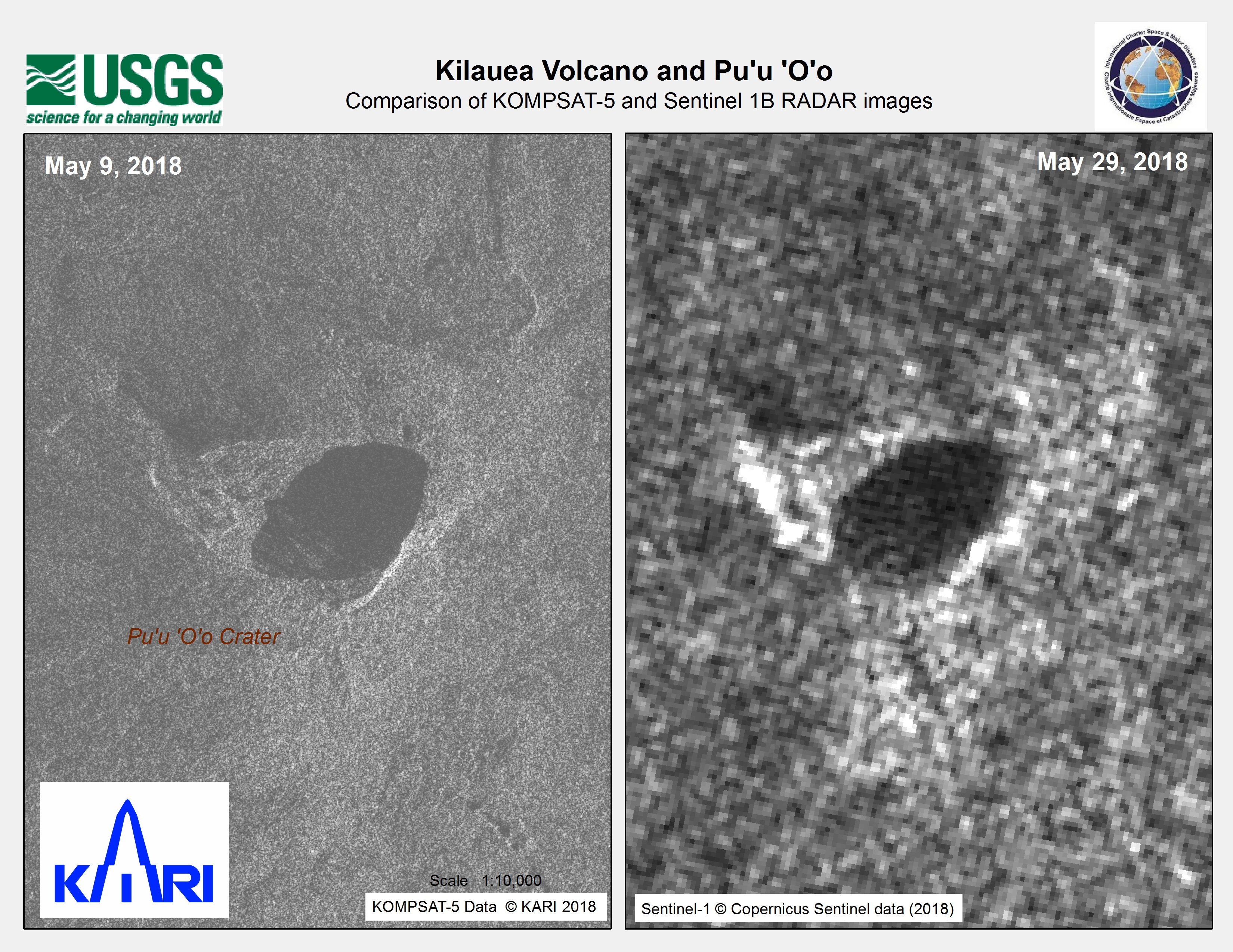
Products
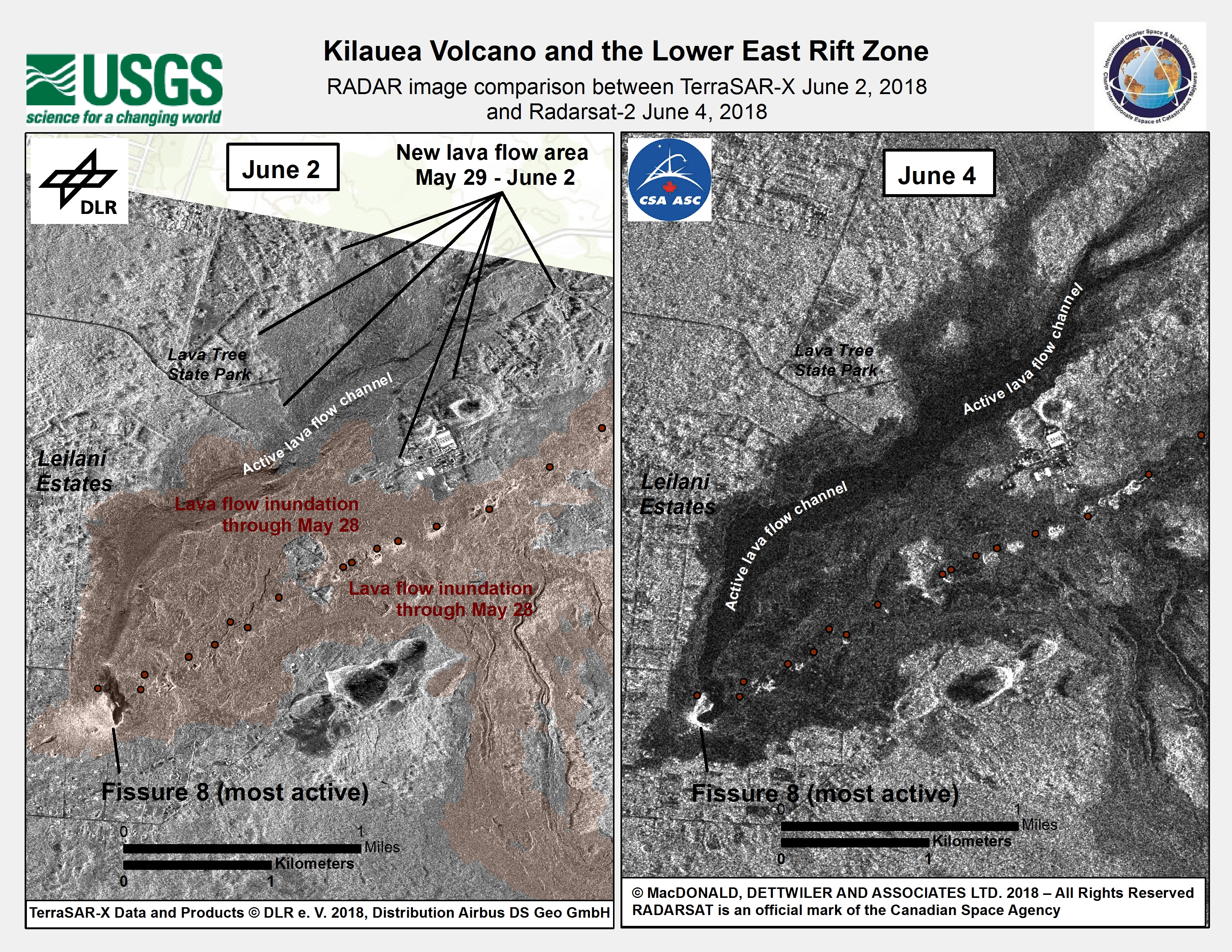
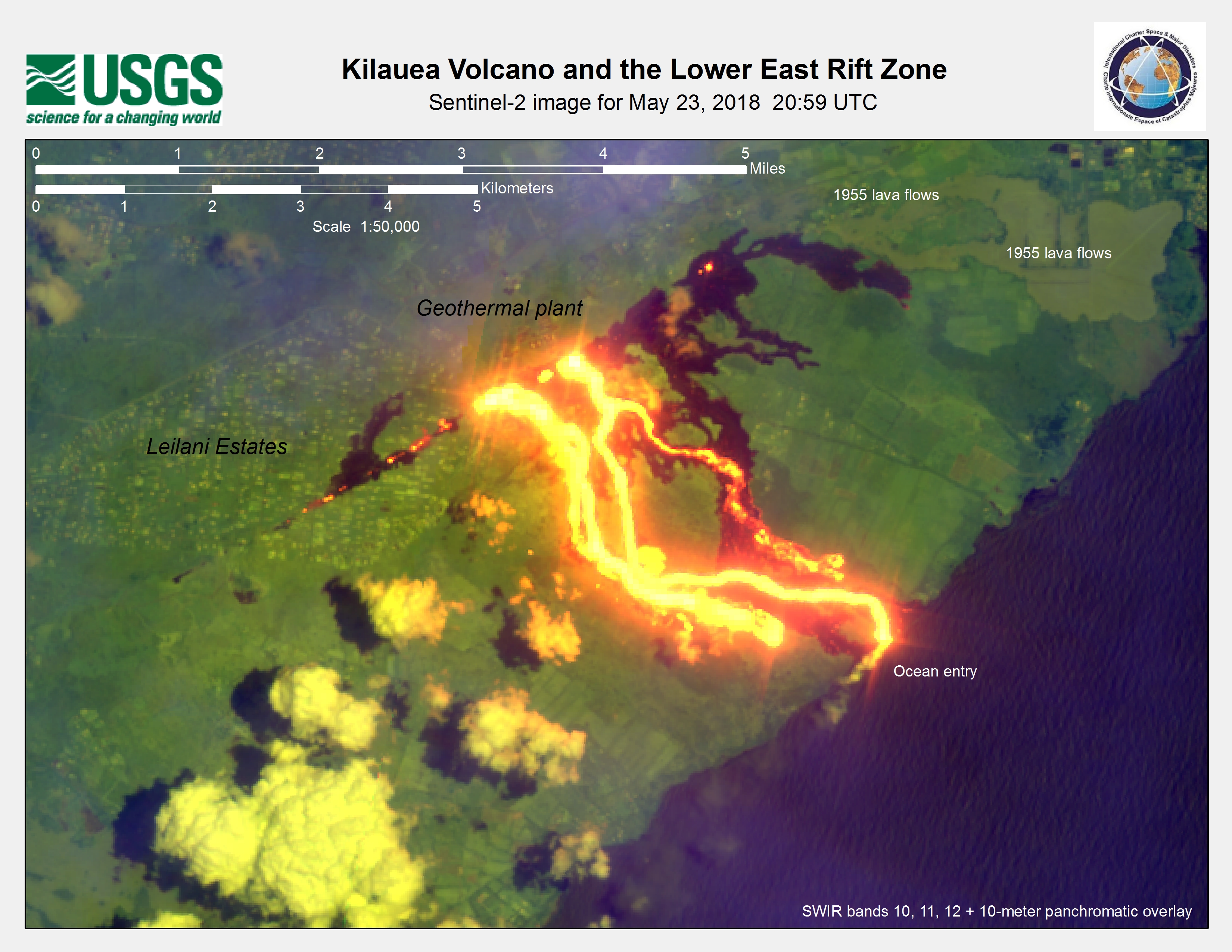
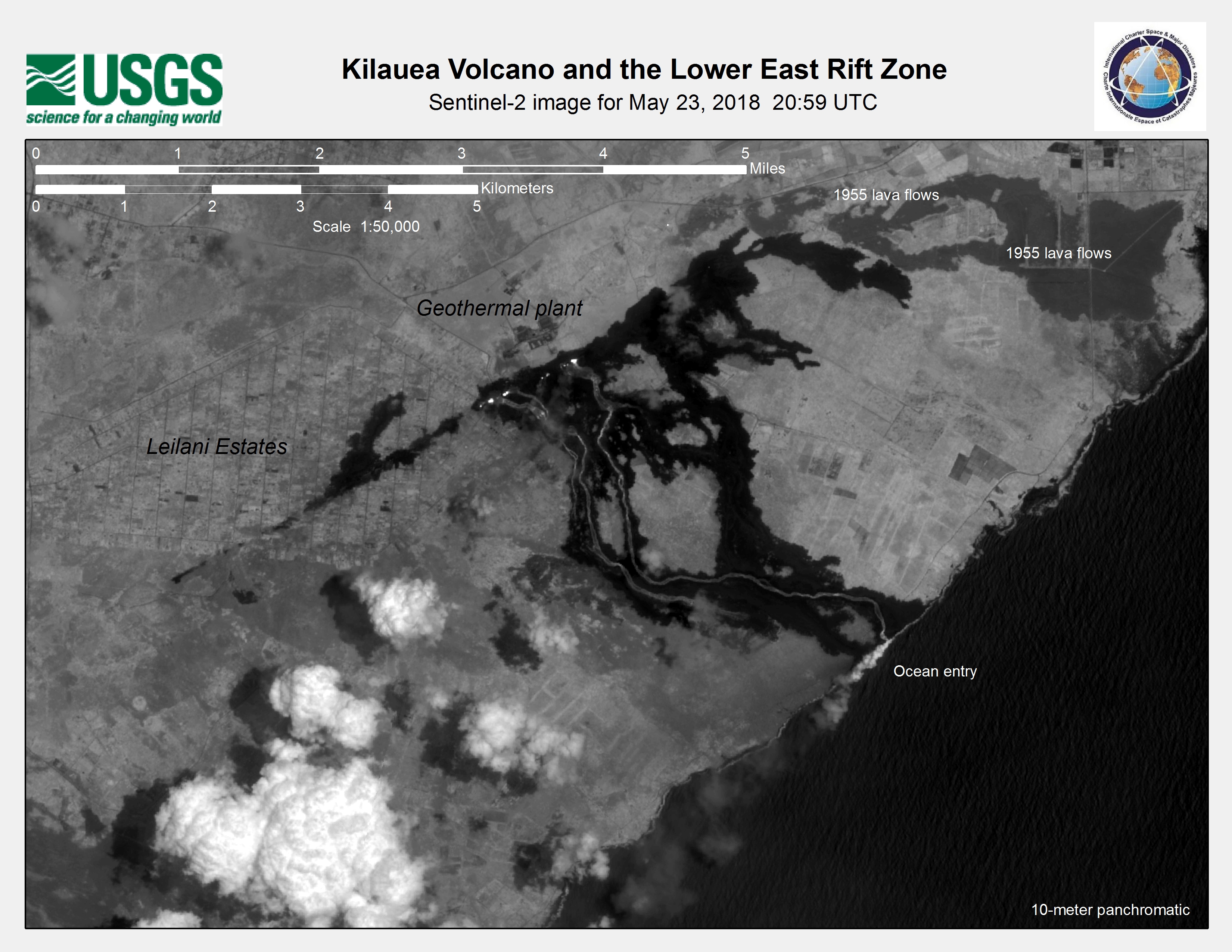
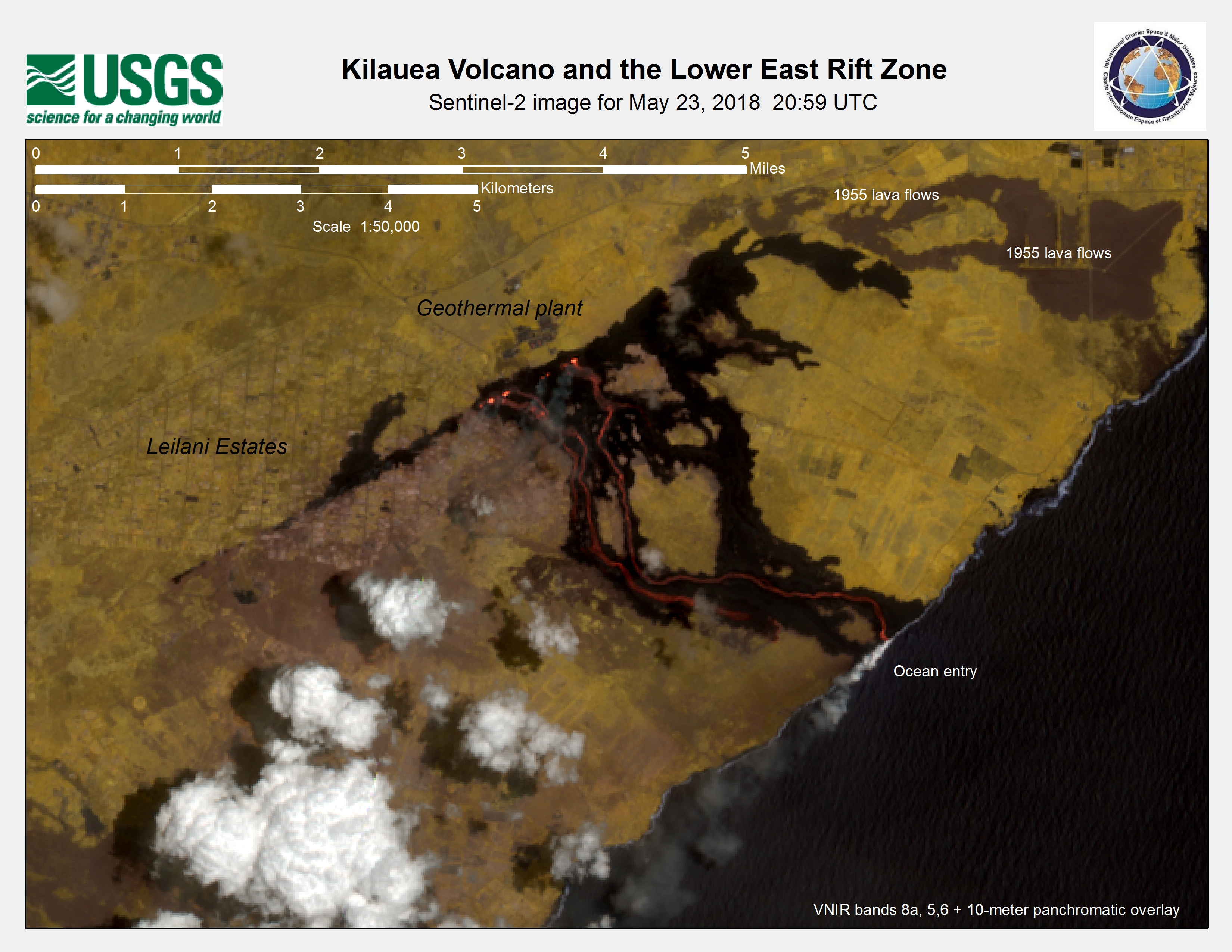
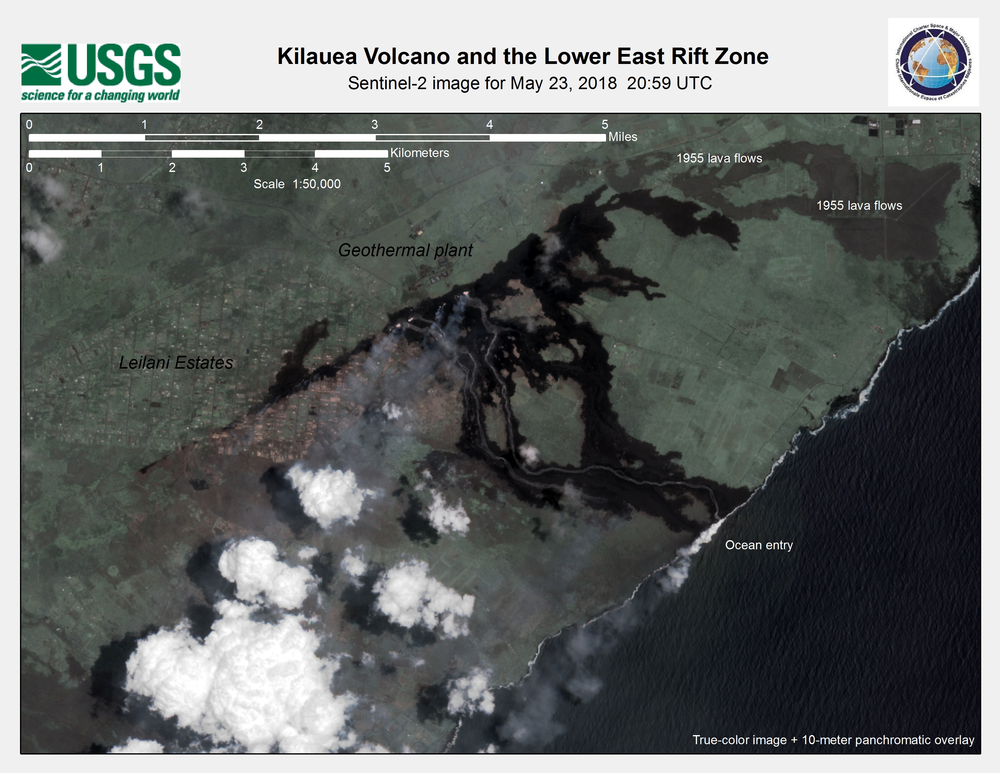
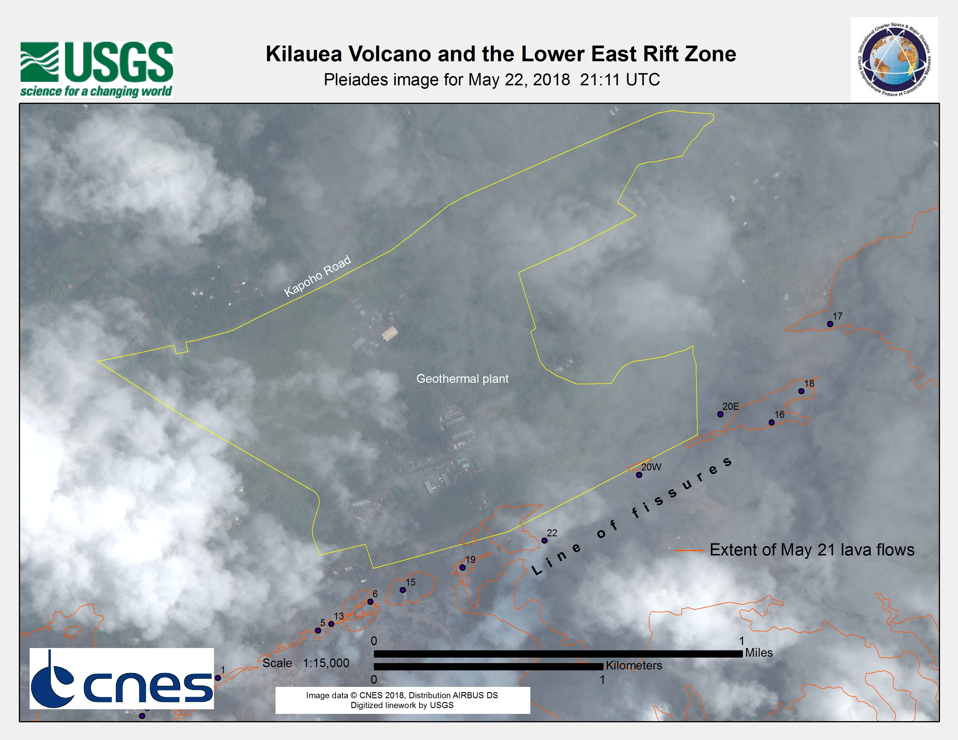
Kīlauea Volcano and the Lower East Rift Zone
Direitos autorais: TerraSAR-X © DLR e. V. 2018, Distribution: Airbus DS Geo GmbH
RADARSAT-2 Data and Products © Maxar Technologies Ltd. (2018) - All Rights Reserved. RADARSAT is an official trademark of the Canadian Space Agency.
Map produced by USGS
Information about the Product
Adquirida: TerraSAR-X: 02/04/2018
RADARSAT-2: 04/04/2018
Fonte: RADARSAT-2 & TerraSAR-X
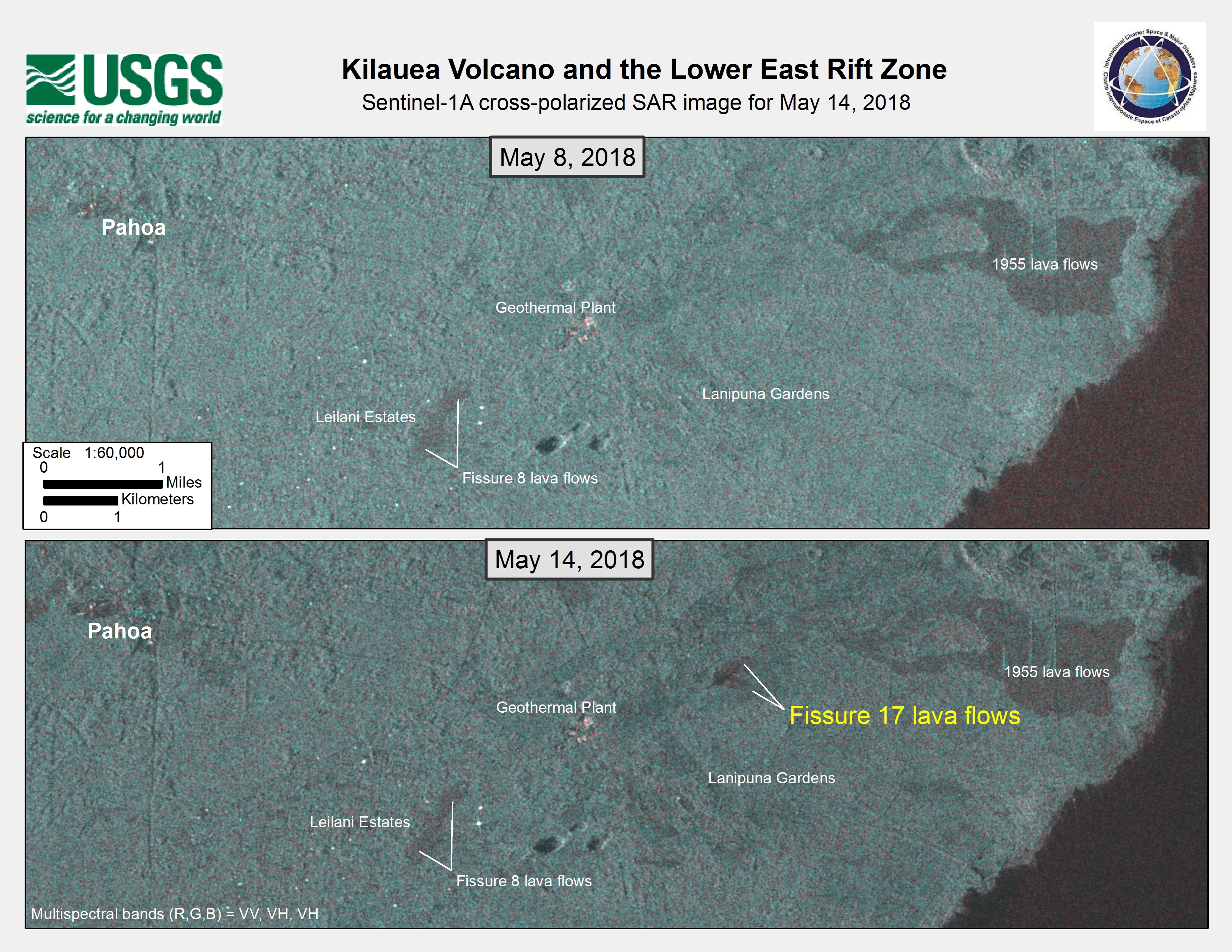
Kīlauea Volcano and the Lower East Rift Zone
Direitos autorais: RADARSAT-2 Data and Products © Maxar Technologies Ltd. (2018) - All Rights Reserved. RADARSAT is an official trademark of the Canadian Space Agency.
Map produced by USGS
Information about the Product
Adquirida: 04/06/2018
Fonte: RADARSAT-2
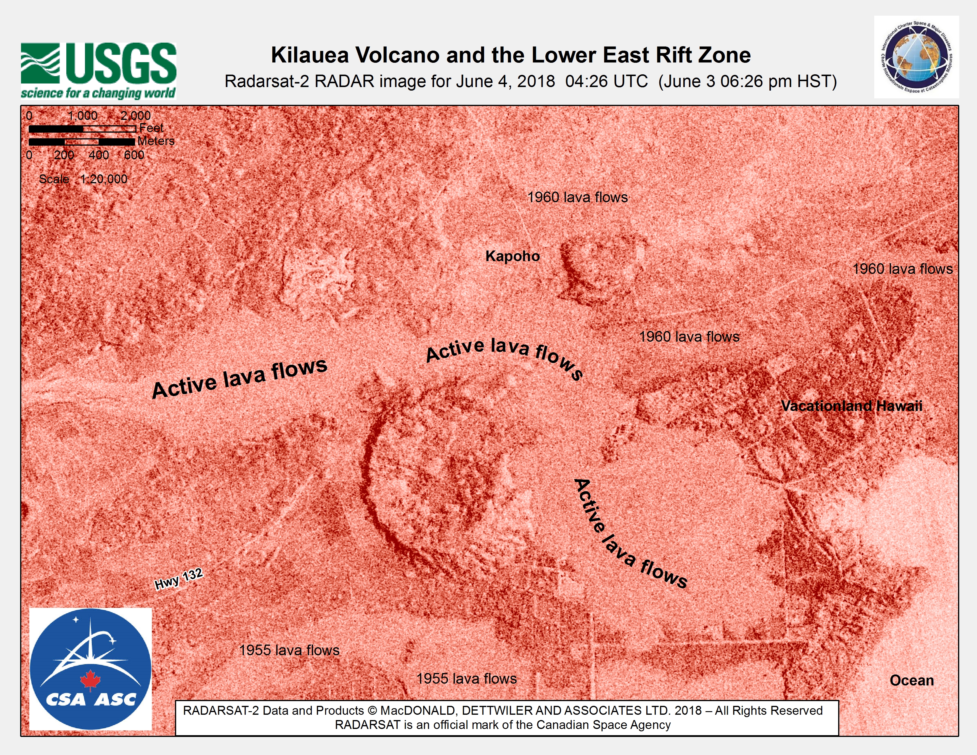
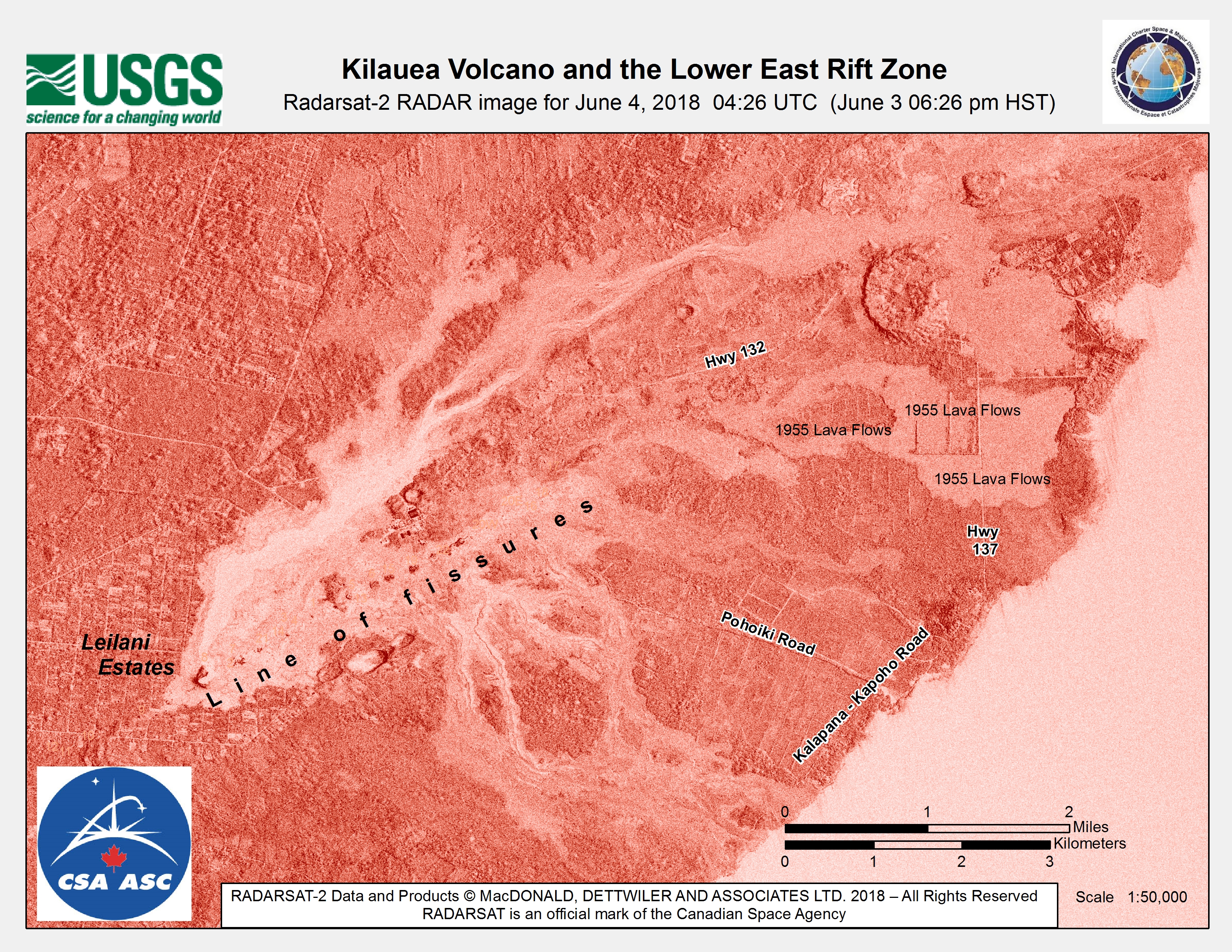
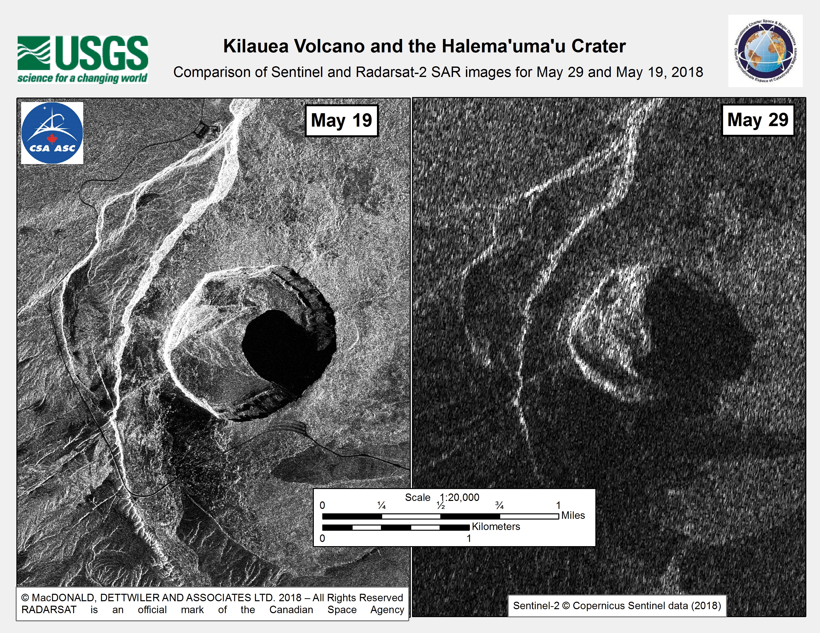
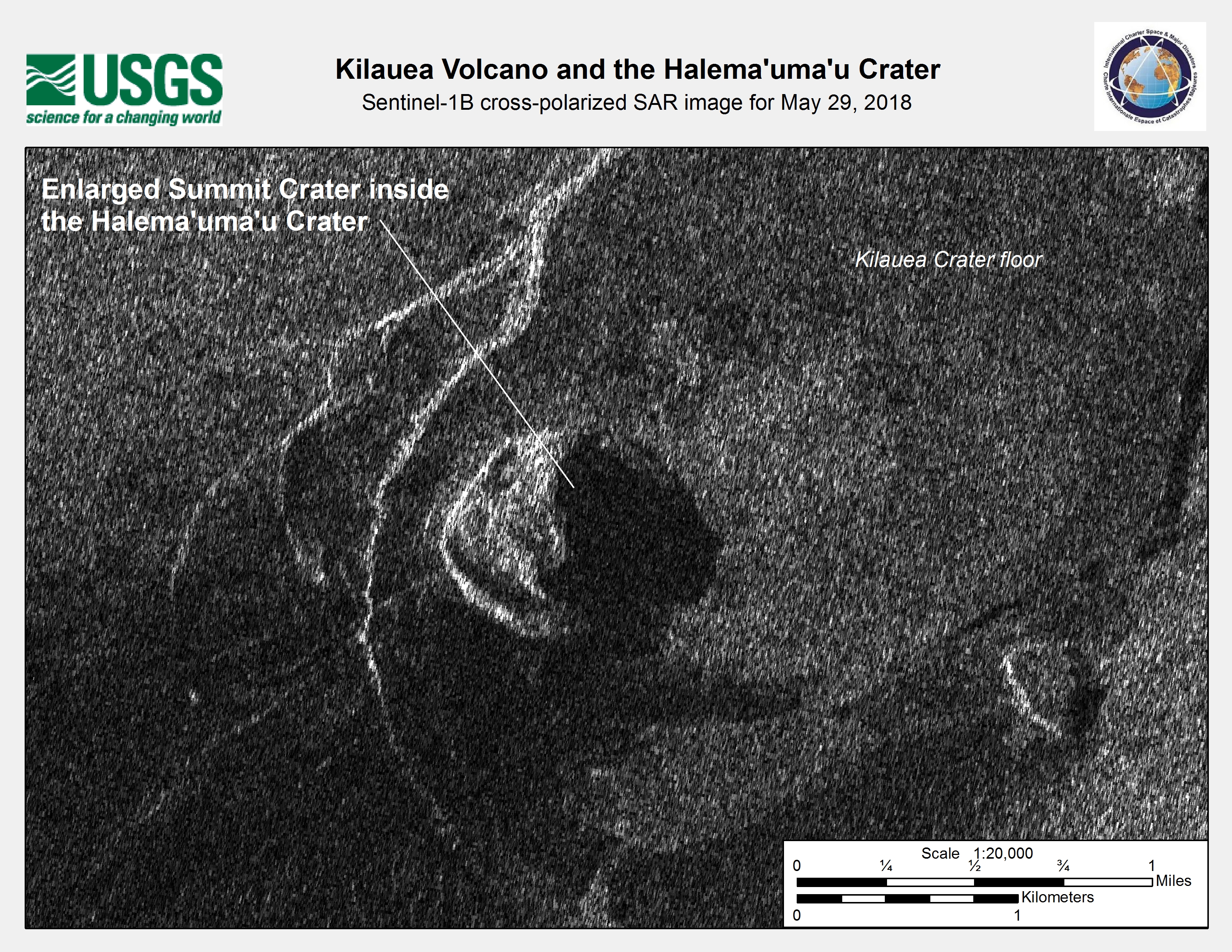
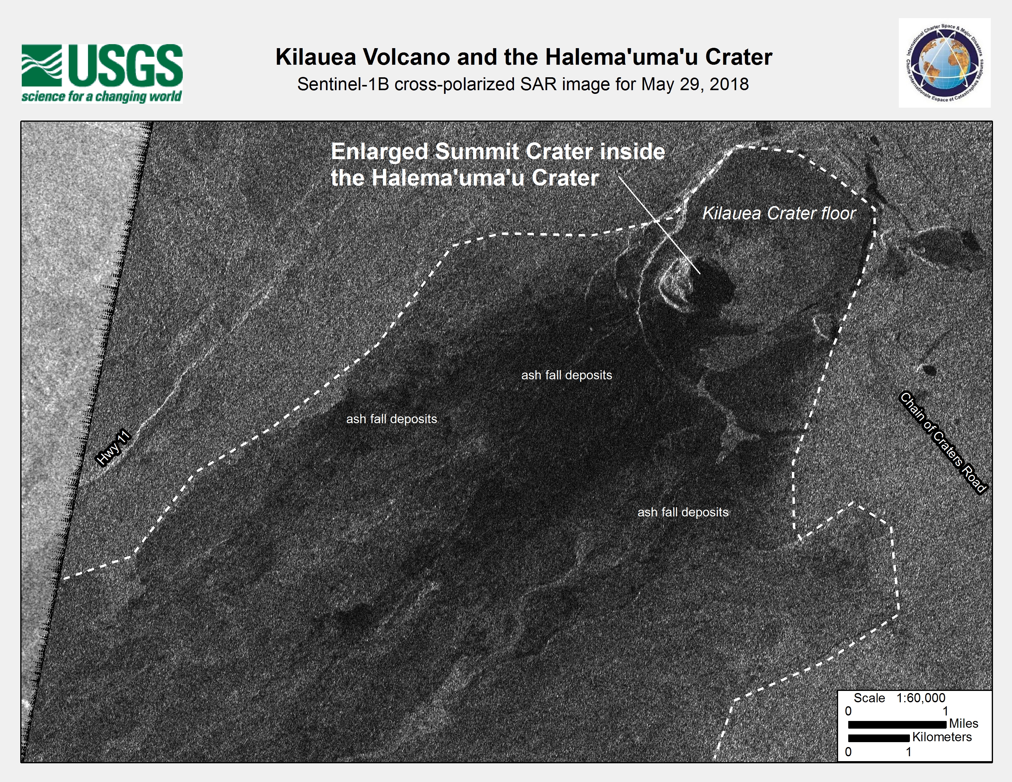
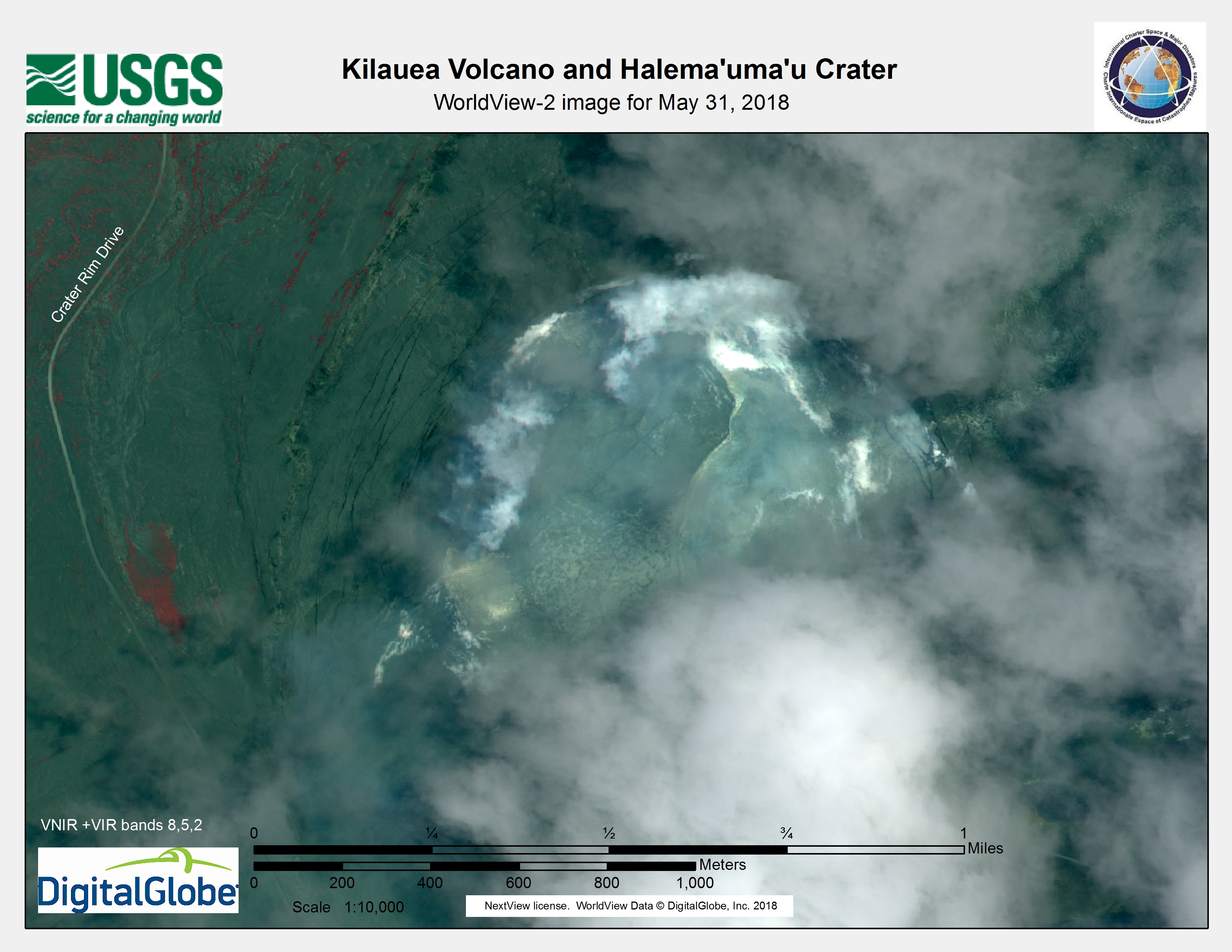
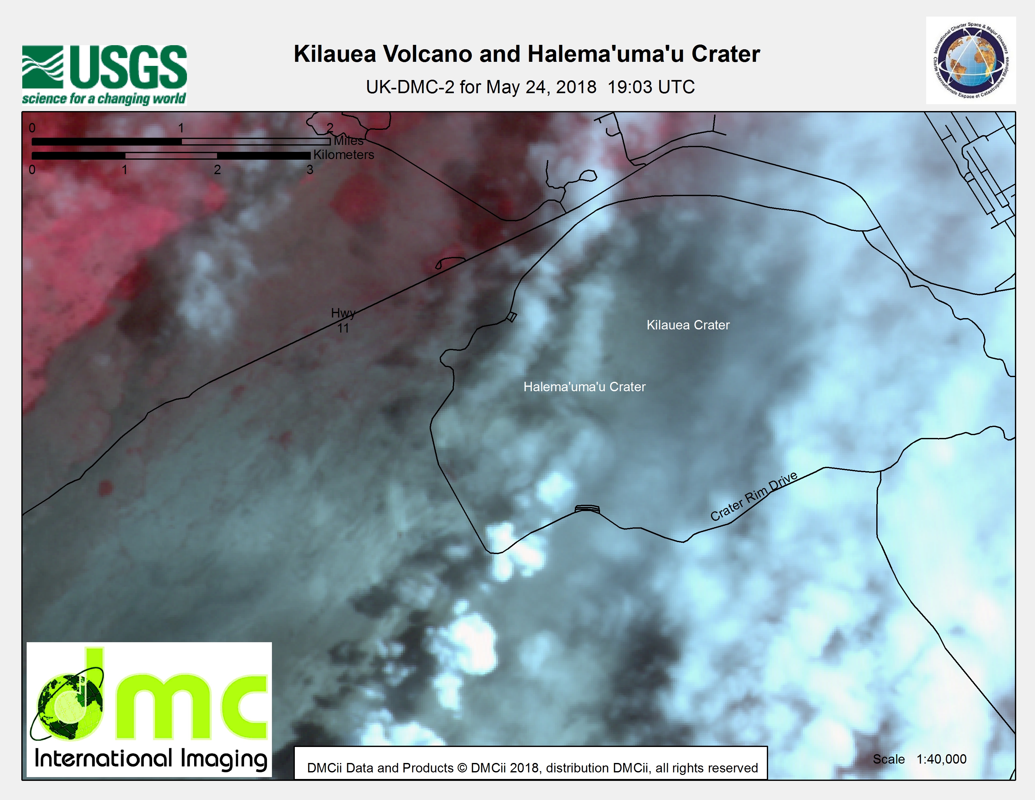
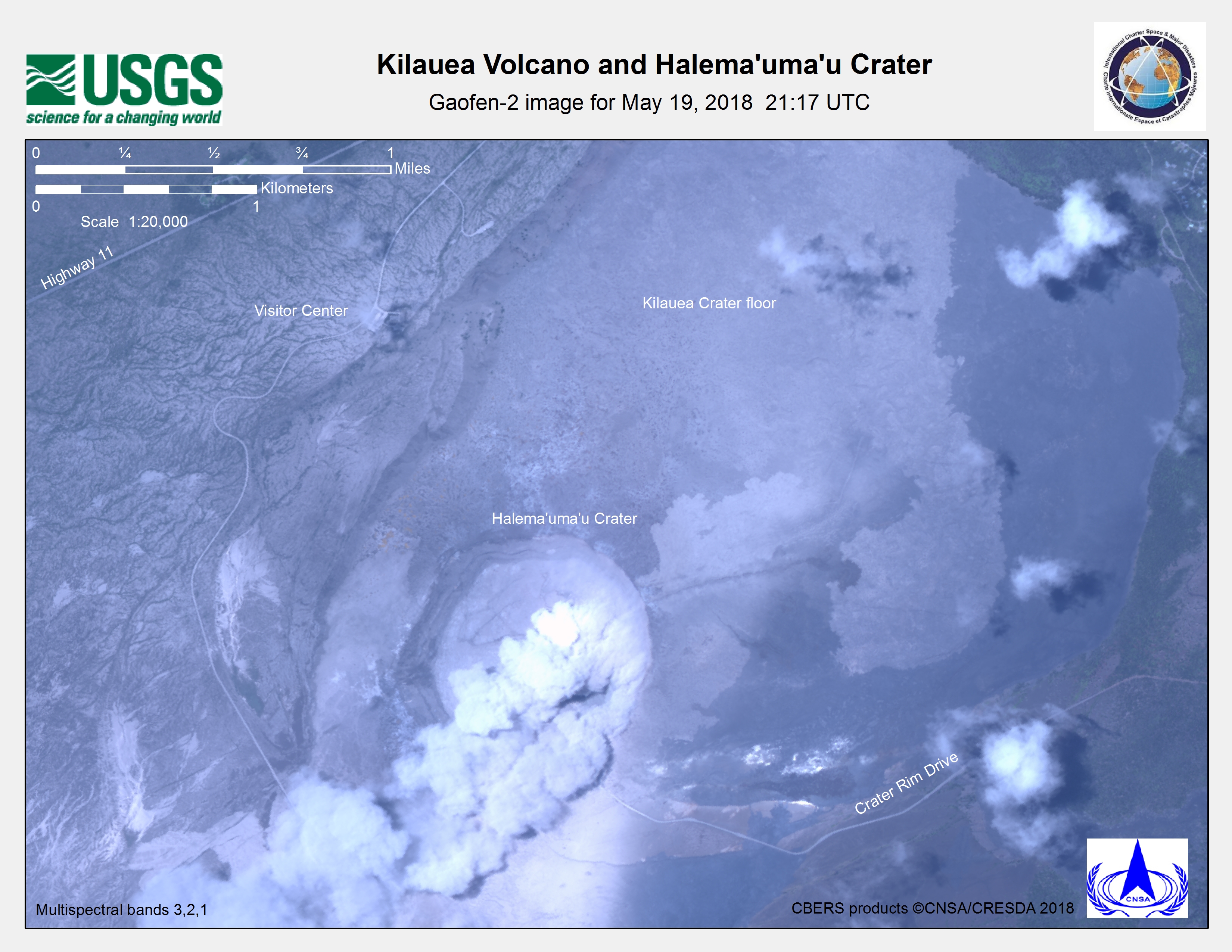
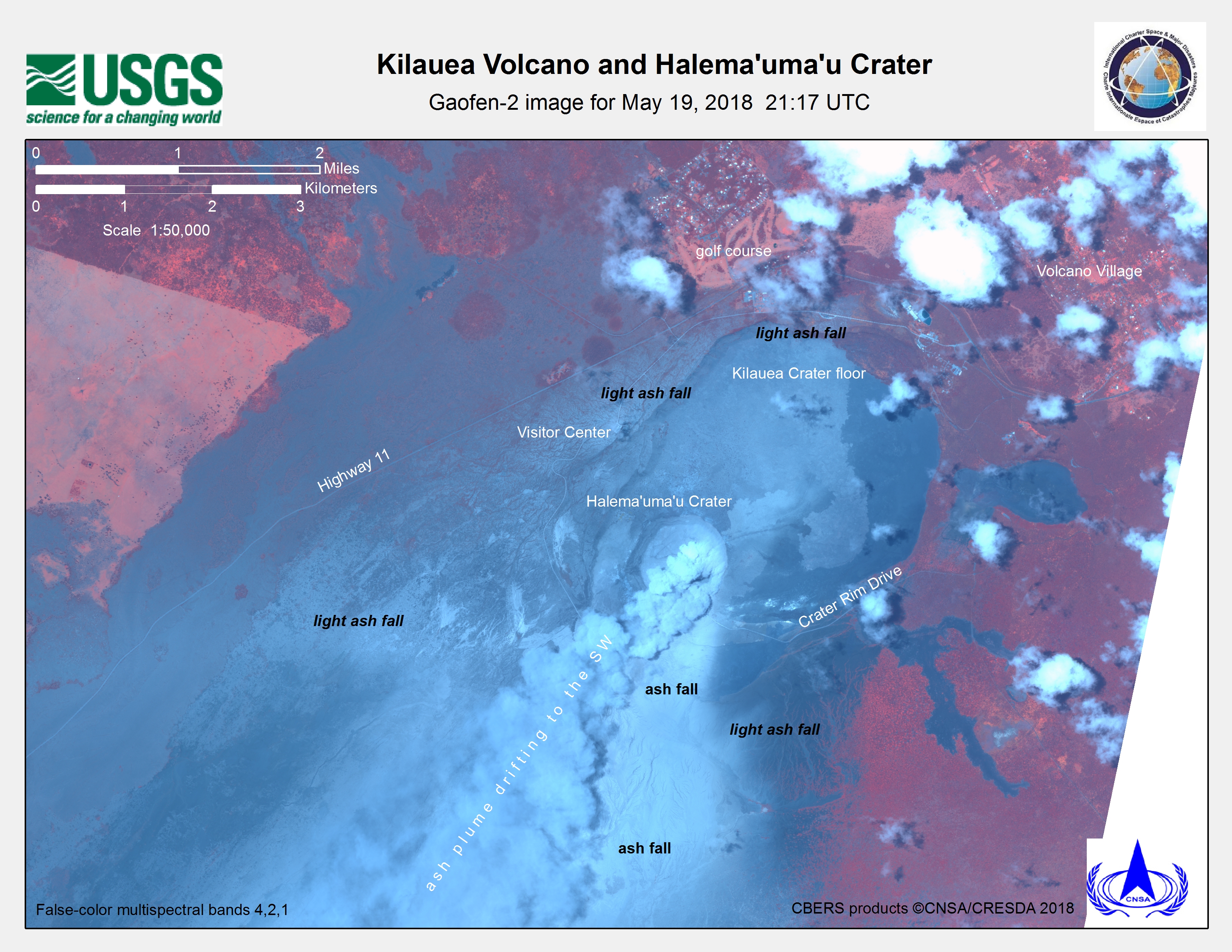
Kīlauea Volcano and the Halema'uma'u Crater
Direitos autorais: Sentinel-2 © Contains modified Copernicus Sentinel data (2018)
RADARSAT-2 Data and Products © Maxar Technologies Ltd. (2018) - All Rights Reserved. RADARSAT is an official trademark of the Canadian Space Agency.
Map produced by USGS
Information about the Product
Adquirida:
RADARSAT-2: 19/052018
Sentinel-2: 29/05/2018
Fonte: Sentinel-2 / RADARSAT-2
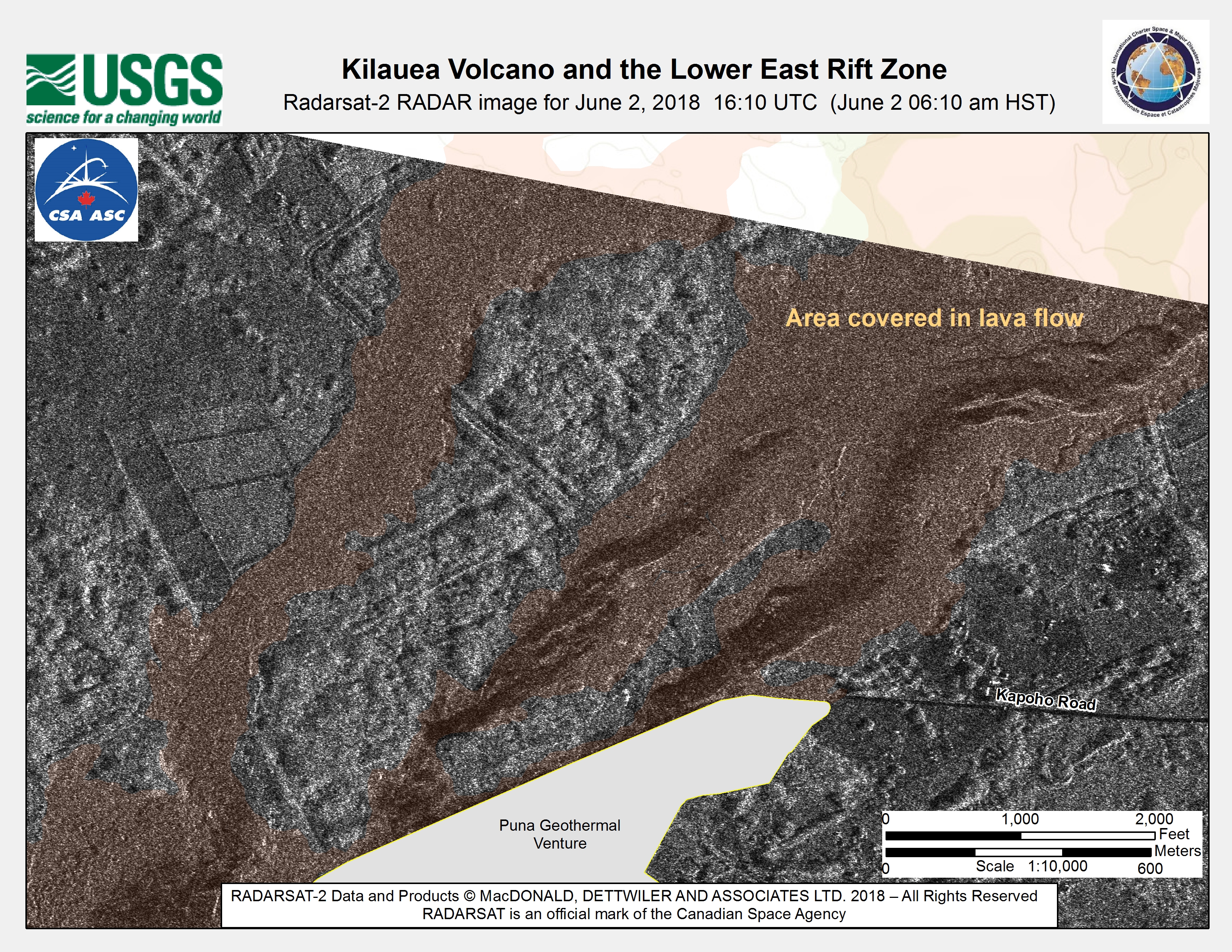
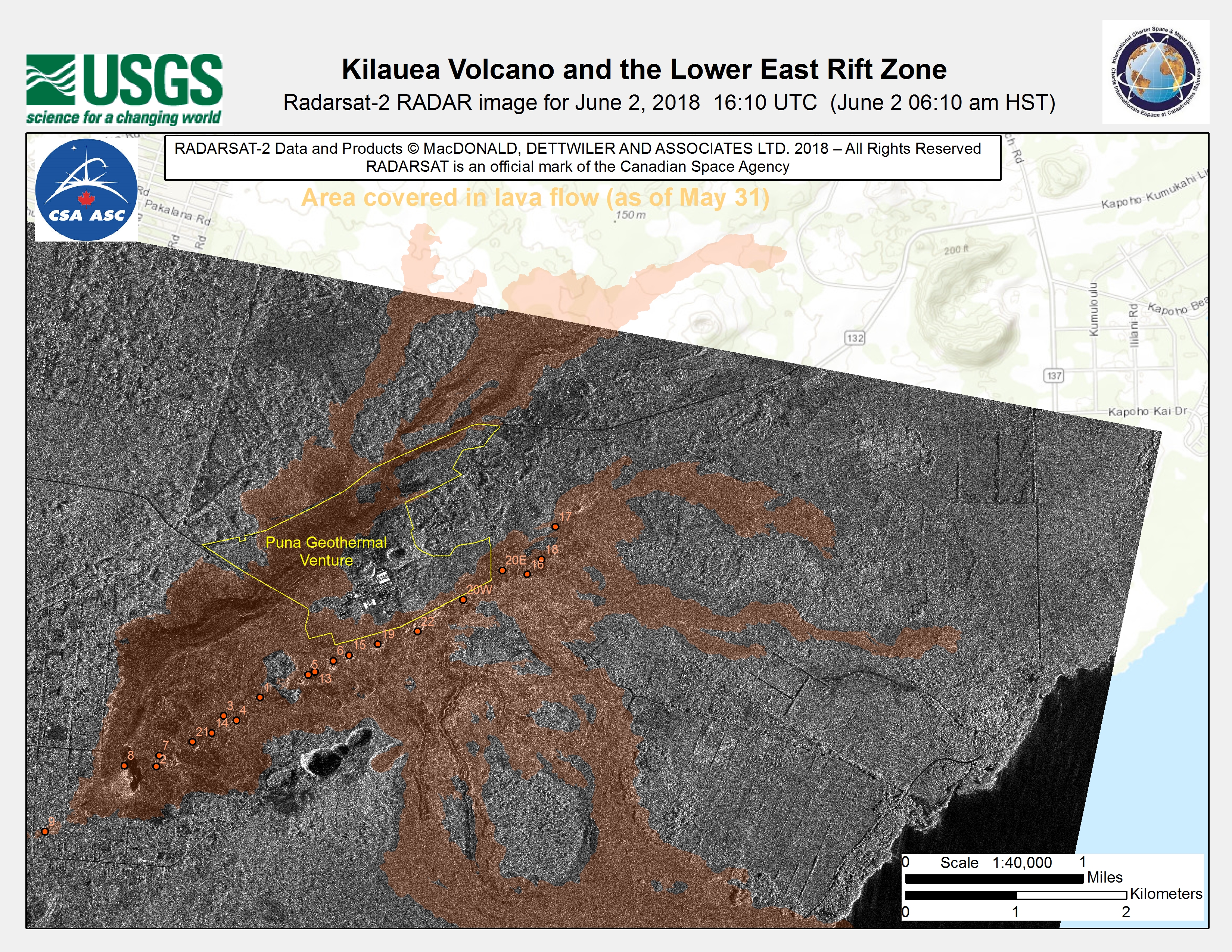
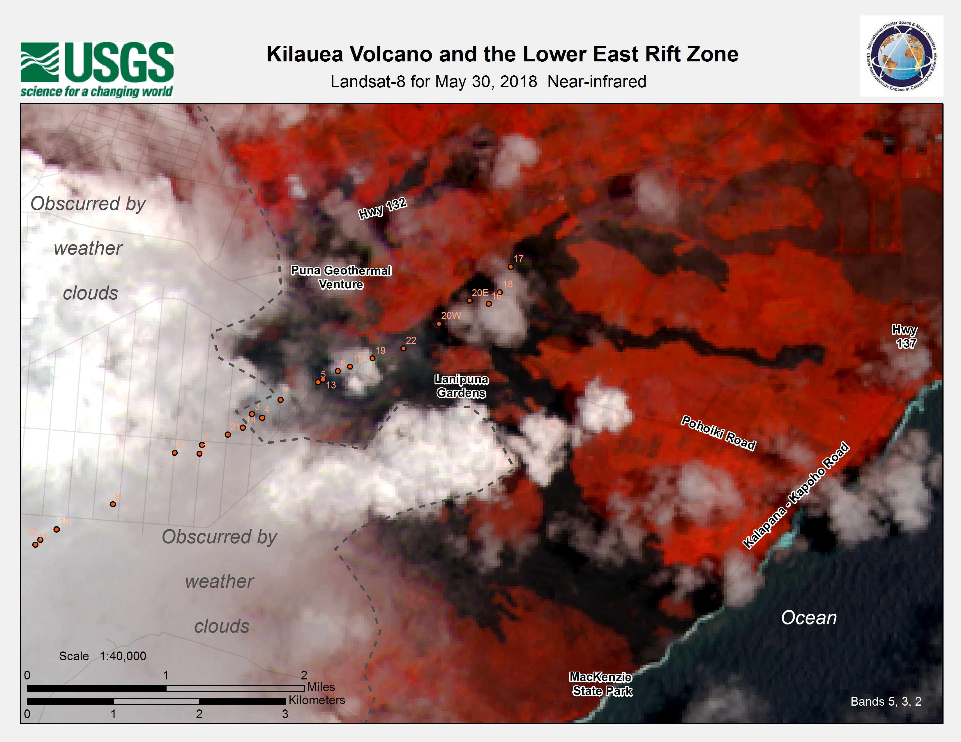
Kīlauea Volcano and the Lower East Rift Zone
Direitos autorais: RADARSAT-2 Data and Products © Maxar Technologies Ltd. (2018) - All Rights Reserved. RADARSAT is an official trademark of the Canadian Space Agency.
Map produced by USGS
Information about the Product
Adquirida: 02/06/2018
Fonte: RADARSAT-2
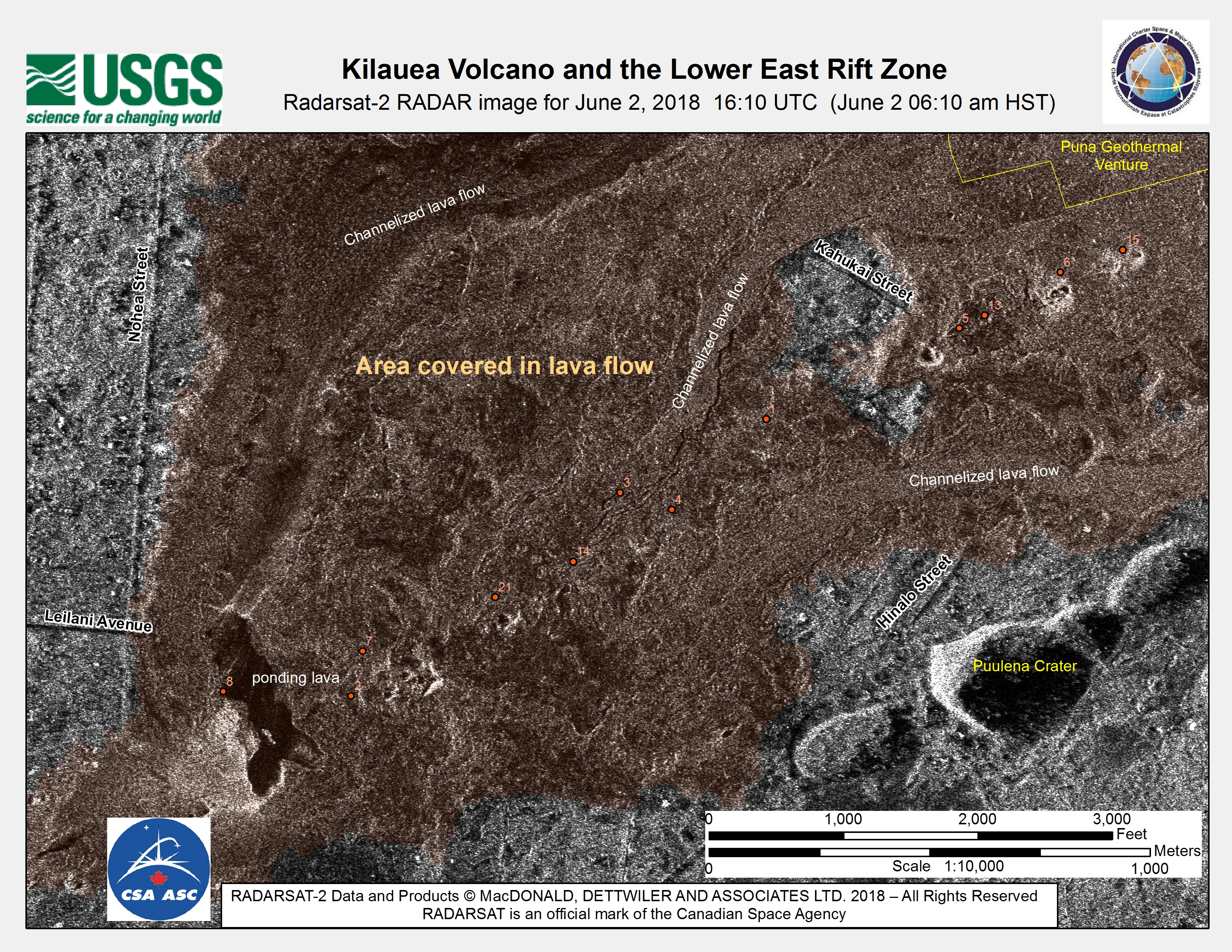
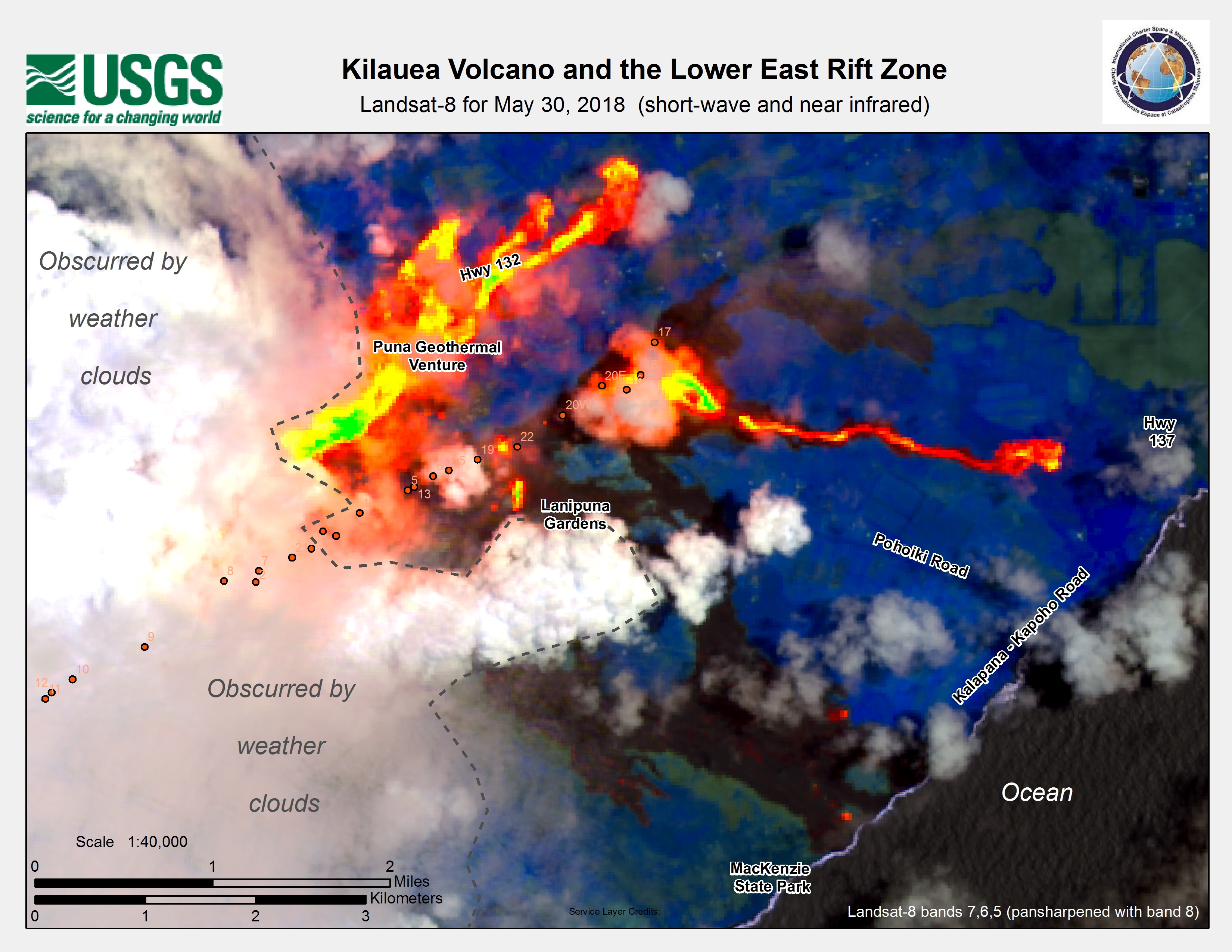

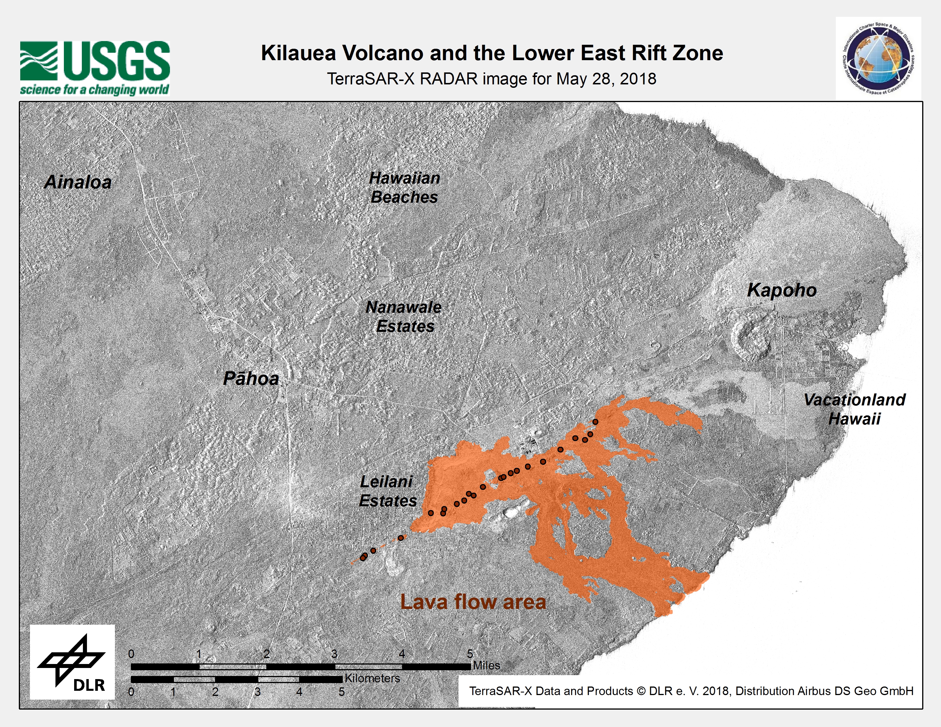

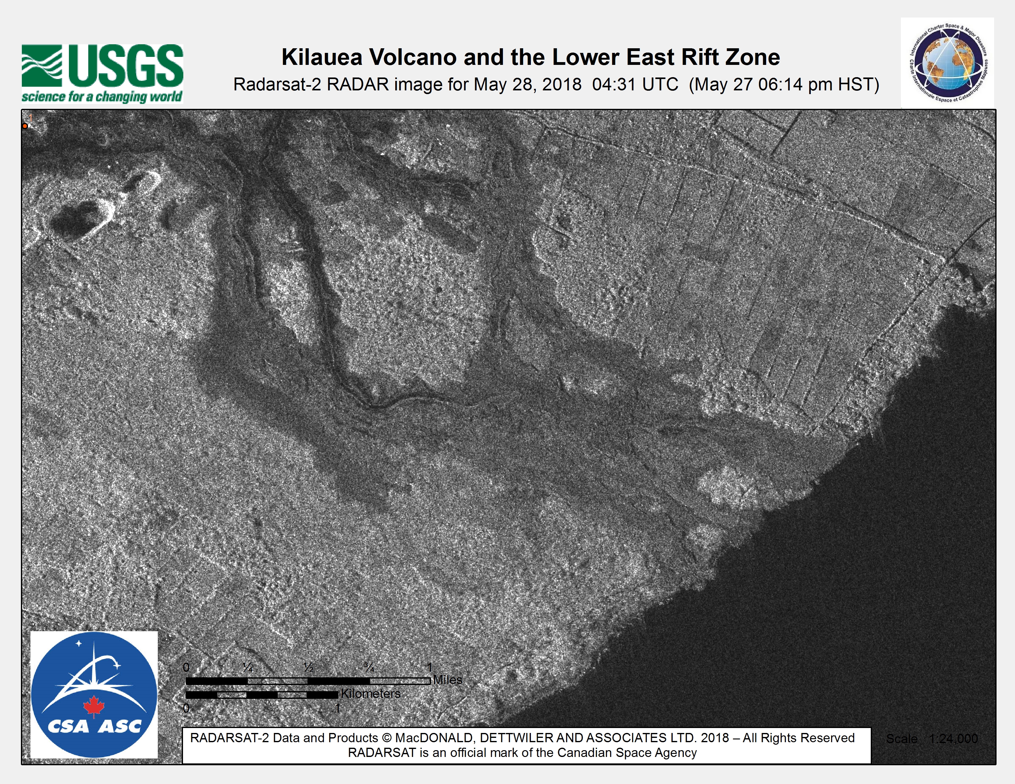
Kīlauea Volcano and the Lower East Rift Zone
Direitos autorais: RADARSAT-2 Data and Products © Maxar Technologies Ltd. (2018) - All Rights Reserved. RADARSAT is an official trademark of the Canadian Space Agency.
Map produced by USGS
Information about the Product
Adquirida: 28/05/2018
Fonte: RADARSAT-2
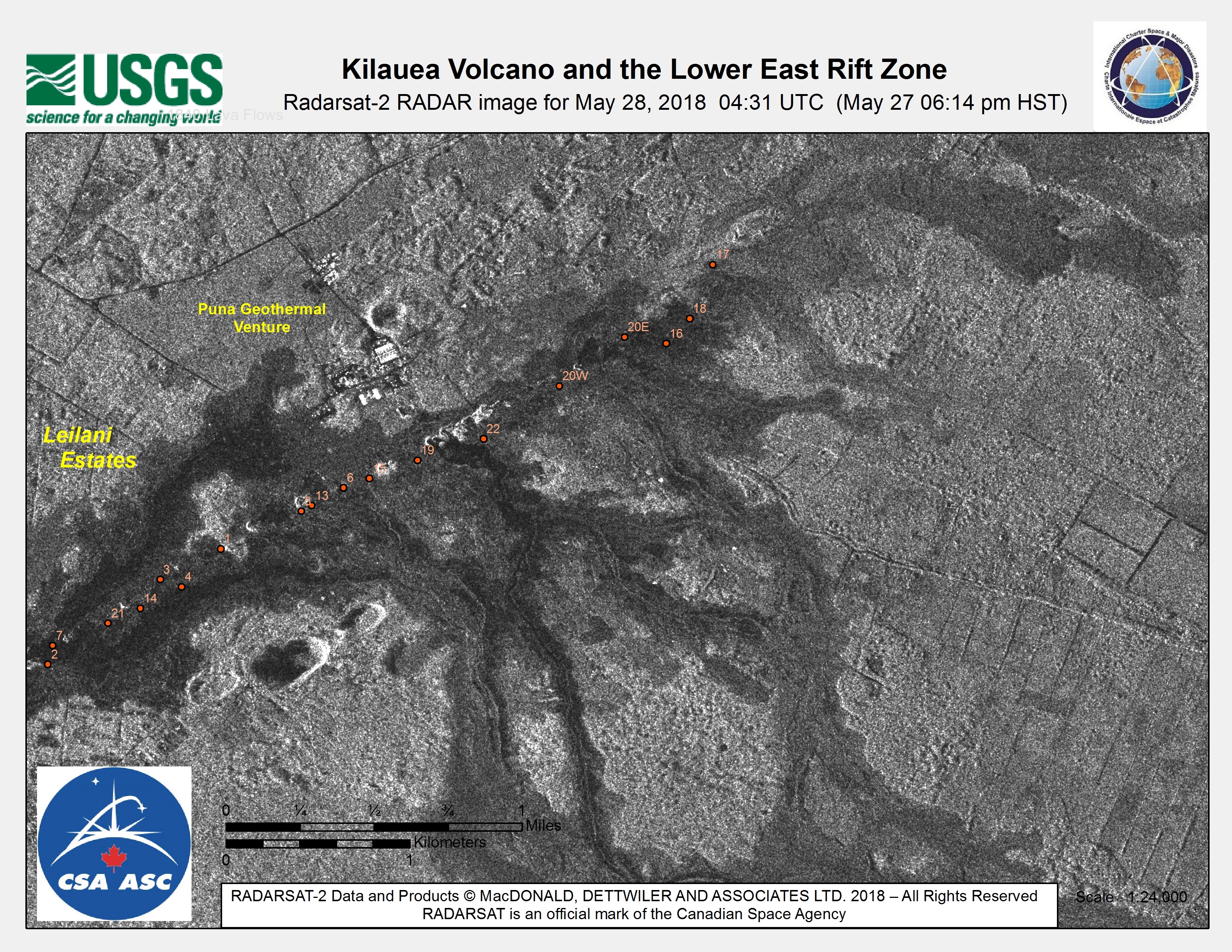
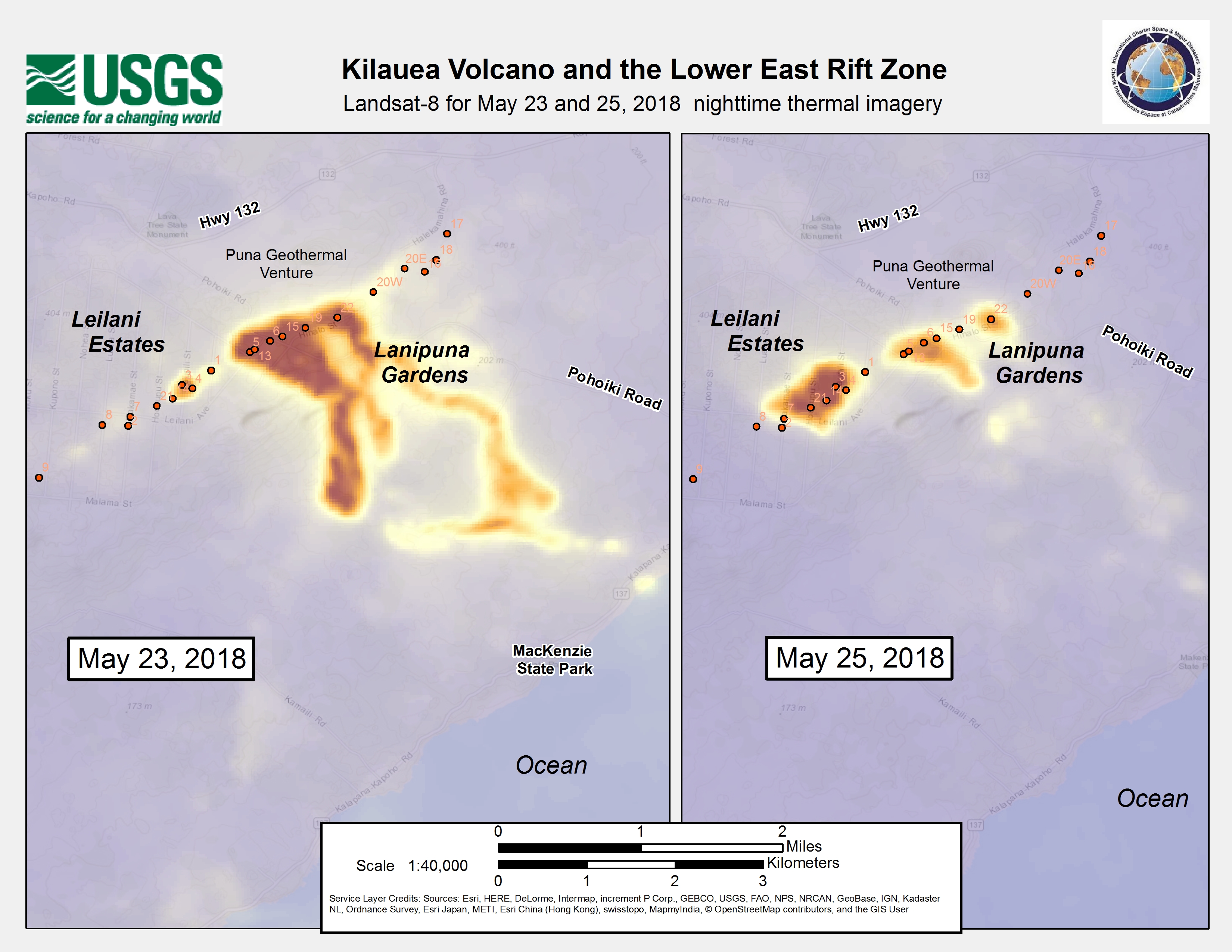
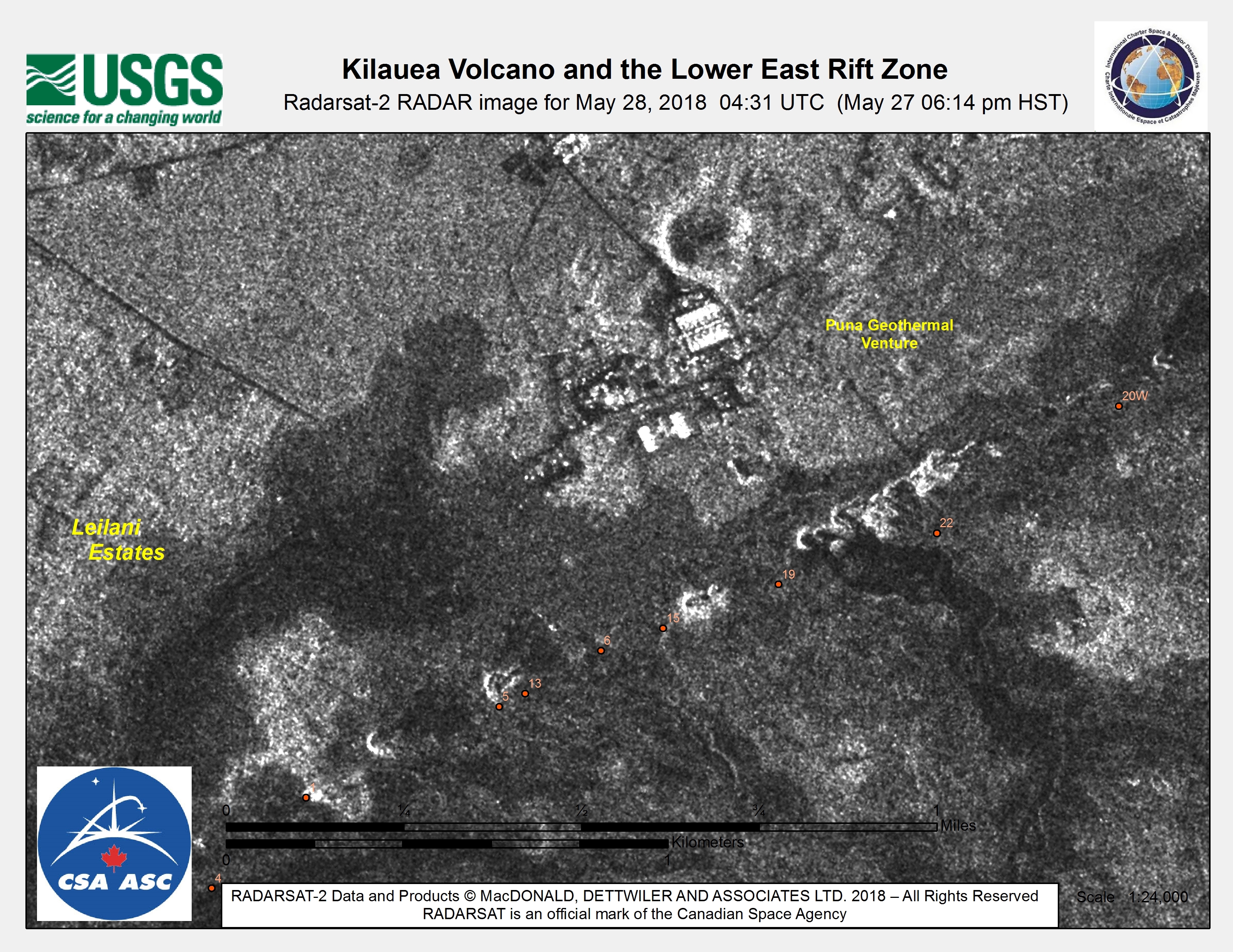
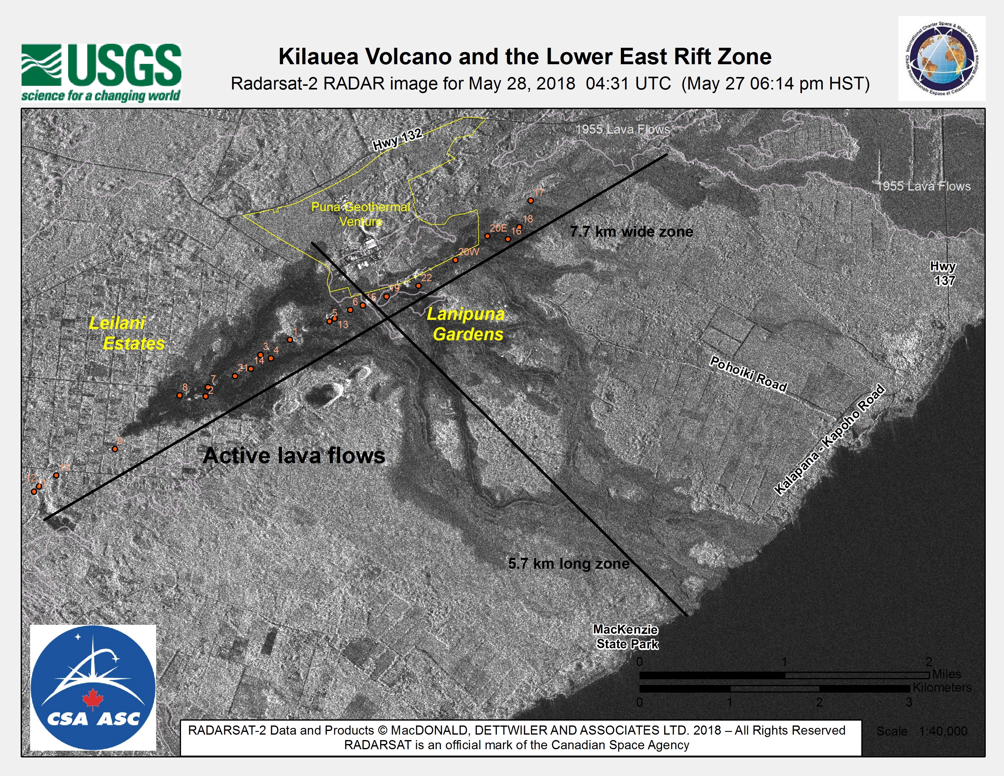
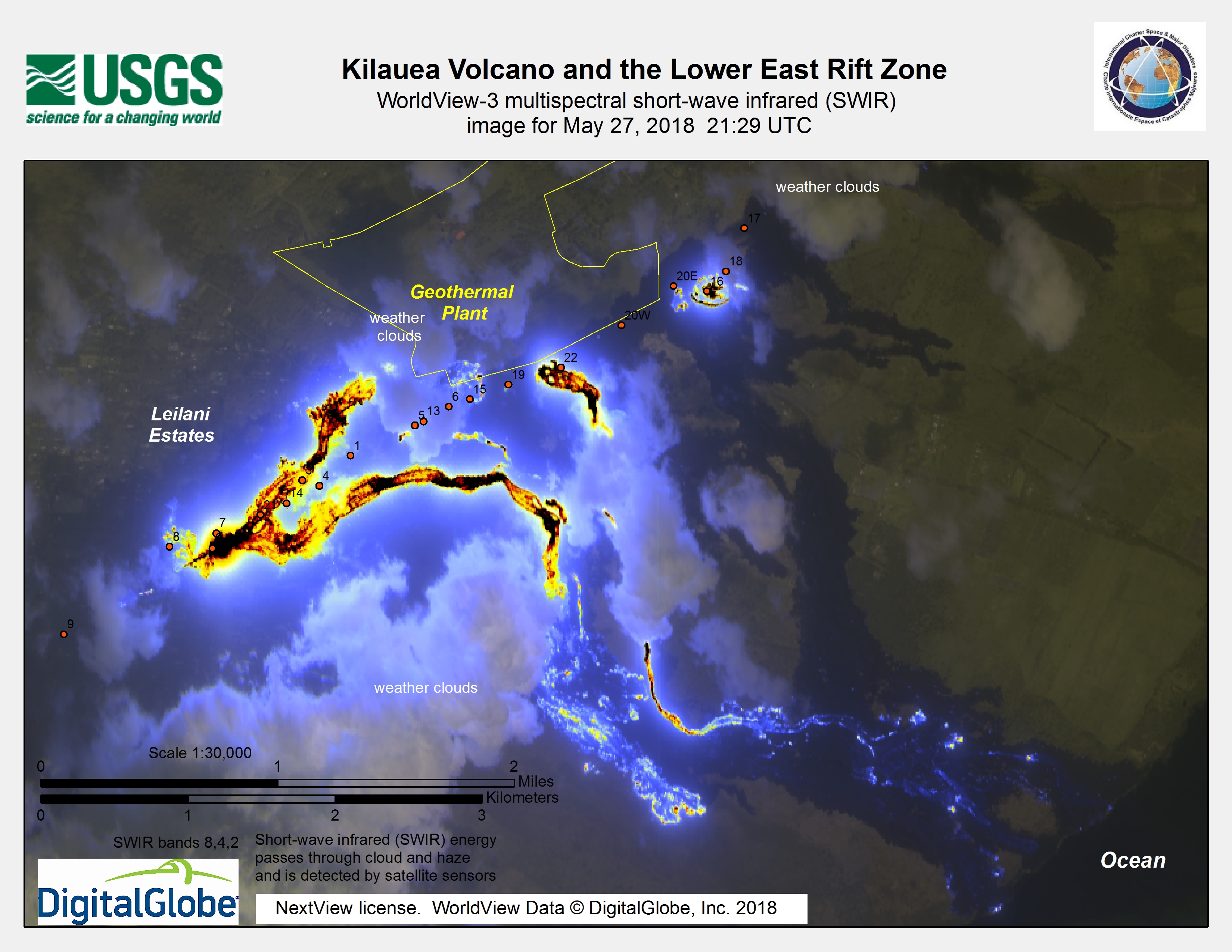
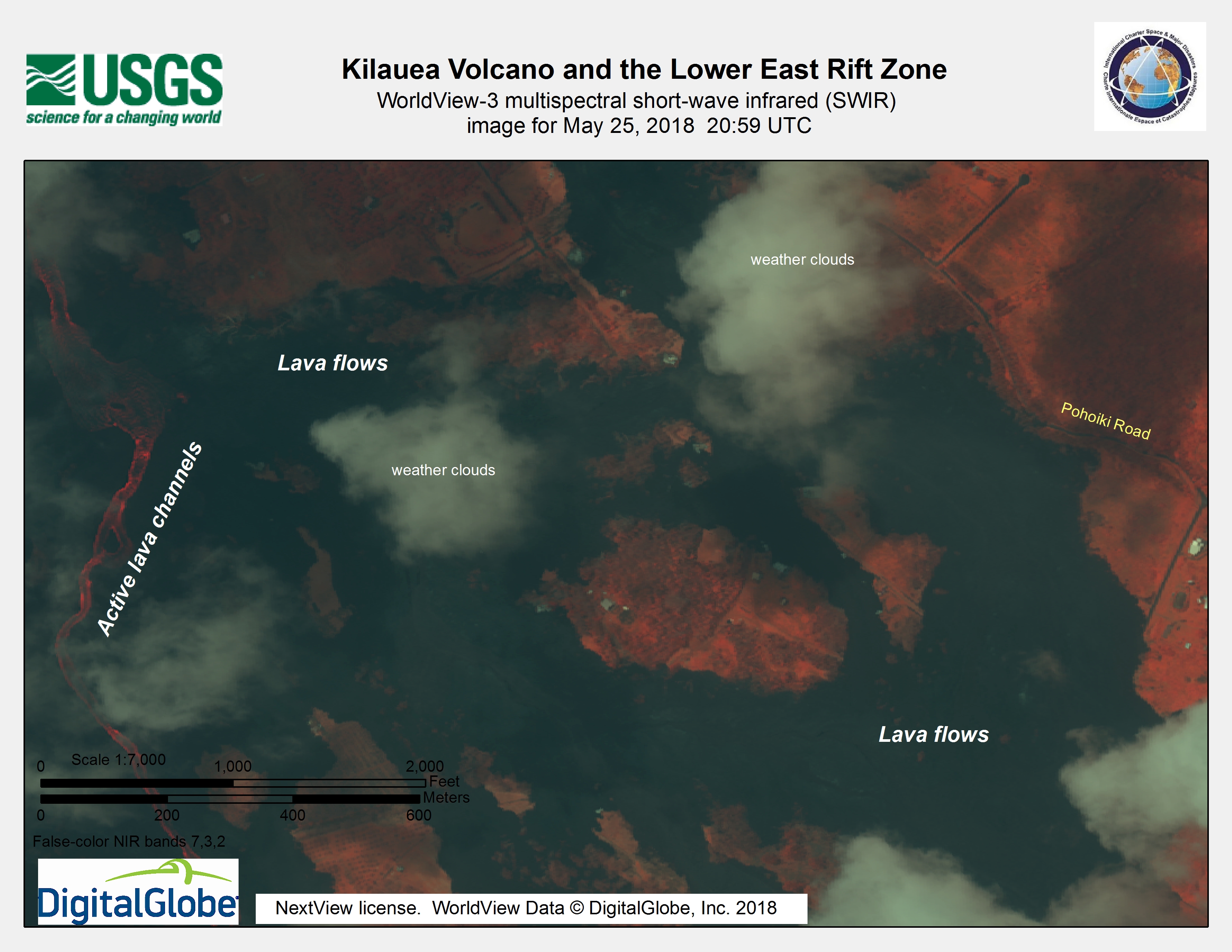
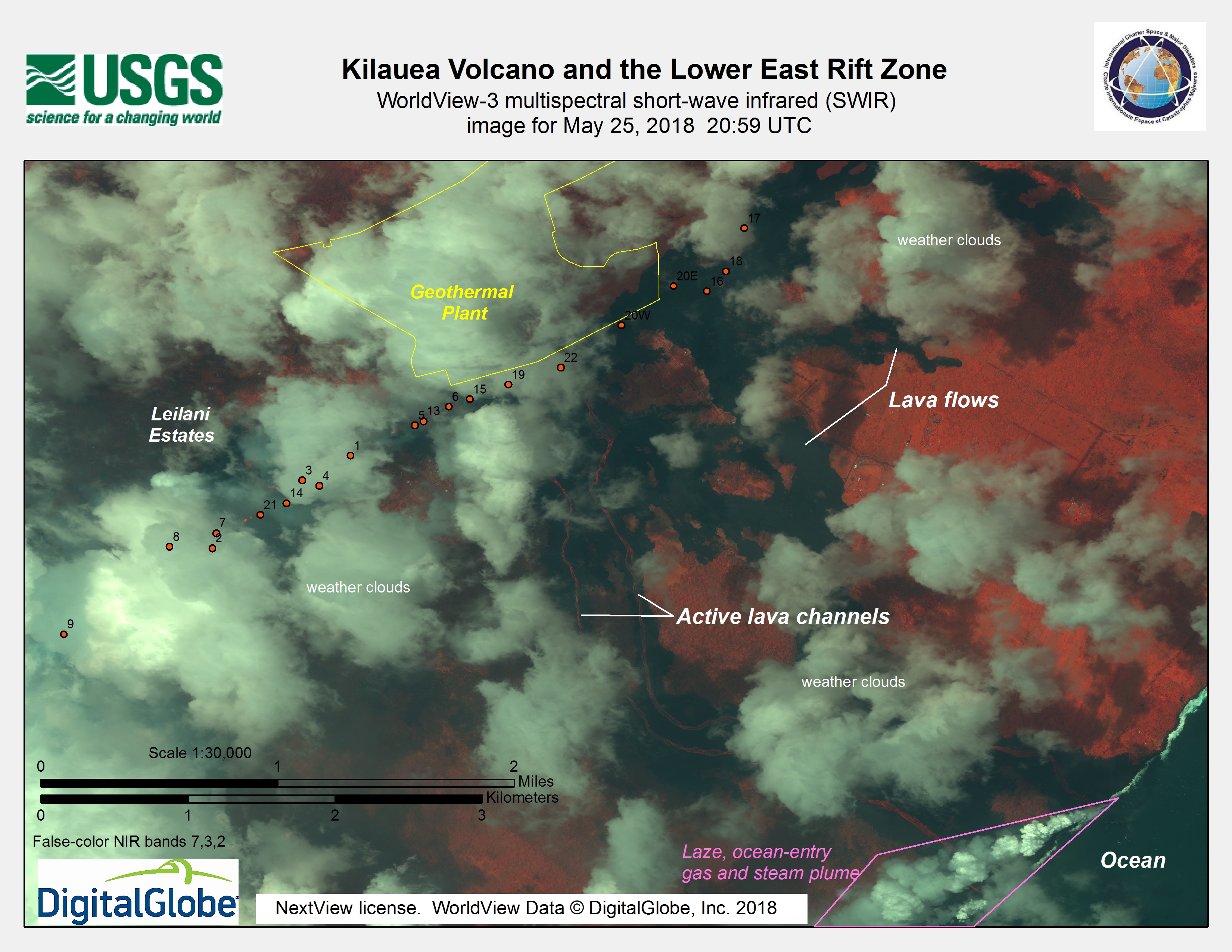
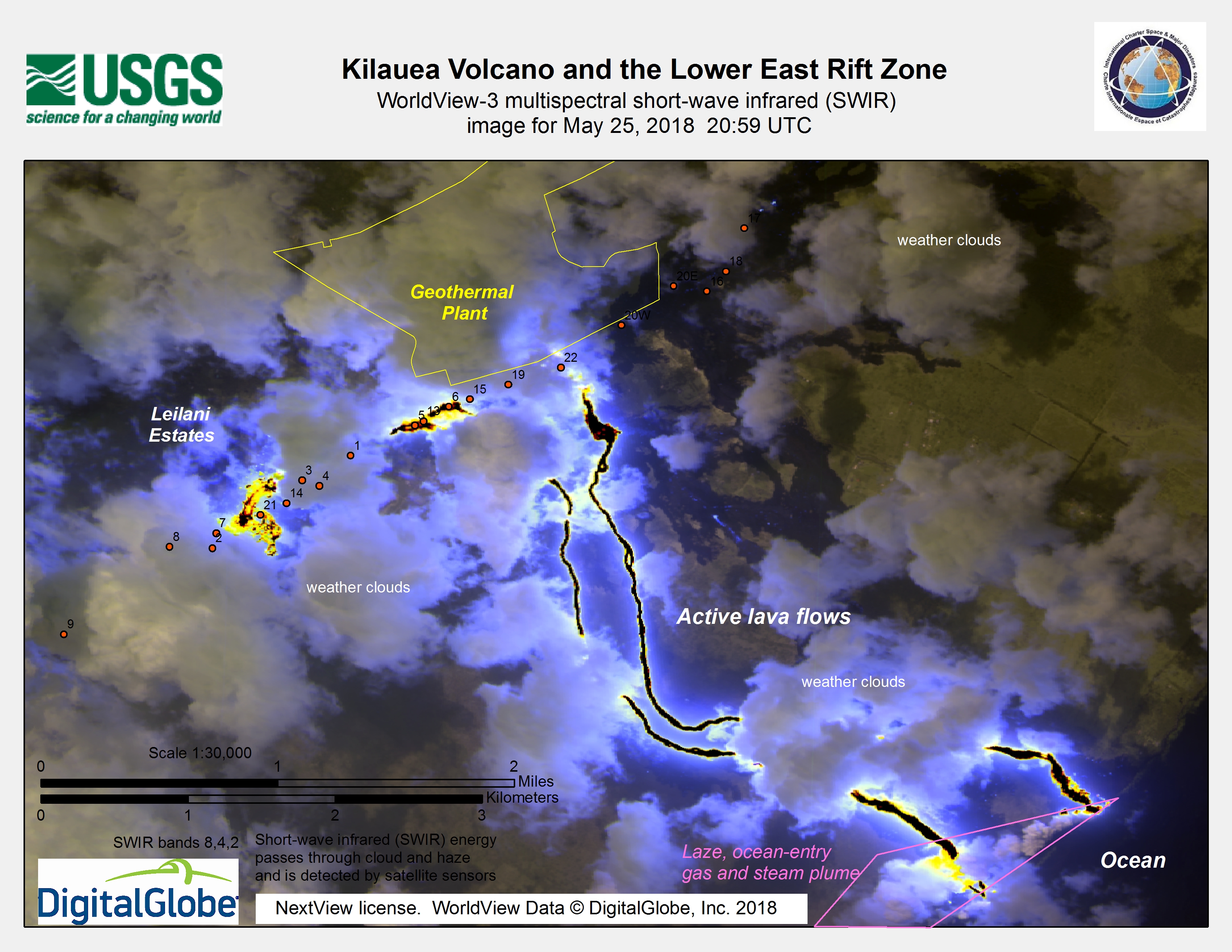
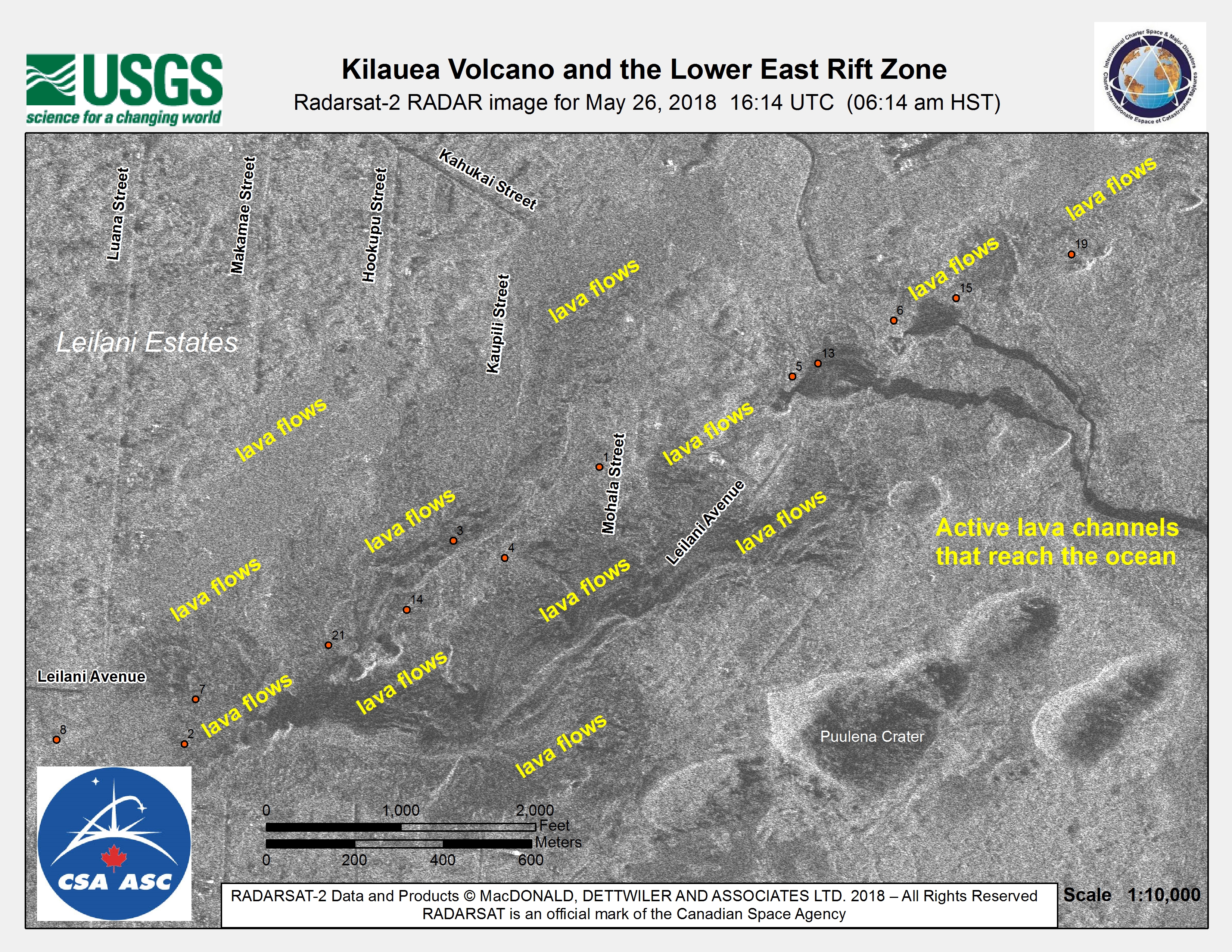
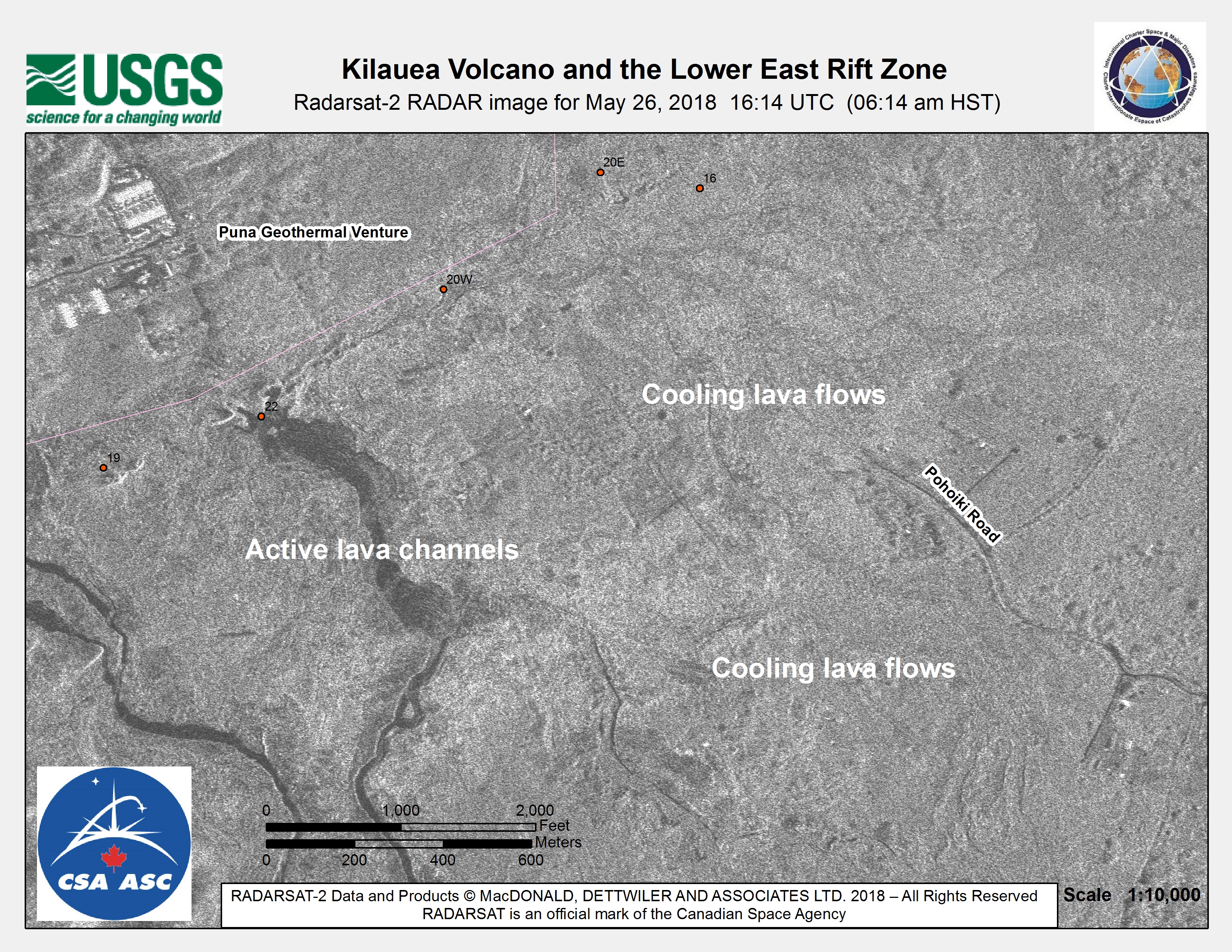
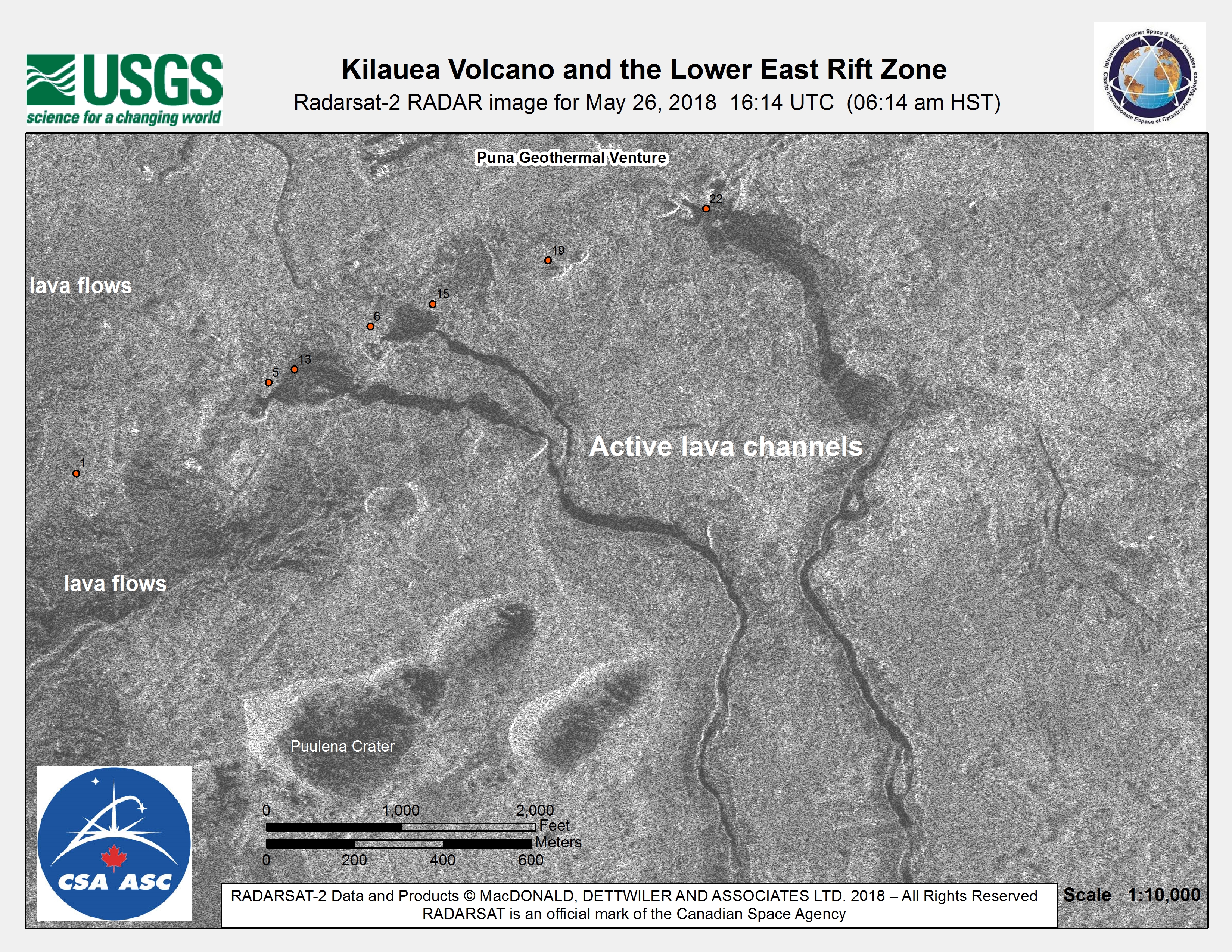
Kīlauea Volcano and the Lower East Rift Zone
Direitos autorais: RADARSAT-2 Data and Products © Maxar Technologies Ltd. (2018) - All Rights Reserved. RADARSAT is an official trademark of the Canadian Space Agency.
Map produced by USGS
Information about the Product
Adquirida: 26/05/2018
Fonte: RADARSAT-2
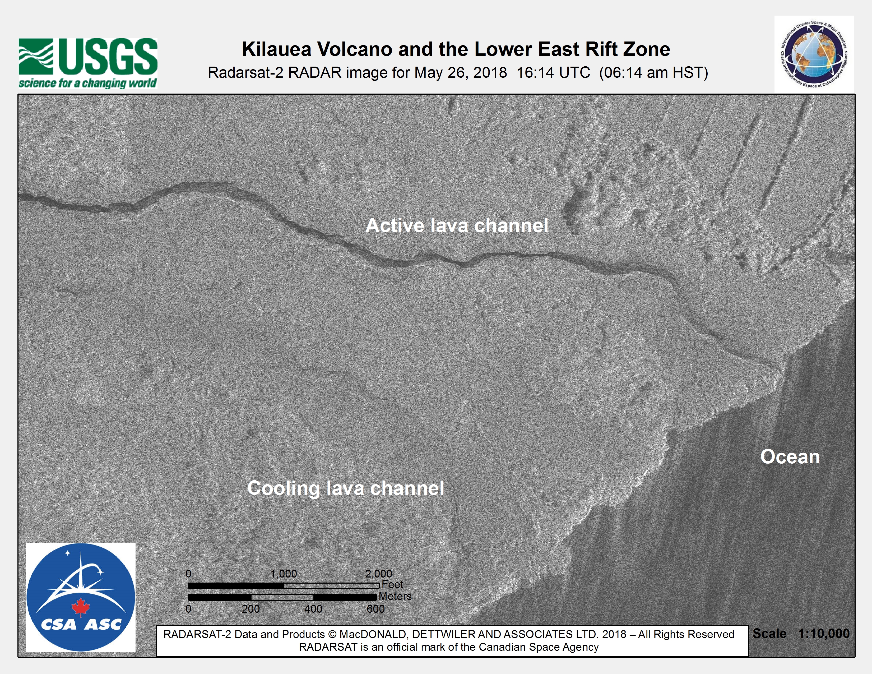
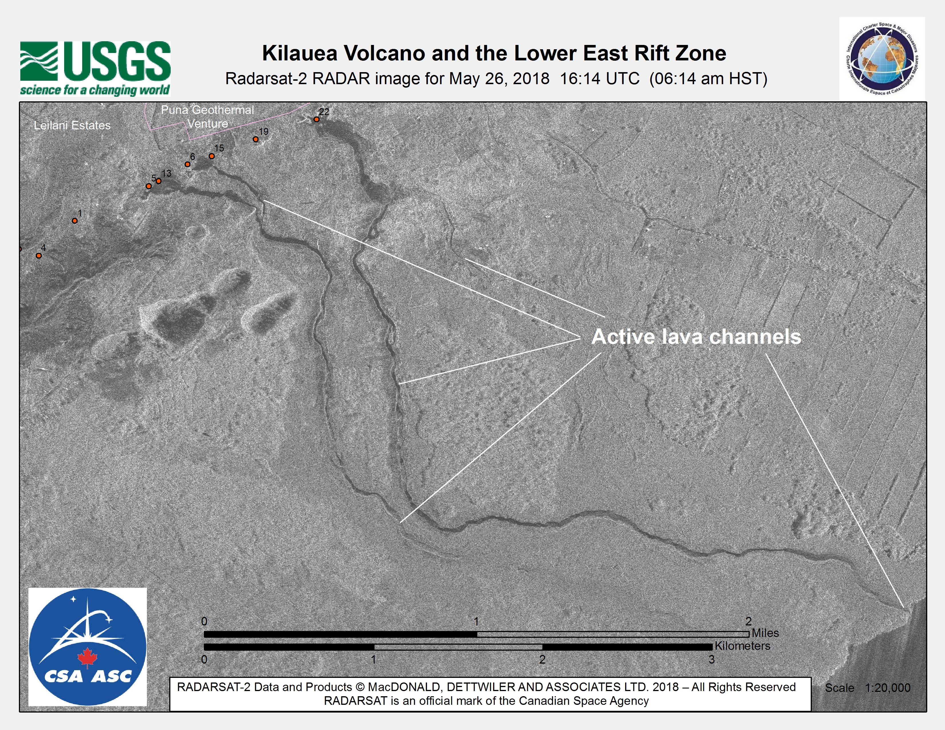
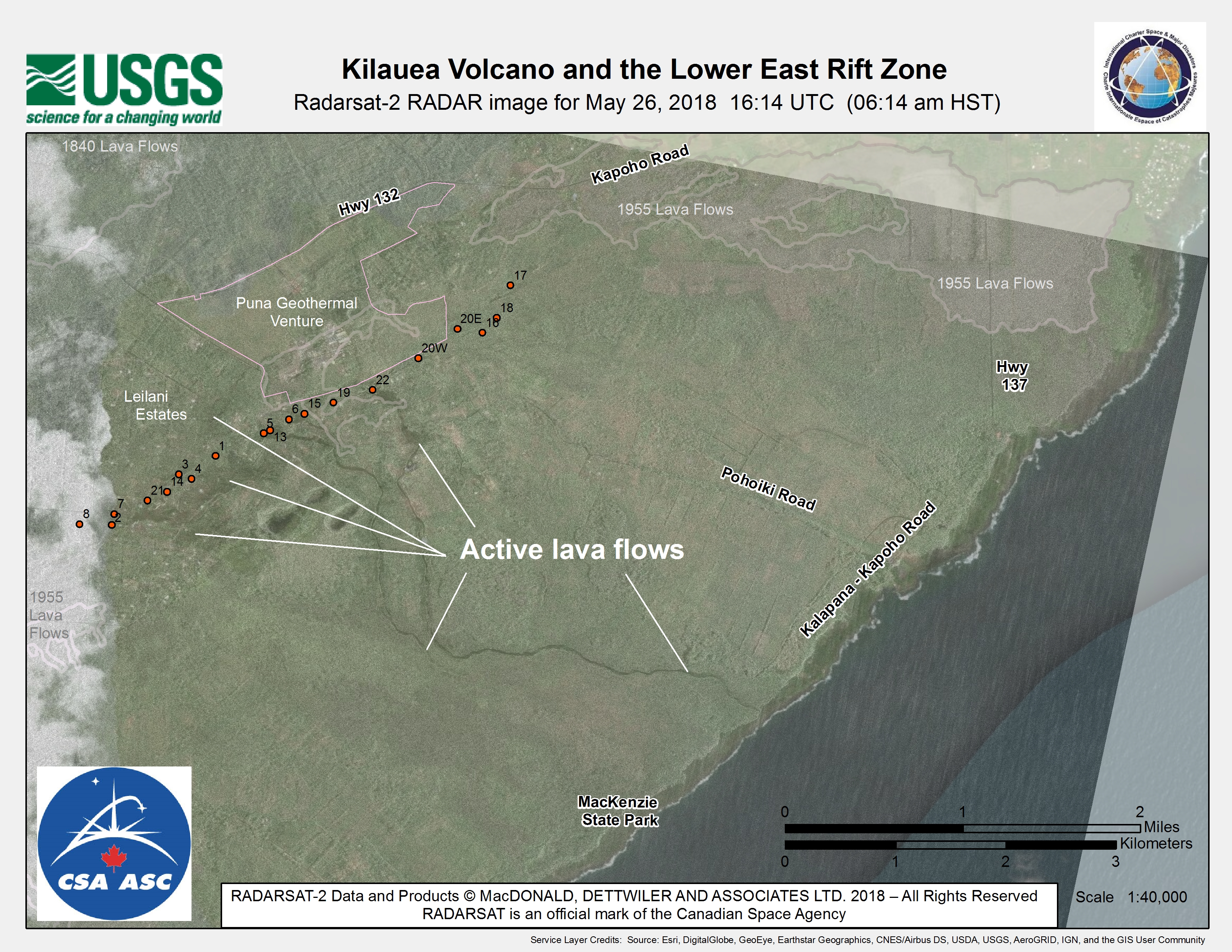

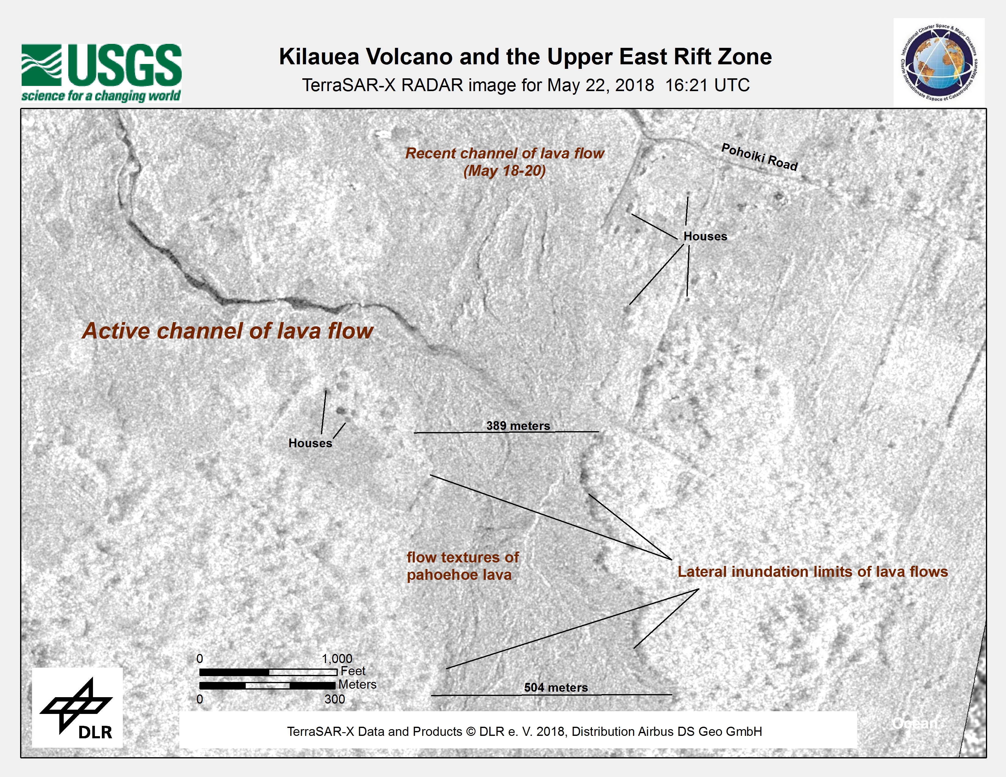
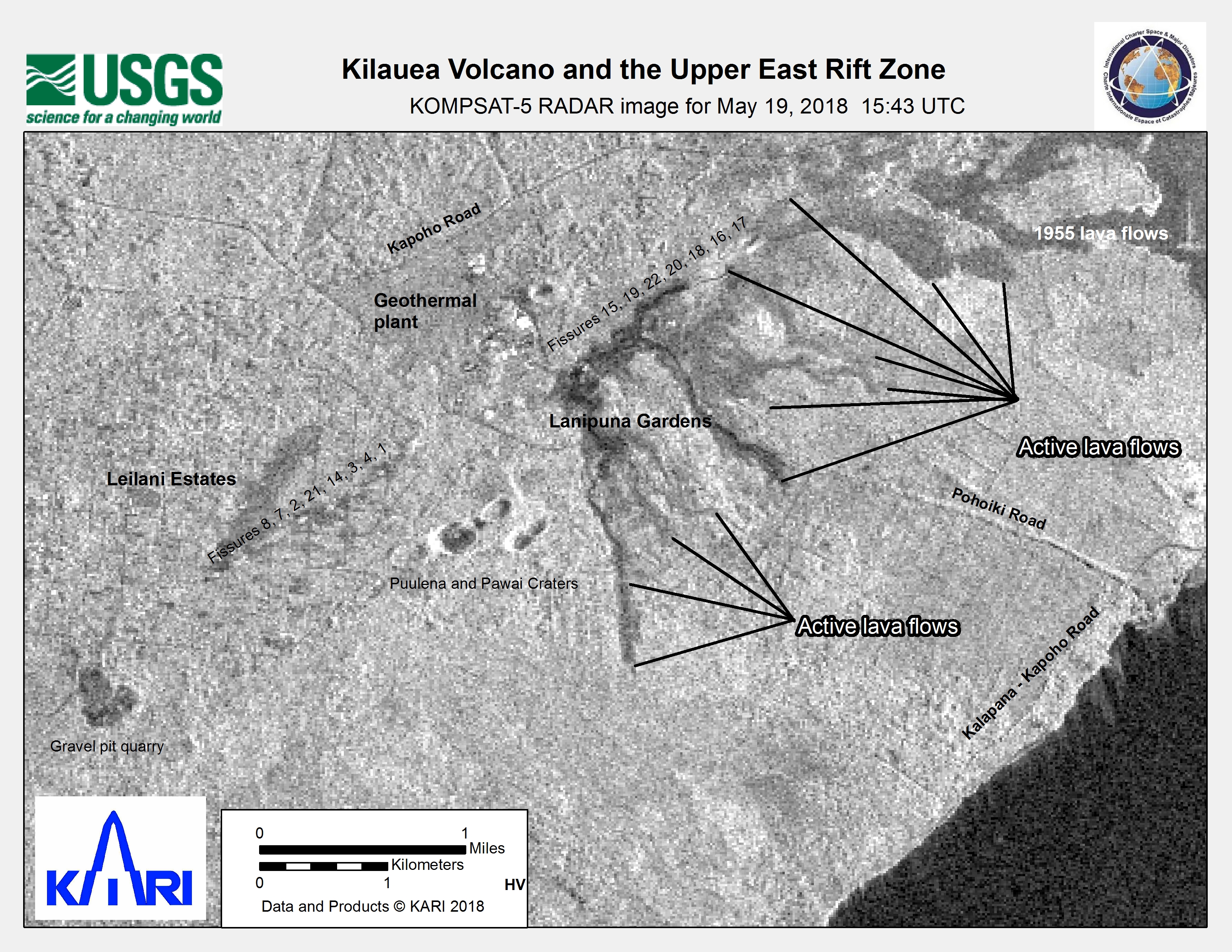
Kīlauea Volcano and the Upper East Rift Zone
Direitos autorais: RADARSAT-2 Data and Products © Maxar Technologies Ltd. (2018) - All Rights Reserved. RADARSAT is an official trademark of the Canadian Space Agency.
Map produced by USGS
Information about the Product
Adquirida: 26/05/2018
Fonte: RADARSAT-2
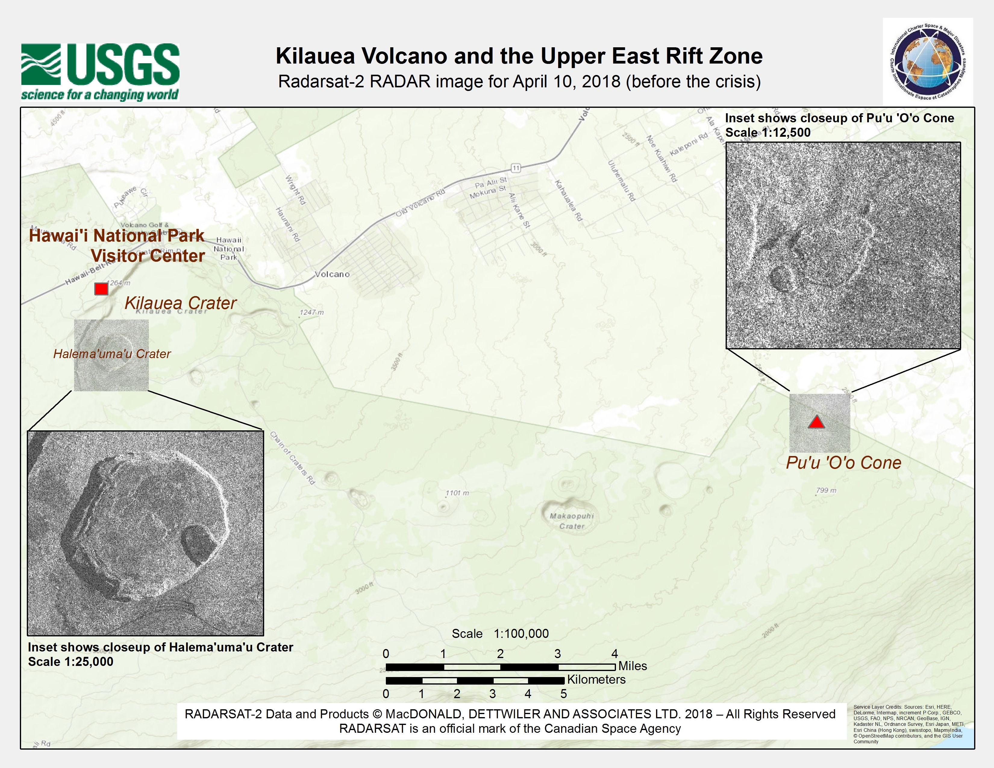
Damage assessment map of Kīlauea Volcano and the upper east rift zone
Direitos autorais: RADARSAT-2 Data and Products © Maxar Technologies Ltd. (2018) - All Rights Reserved. RADARSAT is an official trademark of the Canadian Space Agency.
Map produced by USGS
Information about the Product
Adquirida: 10/04/2018
Fonte: RADARSAT-2
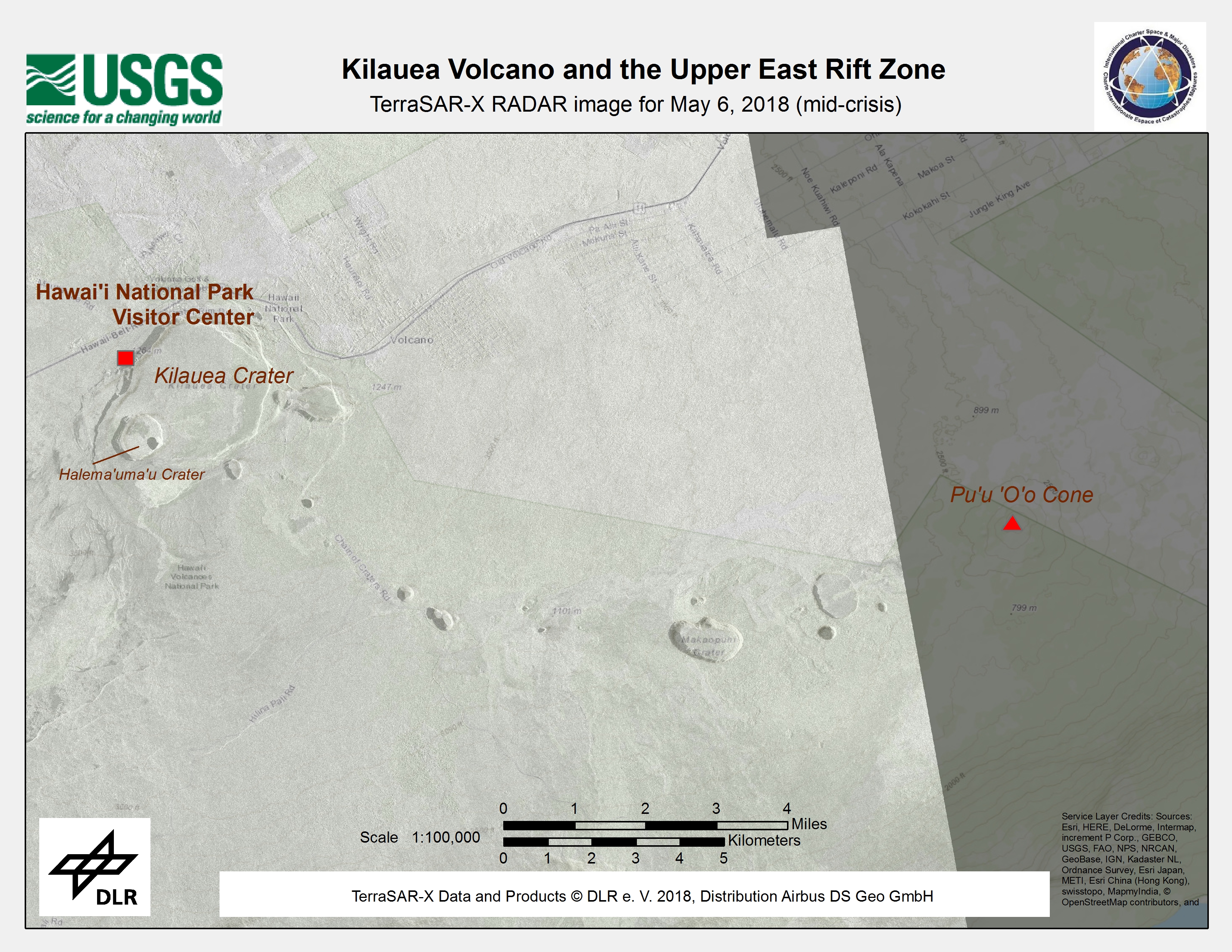
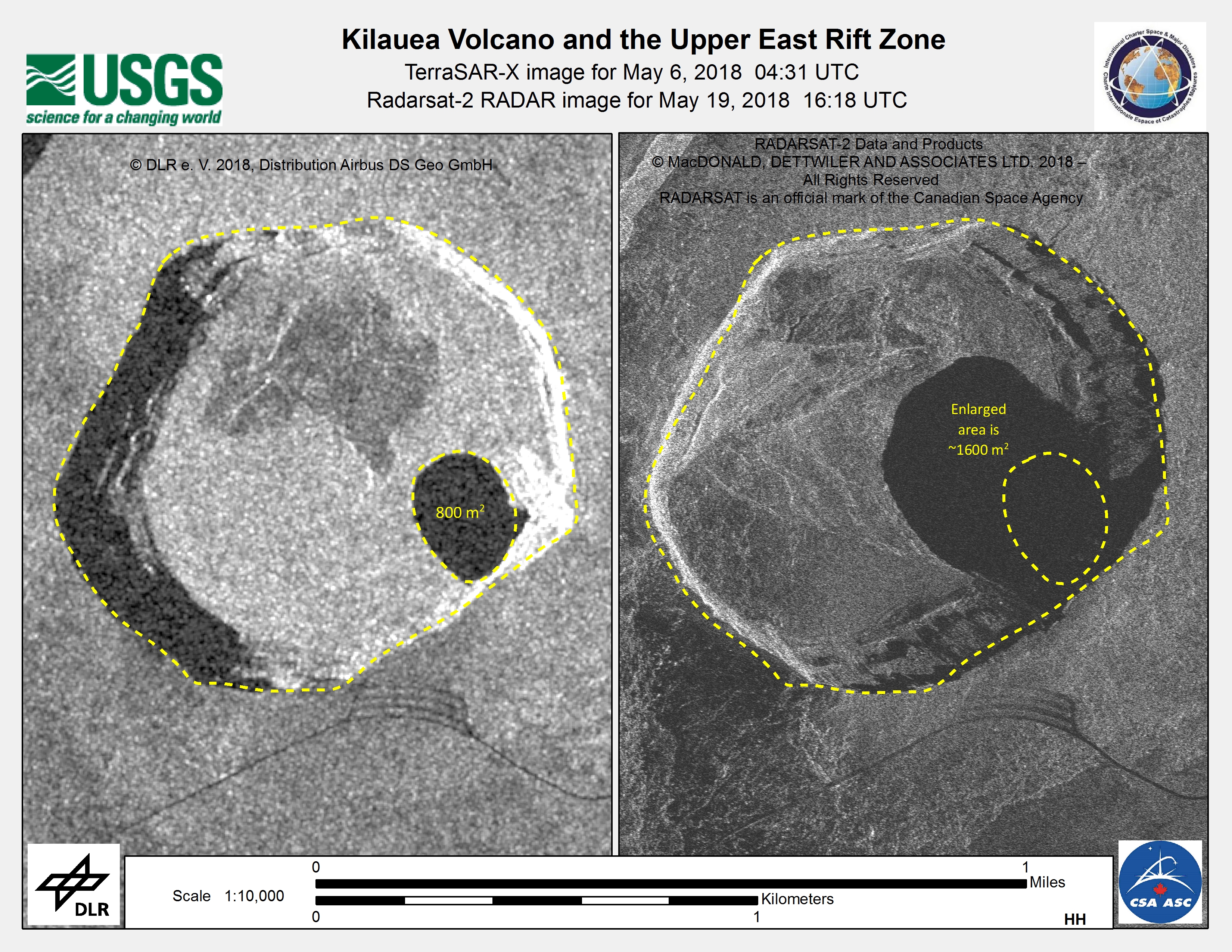
Damage assessment map of Kīlauea Volcano and the upper east rift zone
Direitos autorais: TerraSAR-X © DLR e. V. 2018, Distribution: Airbus DS Geo GmbH
RADARSAT-2 Data and Products © Maxar Technologies Ltd. (2018) - All Rights Reserved. RADARSAT is an official trademark of the Canadian Space Agency.
Map produced by USGS
Information about the Product
Adquirida: TerraSAR-X : 06/05/2018
RADARSAT-2: 19/05/2018
Fonte: TerraSAR-X / RADARSAT-2
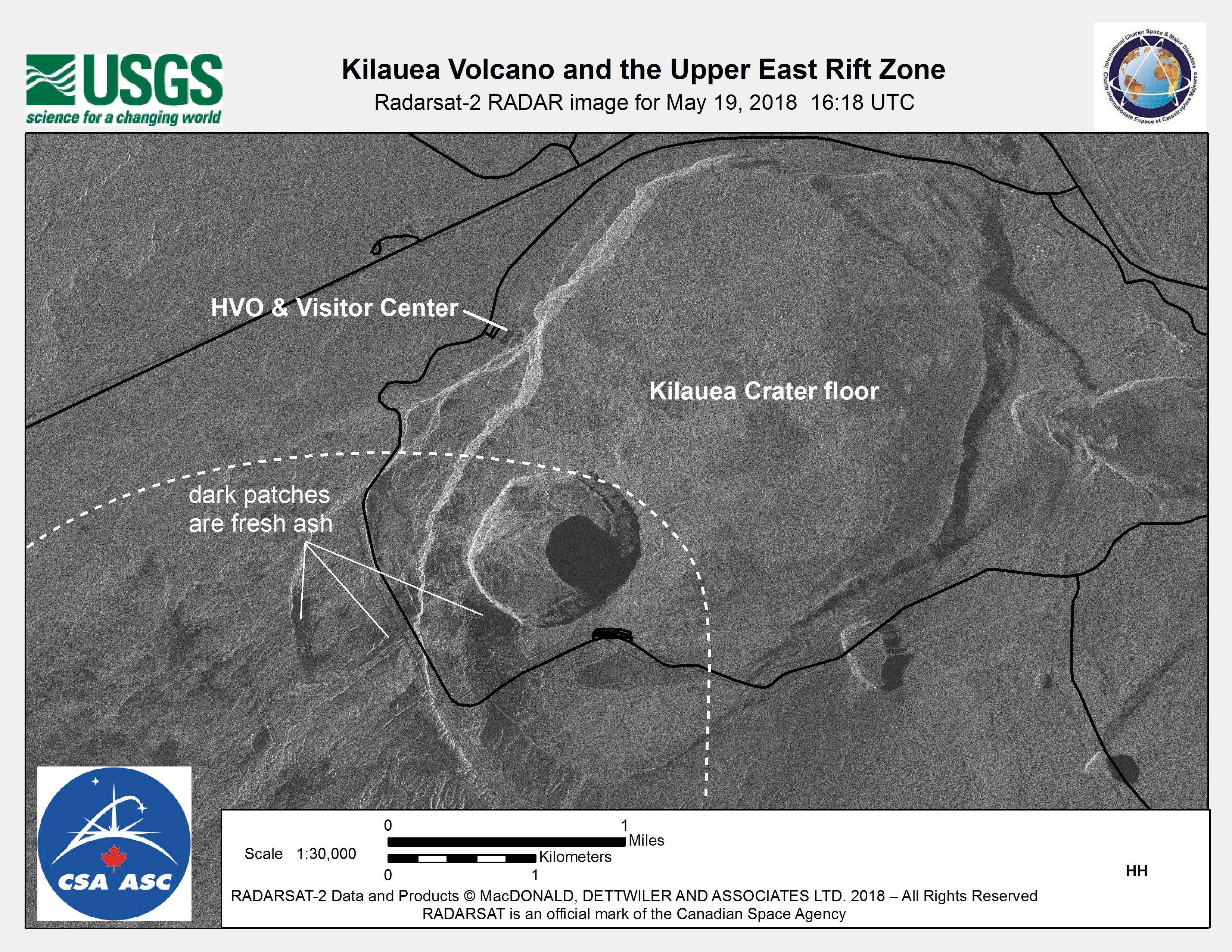
Damage assessment map of Kīlauea Volcano and the upper east rift zone
Direitos autorais: RADARSAT-2 Data and Products © Maxar Technologies Ltd. (2018) - All Rights Reserved. RADARSAT is an official trademark of the Canadian Space Agency.
Map produced by USGS
Information about the Product
Adquirida: 19/05/2018
Fonte: RADARSAT-2
 Voltar ao arquivo completo da Ativação

