 English
 Spanish
 French
 Chinese
 Russian
 Portuguese
 Latest Activation
Charter activations
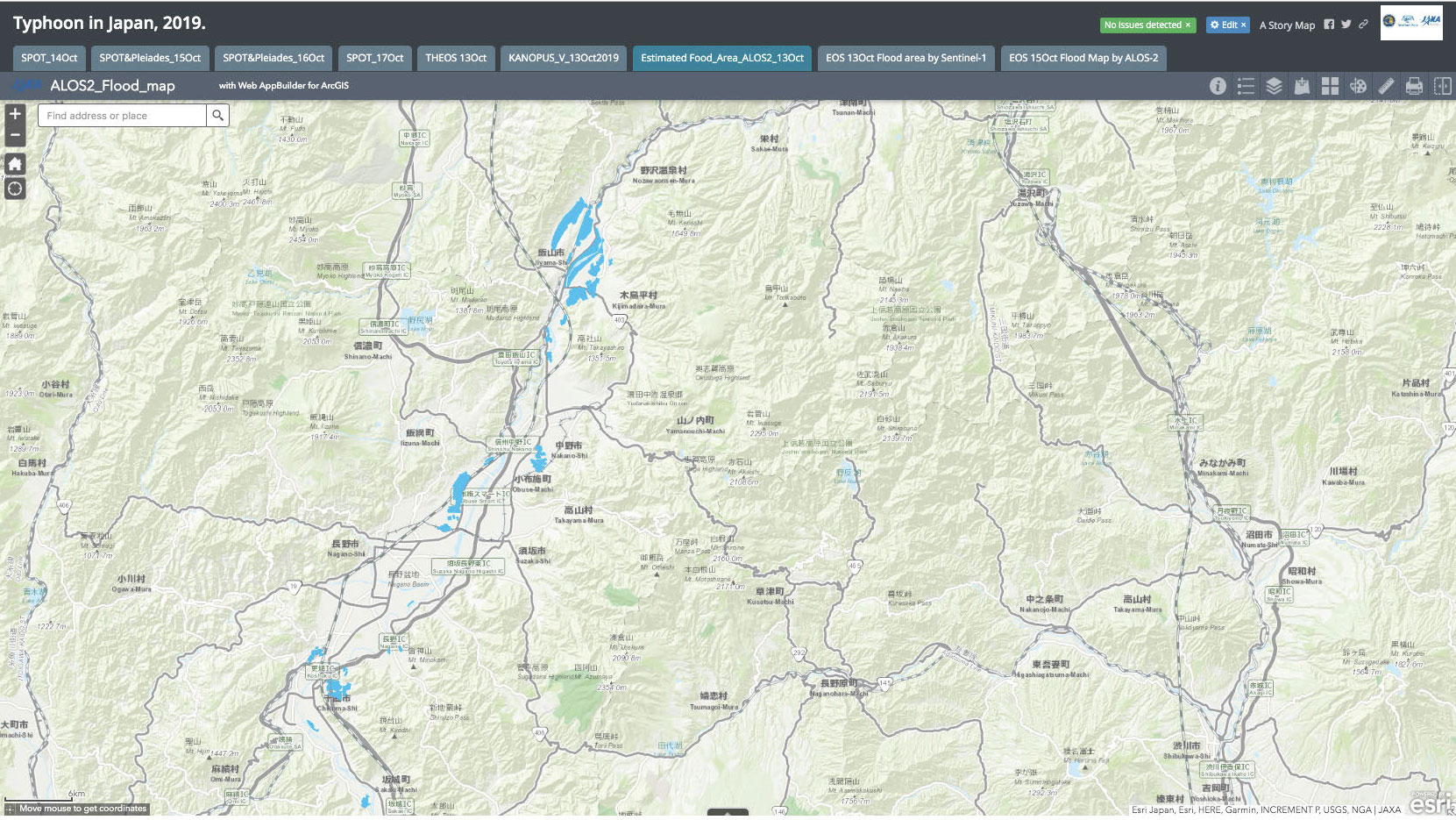
Typhoon Hagibis in Japan
Typhoon Hagibis made landfall on the main Island of Honshu and eastern Japan on 12 October with wind speeds of 140mph. Hagibis is one of the strongest storms to hit Japan in decades, killing at least 40 people and inuring many more.
Hagibis is classified by Japan's Meteorological Agency as "violent" - the highest rating possible. The typhoon affected eight prefectures leaving more than 250,000 homes without power and 120,000 homes without water. 50,000 people have been moved to temporary shelters and 110,000 rescuers have been deployed.
The capital Tokyo escaped the worst of the storm but other cities and towns across the country were inundated by water. Flights, trains and sporting events were cancelled across Japan for safety reasons.
Hagibis weakened as it moved away from land but has left a trail of destruction stretching right across Honshu, from the Mie prefecture in the west, to Iwate in the north of Japan.
Related News and Resources
- Hagibis Heads Toward Japan (NASA)
- Typhoon Hagibis: Japan deploys 110,000 rescuers (BBC)
- Typhoon Hagibis Makes Landfall In Japan (YouTube Video)
| Tipo de evento: | cyclone |
| Local do evento: | Japan |
| Data da Ativação da Carta: | 2019-10-11 |
| Tempo de Ativação da Carta: | 12:37 |
| Zona de Tempo da Ativação da Carta: | UTC+09:00 |
| Requisitante da Carta: | Asian Disaster Reduction Center (ADRC) |
| ID da Ativação: | 625 |
| Gerenciamento de projeto: | Yamaguchi University |
Products


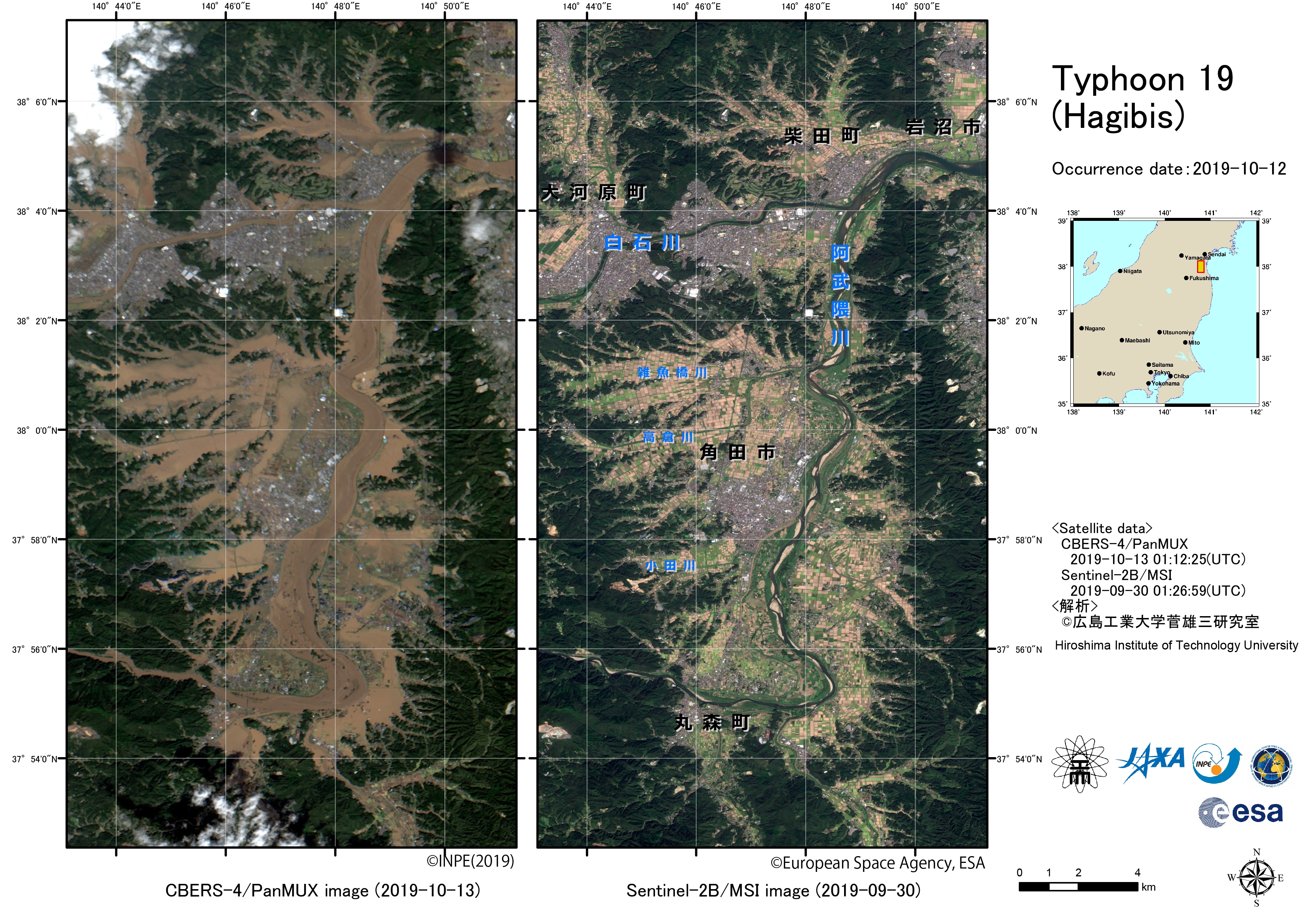
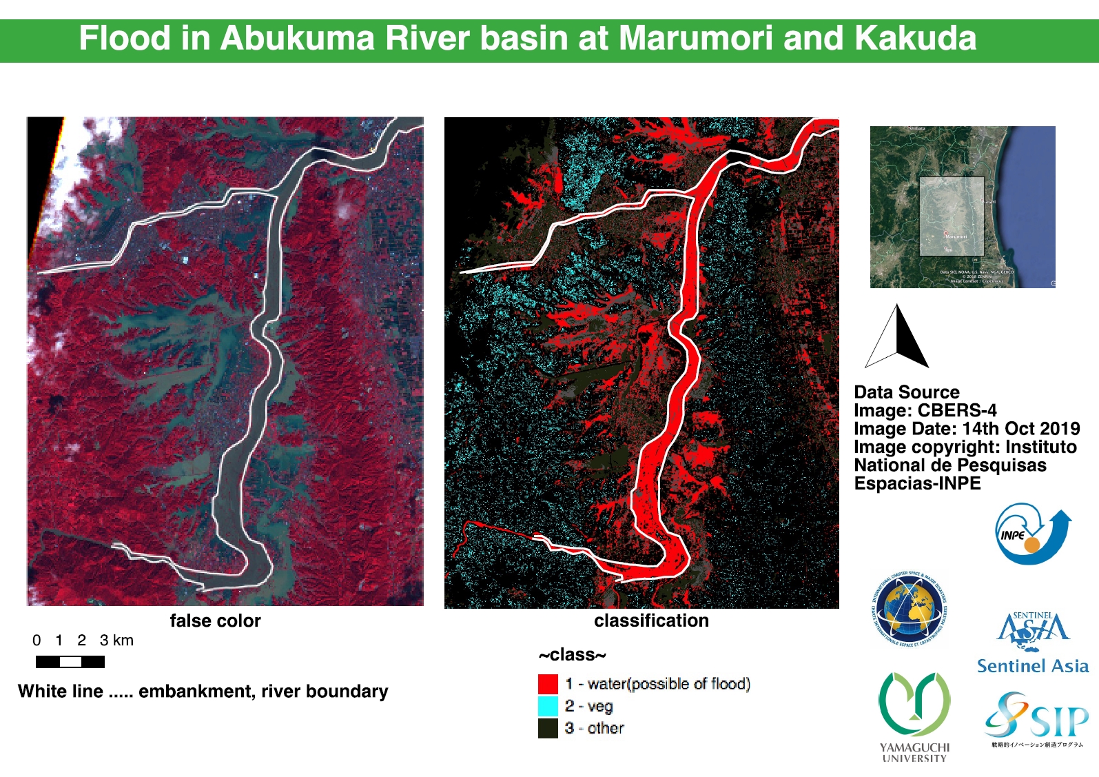
Before and after comparison following Typhoon Hagibis in Japan
Direitos autorais: CBERS-4 © INPE 2019
Sentinel-2 © Contains modified Copernicus Sentinel data (2019)
Map produced by Hiroshima Institute of Technology
Information about the Product
Adquirida: CBERS-4: 13/10/2019
Sentinel-2: 30/09/2019
Fonte: CBERS-4 / Sentinel-2
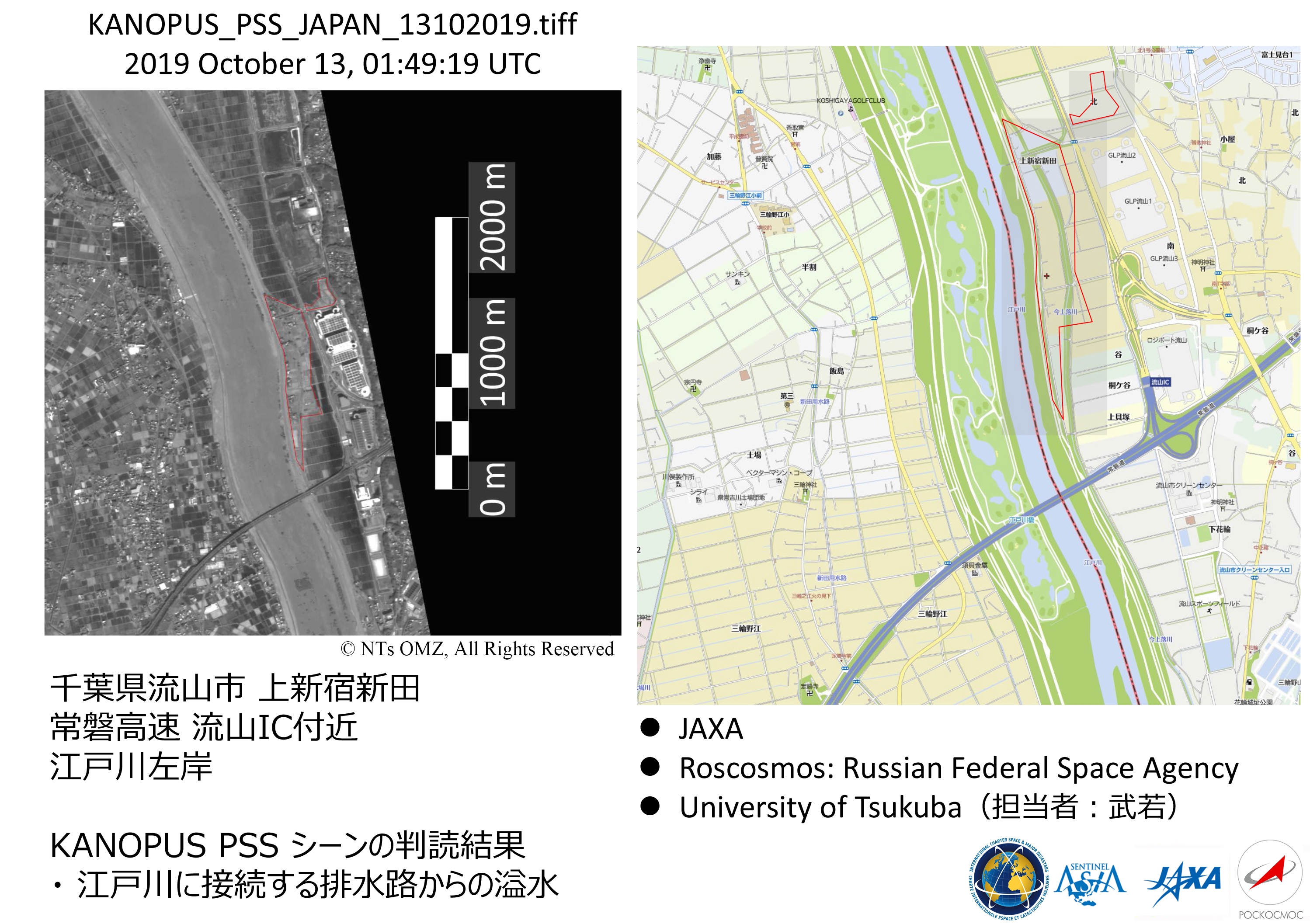

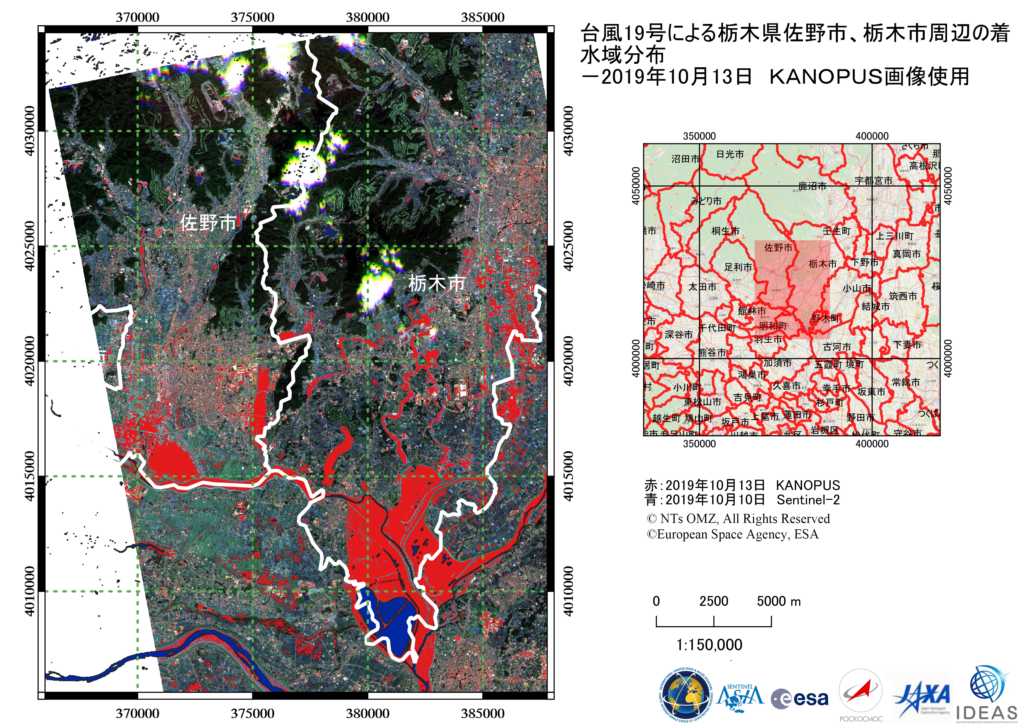
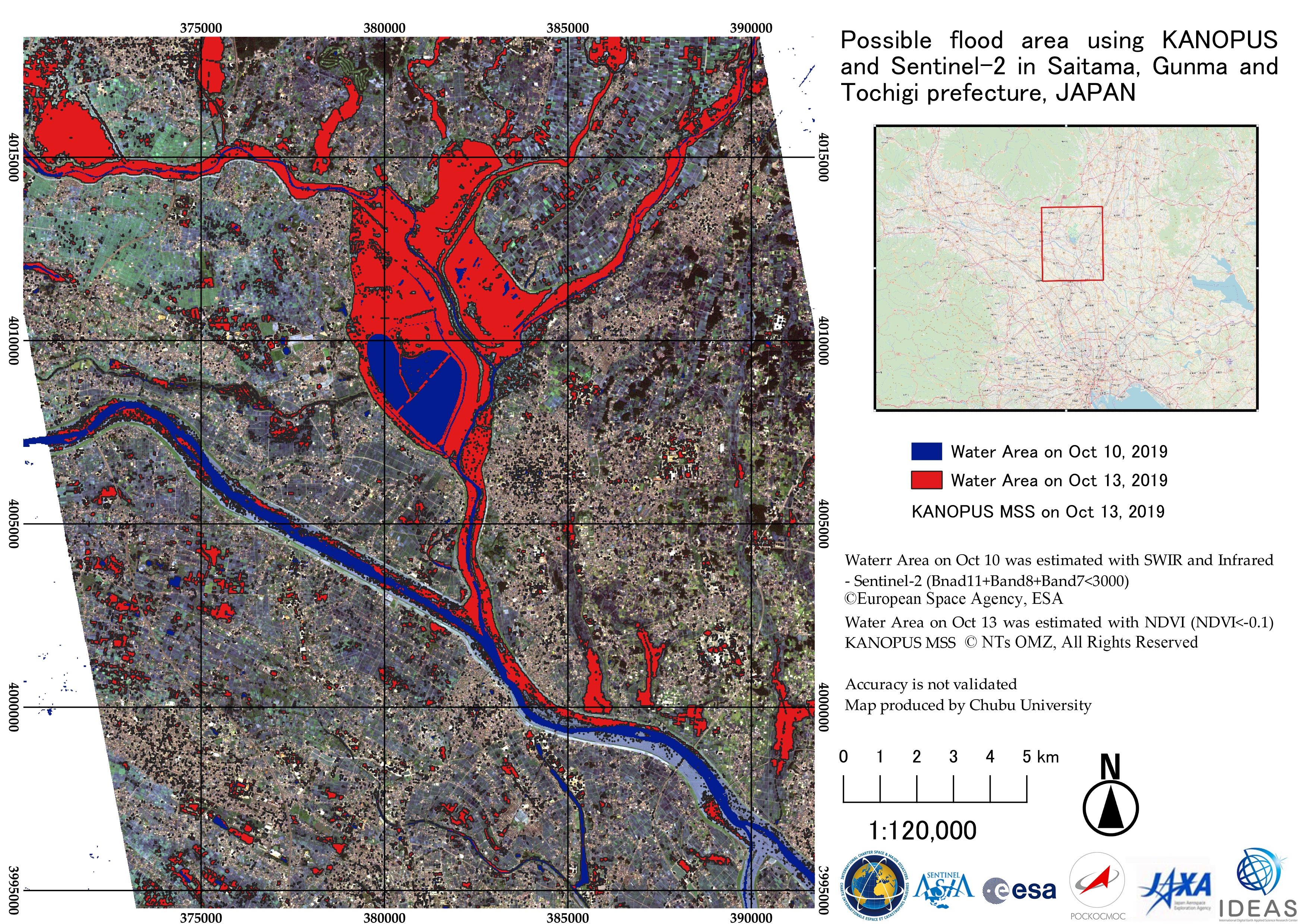
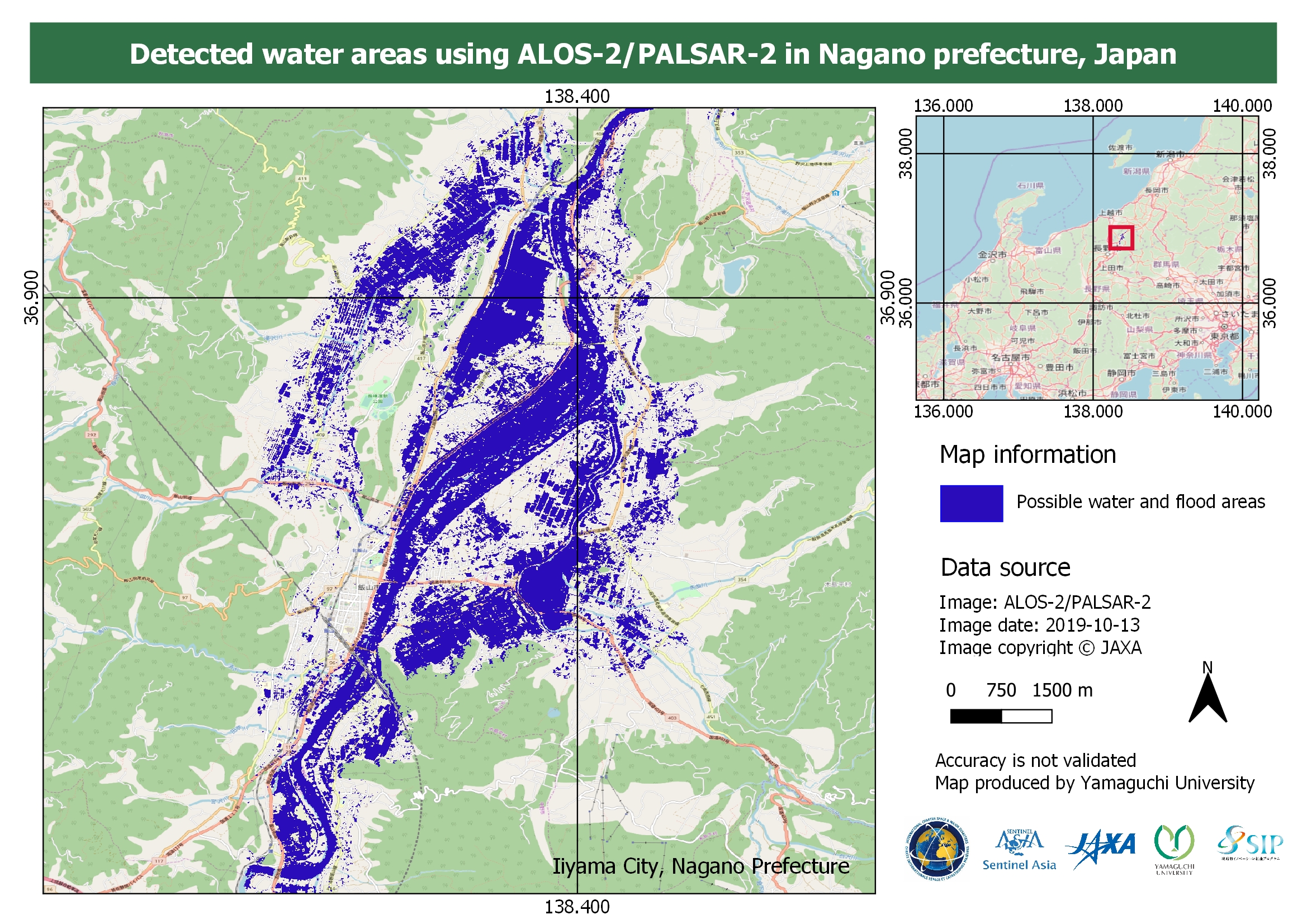
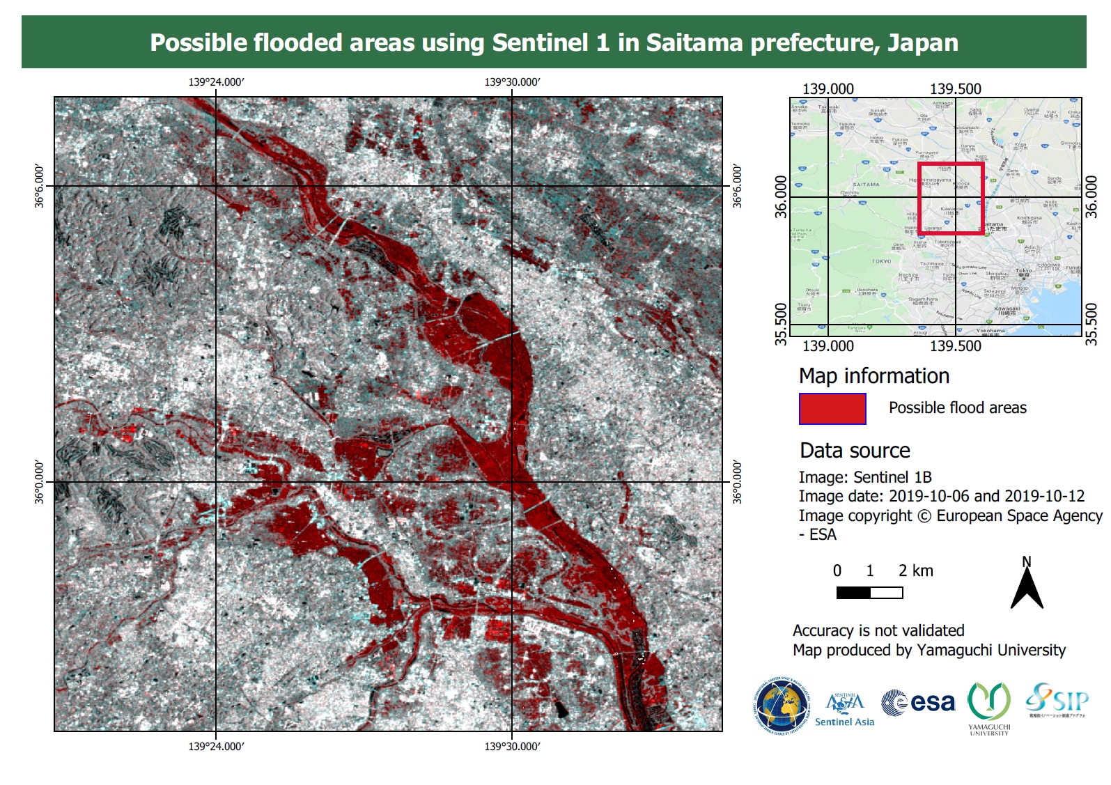
Flooding at Saitama, Gunma and Tochigi Prefecture, Japan
Direitos autorais: Sentinel-2 © Contains modified Copernicus Sentinel data (2019)
Kanopus-V © All rights reserved ROSCOSMOS 2019
Map produced by Chubu University
Information about the Product
Adquirida: Sentinel-2: 10/10/2019
Kanopus-V: 13/10/2019
Fonte: Sentinel-2 / Kanopus-V
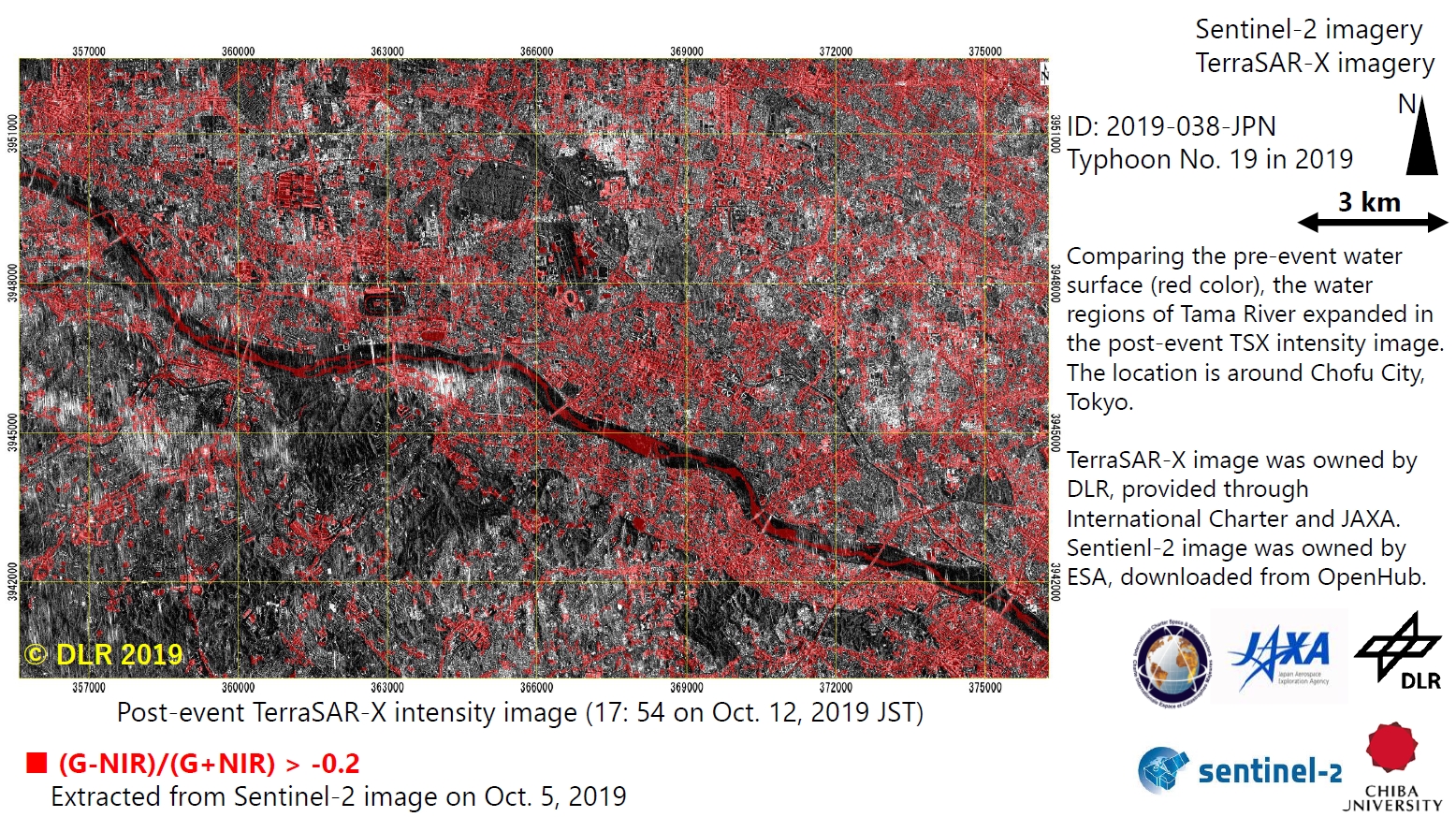
Flooding assessment, Typhoon Hagibis
Direitos autorais: Sentinel-1 © Contains modified Copernicus Sentinel data (2019)
TerraSAR-X © DLR e. V. 2019, Distribution: Airbus DS Geo GmbH
Map produced by Chiba University
Information about the Product
Adquirida: Sentinel-2: 05/10/2019
TerraSAR-X: 12/10/2019
Fonte: Sentinel-2 / TerraSAR-X

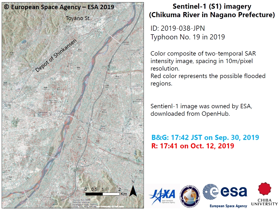


Flooded areas, Eastern Japan
Download the report
Direitos autorais: Sentinel-1 © Contains modified Copernicus Sentinel data (2019)
TerraSAR-X © DLR e. V. 2019, Distribution: Airbus DS Geo GmbH
Map produced by Chiba University
Information about the Product
Adquirida: Sentinel-1: 07/10/2019, 13/10/2019
TerraSAR-X: 12/10/2019
Fonte: Sentinel-1 / TerraSAR-X


 Voltar ao arquivo completo da Ativação

