 English
 Spanish
 French
 Chinese
 Russian
 Portuguese
 Latest Activation
Charter activations
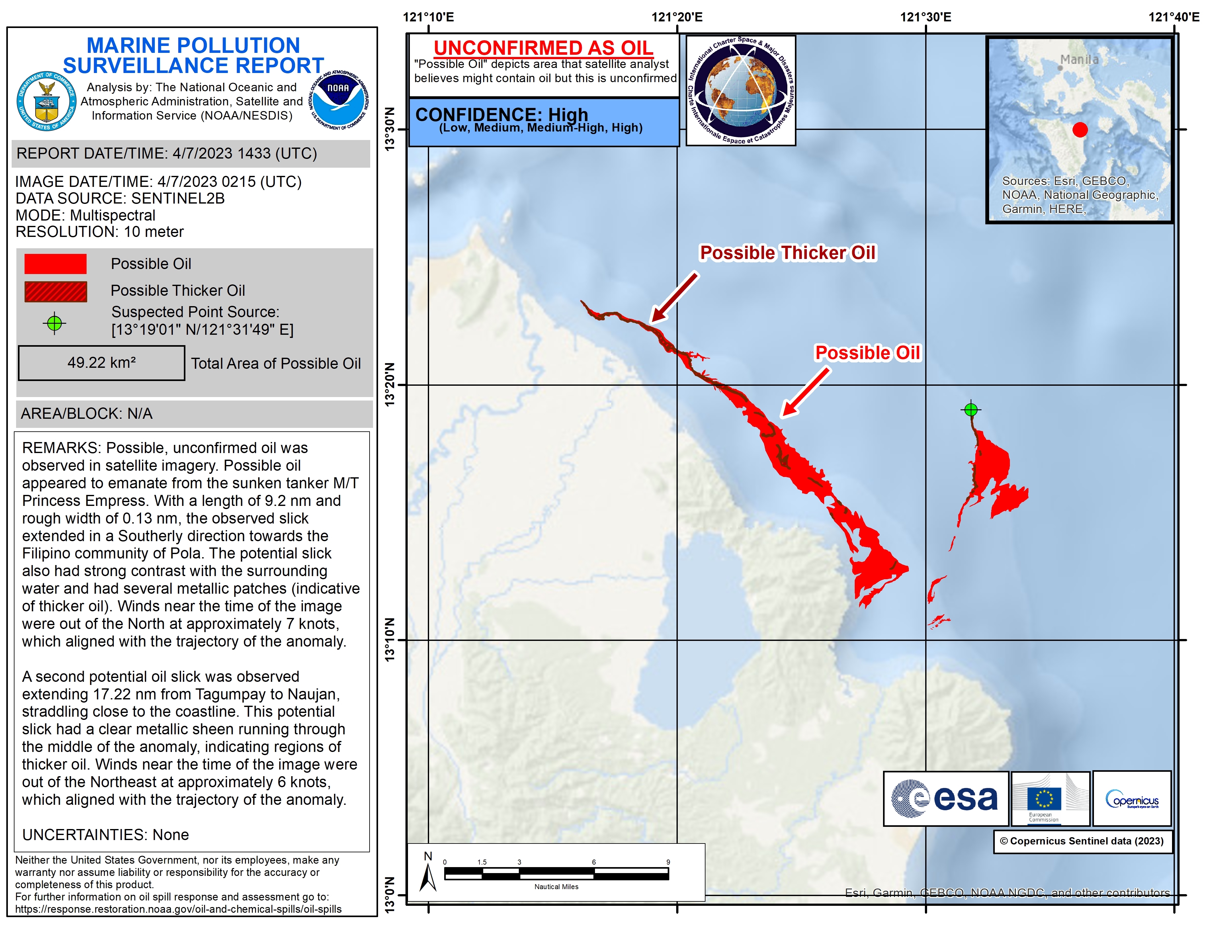
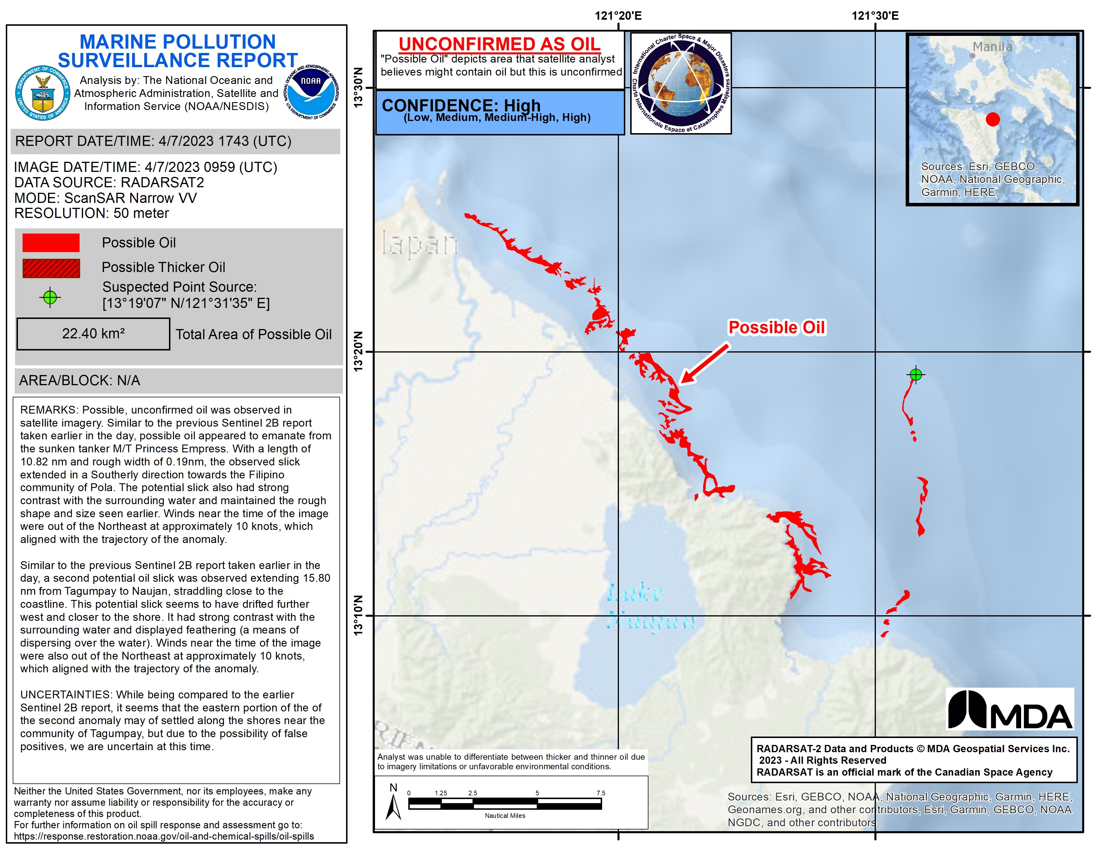
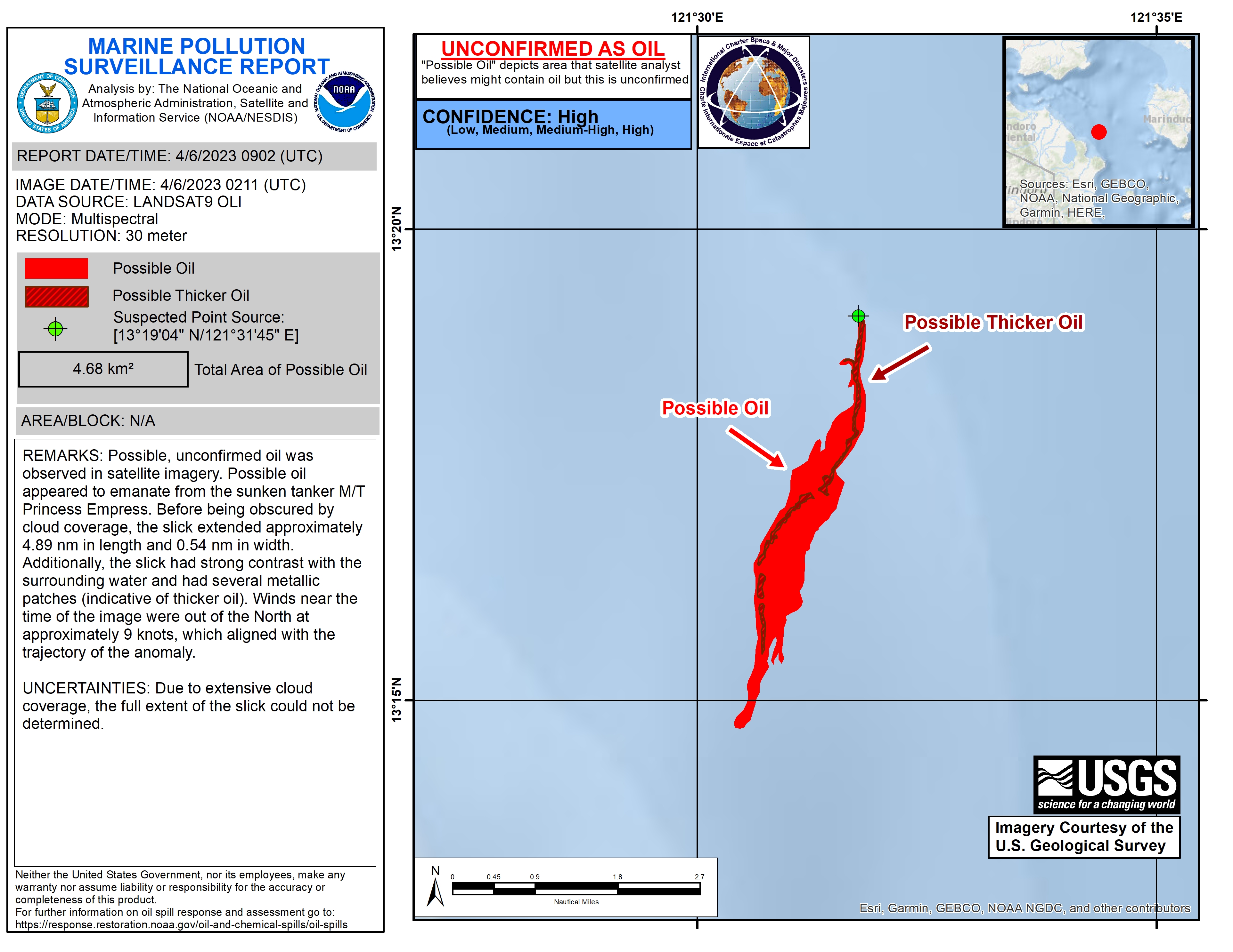
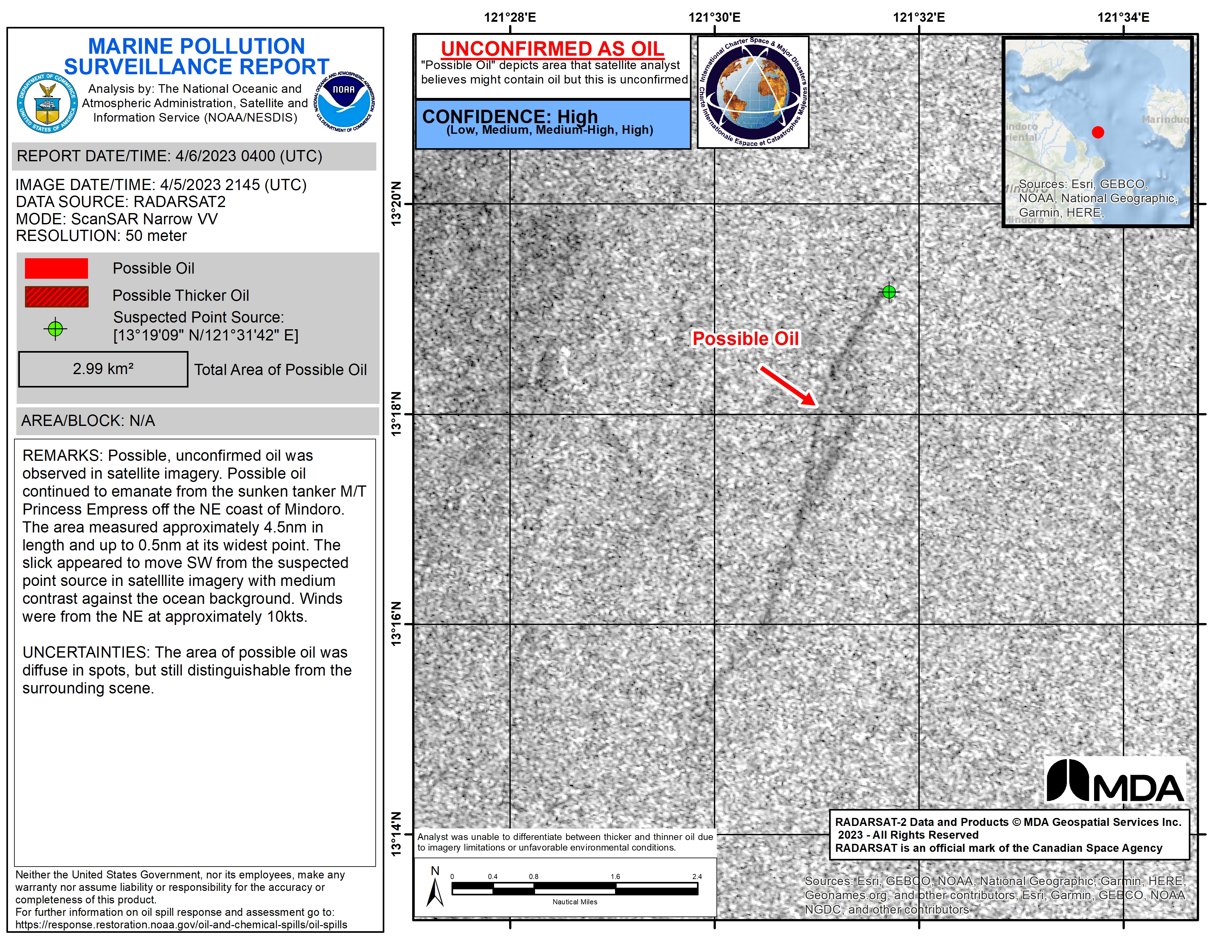
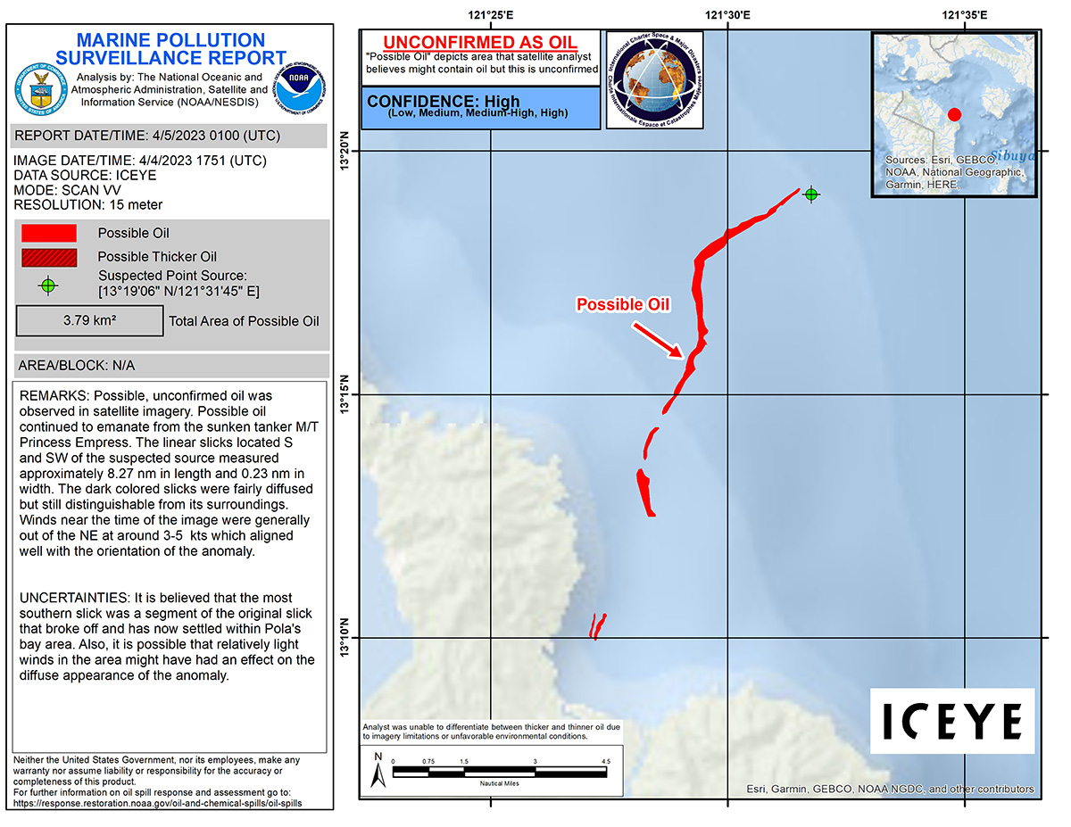
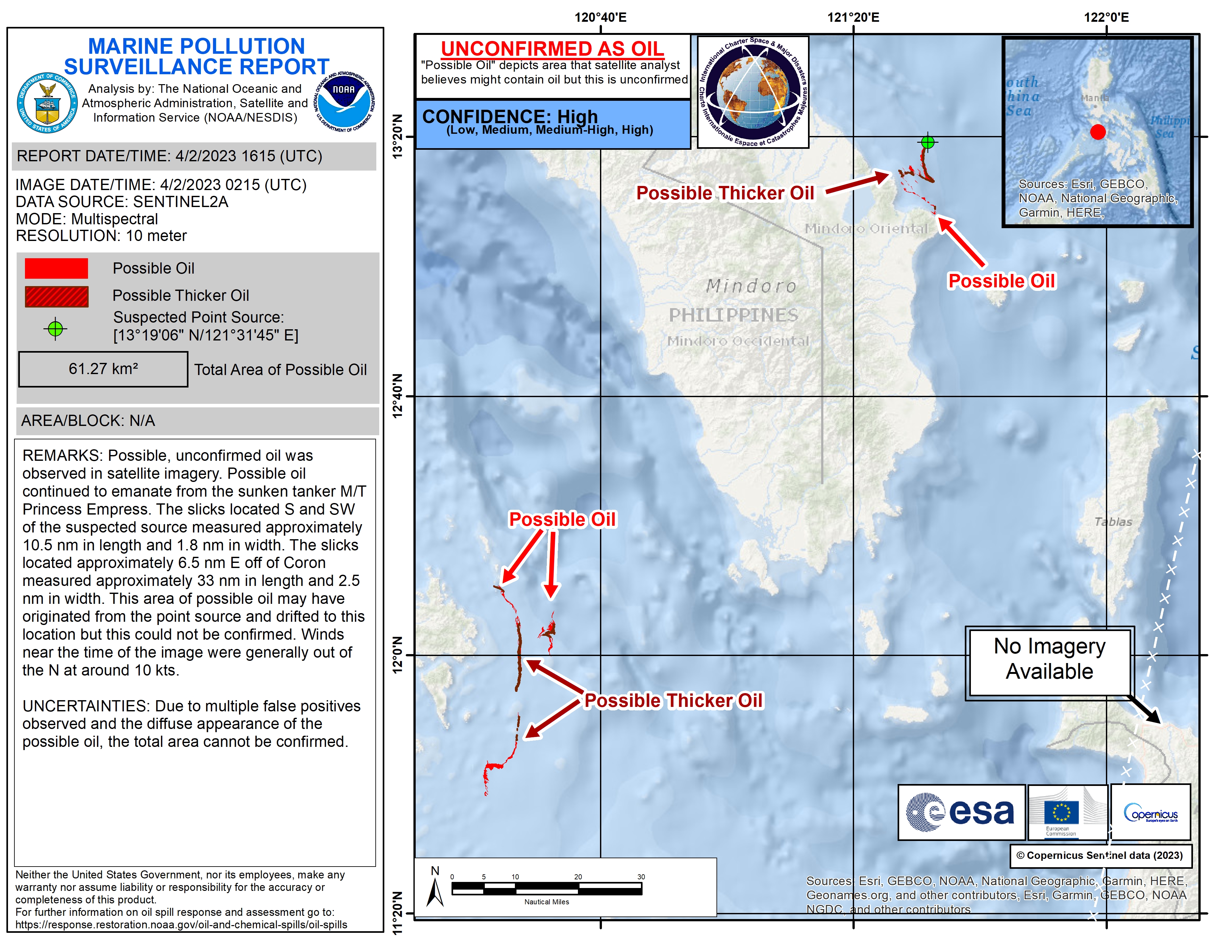
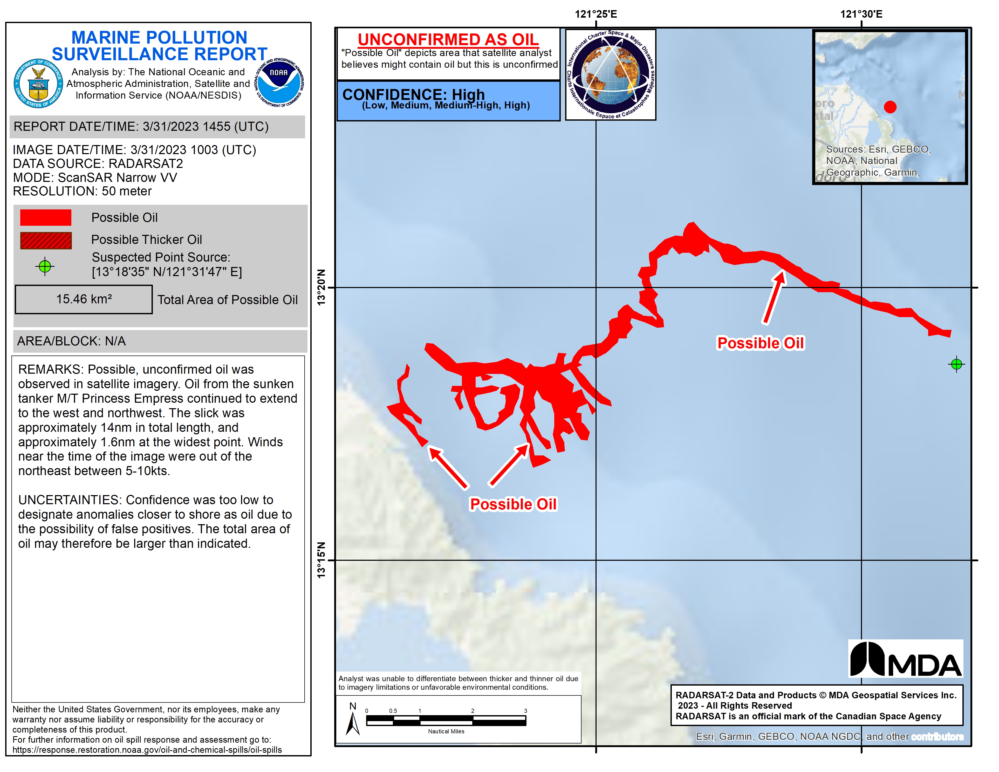
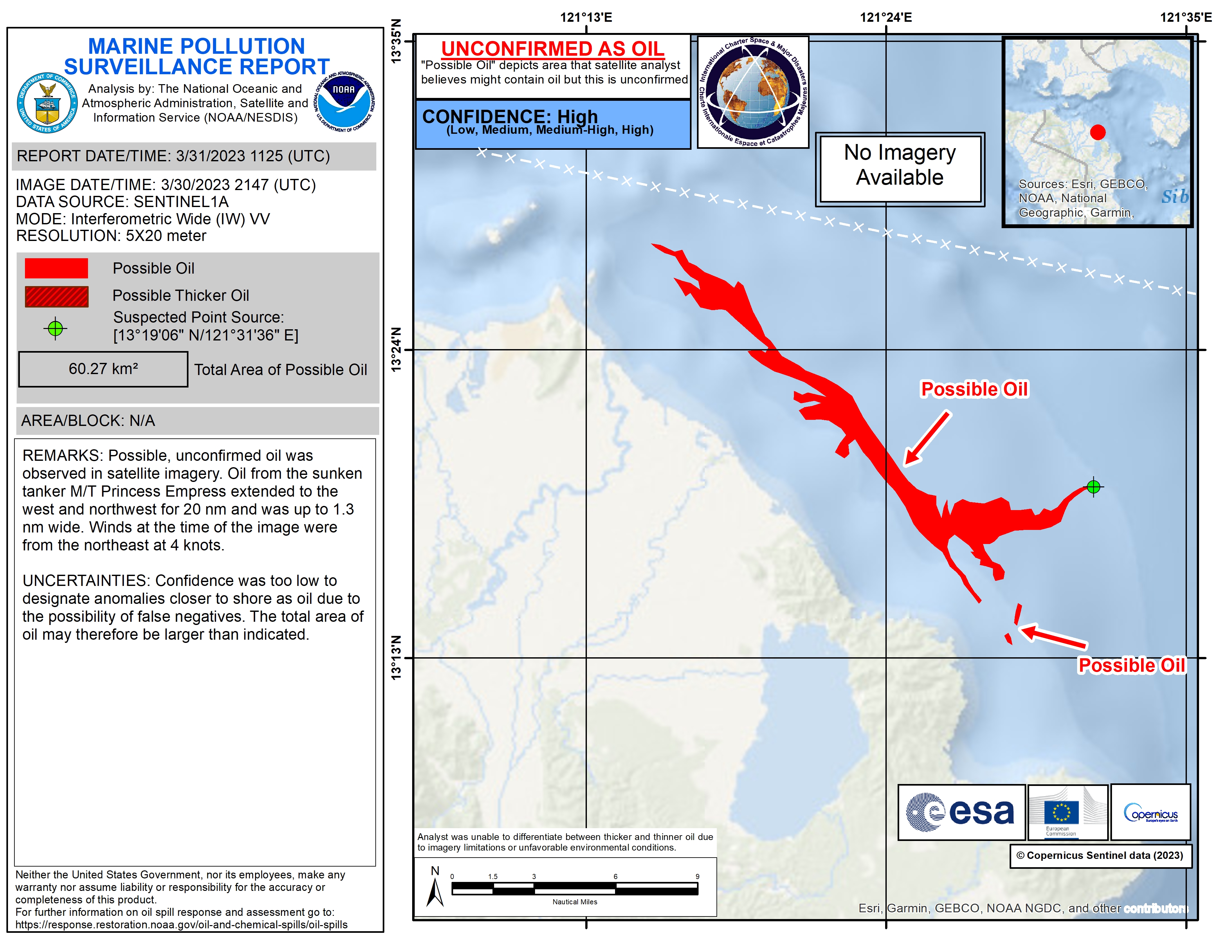
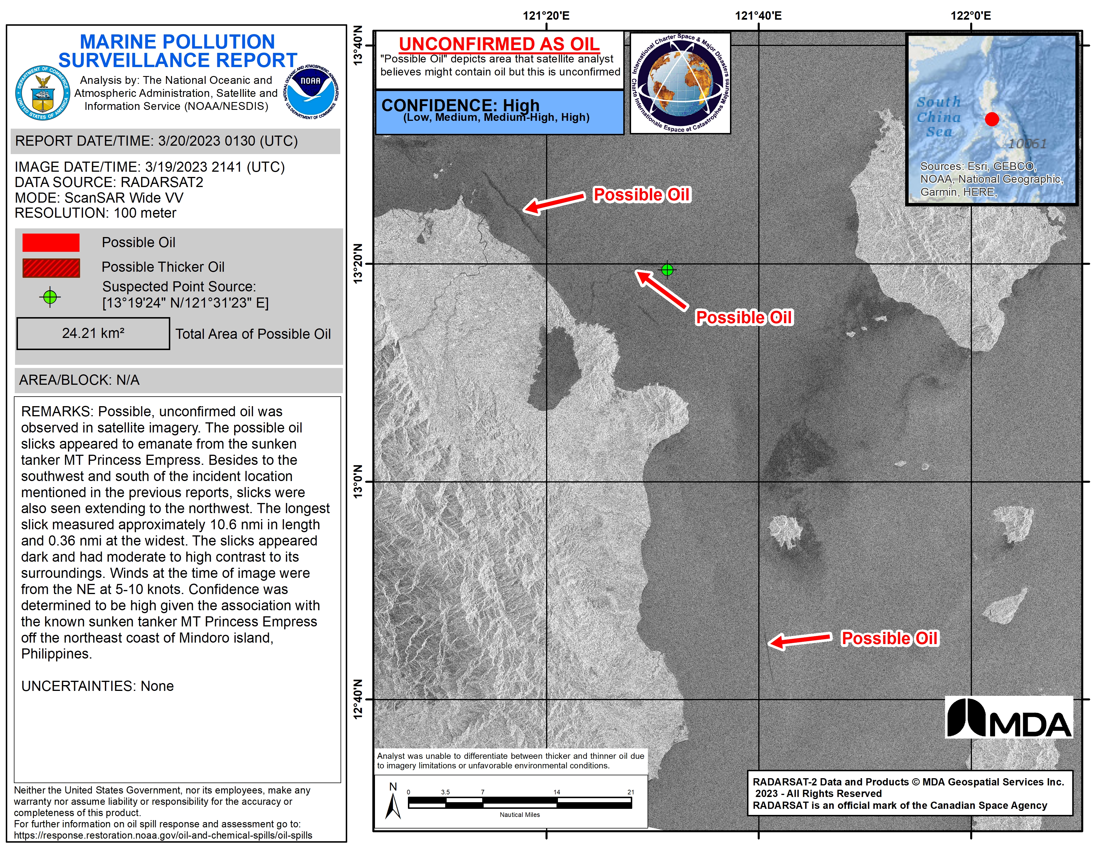
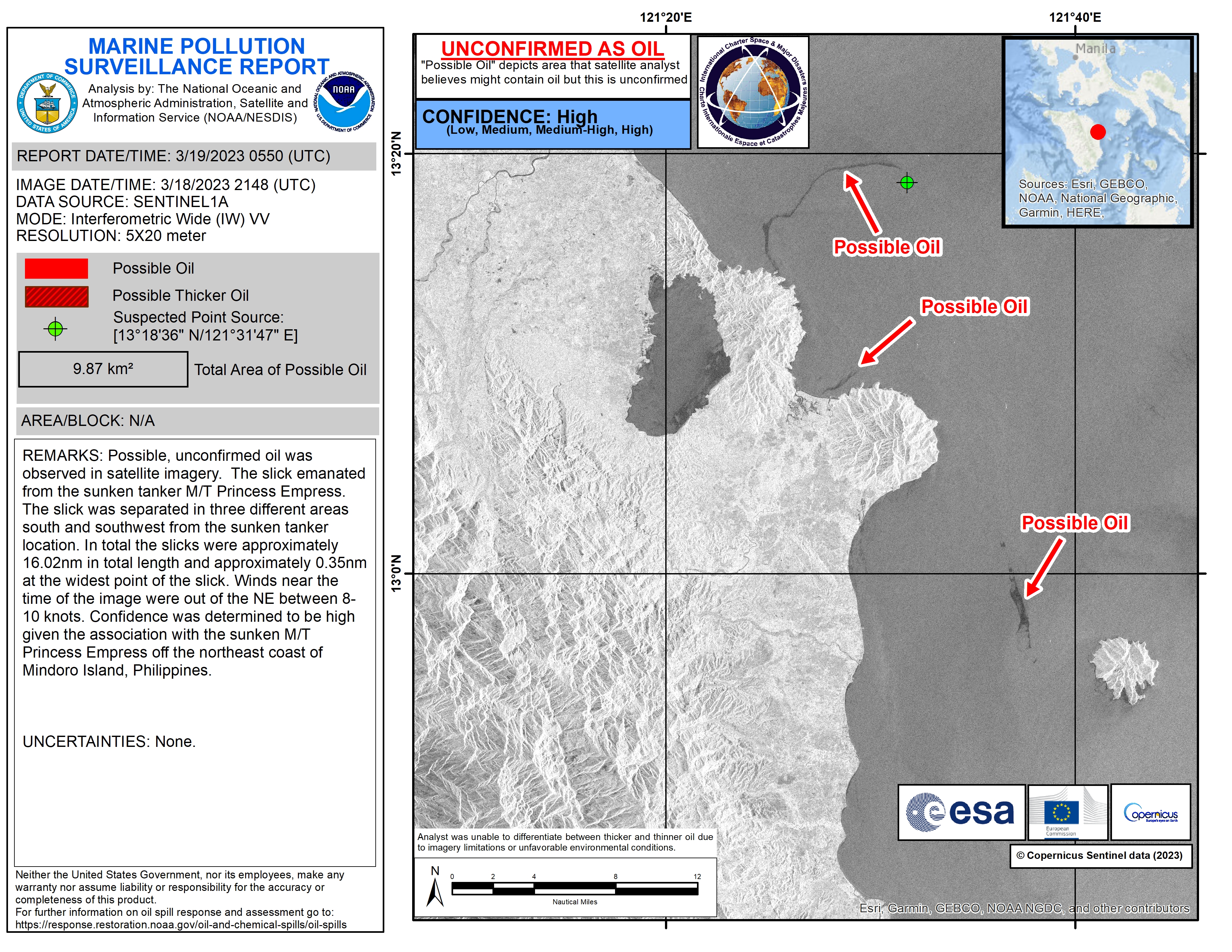
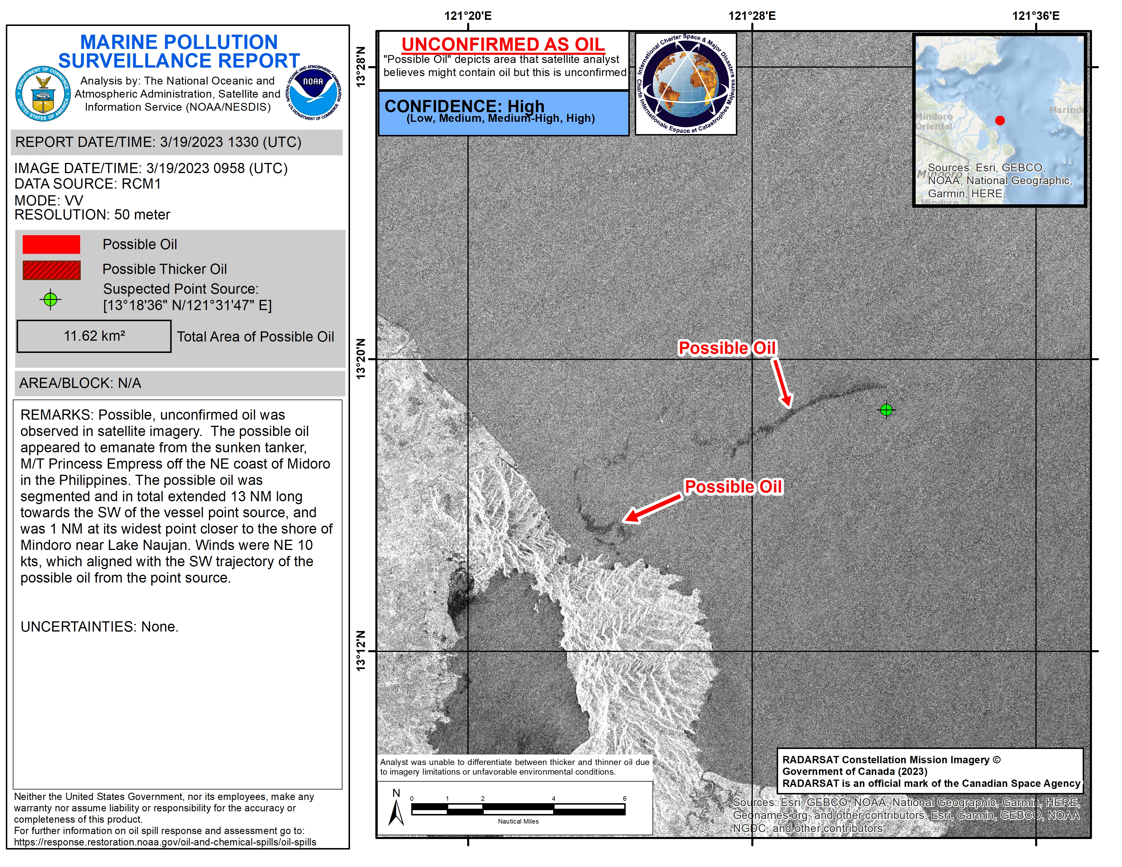
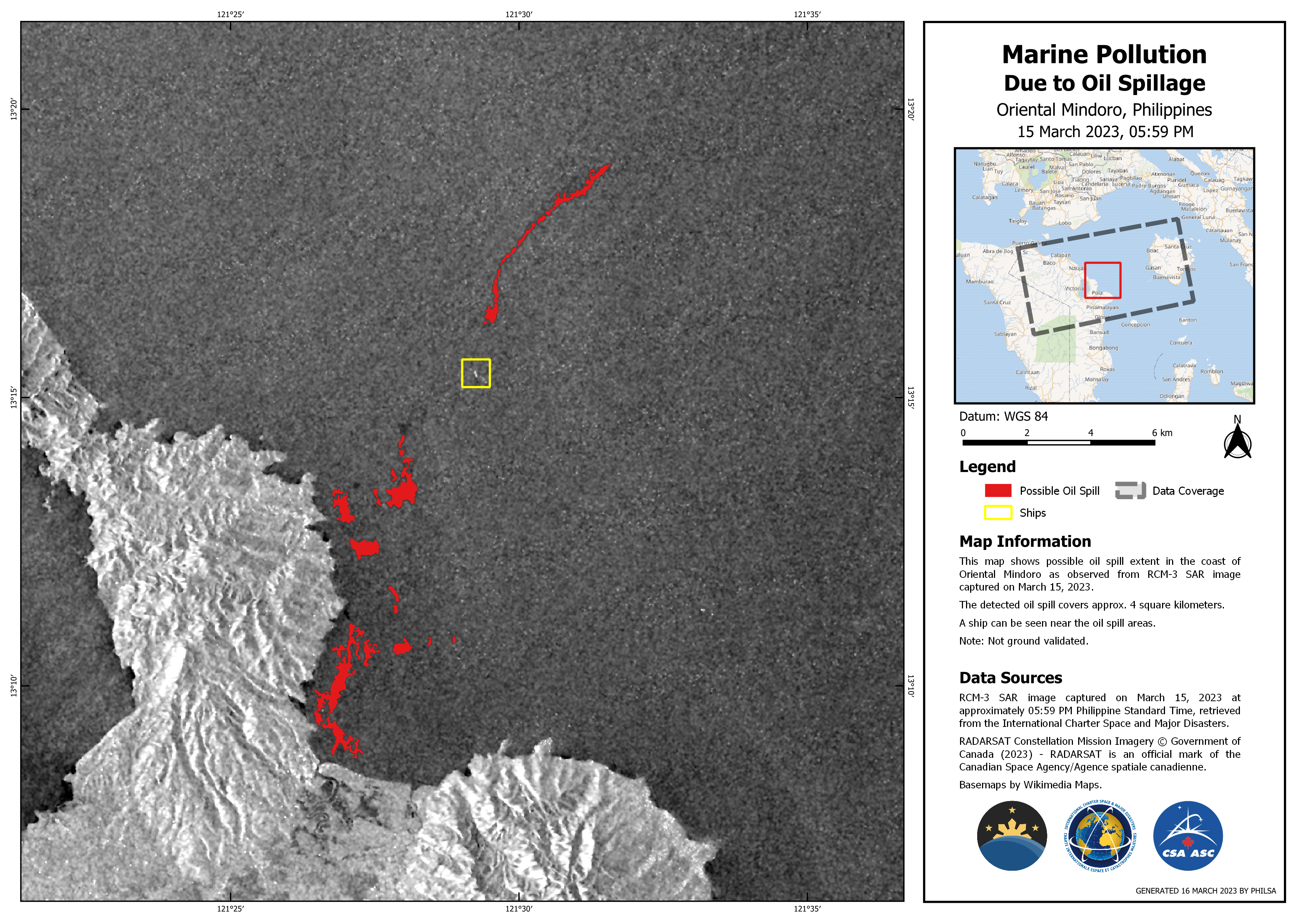
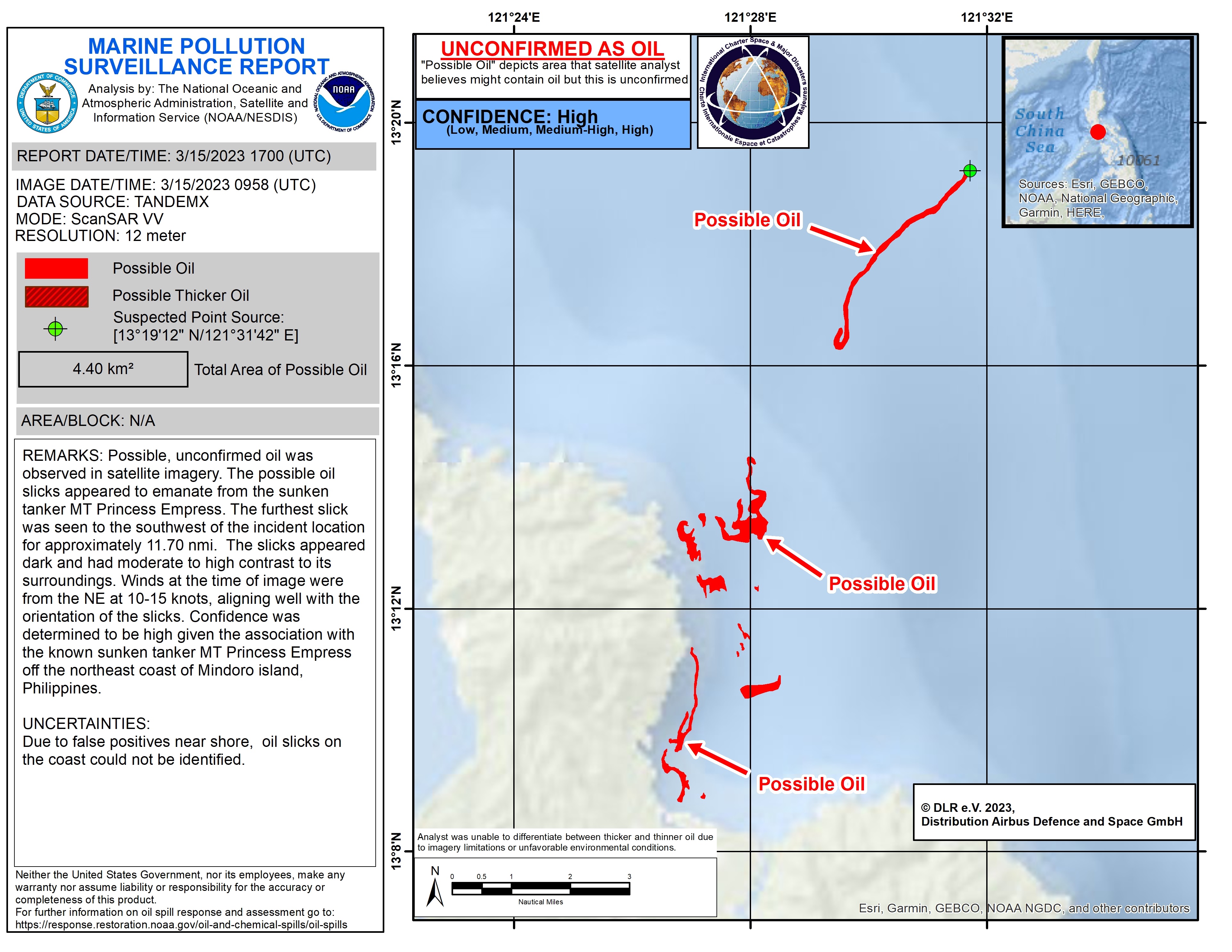
Oil spill in the Philippines
on February 28, the Philippine Coast Guard reported an oil spill from the oil tanker MT Princess Empress that capsized earlier in the day off the coast of Naujan, Oriental Mindoro. The spill did not involve the 800,000 litres of crude oil that the tanker was ferrying from the port of Limay in Bataan to the Port of Iloilo.
Reports are saying the fuel leaked from the stricken vessel has created a 500-metre wide slick and the Department of Environment and Natural Resources (DENR) said it is also monitoring the area for any potential harm to life and livelihoods due to its distance from the shoreline.
The MT Princess Empress sailed from Bataan en route to Iloilo with 20 crew members on board, they were safely rescued and brought to shore.
The submerged vessel is continuously being monitored by officials.
| Tipo de evento: | Oil Spill |
| Local do evento: | Philippines |
| Data da Ativação da Carta: | 2023-03-02 |
| Tempo de Ativação da Carta: | 15:56 |
| Zona de Tempo da Ativação da Carta: | UTC+09:00 |
| Requisitante da Carta: | ADRC on behalf of Philippine Space Agency (PhilSA) |
| ID da Ativação: | 807 |
| Gerenciamento de projeto: | Jamaica Pangasinan (Philippine Space Agency (PhilSA)) |
| act-value-adders: | Roel de la Cruz (Philippine Space Agency) Machele Felicen (Philippine Space Agency) Jamie Stovin-Bradford (ITOPF) |
Products
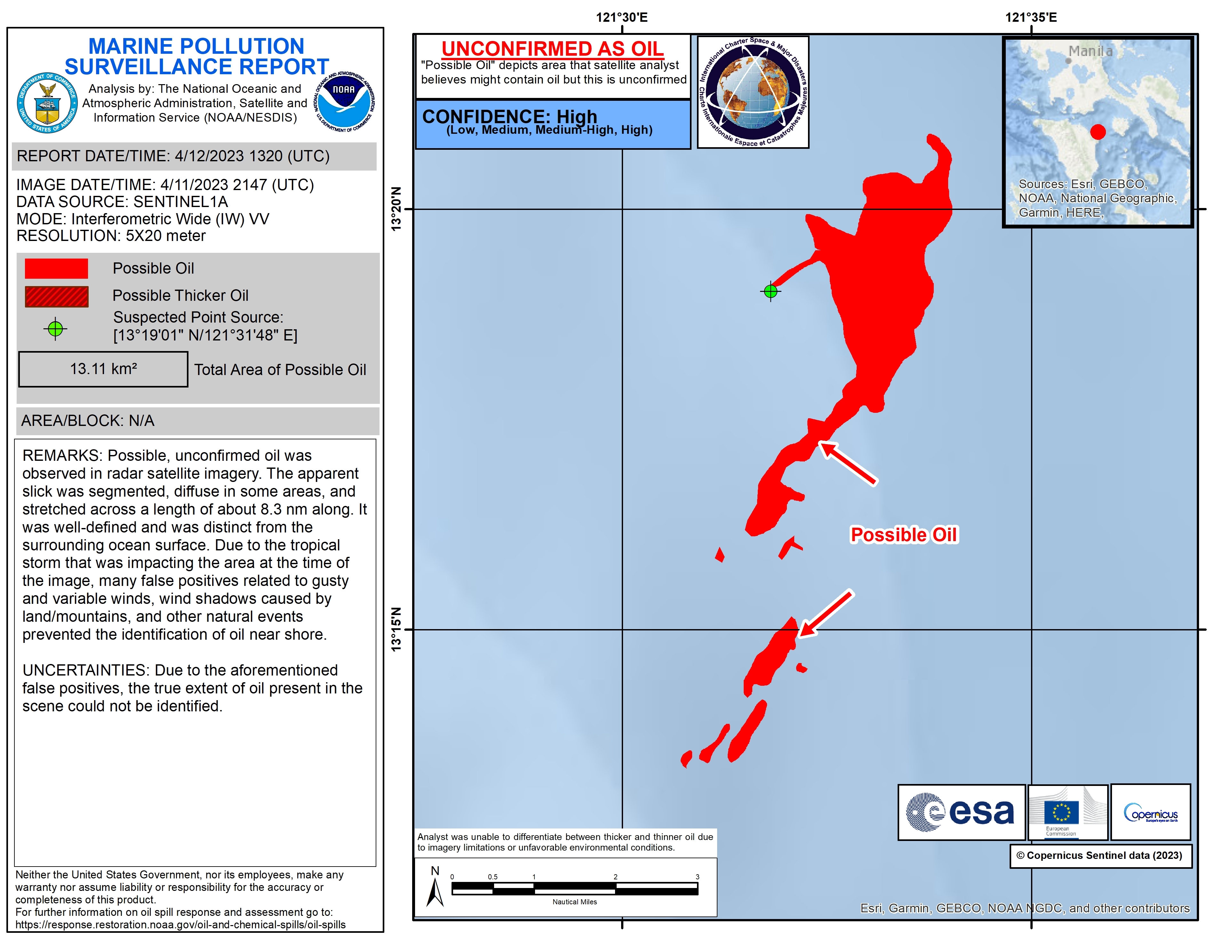
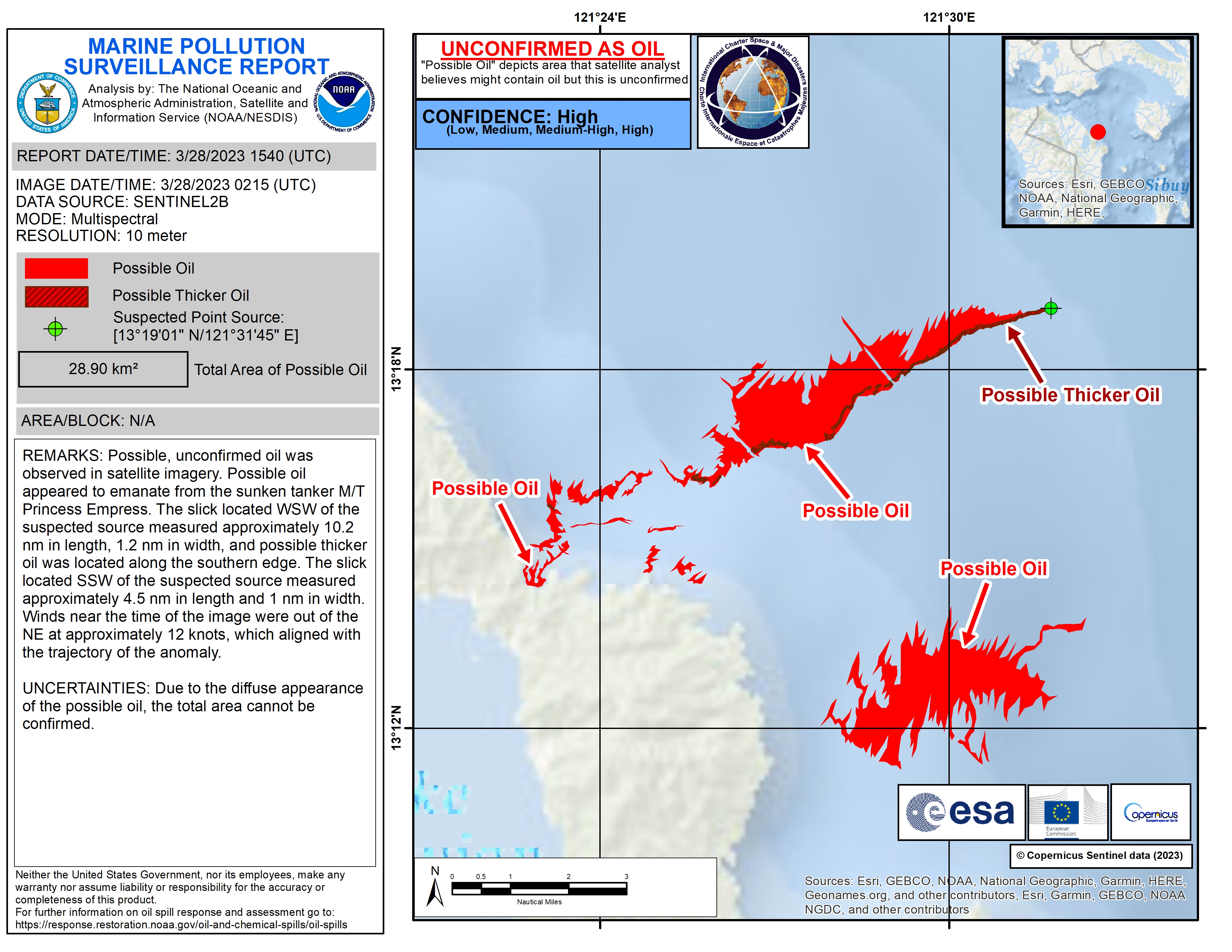
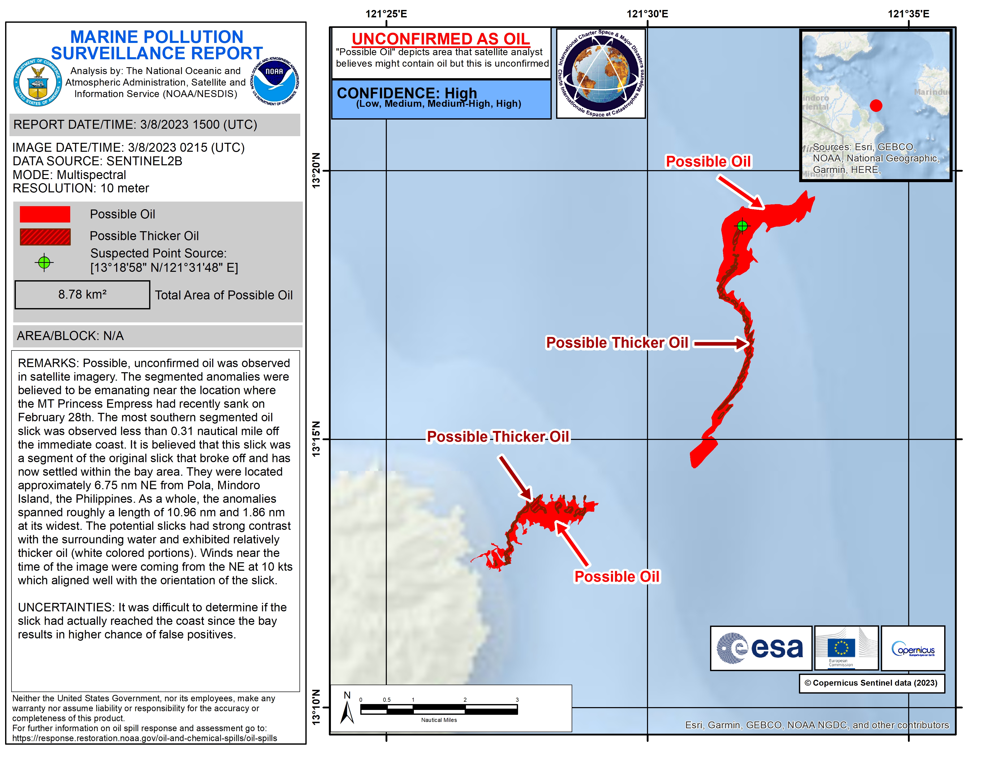
Possible Oil Spill in the Philippines
Direitos autorais: RADARSAT-2 Data and Products © Maxar Technologies Ltd. (2023) – All Rights Reserved
RADARSAT is an official mark of the Canadian Space Agency
Map produced by NOAA/NESDIS.
Information about the Product
Adquirida: 07/04/2023
Fonte: RADARSAT-2
Categoria: Delineation Monitoring Maps
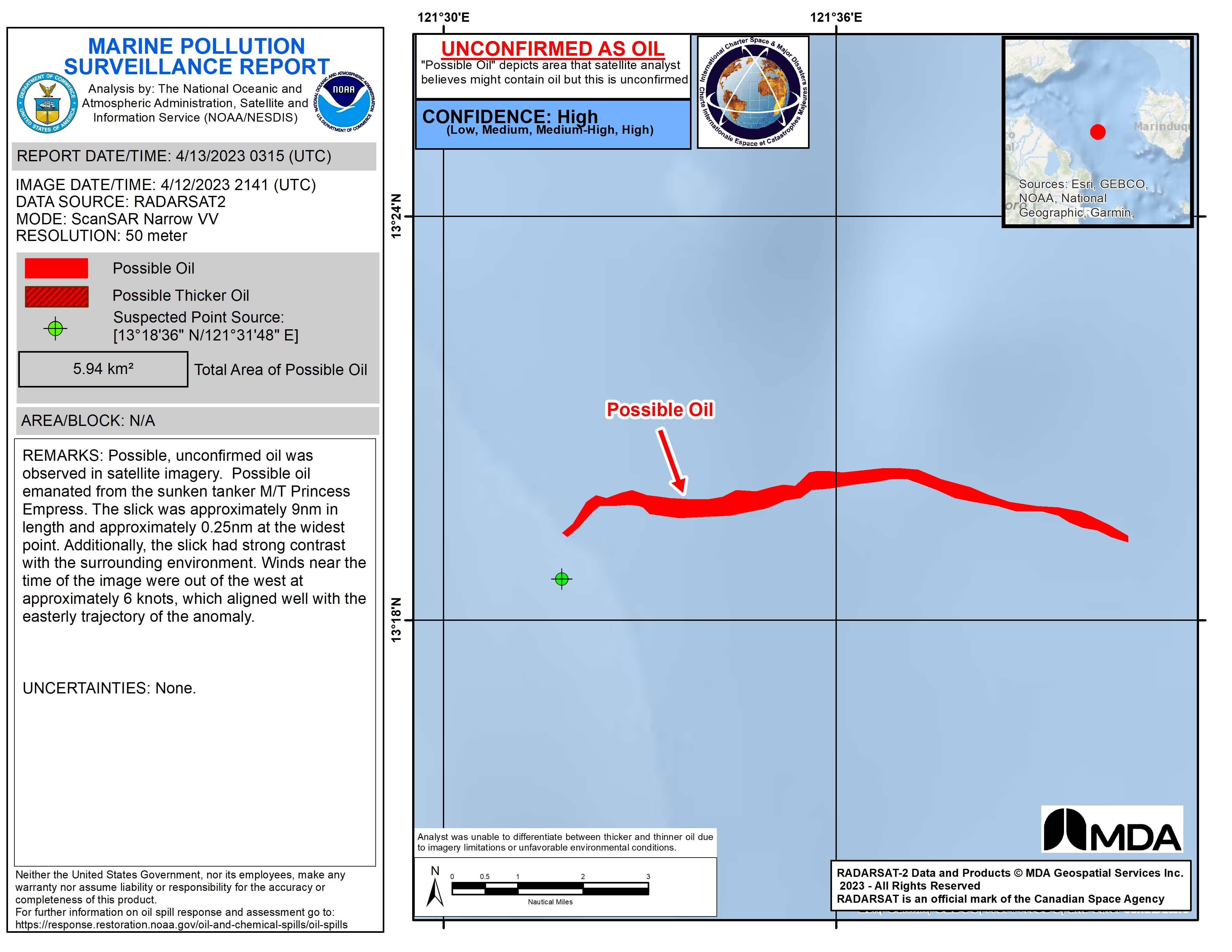
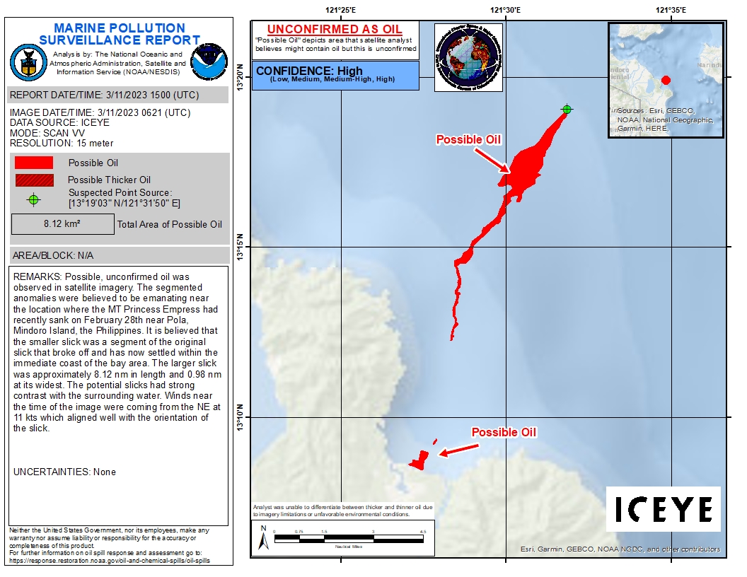
Philippines Oil Spill
Direitos autorais: RADARSAT-2 Data and Products © Maxar Technologies Ltd. (2023) – All Rights Reserved. RADARSAT is an official mark of the Canadian Space Agency
Map produced by NOAA/NESDIS
Information about the Product
Adquirida: 05/04/2023
Fonte: RADARSAT-2
Categoria: Delineation Map
Philippines Oil Spill
Direitos autorais: RADARSAT-2 Data and Products © Maxar Technologies Ltd. (2023) – All Rights Reserved
RADARSAT is an official mark of the Canadian Space Agency
Map produced by NOAA / NESDIS
Information about the Product
Adquirida: 31/03/2023
Fonte: RADARSAT-2
Categoria: Reference Map
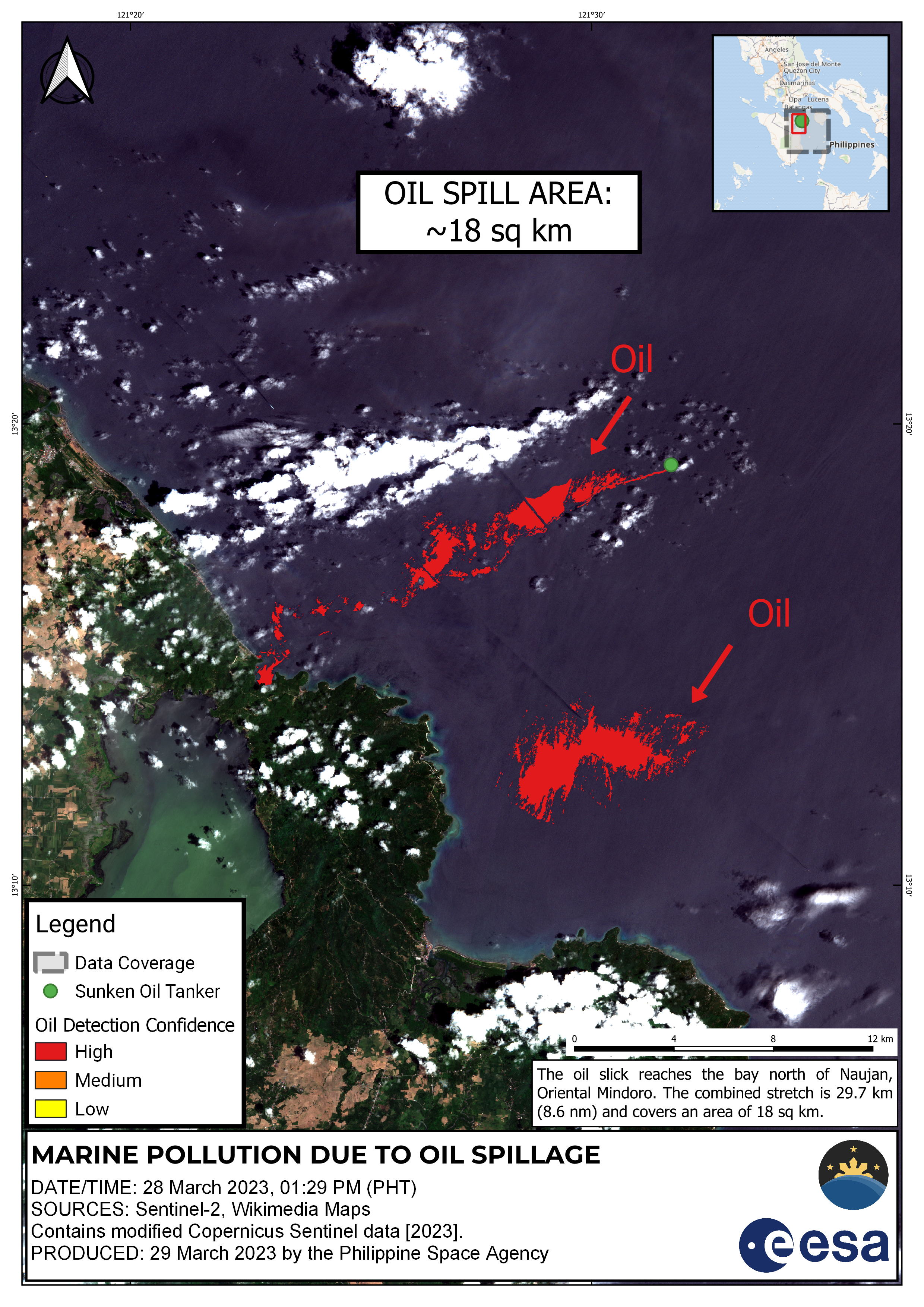
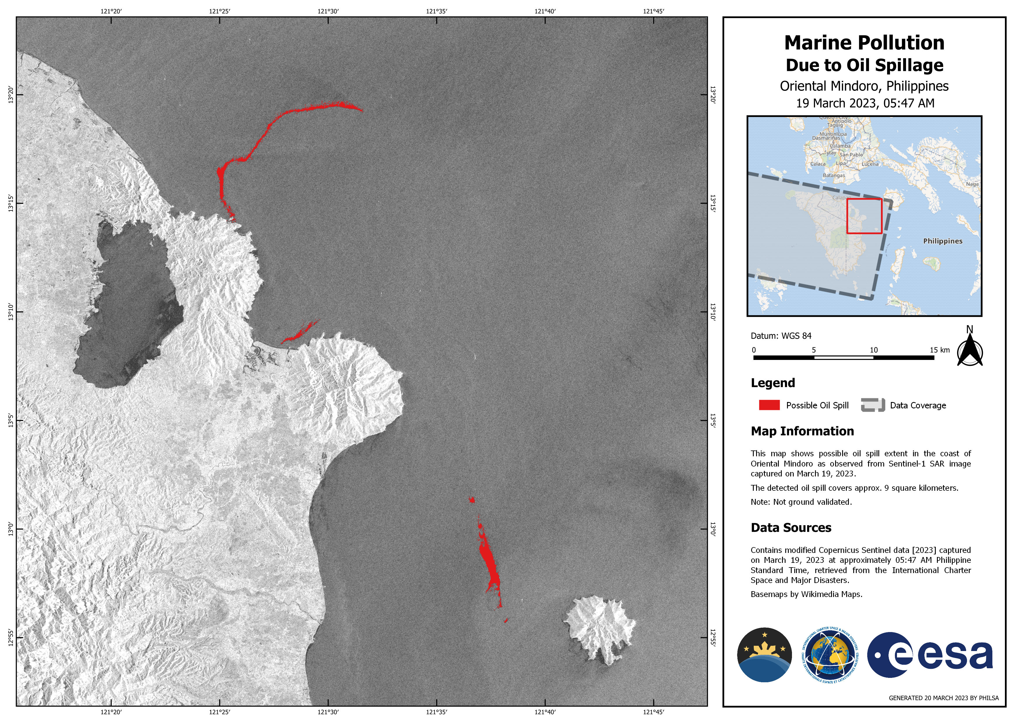

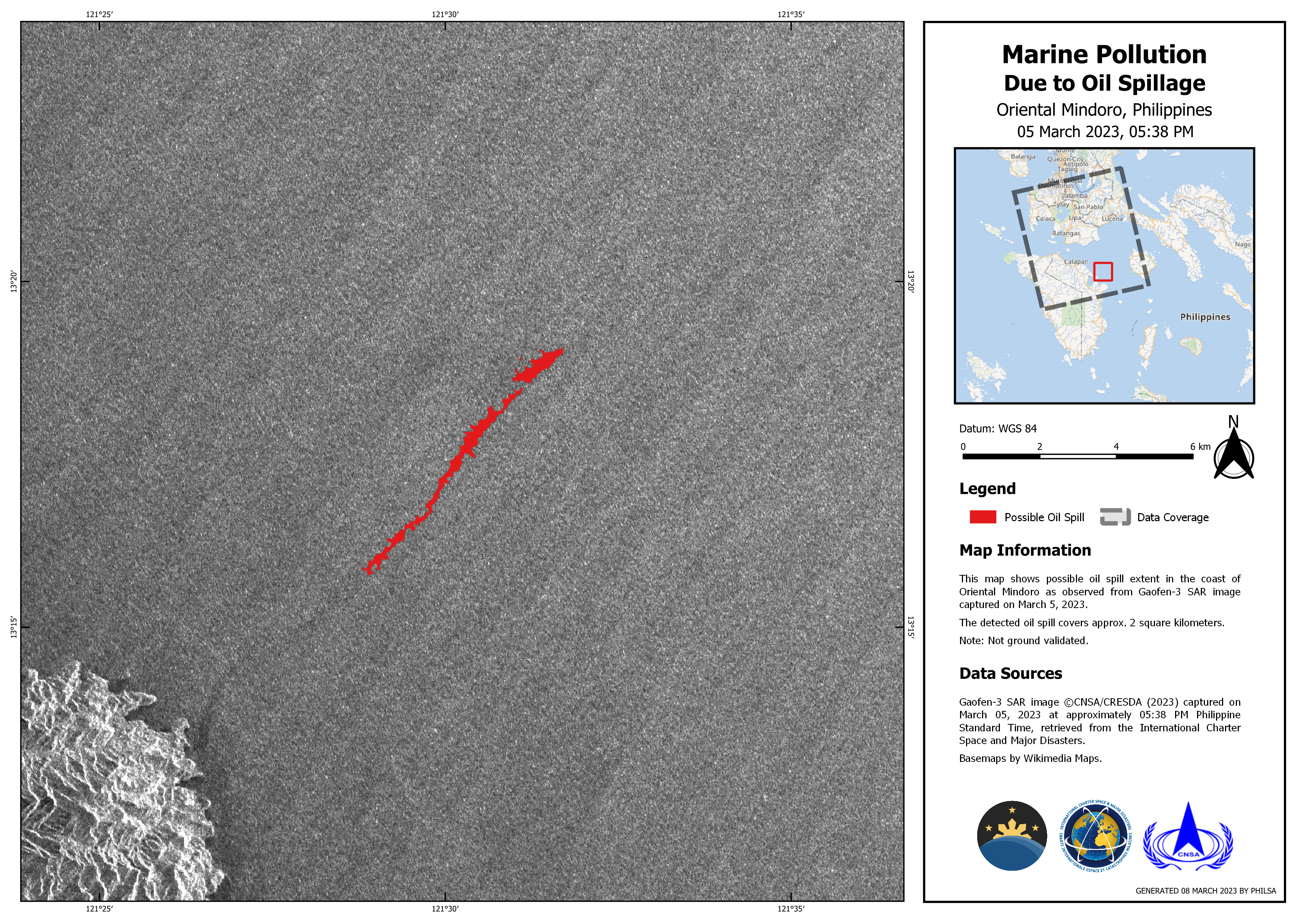
Marine Pollution Due to Oil Spillage Oriental Mindoro, Philippines
Direitos autorais: RADARSAT Constellation Mission Imagery © Government of Canada (2023) - RADARSAT is an official mark of the Canadian Space Agency
Map produced by PHILSA
Information about the Product
Adquirida: 19/03/2023
Fonte: RCM
Categoria: Delineation Monitoring Maps
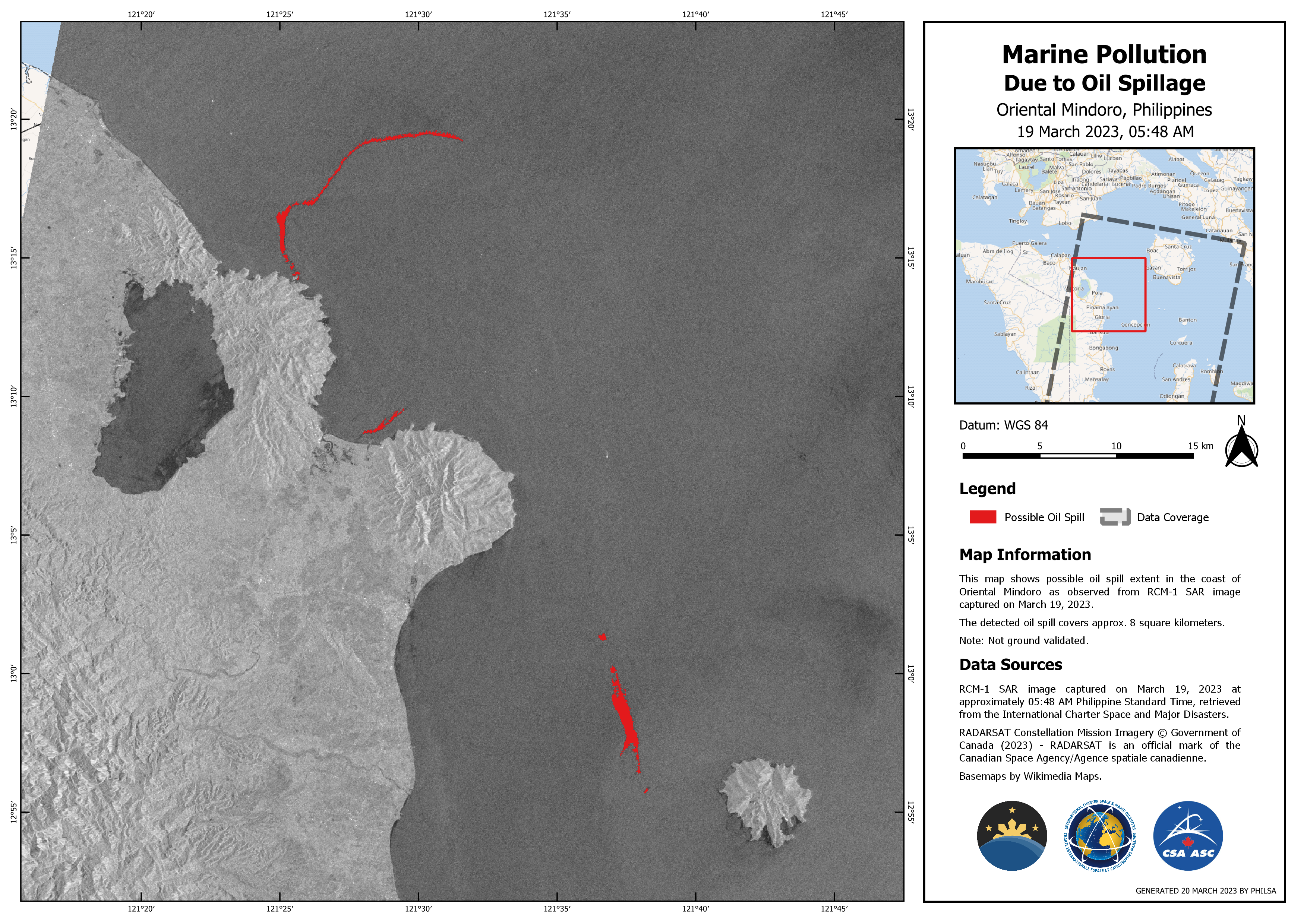
Marine Pollution Due to Oil Spillage Oriental Mindoro, Philippines
Direitos autorais: RADARSAT Constellation Mission Imagery © Government of Canada (2023) - RADARSAT is an official mark of the Canadian Space Agency
Map produced by PHILSA
Information about the Product
Adquirida: 18/03/2023
Fonte: RCM
Categoria: Delineation Monitoring Maps
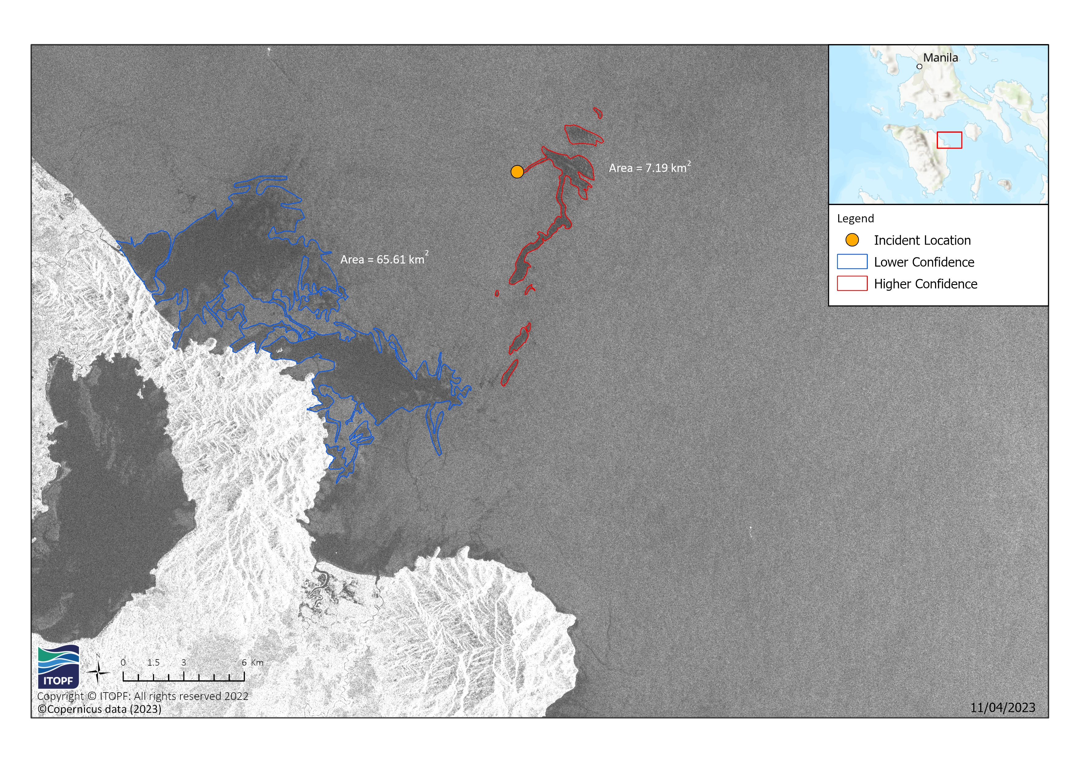
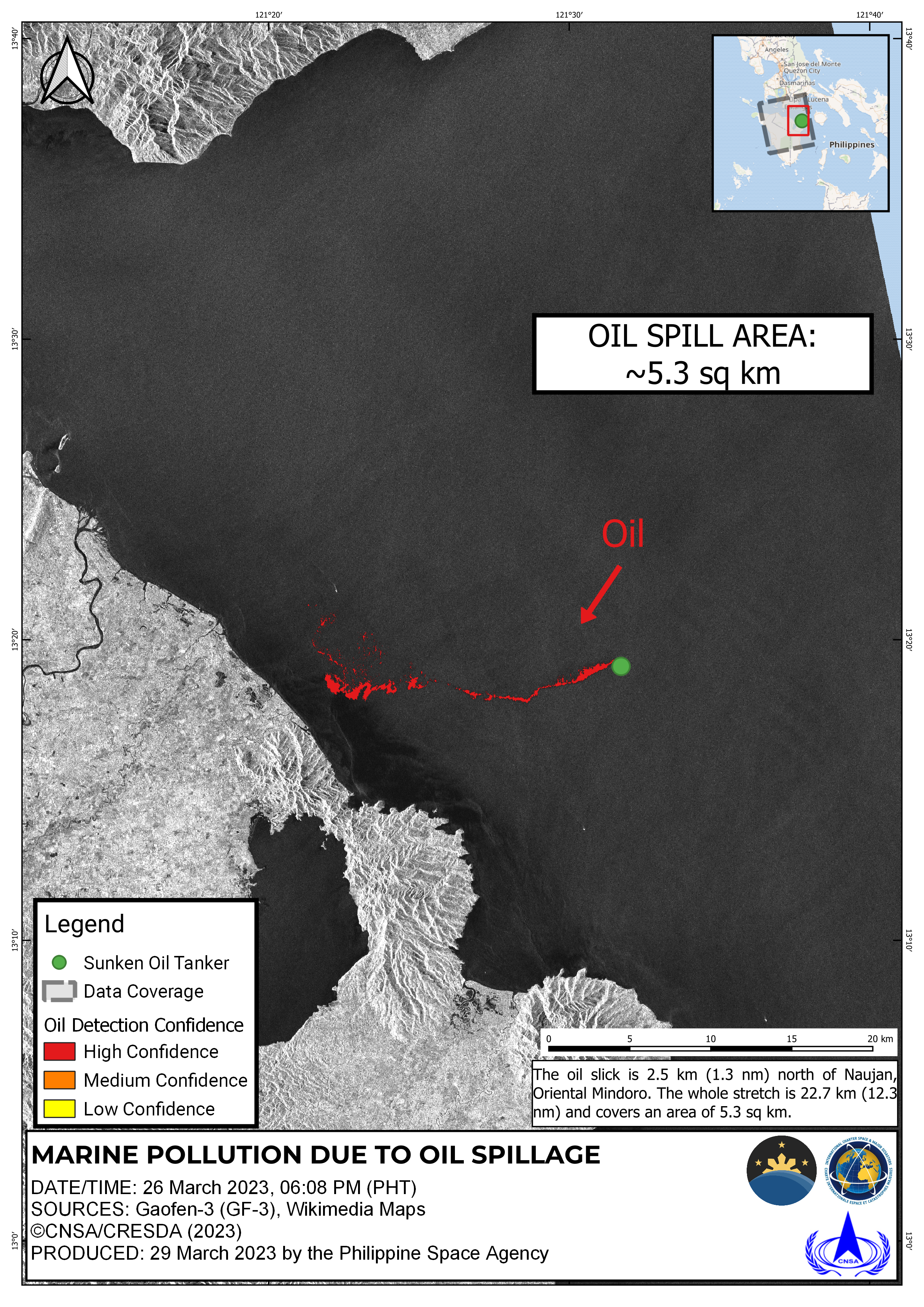
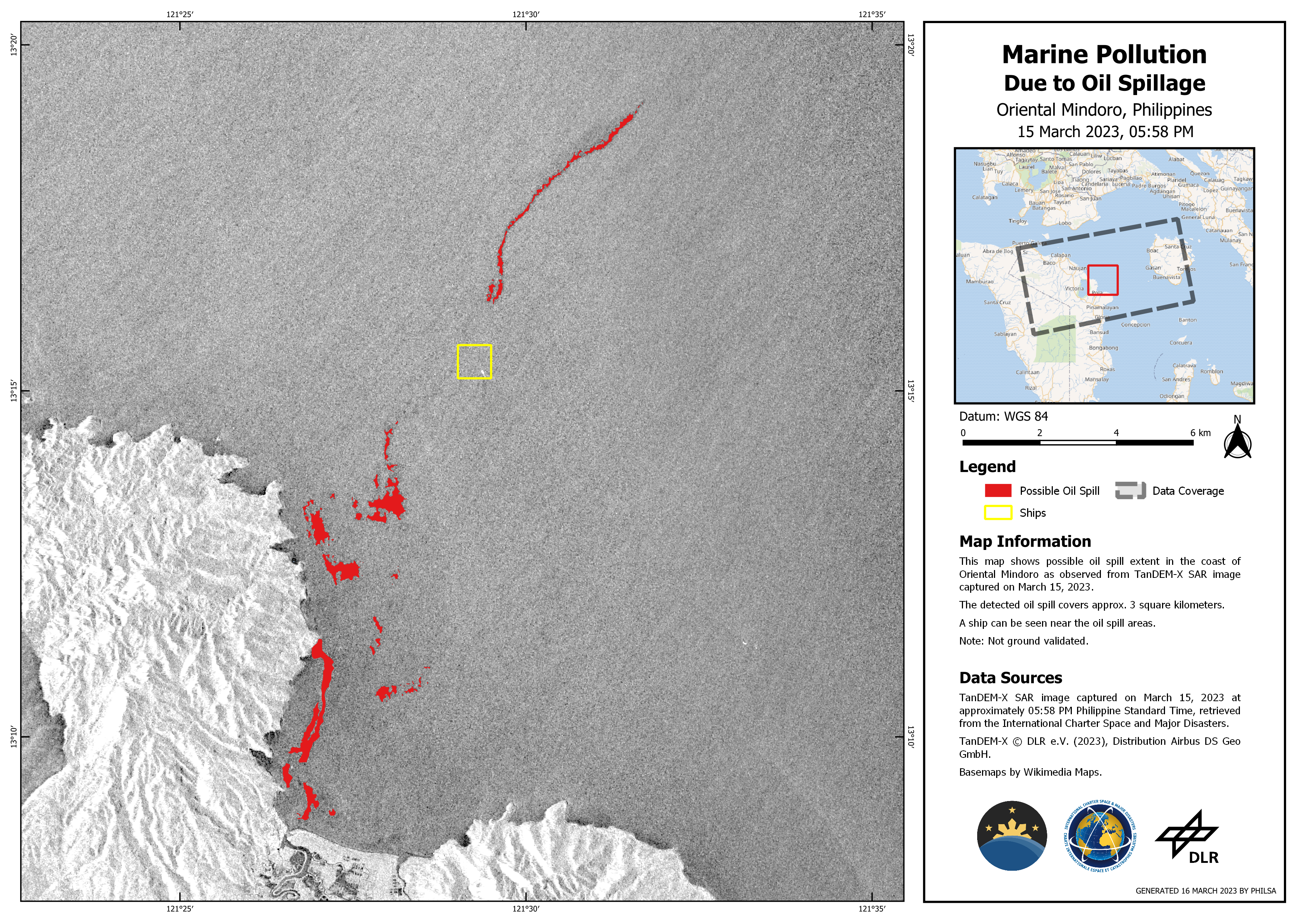
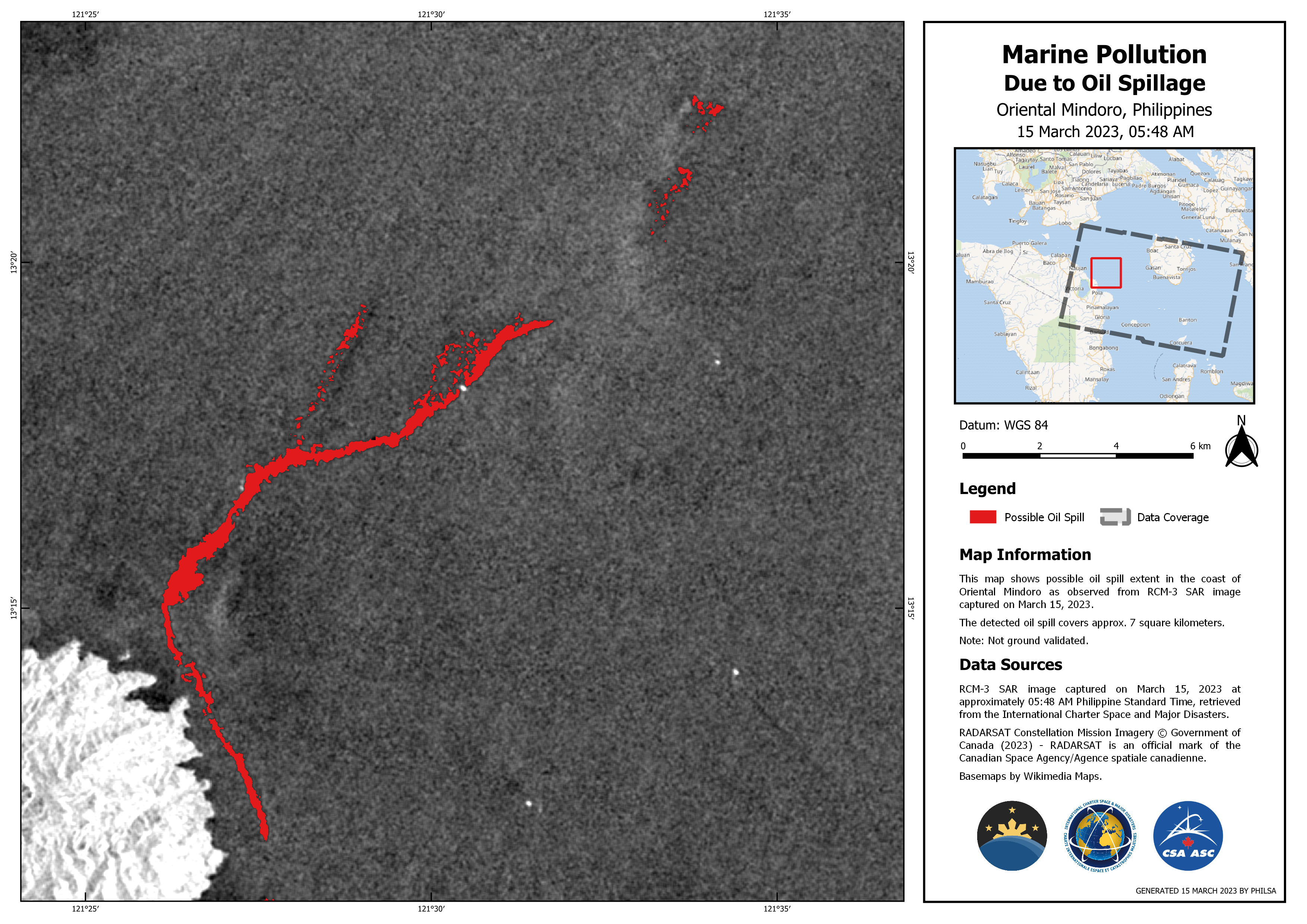
Marine Pollution duet to oil spillage
Direitos autorais: RADARSAT Constellation Mission Imagery © Government of Canada (2023) - RADARSAT is an official mark of the Canadian Space Agency
Map produced by PHILSA
Information about the Product
Adquirida: 15/03/2023
Fonte: RCM
Categoria: Delineation Monitoring Maps
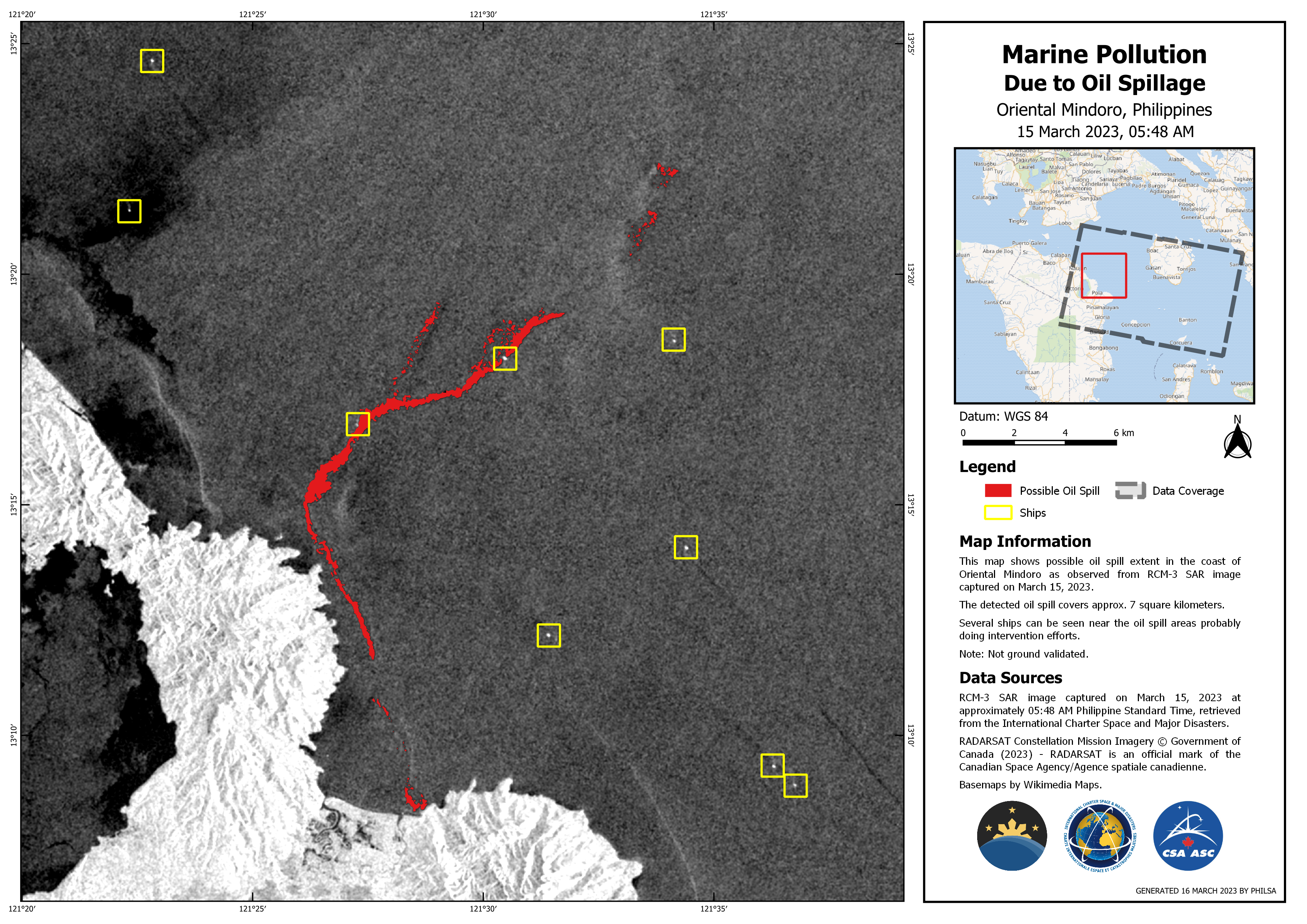
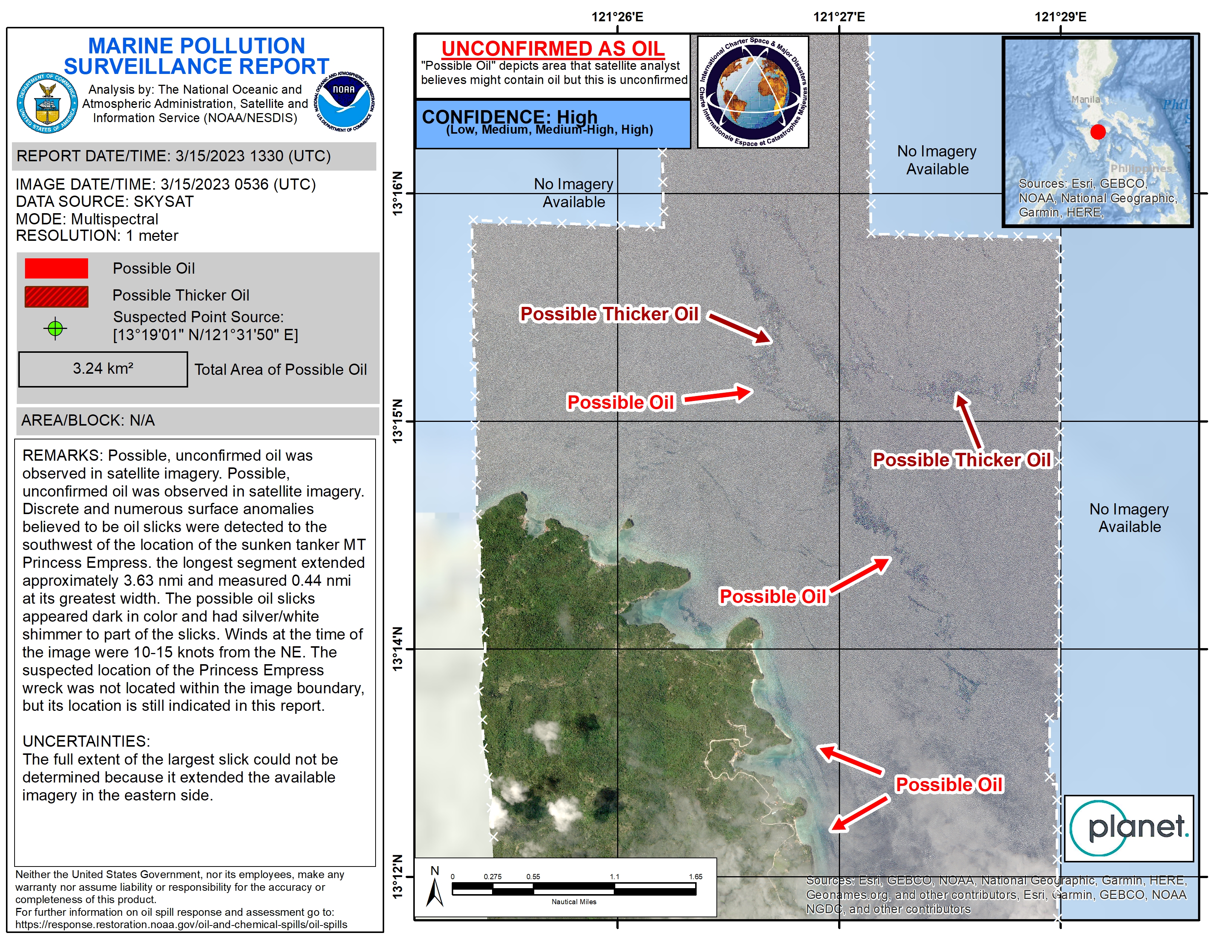
Marine Pollution due to oil spillage
Direitos autorais: RADARSAT Constellation Mission Imagery © Government of Canada (2023) - RADARSAT is an official mark of the Canadian Space Agency
Map produced by PHILSA
Information about the Product
Adquirida: 14/03/2023
Fonte: RCM
Categoria: Delineation Monitoring Maps
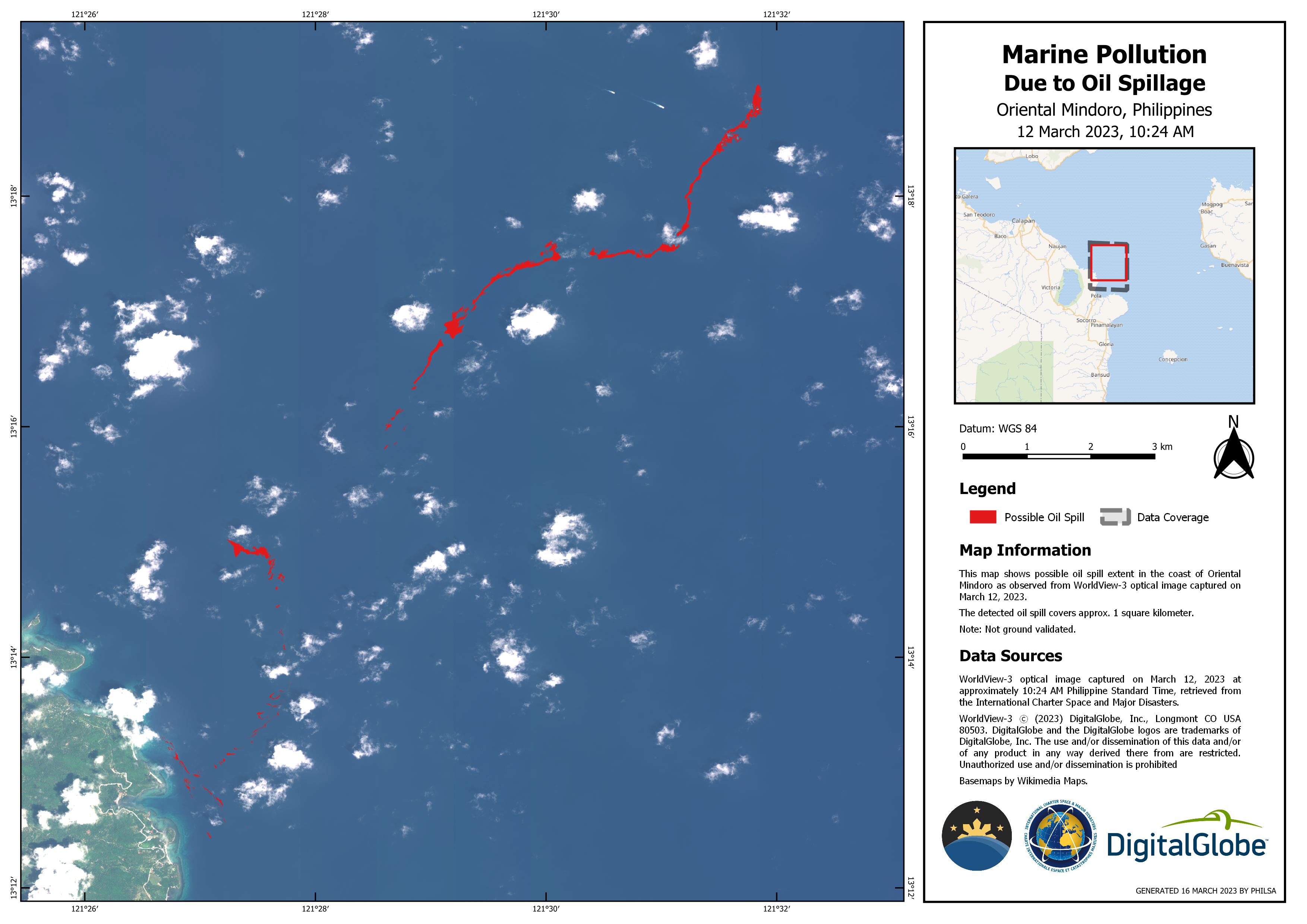
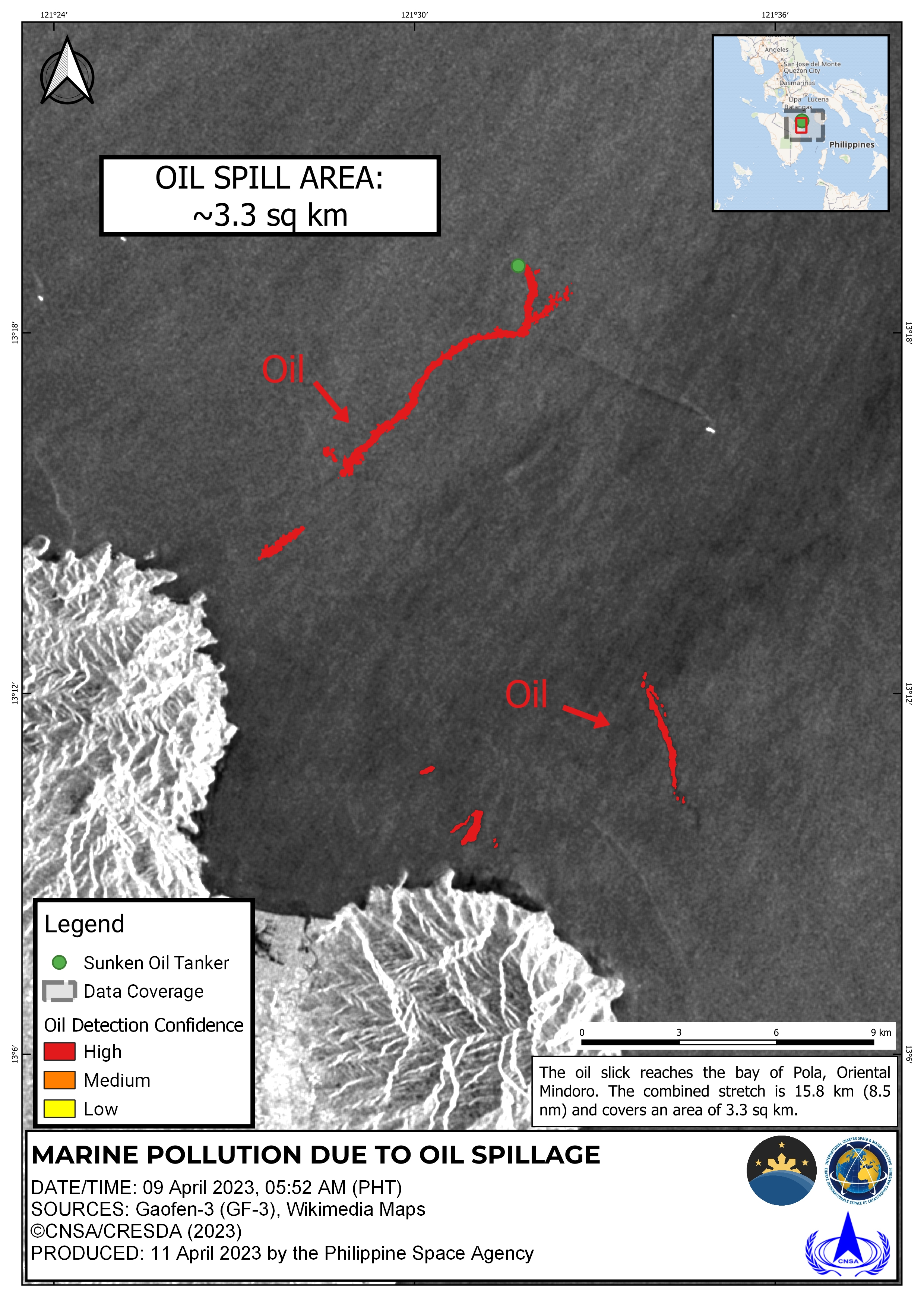
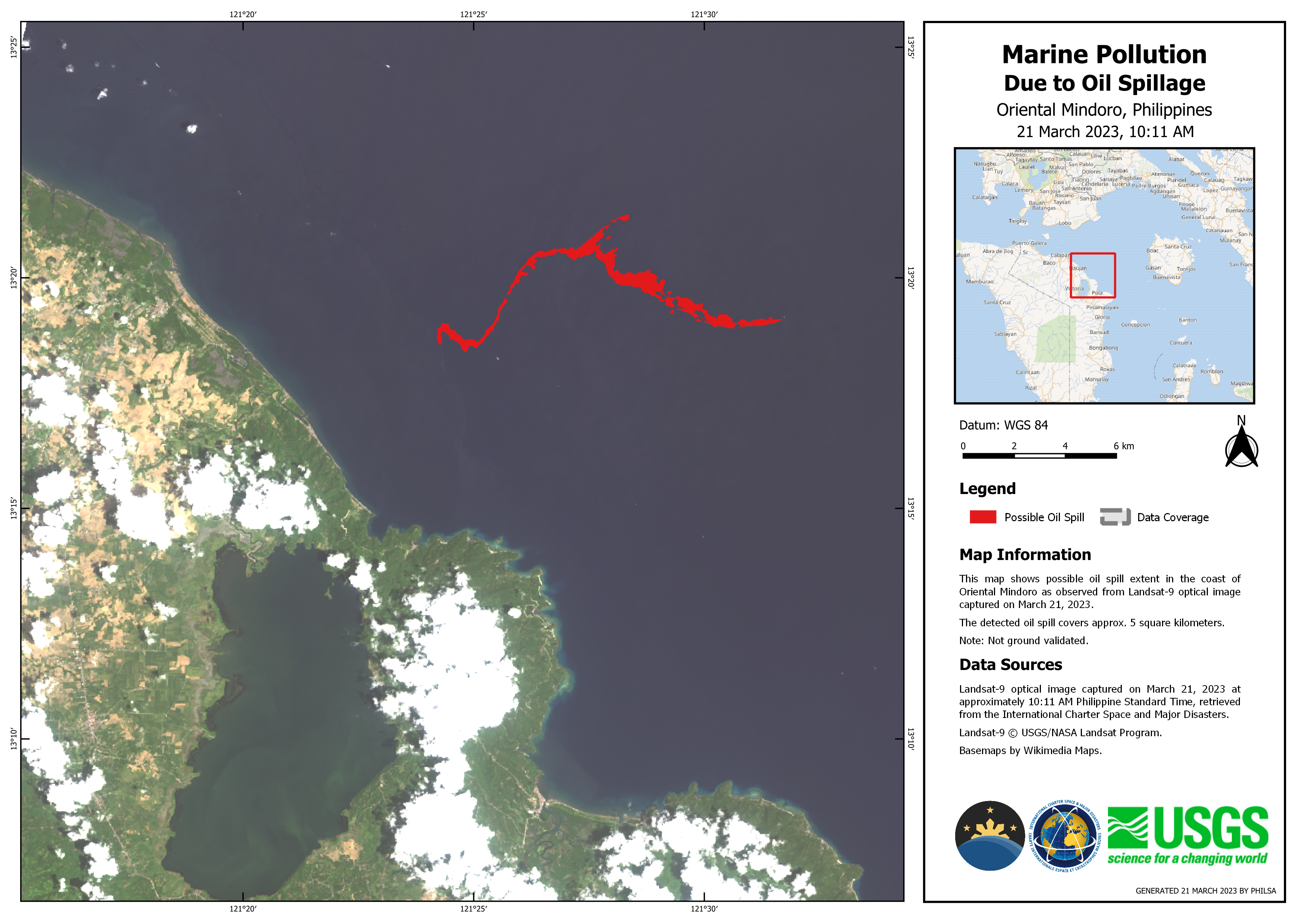
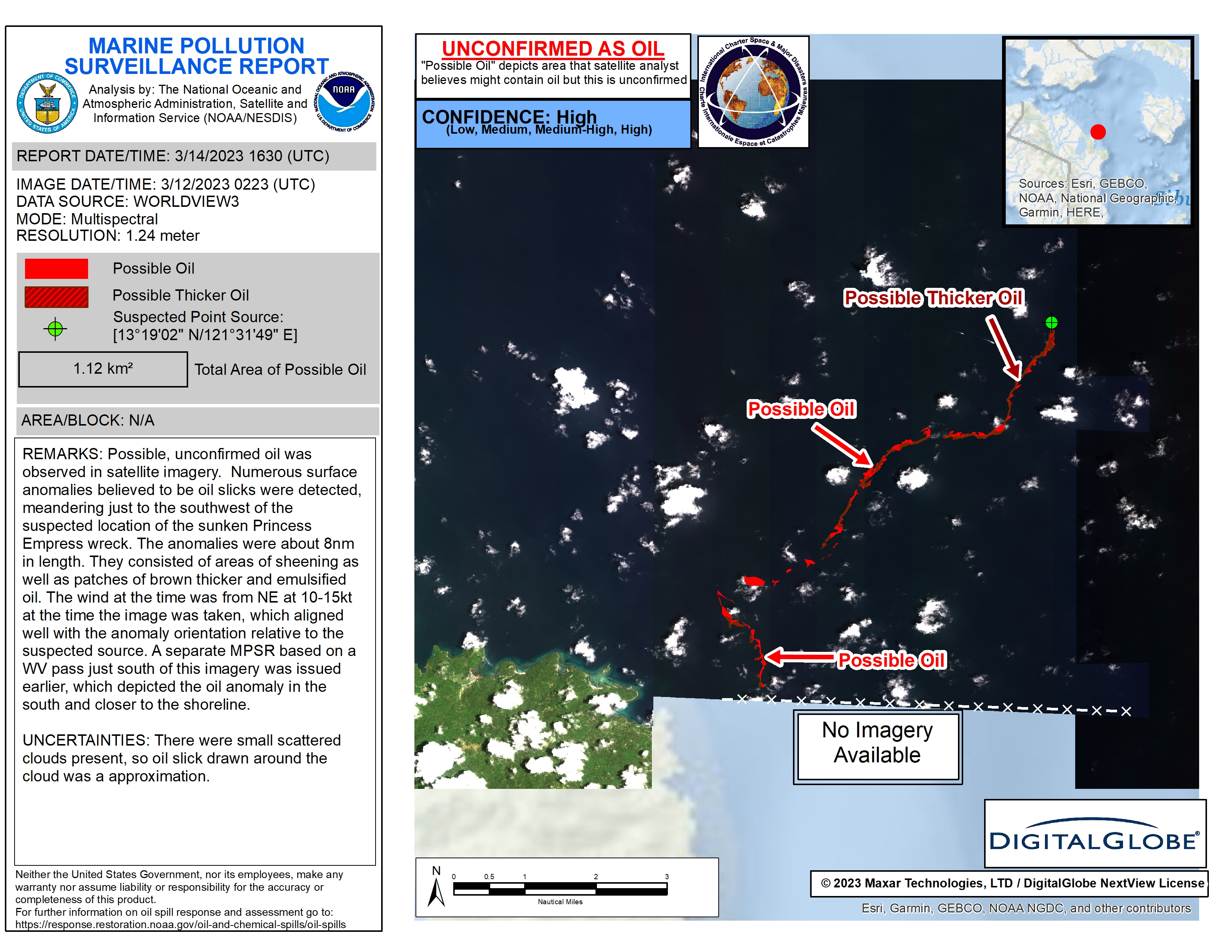
Marine Pollution due to oil spillage
Direitos autorais: © (2023) DigitalGlobe, Inc., Longmont CO USA 80503. DigitalGlobe and the DigitalGlobe logos are trademarks of DigitalGlobe, Inc. The use and/or dissemination of this data and/or of any product in any way derived there from are restricted. Unauthorized use and/or dissemination is prohibited
Map produced by PHILSA
Information about the Product
Adquirida: 12/03/2023
Fonte: WorldView-3
Categoria: Delineation Map
Philippines Oil Spill
Direitos autorais: © (2023) DigitalGlobe, Inc., Longmont CO USA 80503. DigitalGlobe and the DigitalGlobe logos are trademarks of DigitalGlobe, Inc. The use and/or dissemination of this data and/or of any product in any way derived there from are restricted. Unauthorized use and/or dissemination is prohibited.
Map produced by NOAA / NESDIS
Information about the Product
Adquirida: 12/03/2023
Fonte: WorldView-3
Categoria: Delineation Map
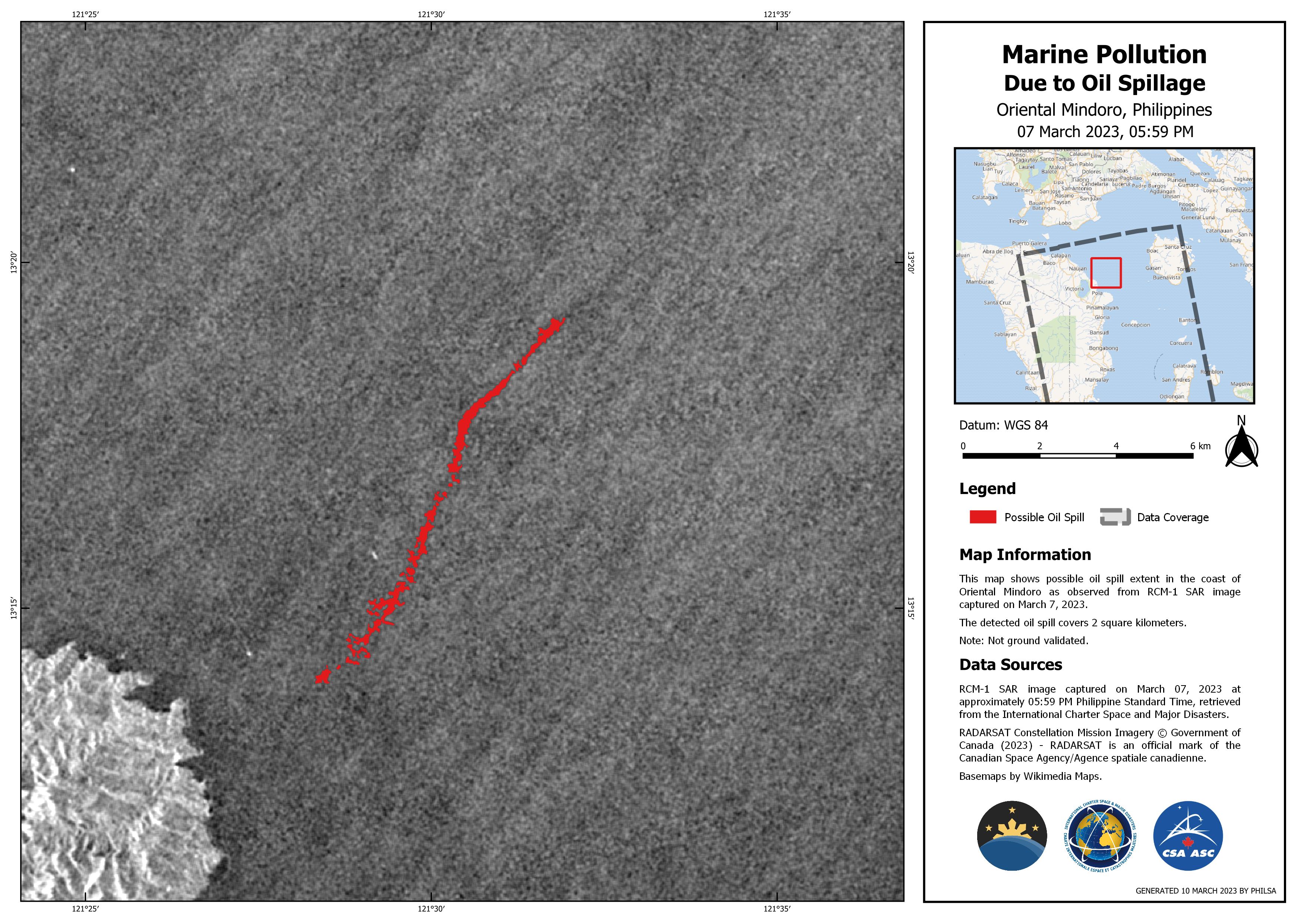
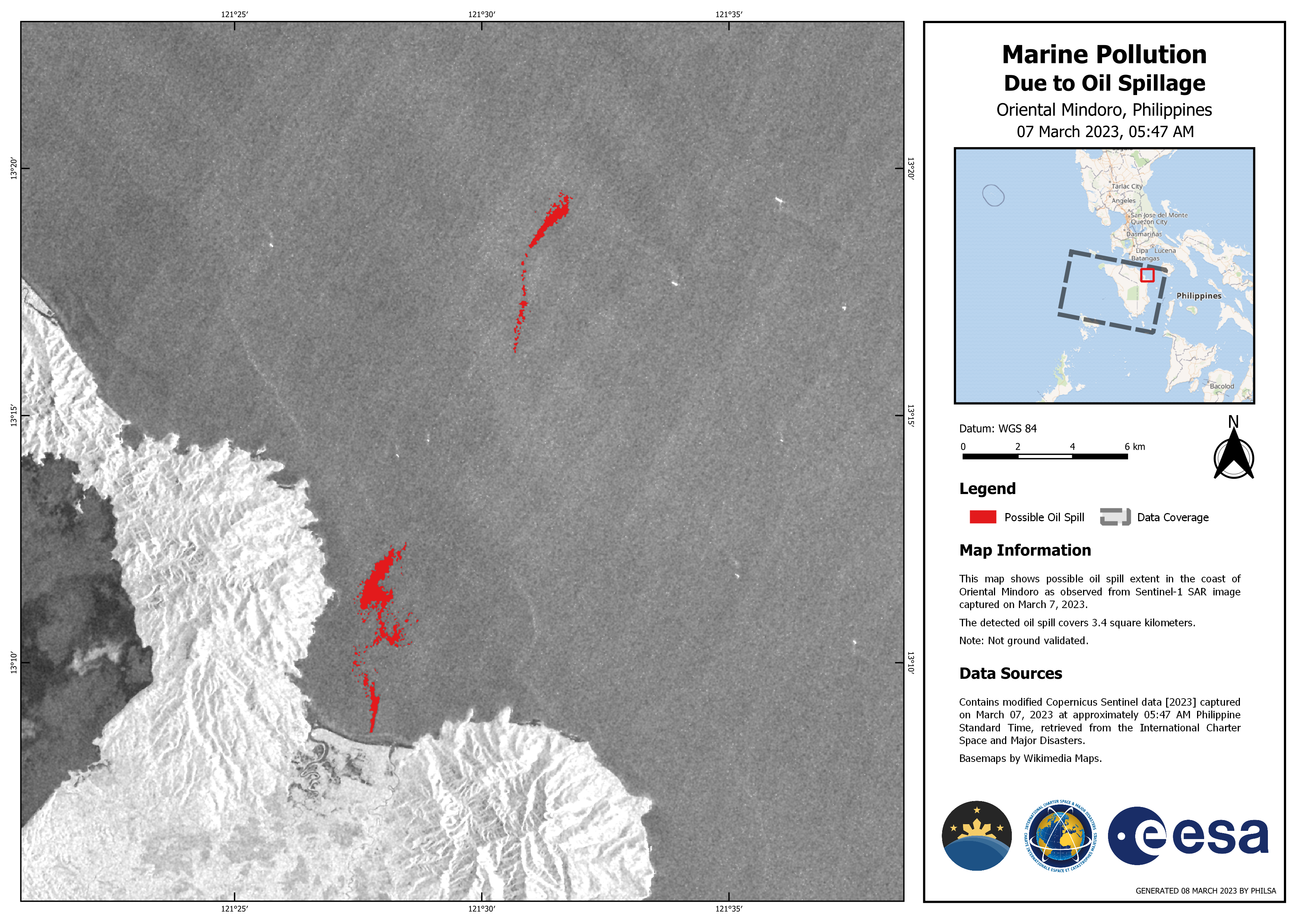
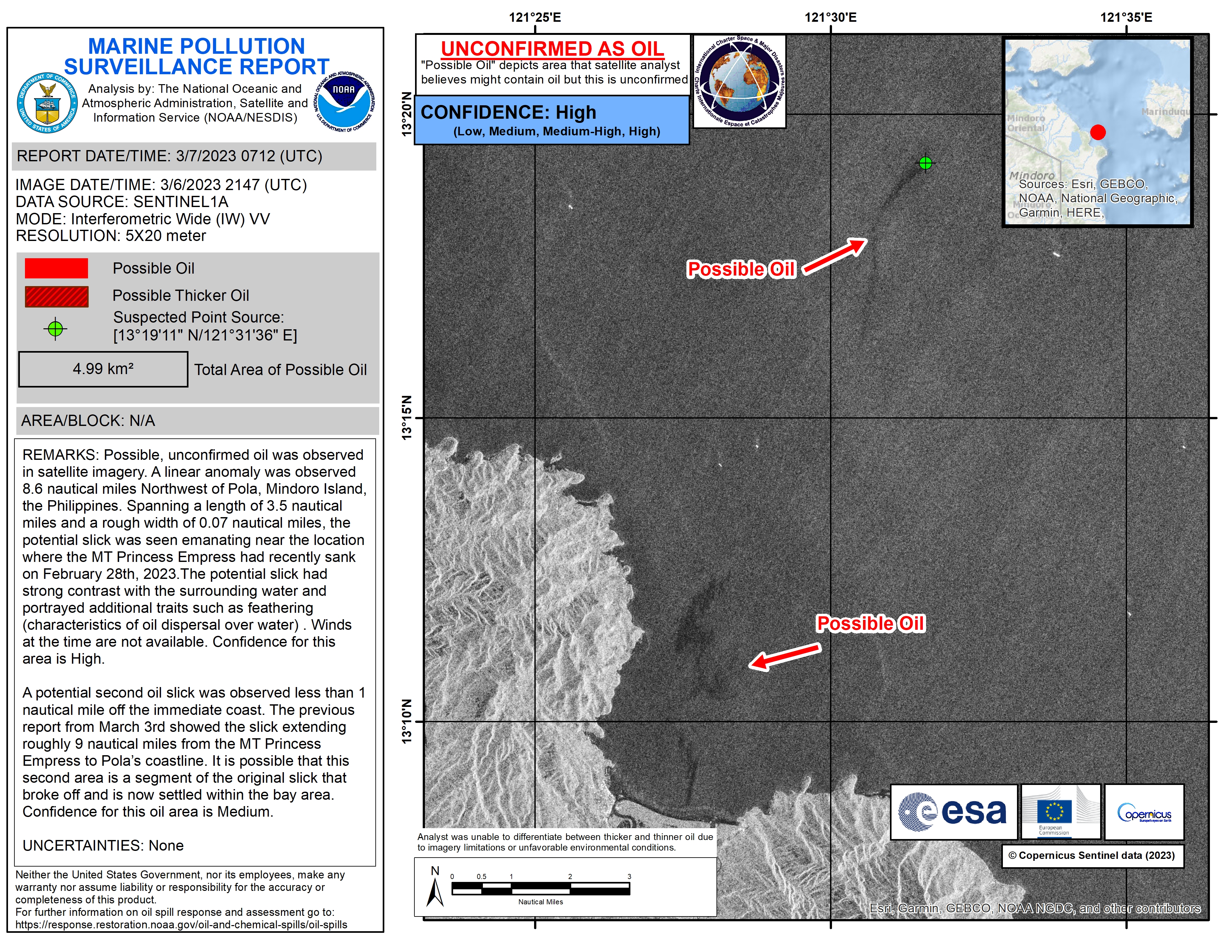
Marine Pollution Due to Oil Spillage Oriental Mindoro, Philippines
Direitos autorais: RADARSAT Constellation Mission Imagery © Government of Canada (2023) - RADARSAT is an official mark of the Canadian Space Agency
Map produced by PHILSA
Information about the Product
Adquirida: 07/03/2023
Fonte: RCM
Categoria: Delineation Monitoring Maps
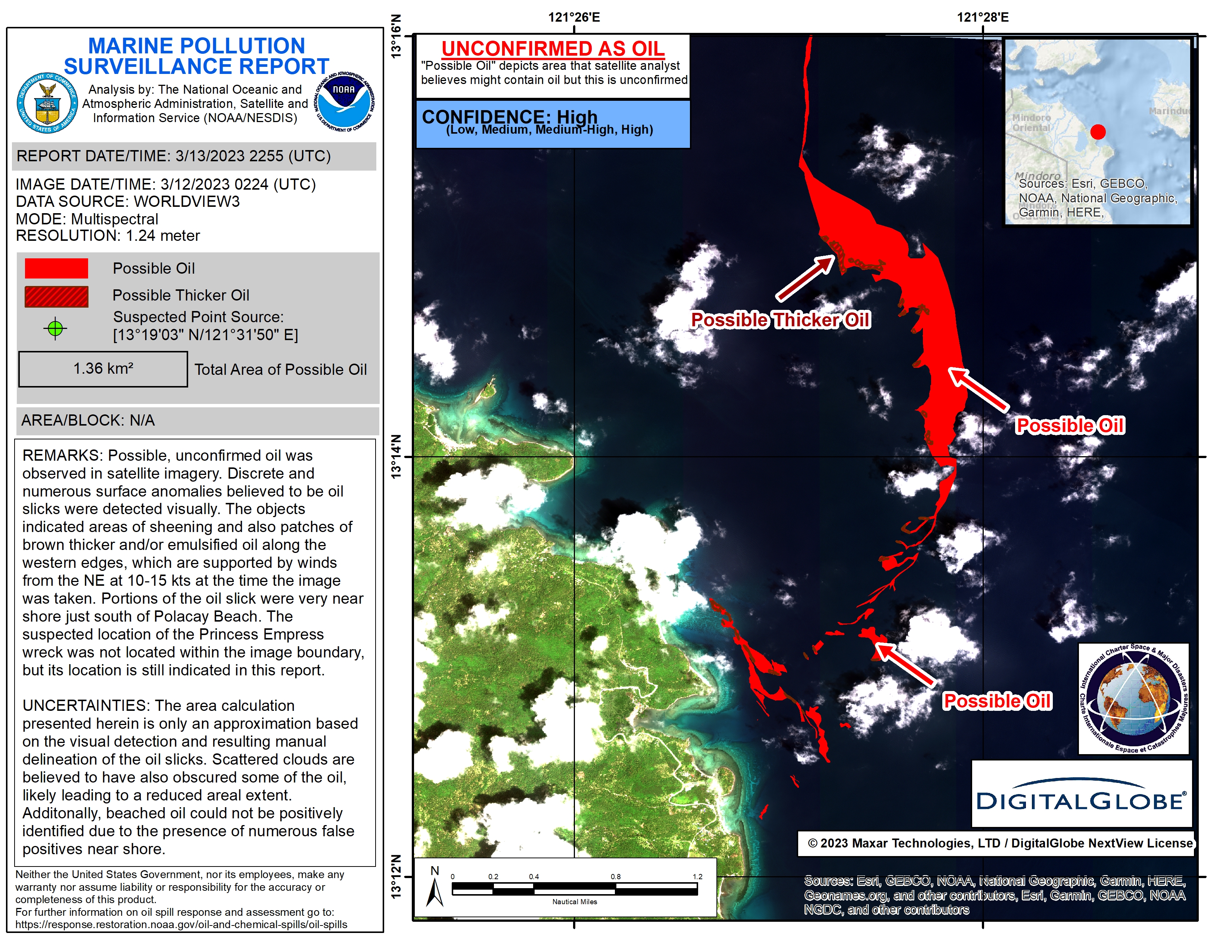
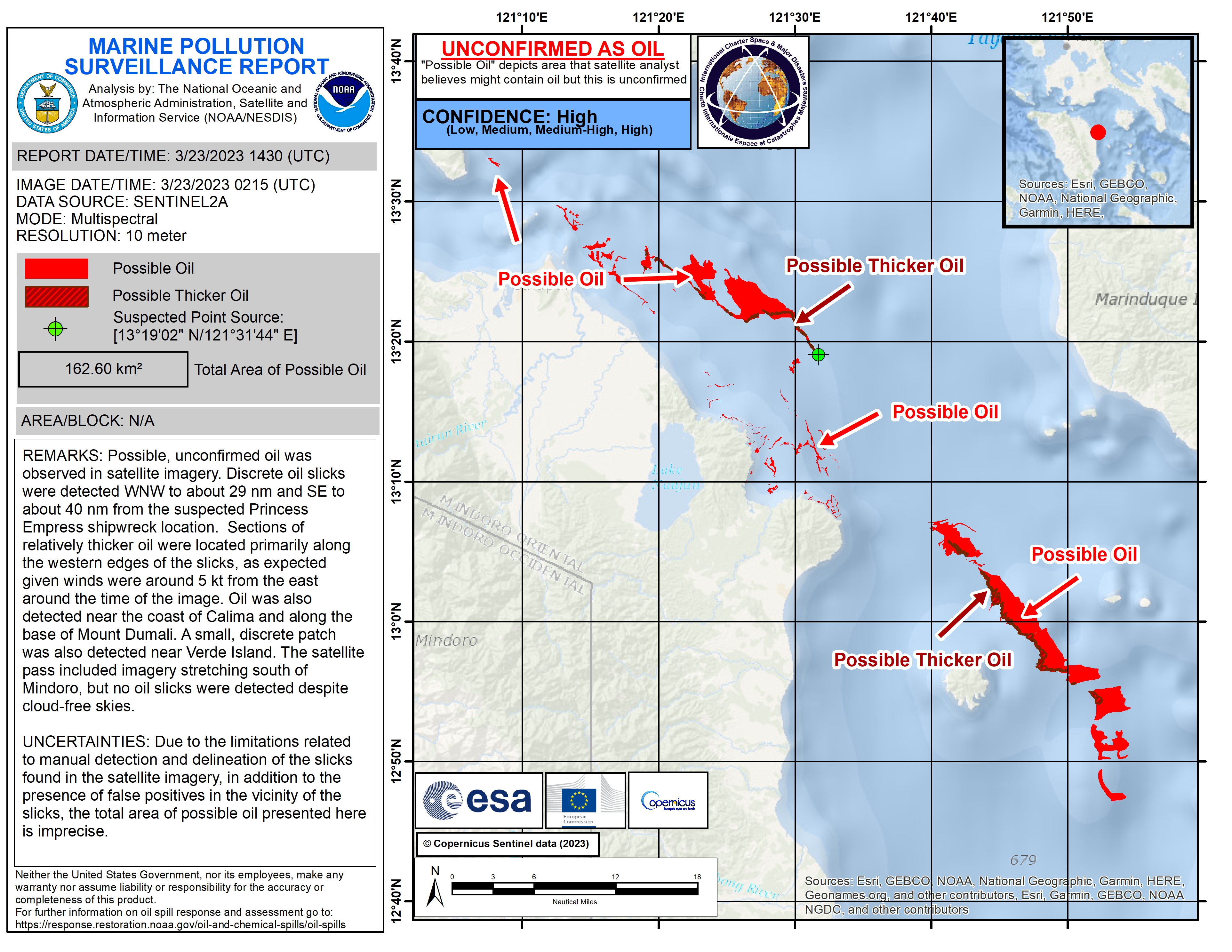
Oil Spill in the Philippines
Direitos autorais: © (2023) DigitalGlobe, Inc., Longmont CO USA 80503. DigitalGlobe and the DigitalGlobe logos are trademarks of DigitalGlobe, Inc. The use and/or dissemination of this data and/or of any product in any way derived there from are restricted. Unauthorized use and/or dissemination is prohibited
Map produced by NOAA / NESDIS
Information about the Product
Adquirida: 12/03/2023
Fonte: WorldView-3
Categoria: Delineation Map
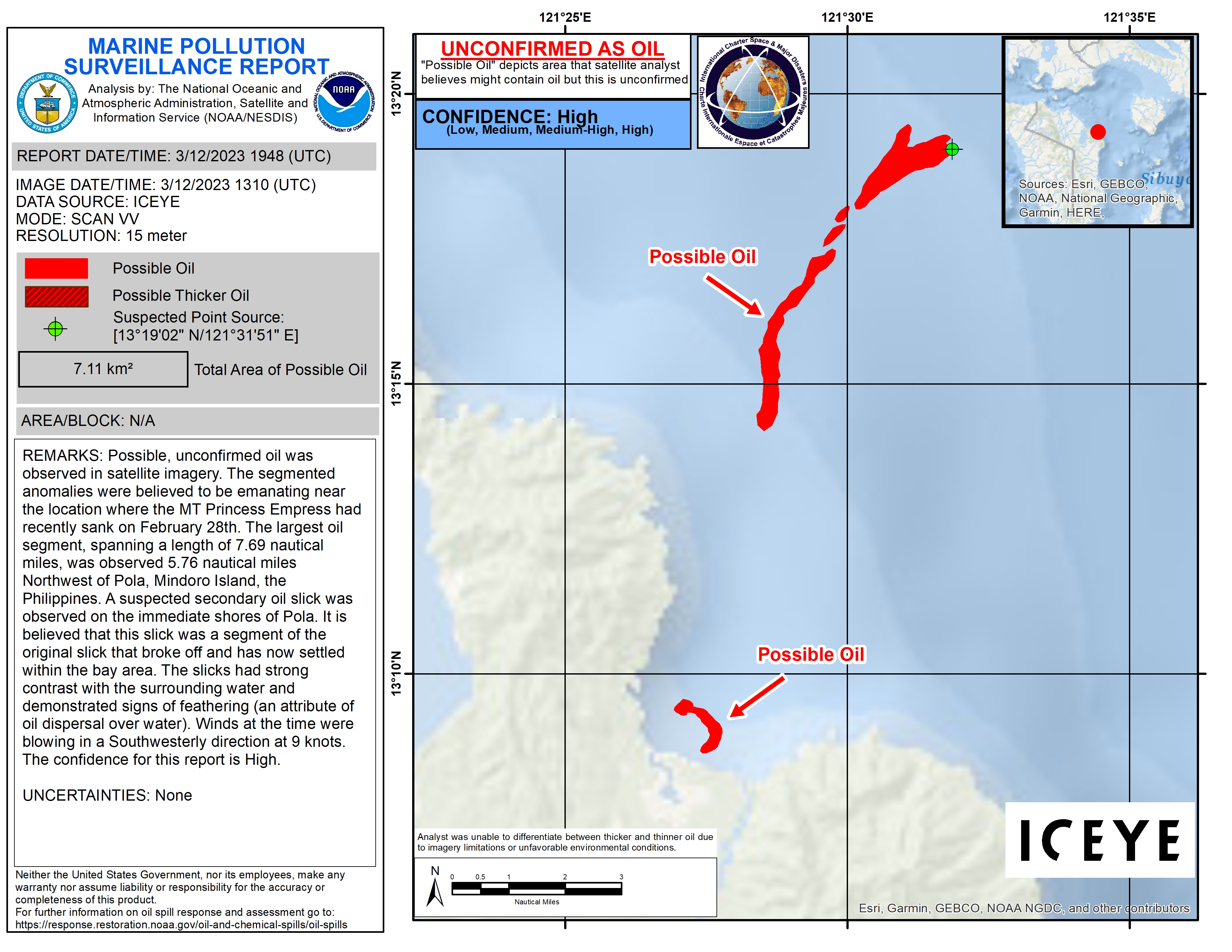
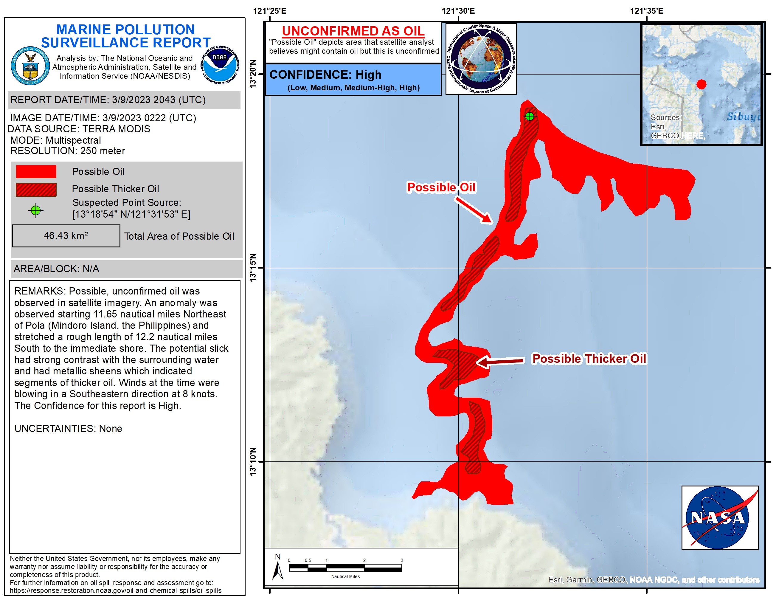
Potential Oil Spill in the Philippines
Direitos autorais: We acknowledge the use of imagery from the NASA Worldview application (https://worldview.earthdata.nasa.gov), part of the NASA Earth Observing System Data and Information System (EOSDIS).
Map produced by NOAA / NESDIS
Information about the Product
Adquirida: 09/03/2023
Fonte: Terra
Categoria: Reference Map
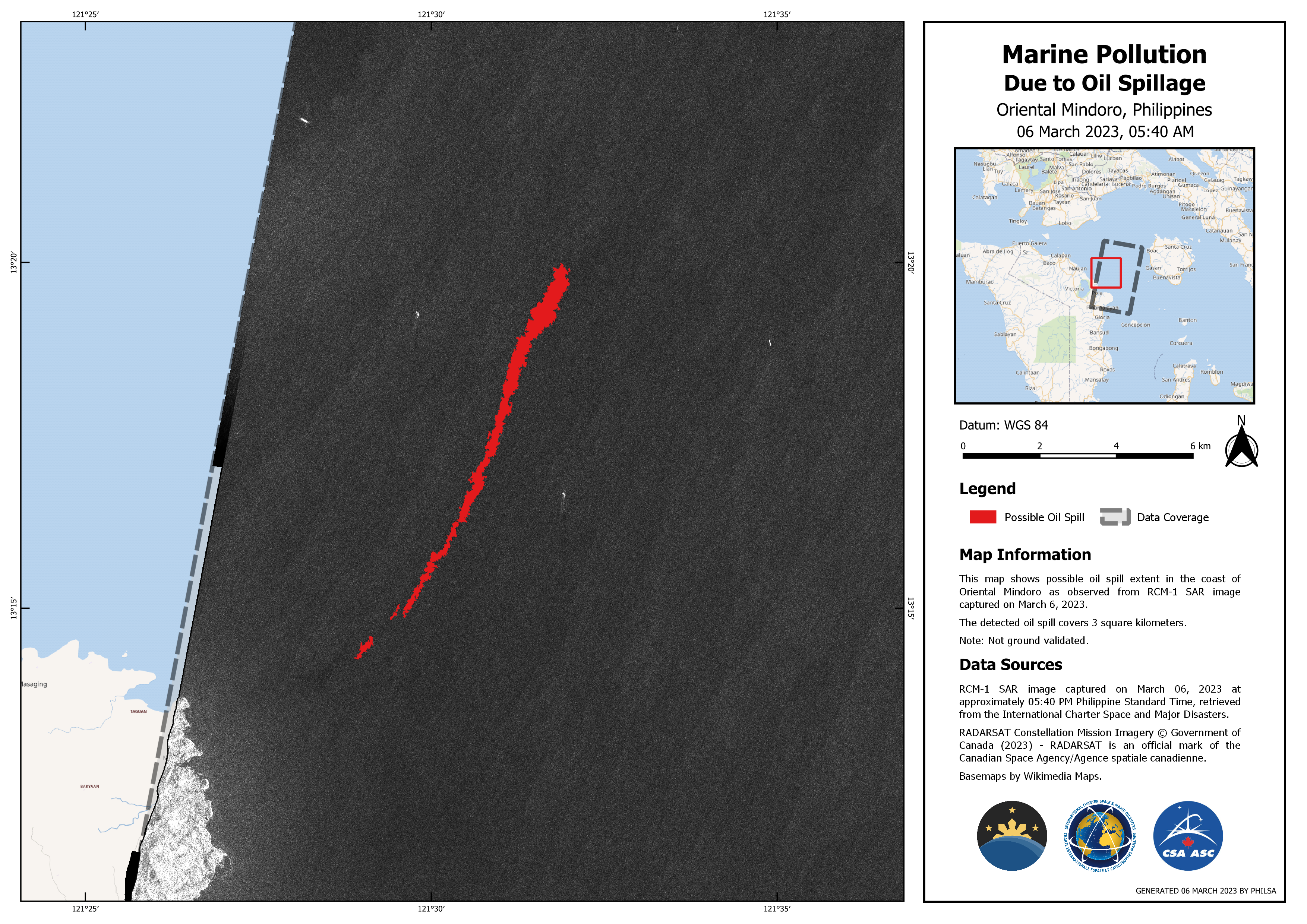
Marine Pollution Monitoring due to oil spillage.
Direitos autorais: RADARSAT Constellation Mission Imagery © Government of Canada (2023) - RADARSAT is an official mark of the Canadian Space Agency
Map produced by PHILSA
Information about the Product
Adquirida: 05/03/2023
Fonte: RCM
Categoria: Delineation Monitoring Maps
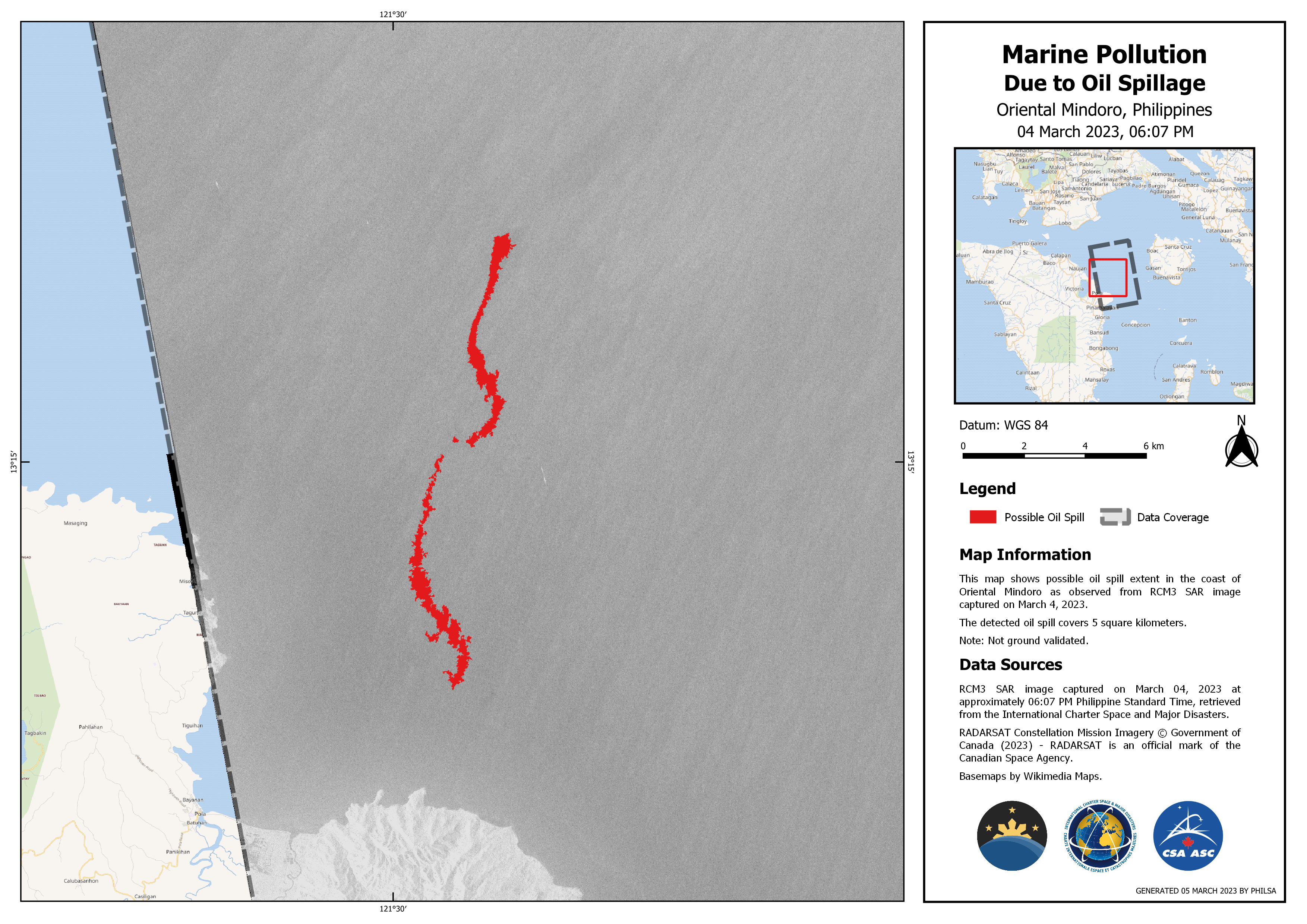
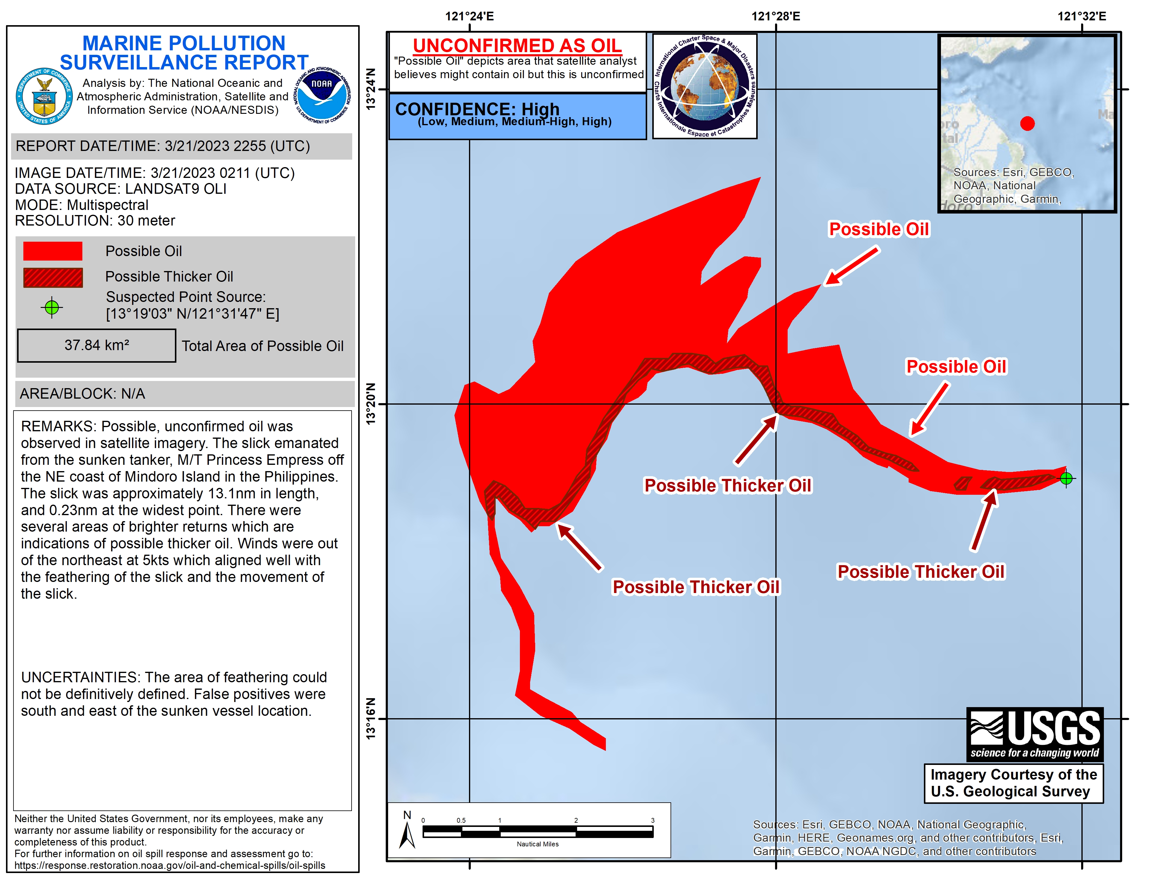
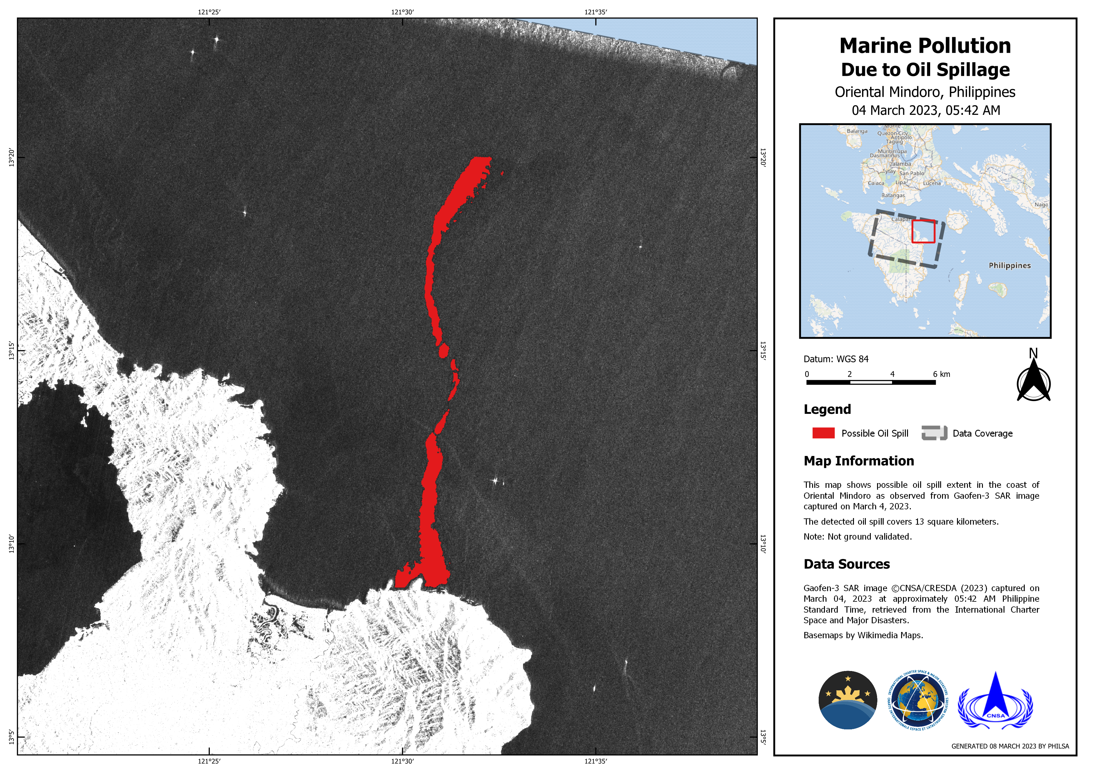
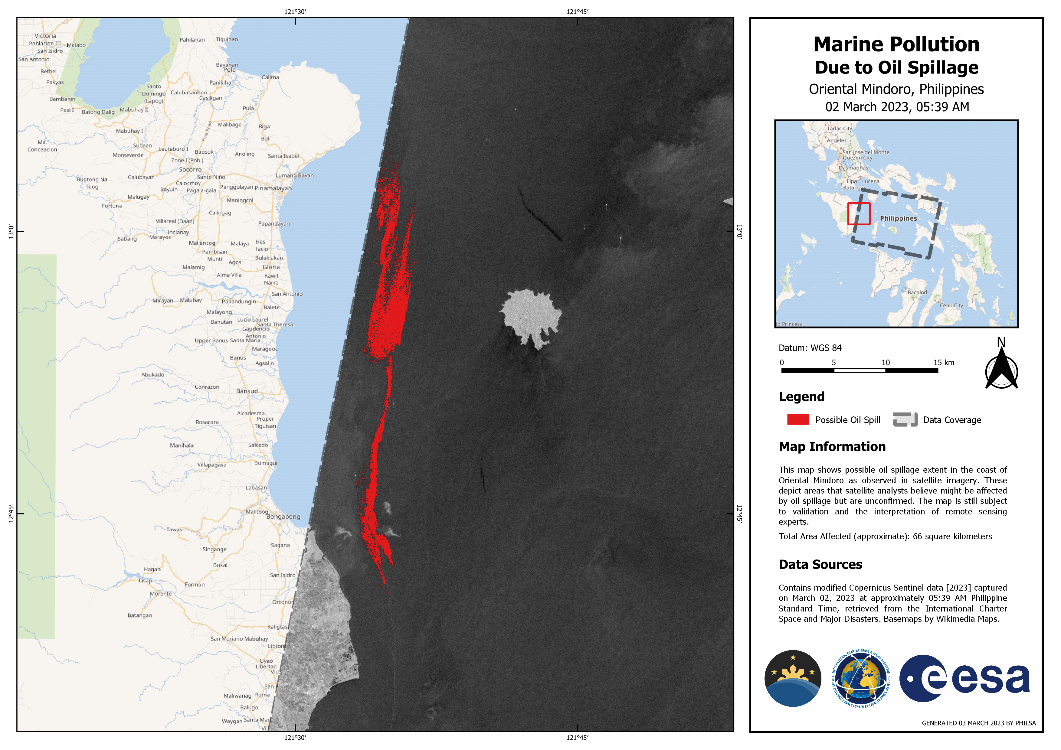
Marine Pollution Due to Oil Spillage
Direitos autorais: RADARSAT Constellation Mission Imagery © Government of Canada (2023) - RADARSAT is an official mark of the Canadian Space Agency
Map produced by PHILSA
Information about the Product
Adquirida: 04/03/2023
Fonte: RCM
Categoria: Delineation Monitoring Maps
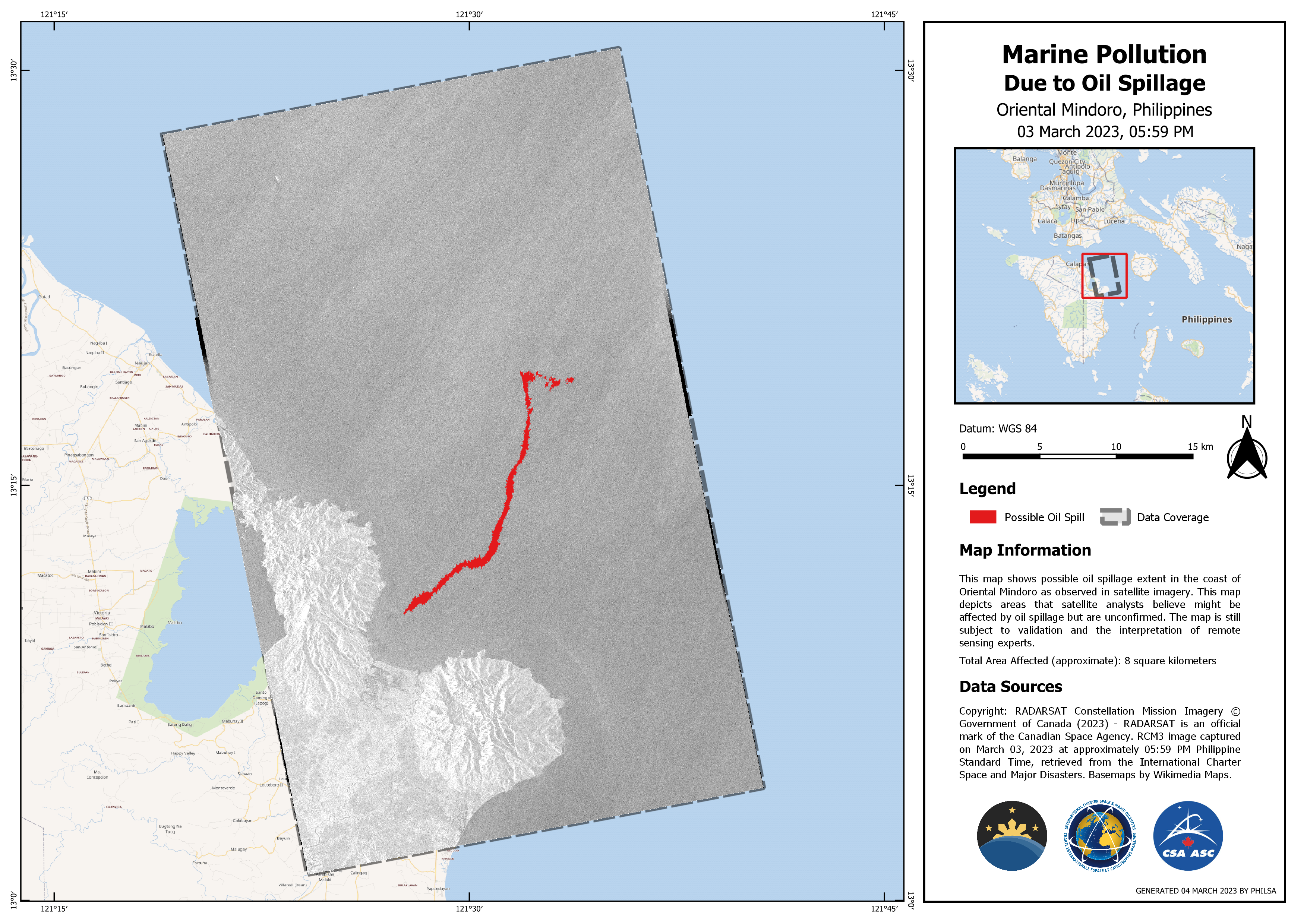
Marine Pollution due to Oil Spillage, Mindoro Philippines
Direitos autorais: RADARSAT Constellation Mission Imagery © Government of Canada (2023) - RADARSAT is an official mark of the Canadian Space Agency
Map produced by PHILSA
Information about the Product
Adquirida: 03/03/2023
Fonte: RCM
Categoria: Delineation Map
 Voltar ao arquivo completo da Ativação

