Latest Activation
Charter activations
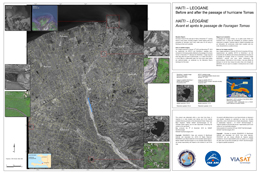
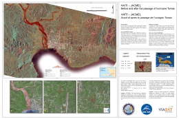
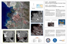
Ocean Storm in Haiti
A category 1 hurricane, tropical storm Tomas, heading towards Haiti, is expected to reach the proximity of Haiti on 5 November 2010.
The storm has already caused major damage to infrastructure and housing. Considering the large number (approximately 1.5 million) of refugees living in very basic conditions, the risk of a major impact is very high.
| Tipo de evento: | Ocean Storm (Hurricane) |
| Local do evento: | Haiti |
| Data da Ativação da Carta: | 05/11/2010 |
| Requisitante da Carta: | Public Safety Canada |
| Gerenciamento de projeto: | CSA |
Products
 Voltar ao arquivo completo da Ativação

 English
 Spanish
 French
 Chinese
 Russian
 Portuguese


