 English
 Spanish
 French
 Chinese
 Russian
 Portuguese
 Latest Activation
Charter activations
Landslide in Sri Lanka
Monsoon rains in Sri Lanka caused a landslide on 29 October 2014, which is believed to have killed over a hundred people.
The landslide occurred near the town of Haldummulla and mud and debris buried approximately 150 houses, and potentially more than a hundred residents.
Hundreds of rescue personnel and the military have been searching for survivors, but as of 30 October they think it unlikely that anyone still buried has survived. Some houses in the town have been buried in mud as deep as 9 metres (30 feet). Ten bodies have been recovered so far.
Haldummulla is located in the Badulla district of Sri Lanka, an agricultural region of the country. Sri Lanka has experienced other landslides in the past few months, due to further bouts of monsoon rain, but this latest incident has taken the highest toll in lives of the year.
| Tipo de evento: | Landslide |
| Local do evento: | Sri Lanka |
| Data da Ativação da Carta: | 30 October 2014 |
| Tempo de Ativação da Carta: | 04:00:00 |
| Zona de Tempo da Ativação da Carta: | UTC+01:00 |
| Requisitante da Carta: | Asia Disaster Reduction Centre (ADRC) on behalf of Asia Disaster Reduction Centre (ADRC) |
| Gerenciamento de projeto: | Asian Institute of Technology (AIT) |
Products
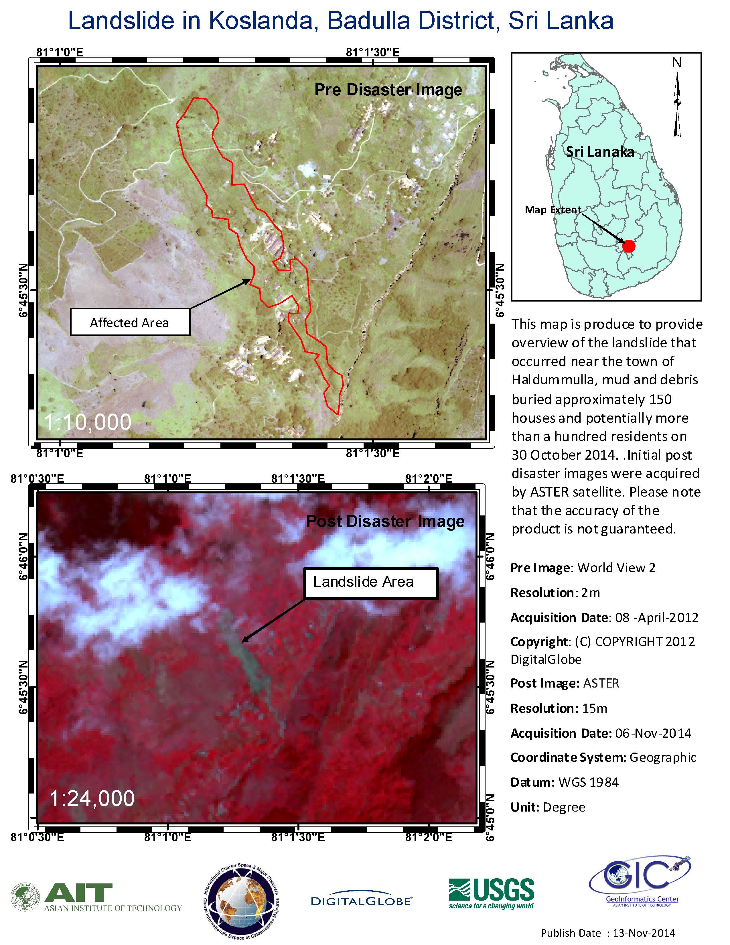
Landslide in Koslanda, Badulla District, Sri Lanka
Direitos autorais: WorldView-2 © DigitalGlobe 2012
ASTER © USGS/NASA
Map produced by Geoinformatics Center, Asian Institute of Technology
Information about the Product
Adquirida: WorldView-2: 08/04/2012
ASTER: 06/11/2014
Fonte: WorldView-2 / Terra-ASTER
 Voltar ao arquivo completo da Ativação

