 English
 Spanish
 French
 Chinese
 Russian
 Portuguese
 Latest Activation
Charter activations
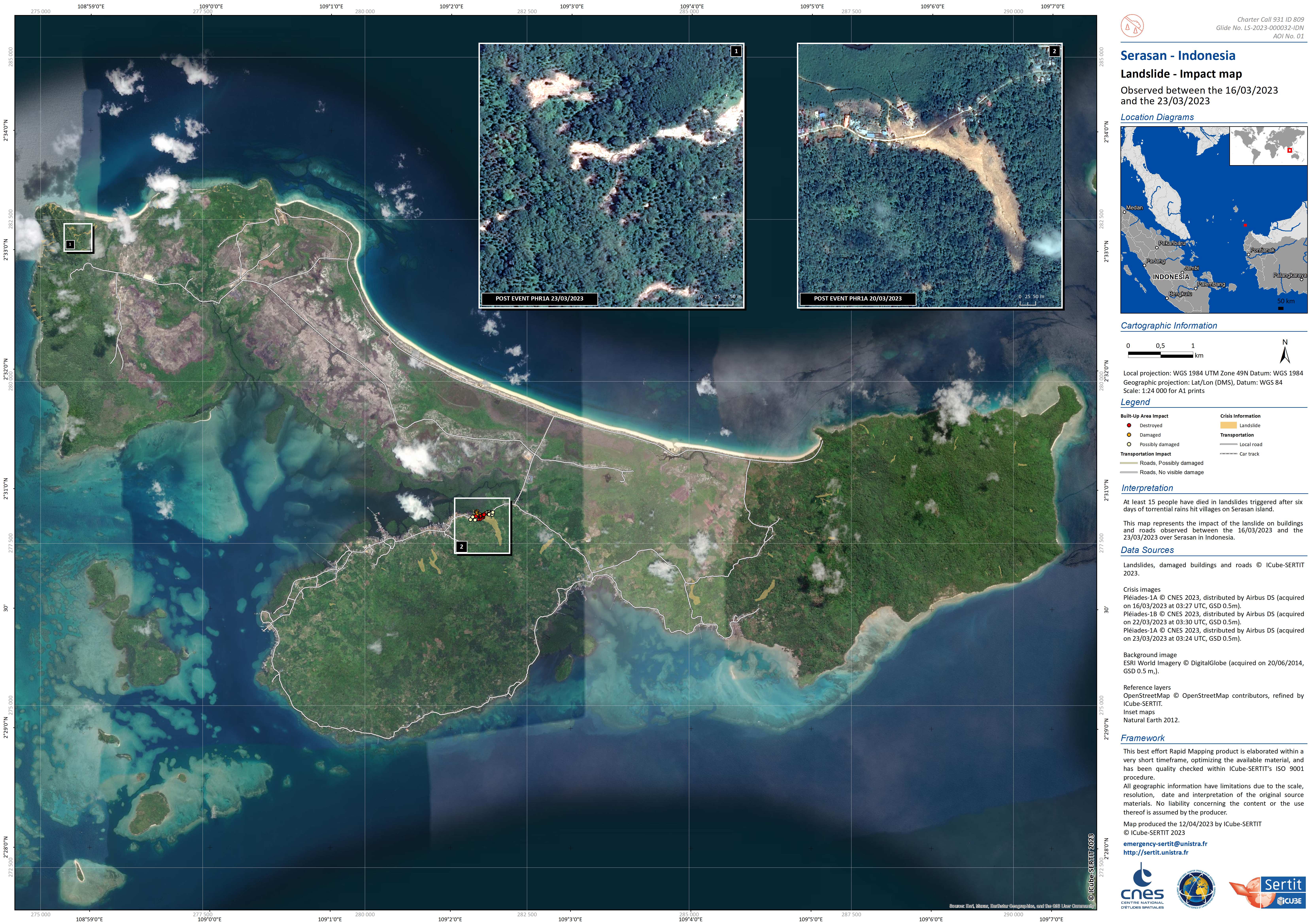
Landslides in Indonesia
At least 15 people have died in landslides triggered after six days of torrential rains hit villages on an island in Indonesia's remote Natuna regency.
Rescuers were still searching on Tuesday for more missing people trapped in houses that were buried under the mud after the landslides, disaster officials have said. The landslides occurred on Monday on the island of Serasan, which is home to about 8,000 people.
More than 1,200 people have been displaced and taken to evacuation centers.
Authorities are still collecting information about the full scale of casualties and damage in the affected areas.
Seasonal rains and high tides in recent days have caused dozens of landslides and widespread flooding across much of Indonesia, a chain of 17,000 islands where millions of people live in mountainous areas or near fertile flood plains close to rivers.
| Local do evento: | Indonesia |
| Data da Ativação da Carta: | 2023-03-07 |
| Tempo de Ativação da Carta: | 17:42 |
| Zona de Tempo da Ativação da Carta: | UTC+09:00 |
| Requisitante da Carta: | ADRC on behalf of BRIN |
| ID da Ativação: | 809 |
| Gerenciamento de projeto: | Angsana Chaksan (Geoinformatics Center – Asian Institute of Technology (GIC-AIT)) |
| act-value-adders: | Udhi Catur Nugroho (National Research and Innovation Agency Indonesia (BRIN)) |
Products
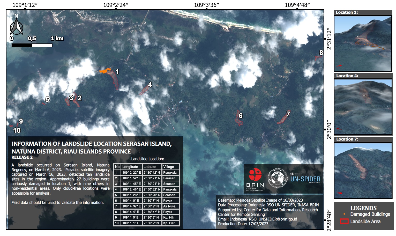
Location of landslides on Serasan Island, Natuna Regency, Riau Islands Province, Indonesia
Direitos autorais: Includes Pleiades material © CNES (2023), Distribution Airbus DS.
Map produced by Indonesia RSO UN-SPIDER, INASA-BRIN
Information about the Product
Adquirida: 16/03/2023
Fonte: Pleiades
Categoria: Delineation Map
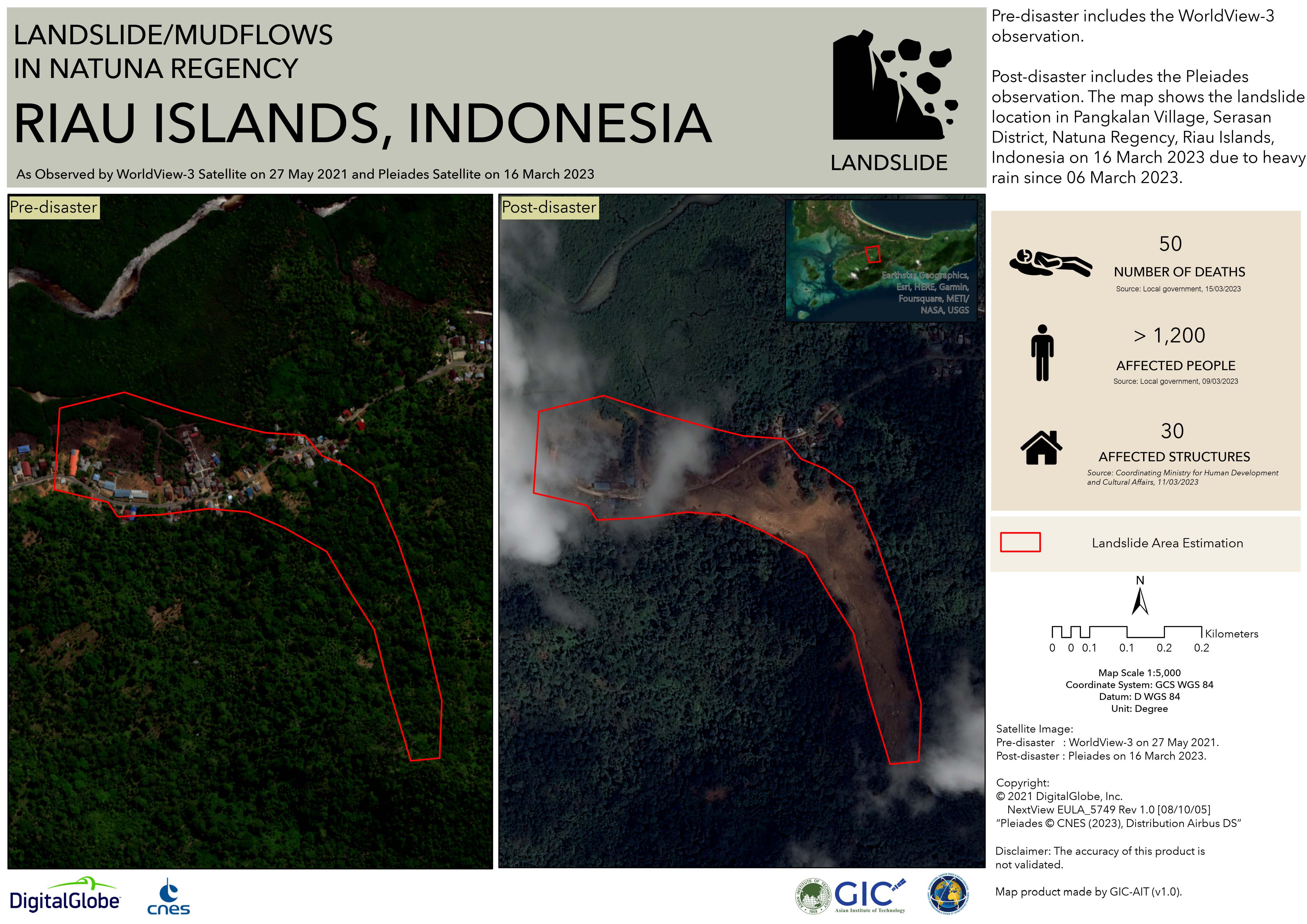
Landslide/Mudflows in Natuna Regency Riau Islands, Indonesia
Direitos autorais: © (2021) DigitalGlobe, Inc., Longmont CO USA 80503. DigitalGlobe and the DigitalGlobe logos are trademarks of DigitalGlobe, Inc. The use and/or dissemination of this data and/or of any product in any way derived there from are restricted. Unauthorized use and/or dissemination is prohibited
Includes Pleiades material © CNES (2023), Distribution Airbus DS.
Map produced by GIC-AIT
Information about the Product
Adquirida: WorldView-3: 27/05/2021
Pleiades: 16/03/2023
Fonte: WorldView-3 / Pleiades
Categoria: Delineation Map
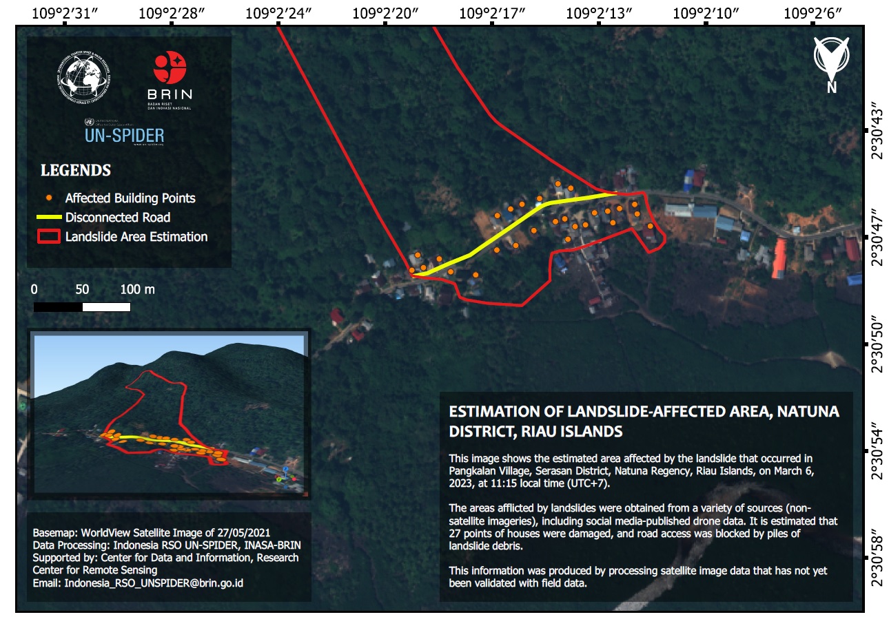
Prediction of affected areas and buildings
Direitos autorais: © (2021) DigitalGlobe, Inc., Longmont CO USA 80503. DigitalGlobe and the DigitalGlobe logos are trademarks of DigitalGlobe, Inc. The use and/or dissemination of this data and/or of any product in any way derived there from are restricted. Unauthorized use and/or dissemination is prohibited
Map produced by BRIN
Information about the Product
Adquirida: 27/05/2021
Fonte: WorldView-3
Categoria: Reference Map
 Voltar ao arquivo completo da Ativação

