 English
 Spanish
 French
 Chinese
 Russian
 Portuguese
 Latest Activation
Charter activations
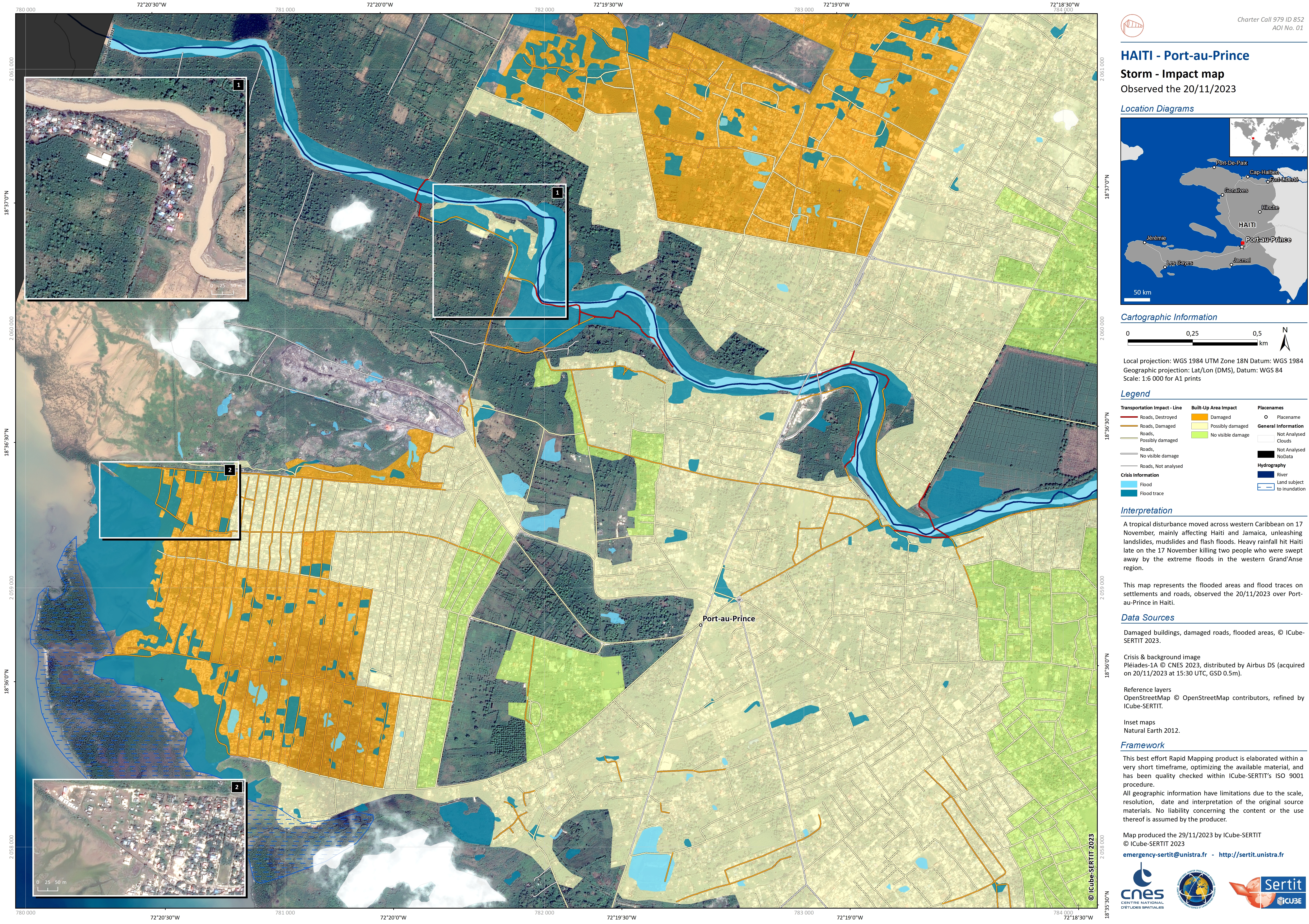
Storm in Haiti
A tropical disturbance moved across western Caribbean on 17 November, mainly affecting Haiti and Jamaica, unleashing landslides, mudslides and flash floods.
Heavy rainfall hit Haiti late on the 17 November killing two people who were swept away by the extreme floods in the western Grand'Anse region. Top wind speeds of 35 mph (55 kph) were recorded on the evening of the 17th.
Forecasters had predicted earlier in the day that the disturbance may go on to become a tropical cyclone however by the evening they said that it was unlikely this would happen. Shortly after, the storm dissipated near the eastern end of Cuba however up to 16 inches (40 centimeters) of rainfall was still expected in parts of southern Haiti, southeast Cuba and Jamaica on 19th November.
| Tipo de evento: | Storm |
| Local do evento: | Haiti |
| Data da Ativação da Carta: | 2023-11-19 |
| Tempo de Ativação da Carta: | 18:15 |
| Zona de Tempo da Ativação da Carta: | UTC+00:00 |
| Requisitante da Carta: | Direction de la Protection Civile de Haiti |
| ID da Ativação: | 852 |
| Gerenciamento de projeto: | GIRAUD Henri (SERTIT) |
| act-value-adders: | Lahache Guillaume (Predict Services) |
Products
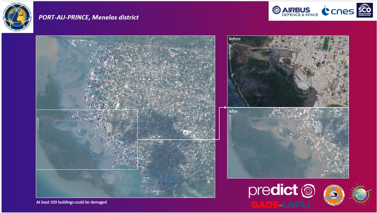
Rapid mapping of damaged areas based on satellite imagery over Port-au-Prince, Haiti
Download the Full Report
Direitos autorais: Includes Pleiades material © CNES (2023), Distribution Airbus DS.
Report produced by PREDICT
Information about the Product
Adquirida: 20/11/2023
Fonte: Pleiades
Categoria: Dossier
 Voltar ao arquivo completo da Ativação

