Minimizar Latest Activation

Charter activations

Landslide in China

Heavy rain triggered a landslide on 24 June which buried Xinmo, a remote village in north Sichuan, China.

The landslide slid half a mile covering parts of the village and blocking a 2km stretch of river. 10 people died and it was initially feared that many more could have fallen victim to the disaster. 40 buildings were destroyed and local police closed roads to aid the rescue effort which involved over 3000 people, many of which were volunteers.

Landslides are a regular occurrence in Sichuan province - which is also prone to earthquakes - though officials say the scale of this disaster is unprecedented.

Tipo de evento:Landslide
Local do evento:China
Data da Ativação da Carta:24 June 2017
Tempo de Ativação da Carta:10:32:00
Zona de Tempo da Ativação da Carta:UTC+08:00
Requisitante da Carta:National Disaster Reduction Center of China
ID da Ativação:538
Gerenciamento de projeto:NDRCC

Products

Post-disaster image for landslide monitoring, Xinmo Village

Direitos autorais: TerraSAR-X © DLR e. V. 2017, Distribution: Airbus DS Geo GmbH
Map produced by NDRCC

Information about the Product

Adquirida: 30/06/2017

Fonte: TerraSAR-X

Post-disaster image for landslide monitoring, Xinmo Village

Direitos autorais: Pleiades © CNES (2017) - Distribution: Airbus Defence and Space, all rights reserved
Map produced by NDRCC

Information about the Product

Adquirida: 30/06/2017

Fonte: Pleiades

Post-disaster image for landslide monitoring, Xinmo Village

Direitos autorais: Pleiades © CNES (2017) - Distribution: Airbus Defence and Space, all rights reserved
Map produced by NDRCC

Information about the Product

Adquirida: 29/06/2017

Fonte: Pleiades

Post-disaster image for landslide monitoring, Xinmo Village

Direitos autorais: RapidEye data © Planet (2017) - All rights reserved
Map produced by NDRCC

Information about the Product

Adquirida: 27/06/2017

Fonte: RapidEye

Post-disaster image for landslide monitoring, Xinmo Village

Direitos autorais: © JAXA 2017
Map produced by NDRCC

Information about the Product

Adquirida: 26/06/2017

Fonte: ALOS

Post-disaster image for landslide monitoring, Xinmo Village

Direitos autorais: © KARI 2017
Map produced by NDRCC

Information about the Product

Adquirida: 26/06/2017

Fonte: KOMPSAT-5

Post-disaster image for landslide monitoring, Xinmo Village

Direitos autorais: Sentinel-1 © Copernicus Sentinel data (2017)
Map produced by NDRCC

Information about the Product

Adquirida: 24/06/2017

Fonte: Sentinel-1

Pre-disaster image for landslide monitoring, Xinmo Village

Direitos autorais: RapidEye data © Planet (2017) - All rights reserved
Map produced by NDRCC

Information about the Product

Adquirida: 07/04/2017

Fonte: Rapideye

Pre-disaster image for landslide monitoring, Xinmo Village

Direitos autorais: WorldView-2 © DigitalGlobe 2017
Map produced by NDRCC

Information about the Product

Adquirida: 09/01/2016

Fonte: WorldView-2

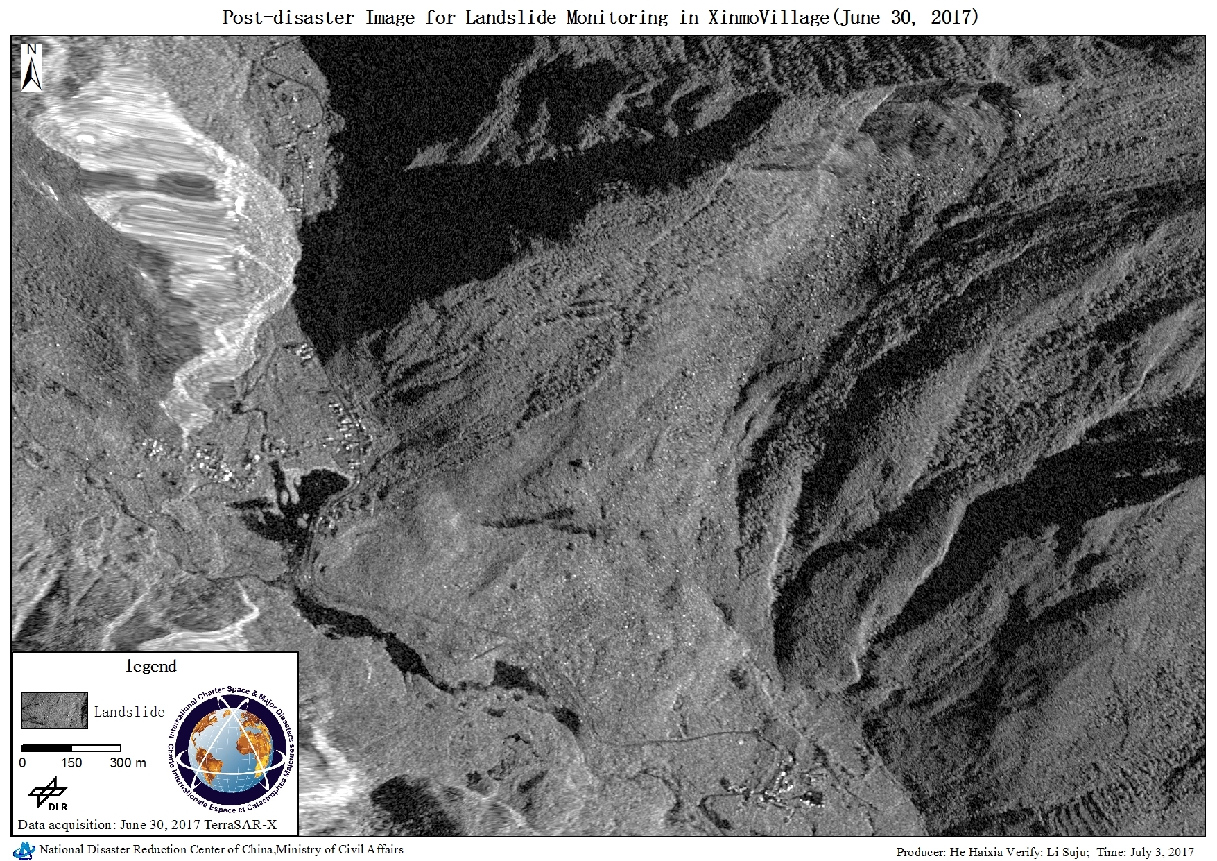
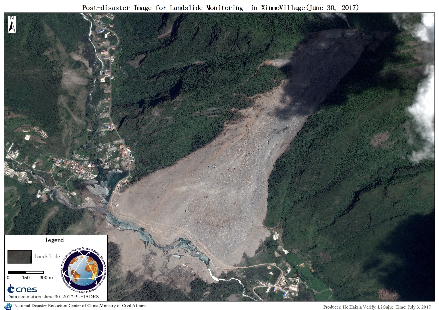
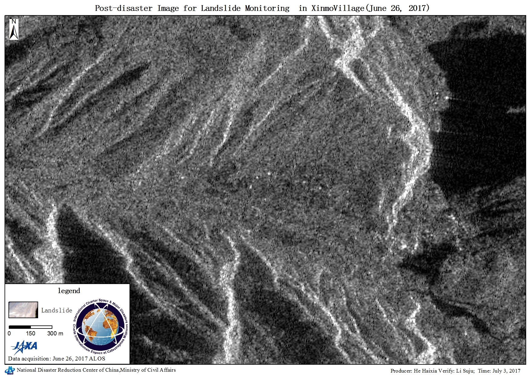
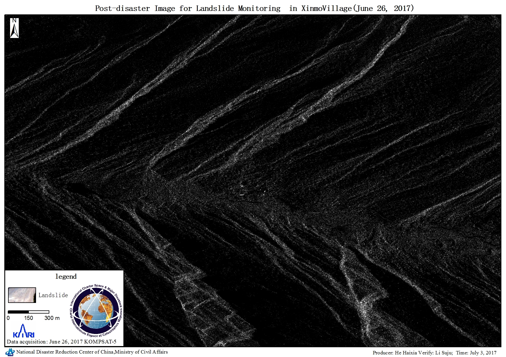
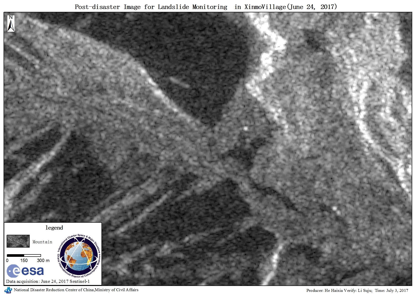
Landslide monitoring, Xinmo Village

Direitos autorais: WorldView-2 © DigitalGlobe 2017
Pleiades © CNES (2017) - Distribution: Airbus Defence and Space, all rights reserved
Map produced by NDRCC

Information about the Product

Adquirida: Pre-disaster: 09/01/2016
Post-disaster: 30/06/2017

Fonte: WorldView-2 & Pleiades

Voltar ao arquivo completo da Ativação