 English
 Spanish
 French
 Chinese
 Russian
 Portuguese
 Latest Activation
Charter activations
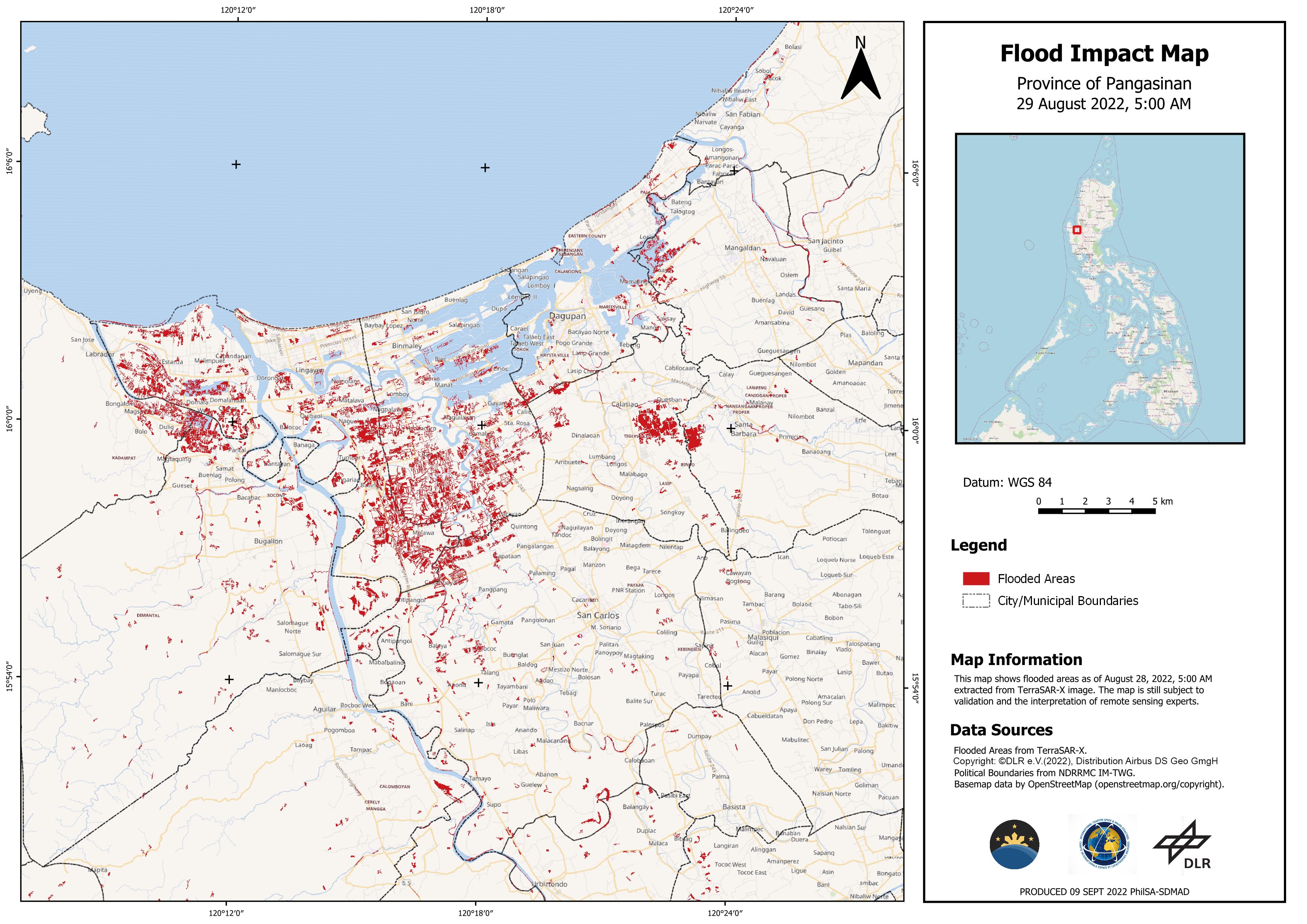
Tropical Storm Ma-On in the Philippines
Tropical Storm Ma-On (known as Florita in the Philippines) passed over the northern Philippines on 23 August, causing flooding.
Ma-On made landfall at Maconacon Town in Isabela Province, where thousands of people in the region were evacuated as a precaution. However, during the storm a passenger bus crashed, leaving two dead and six injured. Trees in Tuguegarao toppled power lines, cutting off electricity to an estimated 28 towns in Cagayan Province. River banks spilled over to nearby areas, and Ma-On caused storm surges on the coast.
The storm moved west over Manila and out into the South China Sea on 24 August.
| Tipo de evento: | Floods |
| Local do evento: | Philippines |
| Data da Ativação da Carta: | 2022-08-23 |
| Tempo de Ativação da Carta: | 14:50 |
| Zona de Tempo da Ativação da Carta: | UTC+02:00 |
| Requisitante da Carta: | UNOOSA/UN-SPIDER on behalf of Philippines Space Agency (PhilSA) on behalf of National Disaster Risk Management Council (NDRRMC) |
| ID da Ativação: | 771 |
| Gerenciamento de projeto: | Jakrapong Tawala (UNITAR) |
 Voltar ao arquivo completo da Ativação

