 English
 Spanish
 French
 Chinese
 Russian
 Portuguese
 Latest Activation
Charter activations
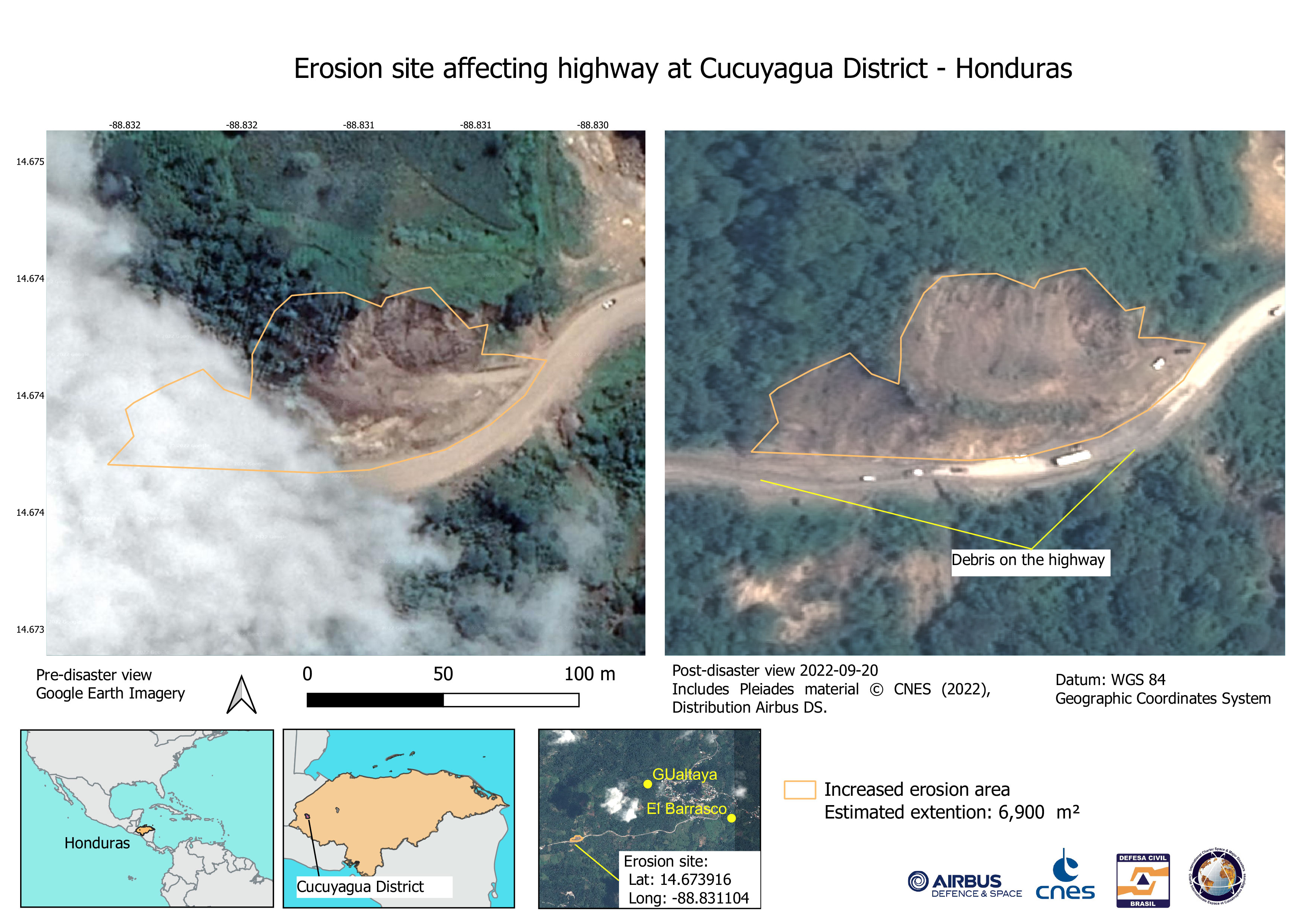
Flood in Honduras
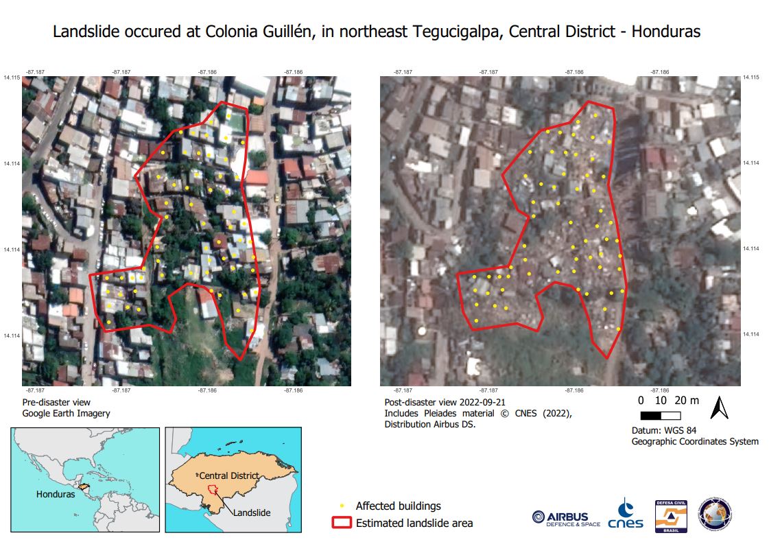
During the month of September, floods and landslides caused by the rainy season in Honduras resulted in at least 16 fatalities and about 3,500 damaged or destroyed houses, as reported by UN OCHA.
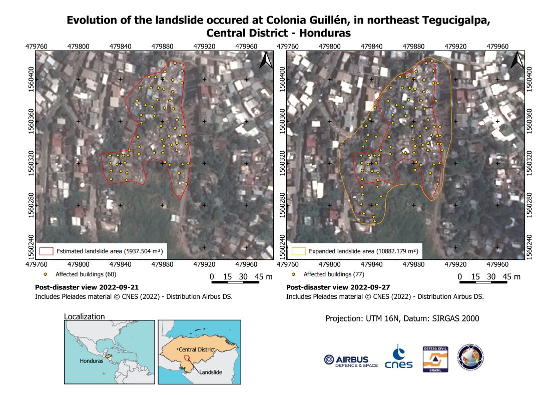
In the Guillén neighbourhood, northeast of Tegucigalpa, the capital of Honduras, people were evacuated due to losing their homes to landslides. The flood situation in the country was exacerbated by the passage of Tropical Storm JULIA in southern Honduras, which left at least 144,000 people affected.
National authorities carried out a survey to evaluate the degree of damage and collect information to rapidly identify the humanitarian needs of the affected population.
| Tipo de evento: | Floods |
| Local do evento: | Honduras |
| Data da Ativação da Carta: | 2022-09-19 |
| Tempo de Ativação da Carta: | 17:08 |
| Zona de Tempo da Ativação da Carta: | UTC-06:00 |
| Requisitante da Carta: | COPECO |
| ID da Ativação: | 778 |
| Gerenciamento de projeto: | Rafael Machado (Ministerio da Integracao e do Desenvolvimento Regional, Secretaria Nacional de Protecao e Defesa Civil) |
| act-value-adders: | Brenda Rocha (INPE) |
Products

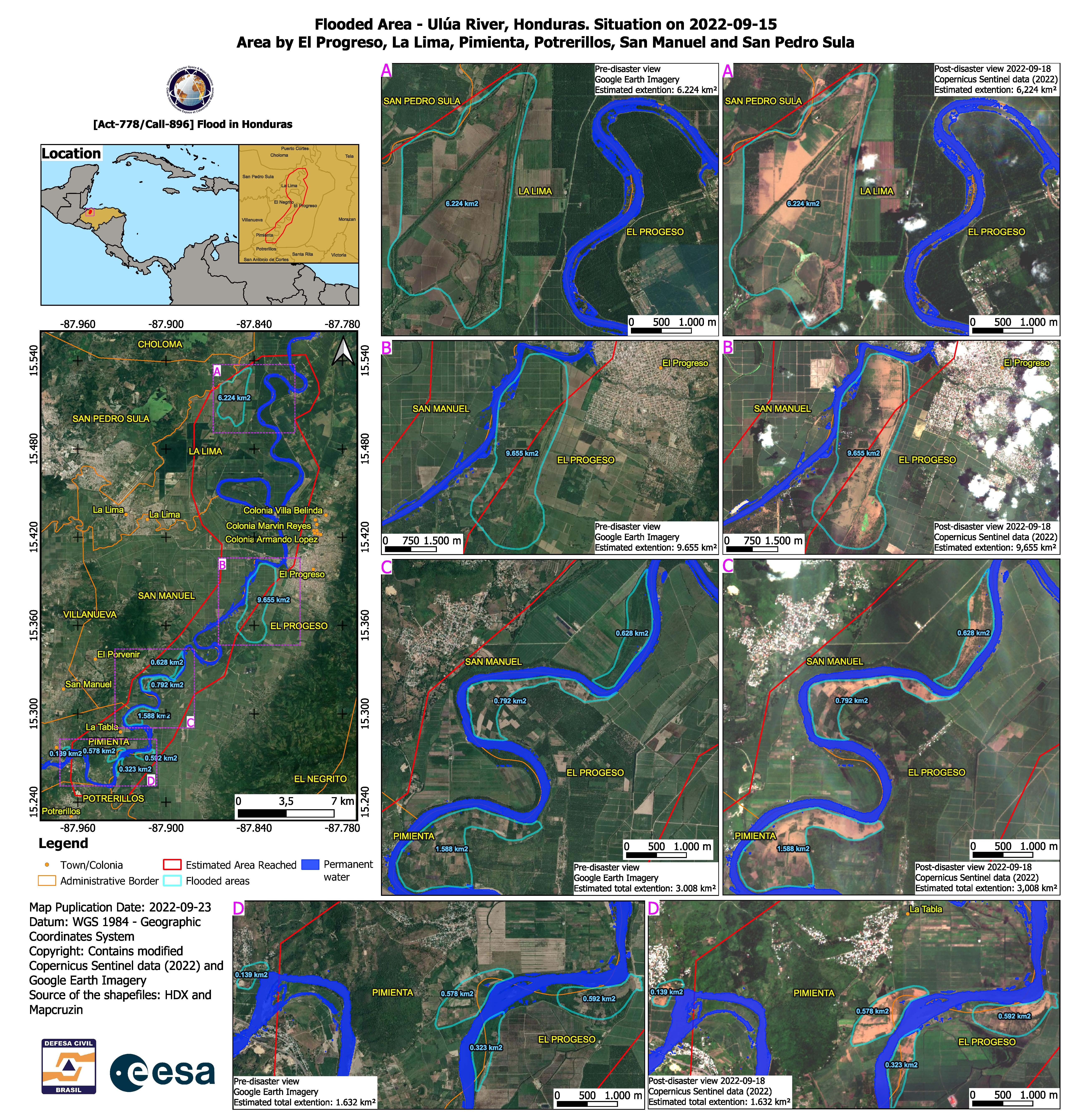
Flooded areas on the Ulúa River, Honduras. Situation at El Progreso, La Lima, Pimienta, Potrerillos, San Manuel and San Pedro Sula
Direitos autorais: Contains modified Copernicus Sentinel data (2022)
Map produced by Defesa Civil Brasil
Information about the Product
Adquirida: 18/09/2022
Fonte: Sentinel-2
Categoria: Reference Map
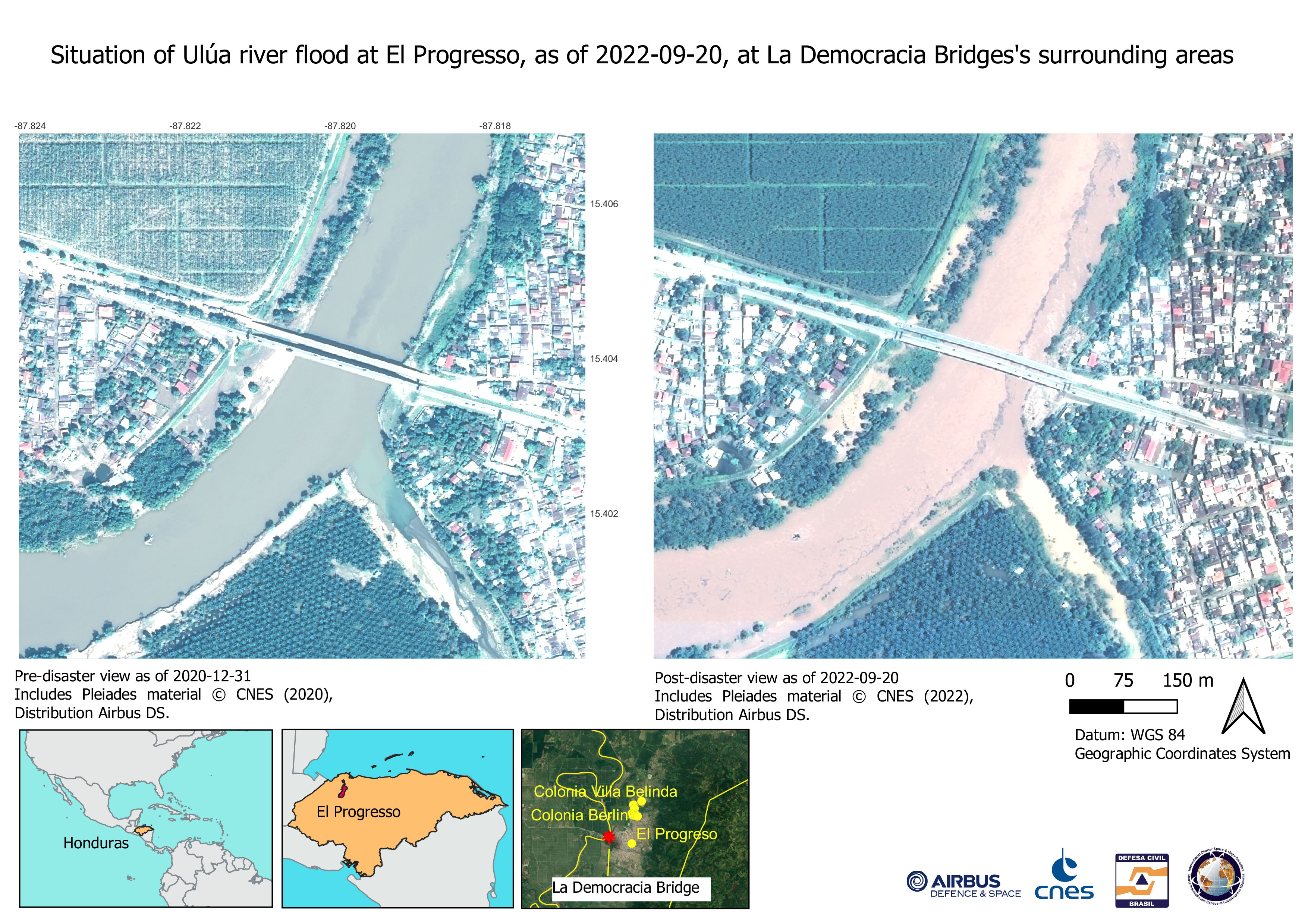
Situation of Ulúa river flood at El Progresso, at La Democracia Bridges's sorrounding areas
Direitos autorais: Includes Pleiades material © CNES (2022), Distribution Airbus DS.
Map produced by Defesa Civil Brasil
Information about the Product
Adquirida: 20/09/2022
Fonte: Pleiades
Categoria: Reference Map
 Voltar ao arquivo completo da Ativação

