 English
 Spanish
 French
 Chinese
 Russian
 Portuguese
 Latest Activation
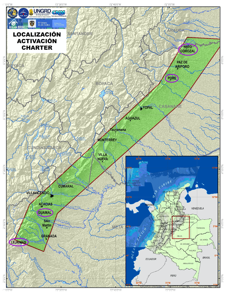
Charter activations
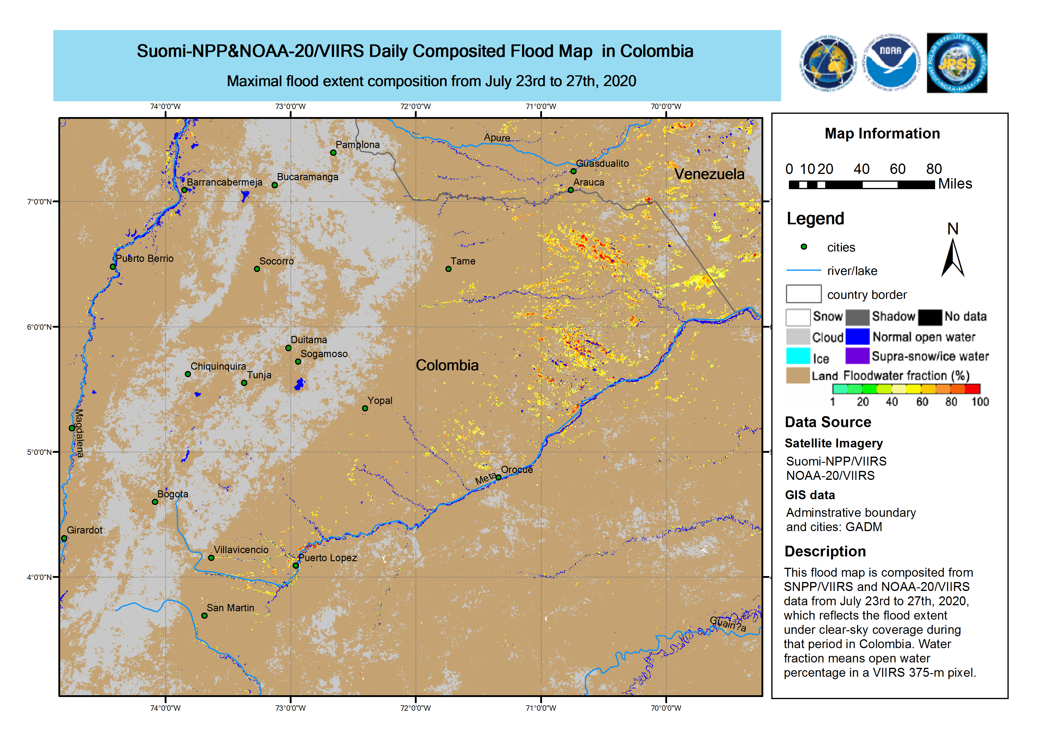
Flood in Colombia
Heavy and persistent rainfall for over three weeks has caused widespread damage and disruption across the department of Meta, Colombia. In total over 8 municipalities have been suffering from flooding, with Meta being the worst affected.
Over 1200 families have been affected with at least 121 being evacuated. Local authorities have estimated that 1600 hectares of crops have been destroyed. In the Putumayo area, more than 2,310 families were affected by floods and landslides.
Response efforts are underway as temporary shelters and food are needed for those affected.
IDEAM, Colombia's Meteorological Agency, raised the flood alert level to the highest (red), as more heavy rains are forecast in the coming days.
| Tipo de evento: | Floods |
| Local do evento: | Colombia |
| Data da Ativação da Carta: | 2020-07-13 |
| Tempo de Ativação da Carta: | 22:31 |
| Zona de Tempo da Ativação da Carta: | UTC+02:00 |
| Requisitante da Carta: | National Unit for Disaster Risk Management |
| ID da Ativação: | 659 |
| Gerenciamento de projeto: | Beijing University |
Products
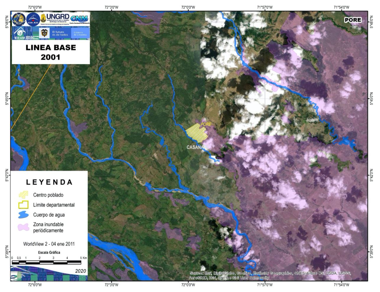
Satellite detected water extent in Pore, Colombia
Direitos autorais: © (2011) DigitalGlobe, Inc., Longmont CO USA 80503. DigitalGlobe and the DigitalGlobe logos are trademarks of DigitalGlobe, Inc. The use and/or dissemination of this data and/or of any product in any way derived there from are restricted. Unauthorized use and/or dissemination is prohibited
Map produced by UNGRD
Information about the Product
Adquirida: 04/01/2011
Fonte: WorldView-2

Satellite detected water extent in Paz de ariporo of Colombia
Direitos autorais: © (2011) DigitalGlobe, Inc., Longmont CO USA 80503. DigitalGlobe and the DigitalGlobe logos are trademarks of DigitalGlobe, Inc. The use and/or dissemination of this data and/or of any product in any way derived there from are restricted. Unauthorized use and/or dissemination is prohibited
Information about the Product
Adquirida: 04/01/2011
Fonte: WorldView-2
Satellite detected water extent in Hato Corozal, Colombia
Direitos autorais: © (2017) DigitalGlobe, Inc., Longmont CO USA 80503. DigitalGlobe and the DigitalGlobe logos are trademarks of DigitalGlobe, Inc. The use and/or dissemination of this data and/or of any product in any way derived there from are restricted. Unauthorized use and/or dissemination is prohibited
Map produced by UNGRD
Information about the Product
Adquirida: 29/03/2017<
Fonte: WorldView-2
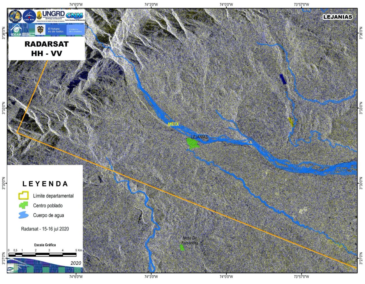
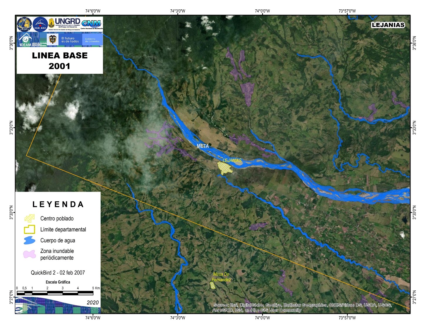
Satellite detected water extent in Lejanis, Colombia
Direitos autorais: RADARSAT-2 Data and Products © Maxar Technologies Ltd. (2020) – All Rights Reserved. RADARSAT is an official mark of the Canadian Space Agency
Map produced by UNGRD
Information about the Product
Adquirida: 15/07/2020 - 16/07/2020
Fonte: RADARSAT-2
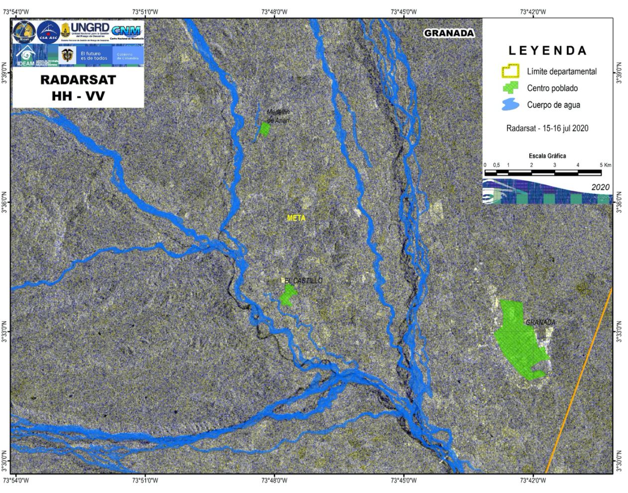
Satellite detected water extent in Granda, Colombia
Direitos autorais: RADARSAT-2 Data and Products © Maxar Technologies Ltd. (2020) – All Rights Reserved. RADARSAT is an official mark of the Canadian Space Agency
Map produced by UNGRD
Information about the Product
Adquirida: 15/07/2020 - 16/07/2020
Fonte: RADARSAT-2
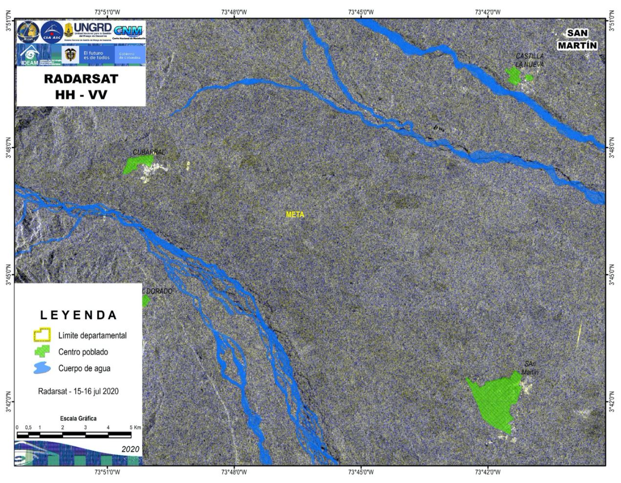
Satellite detected water extent in San Martin, Colombia
Direitos autorais: RADARSAT-2 Data and Products © Maxar Technologies Ltd. (2020) – All Rights Reserved. RADARSAT is an official mark of the Canadian Space Agency
Map prepared by UNGRD
Information about the Product
Adquirida: 15/07/2020 - 16/07/2020
Fonte: RADARSAT-2
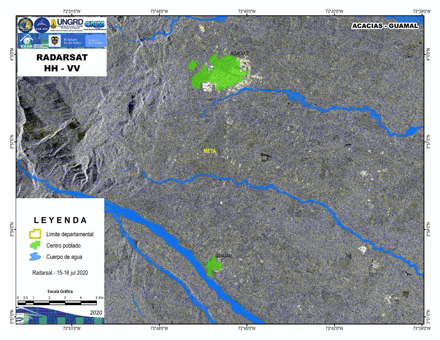
Satellite detected water extent in Acacias-Guamal, Colombia
Direitos autorais: RADARSAT-2 Data and Products © Maxar Technologies Ltd. (2020) – All Rights Reserved. RADARSAT is an official mark of the Canadian Space Agency
Information about the Product
Adquirida: 15/07/2020, 16/07/2020
Fonte: RADARSAT-2
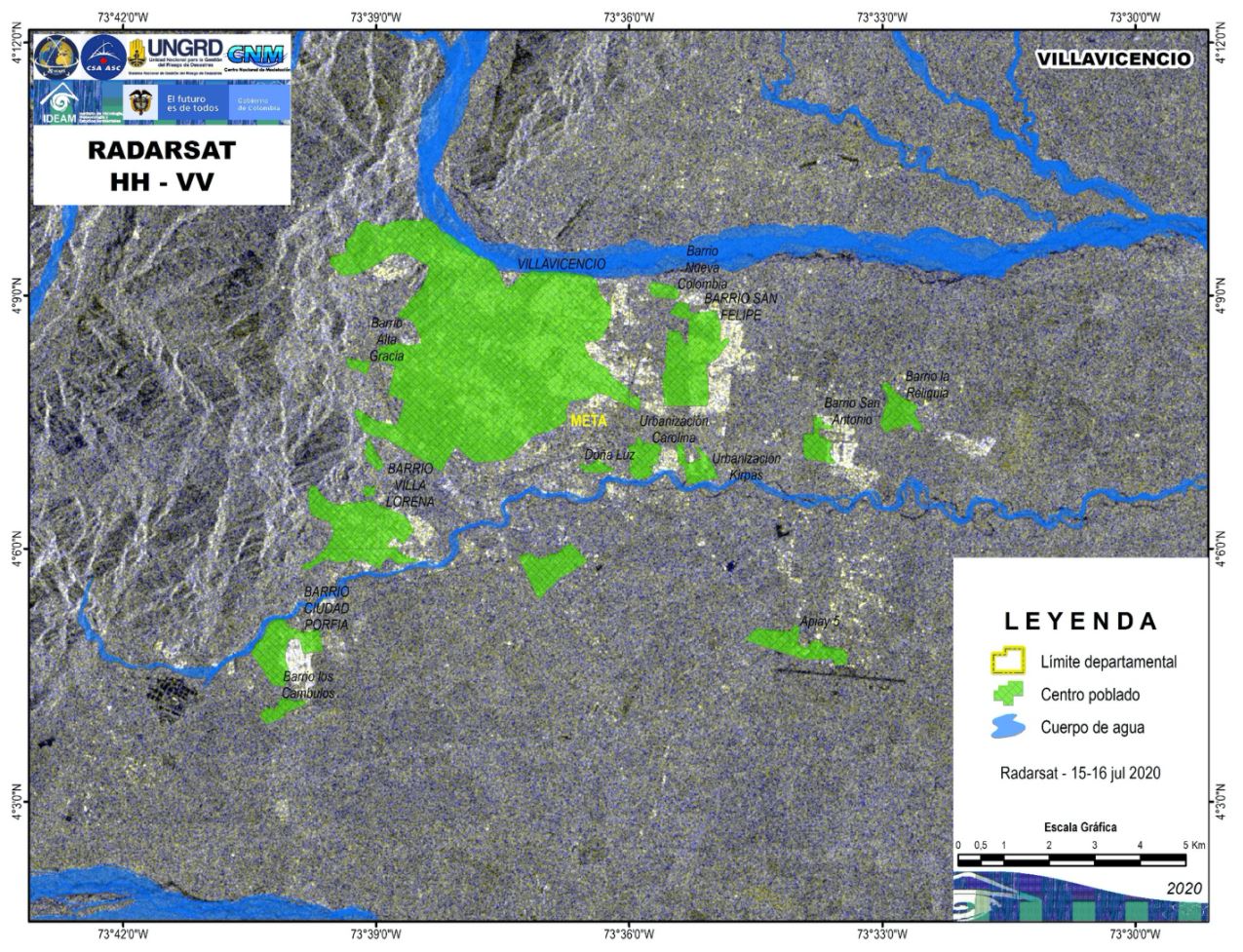
Satellite detected water extent in Villavicencio, Colombia
Direitos autorais: RADARSAT-2 Data and Products © Maxar Technologies Ltd. (2020) – All Rights Reserved. RADARSAT is an official mark of the Canadian Space Agency
Map prepared by UNGRD
Information about the Product
Adquirida: 15/07/2020 - 16/07/2020
Fonte: RADARSAT-2
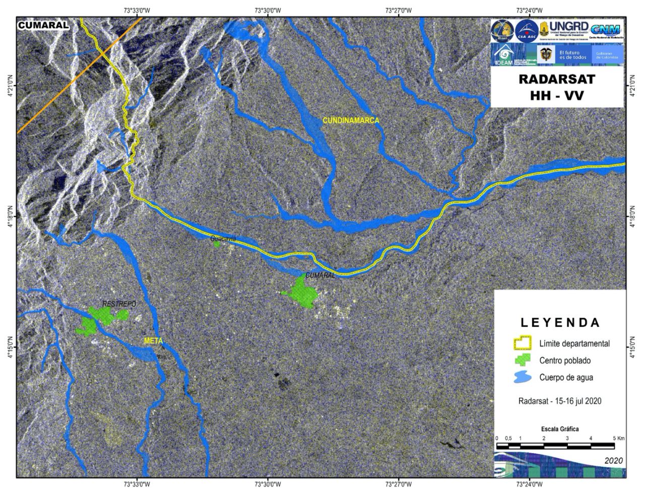
Satellite detected water extent in Cumaral, Colombia
Direitos autorais: RADARSAT-2 Data and Products © Maxar Technologies Ltd. (2020) – All Rights Reserved. RADARSAT is an official mark of the Canadian Space Agency
Map produced by UNGRD
Information about the Product
Adquirida: 15/07/2020 - 16/07/2020
Fonte: RADARSAT-2
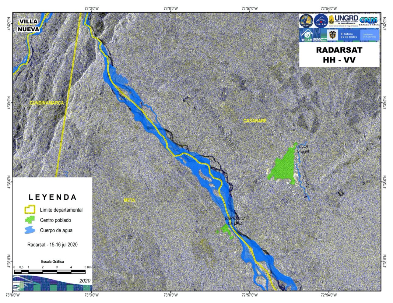
Satellite detected water extent in Villa Nueva, Colombia
Direitos autorais: RADARSAT-2 Data and Products © Maxar Technologies Ltd. (2020) – All Rights Reserved. RADARSAT is an official mark of the Canadian Space Agency
Map produced by UNGRD
Information about the Product
Adquirida: 15/07/2020 - 16/07/2020
Fonte: RADARSAT-2
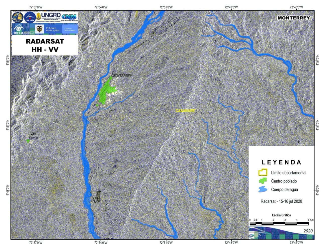
Satellite detected water extent in Monterrey, Colombia
Direitos autorais: RADARSAT-2 Data and Products © Maxar Technologies Ltd. (2020) – All Rights Reserved. RADARSAT is an official mark of the Canadian Space Agency
Map produced by UNGRD
Information about the Product
Adquirida: 15/07/2020 - 16/07/2020
Fonte: RADARSAT-2
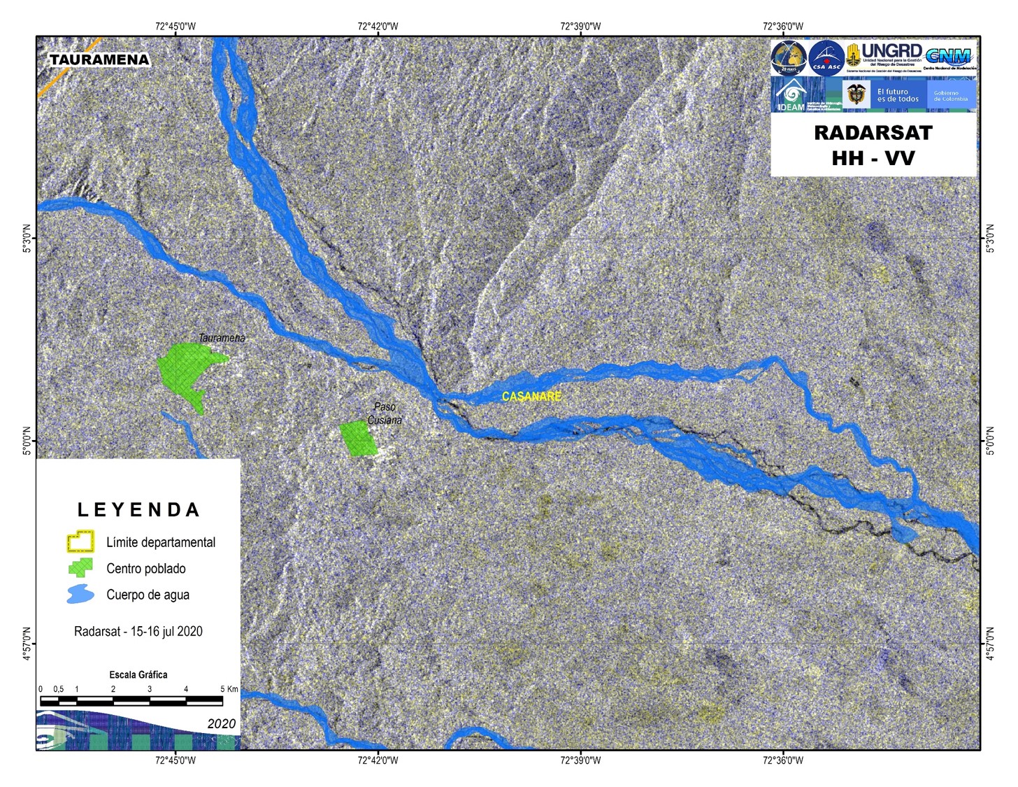
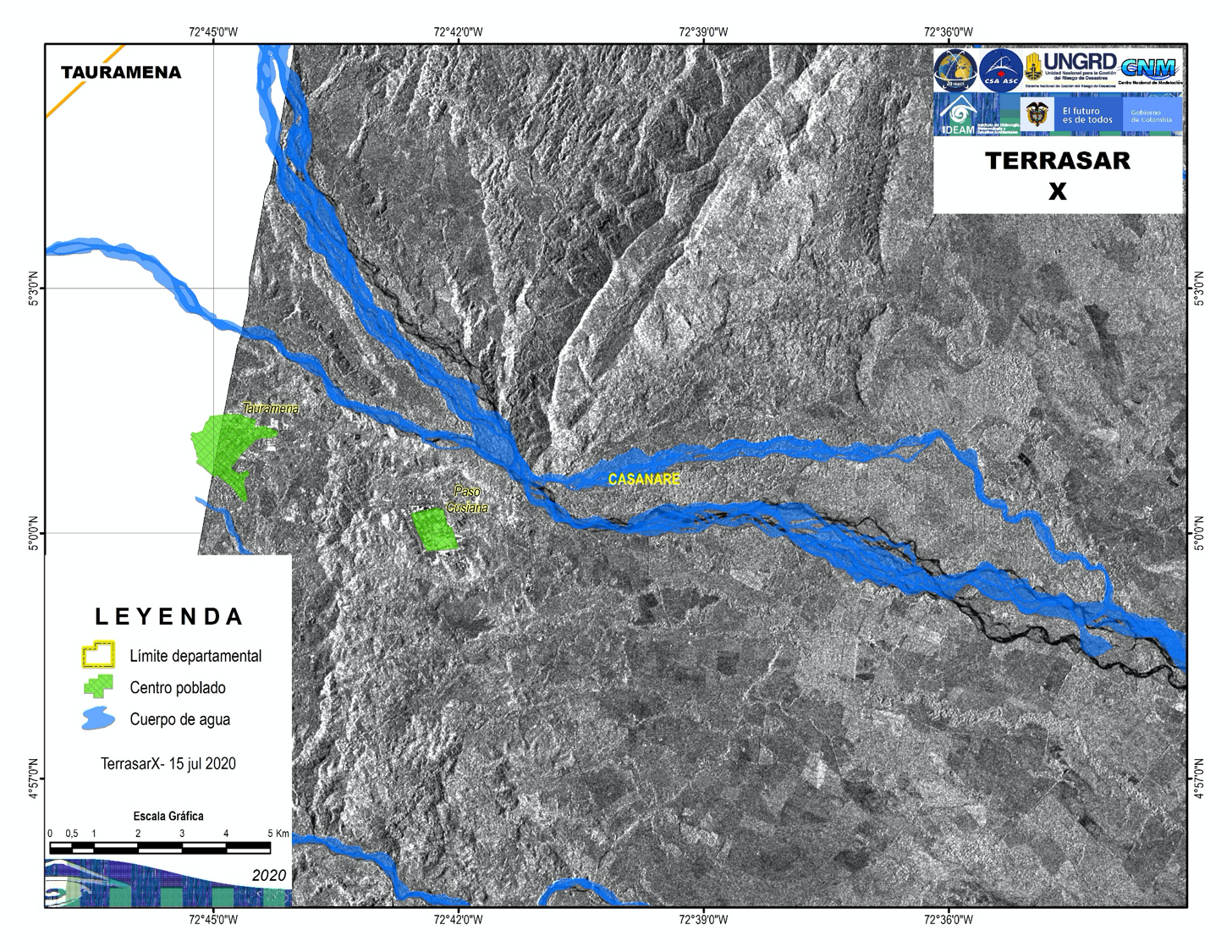
Satellite detected water extent in Tauramena, Colombia
Direitos autorais: RADARSAT-2 Data and Products © Maxar Technologies Ltd. (2020) – All Rights Reserved. RADARSAT is an official mark of the Canadian Space Agency
Map produced by IDEAM
Information about the Product
Adquirida: 16/07/2020 and 15/07/2020
Fonte: RADARSAT-2
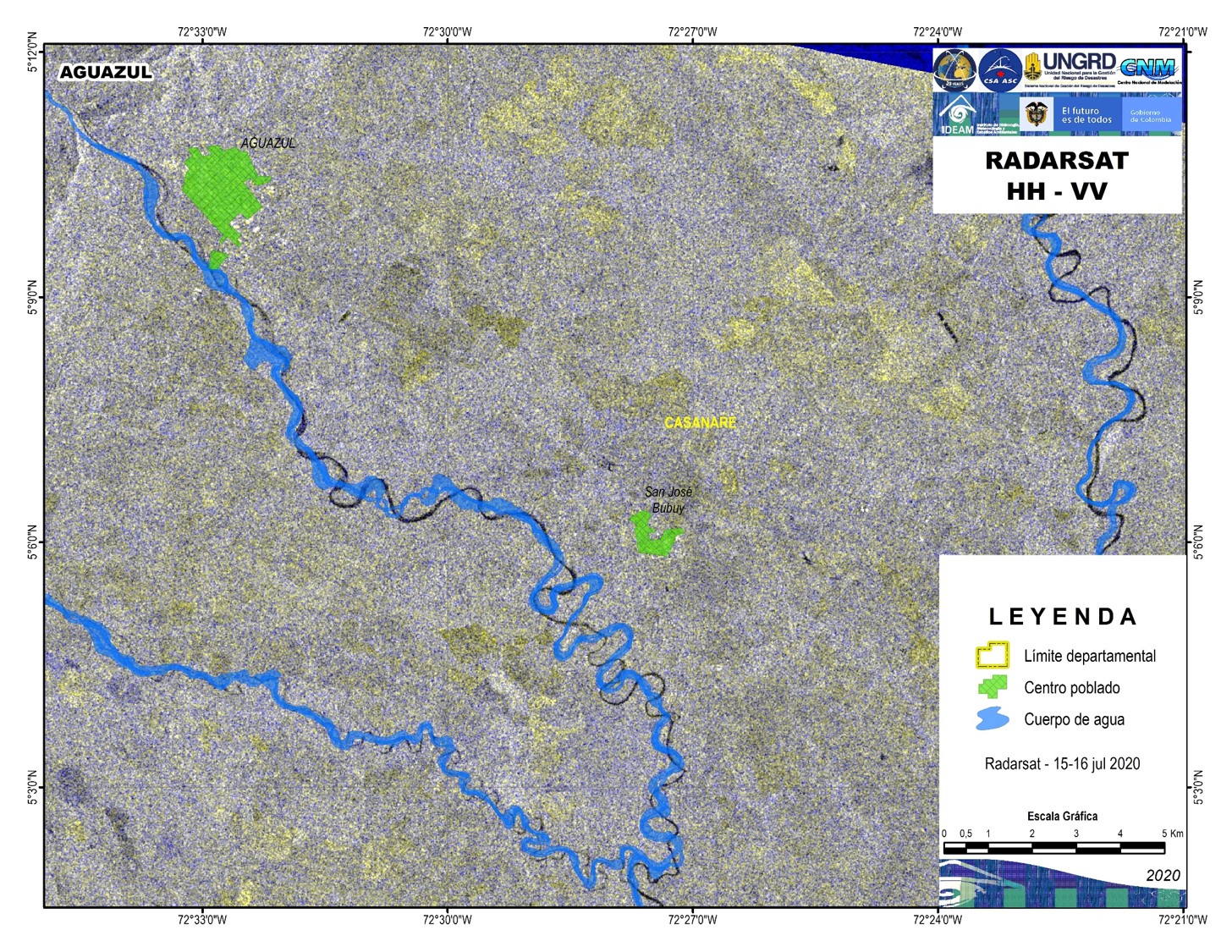
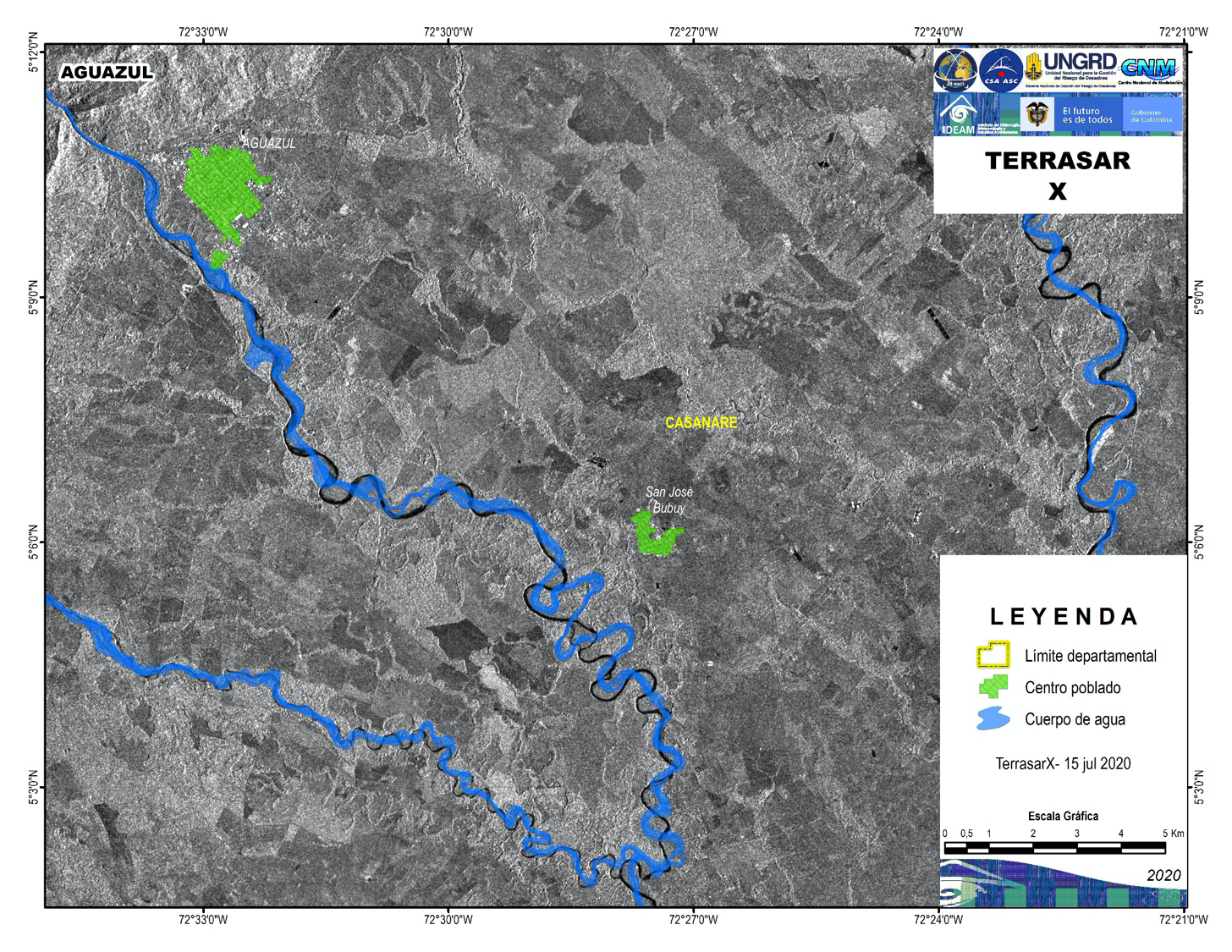
Satellite detected water extent in Aguazul, Colombia
Direitos autorais: RADARSAT-2 Data and Products © Maxar Technologies Ltd. (2020) – All Rights Reserved. RADARSAT is an official mark of the Canadian Space Agency
Map produced by IDEAM
Information about the Product
Adquirida: 16/07/2020 and 15/07/2020
Fonte: RADARSAT-2
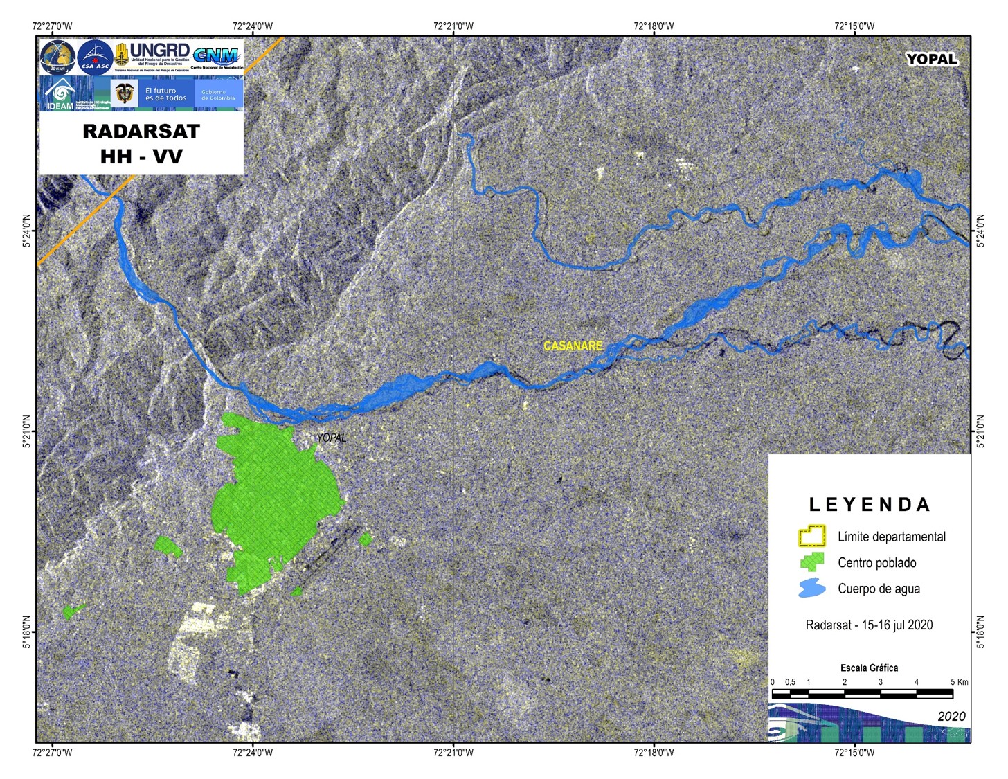
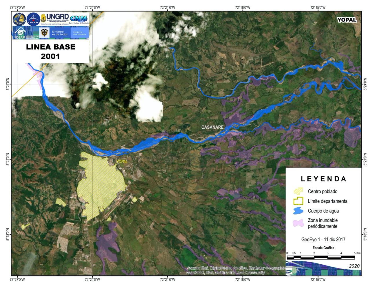
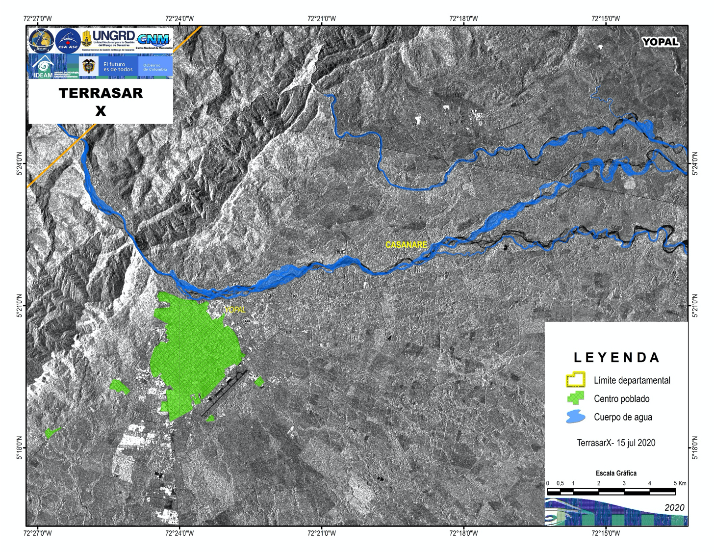
Satellite detected water extent in Yopal, Colombia
Direitos autorais: RADARSAT-2 Data and Products © Maxar Technologies Ltd. (2020) – All Rights Reserved. RADARSAT is an official mark of the Canadian Space Agency
Map produced by IDEAM
Information about the Product
Adquirida: 16/07/2020 and 15/07/2020
Fonte: RADARSAT-2
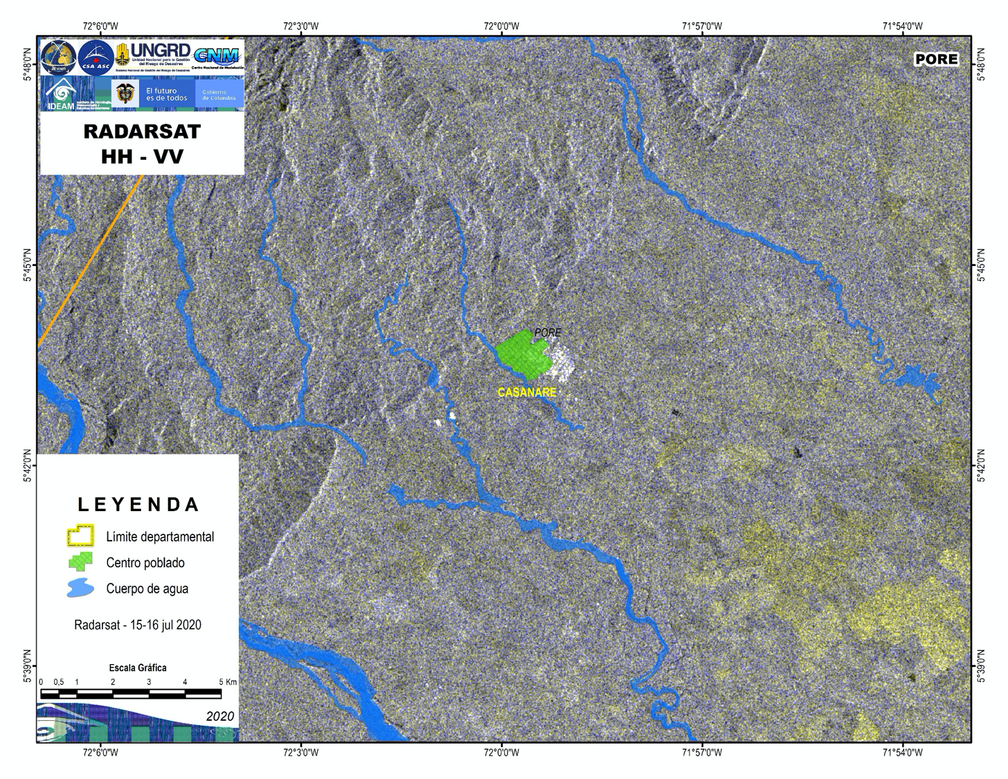
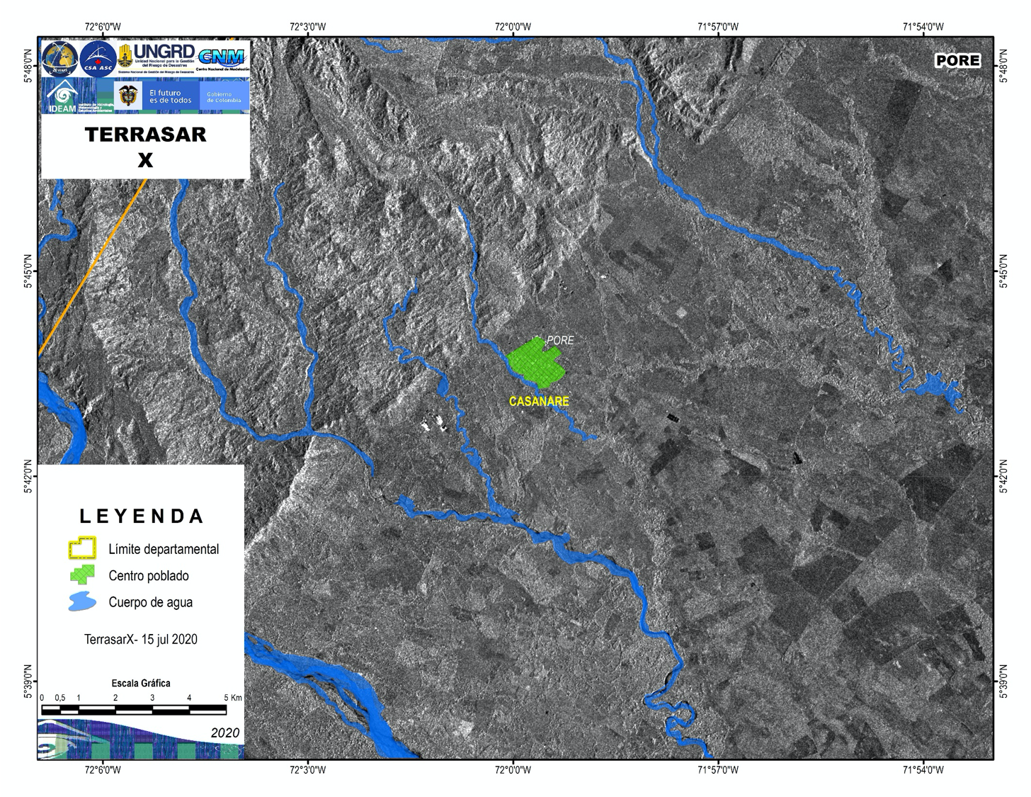
Satellite detected water extent in Pore, Colombia
Direitos autorais: RADARSAT-2 Data and Products © Maxar Technologies Ltd. (2020) – All Rights Reserved. RADARSAT is an official mark of the Canadian Space Agency
Map produced by IDEAM
Information about the Product
Adquirida: 15/07/2020 and 16/07/2020
Fonte: RADARSAT-2
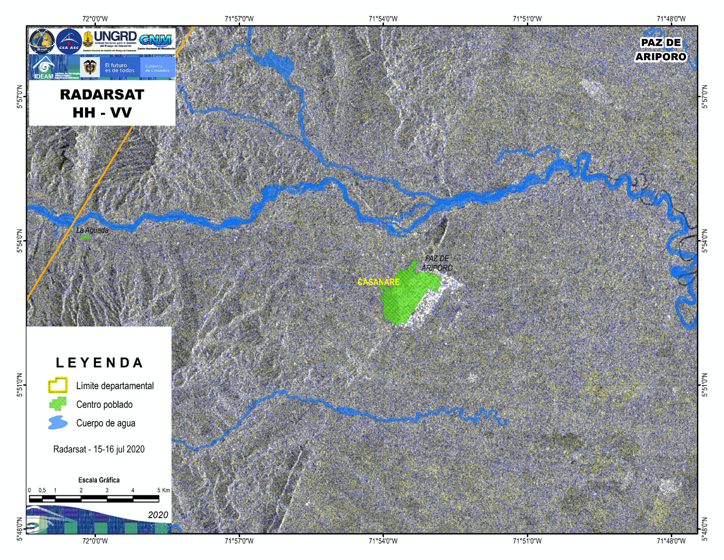
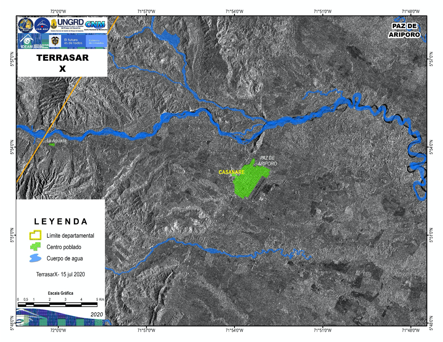
Satellite detected water extent in Paz de ariporo, Colombia
Direitos autorais: RADARSAT-2 Data and Products © Maxar Technologies Ltd. (2020) – All Rights Reserved. RADARSAT is an official mark of the Canadian Space Agency
Map produced by IDEAM
Information about the Product
Adquirida: 15/07/2020 and 16/07/2020
Fonte: RADARSAT-2
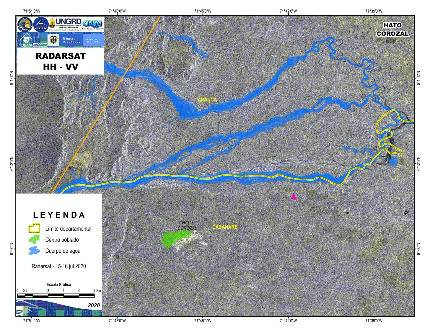
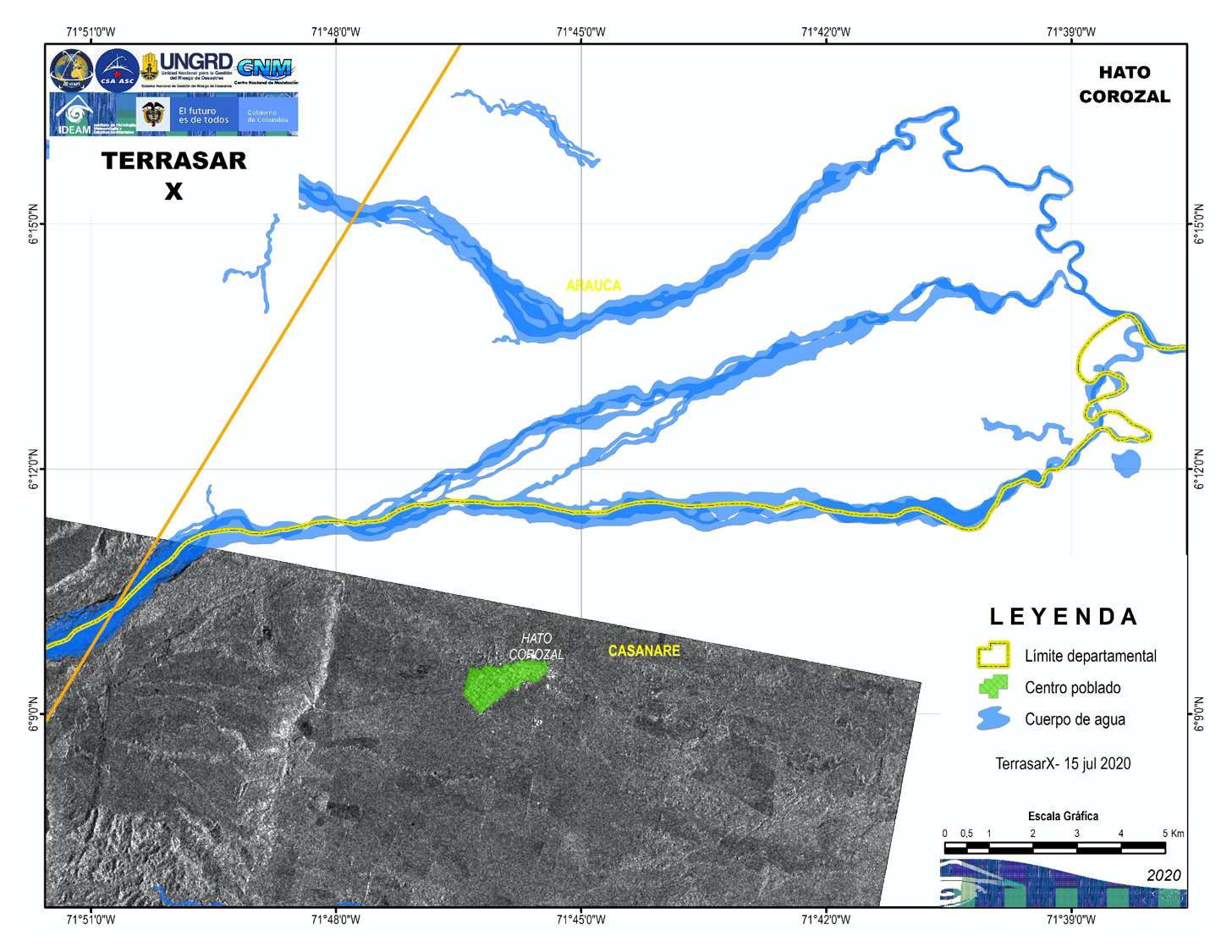
Satellite detected water extent in Hato Corozal, Colombia
Direitos autorais: RADARSAT-2 Data and Products © Maxar Technologies Ltd. (2020) – All Rights Reserved. RADARSAT is an official mark of the Canadian Space Agency
Map produced by IDEAM
Information about the Product
Adquirida: 15/07/2020 and 16/07/2020
Fonte: RADARSAT-2

 Voltar ao arquivo completo da Ativação

