Minimizar Latest Activation

Charter activations

Flood in Sri Lanka

Monsoon rains caused severe flooding and mudslides in western and southern Sri Lanka leaving at least 202 people dead and over half a million affected.

The devastating floods are the worst the country has experienced in over a decade, and the death toll is expected to rise as search operations for victims continue.

It has been reported that 15 of Sri Lanka's 25 districts have been affected, but the southwest of the county has been the worst affected; particularly the Matara and Ratnapura districts. 77,000 people have been forced to evacuate their homes, thousands of which have been damaged.

The Sri Lankan navy and air force have been deployed to provide emergency relief to affected areas, and charity and relief organisations are volunteering aid to help the victims. Their efforts are hindered by the high water levels and roads which are either flooded or blocked by debris from landslides. International aid is also being provided to help with the scale of the disaster.

The Disaster Management Centre (DMC) of Sri Lanka warned that the conditions could worsen with aid organisations remaining on high alert over the coming days.

With the flood waters remaining and forecasts suggesting more rain could follow, there are concerns that diseases such as Dengue may find root in the affected areas.

Tipo de evento:Floods
Local do evento:Sri Lanka
Data da Ativação da Carta:26 May 2017
Tempo de Ativação da Carta:09:35:00
Zona de Tempo da Ativação da Carta:UTC-05:00
Requisitante da Carta:USGS on behalf of Disaster Management Center of Sri Lanka
ID da Ativação:533
Gerenciamento de projeto:CGIAR

Products

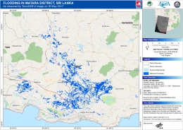
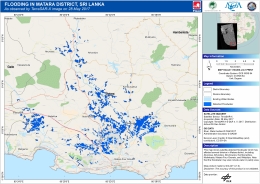
Flooding in Matara District, Sri Lanka

Direitos autorais: © DLR e. V. 2017, Distribution: Airbus DS Geo GmbH
Map produced by GMC-AIT

Information about the Product

Adquirida: 30/05/2017

Fonte: TerraSAR-X

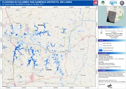
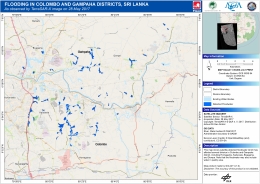
Flooding in Colombo and Gampaha District, Sri Lanka

Direitos autorais: © DLR e. V. 2017, Distribution: Airbus DS Geo GmbH
Map produced by GMC-AIT

Information about the Product

Adquirida: 30/05/2017

Fonte: TerraSAR-X

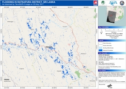
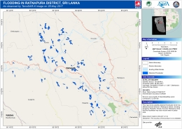
Flooding in Ratnapura District, Sri Lanka

Direitos autorais: © DLR e. V. 2017, Distribution: Airbus DS Geo GmbH
Map produced by GMC-AIT

Information about the Product

Adquirida: 30/05/2017

Fonte: TerraSAR-X

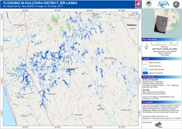
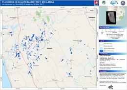
Flooding in Kalutara District, Sri Lanka

Direitos autorais: © DLR e. V. 2017, Distribution: Airbus DS Geo GmbH
Map produced by GMC-AIT

Information about the Product

Adquirida: 30/05/2017

Fonte: TerraSAR-X

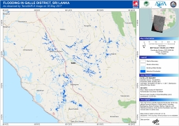
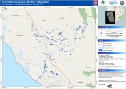
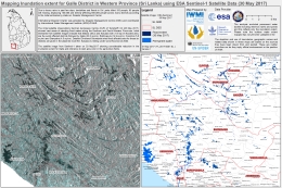
Flooding in Galle District, Sri Lanka

Direitos autorais: © DLR e. V. 2017, Distribution: Airbus DS Geo GmbH
Map produced by GMC-AIT

Information about the Product

Adquirida: 30/05/2017

Fonte: TerraSAR-X

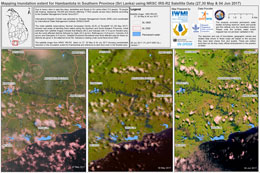
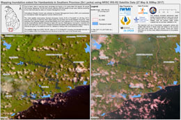
Flood extent for Hambantota in the Southern Province

Direitos autorais: ResourceSat-2 data and products © ISRO (2017) - All rights reserved
Map produced by IWMI

Information about the Product

Adquirida: 27/05/2017, 30/05/2017 and 04/06/2017

Fonte: ResourceSat-2

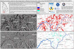
Flood extent for Kalu Ganga basin in the Western Province

Direitos autorais: RADARSAT-2 Data and Products © MacDonald, Dettwiler and Associates Ltd. (2017) - All Rights Reserved. RADARSAT is an official trademark of the Canadian Space Agency.
Map produced by IWMI

Information about the Product

Adquirida: 29/05/2017 and 02/06/2017

Fonte: RADARSAT-2
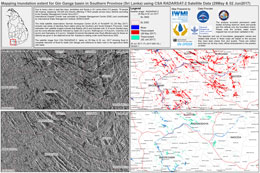
Flood extent for Gin Ganga basin in the Southern Province

Direitos autorais: RADARSAT-2 Data and Products © MacDonald, Dettwiler and Associates Ltd. (2017) - All Rights Reserved. RADARSAT is an official trademark of the Canadian Space Agency.
Map produced by IWMI

Information about the Product

Adquirida: 29/05/2017 and 02/06/2017

Fonte: RADARSAT-2
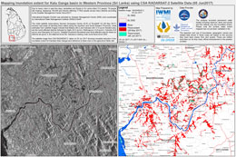
Flood extent for Kalu Ganga basin in the Western Province

Direitos autorais: RADARSAT-2 Data and Products © MacDonald, Dettwiler and Associates Ltd. (2017) - All Rights Reserved. RADARSAT is an official trademark of the Canadian Space Agency.
Map produced by IWMI

Information about the Product

Adquirida: 05/06/2017

Fonte: RADARSAT-2
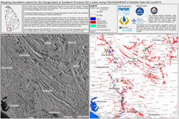
Flood extent for Gin Ganga basin in the Southern Province

Direitos autorais: RADARSAT-2 Data and Products © MacDonald, Dettwiler and Associates Ltd. (2017) - All Rights Reserved. RADARSAT is an official trademark of the Canadian Space Agency.
Map produced by IWMI

Information about the Product

Adquirida: 02/06/2017

Fonte: RADARSAT-2
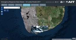
Emergency Response Data Viewer showing the flood extent, photographs and statistics on the disaster

Direitos autorais: Produced by Geoinformatics Centre of the Asian Institute of Technology

Information about the Product

Adquirida: Sentinel-2: 28/05/2017
ALOS-2: 30/05/2017
TerraSAR-X:28/05/2017
RADARSAT-2: 29/05/2017

Fonte: Sentinel-2, ALOS-2, TerraSAR-X and RADARSAT-2
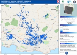
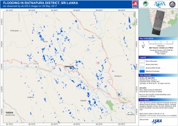
Flooding in Ratnapura District in the Southern Province

Direitos autorais: JAXA (2017) - All rights reserved
Map produced by GMC-AIT

Information about the Product

Adquirida: 30/05/2017

Fonte: ALOS-2

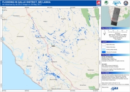
Flooding in Galle District in the Western Province

Direitos autorais: JAXA (2017) - All rights reserved
Map produced by GMC-AIT

Information about the Product

Adquirida: 30/05/2017

Fonte: ALOS-2

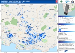
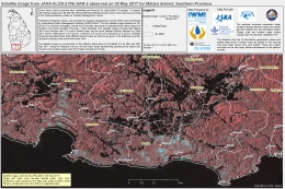
Flooding in Matara District in the Southern Province

Direitos autorais: JAXA (2017) - All rights reserved
Map produced by GMC-AIT

Information about the Product

Adquirida: 30/05/2017

Fonte: ALOS-2

Flooding in Matara District in the Southern Province

Direitos autorais: RADARSAT-2 Data and Products © MacDonald, Dettwiler and Associates Ltd. (2017) - All Rights Reserved. RADARSAT is an official trademark of the Canadian Space Agency.
Map produced by GMC-AIT

Information about the Product

Adquirida: 29/05/2017

Fonte: RADARSAT-2
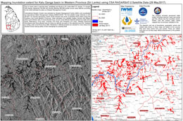
Flooding in Colombo and Gampaha Districts in the Western Province

Direitos autorais: © DLR e. V. 2017, Distribution: Airbus DS Geo GmbH
Map produced by GMC-AIT

Information about the Product

Adquirida: 28/05/2017

Fonte: TerraSAR-X

Flooding in Ratnapura District in the Southern Province

Direitos autorais: © DLR e. V. 2017, Distribution: Airbus DS Geo GmbH
Map produced by GMC-AIT

Information about the Product

Adquirida: 28/05/2017

Fonte: TerraSAR-X

Flooding in Kalutara District in the Western Province

Direitos autorais: © DLR e. V. 2017, Distribution: Airbus DS Geo GmbH
Map produced by GMC-AIT

Information about the Product

Adquirida: 28/05/2017

Fonte: TerraSAR-X

Flooding in Galle District in the Western Province

Direitos autorais: © DLR e. V. 2017, Distribution: Airbus DS Geo GmbH
Map produced by GMC-AIT

Information about the Product

Adquirida: 28/05/2017

Fonte: TerraSAR-X

Flooding in Matara District in the Southern Province

Direitos autorais: © DLR e. V. 2017, Distribution: Airbus DS Geo GmbH Map produced by GIC-AIT

Information about the Product

Adquirida: 28/05/2017

Fonte: TerraSAR-X

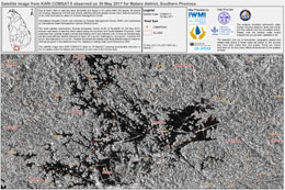
Flood in Matara district in the Southern Province

Direitos autorais: KARI (2017)
Map produced by IWMI

Information about the Product

Adquirida: 30/05/2017

Fonte: KOMPSAT-5

Flood extent in Hambantota in the Southern Province

Direitos autorais: ResourceSat-2 data and products © ISRO (2017) - All rights reserved
Map produced by IWMI

Information about the Product

Adquirida: 27/05/2017 and 30/05/2017

Fonte: ResourceSat-2

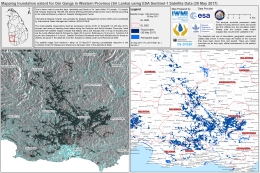
Flood extent in Gin Ganga in the Western Province

Direitos autorais: © Copernicus Sentinel data (2017)
Map produced by IWMI

Information about the Product

Adquirida: 30/05/2017

Fonte: Sentinel-1

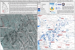
Flood extent in Kalutara District in the Western Province

Direitos autorais: © Copernicus Sentinel data (2017)
Map produced by IWMI

Information about the Product

Adquirida: 30/05/2017

Fonte: Sentinel-1

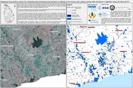
Flood extent in Ambalantota (Hambantota District) in the Western Province

Direitos autorais: © Copernicus Sentinel data (2017)
Map produced by IWMI

Information about the Product

Adquirida: 30/05/2017

Fonte: Sentinel-1

Flood extent in Galle District in the Western Province

Direitos autorais: © Copernicus Sentinel data (2017)
Map produced by IWMI

Information about the Product

Adquirida: 30/05/2017

Fonte: Sentinel-1

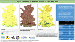
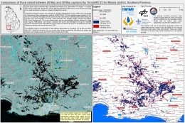
Assessment of the impact the floods have had on Matara district

Direitos autorais: © DLR e. V. 2017, Distribution: Airbus DS Geo GmbH
Map produced by IWMI

Information about the Product

Adquirida: 28/05/2017

Fonte: TerraSAR-X

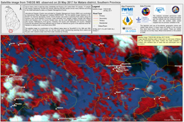
Flood extent in Matara District, in the Southern Province

Direitos autorais: THEOS © GISTDA
Map produced by IWMI

Information about the Product

Adquirida: 28/05/2017

Fonte: THEOS MS

Flooding in Matara District in the Southern Province

Direitos autorais: JAXA (2017) - All rights reserved
Map produced by IMWI

Information about the Product

Adquirida: 30/05/2017

Fonte: ALOS-2

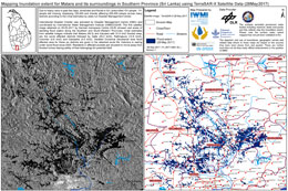
Flood extent in Matara District in the Southern Province

Direitos autorais: © DLR e. V. 2017, Distribution: Airbus DS Geo GmbH
Map produced by IWMI

Information about the Product

Adquirida: 28/05/2017 and 30/05/2017

Fonte: TerraSAR-X

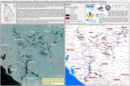
Flood extent in Kalutara District, in the Western Province

Direitos autorais: © DLR e. V. 2017, Distribution: Airbus DS Geo GmbH
Map produced by IWMI

Information about the Product

Adquirida: 28/05/2017 and 30/05/2017

Fonte: TerraSAR-X

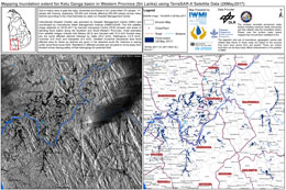
Flood extent in Kalu Ganga basin in the Western Province

Direitos autorais: RADARSAT-2 Data and Products © MacDonald, Dettwiler and Associates Ltd. (2017) - All Rights Reserved. RADARSAT is an official trademark of the Canadian Space Agency.
Map produced by IWMI

Information about the Product

Adquirida: 29/05/2017

Fonte: RADARSAT-2
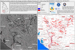
Flood extent in Gin Ganga and Galle in the Western Province

Direitos autorais: RADARSAT-2 Data and Products © MacDonald, Dettwiler and Associates Ltd. (2017) - All Rights Reserved. RADARSAT is an official trademark of the Canadian Space Agency.
Map produced by IWMI

Information about the Product

Adquirida: 29/05/2017

Fonte: RADARSAT-2

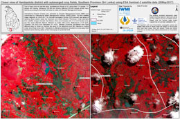
Flood in Hambantota district with submerged crop fields in the Southern Province

Direitos autorais: © Copernicus Sentinel data (2017)
Map produced by IWMI

Information about the Product

Adquirida: 28/05/2017

Fonte: Sentinel-2

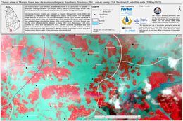
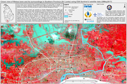
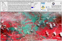
Flood in Matara in the Southern Province

Direitos autorais: © Copernicus Sentinel data (2017)
Map produced by IWMI

Information about the Product

Adquirida: 28/05/2017

Fonte: Sentinel-2

Flood in Matara in the Southern Province

Direitos autorais: © Copernicus Sentinel data (2017)
Map produced by IWMI

Information about the Product

Adquirida: 28/05/2017

Fonte: Sentinel-2

Flood in Matara in the Southern Province

Direitos autorais: © Copernicus Sentinel data (2017)
Map produced by IWMI

Information about the Product

Adquirida: 28/05/2017

Fonte: Sentinel-2

Flood extent in Matara in the Southern Province

Direitos autorais: © DLR e. V. 2017, Distribution: Airbus DS Geo GmbH
Map produced by IWMI

Information about the Product

Adquirida: 28/05/2017

Fonte: TerraSAR-X

Flood extent in Kalu Ganga basin in the Western Province

Direitos autorais: © DLR e. V. 2017, Distribution: Airbus DS Geo GmbH
Map produced by IWMI

Information about the Product

Adquirida: 28/05/2017

Fonte: TerraSAR-X

Flood extent in Sabaragamuwa Province

Direitos autorais: © DLR e. V. 2017, Distribution: Airbus DS Geo GmbH
Map produced by IWMI

Information about the Product

Adquirida: 28/05/2017

Fonte: TerraSAR-X

Voltar ao arquivo completo da Ativação